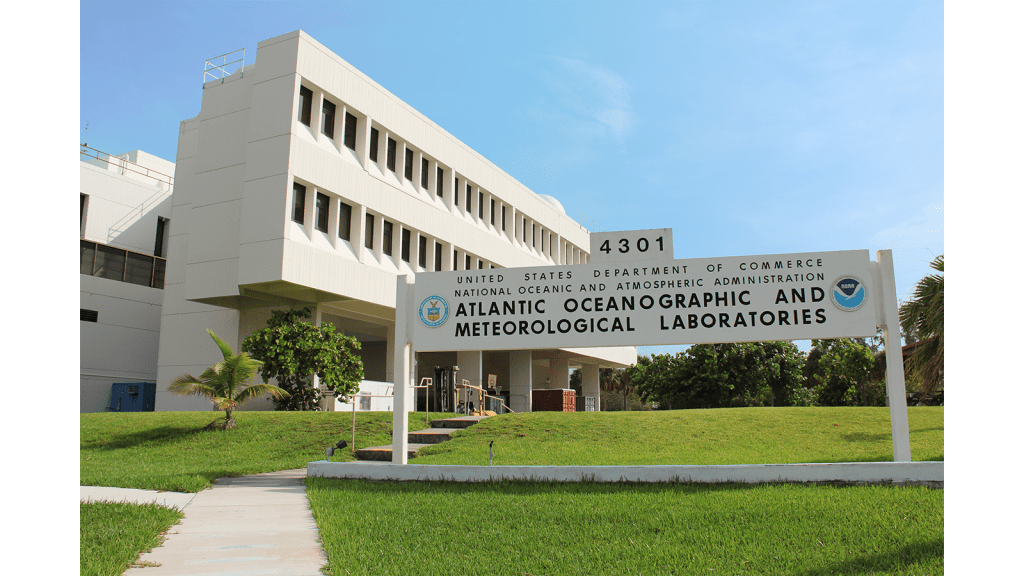
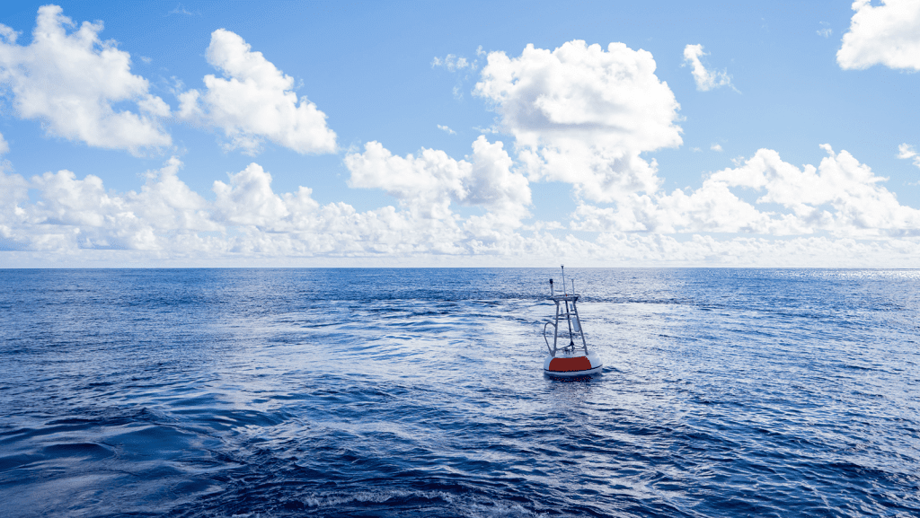
More than 20 years after the first teacher adopted a drifter, NOAA’s Adopt a Drifter Program , co-led by the Global Ocean Monitoring and Observing Program (GOMO) and the Atlantic Oceanographic and Meteorological Laboratory (AOML), continues to grow and evolve this summer.

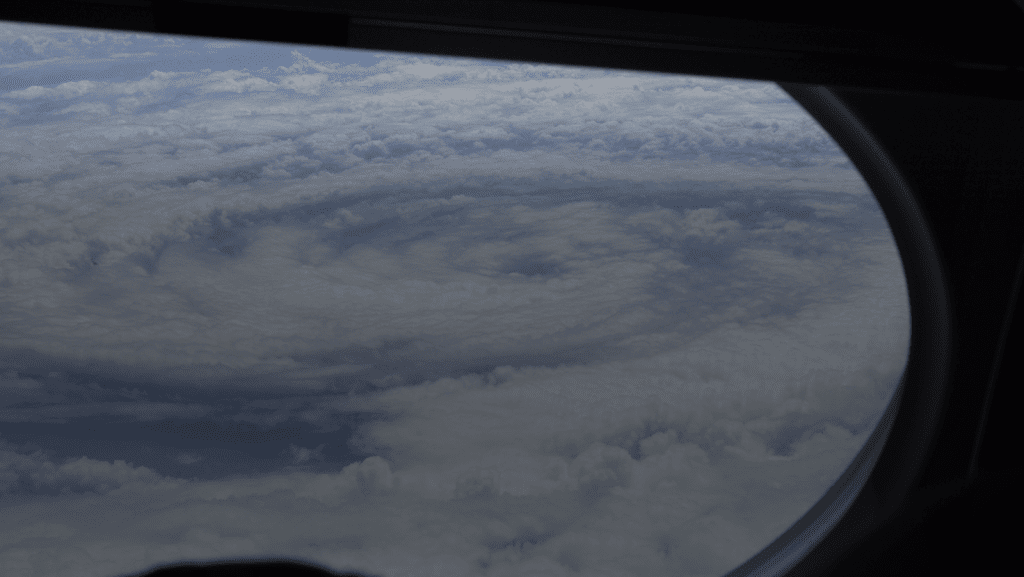
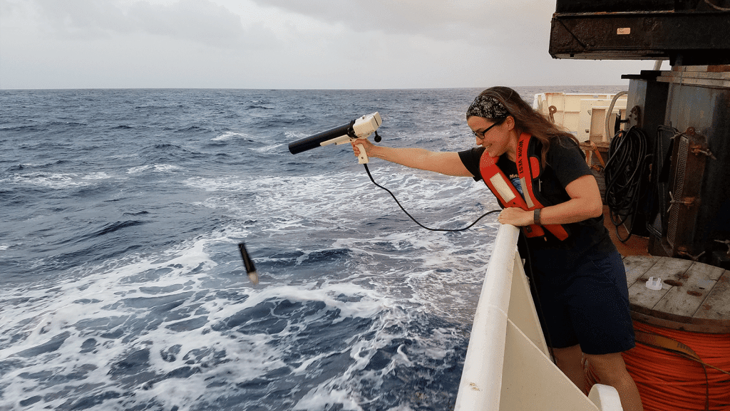
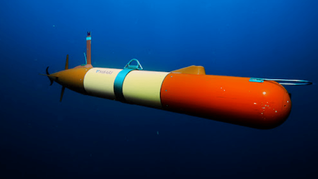
In recent years, uncrewed surface vehicles (USV) have become vital tools used to collect observations to improve hurricane forecasts. To fully understand how storms intensify, scientists need data at the air-sea interface where energy is transferred from the ocean to tropical cyclones. This data is most effectively collected by USVs because of their unique ability to operate in dangerous environments and extreme conditions. In a new study, scientists are able to directly quantify the air-sea momentum exchange (termed ‘wind stress’) and related frictional drag effect that acts to slow a hurricane’s rotating winds. These direct measurements of this process are the first to be collected over the ocean in hurricane-force winds.

In early May, the 273-foot research vessel Roger Revelle docked in Cabo Verde with an international team of scientists after 53 days at sea, crossing the open Atlantic along a cruise path known as A16S. With scientists at NOAA’s Atlantic Oceanographic and Meteorological Laboratory (AOML) and the Cooperative Institute for Marine and Atmospheric Studies (CIMAS) […]

NOAA has released their seasonal outlook for the 2026 hurricane season – spanning from June 1st to November 30th – reporting a 55% probability of a below average season. This prediction is primarily driven by several factors including a strong El Niño event expected to emerge in the Pacific basin. This phenomenon will disrupt typical […]
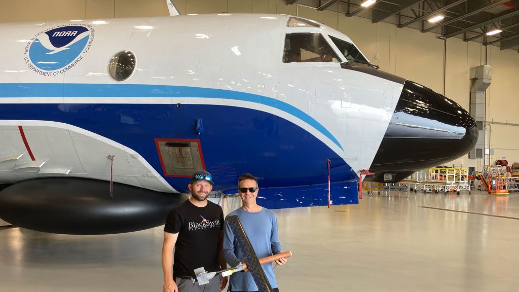
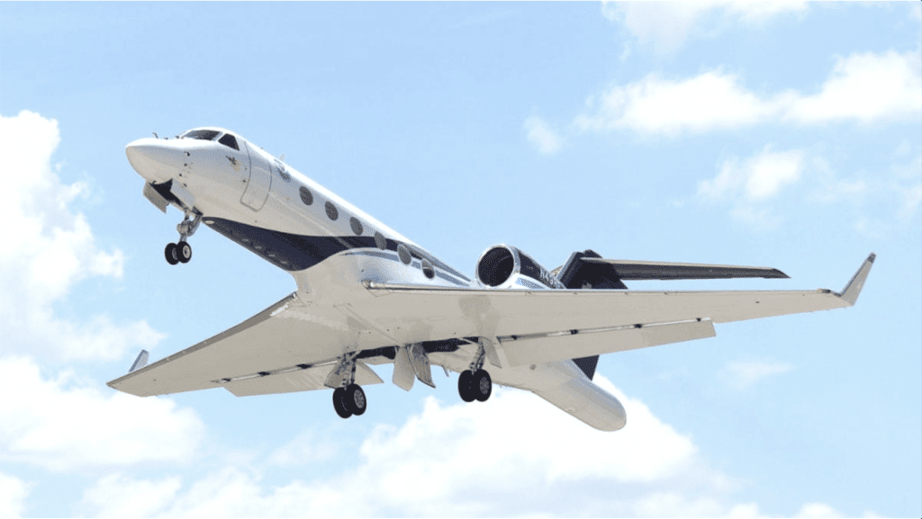
For the first time, data from a small uncrewed aircraft system (sUAS) – Black Swift Technologies’ S0 – will be integrated into NOAA’s hurricane forecast model during the 2026 hurricane season. Scientists from the Cooperative Institute for Marine and Atmospheric Studies (CIMAS) and NOAA’s Atlantic Oceanographic and Meteorological Laboratory (AOML) determined that incorporating sUAS data […]

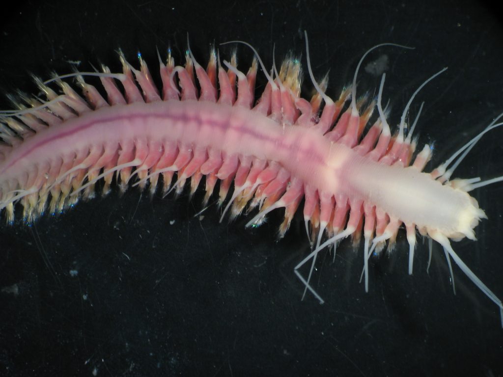
This story is adapted from NOAA Ocean Exploration. See the full story here. In April, NOAA Ocean Exploration, in partnership with NOAA’s National Systematics Laboratory at the Smithsonian National Museum of Natural History, the Northern Gulf Institute, and the Atlantic Oceanographic and Meteorological Laboratory, released its first deep-sea environmental DNA (eDNA) datasets. These biological data […]

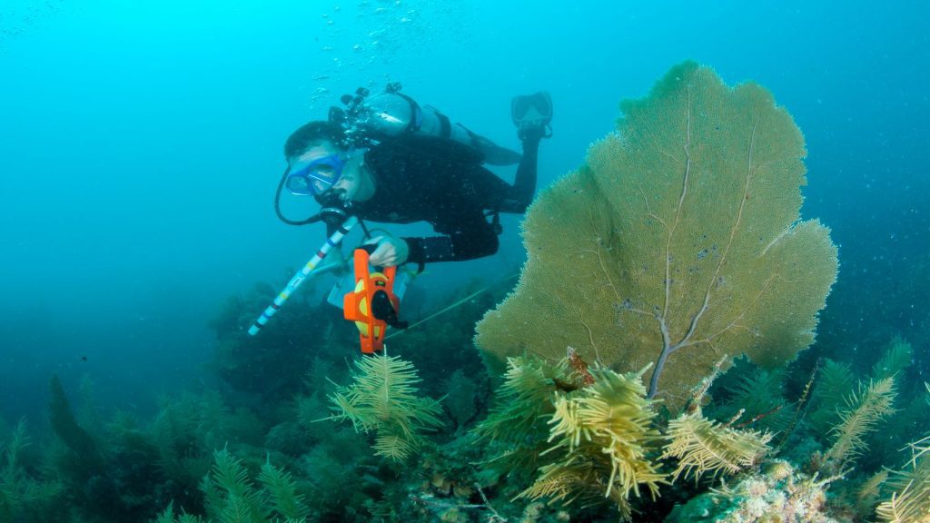
Divers drop over the gunnel. Tanks, weights, divers, and a mesh bag full of tools all descend in emerald waters beneath grey skies. Off the vessel’s bow, a yellow beacon blinks with a red flashing light and a thin data cable stretching to the seafloor, all connected to a suite of sensors twenty feet below […]

There’s a unique interplay between surface winds, the Gulf Stream current, and the continental shelf in the South Atlantic Bight (SAB), that has long been overlooked. Researchers have often speculated that the strength of the Gulf Stream and proximity to the coast impacts primary production and other processes driving essential ecosystems. However, to what degree […]

With sterile sample bottles at the ready, scientists in the Molecular and Environmental Microbiology Lab at NOAA’s Atlantic Oceanographic and Meteorological Laboratory (AOML) prepare to capture water samples for analysis in the lab. Invisible to the naked eye, nutrients, pollutants, and entire communities of bacteria, algae, and other microorganisms drift through these waters leaving clues […]

Last week, scientists with AOML’s Ocean Carbon Cycle team led a workshop under the international Surface Ocean CO2 Reference Observing Network (SOCONET) on best practices for maintaining an underway pCO2 system and quality-controlling data to standardize crucial measurements of the surface ocean’s uptake of carbon. The global ocean takes up carbon from the atmosphere on […]

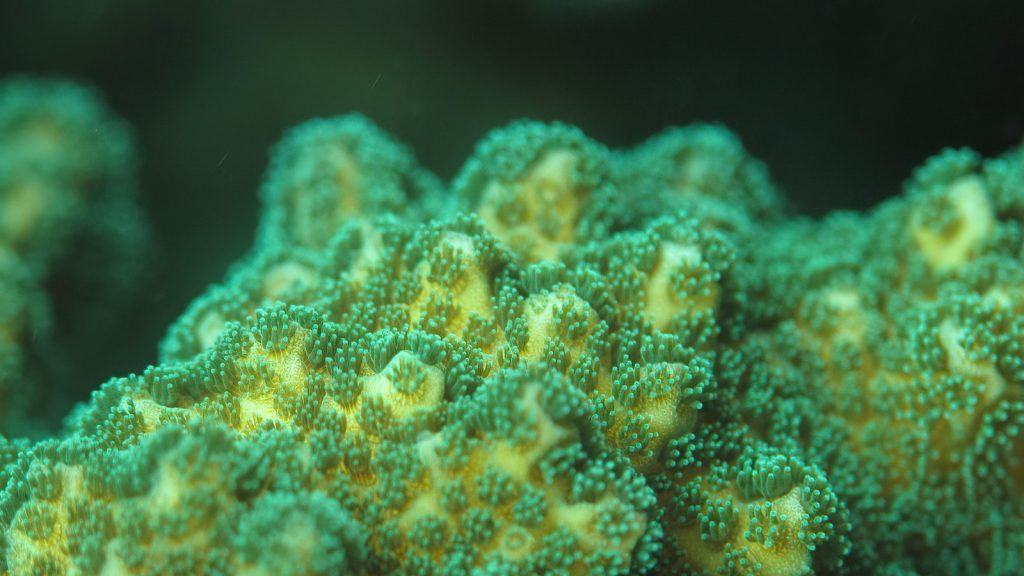
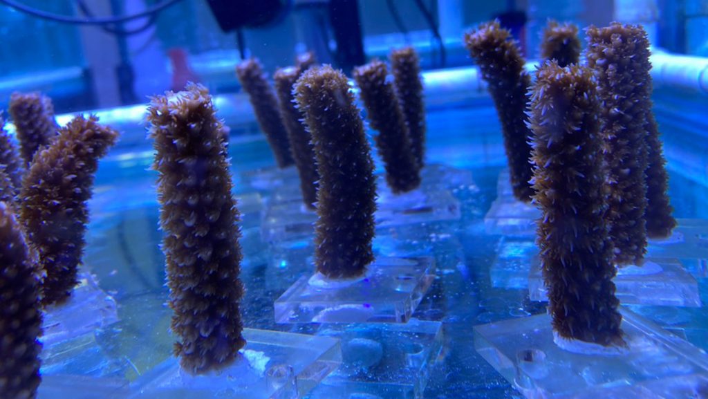
In a new study led by scientists at NOAA’s Atlantic Oceanographic and Meteorological Laboratory (AOML) and the Cooperative Institute for Marine and Atmospheric Studies (CIMAS), a novel form of alkalinity enhancement (AE) was demonstrated to significantly enhance the growth rates of corals, a finding that could promote the scaling of coral reef restoration. Coral reef […]

A new study led by scientists at NOAA’s Atlantic Oceanographic and Meteorological Laboratory (AOML) and the Cooperative Institute for Marine and Atmospheric Studies (CIMAS) indicates that stony coral tissue loss disease (SCTLD) has long-lasting impacts not only on corals, but also on their bacteria. Just as humans have bacteria and other microbes essential to our […]

Scientists at NOAA’s Atlantic Oceanographic & Meteorological Lab and the Northern Gulf Institute applied omics techniques to provide the first basin-scale assessment of the microbial communities at the base of marine ecosystems across the Gulf region. The new study from Dr. Luke Thompson’s group, conducted by Dr. Sean Anderson and co-authors, is the largest environmental […]

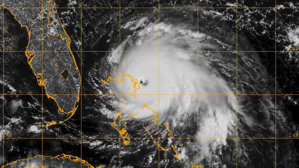
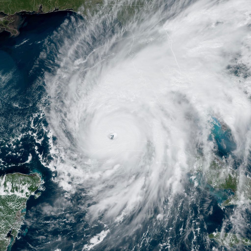
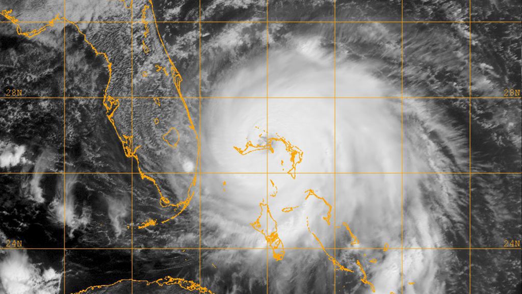
On August 30, 2023, Hurricane Idalia made landfall as a major Hurricane in Florida’s Big Bend after meandering through the northwestern Caribbean and intensifying over the warm waters of the Gulf of America. In its aftermath, damage on land was immediately visible, but observations from satellites and ocean-going robots revealed that the ocean was also […]

Sundararaman “Gopal” Gopalakrishnan, PhD, senior meteorologist in the Hurricane Research Division (HRD) at NOAA’s Atlantic Oceanographic and Meteorological Laboratory, has been elected a Fellow of the American Meteorological Society (AMS). Fellows are elected for their “outstanding contributions to the atmospheric or related oceanic or hydrologic sciences or their applications during a substantial period of years.” […]

Scientists at AOML and the Cooperative Institute for Marine and Atmospheric Studies (CIMAS) are employing advanced ‘Omics techniques to holistically examine the effectiveness of ongoing efforts to restore coral reefs throughout the Florida Keys National Marine Sanctuary (FKNMS) under the ambitious Mission: Iconic Reefs initiative. The Florida Keys National Marine Sanctuary consists of 350 miles […]

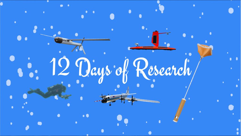
As 2025 comes to an end, NOAA’s Atlantic Oceanographic and Meteorological Laboratory (AOML) is proud to present a recap of some of our research accomplishments, creative tools, and significant impacts. Enjoy our “12 days of research” series where we highlight the vital work AOML is conducting to protect life, property, and our natural resources.

Alkalinity enrichment in the lab may be the key to more effective reef restoration. An innovative Ph.D. student puts this hypothesis to the test using cutting-edge technology. In a tank filled with glass jars, stir bars, and coral babies settled onto ceramic tiles, a robotic arm glides with precision, dosing each jar with various levels […]

Hurricanes are among some of the most destructive natural disasters and pose major risks to coastlines. Given warming oceans, increasing storm intensities, and population growth, advancing hurricane research is vital for tracking storms and predicting their strengths and landfalls. A complex team, from program managers to meteorologists, is essential for successfully predicting, observing, and forecasting […]

The 2025 Atlantic hurricane season has officially come to an end. Throughout this record-breaking season, NOAA scientists conducted innovative research on tropical cyclones that will improve forecasting accuracy, enhance understanding of storm behavior, and strengthen preparedness efforts for communities. Their work and dedication contributed to a safer and more resilient future for those facing the impacts of extreme weather events.

In a new study, scientists at AOML and the University of Miami’s Cooperative Institute for Marine and Atmospheric Studies (CIMAS) demonstrate how photogrammetry-based techniques enable their team to monitor the persistence and structural complexity of coral reef habitats at an unprecedented scale. Led by John Morris, Ph.D., a CIMAS Postdoctoral Associate with AOML’s Coral Program, […]
Extreme weather events are difficult to predict, causing loss of life and immense damage. Due to this, NOAA has significant interest in extending the forecast lead times for these events by advancing forecasting capabilities.

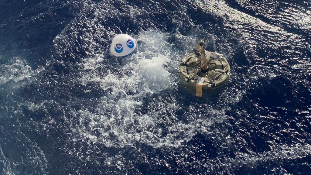
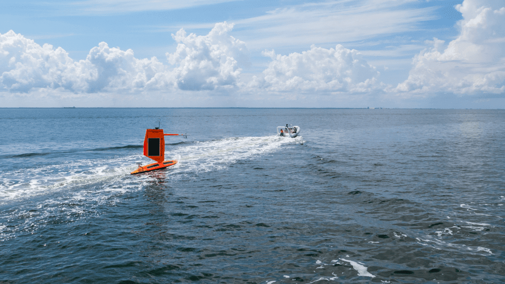
NOAA and Oshen robots bring back key wind and pressure data from Hurricane Humberto A small, wind–powered ocean robot became the first uncrewed surface vehicle to capture and transmit data from inside a Category 5 hurricane on Sunday, September 28, as part of research by NOAA, the United Kingdom-based robotics company, Oshen, and the University […]

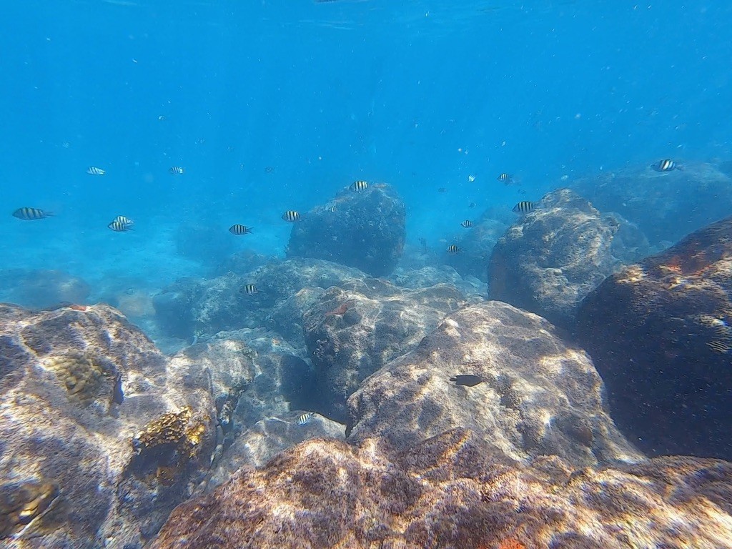
The National Coral Reef Monitoring Program (NCRMP) led by NOAA’s Coral Reef Conservation Program is the largest monitoring effort globally to support the conservation of reefs. Scientists with NOAA’s AOML Coral Program and the Cooperative Institute for Marine and Atmospheric Studies (CIMAS) lead the monitoring efforts in the Gulf of America, Caribbean and the Atlantic […]

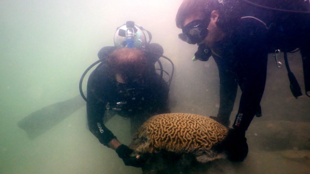
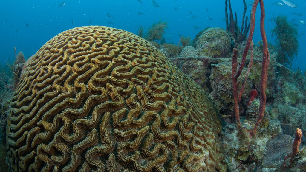
Scientists at NOAA’s Atlantic Oceanographic & Meteorological Laboratory (AOML) and the Cooperative Institute for Marine and Atmospheric Studies (CIMAS) have successfully overseen the first-ever crossbreeding between grooved brain corals (Diploria labyrinthiformis) collected from a highly urbanized site in PortMiami and a nearby reef – a breakthrough that could revolutionize efforts to restore local coral reefs.
Hurricane Erin was one of the largest storms recorded in the Atlantic basin, with only around 5% of storms matching or exceeding its size. Both operational and experimental NOAA forecast models for Erin proved incredibly accurate, especially for Erin’s track early in the forecast period. NOAA’s flagship hurricane forecast model, the Hurricane Analysis and Forecast […]

Jen McWhorter, Ph.D., a Cooperative Institute for Marine and Atmospheric Science (CIMAS) Assistant Scientist with AOML’s Ocean Biogeochemistry and Physical Oceanography teams, has been selected to serve a one year term as a member of the NOAA in the Caribbean Executive Team. As a member of the Executive Team, McWhorter will help provide strategic direction […]

A new study led by AOML and CIMAS scientists further shows that the impacts of Atlantic Niño/Niña on tropical cyclones are not limited to the Atlantic basin (i.e., hurricanes), but also extend to the western North Pacific basin (i.e., typhoons) through inter-basin teleconnections.
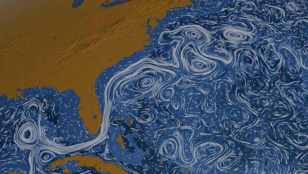
The flow of the Florida Current, one of the most powerful ocean currents in the world, has been measured by a submarine telecommunications cable between Florida and the Bahamas since 1982. Unfortunately, this record was interrupted in November 2023 due to a mechanical failure of the cable. Building on prior research, a new study presents an alternative method to continue providing the Florida Current daily transport estimates until the cable can be repaired.

The Hurricane Research Division (HRD) within NOAA’s Atlantic Oceanographic and Meteorological Laboratory (AOML) is a worldwide leader in the advancement of hurricane science and prediction by collecting novel airborne observations, testing new observing technologies, and developing state-of-the-art forecast model systems that optimally ingest these unique datasets. These efforts make hurricane forecasts more accurate, ultimately protecting […]

Uncrewed systems are a rapidly emerging tool for NOAA in hurricane research and forecasting as they allow researchers to gather data from otherwise inaccessible regions of the storm. While some uncrewed system deployments in hurricanes have already been shown to improve hurricane intensity forecasts, others still require further research and development. Prior to hurricane season, NOAA tests new and updated emerging technologies in non-storm environments, or “clear air,” to consider incorporating them into the hurricane reconnaissance program.

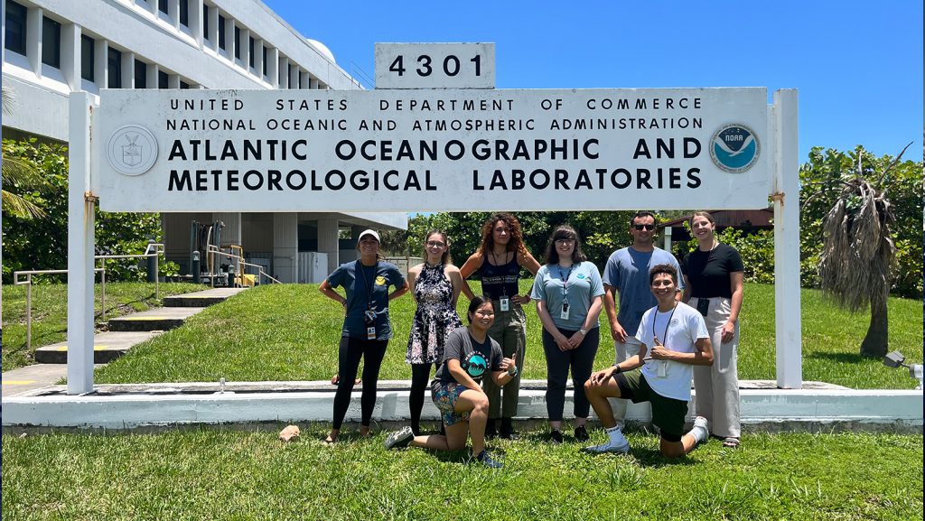
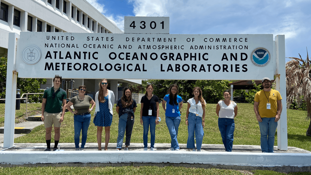
In celebration of National Intern Day, NOAA’s Atlantic Oceanographic & Meteorological Laboratory (AOML) is proud to recognize its FY 2025 class of interns. Ranging from high school to graduate students, these talented individuals are gaining hands-on experience across a wide array of research areas—including coral reefs, microbial ecology, hurricanes, ocean acidification, physical oceanography, science communication, […]

Phytoplankton covering the ocean’s surface are responsible for over 50% of the oxygen that has been produced on Earth. In a spoonful of oceanwater, there are thousands of these microscopic organisms of different species. And without them, most – if not all – marine food webs would collapse. Studying what species comprise planktonic communities in […]

From July 14-16, NOAA’s Atlantic Oceanographic and Meteorological Laboratory (AOML) and the University of Reading held the inaugural Joint US-UK Symposium on Emerging Technologies for High Impact Weather in Reading, UK. Through this collaboration, AOML sought to bring together subject matter experts from the government, academia, and industry on both sides of the Atlantic.

Extreme heat is the leading weather-related cause of death in the United States. In a new study published in Nature Communications, scientists found a link between the long-lasting 2023 heatwave over the southwest US and Mexico and the record warm sea surface temperatures in both the Atlantic and Pacific Ocean.
Originally published as an official press release on the University of Miami’s Rosenstiel School’s newsroom website. Atlantic Niño/Niña events can influence hurricane development, but they can be difficult to predict. A new study sheds light on the oceanic chain reaction that can trigger these events, potentially improving our ability to forecast them. A new study […]

Stony Coral Tissue Loss Disease (SCTLD) is the deadliest known coral disease to species with a hard skeleton (i.e., Scleractinians), causing rapidly-expanding, bare lesions to form across a coral’s skeleton until there is no more living tissue. The pathogen or microbes leading to the spread of this disease have yet to be identified. Yet scientists […]

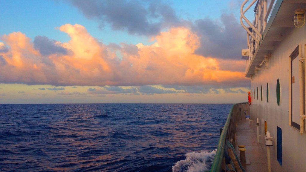
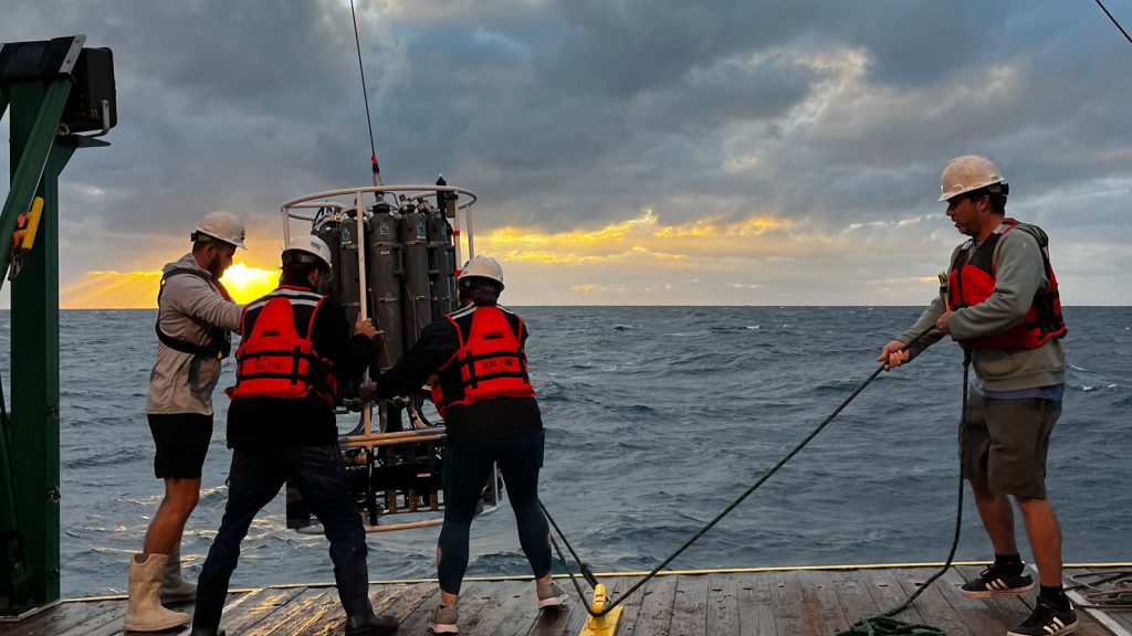
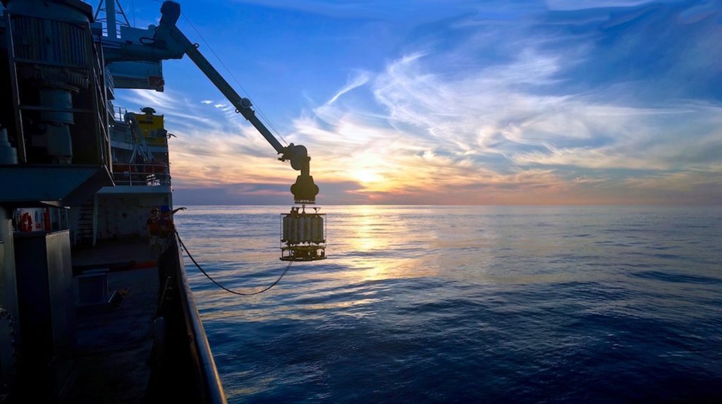
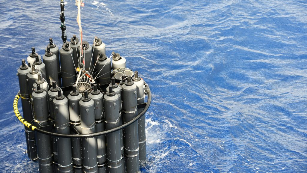
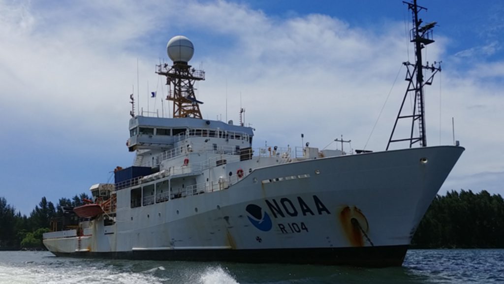
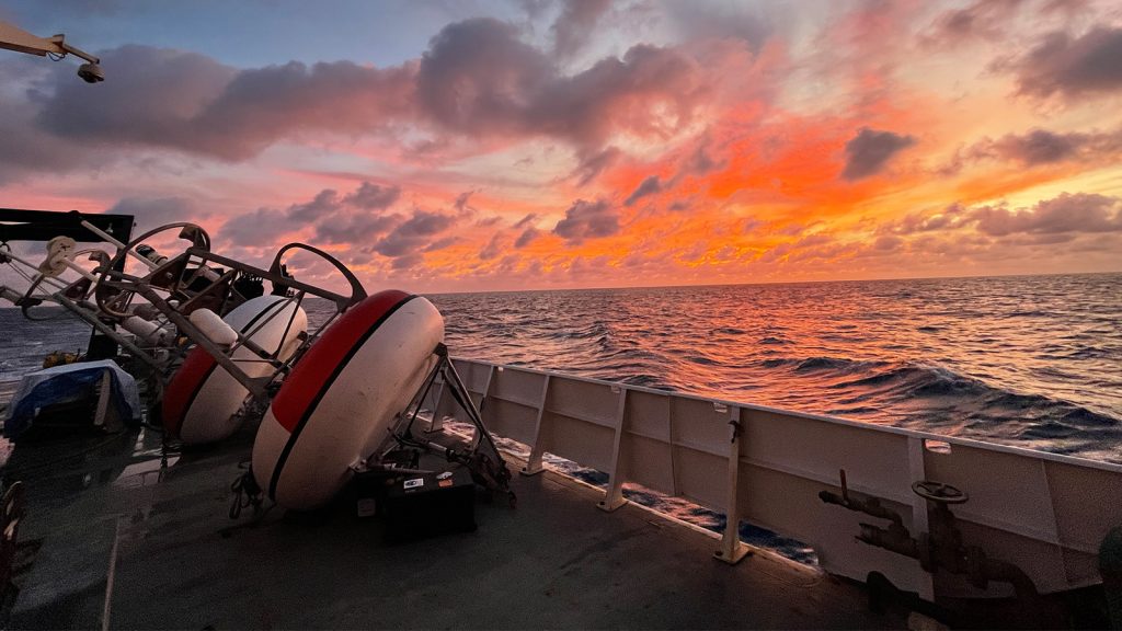
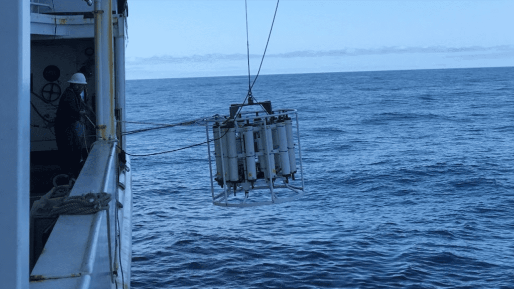
Research cruises are essential for scientists to collect data, deploy instrumentation, and maintain ocean observing systems. NOAA regularly conducts research at sea to study the ocean and atmosphere, advancing our understanding of the ocean, monitoring ocean conditions, and ensuring sustainable fisheries and healthy marine habitats. These expeditions provide essential data for weather prediction, ocean acidification […]

The ocean and the atmosphere are constantly seeking balance. Gases like oxygen, nitrogen, and carbon move between the ocean’s surface and the atmosphere by billions of metric tons every year. A higher concentration of one gas in the atmosphere leads to more of that gas being taken up by the ocean as the two try […]

In 2018, an Australian couple curiously stumbled upon a bottle of gin washed ashore in Wedge Island, Australia. Yet, there was no gin inside. Rather, preserved within the bottle was a note with the date June 12th, 1886; the name of a German barque, Paula; the ship’s departure and arrival ports; and the exact coordinates […]

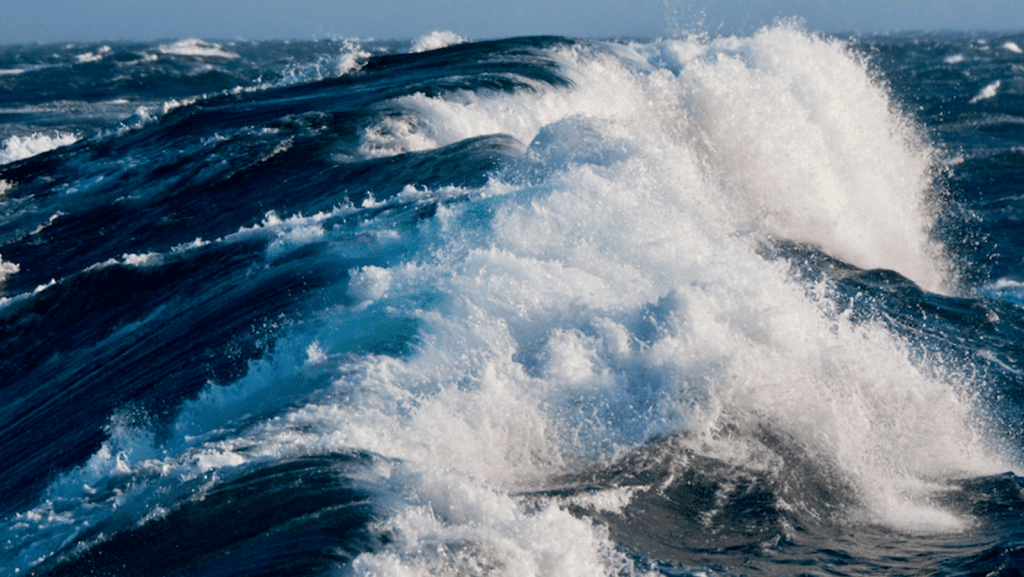
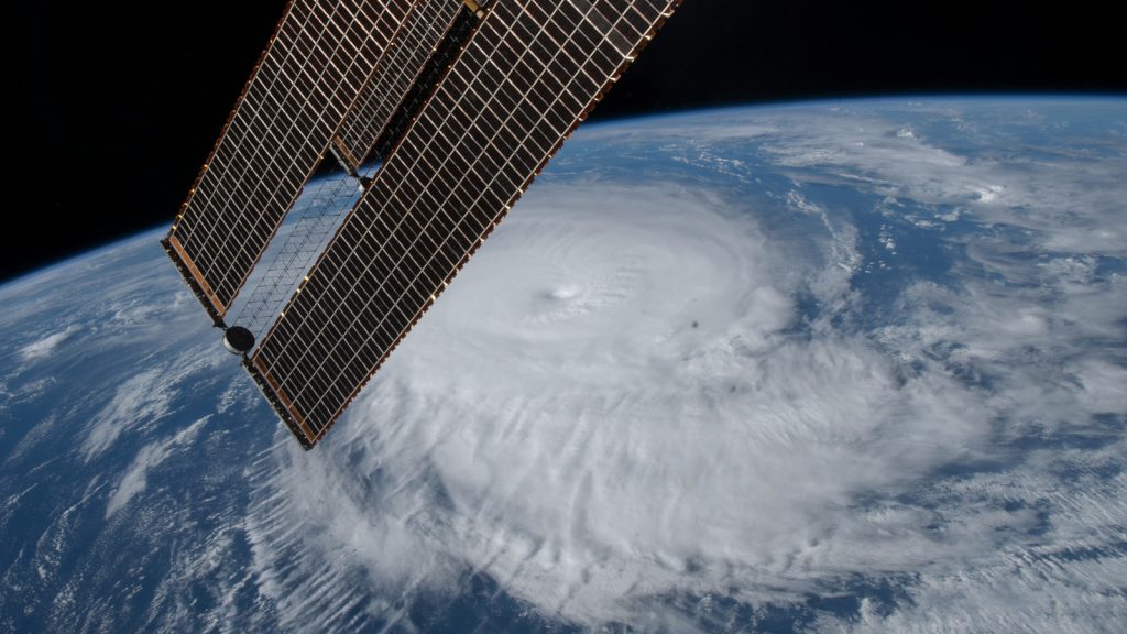
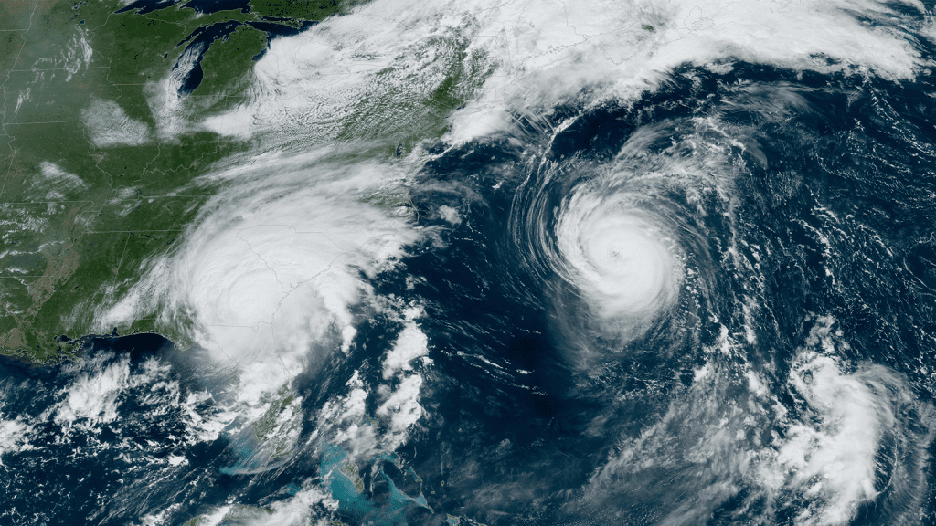
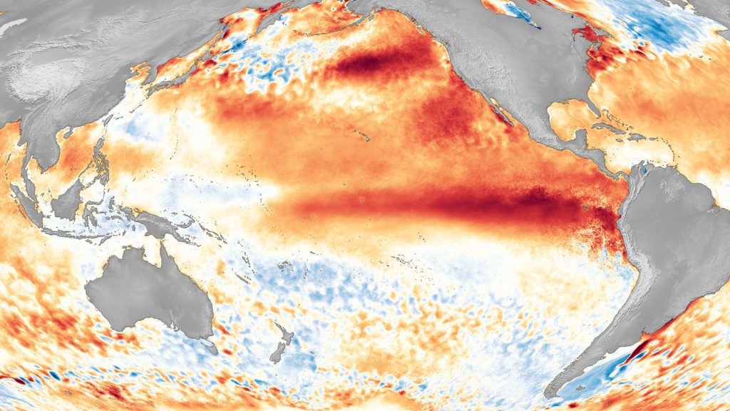
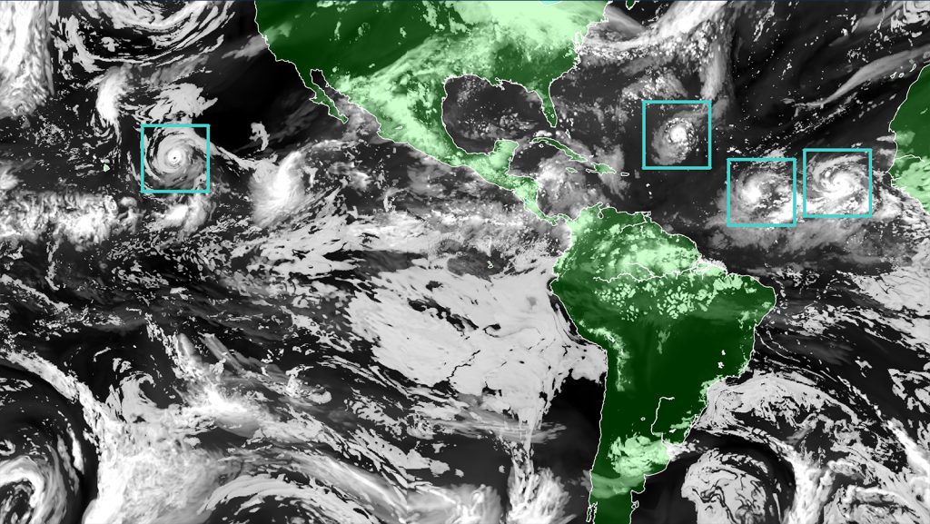
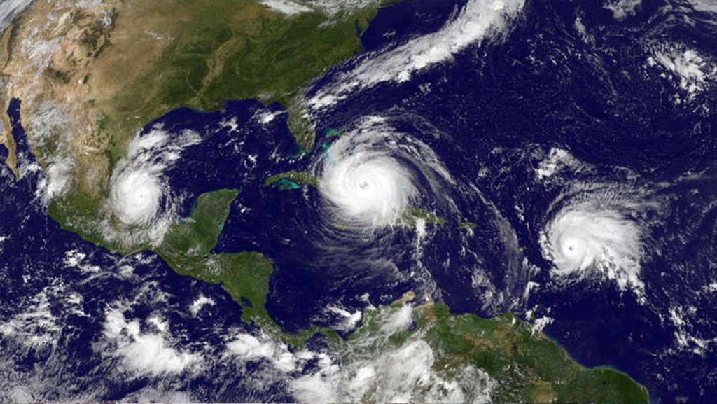
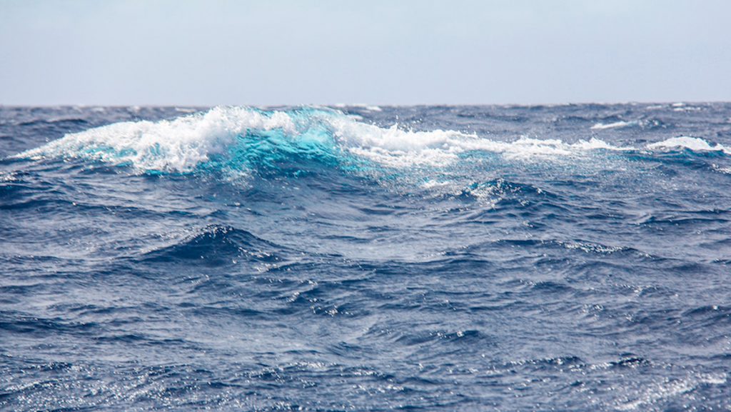
Join us as we celebrate and learn about our world ocean throughout National Ocean Month. June 1st not only marks the start of National Ocean Month, it also is the first day of hurricane season. To kick off this year’s Ocean Month, we are looking at the major role the ocean plays in the formation […]
The 2025 Atlantic hurricane season started on June 1 and runs through November 30. NOAA predicts a 30% chance of a near-normal season, a 60% chance of an above-normal season, and a 10% chance of a below-normal season in the Atlantic basin this year: NOAA’s Atlantic Oceanographic and Meteorological Laboratory (AOML) will work with partners […]

Water masses move over reefs, seagrass beds, and sandbanks – and as they do, the seawater chemistry changes. In the Florida Keys, changes in coral reef carbonate chemistry are driven by benthic metabolism, the origin of the water mass, and the connectivity of habitats. A new study from NOAA’s Atlantic Oceanographic and Meteorological Laboratory (AOML) […]

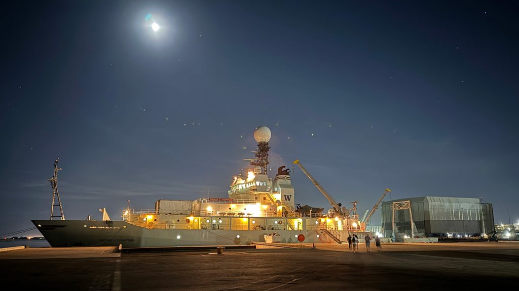
After nearly 40 days at sea, the I09N GO-SHIP cruise (short for “Global Ocean Ship-based Hydrographic Investigations Program”) aboard the R/V Thomas G. Thompson arrived in Phuket, Thailand on April 27th, successfully completing its mission surveying both the Indian Ocean and Bay of Bengal. After departing from Fremantle, Australia on March 21st, the international team of researchers spent weeks collecting data essential for investigating global changes in ocean physics, chemistry, and biology.

For the past three years, scientists at NOAA’s Atlantic Oceanographic and Meteorological Laboratory (AOML) and the Cooperative Institute for Marine and Atmospheric Science have been uncovering the secrets behind the extraordinary resilience of corals in PortMiami. Now, you can dive into their groundbreaking research like never before with a new virtual reality experience, Unlocking the […]
Original article published by NOAA Research on March 31, 2025. Hurricane researchers know bumpy flights better than anyone else, but, after a particularly turbulent flight into Hurricane Ian, scientists were left wondering if it was the bumpiest flight on record aboard a NOAA WP-3D Orion hurricane hunter aircraft. This question led scientists to develop a […]

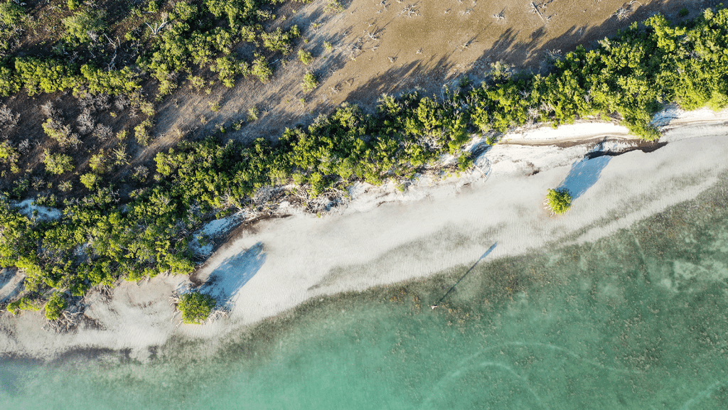
South Florida is comprised of 350 miles of the only barrier coral reef in North America – and the third largest in the world. 1,800 miles of shoreline is lined with mangroves in the Florida Keys alone, which provide coastal protection from storms and support juveniles of commercialized fish species. The region sustains the largest […]

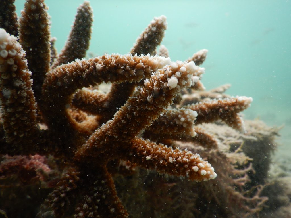
In a new study, scientists at AOML and the University of Miami’s Cooperative Institute for Marine and Atmospheric Sciences (CIMAS) demonstrated how some genotypes of the reef-building coral Acropora cervicornis (Staghorn Coral), listed on the Endangered Species Act, proved resilient when exposed to high nutrient levels or disease, but not when the two stressors were […]

New study reveals long-term cooling and freshening of the deep Subtropical North Atlantic Ocean, with hints of major shifts to come over next decade An official press release can be seen on the University of Miami Rosenstiel School’s newsroom website. A new study published in Nature Communications, Earth & Environment unveils a surprising new take […]

Extreme hydroclimate events, such as droughts, floods, and heavy rainfall, account for a substantial portion of weather-related disasters in the United States, leading to significant socio-economic losses involving agriculture, water resources, and public health, among others. For instance, from 1980 to 2024, droughts were responsible for approximately $368 billion in economic losses for the United […]

A new study by scientists at the Atlantic Oceanographic and Meteorological Laboratory (AOML) and the Cooperative Institute for Marine and Atmospheric Sciences (CIMAS) provides new insights for effective restoration of the crucial reef-building coral species Acropora palmata, or Elkhorn coral. Applying ‘Omics techniques to investigate how habitat and coral microbiomes influence ongoing restoration efforts, this […]

Jason Dunion, Ph.D. – a Cooperative Institute for Marine and Atmospheric Studies (CIMAS) meteorologist affiliated with NOAA’s Atlantic Oceanographic and Meteorological Laboratory (AOML) – has been awarded the Presidential Early Career Award for Scientists and Engineers (PECASE), the most prestigious award granted by the U.S. government to exceptional scientists and engineers in the early stages […]
A pause in the weakening of the AMOC since the early 2010s A recent study by scientists at AOML found that extensive weakening of the Atlantic Meridional Overturning Circulation (AMOC) occurred in the 2000s, but has paused since the early 2010s due to a tug-of-war between the natural and anthropogenic signals. The AMOC is the […]
Every year, scientists at AOML participate in the international effort led by the University of Exeter’s Global Systems Institute in developing the annual Global Carbon Budget Report, an assessment of global carbon emissions and the progress towards achieving the climate goals set by the 2016 Paris Agreement. The 2024 Global Carbon Budget Report now indicates […]

Originally published on noaa.gov on January 13th, 2025. Accurate forecasts and early warnings from NOAA’s National Hurricane Center (NHC) — a division of NOAA’s National Weather Service (NWS) — are vital to safeguarding communities that are in the paths of hurricanes and tropical storms. As we kick off the new year, now is the perfect time to look back […]

The air and surface temperature tip just above freezing. Cruiseliner Ponant’s 492-ft vessel Le Commandant Charcot floats idle at marked coordinates in the Arctic tundra between Alaska and Norway. On the aft deck, a team of scientists deploys Niskin bottles using a handcrank to the depths, collecting water samples 900 meters below an ocean blanketed […]
Behind every research project at NOAA’s Atlantic Oceanographic and Meteorological Laboratory (AOML) are a suite of instruments. Whether descending to depths or weathering storms, these technologies are paramount to oceanic and atmospheric observations. Get to know 12 of these instruments with a new social media series: 12 Days of teKNOWLEDGEy! On the 1st day of […]

AOML scientists, staff, and team members were recognized this year for their outstanding contributions and dedication to NOAA’s mission. The following individuals and teams are recipients of prestigious awards that acknowledge their dedication to sharing our mission and initiatives with the community, fostering deeper connections and leaving a lasting, positive impact on the lives of those we serve.
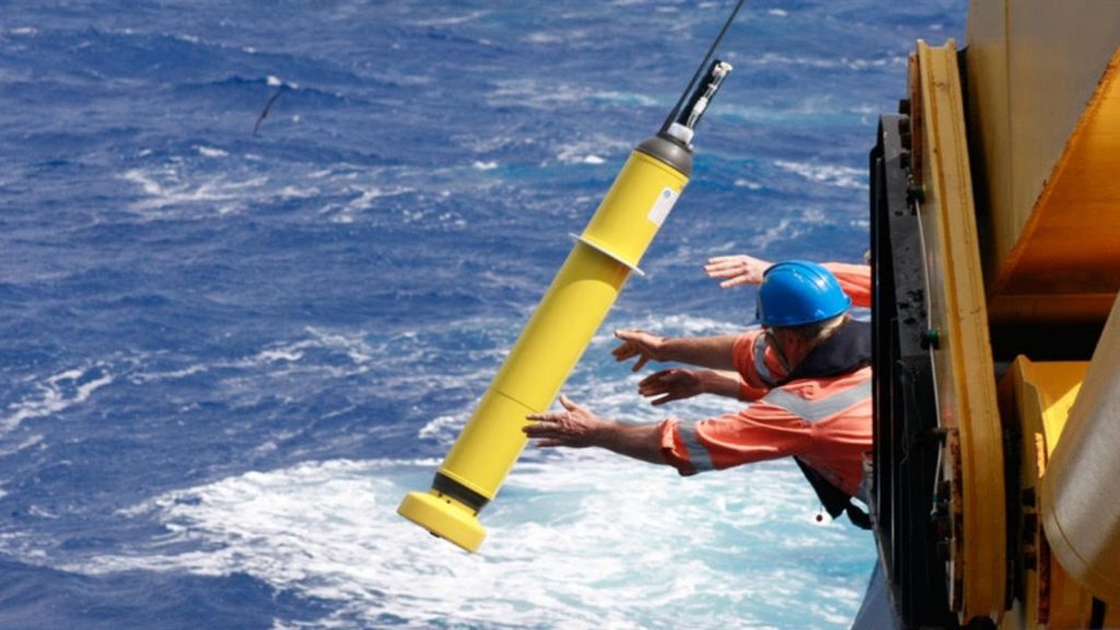
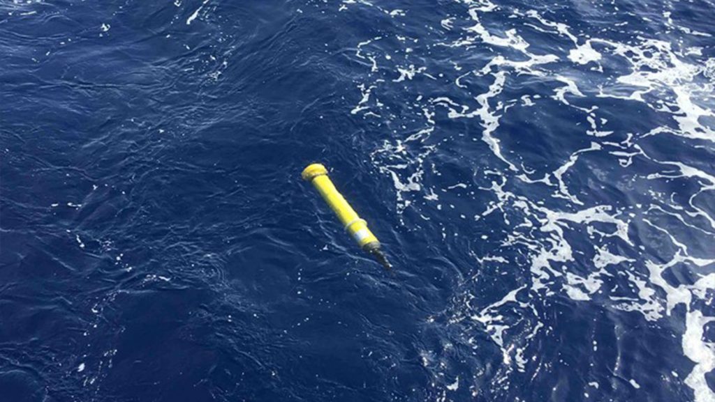
Originally published on noaa.gov on December 11, 2024. Somewhere in the middle of the ocean, a merchant mariner lowers a cylindrical robotic ocean observing instrument from a ship into the sea to record ocean temperature and salinity. Another instrument is deployed from a plane into the eye of a hurricane to take the pulse of […]

November 30th marks the official end of the 2024 Atlantic hurricane season. Throughout this active season, NOAA scientists set new records in tropical cyclone research that will improve forecasting accuracy, enhance our understanding of storm behavior, and strengthen preparedness efforts for communities in hurricane-prone regions. Their dedication and innovation contribute to a safer and more […]
Tropical cyclones are among the most deadly and costly natural disasters that affect the United States and many other countries each year. This has led the scientific community to prioritize improving tropical cyclone prediction and the understanding of how tropical cyclone activity has changed and will change in the future. In a new study published […]
Whether flying through hurricanes, diving in urban ports to study coral spawning, or sampling deep ocean currents on oceanographic cruises, summer at NOAA’s Atlantic Oceanographic and Meteorological Laboratory (AOML) is filled with scientific activity. To highlight the broad and impactful research conducted at the lab and the passionate scientists driving that work, AOML launched its […]

As Hurricane Rafael developed in the Caribbean, AOML researchers were inside the storm testing the newest experimental hurricane observation instrument: the Skyfora StreamSonde. The 2024 hurricane season marks the first year that Skyfora’s StreamSondes were released in high volumes by NOAA’s Hurricane Hunters for research and testing with a total of 91 sondes released. These […]

Over the past few months, the University of Miami’s Rosenstiel School of Marine, Atmospheric, and Earth Science has conducted three FLOTSUM, i.e., Florida Ocean Time Series by Undergrads at UM, cruises aboard its research vessel the F.G. Walton Smith. FLOTSUM day cruises are conducted five times per year in the Florida Straits for training purposes […]
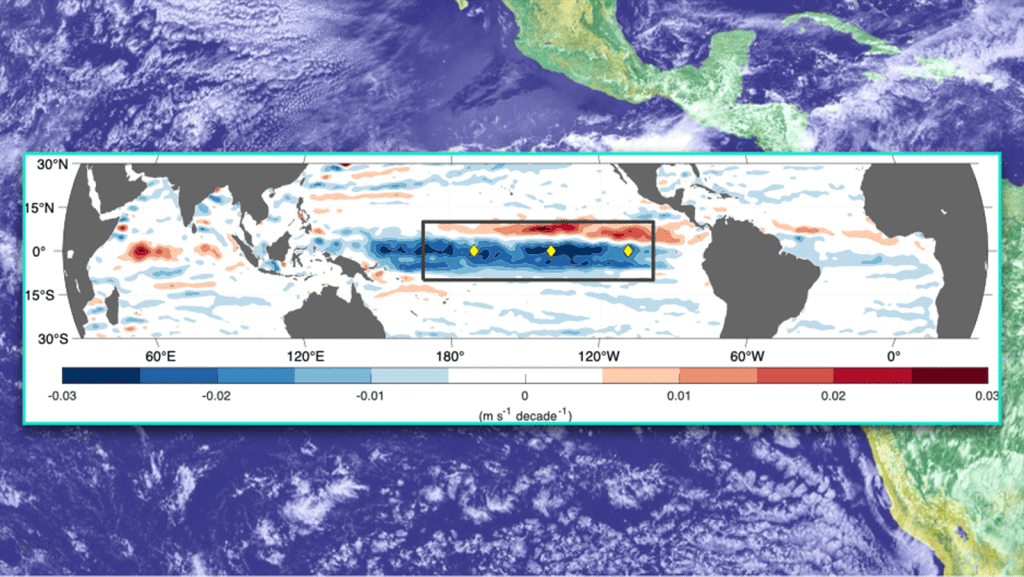
An official press release can be seen on the University of Miami Rosenstiel School’s newsroom website. A critical ocean layer for El Niño–Southern Oscillation (ENSO) dynamics. A study published October 31, 2024, in the Journal of Geophysical Research: Oceans has revealed significant acceleration in the upper-ocean circulation of the equatorial Pacific over the past 30 years. This […]

The waves lap at the bow of the RV Cable while glimmers of Cheeca Rocks, a bustling inshore patch reef, ebb and flow into focus below the surface. For eleven consecutive weeks, the Coral Program at NOAA’s Atlantic Oceanographic and Meteorological Laboratory (AOML) laid anchor at this long-term monitoring site to deploy and maintain Benthic […]
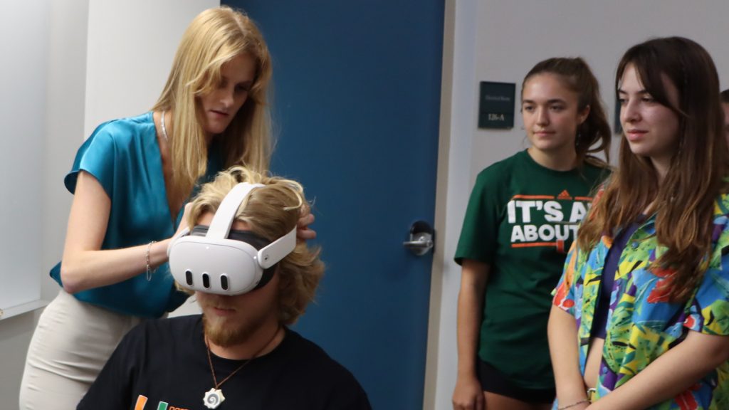
VR technology represents a new frontier in science communication, and NOAA’s Atlantic Oceanographic and Meteorological Laboratory (AOML) is using it to invite everyone on a research mission alongside their scientists. This virtual reality research experience is a project for Masters student Devon Ledbetter, who works as a science communication intern at AOML. Devon’s project aims […]

In recent years, meteorologists have made strides in predicting the trajectory of tropical cyclones as models and forecasts have become more accurate. However, forecasting intensity remains a much larger challenge; small changes in atmospheric conditions can have a large impact on forecasts. To better understand why some forecasts are more accurate, scientists at NOAA’s Atlantic […]

After more than 40 years of federal service, NOAA’s Atlantic Oceanographic and Meteorological Laboratory (AOML) celebrates the career of Frank Marks, PhD. Marks’ contributions to meteorology and hurricane research have left an indelible impact on the field, making him a true NOAA legend. Marks began his career at AOML in July 1980 as a Research […]

As Hurricane Helene developed in the Gulf of America, NOAA researchers gathered critical data from the sea and sky to better understand tropical cyclones and support the National Hurricane Center forecasters. This real time data gives meteorologists a clearer picture of the storm environment and structure, reducing forecast uncertainty. Researchers from NOAA’s Atlantic Oceanographic & […]

NOAA’s Atlantic Oceanographic and Meteorological Laboratory (AOML) is excited to announce the selection of Dr. Ghassan “Gus” Alaka as the new Director of the Hurricane Research Division (HRD). As a vital member of the AOML team since 2014, Alaka brings a wealth of experience and expertise to the role. Alaka’s journey with AOML began when […]

There is growing scientific interest in quantifying how large-scale ocean circulation is evolving as part of a changing global climate. Of particular interest is the potential weakening of the Atlantic Meridional Overturning Circulation (AMOC). However, the strength of the Florida Current, a key component of the AMOC, has remained stable for the past four decades, […]

Weather has no regard for political or geographic boundaries, making the timely and accurate prediction of extreme weather events a collective goal that bridges meteorological and ocean observing agencies worldwide. To encourage collaborative science and expand the network of ocean-atmosphere observations, scientists with NOAA’s Atlantic Oceanographic and Meteorological Laboratory (AOML) participated in a series of […]

Adapted from NOAA press release on August 22, 2024 Today, August 22, the 2023 State of the Climate report was released by the American Meteorological Society, showing Greenhouse gas concentrations, the global temperature across land and the ocean, global sea level and ocean heat content all reached record highs in 2023. The international annual review […]

Scientists and engineers at NOAA/AOML frequently participate in cruises in support of the NOAA/AOML eXpendable BathyThermograph (XBT) Network. Recently, Dr. Marlos Goes, a University of Miami CIMAS scientist, gave a short talk to the officers of the Vienna Express, a vessel from the Hapag-LLoyd company, about the importance of the Ship Of Opportunity Program (SOOP) […]

One of the largest challenges in hurricane research is studying the inner dynamics of a storm. The regions within the hurricane that provide the most valuable data are often the most inaccessible and dangerous to reach, creating an opportunity for researchers to utilize emerging technology to enter the storm. Small uncrewed aircraft systems (sUAS), commonly […]

This article was originally published on climate.gov on August 14th, 2024. Written by: Franz Philip Tuchen If you’re a regular reader of Climate.gov’s ENSO blog, then you know that scientists have been carefully observing how the Pacific Ocean is changing from El Niño’s warmer-than-average conditions earlier this year to expected cooler-than-average La Niña conditions by late […]

There and back again: NOAA Ship Gordon Gunter journeyed away from Pascagoula, Mississippi for 90+ days and 12,700+ nautical miles to conduct the PIRATA Northeast Extension cruise. A NOAA ship that traditionally sails in the Gulf of America embarked on a 90+ day journey into international waters and successfully completed its mission in support of […]

A 12-year collaboration between NOAA’s Atlantic Oceanographic and Meteorological Laboratory (AOML) and the Indian Ministry of Earth Sciences (MoES) has culminated in a renewal of an Implementing Arrangement (IA) on Technical Cooperation in Development of Tropical Cyclone Numerical Weather Prediction System for the Indian Seas, which paves the way for advances in severe weather modeling. […]
NOAA’s Atlantic Oceanographic & Meteorological Laboratory (AOML) is celebrating our FY 2024 internship class! From high school students to post doctoral fellows, these exceptional individuals are joining us from schools across the country, from Hawaii to Florida. They are researching corals, microbes, hurricanes, air-sea interaction, ocean acidification, communications strategies, and much more. Some of the […]
New study led by scientists at CIMAS, AOML and NMFS reveals impacts of suspended sediment from Port Miami on early life stages of a threatened Caribbean coral species.
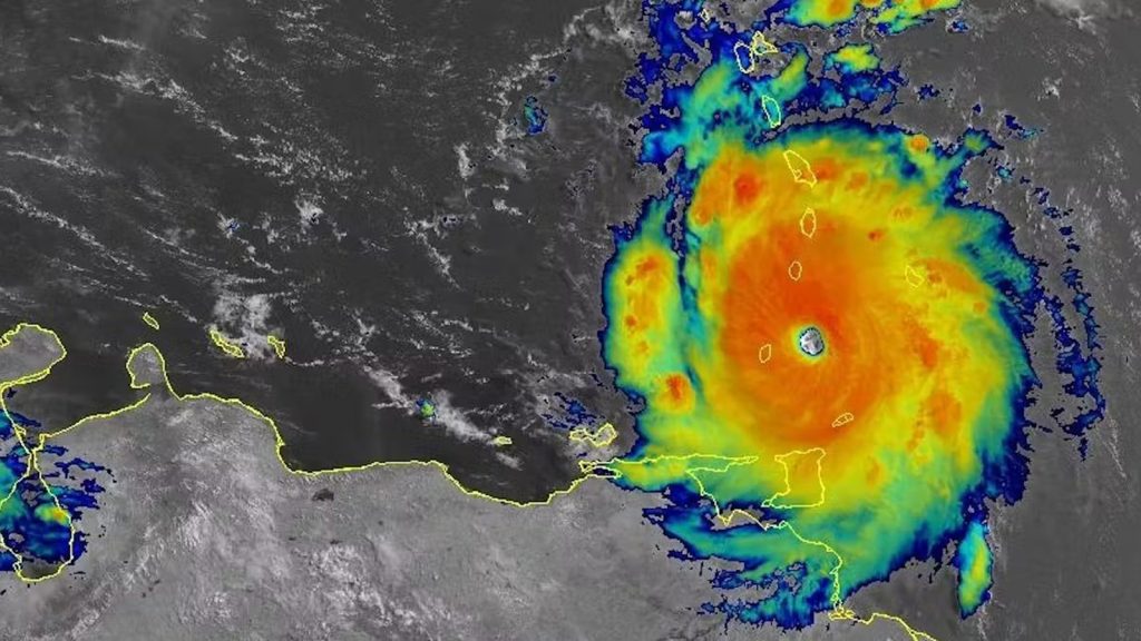
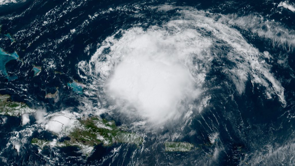
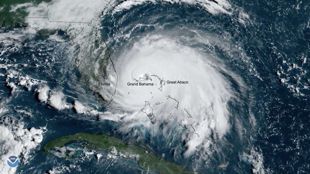
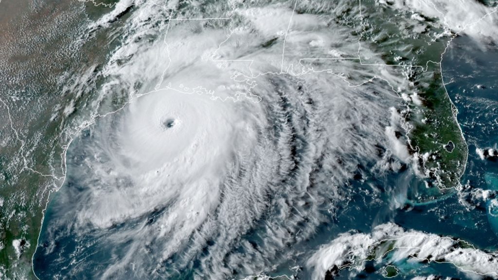
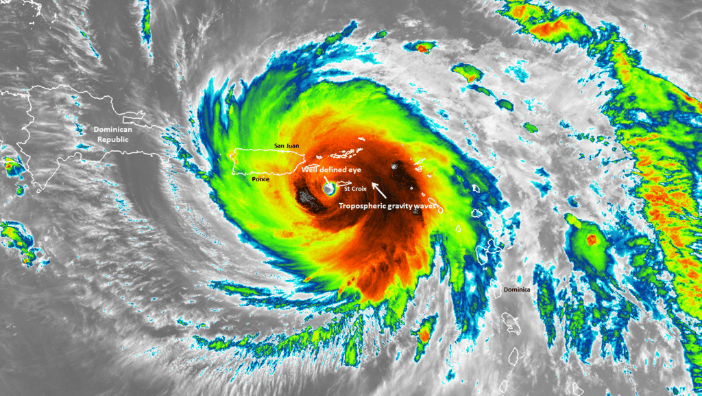
In early July, the Caribbean experienced 165 mph winds as Category 5 Hurricane Beryl swept through the region. Beryl was unprecedented, becoming the Atlantic’s earliest forming Category 5 tropical cyclone on record. The storm developed and rapidly intensified to maximum wind speed in less than four days – a behavior uncommon this early in the season. Despite the unprecedented intensification, hurricane scientists with NOAA’s Atlantic Oceanographic and Meteorological Laboratory were prepared.

Tornadoes are among the deadliest and costliest natural disasters in the United States and are one of the hardest to predict. In December 2021, the most destructive winter tornado outbreak, known as the Quad-State Tornado Outbreak, caused 89 fatalities, 672 injuries, and at least $3.9 billion in property damages. Scientists at the University of Miami’s Cooperative Institute of Marine and Atmospheric Studies (CIMAS) and NOAA’s Atlantic Oceanographic and Meteorological Laboratory (AOML) investigated this outbreak and found that it occurred under an exceptionally strong and prolonged negative Pacific-North American (PNA) pattern, which created favorable conditions for tornado outbreaks.
Tropical Cyclone Freddy breaks records as the longest-lasting cyclone on record. Spanning 36 days, it traveled from the Australia to Africa, nearly 33% of the Earth’s circumference.

A new study spanning two decades of research may indicate a series of reefs from the surface to 150 meters deep in the Gulf of America are more resilient to warmer oceans as they are exposed to a wider range of temperatures brought on by a physical movement of seawater called “eddies.”

In May 2024, representatives from the Hurricane Modeling Team at NOAA’s Atlantic Oceanographic & Meteorological Laboratory (AOML) hosted a Summer Colloquium focused on equipping the next generation of hurricane scientists with a knowledge base of the HAFS model.
With an active hurricane season on the horizon, the need for reliable hurricane forecasting is at the forefront of our minds. Heightened sea surface temperatures, weakened vertical wind shear, and an enhanced West African monsoon are expected to contribute to the development of tropical cyclones in the Atlantic. To predict these developing storms, meteorologists employ models that rely on current observations and mathematical calculations to predict a storm’s behavior and track. These models are complex and utilize inputs from a variety of sources including historic, numeric, oceanic, and atmospheric data to generate their predictions.
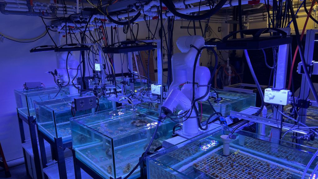
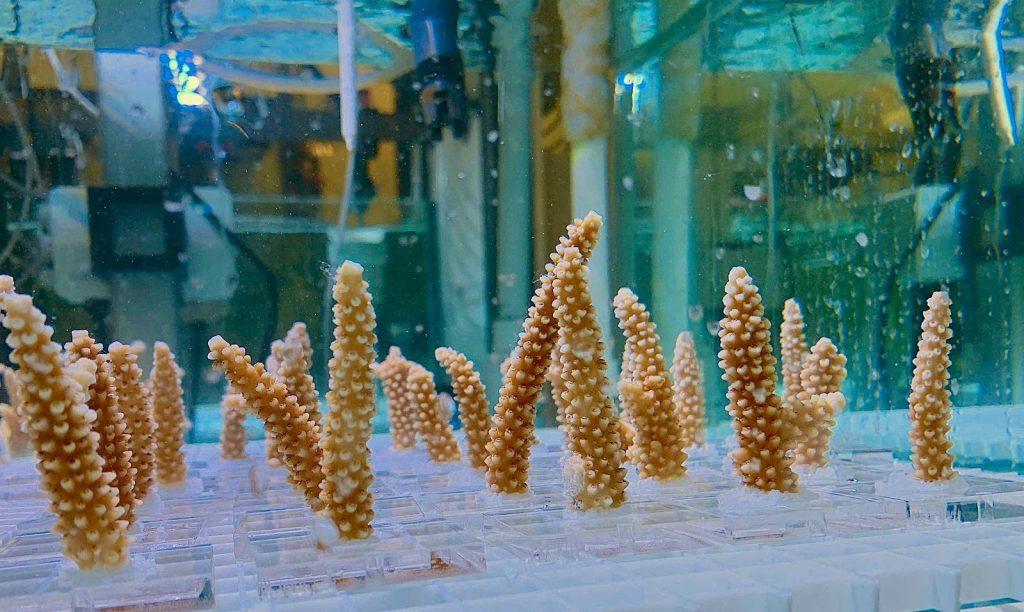
Blue lights fill the room. The faint smell of salt emanates throughout the space as wires and tubes intricately suspended over robotic arms move along custom-built tracks over four rows of tanks filled with seawater – and fragments of critically-endangered corals. In the Experimental Reef Lab, scientists at NOAA’s Atlantic Oceanographic and Meteorological Laboratory (AOML) and the Cooperative Institute for Marine and Atmospheric Studies (CIMAS) are investigating how crucial reef-building coral species are affected by the impacts of climate change using a suite of open-source robotic arms designed and built at AOML.
Floating ice, freezing temperatures, and streaks of lights in the night sky. The I08S GO-SHIP cruise successfully concluded on April 1st.

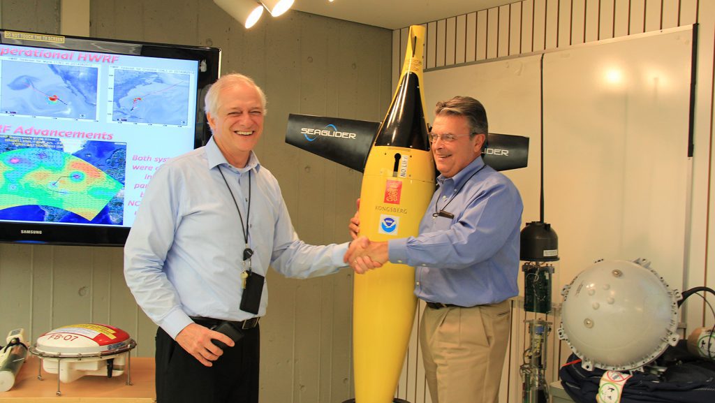
Improvements in the operational Hurricane Weather Research and Forecasting Model paved the way for tropical cyclone prediction and modeling by lowering intensity forecast errors by 45-50%.
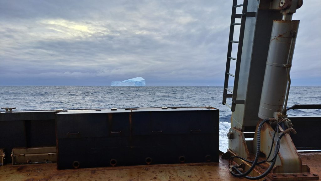
Wind, waves, and icebergs pierced through morning fog – the A13.5 GO-SHIP cruise proved both tumultuous and rewarding with vast amounts of new data that bring the promise of groundbreaking future research. After 52 days at sea, the A13.5 GO-SHIP cruise (short for “Global Ocean Ship-based Hydrographical Investigations Program”) returned to Cape Town, South Africa […]
Just in! A new study, which analyzed mooring observations and hydrographic data, found the Atlantic Meridional Overturning Circulation (AMOC) abyssal limb in the North Atlantic has weakened over the past two decades contributing to sea level rise in the region.
In a groundbreaking new study, National Oceanic and Atmospheric Administration (NOAA) scientists unveiled a significant advancement in hurricane tracking and forecasting. The study, named “The G-IV Inner Circumnavigation: A Story of Successful Organic Interactions Between Research and Operations at NOAA,” discusses how scientists across NOAA are improving hurricane forecasts through the effective use of NOAA […]
Chris Kelble, Ph.D. will serve as a Federal Coordinating Lead Author on first-ever National Nature Assessment (NAA).
Meet NOAA Corps Officer, LTJG Anna Gaskill In honor of Women’s History Month, NOAA’s Atlantic Oceanographic and Meteorological Laboratory (AOML) spoke with our NOAA Corps Officer, LTJG Anna Gaskill, about her career at NOAA and her advice for women considering opportunities with the NOAA Corps. Anna currently serves as the AOML Operations Manager, primarily coordinating […]
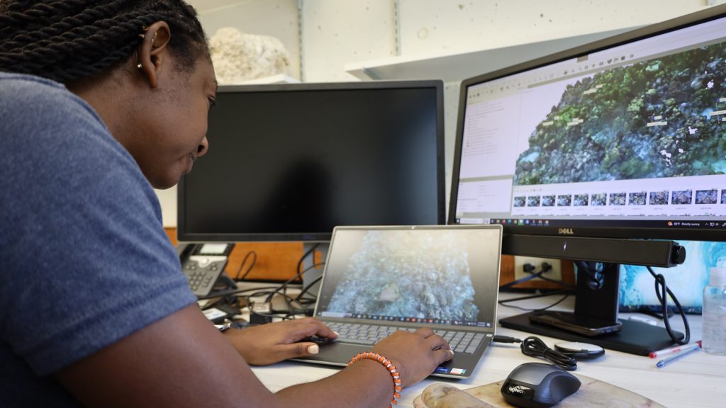
In honor of Black History Month, NOAA’s Atlantic Oceanographic and Meteorological Laboratory (AOML) spoke with Oceanographer Kayelyn Simmons, PhD, about her role at AOML and what Black History Month means to her. Kayelyn is a federal oceanographer at AOML, leading benthic habitat characterization studies using 3D mapping with the Ocean Chemistry and Ecosystems Division. Her […]
Scientists at NOAA’s Atlantic Oceanographic and Meteorological Laboratory (AOML) are gearing up for a busy season at sea with three research cruises departing in the month of February. The A13.5 Global Ocean Ship-based Hydrographic Investigations Program (GO-SHIP) cruise, the I08S GO-SHIP cruise, and the Prediction and Research Moored Array in the Tropical Atlantic (PIRATA) Northeast Extension cruise will all depart in February to collect samples from the surface to the depths of the ocean and improve our understanding of ocean circulation, carbon uptake, biological conditions, and climate variability.

Congratulations to AOML’s 2024 Department of Commerce Medal winners! AOML is proud to recognize the achievements of our outstanding scientists for their vital contributions to better understand the Earth systems and protecting our nation.
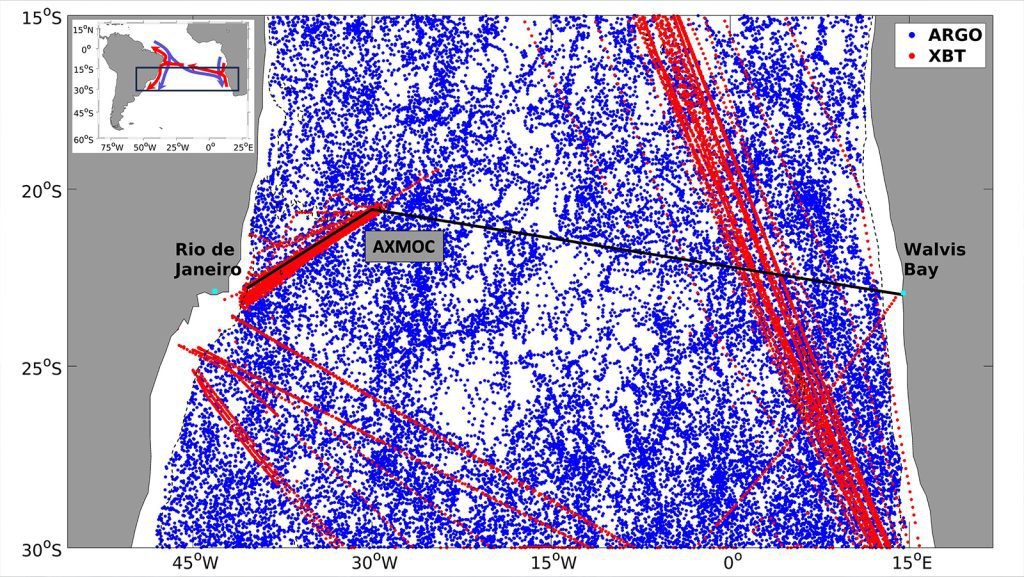
Changes in the Atlantic Meridional Overturning Circulation (AMOC) and its transport of heat can affect climate and weather patterns, regional sea levels, and ecosystems. A new study led by Ivenis Pita, a University of Miami PhD student working at NOAA’s Atlantic Oceanographic and Meteorological Laboratory/ the Cooperative Institute of Marine and Atmospheric Studies (CIMAS), is the first to estimate the AMOC and heat transport at 22.5°S in the South Atlantic, demonstrating the importance of sustained in situ observations to monitor the state of the AMOC.
A team of scientists from AOML, the U.S. Geological Survey (USGS), and the University of South Carolina retrieve a sediment trap from the Gulf of America, spending months processing and examining the flurry of microscopic shells and environmental DNA (eDNA) of biological debris collected by the trap, known as “marine snow.” This collaborative NOAA–USGS research project uses these sediment trap samples to investigate the biological carbon pump, the ocean’s role in removing atmospheric carbon, and climate change patterns.
Congratulations to Lev Looney, a University of Miami graduate student working at NOAA’s Atlantic Oceanographic Meteorological Laboratory (AOML), for surpassing his 1,000th student through the Skype a Scientist program!
A groundbreaking new study spanning more than a decade and hundreds of miles of the Florida Coral Reef demonstrates the key role benthic communities play in reducing the impacts of climate change on coral reef ecosystems, specifically Ocean Acidification.
Happy Holidays to all! As we close out 2023, join us as we look back at some of our top research highlights this year! From responding to heat waves to setting records and launching new tech, our dedicated team continues to push the boundary in an effort to support NOAA’s mission to build a climate-ready […]
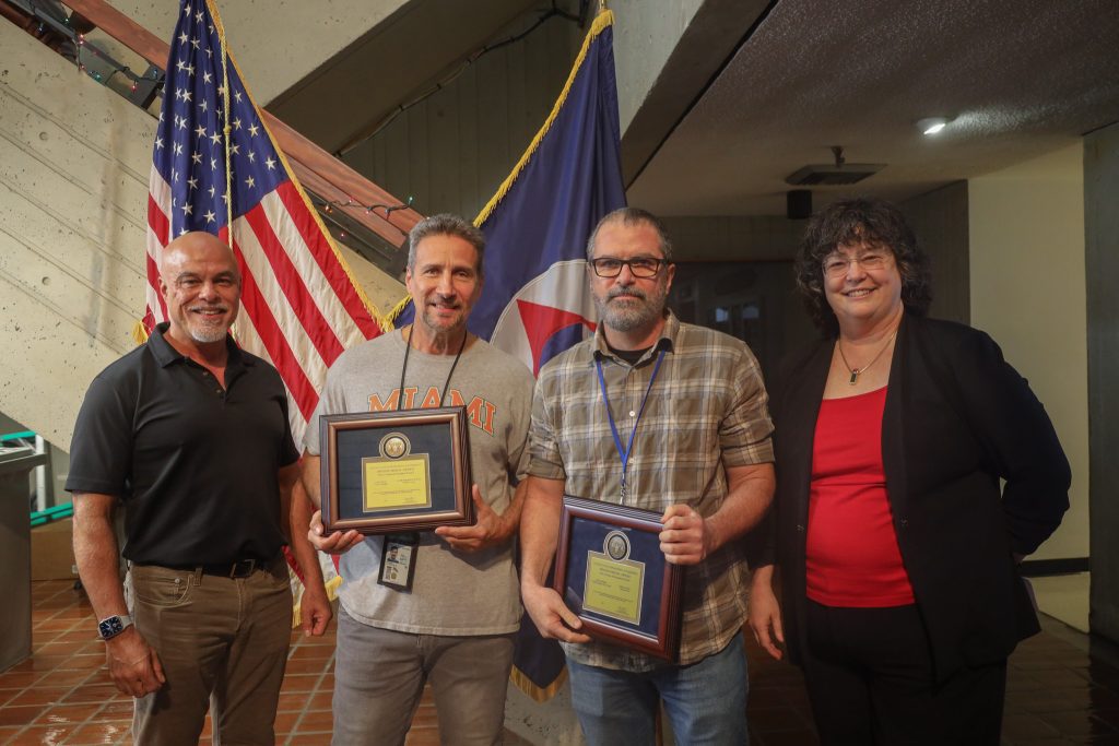
AOML scientists, staff, and team members were recognized this year for their outstanding contributions and dedication to NOAA’s mission. The following individuals and teams are recipients of prestigious awards that acknowledge their dedication to sharing our mission and initiatives with the community, fostering deeper connections and leaving a lasting, positive impact on the lives of those we […]
November 30th marks the official end to the 2023 Atlantic hurricane season. Scientists and forecasters from across NOAA pushed boundaries as they worked throughout this active season to conduct crucial tropical cyclone research that will strengthen our ability to forecast future tropical cyclone development and better protect those most affected.
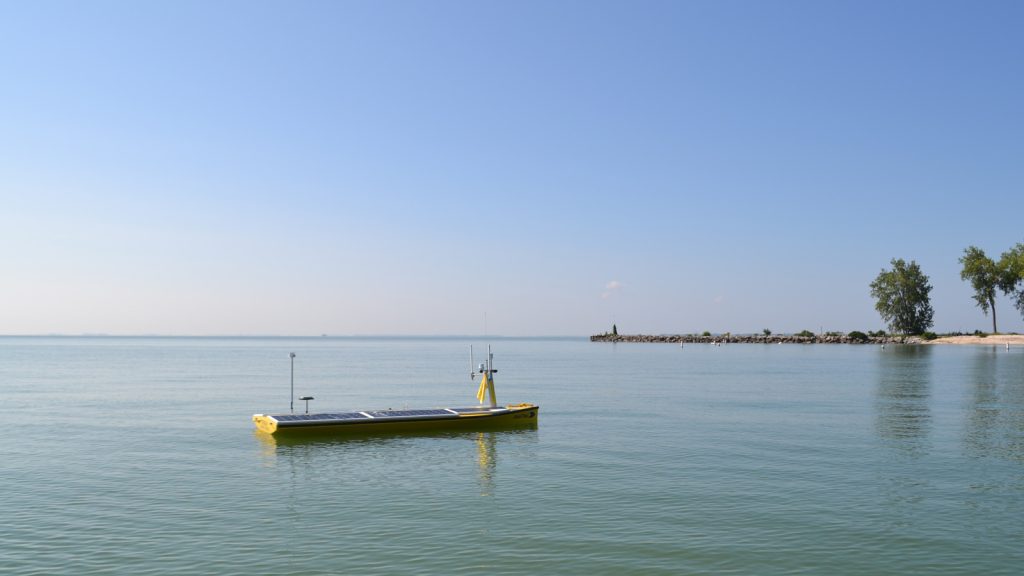
For engineers and scientists, sometimes failure means progress. When developing a new technology, the process is to field test, fail, tweak, and test again, each time failing a little less and learning what does and does not work until – finally – they get it right. On August 5, 2023, scientists from NOAA’s Great Lakes […]
NOAA announced $4.2 million in funding awarded to a collaborative project entitled the Florida Regional Ecosystems Stressors Collaborative Assessment (FRESCA), co-led by NOAA’s Atlantic Oceanographic & Meteorological Laboratory (AOML) and the University of Miami, and involving seven different academic and research institutions.
After over 25 years of federal service as a physical oceanographer, we celebrate the career of Dr. Gustavo Goni as he retires from NOAA’s Atlantic Oceanographic and Meteorological Laboratory (AOML). Gustavo began his career at AOML in 1991 when he accepted a Research Associate position with the University of Miami’s Cooperative Institute of Marine and Atmospheric Studies. Gustavo began his federal career with NOAA in 1997 as an oceanographer with the Physical Oceanography Division of AOML. In May 2009, he became the Director of the Division, a position he held until March 2021.
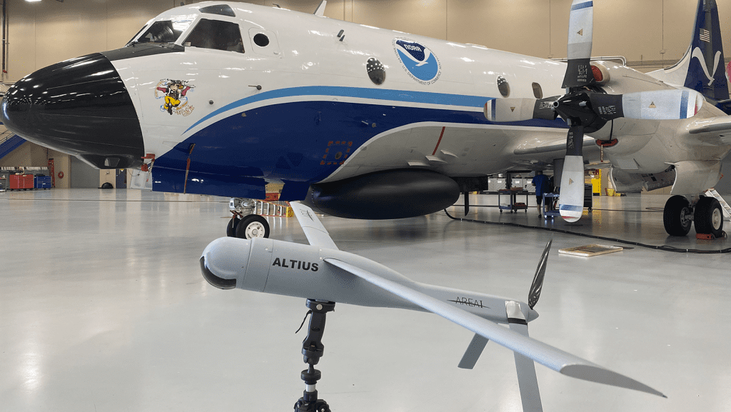
NOAA hurricane researchers successfully deployed a new uncrewed aircraft system (UAS) into Tropical Storm Tammy (2023) near an uncrewed surfance vehicle, saildrone, to measure parts of the storm too dangerous for humans to go. The Altius 600 UAS was launched from the NOAA WP-3D Orion Hurricane Hunter aircraft by scientists from NOAA’s Atlantic Oceanographic and Meteorological Laboratory during missions into the storm in coordination with the saildrone researchers and pilots.
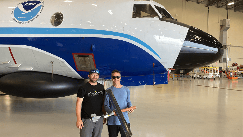
NOAA hurricane researchers successfully deployed a new uncrewed aircraft system (UAS) into Tropical Storm Tammy (2023) to measure parts of the storm too dangerous for humans to go. The Black Swift Technologies S0™ UAS was launched from the NOAA WP-3D Orion Hurricane Hunter aircraft by scientists from NOAA’s Atlantic Oceanographic and Meteorological Laboratory during missions into the storm as it strengthened and headed closer to the Leeward Islands of the Caribbean.
The Global Drifter Program at AOML has a new ERDDAP, or Environmental Research Division Data Access Program, server that is now publicly available and hosts both hourly and 6-hour quality-controlled interpolated drifter datasets. This new scientific data server uses free and open-source software created by the Environmental Research Division of NOAA’s Southwest Fisheries Science Center.
As Hurricanes Franklin and Idalia strengthened in late August, NOAA scientists collected critical data from the air, sea surface, and underwater to enhance forecasts and increase scientific knowledge. In less than two weeks, a fleet of strategically placed oceanographic instruments gathered temperature, salinity, and surface wind speed data, while NOAA’s Hurricane Hunter aircraft repeatedly flew […]

Today, September 6, the 2022 State of the Climate report was released by the American Meteorological Society, showing greenhouse gas concentrations, global sea levels, and ocean heat content reached record highs in 2022.
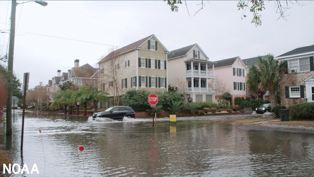
Sea level rise is one of the most challenging consequences of global warming. A new collaborative study led by Dr. Denis Volkov from NOAA-AOML and the University of Miami’s Cooperative Institute of Marine and Atmospheric Studies found that Atlantic Meridional Overturning Circulation (AMOC) induced changes in basin-wide ocean heat content are influencing the frequency of floods along the United States southeastern coast.
A landmark study published last week demonstrates that the ocean’s role as a carbon sink and its ability to store anthropogenic, or human-caused, carbon may be weakening. A collaboration among international researchers led by Jens Daniel Müller, Ph.D. (ETH Zurich), this study captures a snapshot of three decades of global interior ocean measurements to determine […]
In a new study, scientists from NOAA, University of South Florida, Florida International University, University of Miami, and LGL Ecological Associates, compared wind information alongside Sargassum Inundation Risk (SIR) maps against citizen science reports of inundation in the coasts of Florida, Gulf of America, Bahamas, and Caribbean regions. With present SIR maps, inundation is considered as more likely if large densities of satellite-detected Sargassum are near a coast. The scientists in the study found that shoreward wind velocity used in conjunction with SIR indicators greatly improves the agreement with coastal observations of Sargassum beaching compared to SIR indicators alone. Including wind metrics in SIR maps will allow for improved understanding of Sargassum trajectories in coastal areas for forecast purposes.
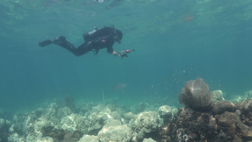
The growing concerns of coral bleaching due to the ongoing marine heatwave across South Florida, the Gulf of America, and the greater Caribbean led scientists at NOAA’s Atlantic Oceanographic & Meteorological Lab (AOML) to return to Cheeca Rocks on July 31st and August 1st, 2023.
On National Intern Day, AOML is celebrating our largest internship class ever of 36 interns ranging from high school students to post doctoral fellows. They are joining us from schools across the country, from California to Florida, and are researching corals, microbes, hurricanes, air-sea interaction, ocean acidification, communications strategies, and much more, all within our 4 divisions:
Congratulations to AOML scientist, Dr. Hosmay Lopez, for receiving the 2022 Federal Employee of the Year award for the Scientific category at the 58th annual South Florida Federal Executive Board’s awards program. Hosmay was recognized for his groundbreaking contributions to the understanding of how El Niño-Southern Oscillation (ENSO) events will evolve with global warming, with significant implications for how residents of South Florida will experience climate change over the next several decades.
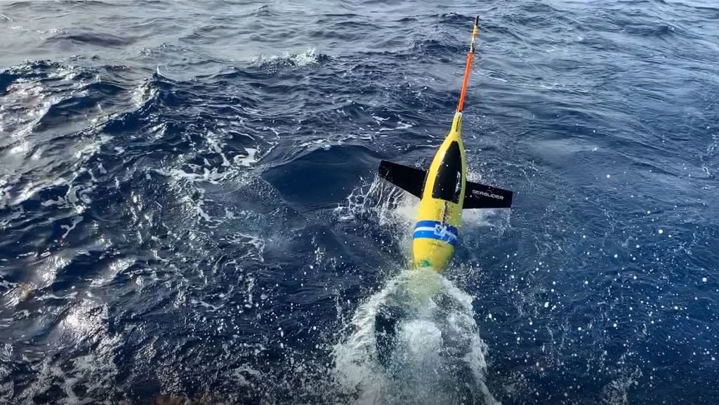
This summer marks AOML’s tenth consecutive year of gathering underwater glider observations during the Atlantic hurricane season. The project began in 2014 with two gliders deployed off Puerto Rico to study the ocean’s role in tropical cyclone development and intensification. Since then, glider observations have become an integral part of the data gathered annually to improve tropical cyclone forecasts, as well as better understand how the ocean and atmosphere interact during the passage of tropical cyclones.
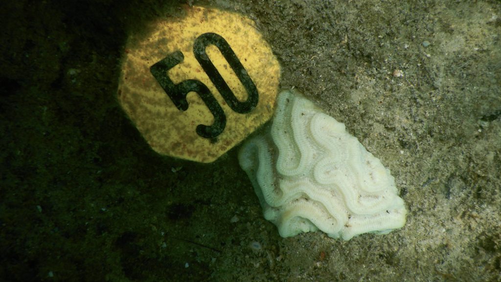
A marine heatwave has spread across the Gulf of America and the Caribbean with temperatures ranging between one and three degrees Celsius (~2-4.5˚F) above average. Ocean temperatures around south Florida are the warmest on record for the month of July (dating back to 1981). Marine heatwaves are not unprecedented, but their influence on tropical storm development and coral reef health, as well as the persistence of the current heatwave, are among the causes for concern.
AOML’s Hurricane Modeling Group was founded in 2007 to advance hurricane forecast models through development and targeted research. From inception, the team has worked to improve NOAA’s hurricane modeling systems; first with the legacy Hurricane Weather Research Forecast (HWRF) model, and now with its transition to the next generation model, Hurricane Analysis and Forecast System (HAFS).
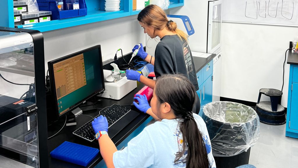
Only a few weeks into summer, Coral Program Interns Lorelei Ing, Taylor Gill, Zachary Zagon and Kenzie Cooke have been hard at work as they process coral samples and perform DNA extractions in preparation for ‘Omics analyses that will help to better understand how the genetic structure of corals influences their resilience to environmental stressors. The Coral Program falls within the Ocean Chemistry and Ecosystems Division (OCED) at NOAA’s Atlantic Oceanographic and Meteorological Laboratory (AOML).
Scientists at NOAA’s Atlantic Oceanographic and Meteorological Laboratory (AOML) found that Atlantic Niño, the Atlantic counterpart of the Pacific El Niño, increases the formation of tropical cyclones off the coast of West Africa, also known as Cape (Cabo) Verde hurricanes. The study published in Nature Communications is the first to investigate the links between Atlantic Niño/Niña and seasonal Atlantic tropical cyclone activity and the associated physical mechanisms.
NOAA and partners are improving hurricane forecasting by harnessing the power of new technologies and working to coordinate these technologies to predict hurricane track, intensity, and rapid intensification.
On May 9, a team of scientists aboard the NOAA Ship Ronald H. Brown arrived at their final destination in Reykjavik, Iceland following 55 days at sea. The team of 50 scientists and 28 crew members followed a track through the North Atlantic, from Brazil to Iceland, referred to as the A16N transect, and successfully completed 150 stations, collecting over 3,000 samples from the Atlantic’s surface to the seafloor, giving scientists a holistic snapshot of the Atlantic Ocean basin.
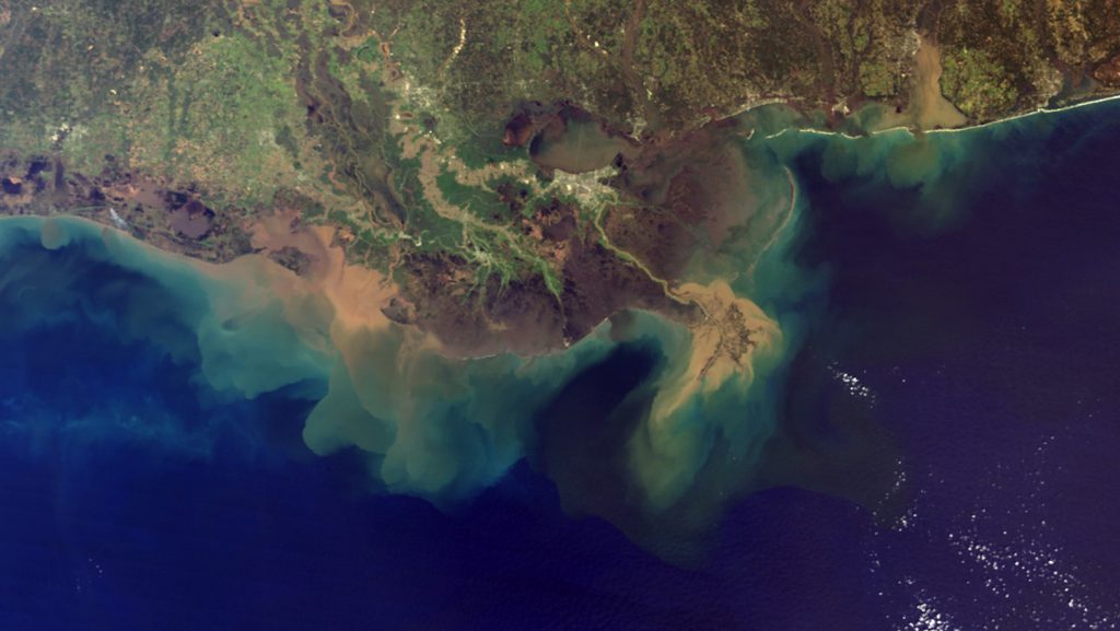
A new river chemistry and discharge dataset for U.S. coasts has been released. A recent publication by scientists at NOAA’s Atlantic Oceanographic and Meteorological Laboratory (AOML), Northern Gulf Institute (NGI), and NOAA’s Geophysical Fluid Dynamics Laboratory (GFDL) provides a river chemistry and discharge dataset for 140 U.S. rivers along the West, East, and Gulf of America coasts, based on historical records from the U.S. Geological Survey (USGS) and the U.S. Army Corps of Engineers. This dataset will be very useful for regional ocean biogeochemical modeling and carbon chemistry studies.
Researchers at NOAA seek new techniques to advance hurricane forecasts to better protect life and property. In preparation for the upcoming 2023 hurricane season, which begins June 1, scientists are accelerating the use of small uncrewed aircraft technologies and the collocation of observational ocean assets, among other advancements. Here are five ways that NOAA researchers are improving hurricane track and intensity forecasts:
The NOAA Commissioned Officer Corps is one of the nation’s eight uniformed services and its officers are an integral part of the National Oceanic and Atmospheric Administration (NOAA). With approximately 330 officers and growing, the NOAA Corps supports nearly all of NOAA’s programs and missions. The combination of commissioned service and scientific expertise makes these officers uniquely capable of leading some of NOAA’s most important initiatives.
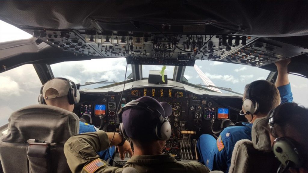
There is more to the job of a Hurricane Hunter than meets the eye. Researchers and pilots from the National Oceanic and Atmospheric Administration (NOAA) bravely fly into one of the most dangerous environments on Earth to collect data inside a tropical cyclone, which helps to improve forecast models and protect lives and property.
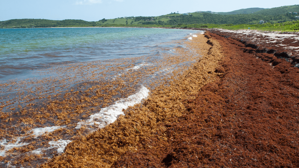
When massive mounds of golden-brown seaweed began piling up on beaches throughout the Caribbean and West Africa in summer of 2011, the question of where it came from probably mattered less to residents and businesses than how they were going to get rid of it. Certainly, few would have connected the Sargassum seaweed invasion to the extremely snowy 2010-11 winter in the eastern United States. But according to a hypothesis proposed by a team of NOAA AOML-led scientists in 2020, the two phenomena share an origin story: an extremely strong and long-lasting shift of the North Atlantic Oscillation into its negative phase back in 2010.
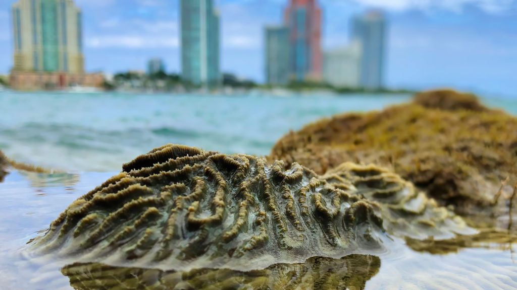
The Port of Miami is a bustling waterway with large cruise and cargo ships, ferries, fishing vessels, and recreational boats. As it turns out, this waterway is also home to a thriving coral community.
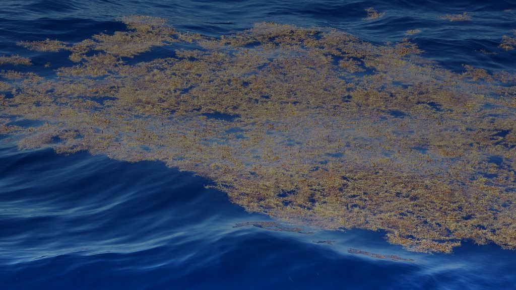
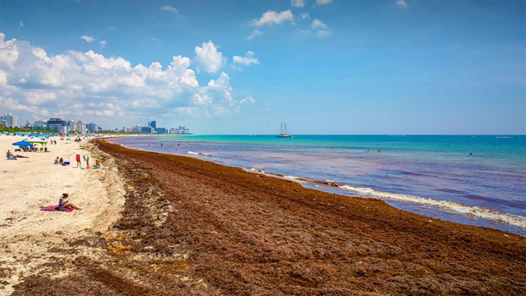
Earlier this year, ocean scientists raised an alert about the large amount of seaweed drifting in the tropical Atlantic this spring. Experts warned that the region’s annual spring bloom of Sargassum—a free-floating brown macroalgae from the North Atlantic that suddenly appeared in large quantities in the tropics in 2011— was the densest observed in March since scientists began tracking the phenomenon with satellite images twenty years ago. Excessive amounts of Sargassum raise the chances that large mats will break free from the prevailing currents and wash ashore later this spring and summer in the Caribbean, Gulf of America, and around Florida.
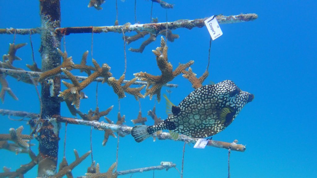
In collaboration with the Lirman Lab at the University of Miami (UM), NOAA Atlantic Oceanographic and Meteorological Laboratory’s (AOML) Coral Program now has its own coral nursery tree!
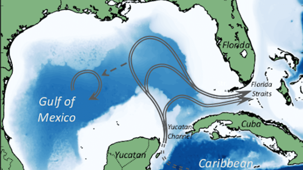
A recent study by scientists at NOAA’s Atlantic Oceanographic and Meteorological Laboratory (AOML) in collaboration with partners at the University of Miami’s Rosenstiel School of Marine, Atmospheric, and Earth Science used a numerical modeling approach to investigate the impact of the eddy field in the Caribbean Sea on Loop Current predictions downstream in the Gulf of America. They found that eddy activity in the Caribbean Sea is crucial for the accurate prediction of eddy shedding by the Loop Current.

In honor of Women’s History Month, NOAA’s Atlantic Oceanographic and Meteorological Laboratory (AOML) would like to recognize two of our female leaders within the Hurricane Research Division (HRD), Heather Holbach and Shirley Murillo. We talked to these incredible scientists to learn more about their leadership roles within the division and to seek out any advice they have for women early in their science career.
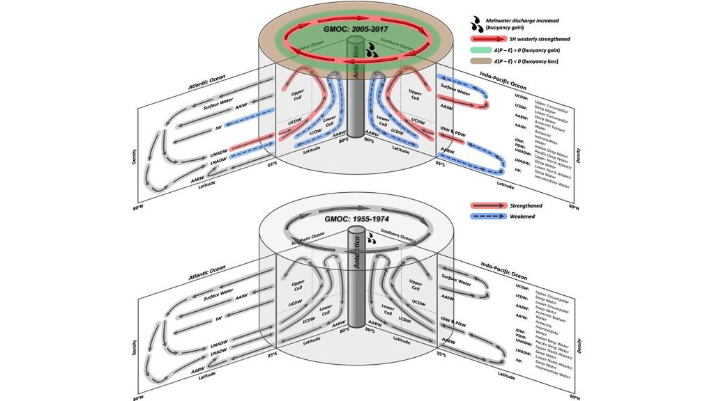
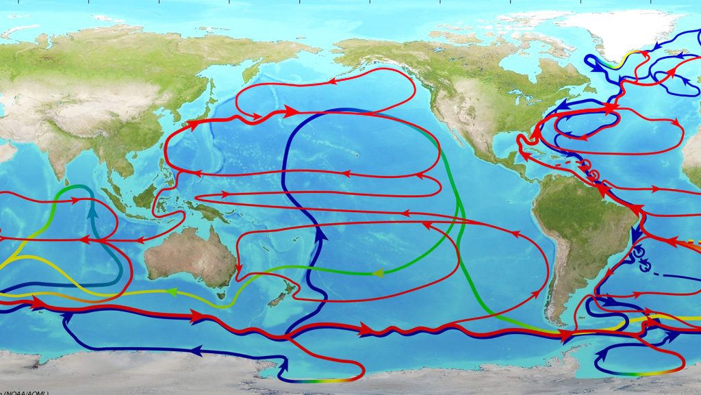
Scientists at NOAA’s Atlantic Oceanographic and Meteorological Laboratory (AOML) have shown that the Global Meridional Overturning Circulation (GMOC), commonly known as the global ocean conveyor belt, has changed significantly in the Southern Ocean since the mid-1970s, with a broadening and strengthening of the upper overturning cell and a contraction and weakening of the lower cell. These changes are attributed to human induced ozone depletion in the Southern Hemisphere stratosphere and increased carbon dioxide in the atmosphere. The study also shows that the changes in the Southern Ocean are slowly advancing into the South Atlantic and Indo-Pacific oceans.
Using a crowdsourcing approach to gather both published and unpublished data, scientists have determined the global bacteria patterns associated with deadly stony coral tissue loss disease (SCTLD).
In celebration of Women’s History Month, NOAA’s Atlantic Oceanographic and Meteorological Laboratory (AOML) would like to recognize two female scientists from our Ocean Chemistry and Ecosystems Division who are leaders aboard the A16N GO-SHIP (Global Ocean Ship-based Hydrographic Investigations Program) Repeat Hydrography cruise.
In honor of Women’s History Month, NOAA’s Atlantic Oceanographic and Meteorological Laboratory (AOML) spoke with our Administrative Officer, Dalynne Julmiste, about her leadership role at AOML and the advice she has for women just starting out their careers.
Originally published at NOAA Global Ocean Monitoring & Observing on March 7th, 2023. 30-years of ocean observations provide view into long-term ocean trends On March 6, a team of scientists on the NOAA Ship Ronald H. Brown departed from Suape, Brazil for a 55-day cruise to the northerly waters of Reykjavik, Iceland. With 150 planned stops along this […]

In celebration of NOAA’s Atlantic Oceanographic and Meteorological Laboratory’s 50th Anniversary and Women’s History Month, we sat down with Dr. Silvia Garzoli, a retired NOAA/AOML scientist, to speak about her time with NOAA and what Women’s History Month means to her.
A heat-tolerant algae found in some tropical Pacific corals can make reefs more resilient to heatwave events, according to a new study in the Proceedings of the National Academy of Sciences. Researchers with University of Miami’s Cooperative Institute for Marine and Atmospheric Studies (UM-CIMAS) and NOAA’s Atlantic Oceanographic and Meteorological Laboratory (AOML) examined four decades of temperature, coral cover, bleaching, mortality data from three mass bleaching events, and symbiont community data from the last two, to find that a symbiont algae helped corals better tolerate heat stress, increasing their resilience to warming ocean temperatures.
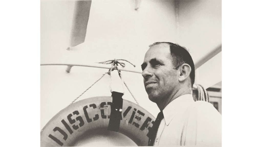
As a part of NOAA’s Atlantic Oceanographic and Meteorological Laboratory (AOML)’s 50th anniversary celebration, we would like to honor and remember AOML’s dedicated founder and first Director, Dr. Harris B. Stewart, Jr.
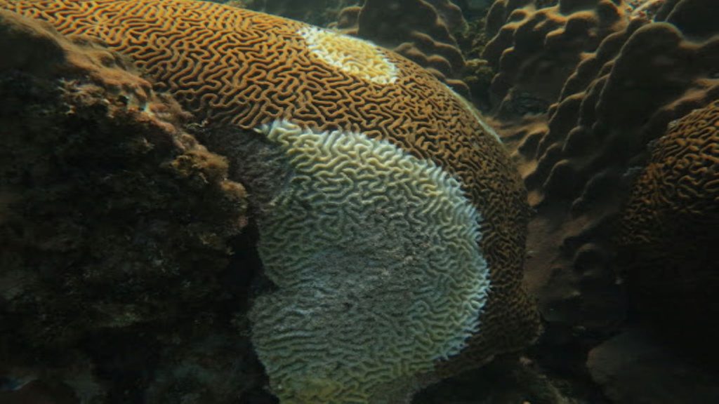
When white lesions began appearing at the famously intact Flower Garden Banks coral reef system, scientists knew a rapid, multi-agency, collaborative response was vital. Scientists from NOAA’s Atlantic Oceanographic and Meteorological Laboratory (AOML) and University of Miami’s Cooperative Institute of Marine and Atmospheric Studies (CIMAS) recently co-authored a publication about rapid tissue loss on the three dominant coral species at Flower Garden Banks National Marine Sanctuary, observed during National Coral Reef Monitoring Program cruises in the fall of 2022.

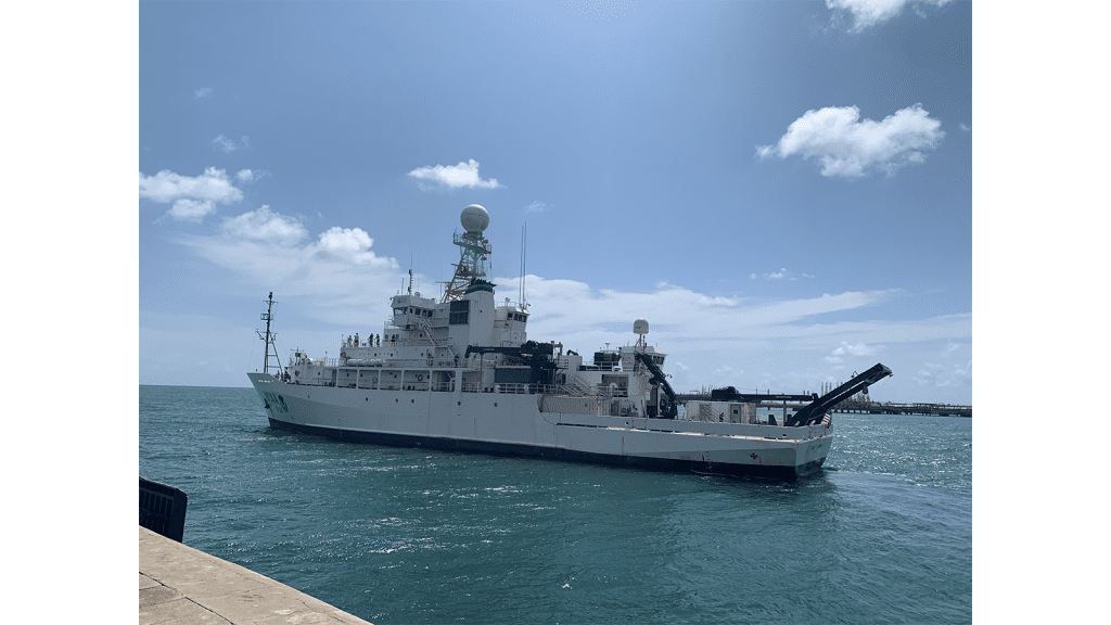
Researchers with NOAA’s Atlantic Oceanographic and Meteorological Laboratory (AOML), NOAA’s Pacific Marine Environmental Laboratory (PMEL), NOAA’s National Environmental Satellite, Data and Information Service, and partners set sail from Bridgetown, Barbados aboard NOAA Ship Ronald H. Brown on November 1st, 2022. Over the next 40 days, the crew and scientists recovered and redeployed key moorings in the Prediction and Research Moored Array in the Tropical Atlantic (PIRATA), deployed an additional mooring, and serviced two equatorial PIRATA buoys in support of the PIRATA Northeast Extension project and broader PIRATA objectives. They also conducted a number of research projects on the ocean and atmosphere that advance our understanding of carbon absorption in the ocean and atmospheric pollution.
Congratulations to AOML’s 2023 Department of Commerce Gold Medal winners! AOML is proud to recognize the achievements of our outstanding scientists and staff for their vital contributions to increasing the efficiency and effectiveness of NOAA.
Scientists from NOAA’s Atlantic Oceanographic and Meteorological Laboratory (AOML), and our cooperative institute partners, the University of Miami’s Cooperative Institute of Marine and Atmospheric Studies and the Northern Gulf Institute, recently participated in Ocean Acidification Annual Community Meetings at the Scripps Institute of Oceanography in San Diego, California. Over the course of multiple days, scientists attended various meetings on ocean acidification research topics, visited laboratories, met with fellow scientists, learned about new ocean acidification technologies, and much more.
Coral scientists at NOAA’s Atlantic Oceanographic and Meteorological Laboratory (AOML) and University of Miami Cooperative Institute of Marine and Atmospheric Science (CIMAS) developed a new modeling approach, for evaluating coral reef persistence under climate change scenarios. Aiming to improve coral restoration efforts, this new user-friendly framework has been created as a helpful tool for coral reef scientists and managers to address the increasing vulnerability of these vital ecosystems.
The world’s largest yearly gathering for the weather, water and climate community took place earlier this month in Denver, Colorado. Scientists from NOAA’s Atlantic Oceanographic and Meteorological Laboratory (AOML) participated in the 103rd annual American Meteorological Society (AMS) meeting from January 8 – 12, both virtually and in-person. Formal presentations, posters, panel discussions and town hall meetings were all featured during the meeting.
Since the inception of the international South Atlantic Meridional Overturning Circulation (SAMOC) initiative in 2007, substantial advances have been made in observing and understanding the South Atlantic component of the Atlantic Meridional Overturning Circulation (AMOC). The goals of the SAMOC initiative are to monitor climatically relevant oceanic fluxes of mass, heat, and freshwater, provide observations to validate and improve numerical models and climate predictions, and understand the impacts of the SAMOC on climate and weather.
NOAA’s Atlantic Oceanographic and Meteorological Laboratory (AOML) is celebrating New Years with a look back at some of our top stories from 2022!
Scientists at NOAA’s Atlantic Oceanographic and Meteorological Laboratory (AOML) have discovered that “long-read” genetic sequencing can be used to learn more about eukaryotic plankton, including krill and copepods, which are involved in many important marine processes.

Introducing a new social media series from NOAA’s Atlantic Oceanographic and Meteorological Laboratory (AOML): 12 Days of Instruments!
This series highlights 12 of the many instruments used by our researchers at AOML! Each of these instruments are vital to conducting our groundbreaking research.

NOAA affiliated scientists led a water quality and biodiversity workshop in São Paulo, Brazil, meeting with local leadership to discuss new plans for the sustainable management of an increasingly vulnerable coastal area.
A group of scientists from NOAA’s Atlantic Oceanographic and Meteorological Laboratory and the University of Miami’s Cooperative Institute of Marine and Atmospheric Studies have found that 70 percent of Florida’s coral reefs are experiencing a net loss of reef habitat.
November 30th marked the official end to the 2022 Atlantic hurricane season. Scientists and forecasters from across NOAA worked tirelessly throughout the season to conduct critical tropical cyclone research. This year, NOAA’s Atlantic Oceanographic and Meteorological Laboratory (AOML) coordinated the longest series of missions into a single tropical system, arranged multiple observing assets for simultaneous data collection, deployed new sUAS technology, and included a novel “moving nest” to our next-generation hurricane model.
Coral researchers from NOAA’s Atlantic Oceanographic and Meteorological Laboratory (AOML) and the University of Miami Cooperative Institute of Marine and Atmospheric Science (CIMAS) recently organized into three teams and ventured into the field to tackle a multitude of research projects relating to sensitive coral ecosystems in Miami and the Florida Keys. The first project, led […]
The ability to predict whether and when a tropical cyclone will become vertically aligned is critical for intensity change forecasts, as storms can intensify quickly after achieving an aligned structure. A recent study from researchers at NOAA’s Atlantic Oceanographic and Meteorological Laboratory and the University of Miami’s Cooperative Institute for Marine and Atmospheric Studies shows how weak, disorganized tropical cyclones containing different center locations with height, called misalignment, can develop a vertically aligned structure. This study works to improve forecasts of when this alignment might occur by identifying key times of the day and other tropical cyclone characteristics when alignment is likely.
This story was adapted from an article by the University of Miami Rosenstiel School of Marine, Atmospheric, and Earth Science. A new study suggests that ships may be spreading a deadly coral disease across Florida and the Caribbean. The findings may help to establish testing and treatment methods to prevent further spread. According to lead […]

Heat extremes are the number one weather-related cause of death in the United States, prompting the climate community to study the driving forces behind these extreme events to improve their prediction. A new study published in the Journal of Geophysical Research finds an increase in summertime heat wave occurrence over the US Great Plains is linked to a larger than normal tropical Atlantic warm pool.
President Biden has selected John Cortinas, Ph.D, NOAA’s Director at the Atlantic Oceanographic and Meteorological Laboratory, as one of the recipients of the 2022 Presidential Rank Award. The award is one of the most prestigious in the federal career civil service and recognizes the hard work and important contributions of dedicated civil servants in the American federal workforce.
Global carbon dioxide emissions in 2022 remain at record levels and natural carbon sinks are being impacted by climate change, according to a report published last week by the Global Carbon Project.
New NOAA research published in the journal Geophysical Research Letters, found that hurricane intensification rates near the U.S. Atlantic coast have increased significantly over the last 40 years and will likely continue to increase in the future.
A recent study by scientists at the University of Miami’s Rosenstiel School of Marine, Earth and Atmospheric Science, the Cooperative Institute of Marine and Atmospheric Studies (CIMAS), and NOAA’s Atlantic Oceanographic and Meteorological Laboratory (AOML) identified genetic variants in staghorn coral, Acropora cervicornis, that can tolerate elevated temperatures and nutrient pollution, two environmental stressors that […]
Scientists at NOAA’s Atlantic Oceanographic & Meteorological Laboratory (AOML) and the University of Miami’s Cooperative Institute of Marine & Atmospheric Studies (CIMAS) examine the challenges of accurately predicting when a tropical cyclone will begin a quick and sudden increase in intensity (called rapid intensification or RI) in a new study published in Monthly Weather Review.
A new study from scientists at NOAA’s Atlantic Oceanographic & Meteorological Laboratory (AOML) and the University of Miami’s Cooperative Institute of Marine & Atmospheric Studies (CIMAS) investigates Hurricane Dorian’s track forecast uncertainties.
An Area-I Altius-600 uncrewed aircraft system was deployed from a NOAA WP-3D Orion Hurricane Hunter aircraft (N42RF, “Kermit”) into Hurricane Ian by scientists from NOAA’s Atlantic Oceanographic and Meteorological Laboratory
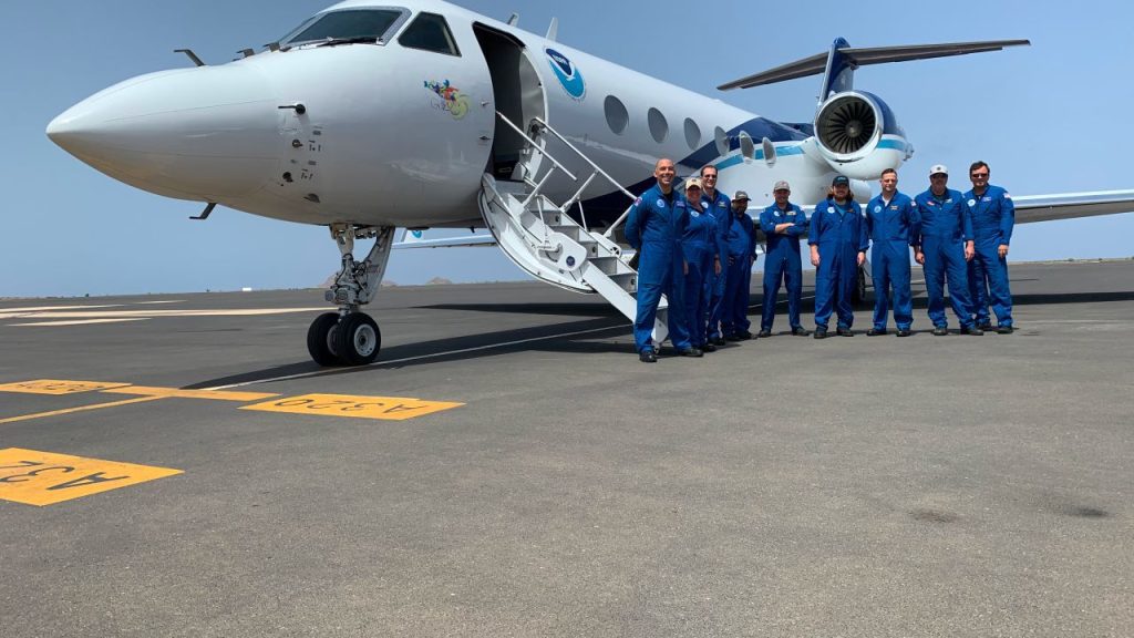
Scientists at AOML deployed to the Cabo Verde islands in August to explore how tropical waves that move off the coast of West African develop into tropical storms and hurricanes. These first-ever missions thousands of miles across the Atlantic mark the farthest distance traveled by NOAA’s Hurricane Hunters to help forecast models better predict the future track and intensity of developing storms.
After two weeks at sea, the South Atlantic Meridional Overturning Circulation (SAM) project team completed its first cruise since June 2019!
A recent study authored by five NOAA Atlantic Oceanographic and Meteorological Laboratory (AOML) scientists (Lew Gramer, Jun Zhang, Ghassan Alaka, Andrew Hazelton, and Sundararamen Gopalakrishnan) was recently selected out of a variety of publications as a featured paper for EOS Science News by the American Geophysical Union.
The State of the Climate in 2021 report was released today by the American Meteorological Society, showing greenhouse gas concentrations, global sea levels, and ocean heat content reached record highs in 2021 despite a La Niña event taking place in the Pacific Ocean.

At NOAA’s Atlantic Oceanographic and Meteorological Laboratory (AOML), we are extremely lucky to have many amazing women at the forefront of our science. For Women’s Equality Day, we spoke with some of our lab’s female leaders to learn more about their experiences and challenges, and to hear their valuable advice.
A recent study co-authored by Jean Lim, University of Miami CIMAS scientist working with Kelly Goodwin and Luke Thompson at NOAA’s Atlantic Oceanographic & Meteorological Laboratory, has been selected out of a wide array of publications as a spotlight paper in the latest issue of Applied and Environmental Microbiology. The focus of this special feature […]
Hurricane Andrew made landfall on August 24, 1992, near Homestead, Florida, becoming one of the most catastrophic hurricanes in U.S. history. It had an extremely low central pressure of 922 millibars and maximum sustained wind speeds estimated at 165 miles per hour. The storm rapidly intensified less than 36 hours before landfall, leaving most residents less than a day to secure their homes and heed evacuation orders.
NOAA’s Atlantic Oceanographic & Meteorological Laboratory (AOML) is pleased to announce Dr. Renellys Perez as AOML’s Physical Oceanography Divison’s next deputy director. Renellys officially begins her new position, today, August 15th.
A team of coral researchers from the National Oceanic & Atmospheric Administration (NOAA) and the University of Miami (UM) rescued 43 coral colonies after a sea wall collapsed at Star Island, near Miami Beach. The rapid coral rescue effort occurred at one of NOAA’s regularly monitored research sites. While conducting a routine survey, scientists from […]
Dr. Kelly Goodwin, a microbiologist at NOAA’s Atlantic Oceanographic & Meteorological Laboratory, recently served as one of the NOAA representatives at the historic signing of the All-Atlantic Ocean Research and Innovation Declaration during the All-Atlantic Ocean Research Forum 2022. This declaration represents a major milestone towards ocean science diplomacy and a cooperative effort towards a sustainable Atlantic Ocean. The Atlantic Ocean serves as a valuable resource for many nations and requires widespread cooperation in order to effectively establish a management framework to address climate change, pollution, ocean observation, marine ecosystem conservation, a sustainable ocean economy, and effective aquaculture and fisheries. By signing this declaration, Canada, the United States, Brazil, Morocco, Argentina, Cabo Verde, South Africa, and the European Union have taken a major step toward protecting the ocean for the communities that rely on it now, as well as in the future.
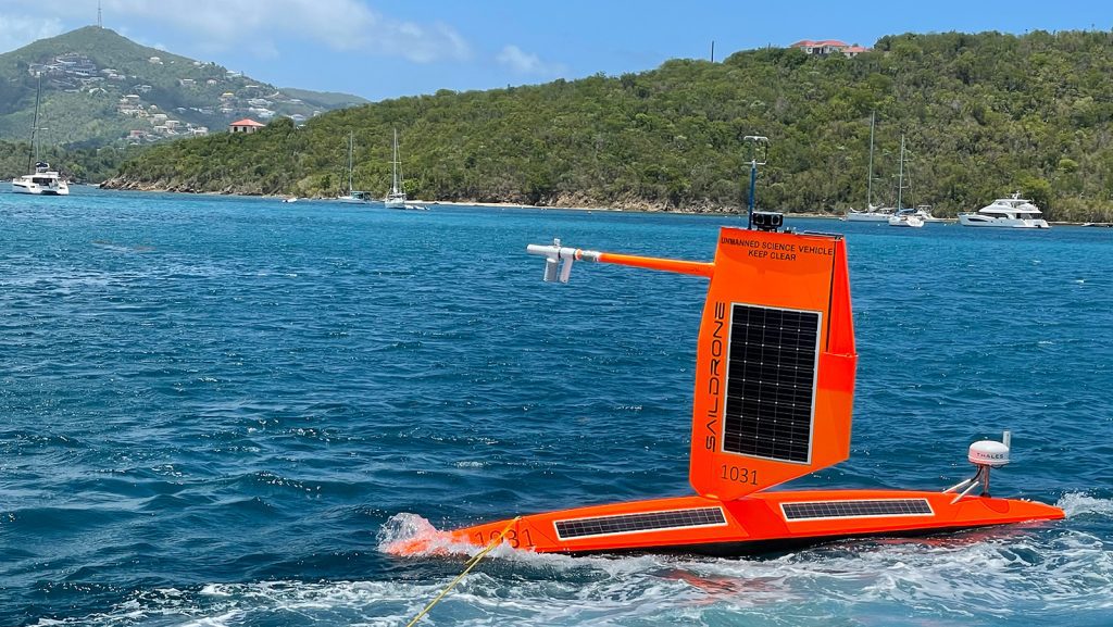
In partnership with NOAA, Saildrone Inc. is deploying seven ocean drones to collect data from hurricanes during the 2022 hurricane season with the goal of improving hurricane forecasting. For the first year, two saildrones will track hurricanes in the Gulf of America.
Jennifer McWhorter, PhD, started at NOAA AOML in April 2022 as an Oceanographer with the Ocean Chemistry and Ecosystems Division. Jennifer’s research spans climate science, physical oceanography, and coral reef ecology to better understand climate threats to reef ecosystems. She is now researching the influence of open ocean processes on mesophotic coral reefs using the biogeochemical Argo array in the Gulf of America.
On National Intern Day, AOML is celebrating our largest internship class ever – 30 interns ranging from high school students to post doctoral fellows. They are joining us from schools across the country, from California to Florida, and are researching corals, microbes, hurricanes, air-sea interaction, ocean acidification, communications strategies, and much more.
AOML welcomes Philip Tuchen, Postdoctoral Research Associate. Learn more about his research below. Press release originally published at GEOMAR on June 30th, 2022. Data from one of the longest time series in the tropical Atlantic now publicly available For more than 20 years an observatory at 23°W on the equator has been measuring velocities of […]
After 36 years of federal service as a physical oceanographer, we celebrate the career of Elizabeth “Libby” Johns as she retires from NOAA’s Atlantic Oceanographic and Meteorological Laboratory (AOML). Libby began her career at NOAA in 1986 when she accepted a position at AOML as an Oceanographer.
The ocean produces at least half of the world’s oxygen, is home to most of Earth’s biodiversity, and is the main source of protein for more than a billion people around the world. It is what makes life on Earth possible not only for humans, but for all organisms on our planet.
This summer during the 2022 Atlantic hurricane season, scientists at NOAA’s Atlantic Oceanographic and Meteorological Laboratory (AOML) will once again be on the frontlines helping NOAA prepare the public for severe weather. They will also conduct new research on the complex processes of how tropical cyclones form, develop, and dissipate.
In a major step forward for monitoring the biodiversity of marine systems, a new study published in Environmental DNA details how Monterey Bay Aquarium Research Institute (MBARI) and NOAA’s Atlantic Oceanographic & Meteorological Laboratory (AOML) researchers are using autonomous underwater robots to sample environmental DNA (eDNA). eDNA allows scientists to detect the presence of aquatic species from the tiny bits of genetic material they leave behind. This DNA soup offers clues about biodiversity changes in sensitive areas, the presence of rare or endangered species, and the spread of invasive species—all critical to understanding, promoting, and maintaining a healthy ocean.
Tropical cyclones intensify by extracting heat energy from the ocean surface, making the sea surface temperature under storms crucial for storm development. A recent study by researchers at the Pacific Northwest National Laboratory and NOAA’s Atlantic Oceanographic and Meteorological Laboratory found that large amounts of rain under tropical cyclones can reduce the sea surface cooling induced by them.
The international Argo Program, which includes NOAA’s Atlantic Oceanographic and Meteorological Laboratory, was recently awarded the Institute for Electrical and Electronics Engineers (IEEE) Corporate Innovation Award “for innovation in large-scale autonomous observations in oceanography with global impacts in marine and climate science and technology.”
Although too tiny to be seen by the naked eye, microscopic organisms have a big impact on our planet – supporting fisheries, degrading pollutants, and helping regulate the earth’s climate. A new study published in Nature Communications employed cutting edge research techniques (collectively referred to as ‘omics) to reveal how the ocean’s tiniest creatures respond to changes in the marine environment. This work addressed a number of objectives in the NOAA ‘Omics Strategic Plan, which calls for the characterization of food webs that sustain fisheries and vulnerable species.
Observations obtained by the Coyote small Uncrewed Aircraft System led to a significant improvement in the analyses of Hurricane Maria’s (2017) position, intensity, and structure, according to new research published in the journal Monthly Weather Review. The study by scientists with the University of Miami’s Cooperative Institute for Marine and Atmospheric Studies and Atlantic Oceanographic and Meteorological Laboratory (AOML) highlights how the Coyote’s novel near-surface measurements helped to more accurately depict Hurricane Maria’s inner core, demonstrating their ability to improve forecasts.
Warning the public of the damaging winds in tropical cyclones is critical for safeguarding communities in harm’s way. A new study by hurricane scientists at AOML is the first to quantify the value added to tropical cyclone intensity forecasts by storm-following nests. The research, published in the Bulletin of the American Meteorological Society, demonstrates that storm-following nests applied to multiple hurricanes in the same forecast cycle can improve intensity predictions by as much as 30%.
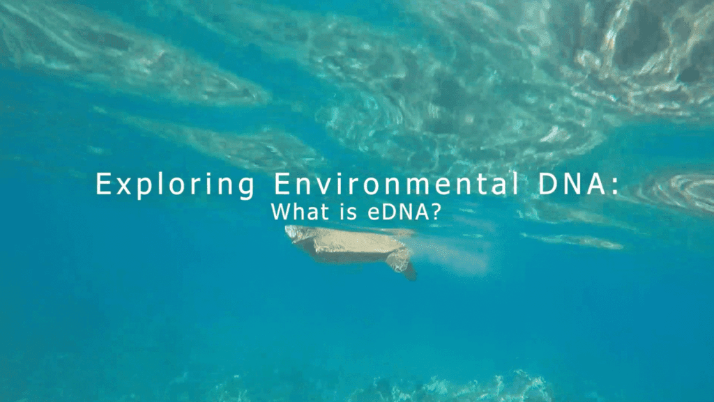
Have you ever wondered what animals might be present in a particular habitat or traveled through a certain area of the ocean? Scientists are able to use environmental DNA or “eDNA” sampling to help answer those questions. NOAA’s Atlantic Oceanographic and Meteorological Laboratory (AOML) has recently released a new educational video series, “Exploring Environmental DNA” on their website and Youtube channel.
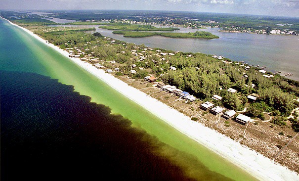
This article is adapted from an article originally published by the University of Miami Red tides caused by the algae Karenia brevis have become a near annual occurrence along the west coast of Florida, causing widespread ecological and economic harm. A new study analyzed 16 years of oceanographic data from across the West Florida Shelf […]
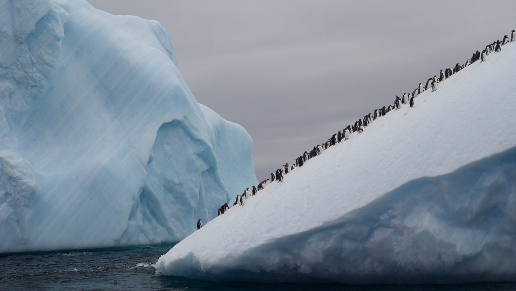
At 20:00 at 64°S in the austral summer month of February, the sun was still high in the sky. It cast a delicate light over the sea surface dotted with icebergs, which ranged from small misshapen chunks to massive angular structures with marbled cliffsides. In January and February 2022, I took part in an Antarctic voyage aboard the French schooner Tara. My participation was part of a partnership between NOAA and AtlantECO, a European-led consortium to characterize, quantify, and model Atlantic Ocean ecosystems.
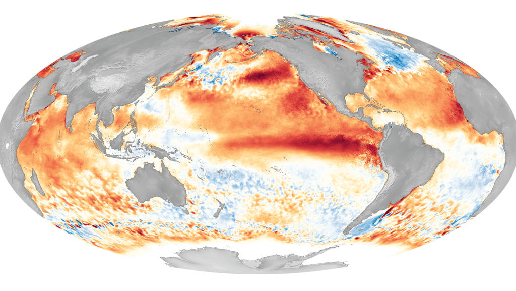
In a new study published in Nature Communications, scientists at NOAA’s Atlantic Oceanographic & Meteorological Laboratory (AOML) investigate the projected changes in the seasonal evolution of El Niño – Southern Oscillation (ENSO) in the 21st century under the influence of increasing greenhouse gases. The study found that global climate impacts on temperature and precipitation are projected to become more significant and persistent, due to the larger amplitude and extended persistence of El Niño in the second half of the 21st Century (2051-2100).
In a recent study published in the journal Coral Reefs, scientists at NOAA’s Atlantic Oceanographic and Meteorological Laboratory (AOML) found that staghorn coral (Acropora cervicornis) fragments exposed to an oscillating temperature treatment were better able to respond to heat stress caused by warming oceans.
A recent study by scientists at NOAA’s Atlantic Oceanographic and Meteorological Laboratory (AOML) is the first to demonstrate that El Niño-Southern Oscillation (ENSO) temperature variations in the equatorial Pacific Ocean can help predict Florida Current transport anomalies three months later. The connection between Florida Current transport and ENSO is through ENSO’s impact on sea level on the eastern side of the Florida Straits, which plays a dominant role in the Florida Current transport variability on interannual time scales.
A new video by the ANGARI Foundation, focuses on the efforts of NOAA’s Atlantic Oceanographic and Meteorlogical Laboratory coral researchers to document climate-driven impacts–thermal stress, ocean acidification, and ecological changes–at coral reefs in the Dry Tortugas.
After a year and a half of concerted effort between NOAA’s National Hurricane Center (NHC), Atlantic Oceanographic and Meteorological Laboratory (AOML), and other NOAA offices, including the Weather Program Office, the Hurricane and Ocean Testbed (HOT) has been successfully launched in the newly designed William M. Lapenta Laboratory, named in memory of the late director of the National Centers for Environmental Protection. This testbed establishes a physical and virtual collaboration space for researchers and forecasters.
A new study by scientists at NOAA’s Atlantic Oceanographic and Meteorological Laboratory (AOML) and Northern Gulf Institute (NGI) has revealed the alkalinity of river runoff to be a crucial factor for slowing the pace of ocean acidification along the Gulf of America’s northern coast. This valuable, first-time finding may be indicative of ocean carbon chemistry patterns for other U.S. coastal areas significantly connected to rivers.
NOAA’s Atlantic Oceanographic and Meteorological Laboratory is pleased to announce Jasmin John as AOML’s Ocean Chemistry and Ecosystems Division new deputy director.

On December 19th, after nearly six weeks at sea, scientists aboard the NOAA ship Ronald H. Brown returned to land and docked in Praia, Cape Verde, completing the PIRATA (Prediction and Research Moored Array in the Tropical Atlantic) Northeast Extension (PNE) cruise.
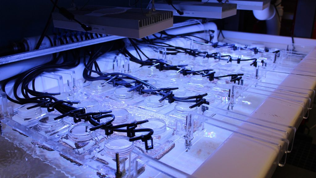
MIAMI—A new study found that seafloor sediments have the potential to transmit a deadly pathogen to local corals and hypothesizes that sediments have played a role in the persistence of a devastating coral disease outbreak throughout Florida and the Caribbean.
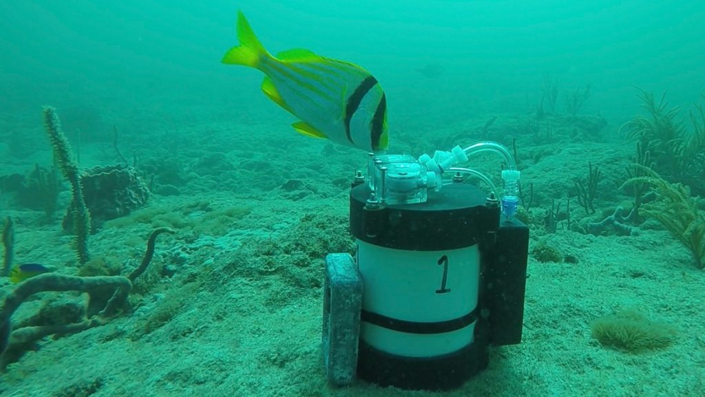
Scientists at NOAA’s Atlantic Oceanographic and Meteorological Laboratory (AOML),the Cooperative Institute for Marine and Atmospheric Studies (CIMAS) at the University of Miami Rosenstiel School of Marine and Atmospheric Science, and the Northern Gulf Institute at Mississippi State University have engineered a new instrument that will provide valuable information about the biodiversity of aquatic ecosystems. A recently published paper in Hardware X describes the design and creation of a low-cost, open-source sub-surface automated environmental DNA (eDNA) sampler (SASe), for sampling eDNA in the water column. The SASe represents a milestone for AOML as one of the first pieces of technology to go through a rigorous transition process from the desks of scientists in the laboratory, through organizational approval channels, to the wider scientific community with full accessibility to the public.
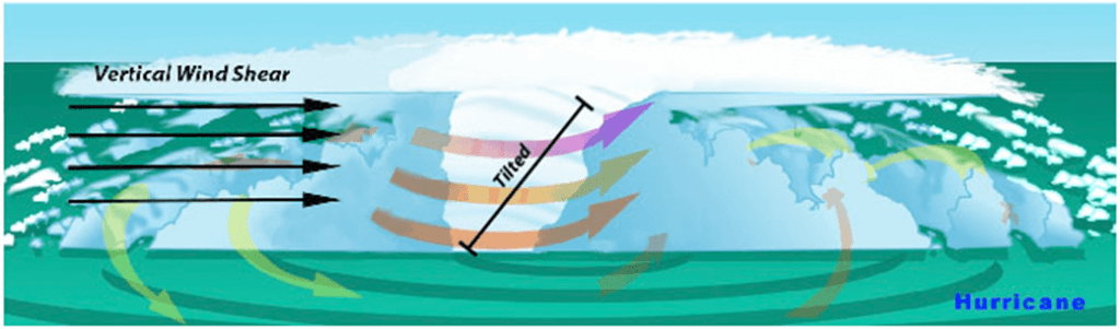
The amount of wind shear, i.e., the change of the wind with height, is one of the most commonly used predictors of tropical cyclone intensity change, with large amounts of wind shear generally being unfavorable for intensification. Regardless of the direction of the wind shear, tropical cyclones in the North Atlantic basin usually have warm, moist air from the environment near the sea surface on their east side (solid red arrows in the images) and cool, dry air from the environment on their west side (solid blue arrows in images).
The active 2021 Atlantic hurricane season ended on November 30, producing 21 named tropical storms (39‑73 mph winds), seven hurricanes (74 mph winds and above), and four major hurricanes (111 mph winds and above). The year will be remembered as the third-most active on record, as well as the third costliest, causing more than $80 billion in damage.
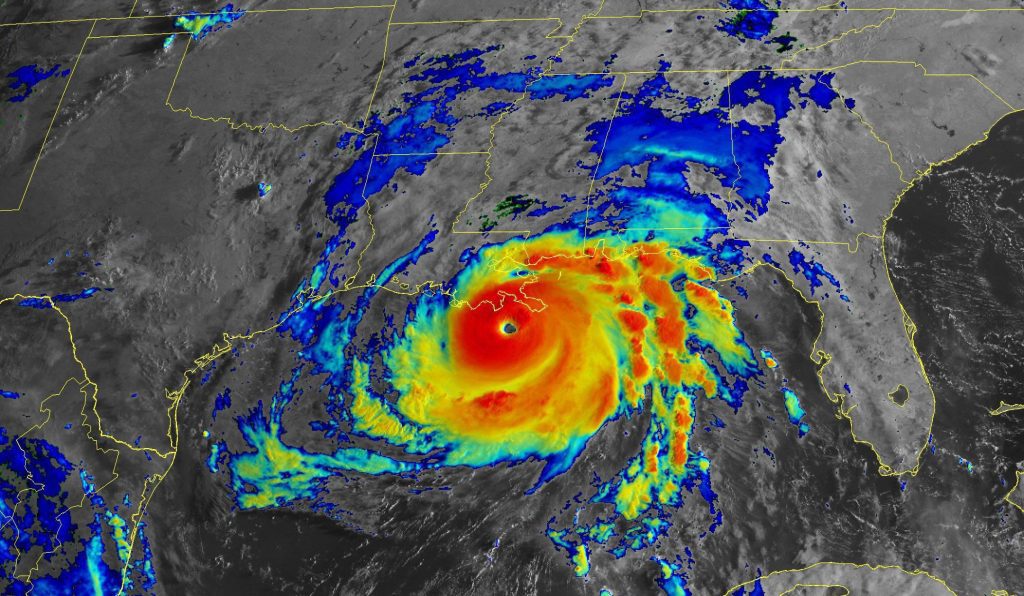
Hurricane scientists at AOML sampled multiple storms this summer as the Atlantic entered its peak period for hurricane formation. From Elsa to Sam, the observations they gathered supported NOAA’s mission of preparing the public for severe weather by providing critical data for accurate, up-to-date forecasts.
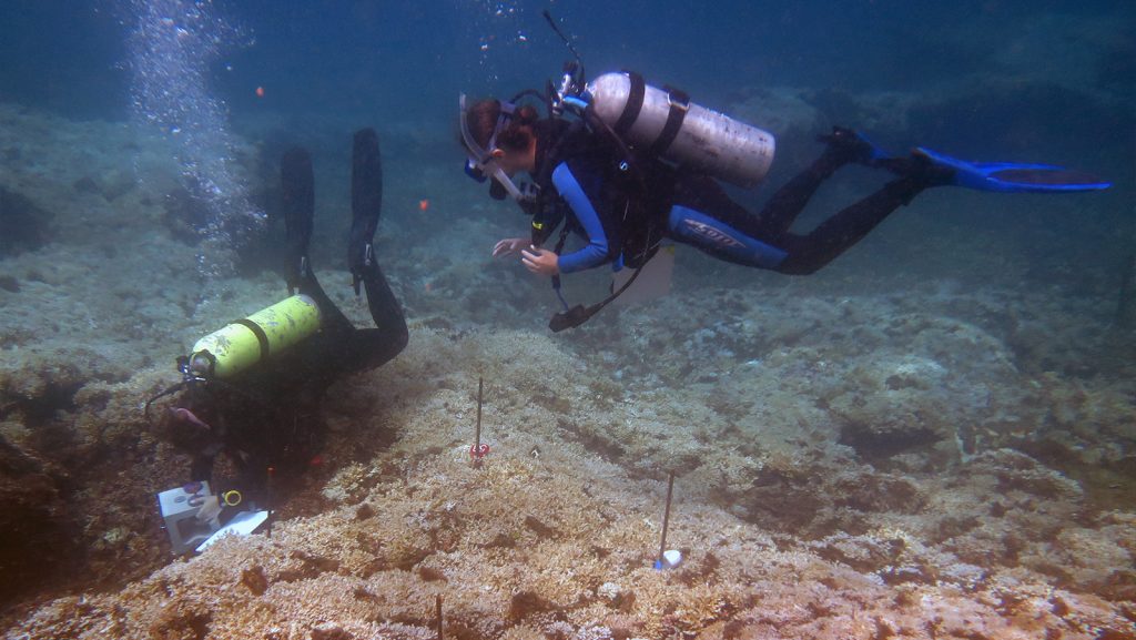
Trying to predict how coral reefs will respond to warming oceans and a changing climate may be considered a daunting task for scientists. In the face of this challenge, scientists at AOML recently published a study that characterizes the organisms and processes that lead to coral reef accretion (build up) and bioerosion (break down) in the dynamic environments of the Gulf of Panama and Gulf of Chiriqui in the eastern Pacific.
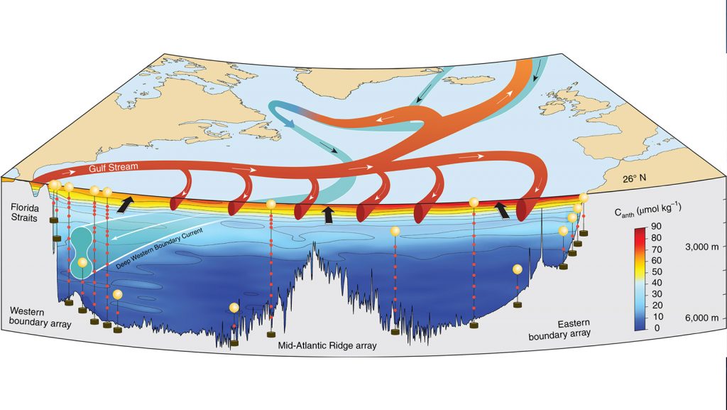
In a recently published study in Nature Geoscience, scientists at AOML and international partners quantified the strength and variability of anthropogenic (man-made) carbon (Canth) transport in the North Atlantic Ocean. The study found that buildup of Canth in the North Atlantic is sensitive to the Atlantic Meridional Overturning Circulation (AMOC) strength and to Canth uptake at the ocean’s surface.
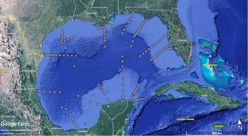
AOML scientists and partners from an assortment of universities and Cooperative Institutes successfully completed the most comprehensive ocean acidification sampling of the Gulf of America to date with the conclusion of the fourth Gulf of America Ecosystems and Carbon Cruise, also known as the GOMECC-4 cruise. The research effort aboard the NOAA Ship Ronald H. Brown began out of Key West, Florida on September 13, 2021 with 25 scientists and graduate students aboard. It ended 39 days later on October 21 with a port stop in St. Petersburg, Florida.
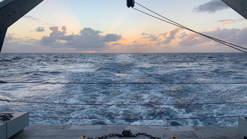
In a recent study published in American Geophysical Union (AGU), scientists at NOAA’s Atlantic Oceanographic and Meteorological Laboratory (AOML) contributed to an international study that confirmed warming trends and the possibility of increased rates of warming in one of the deepest channels of the Southwest Atlantic ocean, the Vema Channel.
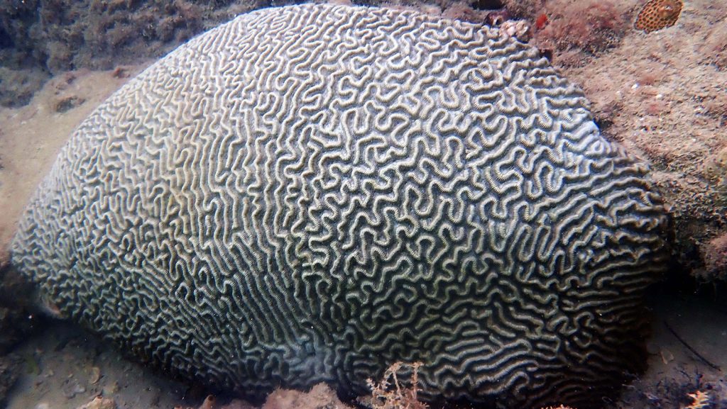
When we look at the state of corals globally, it can be difficult to see a silver lining, but a recent paper published in Frontiers in Marine Science shows hope for corals in unlikely places. In the study, scientists at NOAA’s Atlantic Oceanographic and Meteorological Laboratory (AOML) and the Cooperative Institute for Marine and Atmospheric Studies (CIMAS) at the University of Miami Rosenstiel School of Marine and Atmospheric Science compared the molecular processes of brain corals (Pseudodiploria strigosa) living in urban waters at the Port of Miami with offshore corals at Emerald Reef. They found the urban corals had adapted to challenging conditions that helped them differentiate and consume healthy food particles over diseased organisms.
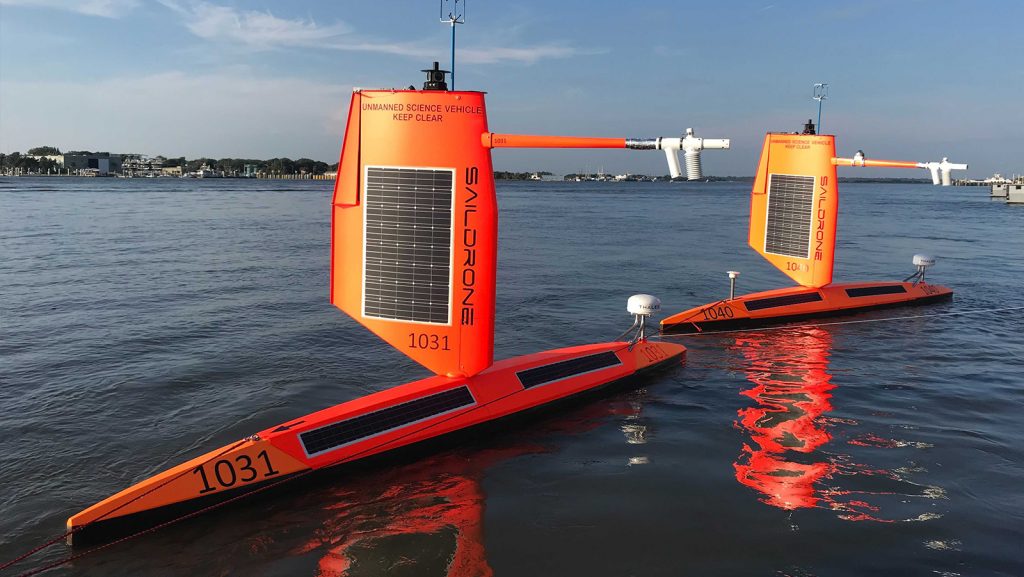
For the first time ever, Saildrone Inc. and NOAA have used an uncrewed surface vehicle to collect oceanic and atmospheric data from inside the eye of a hurricane. On September 30th, 2021 saildrone 1045 travelled directly into Category 4 Hurricane Sam.
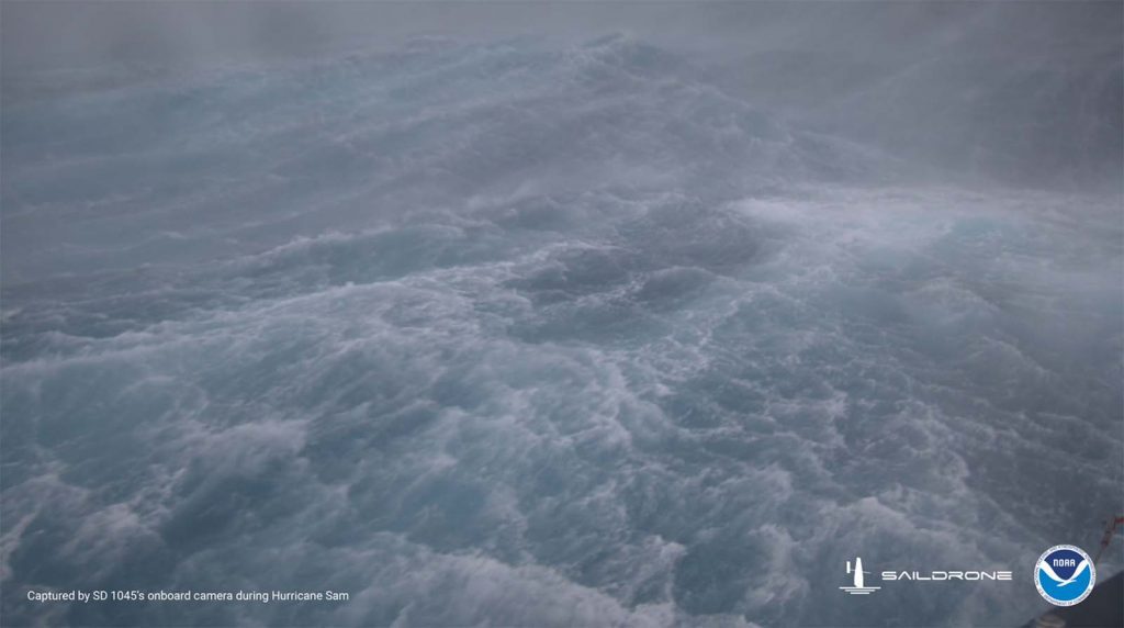
Saildrone Inc. and the NOAA have released the first video footage gathered by an uncrewed surface vehicle (USV) from inside a major hurricane barreling across the Atlantic Ocean.
The Saildrone Explorer SD 1045 was directed into the midst of Hurricane Sam, a category 4 hurricane, which is currently on a path that fortunately will miss the U.S. east coast. SD1045 is battling 50 foot waves and winds of over 120 mph to collect critical scientific data and, in the process, is giving us a completely new view of one of earth’s most destructive forces.

Today, August 25th, the 2020 State of the Climate report was released by the American Meteorological Society, showing 2020 to be one of the hottest years on record since the start of the Industrial Revolution. Even with environmental cooling factors, such as the transition from the El Niño of 2018-2019 to the La Niña of late 2020, global trends indicate the Earth is warming and sea level is rising. Throughout the report, environmental processes that influence climate and these warming trends are documented.

AOML’s newest issue of the Keynotes Newsletter is now live! This issue offers in-depth research highlights about new technology for the 2021 hurricane season, the ocean’s role in fueling hurricanes, new uses for Ship of Opportunity Data, new research on heat tolerant corals, eDNA and it’s connection to marine food webs, new sargassum tracking tools, recent publications, and more.
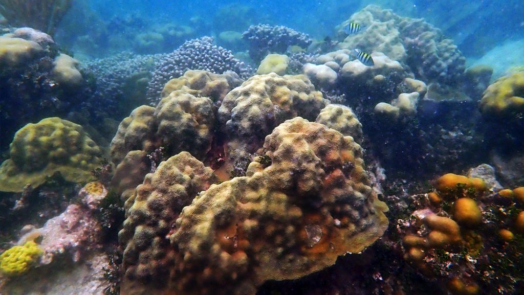
It can be hard to stay upbeat as a marine biologist, especially with the onslaught of existential threats like climate change facing the planet. Coral reefs are arguably the ecosystem that stands to lose the most with respect to climate change, namely because the resident organisms are highly sensitive to elevated temperatures. Furthermore, the limestone-based reef framework itself is diminishing before our eyes due to the accompanying rise in carbon dioxide levels (which decreases oceanic pH, leading to ocean acidification). That being said, there are corals out there that display resilience, continuing to thrive in habitats that would appear decidedly marginalized to even the untrained eye.
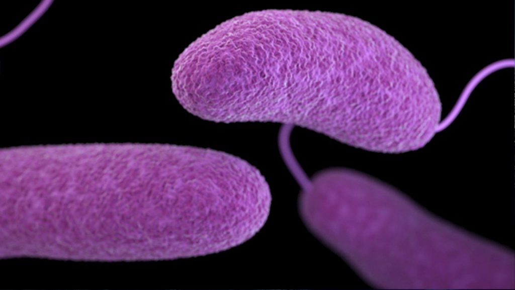
In a recent study published in Lancet Planetary Health, Joaquin Trinanes, a scientist at NOAA’s Atlantic Oceanographic Meteorological Laboratory (AOML), uses a new generation of climate, population, and socioeconomic projections to map future scenarios of distribution and season suitability for the pathogenic bacteria, Vibrio. For the first time, a global estimate of the population at risk of vibriosis for different time periods is provided.
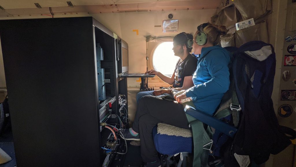
Scientists from NOAA’s Atlantic Oceanographic Meteorological Laboratory are collaborating with NOAA Chemical Sciences Laboratory to test the Micro-pulse Doppler lidar (Microdop), a small light instrument to measure storm winds from NOAA’s Hurricane Hunter P-3 aircraft to learn if this data can improve hurricane forecasts.
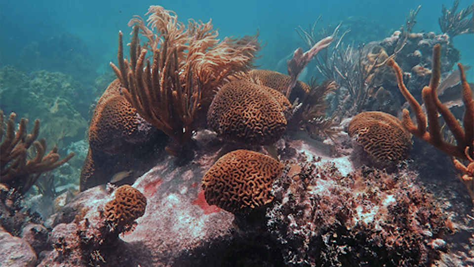
Coral scientists at NOAA’s Atlantic Oceanographic Meteorological Laboratory (AOML) and the University of Miami Rosenstiel School’s Cooperative Institute for Marine and Atmospheric Studies (CIMAS) will be presenting their research at the 14th International Coral Reef Symposium (ICRS) from July 19-23, 2021, which will be held virtually for the first time in the history of the ICRS.
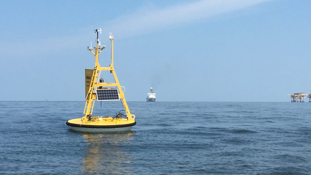
In 2017, the United Nations General Assembly proclaimed the time frame of 2021-2030 as the UN Decade of Ocean Science for Sustainable Development, also known as the “Ocean Decade,” to address the degradation of the ocean and encourage innovative science initiatives to better understand and ultimately reverse its declining health.
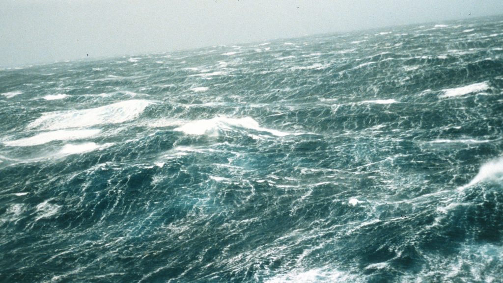
The 2021 hurricane season is off to a busy start with five named storms having already formed in the Atlantic Ocean. Recently, Tropical Storm Claudette travelled directly over three ocean observation platforms, providing key ocean data for the initialization of the ocean component for hurricane forecast models.
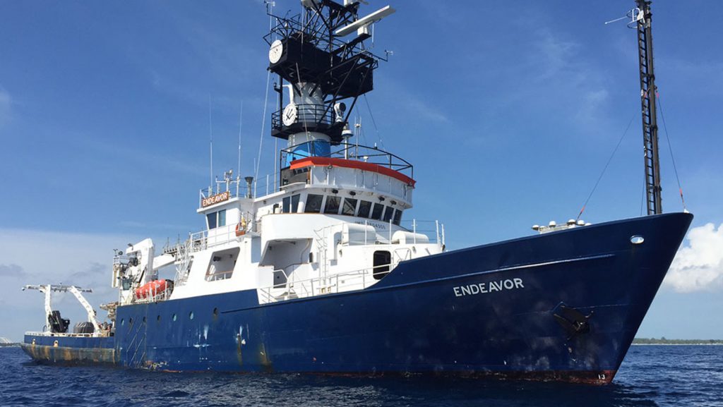
Researchers from the Physical Oceanography Division of AOML conduct regular hydrographic surveys to monitor the western boundary current system in the subtropical North Atlantic Ocean. These cruises are a part of the laboratory’s long-running Western Boundary Time Series (WBTS) project and are designed to monitor both the Florida Current, east of Florida in the Florida Straits, and the North Atlantic Deep Western Boundary Current east of the Bahamas in the North Atlantic Ocean. These western boundary currents are important parts of the Atlantic Meridional Overturning Circulation (AMOC).
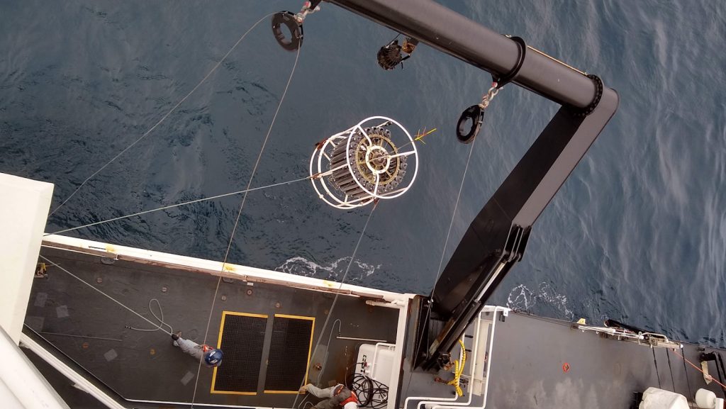
Dr. Nastassia Patin, a Cooperative Institute for Marine and Atmospheric Studies (CIMAS) scientist working at AOML, recently spent three weeks aboard the NOAA ship Reuben Lasker collecting environmental DNA (eDNA) from water samples in support of the Rockfish Recruitment and Ecosystem Assessment Survey (RREAS).
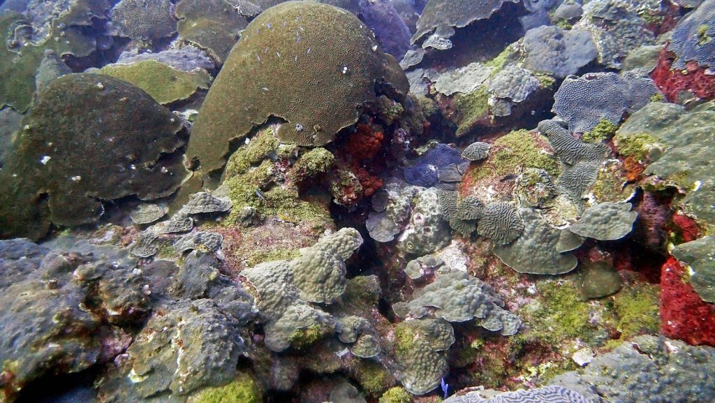
A recent study by researchers at NOAA’s Atlantic Oceanographic and Meteorological Laboratory shows that coral growth observed in symmetrical brain corals (Pseudodiploria strigosa) and mountainous star corals (Orbicella faveolata) in the Flower Garden Banks reefs, in the Gulf of America, are linked to warming sea surface temperatures.
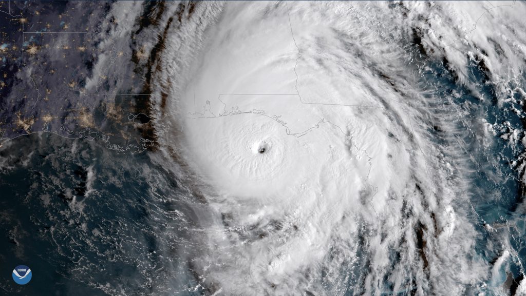
In a recent study published in AGU’s Journal of Geophysical Research – Oceans, scientists at AOML identified key ocean features that supported the rapid intensification of Hurricane Michael (2018), despite unfavorable atmospheric conditions for development. The study demonstrates the importance of using realistic ocean conditions for coupled (ocean-atmosphere) hurricane models in order to achieve the most accurate hurricane intensity forecasts.
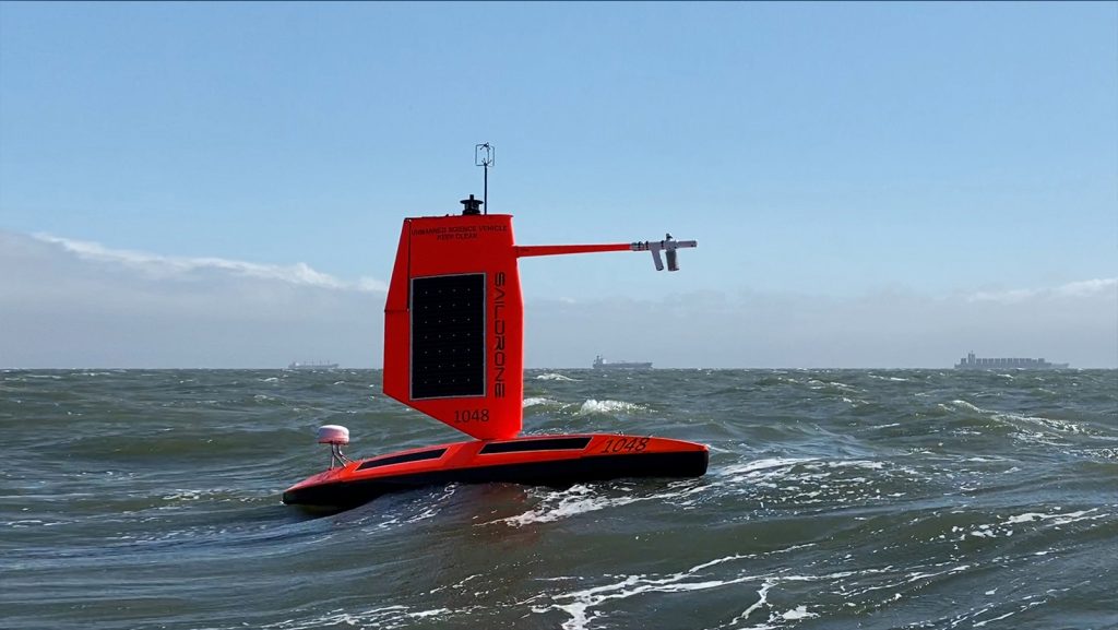
Saildrone is announcing a new mission to deploy five uncrewed surface vehicles (USVs) from the US Virgin Islands in August to gather key data throughout the 2021 Tropical Atlantic hurricane season. The USVs will be equipped with specially designed “hurricane wings” to enable them to operate in extreme conditions. Saildrones are the only USVs capable of collecting this data and are designed to withstand winds over 70 mph and waves over 10 feet, which occur during a hurricane weather system. The five saildrones will sail into the paths of hurricanes to provide valuable real-time observations for numerical hurricane prediction models and to collect new insights into how these large and destructive weather cells grow and intensify.
Scientists at AOML are preparing for the active anticipated 2021 Atlantic hurricane season with the introduction of new observation tools, modeling techniques, and field campaigns to improve hurricane intensity and track forecasts.
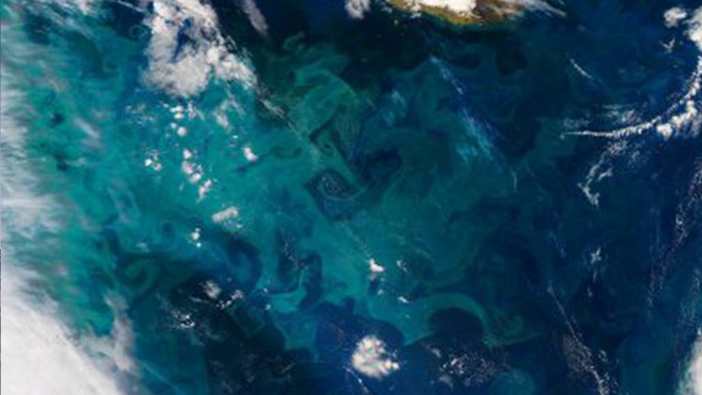
Phytoplankton drifting near the ocean surface play a critical role in marine biogeochemistry, carbon cycling, and ecosystem health. But measuring the activity of these microscopic organisms is challenging. Although scientists rely on ship-based sampling and satellites to quantify their abundance, both methods have limitations. In a study published recently in the Journal of Geophysical Research-Biogeosciences,* Argo profiling floats equipped with biogeochemical sensors, i.e., BGC Argo floats, were used to obtain the first year-long estimates of phytoplankton in the western North Atlantic Ocean.
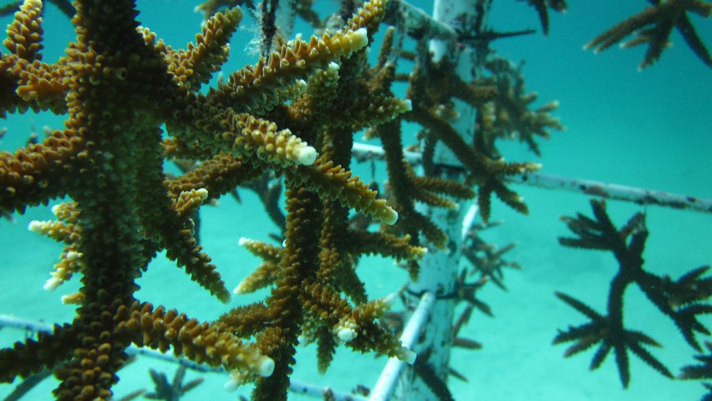
A new study by researchers at the University of Miami’s Rosenstiel School of Marine and Atmospheric Science and NOAA’s Atlantic Oceanographic and Meteorological Laboratory suggests that outplanting corals, specifically staghorn coral (Acropora cervicornis) from higher temperature waters to cooler waters, may be a better strategy to help corals recover from certain stressors. The researchers found that corals from reefs with higher average water temperatures showed greater healing than corals from cooler waters when exposed to heat stress.
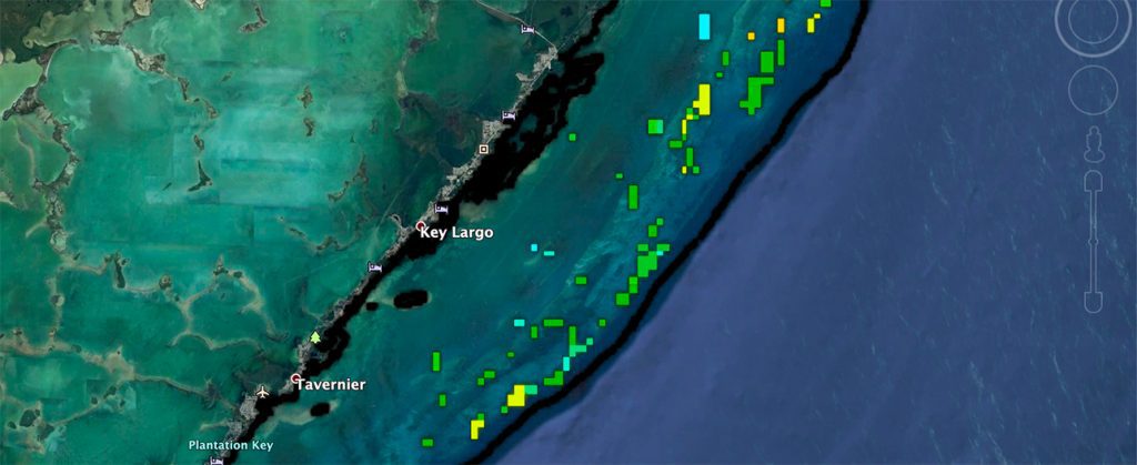
To help improve the long term survival of nursery raised staghorn coral (Acropora cervicornis), Ruben van Hooidonk, a coral scientist with NOAA’s Atlantic Oceanographic and Meteorological Laboratory and the Cooperative Institute for Marine and Atmospheric Studies has developed a new experimental mapping tool i that ranks suitable outplant locations. There are currently at least seven coral nurseries in Florida that cultivate staghorn coral, representing one of the best opportunities to maintain resilient populations of this species.
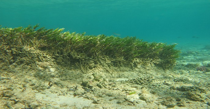
In absorbing carbon dioxide (CO2), the oceans play a crucial role in regulating the climate, a role yet to be fully understood. However, the oceans’ ability to contribute to climate regulation may decline and even be reversed in the future. The oceans that are now the blue lungs of our planet, could end up contributing to global warming.
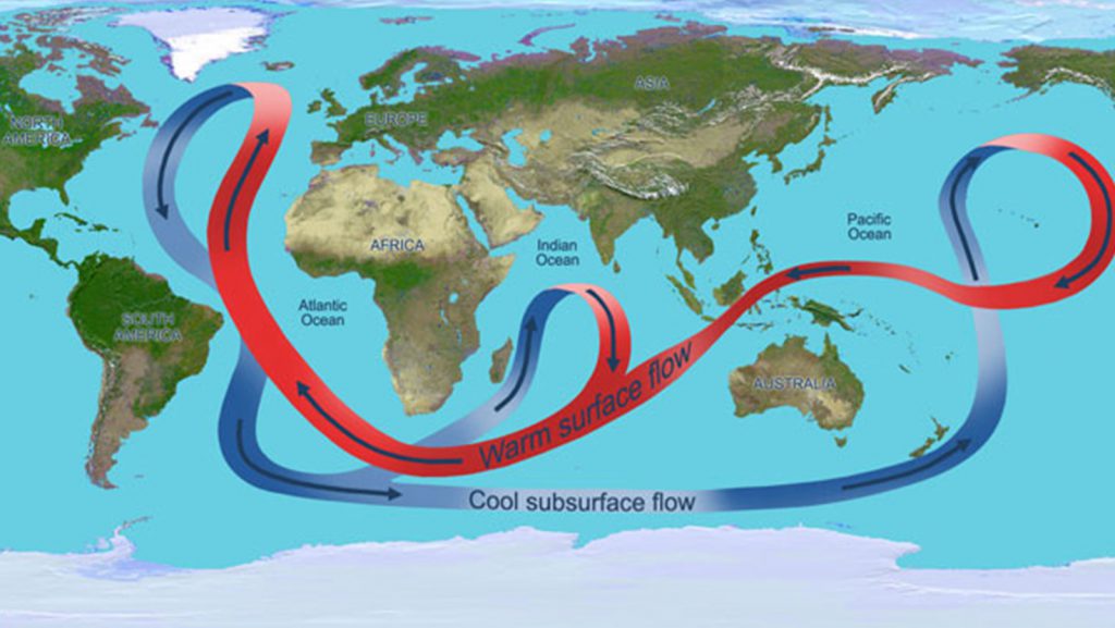
In a recent article published in the Journal of Geophysical Research – Oceans, scientists at AOML evaluate the variability of the heat transport in the South Atlantic by developing a new method to measure its changes on a daily basis. This study presents, for the first time, full‐depth, daily measurements of the volume and heat transported by the Meridional Overturning Circulation (MOC) in the South Atlantic at 34.5°S based on direct observations.
In a recently published study, scientists at AOML present 28-year long (1993-2020) estimates of the Atlantic Meridional Overturning Circulation (AMOC) volume and heat transports at multiple latitudes by merging in-situ oceanographic and satellite observations. By combining ocean observations with satellite data, they were able to estimate the AMOC volume and heat transports in near real time. These data can be used to validate ocean models, to detect climate variability, and to investigate their impact on extreme weather events.
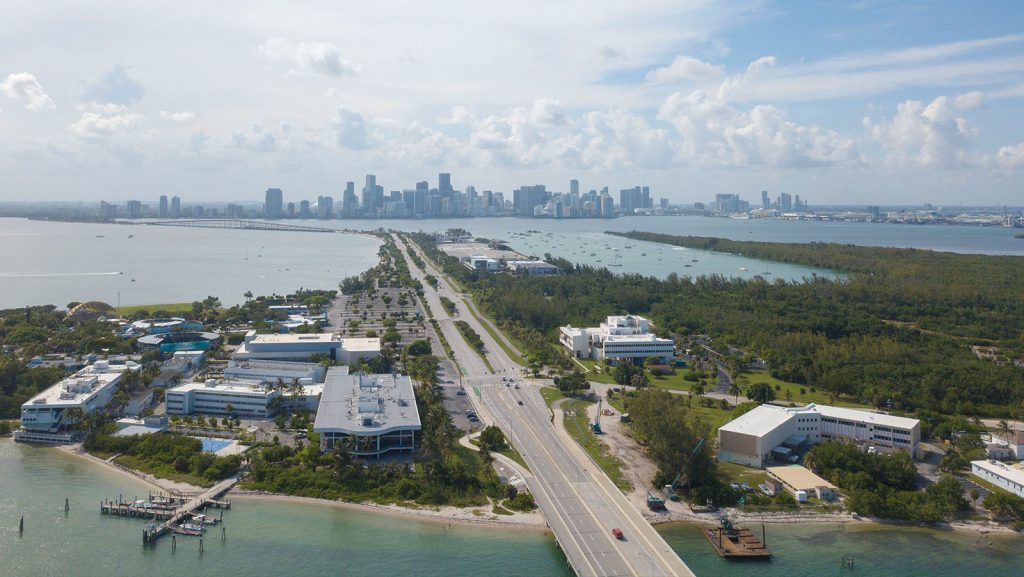
AOML will be celebrating Earth Day this year with a week-long series of webinars on April 19th-23rd, 2021 from 6:00 p.m-7:00 p.m. AOML’s Virtual Open House will feature NOAA scientists talking about everything from hurricane research to oceanography to coral ecosystems to the new technologies being used to improve our understanding of the world around us. Participants will also get the chance to learn more about what it’s like to be a scientist working with NOAA in the Ask AOML Q&A.

Scientists at NOAA’s Atlantic Oceanographic and Meteorological Laboratory are now focusing on what happens where the sea meets the atmosphere to help solve the hurricane intensity problem. The place right above where the air meets the sea is called the planetary boundary layer. The ocean drives global weather. By building on past research, scientists have determined that factors in the boundary layer and underlying ocean such as salinity, temperature, currents, wave and wind patterns, precipitation, are crucial to understanding the energy that fuels a hurricane.
From the desk of CSI: Miami (Fish Edition): Solving an eDNA mystery. NGI Associate Research Professor Luke Thompson and NGI Postdoctoral Associate Sean Anderson have been studying the environmental DNA (eDNA) left behind by fish at the University of Miami dock (pictured), near the NOAA Atlantic Oceanographic and Meteorological Laboratory in Miami, Florida. When they analyzed the data, while many of the fish species detected were expected for the area, they were surprised by several unexpected species, such as rainbow trout. To help solve this mystery, Luke and Sean sent out a survey to fish biologists with expertise in this region.
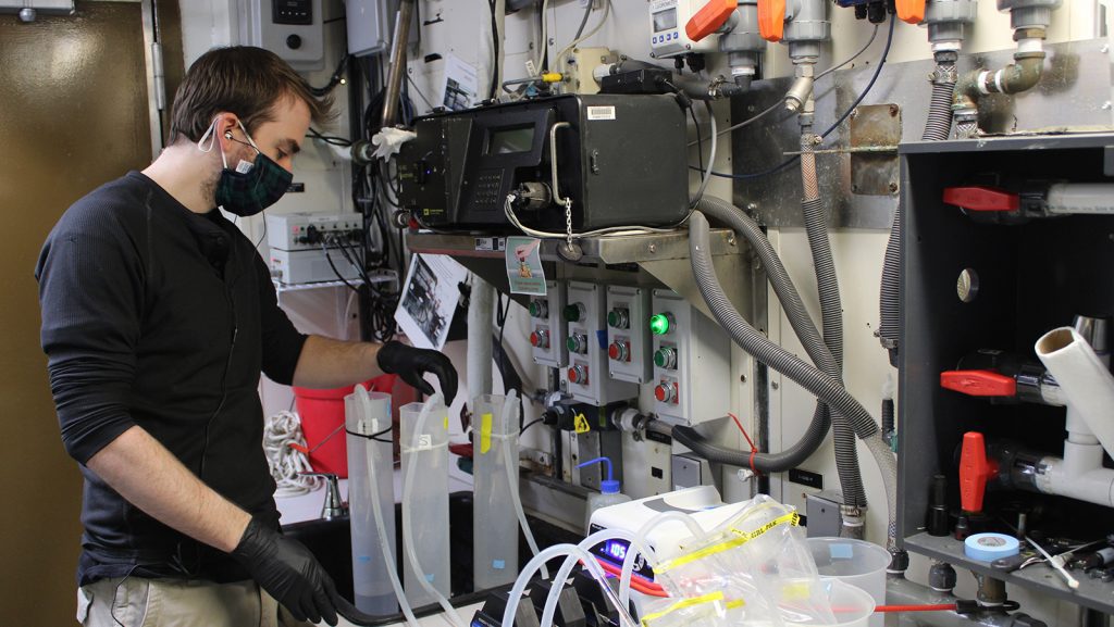
From March to May, NGI Postdoctoral Associate Sean Anderson is taking part in two legs of a NOAA Fisheries survey in the Gulf of America on board NOAA Ship Pisces. The NOAA project, “Environmental DNA Enhancement of Fisheries Independent Monitoring Cruises for Ecosystem Based Fisheries Management”, seeks to improve ecosystem-based fisheries management (EBFM) with the use of environmental DNA (eDNA) sequencing. Camera traps (pictured) placed at the seafloor in the Gulf of America capture video of passing fish, while bottles collect seawater that the fish have passed through, leaving behind DNA traces.
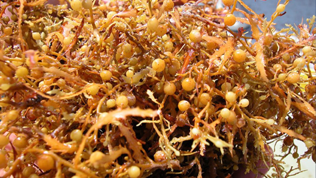
A recently published paper presents the Sargassum Inundation Report (SIR), a product that uses a satellite-based methodology to monitor from space areas with coastal inundation of pelagic Sargassum in the tropical Atlantic Ocean, Caribbean Sea, and Gulf of America. The SIR was created as a response to the need to improve the monitoring and management of Sargassum influxes (e.g., coordinate clean-up), which have major economic, social, environmental, and public health impacts.
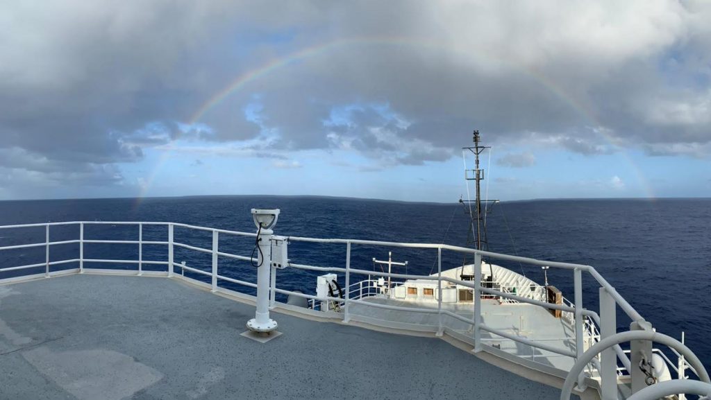
On February 24, researchers with NOAA’s Atlantic Oceanographic and Meteorological Laboratory returned to land, docking in Key West after nearly six weeks aboard the NOAA ship Ronald H. Brown. The scientists were at sea for the PIRATA (Prediction and Research Moored Array in the Tropical Atlantic) Northeast Extension (PNE) cruise, a joint effort between AOML and NOAA’s Pacific Marine Environmental Laboratory to maintain an expansion of the PIRATA array of surface moorings into the northern and northeastern sectors of the tropical Atlantic.
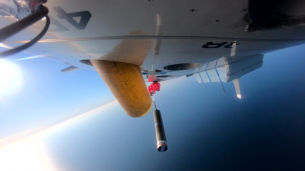
In January 2021, AOML in partnership with NOAA’s Aircraft Operations Center (AOC) completed the air launch testing of the Air-Launched Autonomous Micro-Observer (ALAMO) profiling float. This testing cleared the ALAMO floats for flight and deployed from the NOAA P3 Hurricane Hunter aircraft during their hurricane reconnaissance missions. The data collected and transmitted by the ALAMO floats will be used to understand the ocean’s interaction with tropical cyclones and improve coupled hurricane forecasting models.
The PIRATA (Prediction and Research Moored Array in the Tropical Atlantic) 2021 cruise aboard NOAA’s Ronald H. Brown has returned home! During their 41 days at sea, the cruise facilitated a collaboration between researchers with NOAA’s Atlantic Oceanographic and Meteorological Lab (AOML) and Fearless Fund, an organization dedicated to ocean solutions, supported by the U.S. Department of Energy (DOE). This collaboration targets the removal of carbon dioxide from ocean waters by the growth and harvest of seaweed biomass, known as Sargassum.
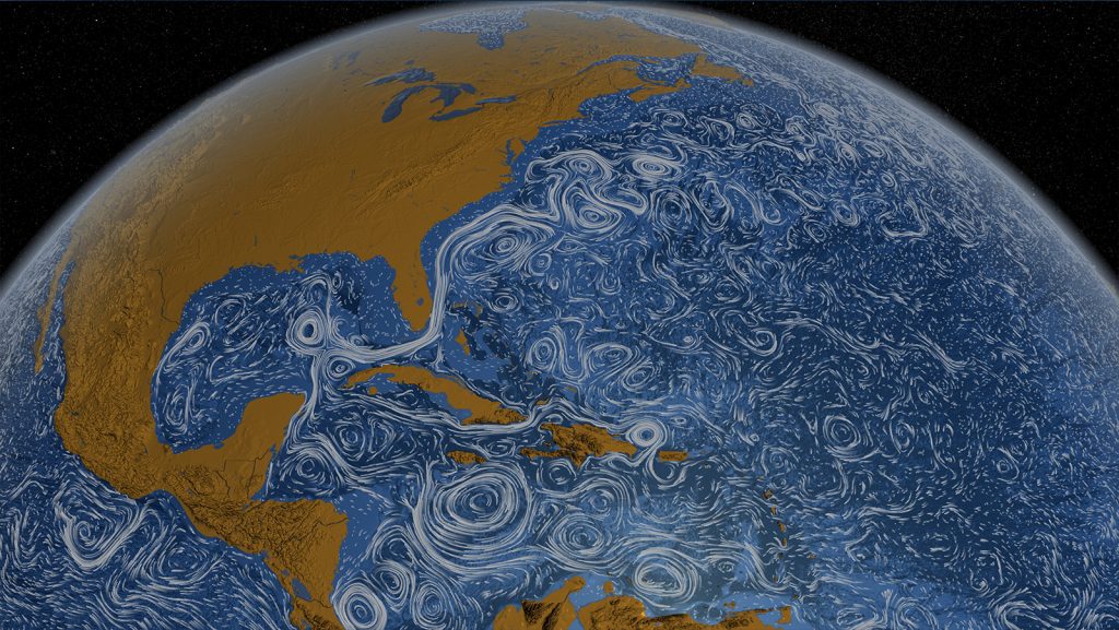
Scientists at AOML in collaboration with partners at the University of Miami’s Rosenstiel School of Marine and Atmospheric Science (RSMAS) have identified Loop Current related anticyclonic eddies along the northwest coast of Cuba in the southern Gulf of America, named “CubAns” (“Cuba anticyclones”). These eddies play an important role in the ocean circulation associated with the Loop Current. This team of scientists is the first to study CubANs.
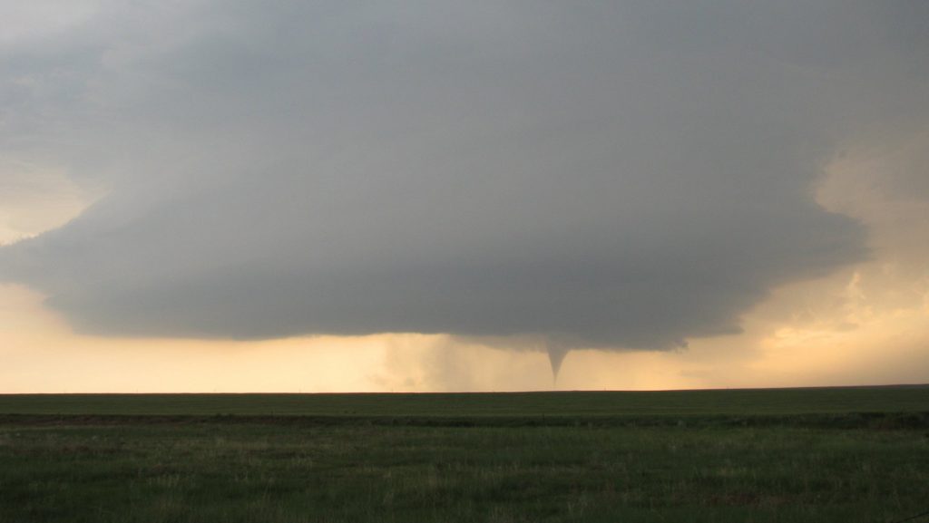
A new paper published in Monthly Weather Review shows some promise for predicting subseasonal to seasonal tornado activity based on how key atmospheric parameters over the US respond to various climate signals, including El Niño and La Niña activity in the Pacific. In this study, a team of researchers from NOAA’s Atlantic Oceanographic and Meteorological Laboratory, Geophysical Fluid Dynamics Laboratory, and Climate Prediction Center presented an experimental seasonal tornado outlook model, named SPOTter (Seasonal Probabilistic Outlook for Tornadoes), and evaluated its prediction skill.
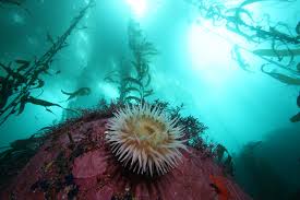
Over the past 10 years, scientists from all over the world and in the United States have achieved incremental successes in using the Integrated Ecosystem Assessment approach. This approach allows them to build relationships with scientists, stakeholders, and managers and balance the needs of nature and society for current and future generations.
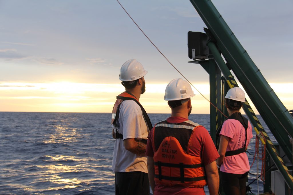 100,000 cells per liter) are present in the water. K. brevis produces toxins called brevetoxins that can cause massive fish kills, weaken or kill marine mammals, and (if the toxin becomes aerosolized and inhaled) cause respiratory distress in humans and marine mammals. The team of scientists will be comprehensively sampling a series of transects along the West Florida Shelf." loading="lazy">
 100,000 cells per liter) are present in the water. K. brevis produces toxins called brevetoxins that can cause massive fish kills, weaken or kill marine mammals, and (if the toxin becomes aerosolized and inhaled) cause respiratory distress in humans and marine mammals. The team of scientists will be comprehensively sampling a series of transects along the West Florida Shelf." loading="lazy">
Scientists are heading to sea on the R/V Walton Smith to sample areas where red tide blooms are commonly present off the west Florida coast. Karenia brevis, the organism that causes red tide, forms blooms when elevated concentrations (>100,000 cells per liter) are present in the water. K. brevis produces toxins called brevetoxins that can cause massive fish kills, weaken or kill marine mammals, and (if the toxin becomes aerosolized and inhaled) cause respiratory distress in humans and marine mammals. The team of scientists will be comprehensively sampling a series of transects along the West Florida Shelf.
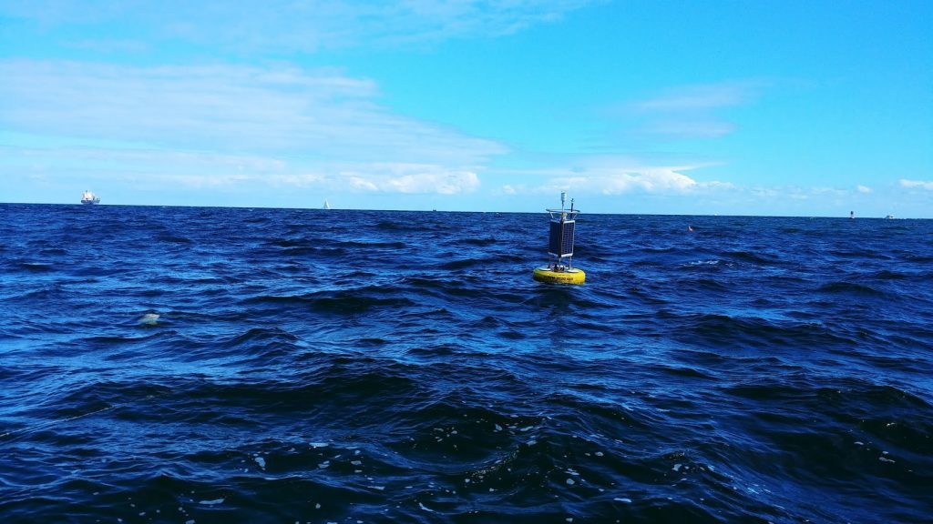
The U.S Army Corps in partnership with NOAA’s Atlantic Oceanographic and Meteorological Laboratory, and NOAA’s Southeast Fisheries Science Center are testing a new ecological forecasting tool known as the ‘Environmental Information Synthesizer for Expert Systems’ (EISES). This new tool is being tested for the first time in a maintenance dredging project in Port Everglades, Fort Lauderdale, Florida in a multi-agency collaborative effort to help capture water quality effects which may be associated with dredging operations.
Hurricane scientists at NOAA’s Atlantic Oceanographic and Meteorological Laboratory have created a new, advanced moving nest model within the Unified Forecast System, the bedrock of NOAA’s weather prediction applications . AOML’s Hurricane Modeling and Prediction Team developed the high resolution moving nest model for the FV3 dynamical core, laying the foundation for next generation advancements in hurricane forecasting.
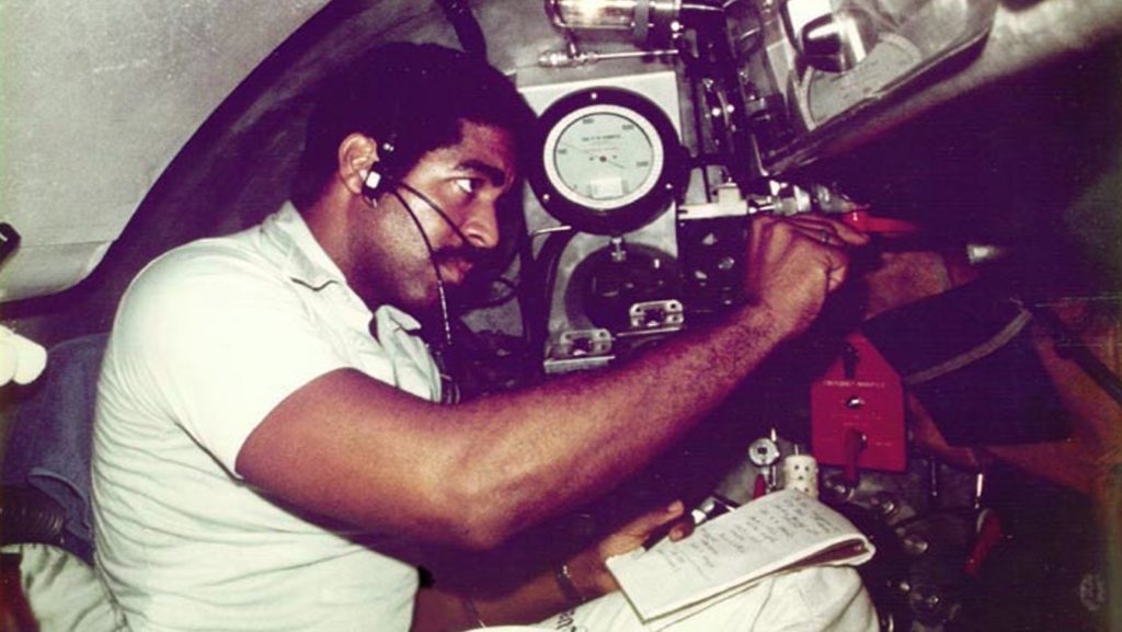
February is Black History Month; in celebration we sat down to talk with oceanographer and Miami native, Evan B. Forde. In 1973, Forde began his career at NOAA’s Atlantic Oceanographic and Meteorological Laboratory, and in 1979 he became the first African American scientist to participate in research dives aboard a deep-sea submersible. During his career Forde has conducted research across various oceanographic and meteorological disciplines and remains one of the few African American oceanographers in the U.S.
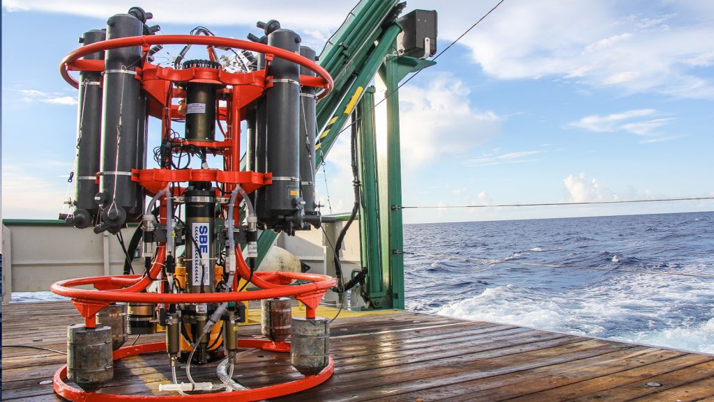
NOAA’s Western Boundary Time Series (WBTS) project, alongside partner projects RAPID and MOCHA, have been awarded the inaugural “Ocean Observing Team Award” by The Oceanography Society (TOS). This award recognizes innovation and excellence in sustained ocean observing for scientific and practical applications. The WBTS/RAPID/MOCHA team is recognized for significantly improving our understanding of Atlantic circulation through the breakthrough design of a basin-wide observing system using endpoint measurements to measure the variability of the overturning circulation across wide areas of the ocean. This design provided continuous, cost-effective measurements that led to a transformation in ocean observing and advances in scientific knowledge.
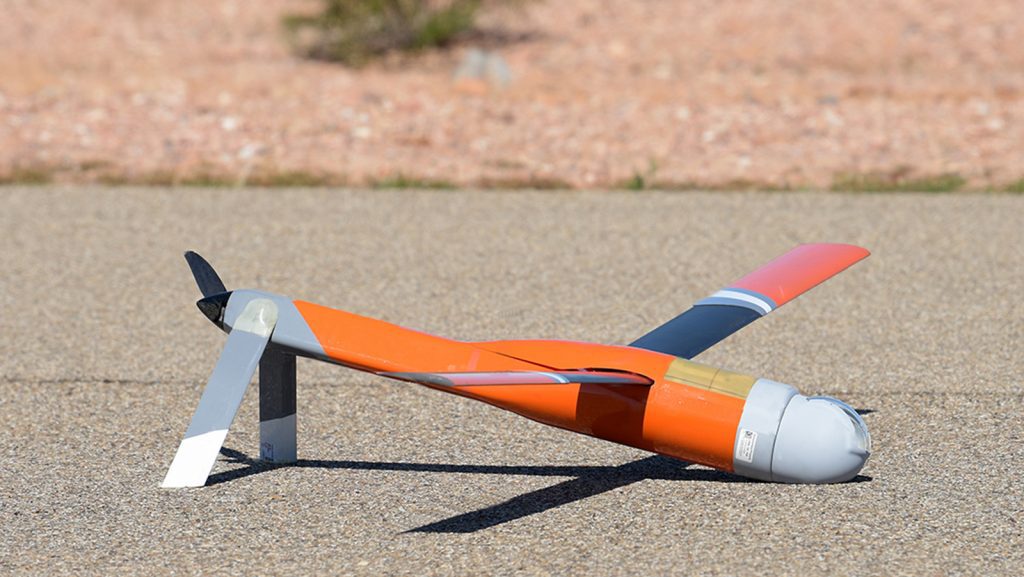
Originally Published January 25th, 2021 at NOAA.Gov
“We’re hopeful this new technology, once it can be successfully tested in a hurricane environment, will improve our understanding of the boundary layer and advance NOAA forecast models used in forecasts,” said Joseph Cione, lead meteorologist at NOAA’s Atlantic Oceanographic and Meteorological Laboratory Hurricane Research Division. “Ultimately, these new observations could help emergency managers make informed decisions on evacuations before tropical cyclones make landfall.”
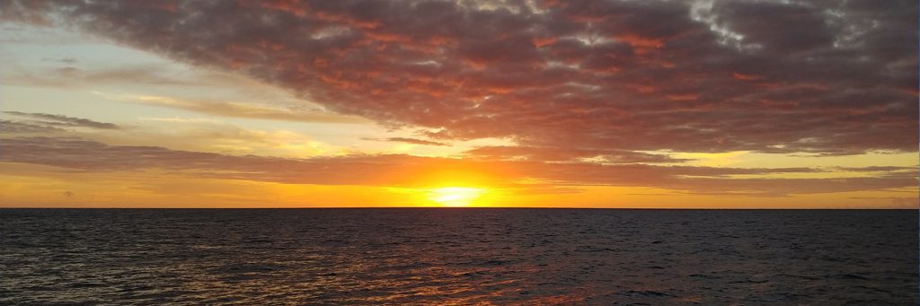
On December 11, 2020 researchers with the Global Carbon Project released their annual update for the Global Carbon Budget. Daily global CO2 emissions are estimated to have decreased by a maximum of about 17% by early April 2020 compared to average levels in 2019. About half of this change is due to changes in surface transport, especially road transport, during the COVID-19 pandemic.
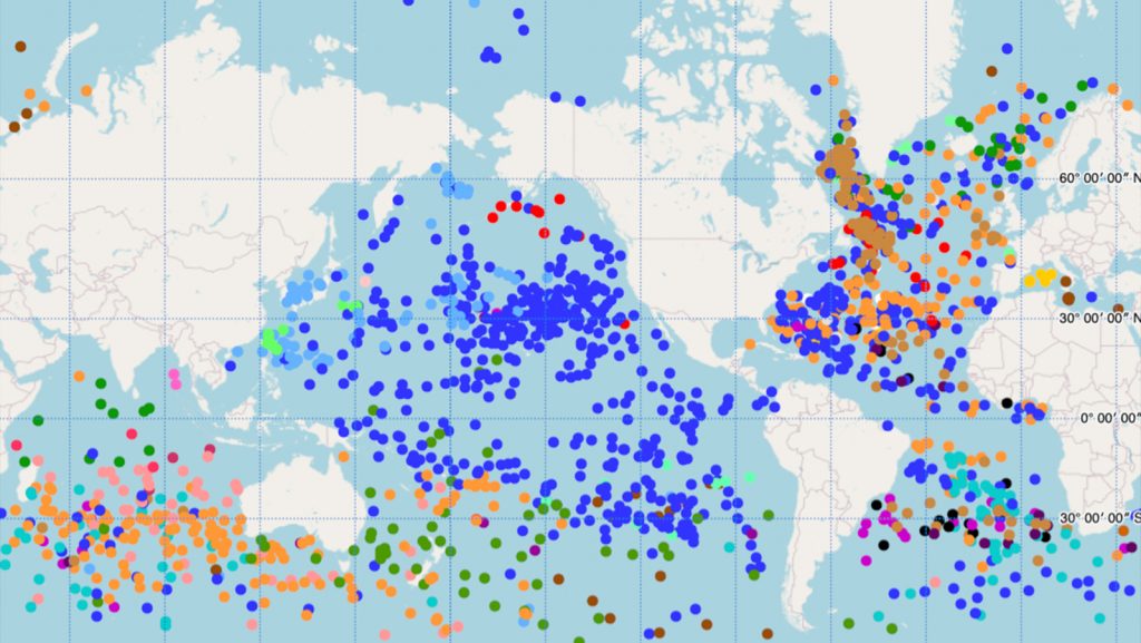
The Global Drifter Program’s (GDP) Drifter Data Assembly Center (DAC) at AOML has launched a new interactive map of the global drifter array. This new tool features the ability to zoom and scroll, hover the cursor over drifters to get their identification numbers, and click to see data and metadata including deployment information, manufacturer, and drifter type in an ID card that can be viewed as a high-resolution image with an additional click.
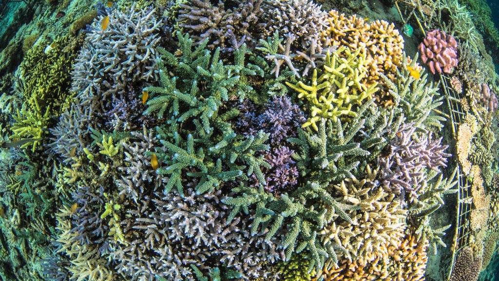
Recently the UN Environment Programme Report on coral bleaching projections for 2020 was published, updating work that was done in 2017 using a previous generation of global climate models to project coral reef bleaching globally. The report shows some interesting new results. Ruben van Hooidonk, a coral researcher at AOML and the University of Miami Rosenstiel School Cooperative Institute for Marine and Atmospheric Studies, was the lead author of the report.
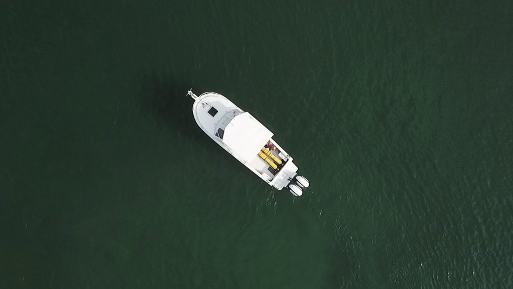
NOAA’s hurricane gliders are returning home after a successful journey during the 2020 hurricane season. These gliders were deployed off the coasts of Puerto Rico, Dominican Republic, the U.S. Virgin Islands, the Gulf of America, and the eastern U.S. to collect data for scientists to use to improve the accuracy of hurricane forecast models.
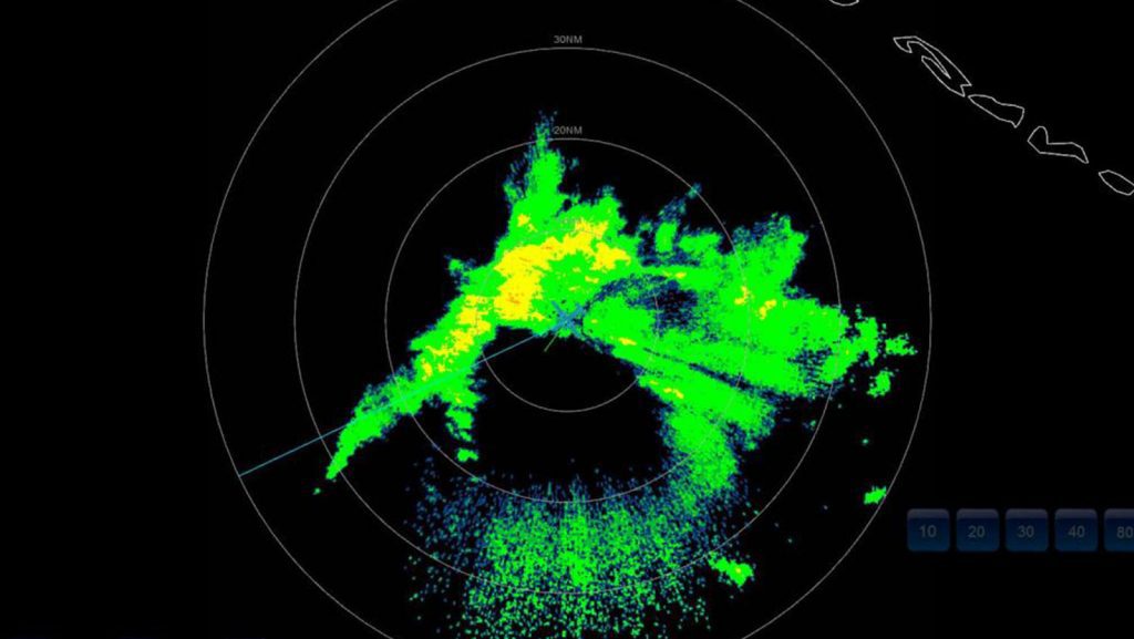
NOAA Hurricane Hunters continue reconnaissance for Tropical Storm Eta, which threatens to bring tropical cyclone hazards to south Florida as it restrengthens over water.
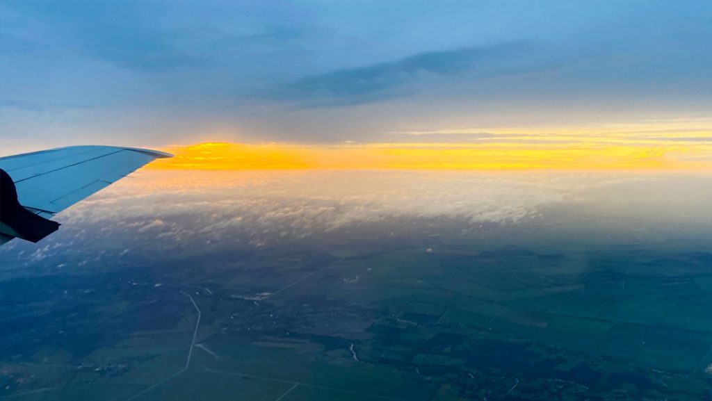
Tasked by the Environmental Modeling Center (EMC) and the National Hurricane Center (NHC), NOAA’s P-3 and G-IV aircraft have conducted reconnaissance for Tropical Storm Eta. Missions are scheduled to proceed through the weekend.
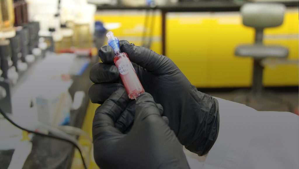
In February 2020, the NOAA ‘Omics Strategy was launched. The Strategy was informed by a whitepaper that recently became available on the NOAA Institutional Repository. This document titled NOAA ‘Omics White Paper: Informing the NOAA ‘Omics Strategy and Implementation Plan, identifies NOAA’s priorities in ‘omics research, promotes integration and communication among line offices, and proposes possible solutions to implementation challenges in this quickly advancing sector of research.
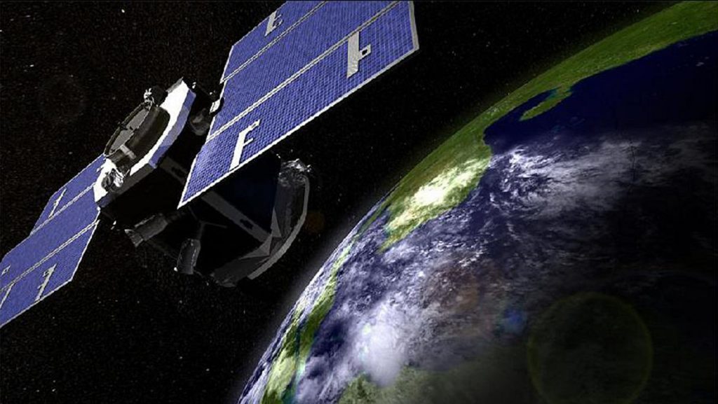
A new study published in Geophysical Research Letters looks at the relationship between how fast a tropical cyclone intensifies and the amount of ice in the clouds that make up the storm. Hurricane scientists found that tropical cyclones with greater amounts of cloud ice are likely to intensify faster than those with less cloud ice.
NOAA’s Modeling, Analysis, Predictions, and Projections (MAPP) program is funding a new collaborative project between the Atlantic Oceanographic and Meteorological Laboratory (AOML) and the Southeast Fisheries Science Center (SEFSC) to understand how a changing climate might be influencing commercially important fish stocks. This project will identify key climate and oceanic processes that affect the biology and chemistry of the ocean of relevance to the coastal open ocean species in the U.S. Gulf of America and South Atlantic Bight, managed by NOAA Fisheries and the regional Fishery Management Councils.
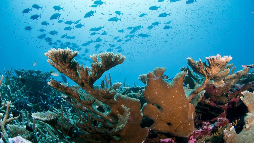
NOAA launched a new National Marine Ecosystem Status web tool, on Monday October 19. This tool shows the status of marine ecosystems across the U.S. It provides easy access to NOAA’s wide range of essential coastal and marine ecosystem data in one location for the first time.
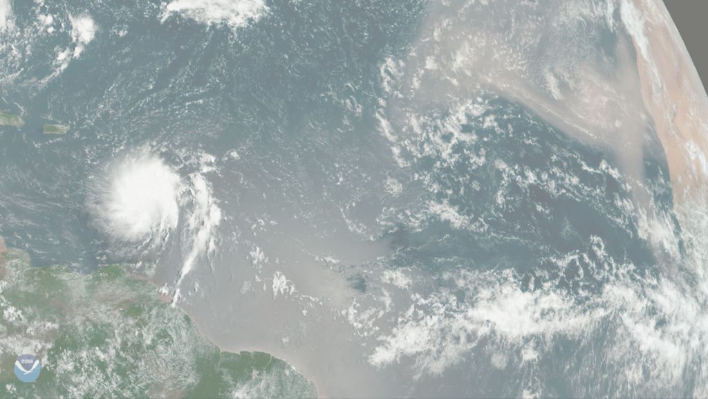
In the Fall of 2019, Atlantic Oceanographic and Meteorological Laboratory (AOML) oceanographer Renellys Perez contacted Geophysical Fluid Dynamics Laboratory (GFDL) and Princeton University oceanographer Sonya Legg to brainstorm how the two labs could increase collaboration. Due to a previous working relationship established with Legg at MPOWIR, a mentoring group created to improve the retention of women in physical oceanography and US CLIVAR, Perez was able to propose a collaborative workshop.

In a new study published in Atmosphere, hurricane scientists looked at how turbulent mixing in the boundary layer affects the intensity and structure of hurricanes in NOAA’s Hurricane Weather Research and Forecasting (HWRF) model. They found that turbulent mixing affects where thunderstorms in hurricanes occur, and how fast air flows towards the center of a storm.
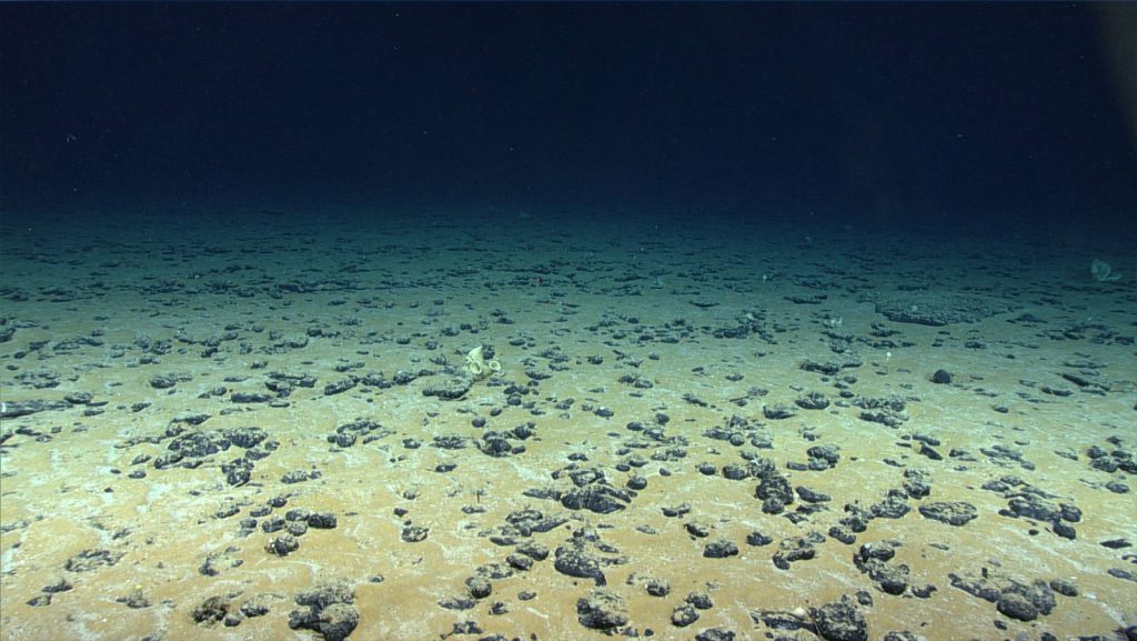
New research reveals temperatures in the deep sea fluctuate more than scientists previously thought and a warming trend is now detectable at the bottom of the ocean.
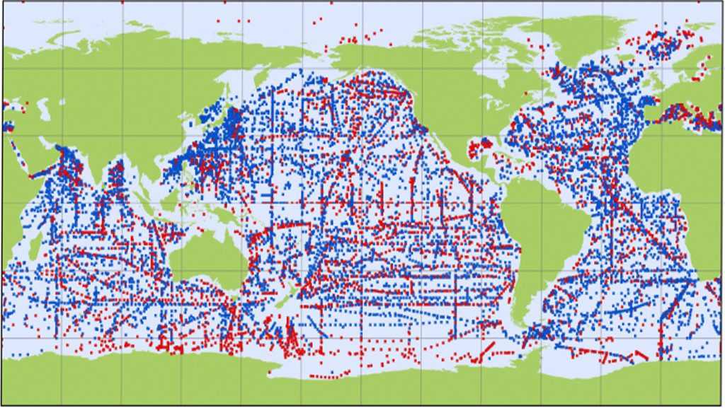
In a recent article published in Frontiers in Marine Science, the history of the Argo program is examined and discussed. The Argo program began in 1998 when a team of international scientists, known as the “Argo Science Team,” proposed the idea for a global array of autonomous floats to obtain temperature and salinity measurements of the upper 2,000 meters of the global ocean. The new array of floats, called Argo, would go on to be endorsed as a pilot program of the Global Ocean Observing System and be used to fill in the large data gaps in ocean observations.

NOAA concludes Environmental Modeling Center (EMC) tasked reconnaissance for Major Hurricane Delta on October 9. The P-3 aircraft took off from Lakeland, FL at 5:00 AM EDT to survey the system’s circulation.

A new study published in Meteorological Applications finds that changes in the flight track patterns of aircraft flying into storms to collect observations for weather forecast models could positively impact forecasts. Differences in where data is collected within a storm changes the model forecast.
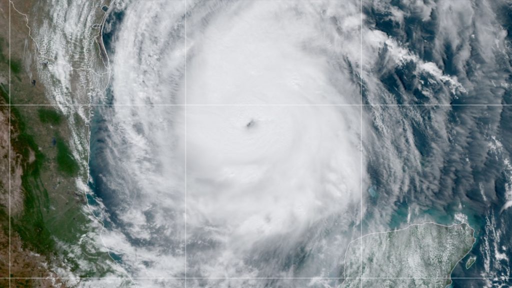
NOAA and Air Force Reserve Hurricane Hunters continue around the clock monitoring of Hurricane Delta as it traverses the Gulf of America. Overnight flights on October 7 through midday October 8 found that Delta’s circulation is intensifying and expanding in size.
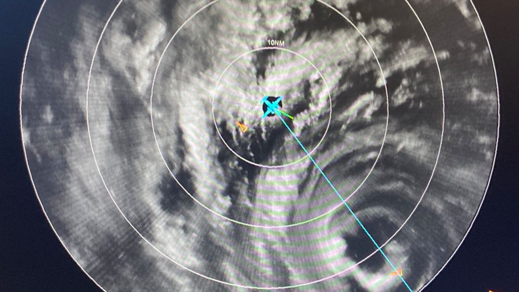
NOAA aircraft reconnaissance continued for Major Hurricane Delta on October 6, capturing the system’s quick maturation overnight. P-3 and G-IV missions are scheduled every 12 and 24 hours from Lakeland, FL. The National Hurricane Center (NHC) tasked NOAA’s Hurricane Hunters to identify the location and strength of the circulation center, and to survey the atmospheric conditions nearby and ahead of Delta. Instrumentation onboard the aircraft have sampled the system’s development, revealing a 55 knot rapid intensification in just 24 hours.
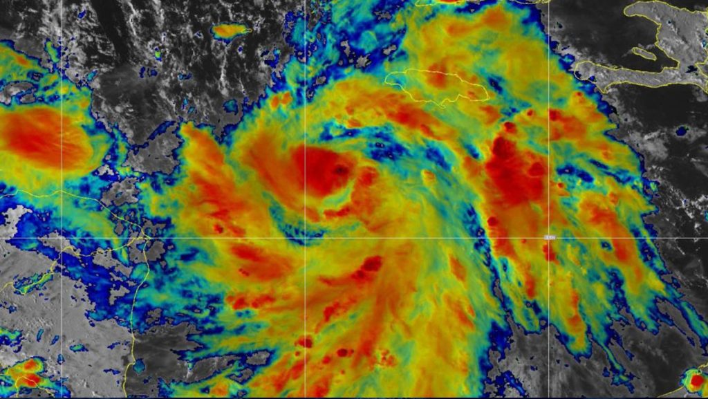
Aircraft reconnaissance operations began October 5 to investigate the location and strength of Tropical Storm Delta’s circulation. Tasked by the National Hurricane Center (NHC), NOAA’s P-3 aircraft took off at 1 PM EDT from Lakeland, FL.
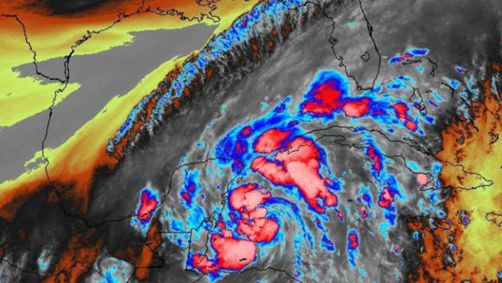
After a week of daily map discussions led by student forecasters at the University at Albany-SUNY, as part of AOML’s Hurricane Field Program, NOAA interest in Tropical Storm Gamma has resulted in planned reconnaissance missions starting at 5 AM EDT on Saturday, October 3.
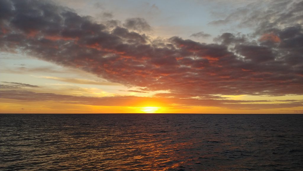
In a recent study published in Science Advances, a team of scientists at AOML led by Denis Volkov used observations and idealized model simulations to explore what caused the abrupt reduction and ensuing recovery of the South Indian Ocean heat and sea level in 2014-2018.
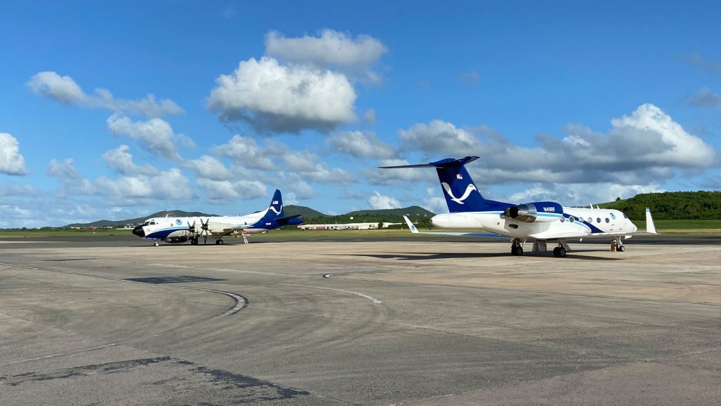
NOAA’s Hurricane Hunters continue reconnaissance for Major Hurricane Teddy, conducting numerous science experiments developed by AOML and its collaborators.
A new study published in Remote Sensing uses radar data from NOAA’s P-3 Hurricane Hunter aircraft to determine the characteristics a satellite would need to measure the surface wind in a tropical cyclone between areas of heavy rainfall. This study finds that satellites with higher resolution can measure larger regions of heavy rainfall.
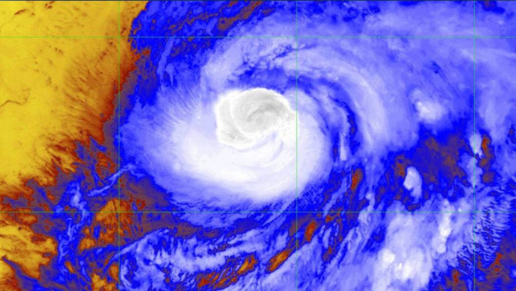
AOML’s Hurricane Research Division tasked all three NOAA Hurricane Hunter aircraft to perform science operations into Hurricane Teddy, now a category-3 tropical cyclone and still intensifying in the mid-Atlantic.
NOAA’s P-3 aircraft wraps up its sequence of missions into Hurricane Sally prior to the system’s eventual landfall along the central Gulf Coast. Tasked by the National Hurricane Center (NHC), its final flight took off on September 15 at 9:30 EDT from Lakeland, FL.
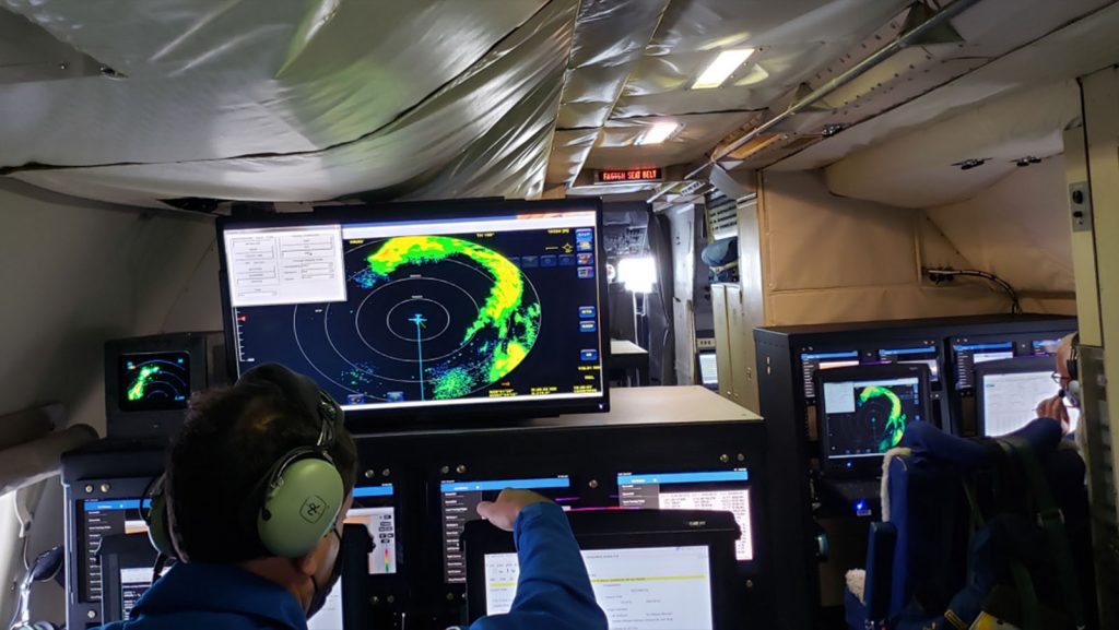
NOAA’s G-IV and two P-3 Hurricane Hunter aircraft took off from Lakeland, FL at 10:30 AM, 1:30 PM and 4:30 PM EDT on September 14th to investigate Hurricane Sally’s circulation. AOML scientists providing onboard and remote support for these missions ensure that Tail Doppler Radar, dropsonde, and Stepped Frequency Microwave Radiometer (SFMR) measurements allow for adequate coverage of the storm environment.
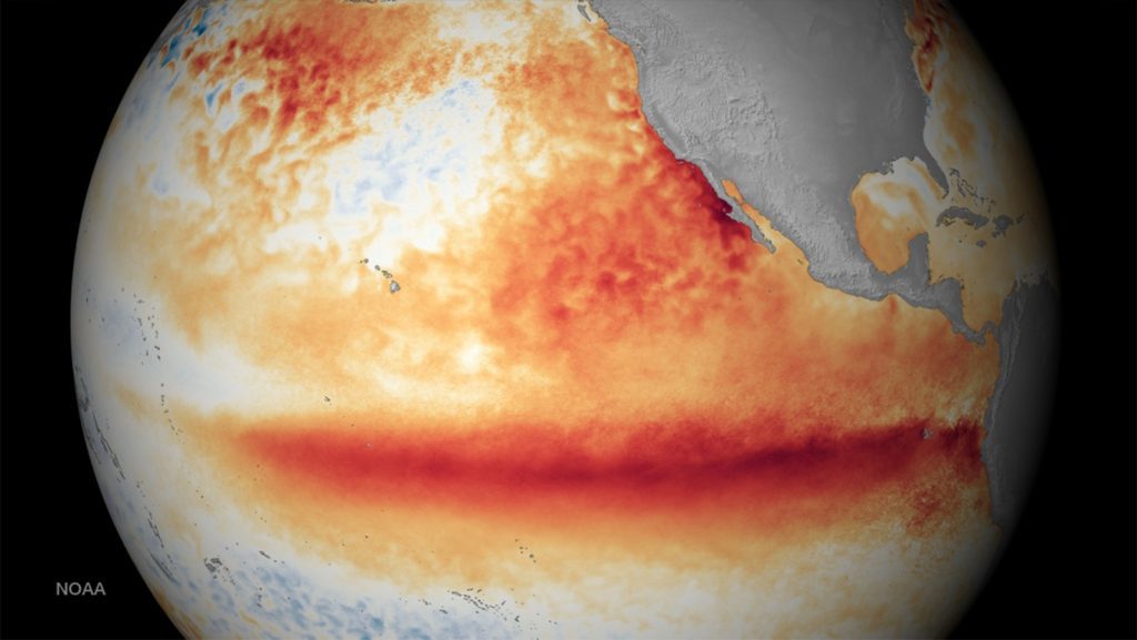
In a new article published in the Journal of Climate, scientists at AOML and the Cooperative Institute for Marine and Atmospheric Science, with collaborators at Boston University, Texas A&M, and North Carolina State University, document the role of ocean dynamics in linking Pacific atmospheric variability to El Niño-Southern Oscillation (ENSO) event generation. The results of the study could be used as a potential predictor of ENSO events up to a year in advance.
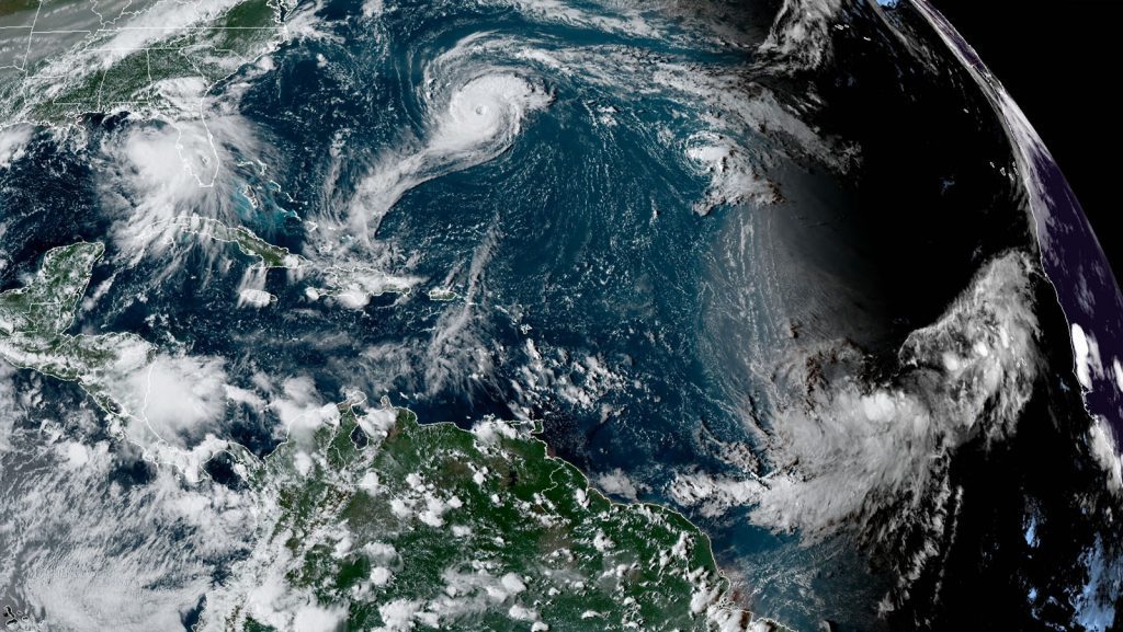
A very active peak in this year’s Atlantic hurricane season has prompted NOAA’s National Hurricane Center (NHC), Environmental Modeling Center (EMC), and AOML’s Hurricane Research Division to task their G-IV and both P-3 aircraft to investigate multiple storms in the Gulf of America and mid-Atlantic.
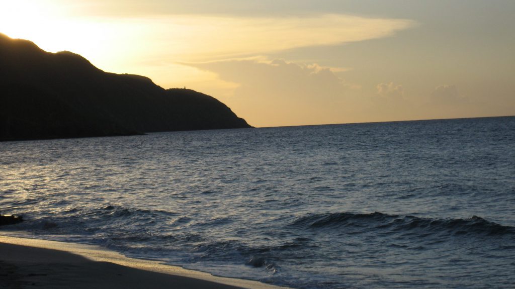
A new paper appearing in the International Journal of Environmental Research and Public Health examines how the presence of children’s open wounds and abrasions during play at the beach may put them at greater risk of skin infections from marine bacteria and other pathogens they encounter. The study finds that children with existing or newly-acquired wounds while at the beach are more susceptible to infection.
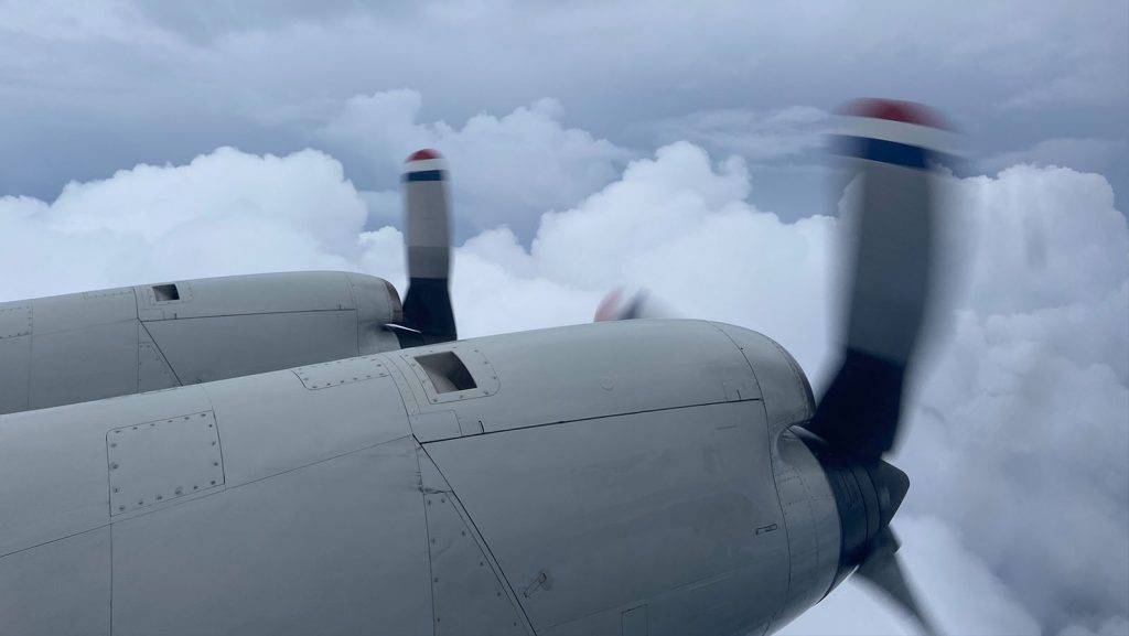
NOAA’s P-3 Hurricane Hunter aircraft completed a flight into Tropical Storm Nana in the Caribbean on the morning of September 2. AOML scientists onboard the aircraft, and from the ground, quality controlled and sent dropsonde and radar data to the Environmental Modeling Center (EMC) and National Hurricane Center (NHC) in real time.
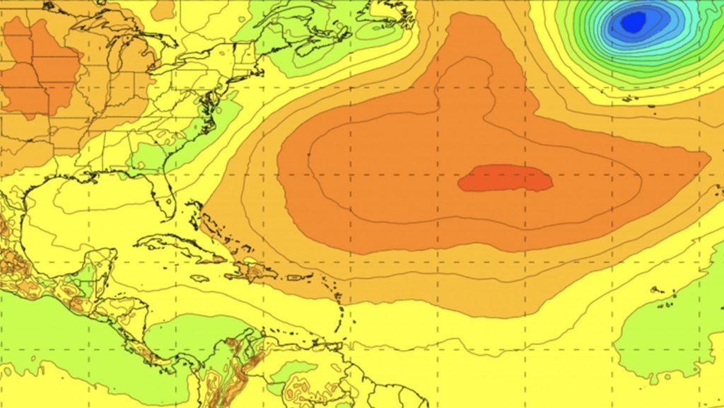
A recent paper published in Atmosphere introduces a new update to the Basin-Scale Hurricane Weather Research and Forecasting (HWRF-B) model, which pairs an atmospheric model with an ocean model via new coupling technology to forecast several tropical cyclones simultaneously. This model, shown to improve forecast skill, was developed at AOML in collaboration with NOAA’s Environmental Modeling Center and the Developmental Testbed Center.
Despite their differences, it is still widely thought that Atlantic Niño is analogous to El Niño in many ways. Specifically, the atmosphere-ocean feedback responsible for the onset of Atlantic Niño is believed to be similar to that of El Niño, a process known as Bjerknes feedback. The near-surface trade winds blow steadily from east to west along the equator. When weaker-than-normal trade winds develop in the western Atlantic basin, downwelling equatorial Kelvin waves propagate to the eastern basin, deepening the thermocline and making it harder for the colder, deeper water to affect the surface.
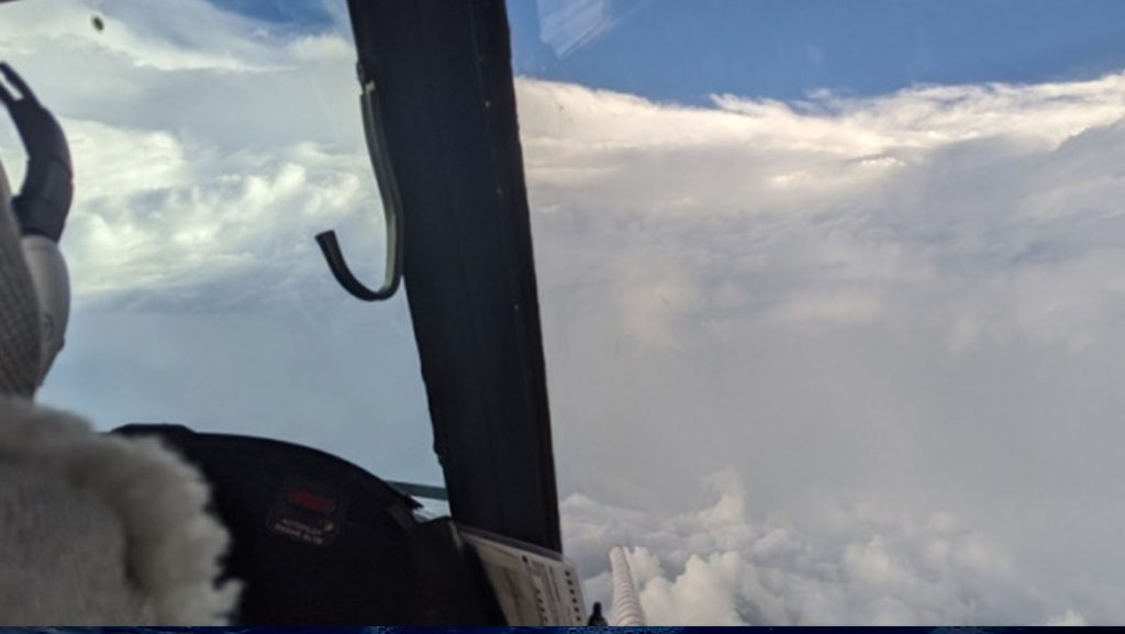
AOML hurricane scientists coordinated with ground crews stationed in the path of Laura’s trajectory to obtain valuable measurements that captured the structural evolution of major Hurricane Laura upon landfall, while successfully completing all operational mission objectives.
AOML hurricane scientists supporting NOAA reconnaissance into Hurricane Laura recognized the onset of rapid intensification when thunderstorms, often referred to as convection, began working its way around the entirety of the storm center.
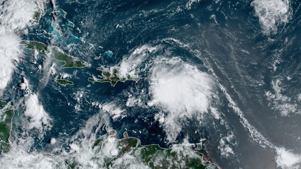
The National Hurricane Center (NHC) upgraded Tropical Depression 13 to Tropical Storm Laura after yesterday morning’s reconnaissance mission confirmed gale-force surface winds within Laura’s vortex. AOML scientists provided remote support for onboard Tail Doppler Radar and dropsonde data processing and continue to do so for upcoming missions into the system.
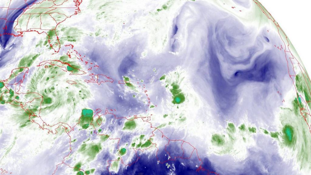
With peak Atlantic hurricane season fast approaching, AOML scientists begin supporting NOAA Hurricane Hunter missions into Tropical Storm Laura. The National Hurricane Center (NHC) and Environmental Modeling Center (EMC) have tasked NOAA’s two P-3 aircraft to investigate the atmospheric conditions associated with the tropical storm.
In a recent study published in the journal Science Advances, oceanographers at AOML and the Cooperative Institute for Marine and Atmospheric Studies for the first time describe the daily variability of the circulation of key deep currents in the South Atlantic Ocean that are linked to climate and weather. The study found that the circulation patterns in the upper and deeper layers of the South Atlantic often vary independently of each other, an important new result about the broader Meridional Overturning Circulation (MOC) in the Atlantic.
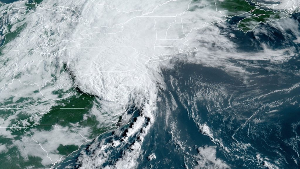
NOAA’s P-3 Hurricane Hunters concluded their Environmental Modeling Center (EMC) tasked reconnaissance into Tropical Storm Isaias with real-time support from AOML’s Hurricane Research Division. The aircraft took off Monday, August 3 at 5 AM EDT, from Lakeland, Florida.
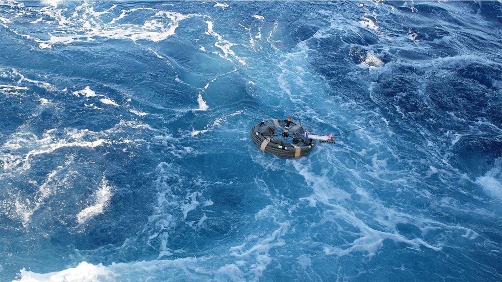
AOML scientists partnered with the U.S. Air Force 53rd Reconnaissance Squadron “Hurricane Hunters” to deploy eight drifting buoys in advance of Tropical Storm Isaias on August 3, 2020 off the Carolina coast, in collaboration with the National Weather Service (NWS), National Hurricane Center (NHC), and Scripps Institution of Oceanography.
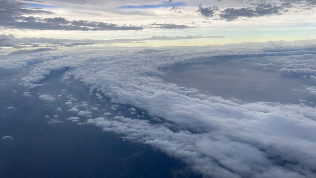
NOAA’s most recent P-3 mission provided scientists and forecasters with measurements indicating that Tropical Storm Isaias maintains its strength as it contends with an environment that is unfavorable for development. Scientists processed these data in real-time, and weather models used these observations to improve forecast performance.
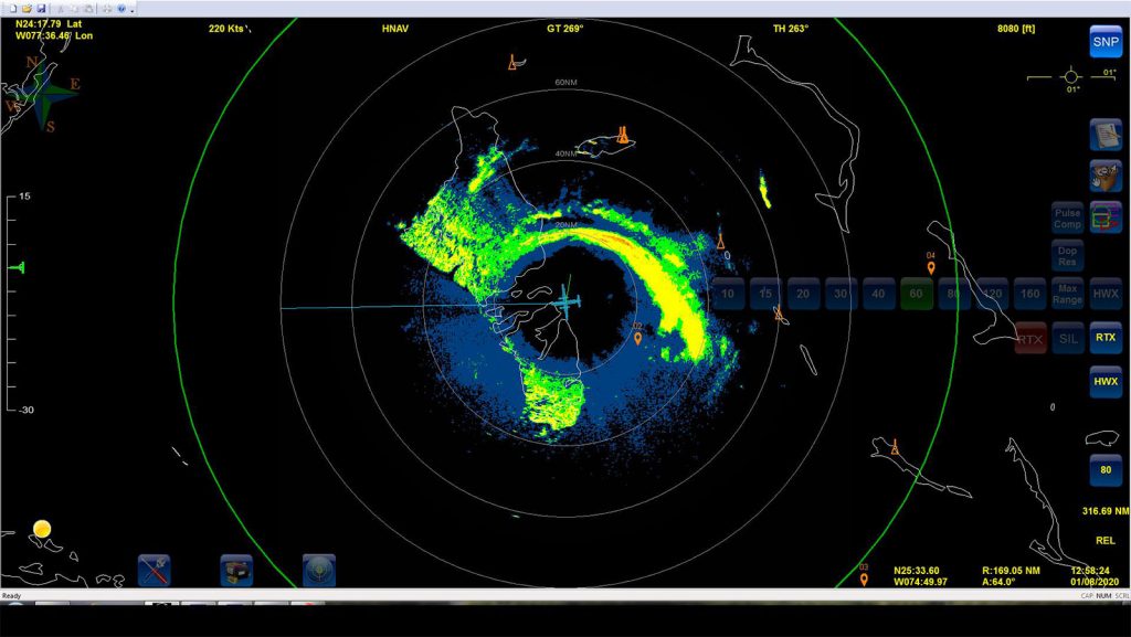
NOAA reconnaissance continues into Tropical Storm Isaias today after their most recent P-3 Hurricane Hunter aircraft returns home from its 7-hour mission tasked by the Environmental Modeling Center (EMC), which took off at 4:30 AM EDT Saturday, August 1st.
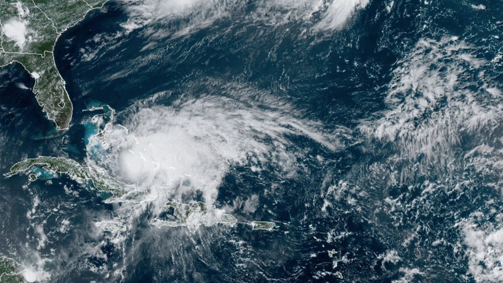
NOAA’s P-3 aircraft will continue Environmental Modeling Center (EMC) tasked reconnaissance into Hurricane Isaias by penetrating the core of its circulation multiple times in order to obtain the most reliable measurements of its environmental conditions. The aircraft took off from Lakeland, FL Friday at 4:00 PM.
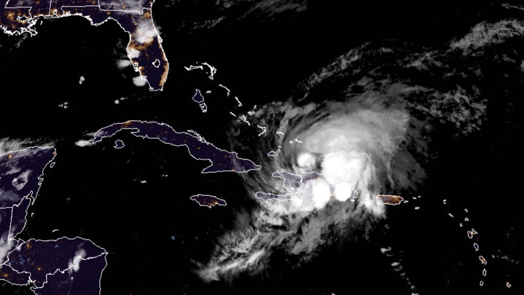
NOAA’s Environmental Modeling Center (EMC) has tasked their P-3 Hurricane Hunters for reconnaissance missions into Tropical Storm Isaias to begin Friday, July 31 at 4:00 AM with additional missions to follow in subsequent days.
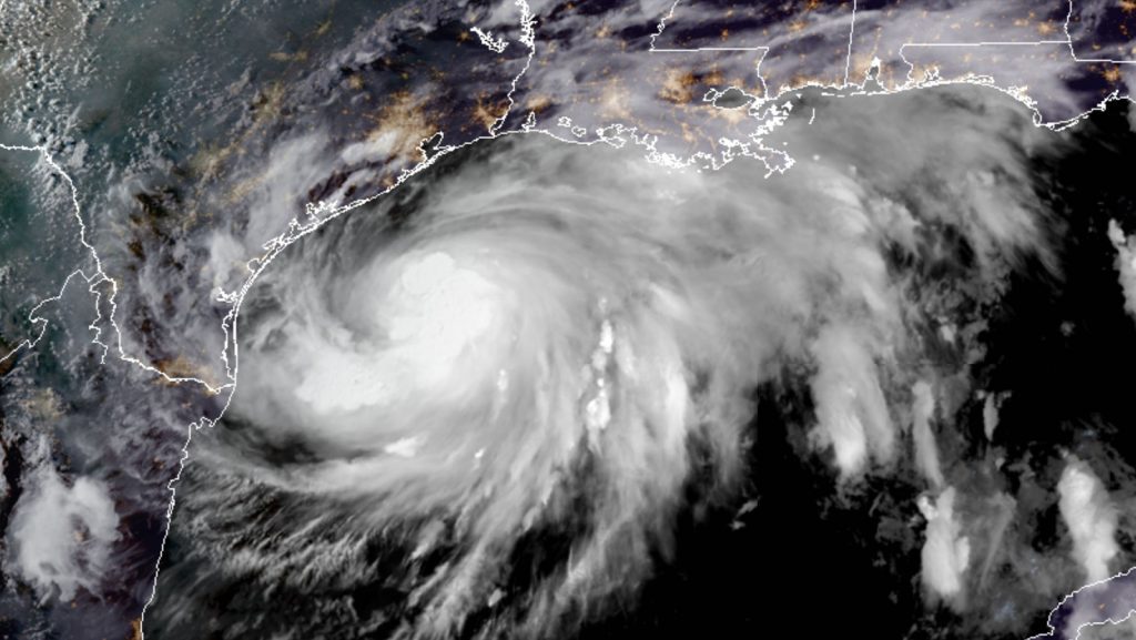
The National Hurricane Center (NHC) continues to task NOAA’s Hurricane Hunter aircraft NOAA43 into Tropical Storm Hanna located in the Gulf of America. AOML radar and dropsonde experts are providing remotely-based data processing in support of these operational missions. The flights are scheduled to continue through Saturday morning, July 25, 2020.
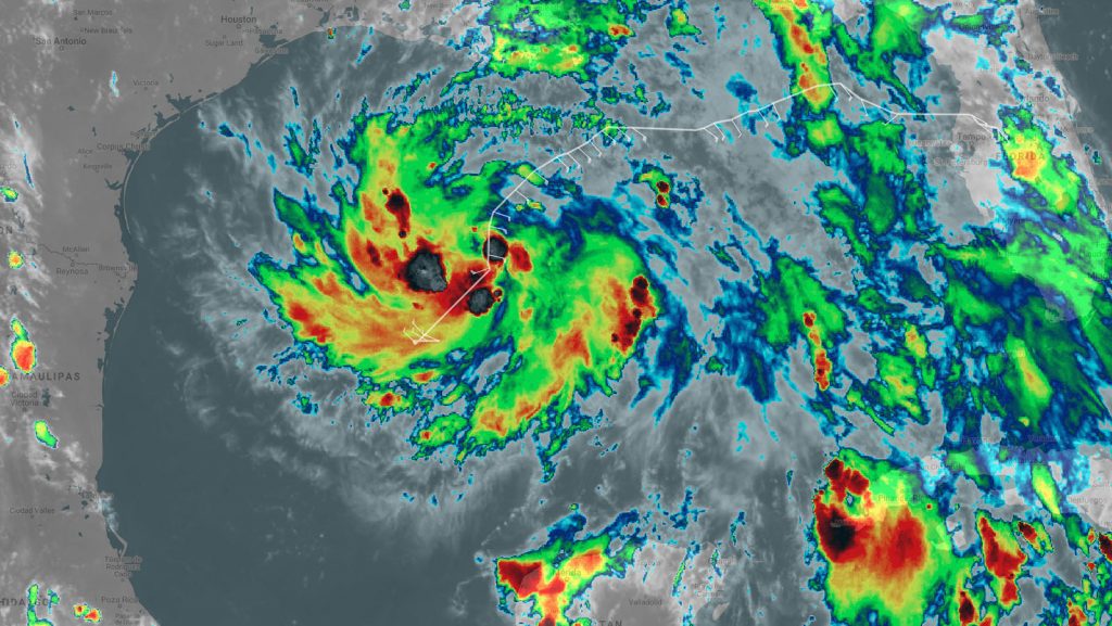
The National Hurricane Center tasked NOAA’s Hurricane Hunter aircraft to investigate Tropical Depression Eight in the Gulf of America Thursday, July 23, 2020.
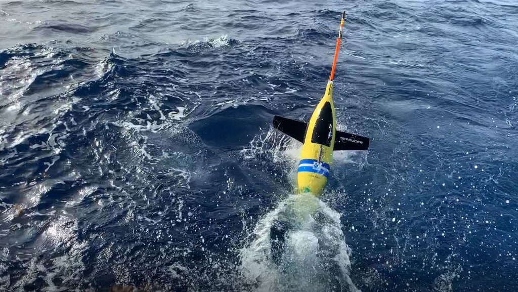
NOAA’s hurricane gliders are heading to sea this week off the coasts of Puerto Rico, the Gulf of America and the eastern U.S. to collect data that scientists will use to improve the accuracy of hurricane forecast models.
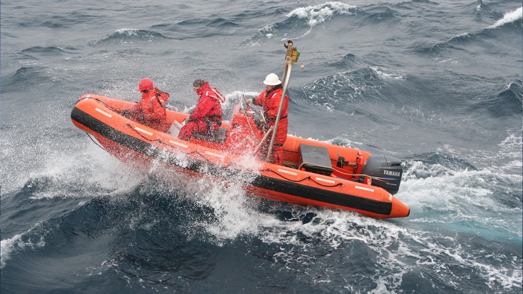
NOAA’s Global Ocean Monitoring and Observation Division and Global Drifter Program recently extended a helping hand to support deployment of commercial Spotter drifters, supported by the U.S. Navy’s Office of Naval Research. These specialized drifters are designed to measure waves, in addition to winds and sea surface temperature, providing valuable data to scientists to be used in hurricane forecast models.
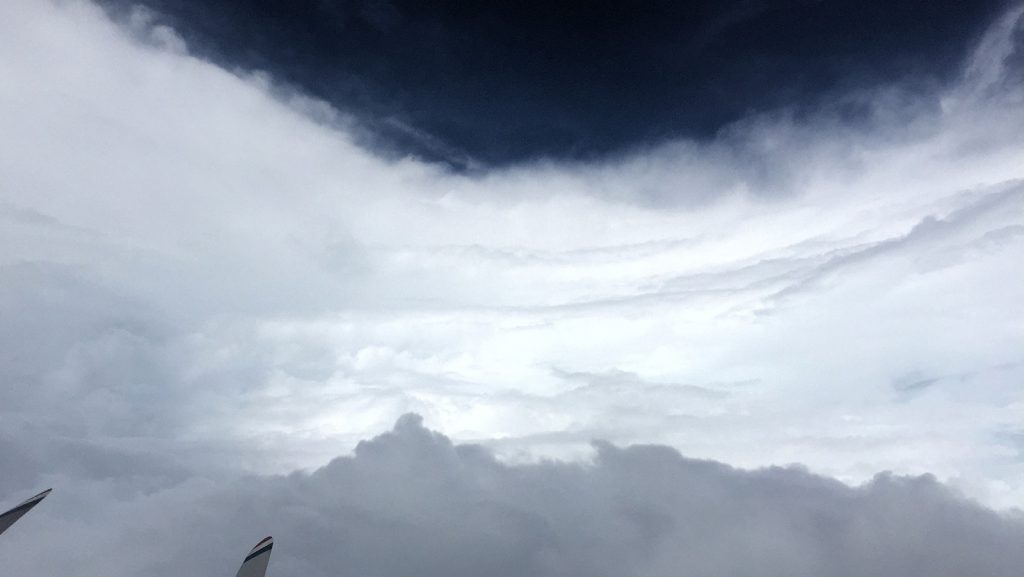
A recent study published in the journal Atmosphere evaluated for the first time, how well NOAA’s regional hurricane model was able to forecast the location and amount of devastating rainfall in 2017’s Hurricane Harvey. The Hurricane Weather Research and Forecasting (HWRF) model predicted the realistic total rainfall and the location of the maximum rainfall of Hurricane Harvey, which were the most devastating impacts of the storm’s landfall in coastal Texas.
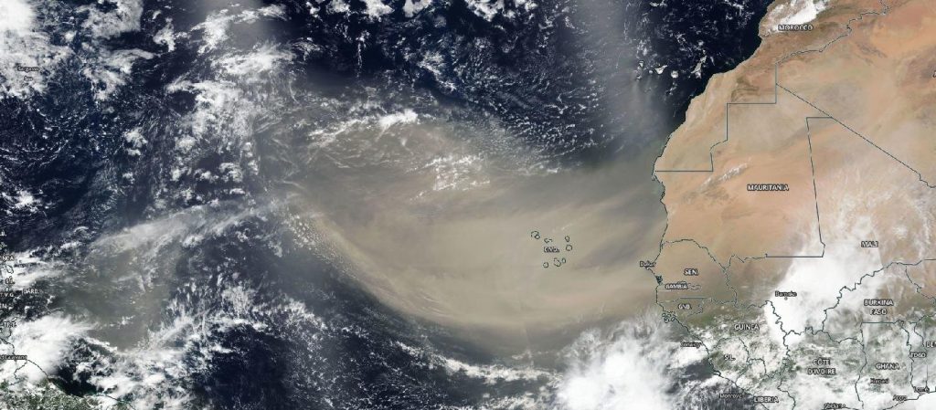
Originally Published Wednesday, June 24, 2020 at NOAA NESDIS
As we move through the 2020 Atlantic Hurricane Season, you will no doubt hear a lot about the Saharan Air Layer—a mass of very dry, dusty air that forms over the Sahara Desert during the late spring, summer and early fall. This layer can travel and impact locations thousands of miles away from its African origins, which is one reason why NOAA uses the lofty perspective of its satellites to track it.
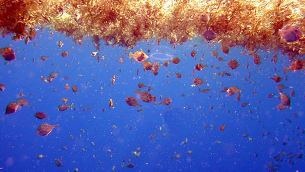
Coastal communities surrounding the northern Caribbean Sea have experienced an abundance of brown algae, known as pelagic Sargassum, washing up along their beaches since 2011. In a recent study conducted by AOML scientists, it was found that Sargassum beaching predictions can be improved by accounting for windage in models.
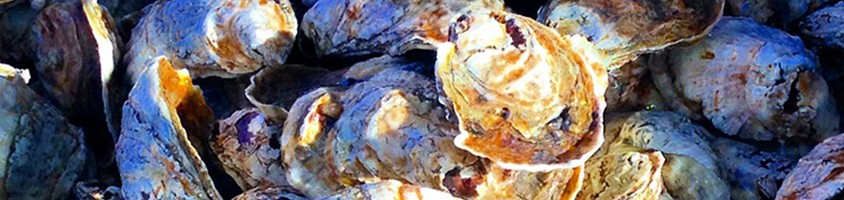
According to AOML scientists, the advancements made in genomics and whole genome sequencing has completely redefined the understanding of Vibrio. These advances have helped provide a clearer picture of how bacteria spread, emerge, and cause disease. Vibrio is a genus of bacteria that has a strong affinity for the environmental conditions in freshwater and marine […]
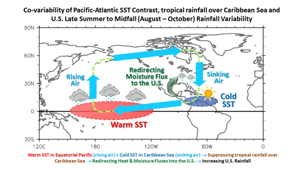
In a recent article published in Geophysical Research Letters, AOML and CIMAS scientists investigated U.S. rainfall variability, focusing on the late summer to mid-fall (August-October) season. The main goal of the study was to identify potential predictors of U.S. precipitation during August-October and to explore the underlying physical mechanisms.
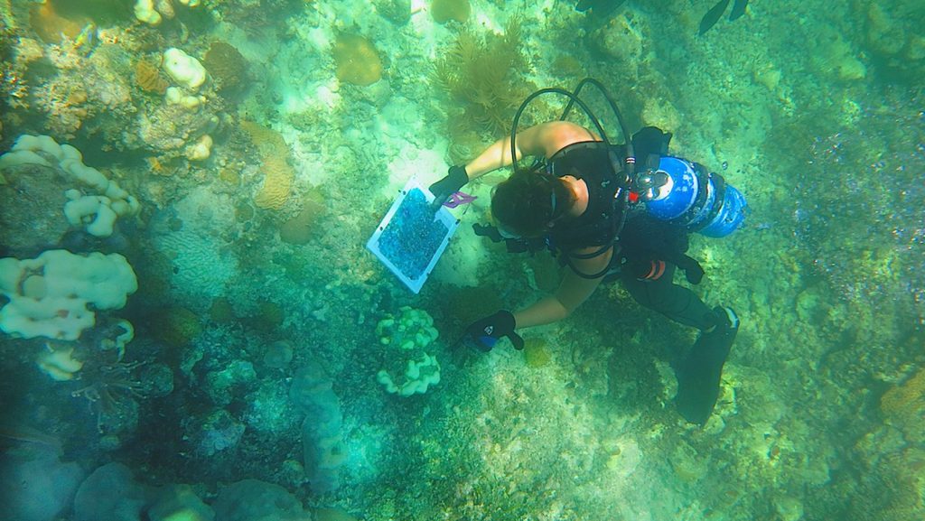
AOML is proud to recognize the recent achievements of our outstanding scientists who were recently awarded the Department of Commerce Bronze Medal for outstanding contributions which have increased the efficiency and effectiveness of NOAA. Kelly Goodwin was honored for her Leadership in the development of the Omics program in NOAA. Ian and Derek are honored for their contributions to addressing Stoney Coral Tissue Loss Disease in the FL Keys.
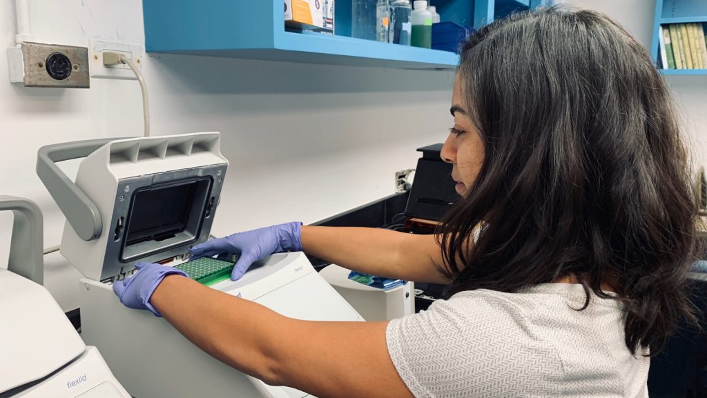
New research on stony coral tissue loss disease reveals similar “bacterial signatures” among sick corals and nearby water and sediments for the first time. Results hint at how this deadly disease might spread, and which bacteria are associated with it, on Florida’s Coral Reef.
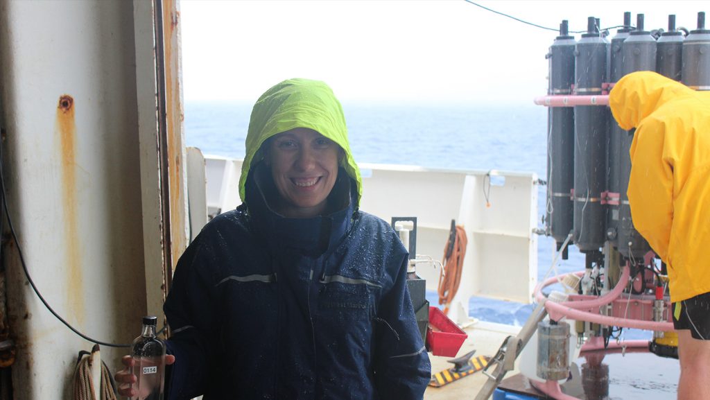
New NOAA and partner research comparing ocean acidification around North America shows that the most vulnerable coastal waters are along the northern part of the east and west coasts. While previous research has looked at specific regions, the new study appearing in Nature Communications, is the first in-depth comparison of ocean acidification in all North American coastal ocean waters.
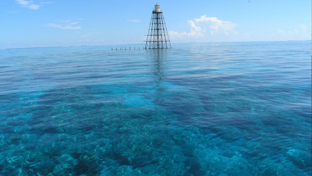
The Florida Keys Integrated Assessment (IEA) team, led by AOML in partnership with managers and scientists from the Office of National Marine Sanctuaries, launched a new Ecosystem Status Report web tool on May 13th. The IEA approach aims to balance the needs of nature and society through Ecosystem-Based Management. It provides scientific knowledge of the Florida Keys National Marine Sanctuary ecosystem to scientists, policy makers and resource managers.
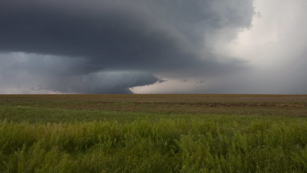
Recently, scientists at NOAA’s Atlantic Oceanographic and Meteorological Laboratory (AOML) and the Cooperative Institute for Marine and Atmospheric Studies (CIMAS) explored the physical causes between U.S. tornado activity and the Madden-Julian Oscillation. In a study recently published in the Journal of Climate (Kim et al., 2020), they showed that a series of key atmosphere-ocean processes are involved in the remote impact of Madden-Julian Oscillation on U.S. tornado activity.
NOAA’s unique science mission benefits every American life every day in positive ways, including keeping Americans safer and contributing to greater US economic growth than ever before. In the next 50 years, NOAA will advance innovative research and technology, answer tough scientific questions, explore the unexplored, inspire new approaches to conservation, and continue its proud legacy of science, service, and stewardship.
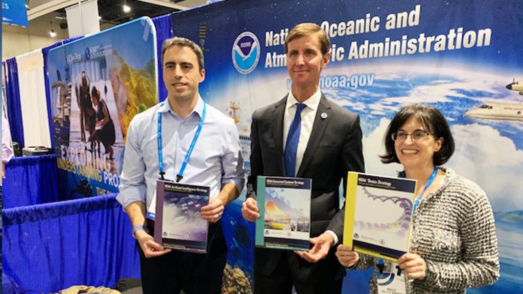
At the 2020 international Ocean Sciences meeting, AOML microbiologist Kelly Goodwin helped NOAA unveil a new strategy for how the agency will dramatically expand its use of ‘Omics in the coming years. The ‘Omics strategy is one of four blueprints NOAA premiered that will guide transformative advancements in the quality and timeliness of its science, products, and services.
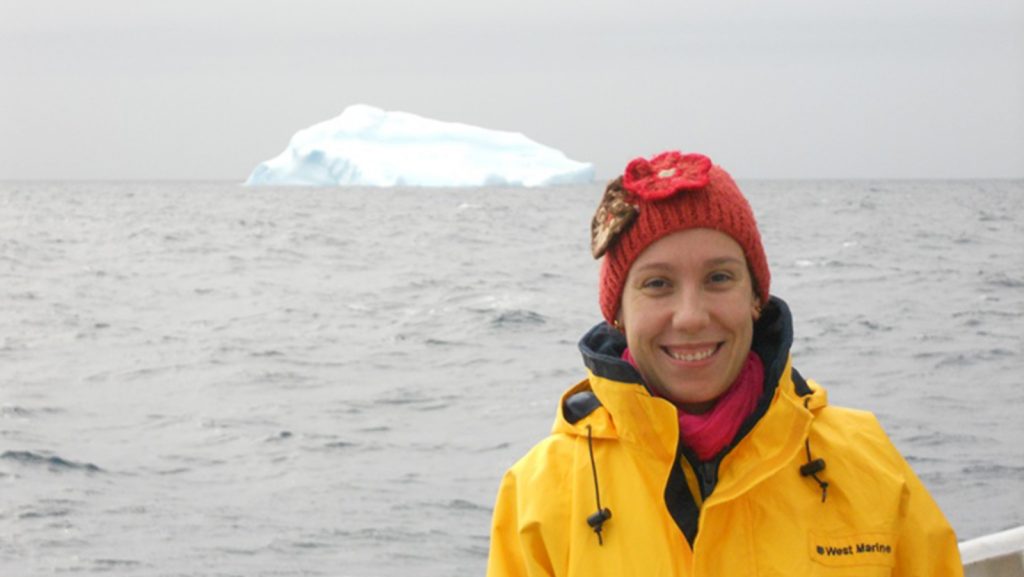
Dr. Leticia Barbero is a chemical oceanographer at NOAA’s Cooperative Institute for Marine and Atmospheric Studies at the University of Miami. In her role, she works with AOML to study the carbon dioxide system in the ocean, specifically ocean acidification in the coastal waters of the U.S. East Coast and Gulf of America.
In a recently published study, AOML hurricane researchers used multiple computer model forecasts to gain a better understanding of how Hurricane Michael, which made landfall in the panhandle of Florida with winds up to 162 mph, rapidly intensified despite strong upper-level wind shear which usually weakens hurricanes. By contrasting two sets of forecasts, the study found that Michael only rapidly intensified when rainfall completely surrounded Michael’s center, and when the eye of the storm itself was located in nearly the same place at different heights.
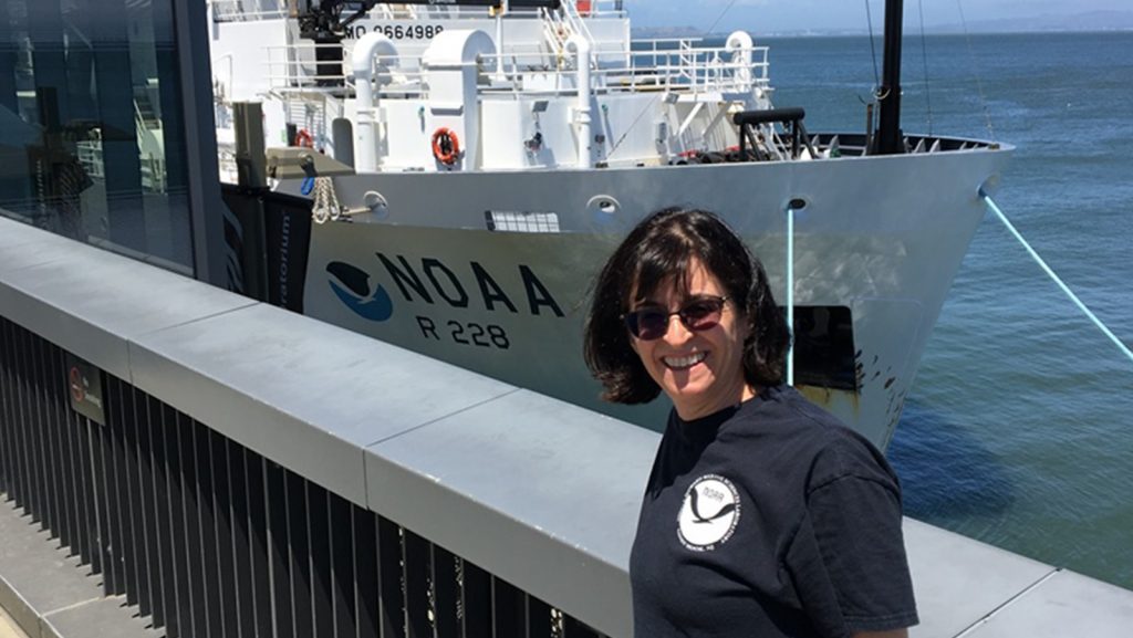
In honor of Women’s History Month, NOAA Research recently featured AOML microbiologist, Kelly Goodwin, in an article which gives readers a look inside the daily life of a researcher. Kelly is a co-chair of the task force that’s laying out the plan to implement NOAA’s Omics Strategy, one of four science and technology strategies that aim to guide transformative advancements in the quality and timeliness of NOAA science, products and services.
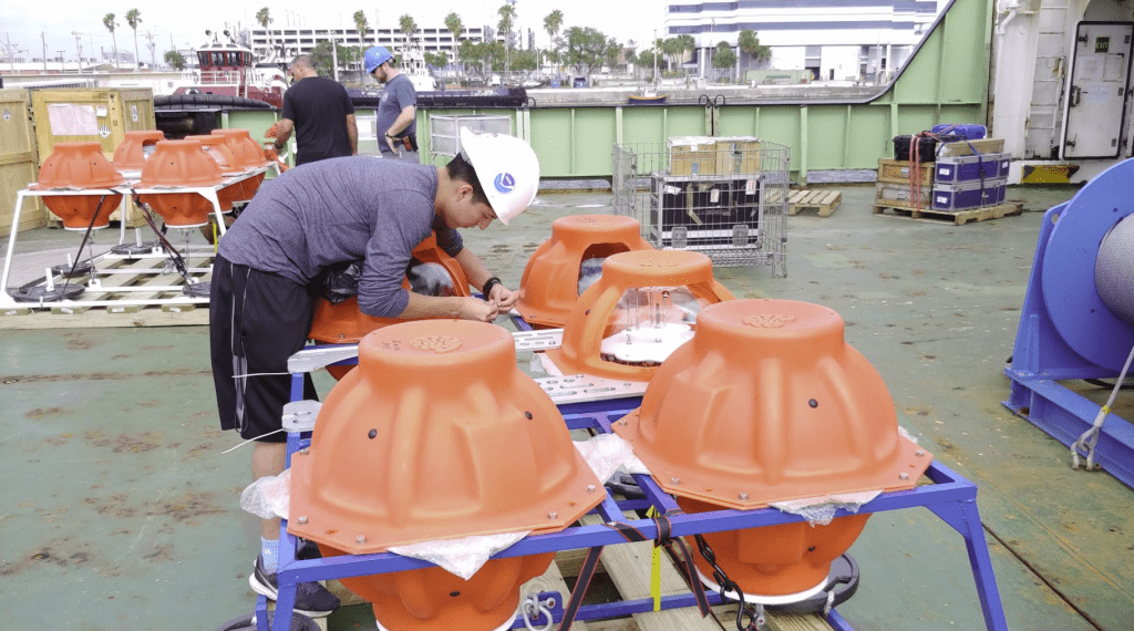
AOML is preparing to deploy two autonomous data pod systems with Pressure Inverted Echo Sounders near the eastern boundary of the North Atlantic during March 2020. This will be the first full scale operational deployment of data pods, with a goal of providing a low-cost solution for the sustained Atlantic Meridional Overturning Circulation monitoring without the continuous use of a research vessel.
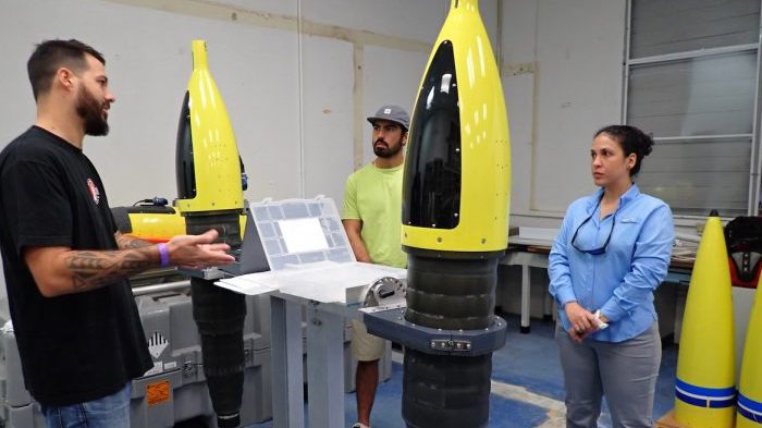
AOML scientists recently traveled to Puerto Rico and the Dominican Republic, respectively, to train members of the CARICOOS and ANAMAR ocean glider teams in the removal and installation of science sensors in the fleet of AOML underwater gliders.
AOML is deploying drifting buoys as part of a large multinational project that aims to improve our current understanding of the complicated interactions between the air and sea which create shallow convective clouds. NOAA scientists are interested in studying shallow cloud and air-sea interactions because of their influence on global conditions from temperature and precipitation to more extreme weather events.
AOML scientists are collaborating with partners from the Northern Gulf Institute of the University of Mississippi, and the University of Miami’s Cooperative Institute for Marine and Atmospheric Studies to tackle increasing nutrient levels throughout Biscayne Bay. A previous study detected the slow but steady eutrophication and warned of a regime shift towards murky algal dominated waters if better water quality management practices were not implemented.
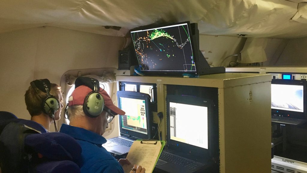
The 2019 Atlantic hurricane season ended on November 30 but not before churning out 18 named storms, including catastrophic Hurricane Dorian. Throughout the season, AOML’s hurricane scientists were at the forefront of NOAA’s efforts to prepare vulnerable communities for severe weather.
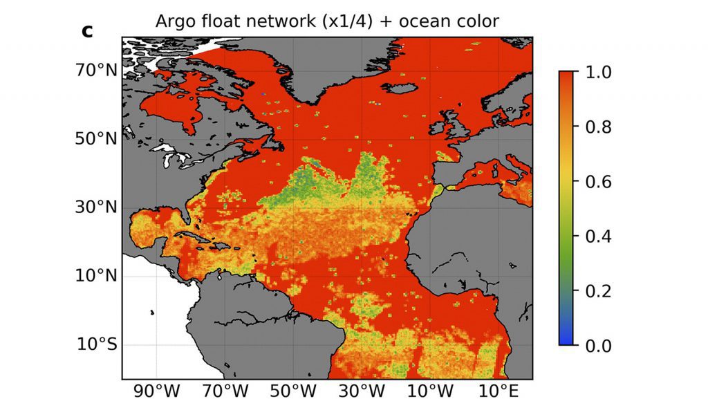
Scientists are now looking to expand their observing capabilities to include the biology and chemistry of the oceans, currently available globally from ocean color satellites that measure chlorophyll, indicating algal blooms at the ocean surface. A recent paper in the Journal of Atmospheric and Oceanic Technology by AOML postdoctoral scientist Cyril Germineaud of the University of Miami’s Cooperative Institute for Marine and Atmospheric Studies and colleagues shows that in close synergy with ocean color satellites, a global array of biogeochemical sensors complementing the existing core Argo network could revolutionize our knowledge of the changing state of primary productivity, ocean carbon cycling, ocean acidification, and the patterns of marine ecosystem variability from seasonal to interannual time scales.
The ways in which Sargassum has invaded the tropical Atlantic have been a mystery, but we may now have an answer. A new study in Progress in Oceanography, led by researchers at NOAA’s Atlantic Oceanographic and Meteorological Laboratory (AOML), identifies possible mechanisms and pathways by which Sargassum entered and flourished in the tropical Atlantic and Caribbean.
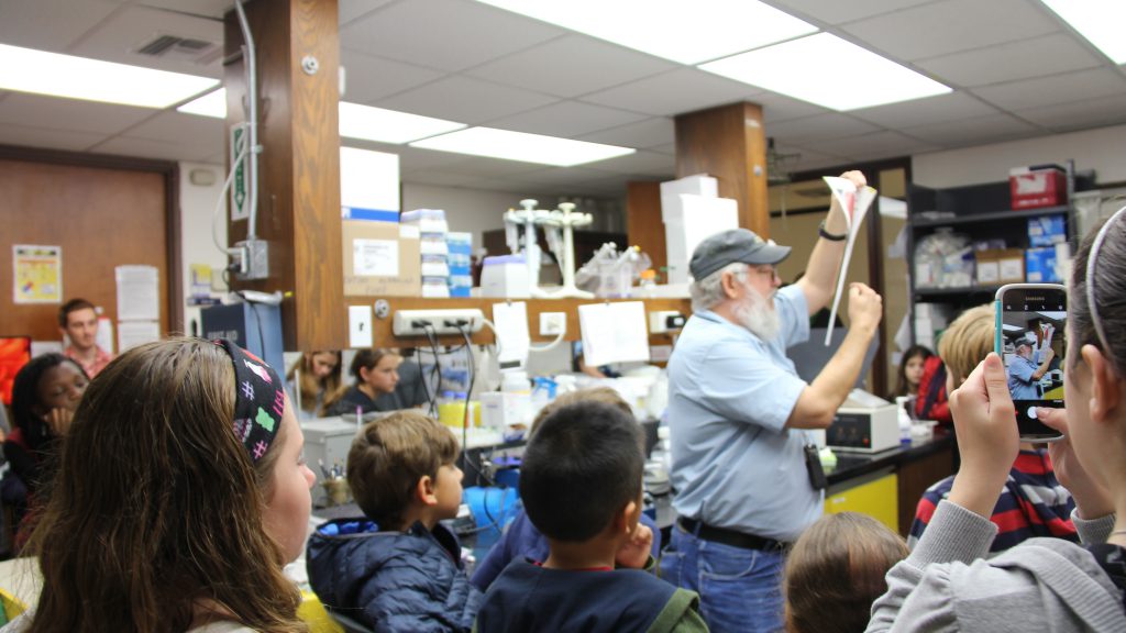
NOAA is turning 50! The federal science agency that provides daily weather forecasts, severe storm warnings, fisheries management, and coastal restoration, is celebrating by opening its doors to the south Florida community with a free open house on April 25th, 2020 from 10:00 a.m to 3:00 p.m. What better way to celebrate Earth Day than seeing science in action with friends and family!
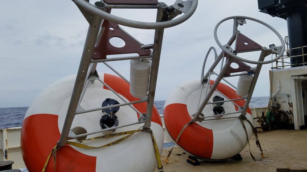
TACOS has added 10 acoustic current meters to the Prediction and Research Moored Array in the Tropical Atlantic (PIRATA) buoy, moored at 4N, 23W. Profile measurements are taken every 1-10 minutes, depending on depth. Prior to the addition of the TACOS upper ocean observations in March 6, 2017 velocity profiles were only collected at this location during shipboard surveys. These measurements are important because ocean currents influence temperature, salinity, and air-sea fluxes in the tropical North Atlantic, which affect weather, climate, and fisheries of the surrounding continents.
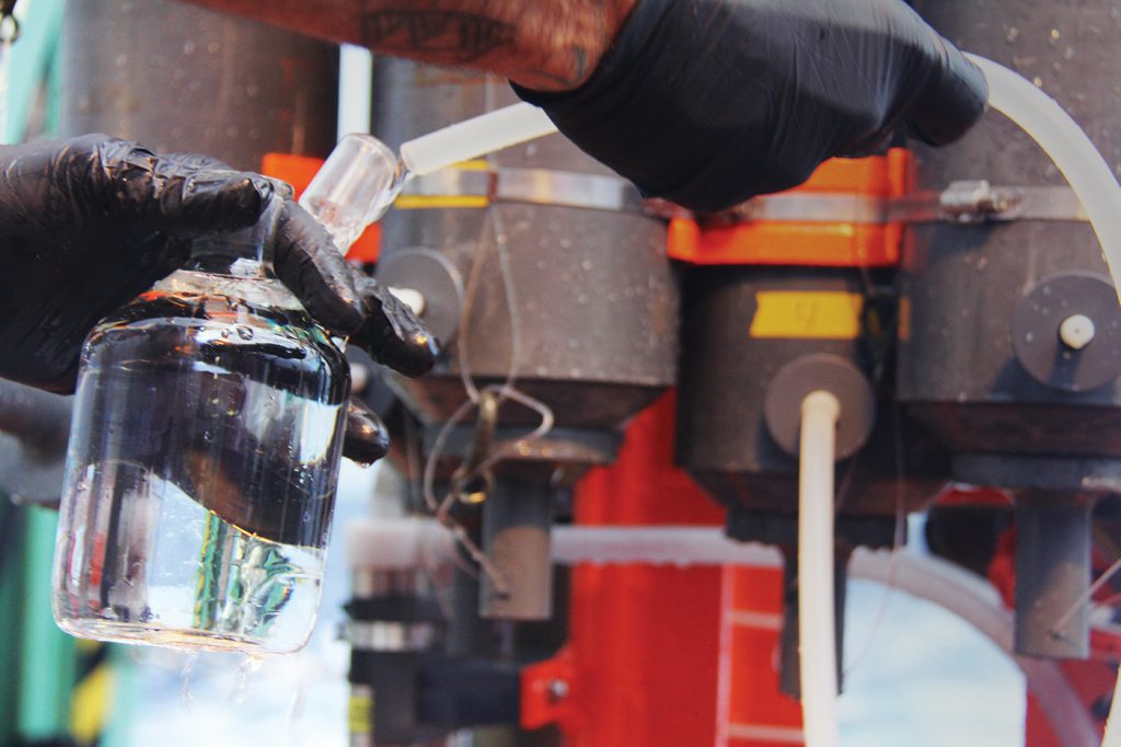
Every year the Global Carbon Project publishes an authoritative observation based Global Carbon Budget detailing the annual release of fossil fuel carbon dioxide and the uptake by the terrestrial biosphere and oceans. In 2018 the global carbon emissions were still increasing, but their rate of increase had slowed. Global carbon emissions are set to grow more slowly in 2019, with a decline in coal burning offset by strong growth in natural gas use worldwide.
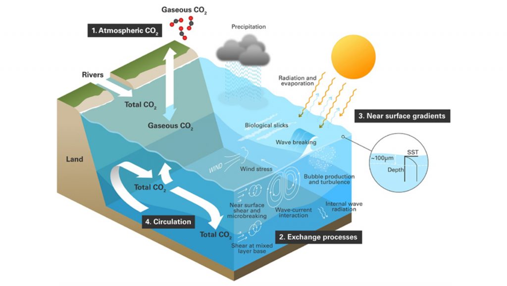
The ability to predict Earth’s future climate relies upon monitoring efforts to determine the fate of carbon dioxide emissions. For example, how much carbon stays in the atmosphere or becomes stored in the oceans or on land? The oceans in particular have helped to slow climate change as they absorb and then store carbon dioxide for thousands of years.
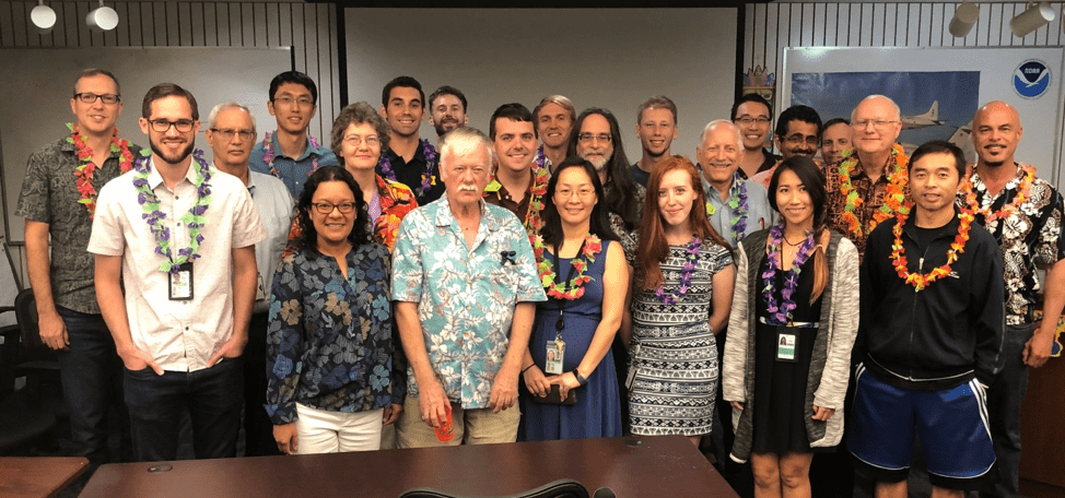
AOML’s hurricane scientists conducted multiple airborne missions into several tropical systems that formed in the Atlantic in September and October. The data gathered in Humberto, Jerry, pre-Karen, Lorenzo, and Nestor improved track and intensity forecasts, aiding NOAA’s efforts to prepare vulnerable communities for severe weather. The missions also supported research to better understand how tropical cyclones form, intensify, and dissipate, as well as supported efforts to validate satellite measurements of these storms.
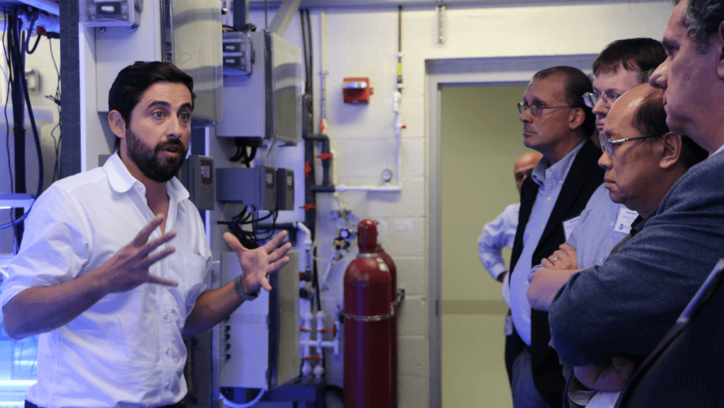
November 19 – 21, 2019, AOML hosted a three day external review to evaluate the quality, performance, and relevance of our research portfolio. NOAA’s Office of Oceanic and Atmospheric Research conducts these reviews every five years to gauge the effectiveness of the research portfolios of all the labs, and also to forge new partnerships for research and collaborations across NOAA. Feedback received after the completion of the lab review will help set new priorities for AOML. The 2019 AOML review featured presentations from each science division, lightning talks from scientists, a poster session, lab tours, and an early career luncheon. We also had the pleasure of hosting Deputy NOAA Administrator Rear Admiral Tim Gallaudet at the opening of the review.
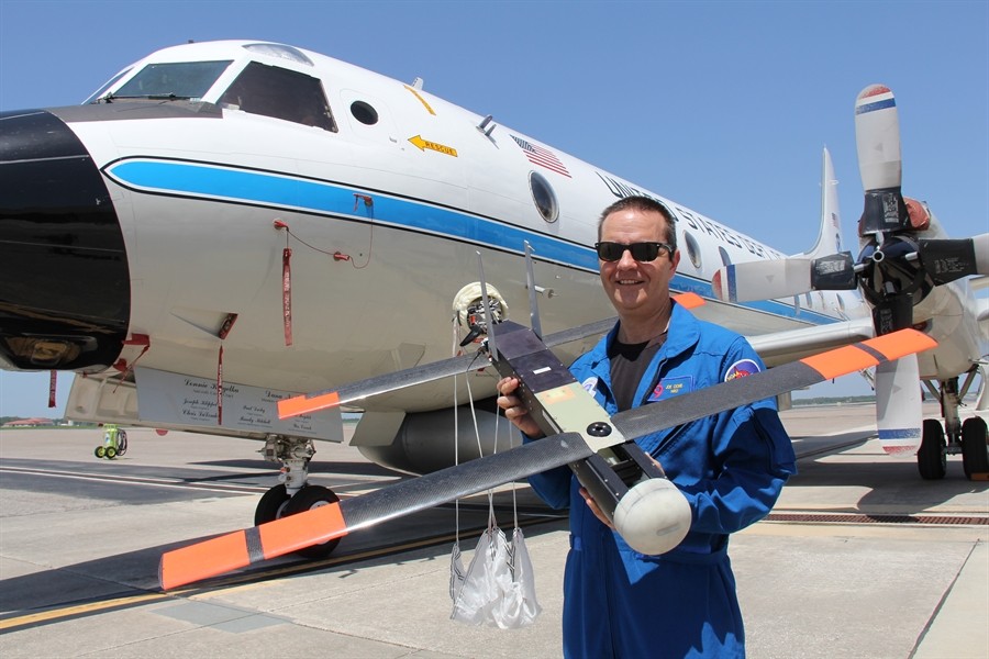
The most dangerous part of the hurricane is the eyewall close to the ocean. It’s where the storm draws energy from heat in the water, which influences how strong – and how quickly – the storm will develop. It’s also where the strongest winds lurk.Direct and continuous observations of the lower eye-wall would help forecasters understand critical information about the storm’s development. NOAA P-3 “Hurricane Hunters” routinely fly through hurricane eyewalls to gather storm data, but avoid flying close to the ocean because conditions are too hazardous.
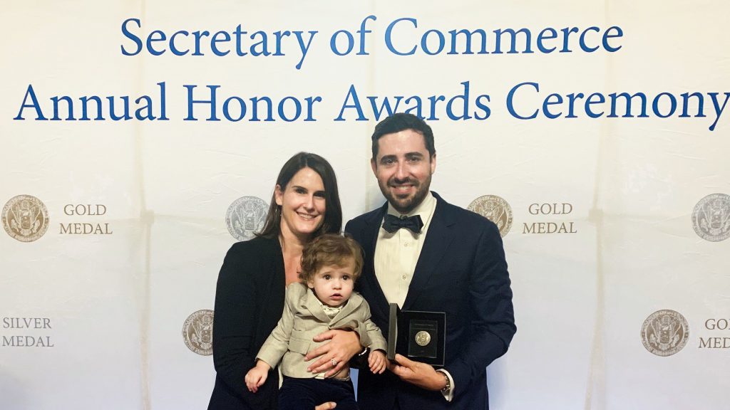
AOML coral ecologist, Ian Enochs, was recently awarded with the Department of Commerce Silver Medal Award for his leadership in developing and implementing the Sub-Surface Automated Sampler (SAS). The DOC Silver Medal is awarded to federal employees for exceptional performance characterized by noteworthy contributions which have a direct and lasting impact.
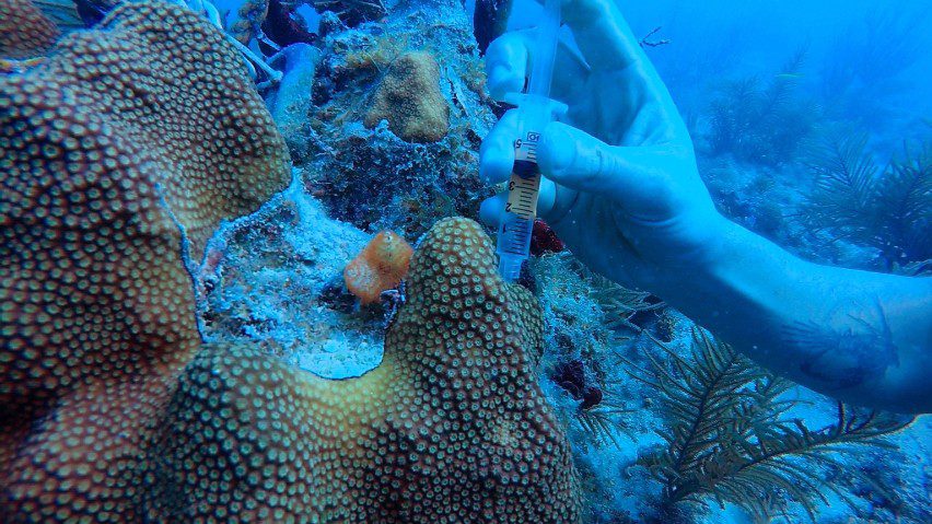
A new study by coral researchers from the University of Miami’s Cooperative Institute for Marine and Atmospheric Studies (CIMAS) and NOAA’s Atlantic Oceanographic and Meteorological Laboratory suggests that the physical oceanographic habitat characteristics-such as, temperature, light availability, and water flow, of corals, may influence microbe communities and health of coral reefs. The results showed a link between physical habitat and coral microbiology in coral reefs in southeast Florida.
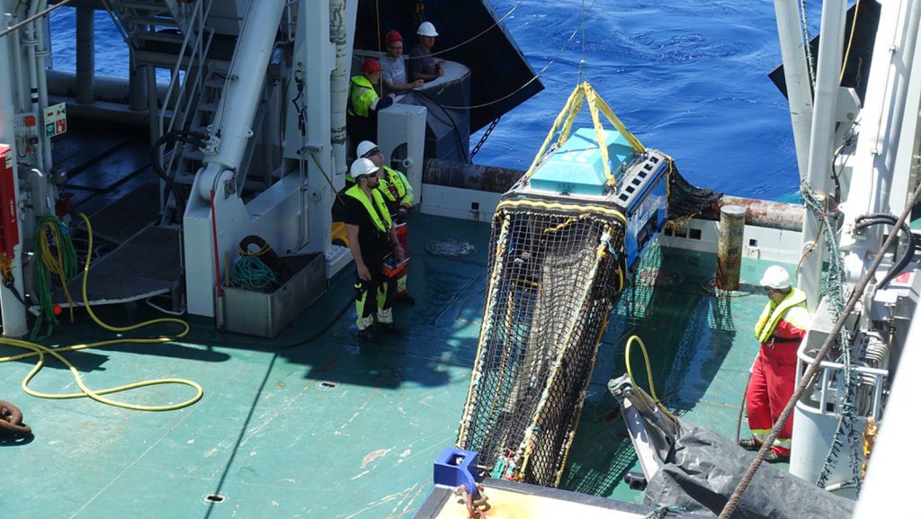
Dr. Luke Thompson, a Northern Gulf Institute Assistant Research Professor at AOML, sailed aboard the Norwegian icebreaker RV Kronprins Haakon in May as part of a research effort focused on characterizing species that dwell in the mesopelagic zone—the region of the ocean 200–1000 meters below the surface. The cruise was undertaken to explore the potential for developing a new fishery based on mesopelagic fish.
Catastrophic Hurricane Dorian will be long remembered as one of the Atlantic basin’s most powerful landfalling hurricanes. NOAA Hurricane Hunters measured Dorian’s intensification from a weak tropical storm in the Caribbean to one of the Atlantic’s fiercest hurricanes. The data they gathered were vital to protecting life and property, supporting NOAA’s efforts to warn vulnerable communities of approaching severe weather through accurate forecasts.
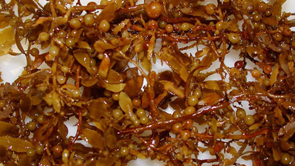
AOML researchers released an assortment of GPS equipped drifters into the tropical Atlantic Ocean and Caribbean Sea to study how ocean currents and winds play a role in the distribution of Sargassum. With the data obtained from the sargassum drifters along with satellite data from the University of South Florida, AOML researchers now have the ability to distribute weekly experimental Sargassum Index Reports.
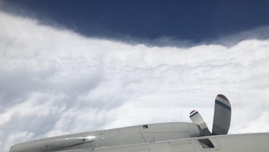
NOAA researchers have been working around the clock to collect vital data during Hurricane Dorian which is being used to improve present and future forecasts to protect and save vulnerable lives and property. Using technology aboard the NOAA Hurricane Hunter P-3 aircraft, AOML hurricane researchers were able to document the rapid intensification of Dorian as it approached the Bahamas.
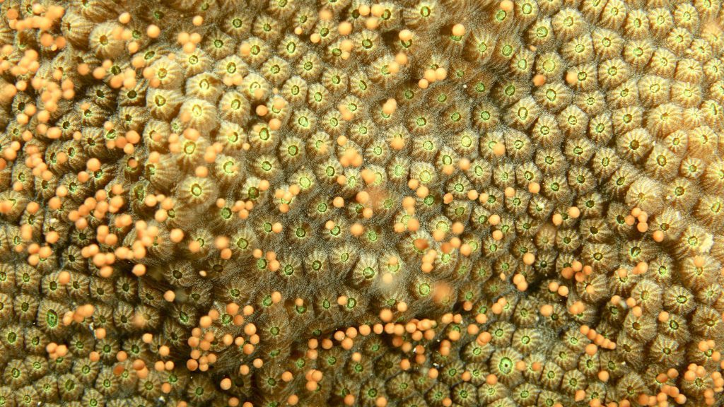
Last week AOML and CIMAS coral researchers, Graham Kolodziej, Anderson Mayfield, and Derek Manzello, entered the ocean off of the Upper Florida Keys to collect tiny floating balls being released from the protected mountainous star coral (Orbicella faveolata). Taking place shortly after moonrise, the spawning process is a visually beautiful part of the circle of life for corals, releasing gametes into the ocean water to become fertilized and eventually settle to create new corals stony coral colonies.
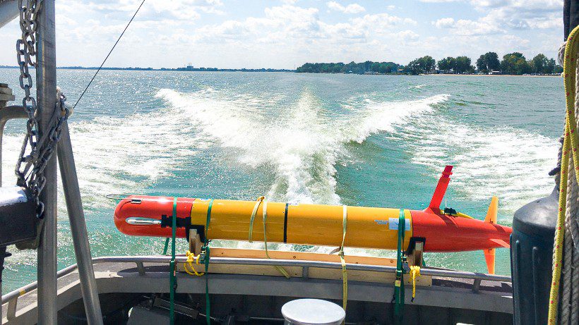
Two underwater robots will be gliding throughout the western Lake Erie basin this week, as NOAA and its partners at the Monterey Bay Aquarium Research Institute (MBARI) test technology to autonomously monitor and measure the toxicity of harmful algal blooms in the Great Lakes.
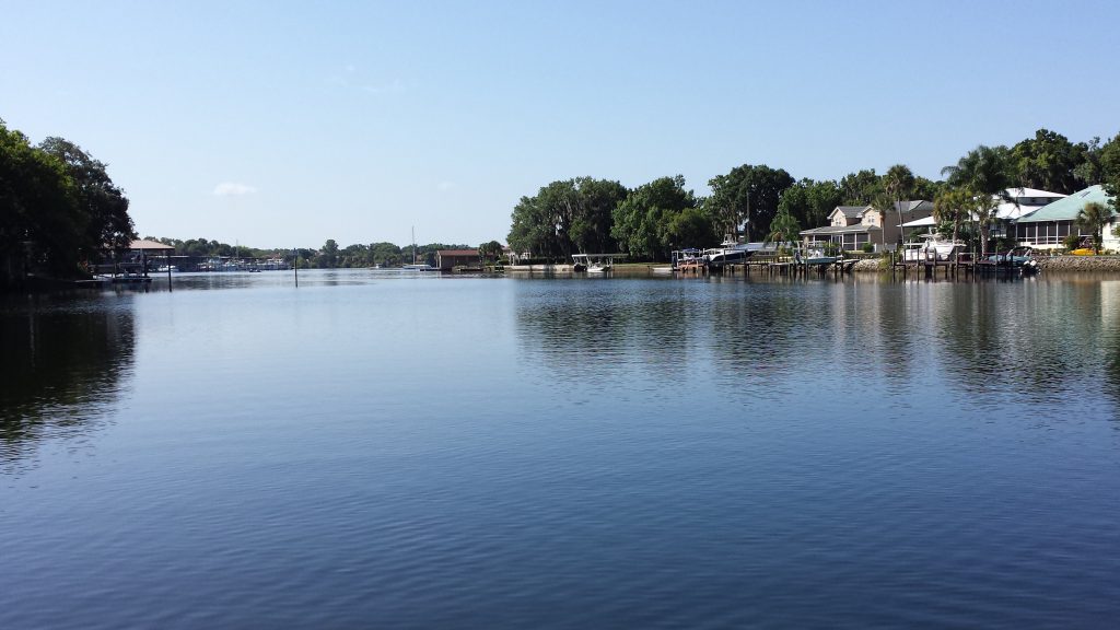
An analysis of 20 years of water quality data shows that Biscayne Bay, a NOAA Habitat Focus Area off southeast Florida, is degrading, as scientists have identified early warning signs that could help inform managers to prevent a regime shift of the bay’s ecosystem.In a recent study published in Estuaries and Coasts, scientists from NOAA and partner organizations detected an increasing trend in chlorophyll and nutrient levels from 48 monitoring stations throughout Biscayne Bay.
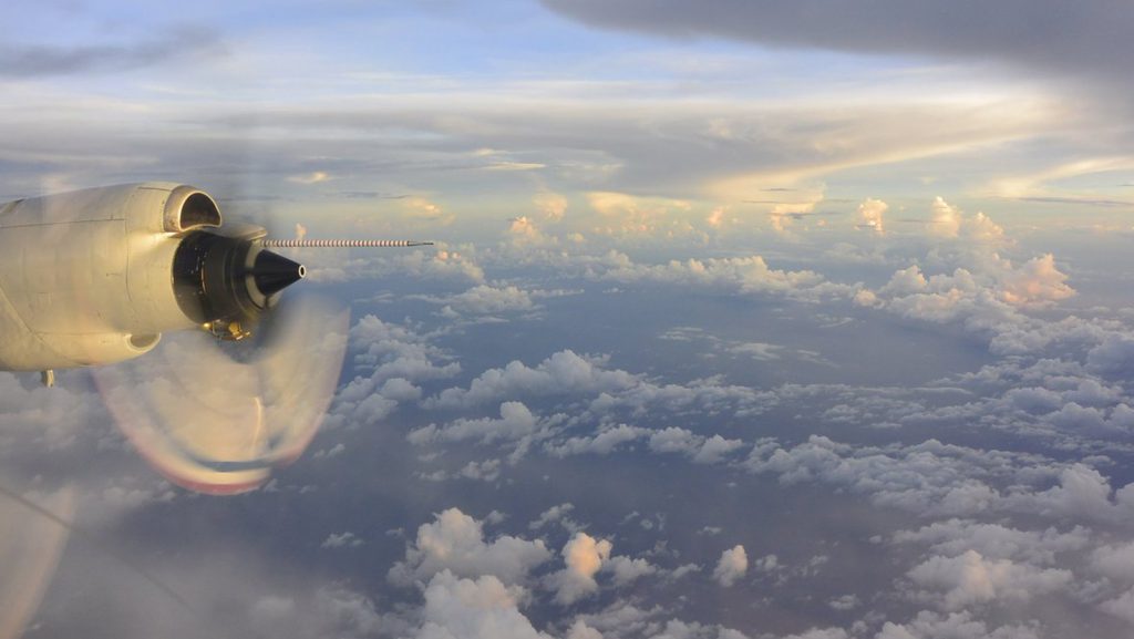
AOML Director Dr. John Cortinas has been elected to become a Fellow of the American Meteorological Society. Fellows are elected for their “outstanding contributions to the atmospheric or related oceanic or hydrologic sciences or their applications during a substantial period of years.” John has been member of the American Meteorological Society since 1983, supporting the organization as an associate editor for the journals Weather and Forecasting and Monthly Weather Review. Additionally, John has served as the AMS Chairperson of the Minority Scholarship Committee, a member of the Board on Women and Minorities, and as a member of the Weather Analysis and Forecasting Committee.
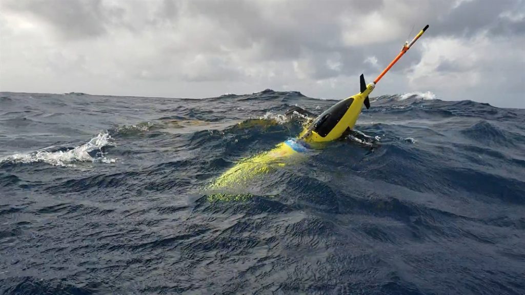
Four ocean gliders set off to sea this week to bring back data that scientists hope will improve the accuracy of hurricane forecast models.The robotic, unmanned gliders are equipped with sensors to measure the salt content (salinity) and temperature as they move through the ocean at different depths. The gliders, which can operate in hurricane conditions, collect data during dives down to a half mile below the sea surface, and transmit the data to satellites when they surface.
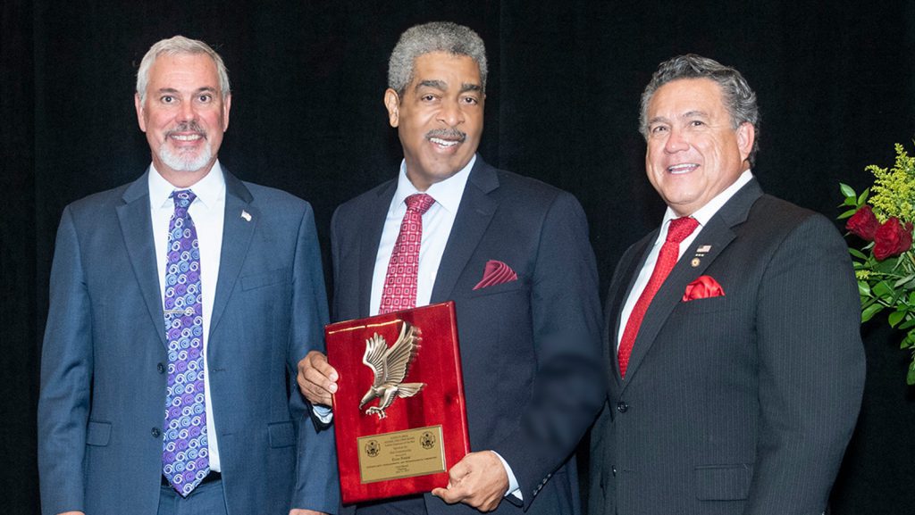
AOML oceanographer Evan B. Forde was named the Federal Employee of the Year for the Service to the Community category at the 54th annual South Florida Federal Executive Board’s banquet on June 21st. For over 30 years Forde has volunteered hundreds of hours per year to creating/enhancing public education and spoken to over 70,000 South […]
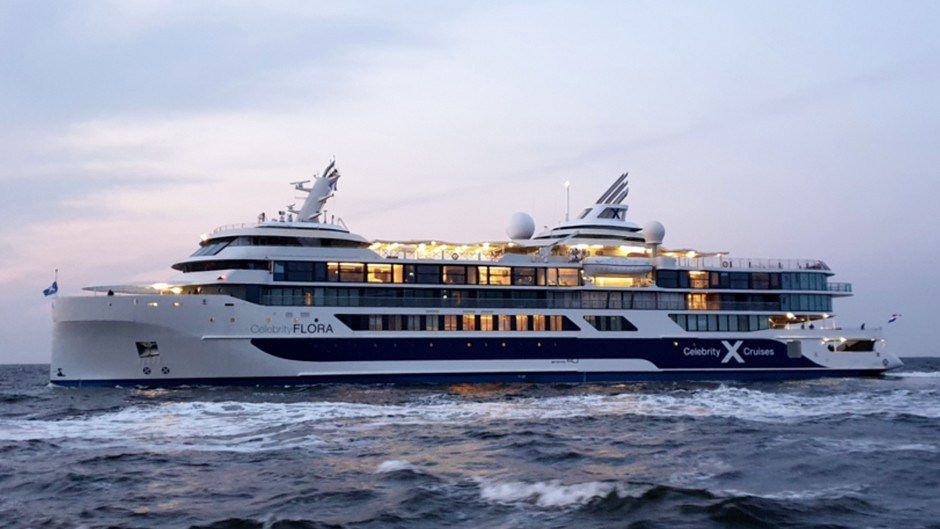
A unique collaboration between Royal Caribbean Cruise Ltd (RCL) and the University of Miami’s (UM) Rosenstiel School of Marine and Atmospheric Science is amassing an incredibly valuable dataset highlighting the intricate connection between the ocean, atmosphere and climate. Over the past 20 years UM has benefited from many scientific collaborators in this endeavor, most importantly, NASA and the National Oceanic and Atmospheric Administration (NOAA) contributing their own scientific expertise and scientific equipment.
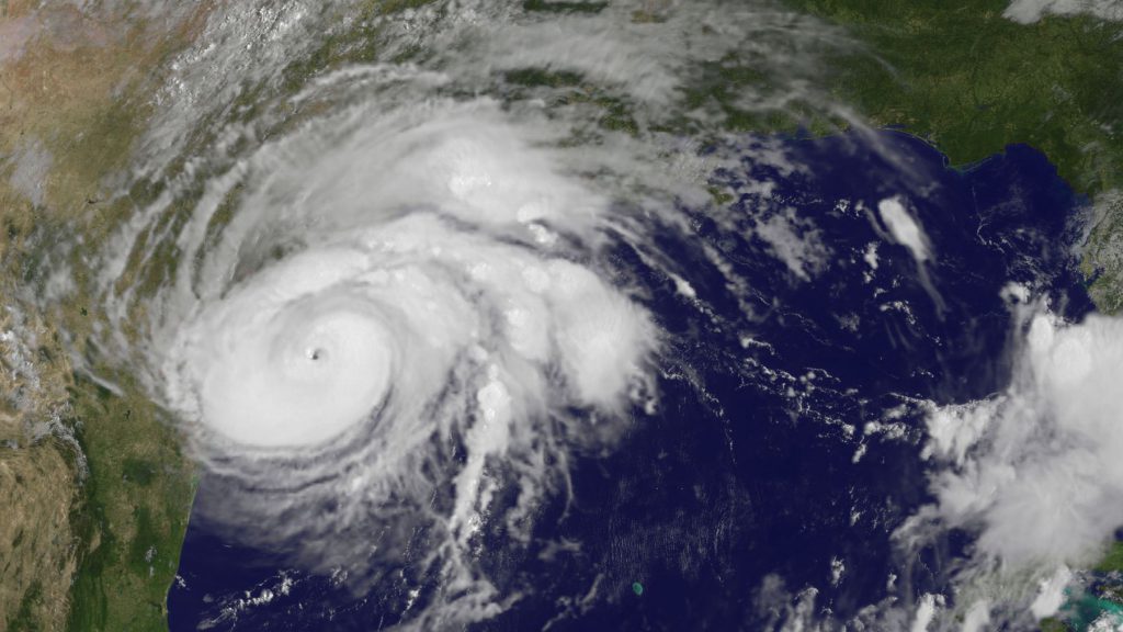
Hurricane season is officially upon us and researchers at NOAA’s Atlantic Oceanographic and Meteorological Laboratory are excited about new model developments and innovative technology to improve hurricane forecasting. AOML’s deputy director, Molly Baringer, briefed Congresswomen Debbie Wasserman Schultz and Donna Shalala on May 30th, 2019 about the science behind the 2019 Atlantic Hurricane Season Outlook and advancements led by AOML and other NOAA offices in the field of hurricane forecasting.
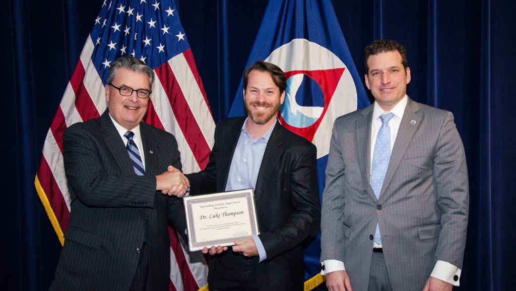
Dr. Luke Thompson, a Northern Gulf Institute professor with AOML’s Ocean Chemistry and Ecosystems Division, and AOML coauthor Kelly Goodwin are the recipients of an Outstanding Scientific Paper Award from NOAA’s Office of Oceanic and Atmospheric Research (OAR) for their landmark paper entitled A communal catalogue reveals Earth’s multiscale microbial diversity. The paper was selected by OAR as the top FY-2018 science article in the Oceans and Great Lakes category. Thompson et al. (2017)* presents an analysis of microbial samples collected by hundreds of researchers worldwide for the Earth Microbiome Project. The paper serves as both a reference database and a framework for incorporating data from future studies, advancing the characterization and understanding of Earth’s microbial diversity

John Cortinas, Ph.D., director of NOAA’s Office of Weather and Air Quality, today was named the new director of NOAA’s Atlantic Oceanographic and Meteorological Laboratory in Miami. He will begin the new position on July 8.“John Cortinas brings proven vision and leadership experience in NOAA to the Atlantic Oceanographic and Meteorological Laboratory where he will lead the lab’s basic and applied research to improve the prediction of severe storms and deliver an enriched scientific understanding of our oceans for all of NOAA,” said Craig McLean, NOAA assistant administrator for NOAA Oceanic and Atmospheric Research.
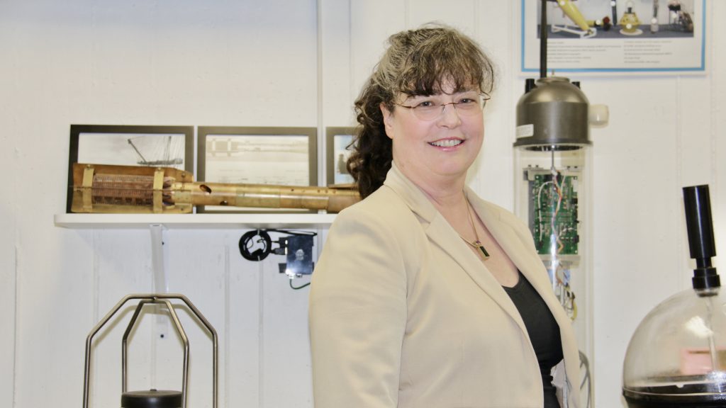
Authors: Heidi Van Buskirk Date: 5/31/19 Each year Miami Today publishes The Best of Miami edition to highlight people and organizations from multiple fields that make a difference in the community. The special edition articles focus on the best in each respective field from arts and culture to health and medicine to international business and role […]
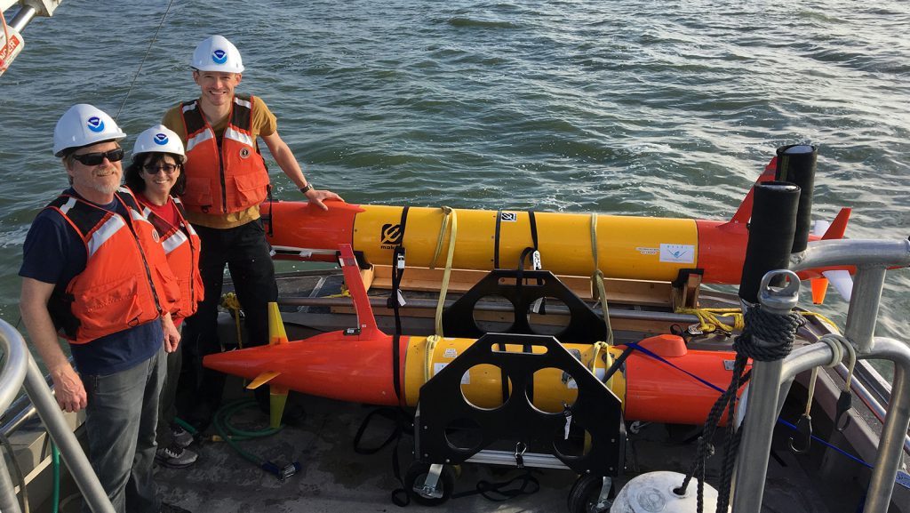
Scientists from NOAA and the Monterey Bay Research Institute (MBARI) are teaming up on June 3-4, 2019 to conduct a complex mission which will integrate acoustic measurements and autonomous sample collection for analysis of environmental DNA (eDNA). Through these efforts NOAA scientists hope to develop faster and cheaper ecosystem assessment methods, ensure sustainable fisheries and broaden our understanding of life in the oceans.

NOAA and partners have launched a new buoy in Fagatele Bay within NOAA’s National Marine Sanctuary of American Samoa to measure the amount of carbon dioxide in the waters around a vibrant tropical coral reef ecosystem. “This new monitoring effort in a remote area of the Pacific Ocean will not only advance our understanding of changing ocean chemistry in this valuable and vibrant coral ecosystem but will also help us communicate these changes to diverse stakeholders in the Pacific Islands and across the United States,” said Derek Manzello, coral ecologist with NOAA’s Atlantic Oceanographic and Meteorological Laboratory.
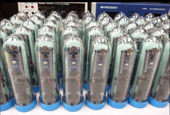
Researchers with AOML’s Ocean Chemistry and Ecosystems Division have entered into a collaborative agreement with Reef Check Foundation to deploy an AOML-designed temperature sensor at coral reef sites around the world. Measuring only six inches in height, the inexpensive, highly-accurate sensors will greatly enhance efforts to more precisely monitor small-scale temperature fluctuations that occur at reefs over time and at various depths.
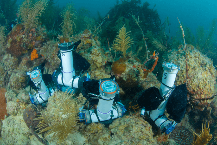
AOML researchers have taken an innovative approach to studying the changing carbonate chemistry of seawater at shallow coral reef sites. Using 3D printing technology made possible by the new Advanced Manufacturing and Design Lab at AOML, researchers with the Acidification, Climate, and Coral Reef Ecosystems Team, or ACCRETE, have created a water sampler in-house.
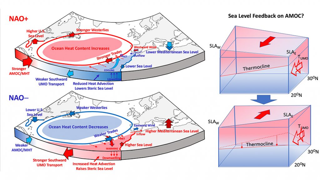
The global mean sea level rise caused by ocean warming and glacier melting over landforms such as Greenland is one of the most alarming aspects of a shifting global climate. However, the dynamics of the ocean and atmosphere further influence sea level changes region by region and over time. For example, along the U.S. East Coast, a pronounced acceleration of sea level rise in 2010-2015 was observed south of Cape Hatteras, while a deceleration occurred up North. These patterns provide background conditions, on top of which shorter-period (and often stronger) weather-driven sea level fluctuations compound what coastal communities directly experience day by day. Therefore, to develop or improve regional sea level predictions, it’s important to identify these patterns and explore how they change over time.
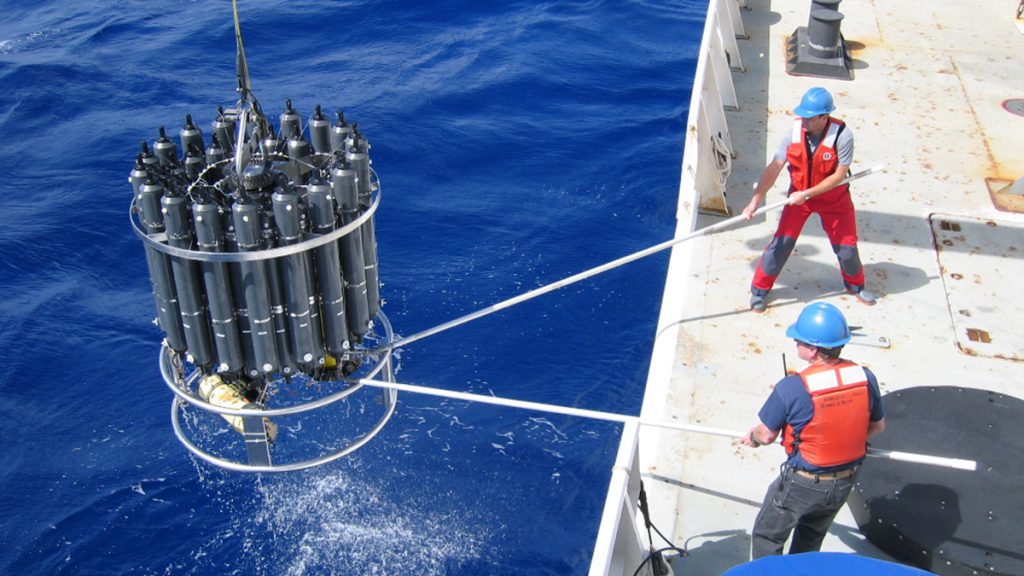
The new research published by NOAA and international partners in Science finds as carbon dioxide emissions have increased in the atmosphere, the ocean has absorbed a greater volume of emissions. Though the volume of carbon dioxide going into the ocean is increasing, the percentage of emissions — about 31 percent — absorbed by it has remained relatively stable when compared to the first survey of carbon in the global ocean published in 2004.
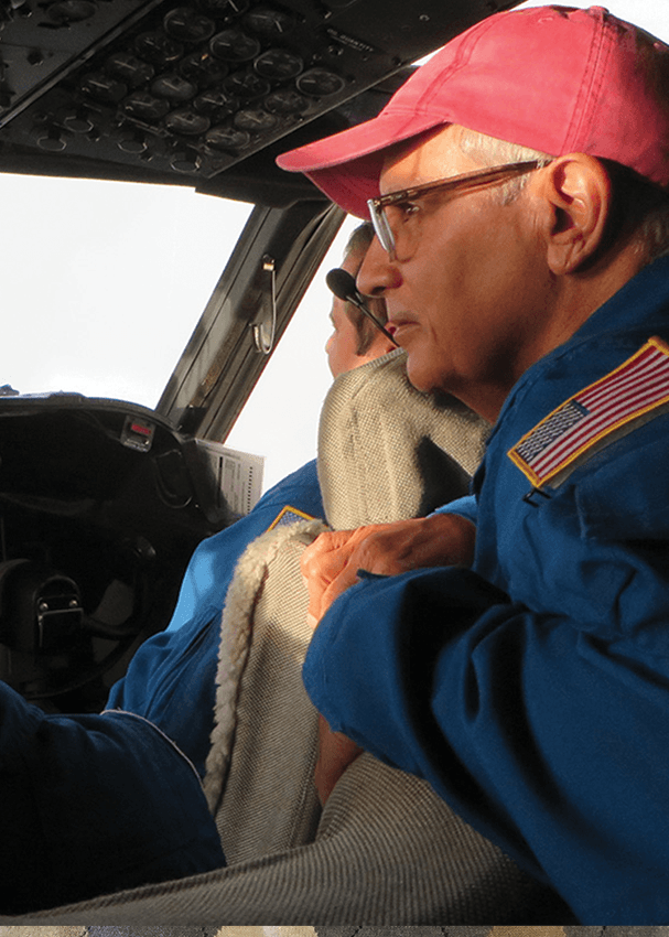
The National Oceanic and Atmospheric Administration’s Oceanic and Atmospheric Research Dr. Daniel L. Albritton Outstanding Science Communicator Award recognizes outstanding achievement in communicating the meaning and value of NOAA-related science and research to non-scientific audiences. The award is named in honor of Dr. Daniel L. Albritton, a retired OAR scientist, who proved to be one of the most effective communicators of NOAA research and related science.
AOML hurricane researchers supported nearly all of the 50 missions NOAA’s Hurricane Hunter aircraft flew into eight tropical systems in 2018’s hurricane season, collecting data to help improve forecasts for future storms. The final flight into Hurricane Lane would make history for several reasons. Hurricane Lane was part of NOAA’s first hurricane deployment out of Hawaii, and one of those flights was led by the first all-female science crew on the flying laboratory. For Women’s History Month, we are proud to highlight this milestone and recognize the members of the first all-female science crew on a hurricane flight.
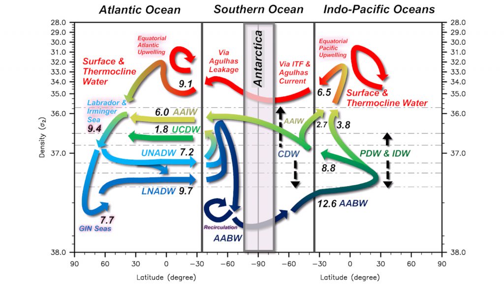
Ocean tracers such as heat, salt and carbon are perpetually carried by the global meridional overturning circulation (GMOC) and redistributed between hemispheres and across ocean basins from their source regions. The GMOC is therefore a crucial component of the global heat, salt and carbon balances.
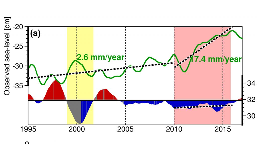
In a new article accepted for publication in the Geophysical Research Letters, Ricardo Domingues (CIMAS University of Miami & NOAA/AOML) and his coauthors explored the observed rapid sea level rise along the U.S. East Coasts during 2010-2015, which is linked to extensive flooding and “sunny day” flooding (or nuisance flooding) events in large urban areas including Norfolk, Baltimore, Charleston, and Miami, among others.
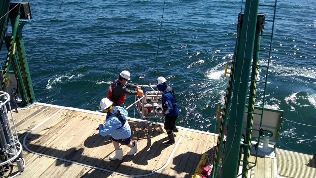
AOML recently led a multi-agency (NOAA/AOML, NOAA/SEFSC, State of Florida Fish and Wildlife Research Institute, Florida Fish and Wildlife Commission, NOAA/NESDIS, University of South Florida, MOTE Marine Laboratory and Aquarium, and University of Miami) research cruise to study the effects of Southwest Florida’s ongoing red tide. To address such a complex problem as red tide, the cruise brought together a diverse team of experts consisting of commercial fishermen, oceanographers, systems ecologist, phytoplankton ecologist, and fish population biologist. This cruise allowed researchers to take a holistic approach to characterize the extent of the red tide and its impacts. The goal of the cruise was to understand why these blooms happen to better inform effective future response measures and hopefully improve Florida’s resilience to these coastal events.
Few accessible places represent Earth’s natural beauty quite like our beaches, but looks can be deceiving if there is a bacterial outbreak or contamination from offshore activities. Not being able to see these contaminants puts families at risk of exposure if they aren’t properly warned. The BEACHES project (Beach Exposure And Child Health Study), a collaboration between the University of Miami’s College of Engineering and the Cooperative Institute for Marine and Atmospheric Studies and AOML, along with the Universities of Arkansas and Texas, aims to pair child behavioral science with microbiology to address exposure risk of beachgoers.
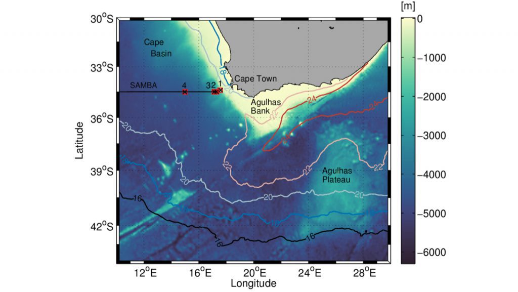
In a recent article published in the journal “Ocean Science”, Marion Kersale (CIMAS, PhOD) collaborated with scientists from South Africa and France to explore the buoyancy and velocity changes due to eddies, dipoles, and current filaments in the Cape Basin using two observational systems that are part of the South Atlantic Meridional overturning circulation Basin-wide Array (SAMBA) at 34.5°S.

In a collaborative effort between NOAA, the Cooperative Institute for Great Lakes Research, and the Monterey Bay Aquarium Research Institute, research merging robotics with biochemistry will give us a detailed, three-dimensional picture of harmful algal blooms in Lake Erie in near real-time and take water samples for genomic analysis. The end goal is a Harmful Algal Bloom forecast to help managers make decisions about environmental health and public safety pertaining to the lake. AOML’s own Dr. Kelly Goodwin is participating in the project to help with instrument and sample recovery.
AOML drives improvements to hurricane forecasts by leveraging expertise in tropical cyclone observations, research, and modeling. Our numerical weather modeling team uses HWRF to test new technology and advance hurricane prediction through data collection, assimilation, and experimental modeling.
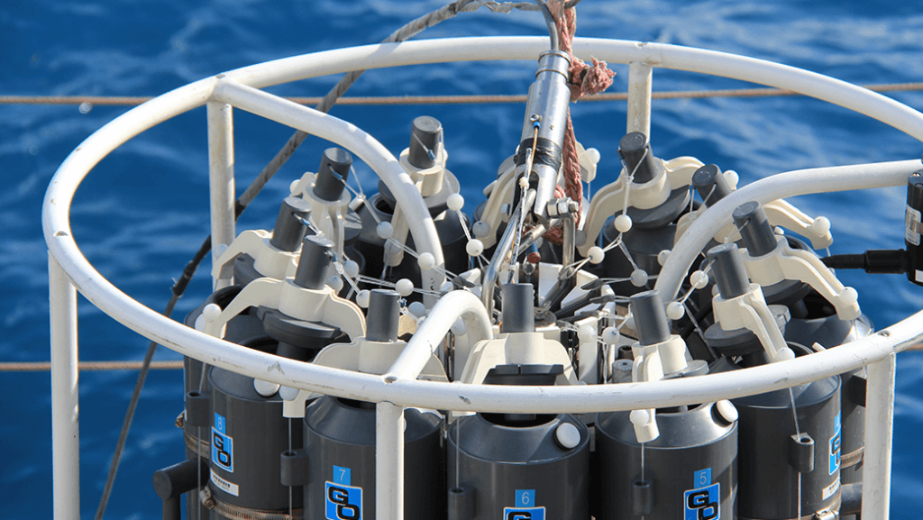
From August 6th to the 10th, AOML researchers, in partnership with the University of Miami and the University of South Florida, embarked on a cruise to investigate water quality along South Florida’s coasts. Two teams alternated to complete 24-hour sampling and data collection.

In August 2018, a team of biological oceanographers and ecologists set sail on the R/V Walton Smith to sample the waters of Biscayne Bay & Florida Bay. AOML has conducted regular interdisciplinary observations of south Florida coastal waters since the early 1990’s. We spoke with Chris Keble, the lead scientist for AOML’s South Florida Ecosystem Restoration Research project, to learn more.
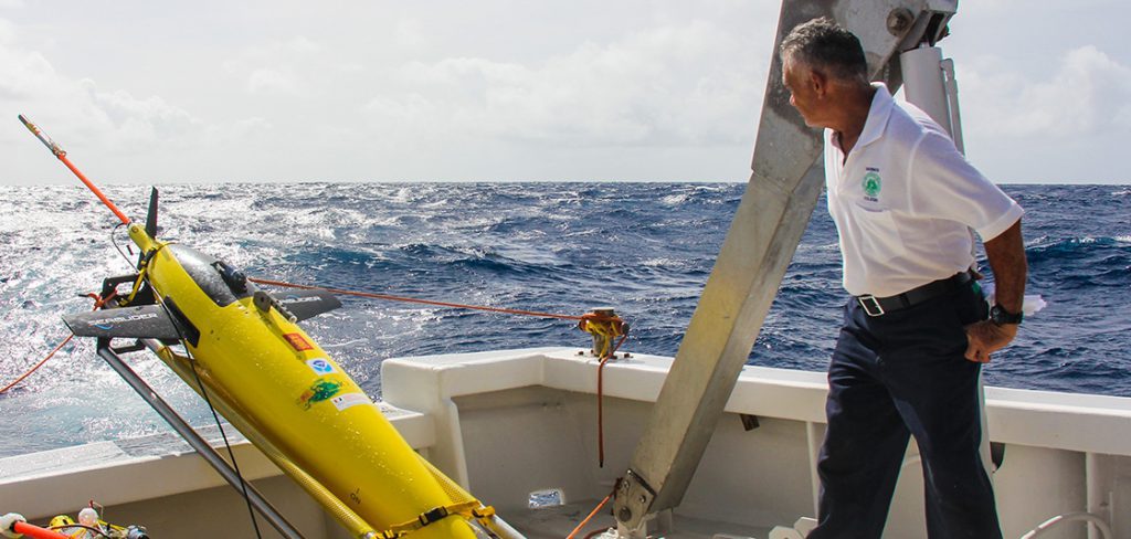
NOAA will soon launch a fleet of 15 unmanned gliders in the Caribbean Sea and tropical Atlantic Ocean this hurricane season to collect important oceanic data that could prove useful to forecasters. “If you want to improve prediction of how hurricanes gain strength or weaken as they travel over the ocean, it’s critical to take the ocean’s temperature and measure how salty it is,” said Gustavo Goni, an oceanographer at NOAA’s Atlantic Oceanographic and Meteorological Laboratory who is helping lead the glider research. “Not just at the surface, which we measure with satellites, but down into deeper layers of ocean waters.”
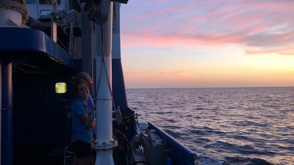
AOML researchers recently participated in the South Florida Ecosystem Restoration Research Cruise, a survey of south Florida’s coastal waters on June 22-26 aboard the R/V Savannah. These cruises have investigated coastal water quality in south Florida since the late 1990s. The science crew collected samples to measure nutrients, plankton, productivity, chlorophyll a, and dissolved inorganic carbon. They also recorded salinity and temperature to help monitor ecosystem restoration efforts in south Florida. These cruises have an additional focus on lower trophic level dynamics downstream from the Shark River on the southwest Florida shelf.

NOAA contributed to a study published today in the journal Nature that compares the upward growth rates of coral reefs with predicted rates of sea-level rise and found many reefs would be submerged in water so deep it will hamper their growth and survival. The study was done by an international team of scientists led by the University of Exeter in the United Kingdom.
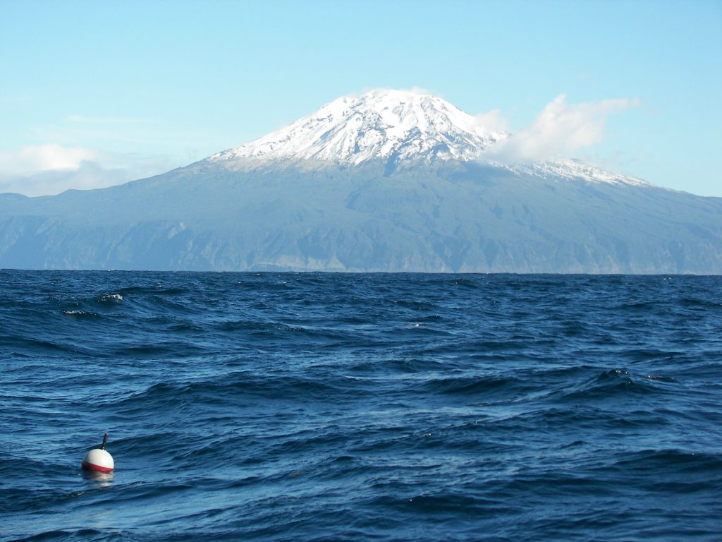
NOAA’s Global Drifter Program is a globally collaborative research project that provides near real-time marine data for the world. It allows us to record data for weather forecasts, track decadal patterns, and pinpoint inter-annual climate variations like El Nino Southern Oscillation. Global drifters provide observational verification for weather models, calibrate satellite observations, and collect and transfer new data about the ocean temperature, currents and barometric pressure.
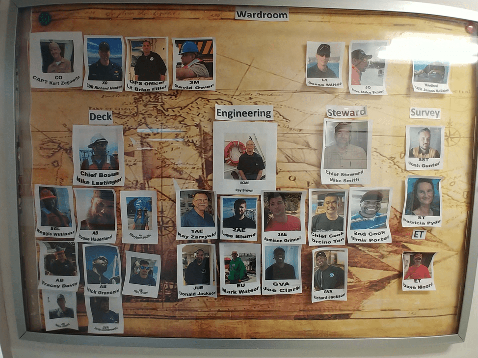
NOAA Ship Ronald H. Brown continues to make its way around the world deploying many devices to observe the ocean. These platforms measure temperature, salinity, and ocean currents. This creates a network of ocean data that can be used to understand its physical dynamics and help us understand and anticipate change in weather, climate, and even ecosystems.
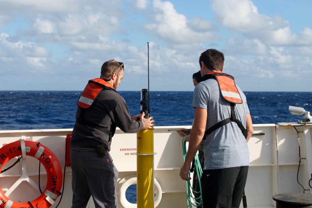
Staff with the US Argo Data Acquisition Center (DAC) at AOML marked an important milestone this past February by processing the one millionth profile from Argo floats. The DAC team has been processing and quality controlling all of the raw data obtained from US-deployed Argo floats since 2001, with about 90,000 temperature-salinity profiles processed annually since 2007. These profiles have provided the global scientific community with an unprecedented record of the evolving state of the upper ocean, advancing understanding of the ocean’s role in world climate.
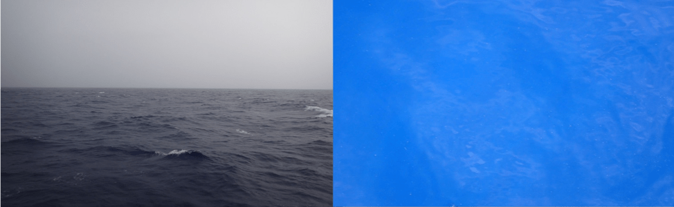
Below the surface of our ocean there is another, smaller world that moves fast and breathes in and out with the ocean. Zooplankton communities likely create the fastest source of sinking carbon to the deeper ocean, and studying this process can help us understand more about the carbon cycle and how it affects us. Victoria Coles, Scientist aboard the NOAA Ship Ronald H. Brown, can tell you more in her post “Biome Beneath the Surface.”
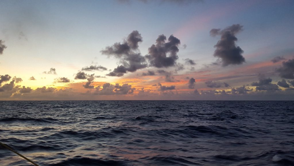
The NOAA Ship Ronald H. Brown is taking scientists across the Indian Ocean on a research cruise to study the ocean’s chemistry, water temperature, and other physical dynamics. Holly Westbrook, a RSMAS scientist aboard the Ronald H. Brown talks about life on a research cruise. Close quarters, beautiful sunrises, and making friends- sub the lab coats for sunglasses!
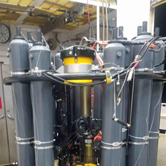
NOAA Ship Ronald H. Brown is taking scientists across the Indian Ocean on a research cruise to understand more about our ocean’s chemistry, temperature, and physical processes. The newest Live Science update follows Amanda Fay as she uses a Lowered Acoustic Doppler Current Profiler (LADCP) to measure the speed of the water through the water column. When the instrument is lowered to depth, sound is sent out and reflected back from particles in the water, giving a complete profile of water column movement. To find out more about how this works in action, visit the GO-SHIP I07N Cruise blog post.
Scientists aboard the Ronald H. Brown for the GO-SHIP cruise arrive at port for some welcomed R&R in the Seychelles Islands, a chain of rocky islands northeast of Madagascar. Read more about the experience.
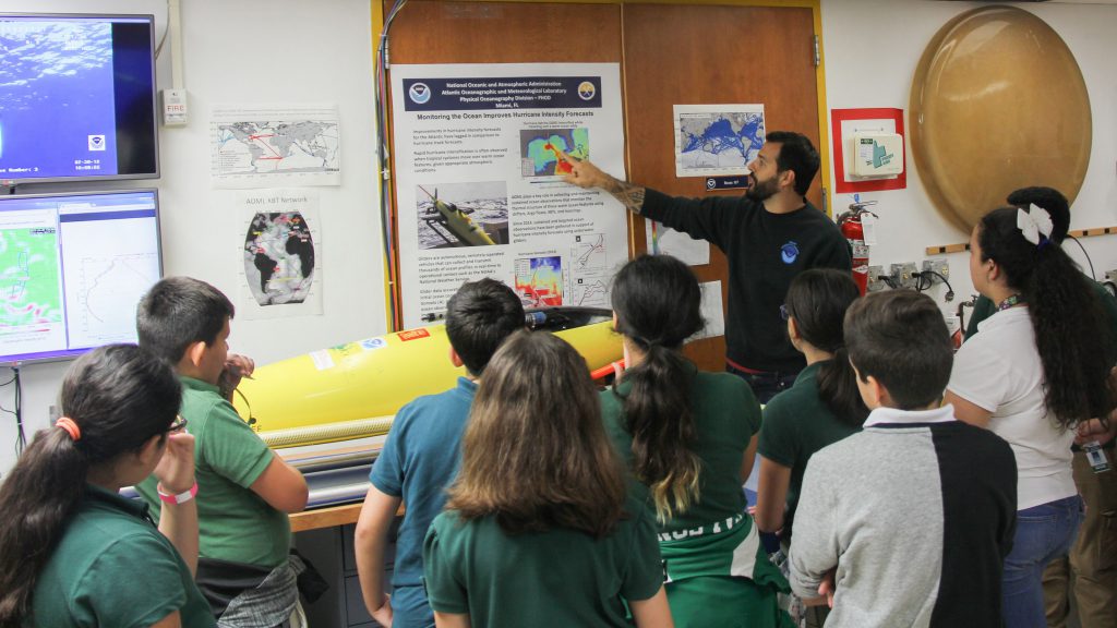
May 10-12, 2018, AOML partnered with our colleagues on Virginia Key to welcome south Florida students and families to a NOAA Open House! The interactive scientific experience centered around three NOAA entities: AOML, the Southeast Fisheries Science Center, and the Miami Weather Forecast Office, as well as the University of Miami Rosenstiel School, MAST Academy, and the ANGARI Foundation. Over the three-day event, 859 guests learned more about the federal agency that provides daily weather forecasts, severe storm warnings, climate monitoring, fisheries management, coral monitoring, and coastal restoration.
The interactive experience rotated from the NOAA facilities on Virginia Key, to the University of Miami Rosenstiel School’s Experimental Fish Hatchery and SUSTAIN research facility. Participants also visited the MAST Academy Land SHARC and Weather on Wheels mobile outreach programs, and learned about weather forecasting from NOAA weather forecasters.
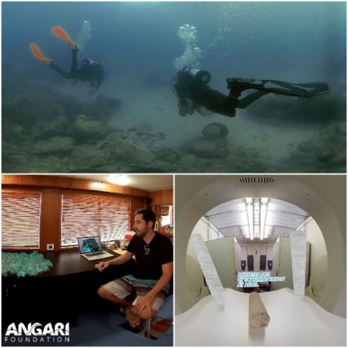
The premiere of Generation Ocean: Coral Reefs is open to the public and will take place during NOAA’s Open House this Saturday, May 12th, from 10 am – 3 pm at AOML, 4301 Rickenbacker Causeway, Miami, FL. During the Open House, attendees will be able to not only experience the premiere of ANGARI Foundation’s new 360/VR film, but will also have the opportunity to meet NOAA scientists, tour the facilities, and learn about hurricanes, corals, fisheries, weather, and more.
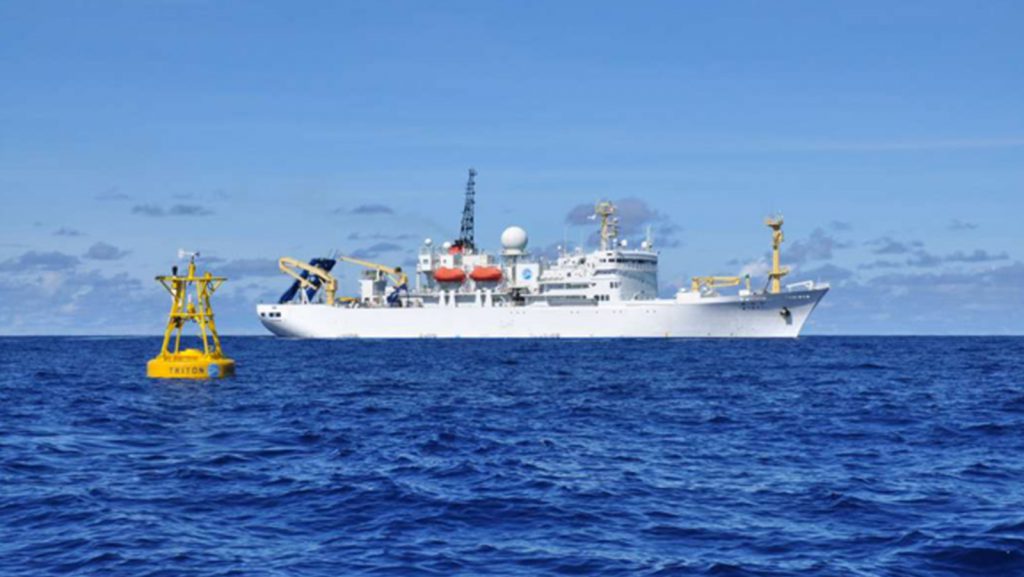
Scientists aboard the Ronald H. Brown for the GO-SHIP engage in international collaboration to monitor carbon dioxide dynamics to understand how the oceans help the Earth regulate its temperature. JAMSTEC and NOAA have a long history of international collaboration, find out more about it on the GO-SHIP Blog.
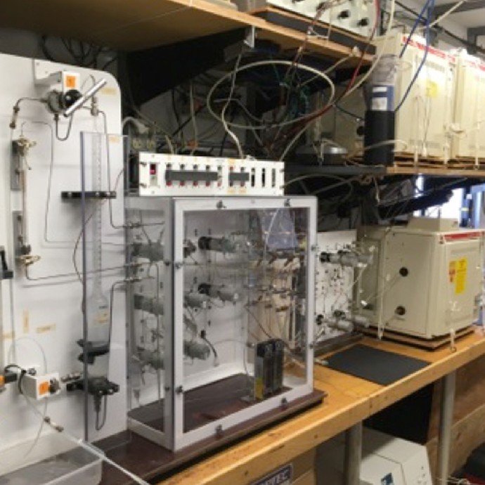
How does the ocean move, and how can you tell? Katey Williams aboard the GO-SHIP I07 Cruise is tracking Chloroflurocarbons (CFCs) through gas chromatography to study how water masses migrate through the ocean. Find out more on the GO-SHIP I07N Blog.
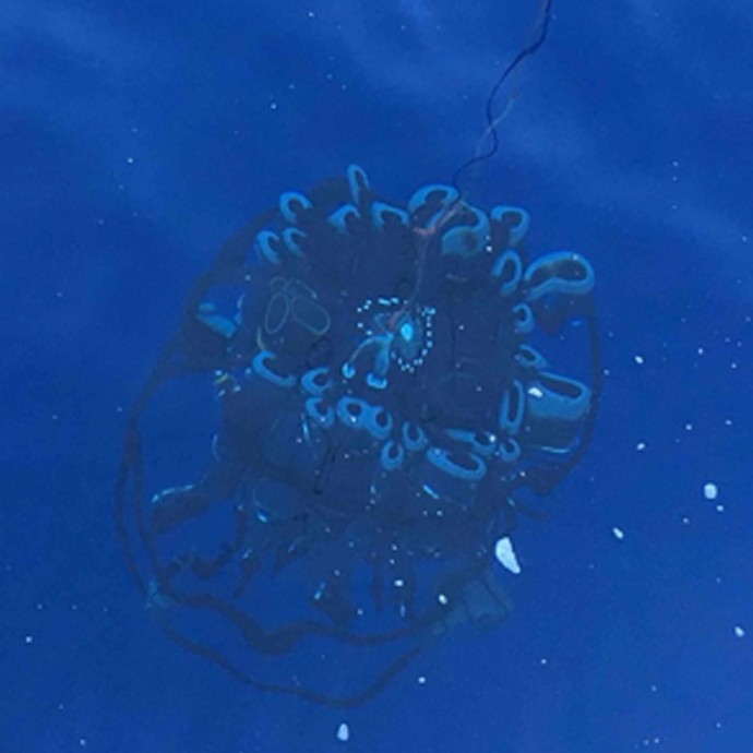
NOAA Scientists, along with partnering institutions have embarked on a two-month research cruise in the Western Indian Ocean to monitor the ocean basins from coast to coast and top to bottom to find out how the ocean has evolved over the past 23 years. The Global Ocean Ship-Based Hydrographic Investigations Program (GO-SHIP) 107N cruise is sending live updates from the Indian Ocean. Check out the post to find out what it’s like aboard a NOAA research vessel. Here are some photos of CTD operation and deployment by one of our partnering scientists, Yashwant Meghare.
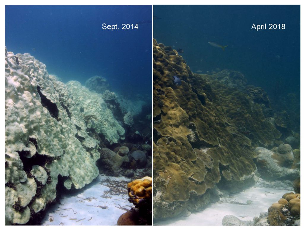
A recent study by AOML and partners identified coral communities at Cheeca Rocks in the Florida Keys National Marine Sanctuary that appear to be more resilient than other nearby reefs to coral bleaching after back to back record breaking hot summers in 2014 and 2015 and increasingly warmer waters. This local case study provides a small, tempered degree of optimism that some Caribbean coral communities may be able to acclimate to warming waters.
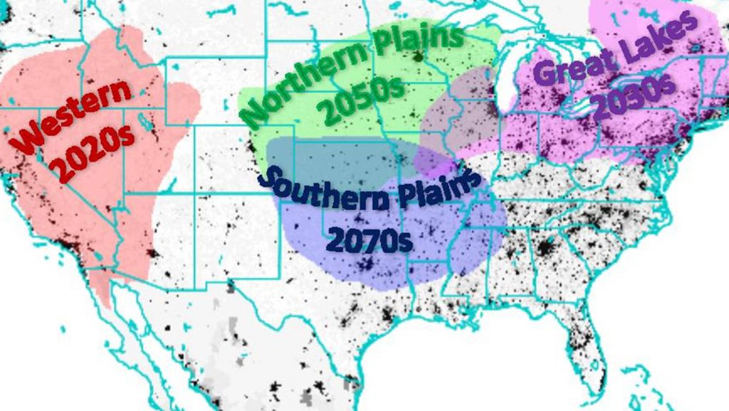
AOML scientists, Hosmay Lopez and his colleagues used observations as well as model simulations of 20th Century climate and 21st Century projections to show that the occurrence of heat waves in the U.S. are on the rise and will continue to do so in the coming decades. This research was recently published in Nature Climate Change.

Existing observations show that Indian Ocean surface water temperatures have been increasing since the 1970’s. But has the deep ocean warmed? Have the regional concentrations of dissolved oxygen, carbon dioxide, or nutrients changed? Has the western Indian Ocean become more acidic? These and more questions will be addressed by scientists after the completion of this cruise.
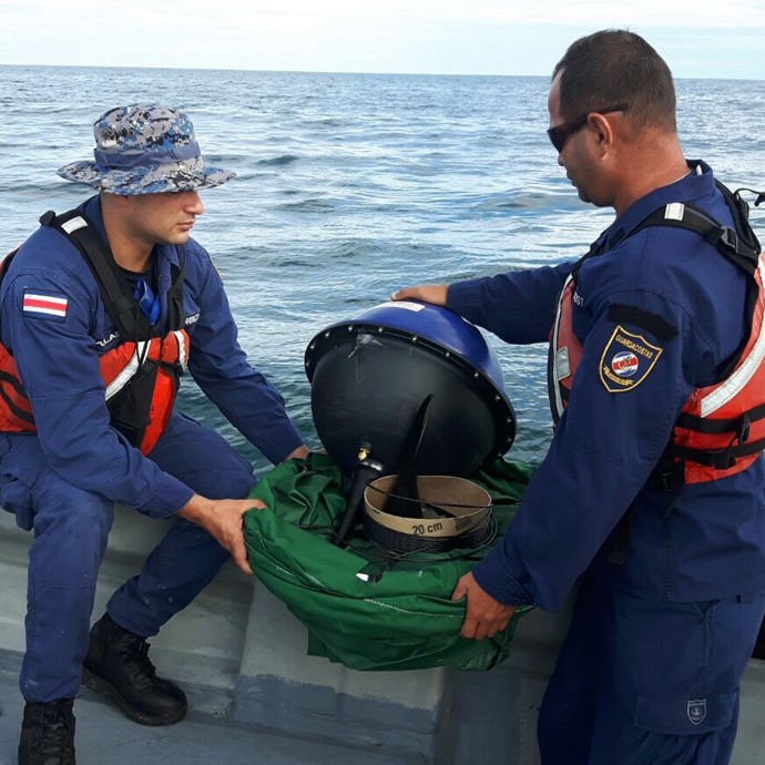
Researchers from AOML’s Physical Oceanography Division recently deployed three surface drifters and ten special spot trace drift buoys, all contributed by NOAA, in the Caribbean Sea to help to identify the site of where an Argentine Air Force C-54E Skymaster aircraft crashed in 1965. The data gathered by the drifters will help back track the possible location of the lost aircraft based on the location of life vests recovered during search operations after the crash. These deployments are part of a larger effort in support of the Argentine Air Force and search and rescue operations professionals from the US, Costa Rica, Panama and Argentina to locate the remains of the flights. Mr. Jose Rivera of NOAA, Captain Marcelo Covelli from Perfectura Naval Argentina and Licenciado Mariano Torres Garcia, representing the Argentine Air Force, are closely coordinating the 4th Expedition in the Caribbean Sea to locate the remains of TC48 and its 68 crew members on April 2018.
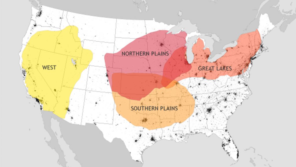
Climate projections for the twenty-first century suggest an increase in the occurrence of heat waves. However, the time at which externally forced signals of anthropogenic climate change (ACC) emerge against background natural variability (time of emergence (ToE)) has been challenging to quantify, which makes future heat-wave projections uncertain. In a new article published in Nature Climate Change (Lopez et al., 2018), Hosmay Lopez and his team combine observations and model simulations under present and future forcing to assess how internal variability and ACC modulate US heat waves.

NOAA/AOML hurricane scientists attended the Aviation Week and Science Technology Laureate Awards in Washington D.C. to receive Aviation Week magazine’s prestigious Laureate award for Dual Defense Use. The NOAA/Raytheon team was recognized for using Coyote Unmanned Aircraft Systems (UAS) during missions into Hurricane Maria, to help track and model hurricanes.
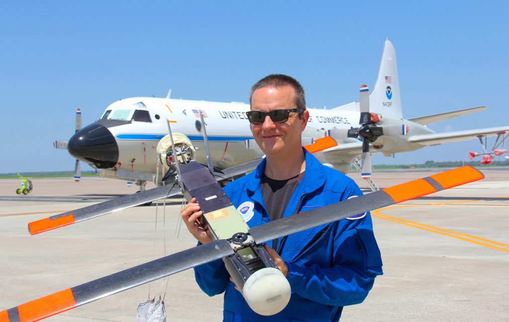
NOAA AOML scientists attended the Aviation Week and Science Technology Laureate Awards in Washington D.C. to receive Aviation Week magazine’s prestigious Laureate award for Dual Defense Use. The NOAA/Raytheon team was recognized for using Raytheon Coyote Unmanned Aircraft Systems (UAS) to track and model hurricanes.
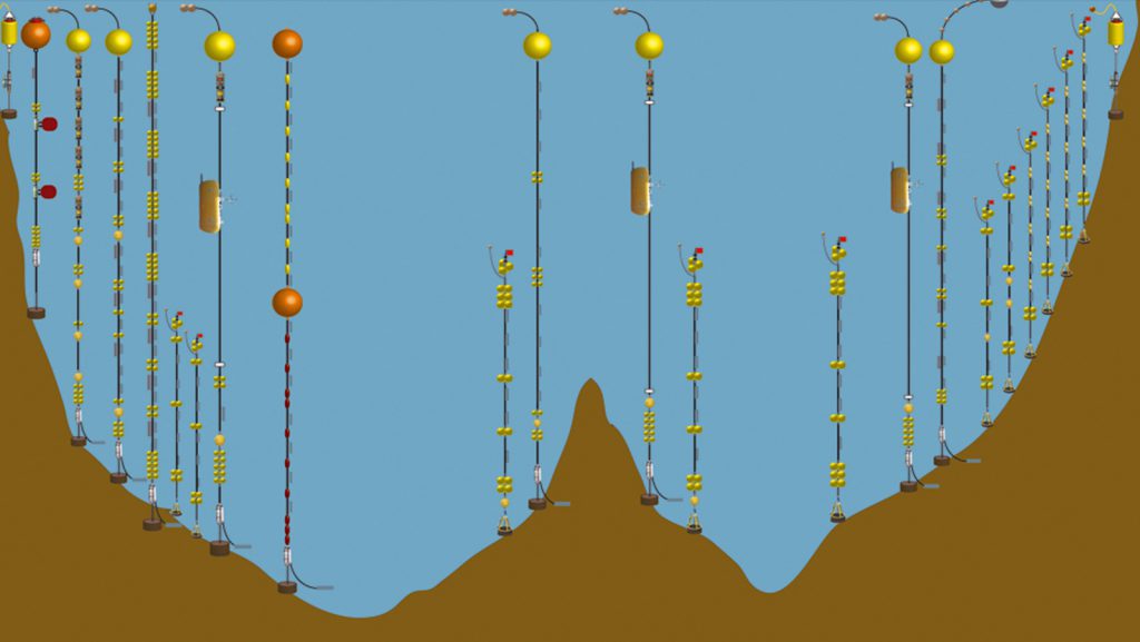
AOML oceanographers Christopher Meinen and Molly Baringer participated in the development of a new thirteen-year-long record of the daily Atlantic ocean overturning that has recently been released. This project is a collaboration between a large team of researchers at NOAA, at the University of Miami ,and at the National Oceanography Centre in Southampton, United Kingdom.
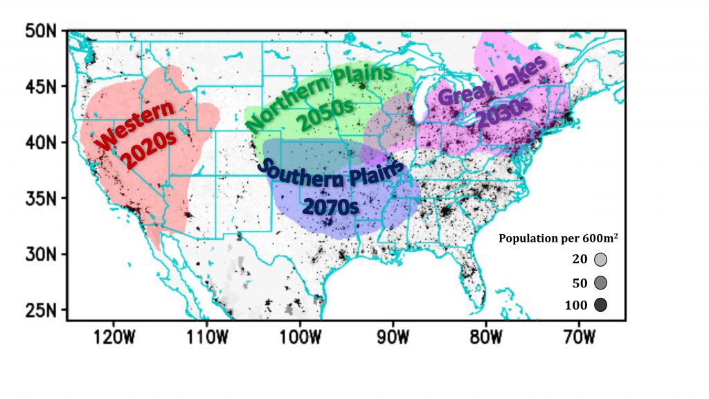
A new analysis of heat wave patterns appearing in Nature Climate Change focuses on four regions of the United States where human-caused climate change will ultimately overtake natural variability as the main driver of heat waves. Climate change will drive more frequent and extreme summer heat waves in the Western United States by late 2020’s, the Great Lakes region by mid 2030’s, and in the northern and southern Plains by 2050’s and 2070’s, respectively.
“These are the years that climate change outweighs natural variability as the cause of heat waves in these regions,” said Hosmay Lopez, a meteorologist at NOAA’s Atlantic Oceanographic Meteorological Laboratory and the University of Miami’s Rosenstiel School Cooperative Institute for Marine and Atmospheric Studies and lead author of the study. “Without human influence, half of the extreme heat waves projected to occur in the future wouldn’t happen.”
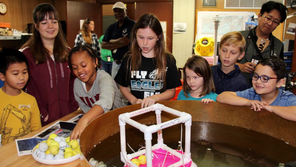
Each year, AOML scientists have the opportunity to bring their children to work, where they are taught about different aspects of the research being performed within the three divisions of AOML. This year, the children partook in lessons and activities in the subjects of buoyancy, density, ocean currents and circulation, marine debris, ecosystem based management, and ocean observations.
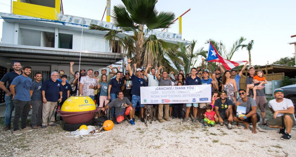
Scientists strategically deployed the gliders during the peak of hurricane season, from July through November 2017, collecting data in regions where hurricanes commonly travel and intensify. The gliders continually gathered temperature and salinity profile data, generating more than 4,000 profiles to enhance scientific understanding of the air-sea interaction processes that drive hurricane intensification.
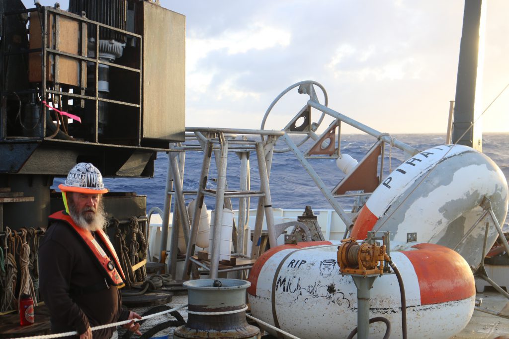
The manuscript “An enhanced PIRATA data set for tropical Atlantic ocean-atmosphere research”, by Greg Foltz, Claudia Schmid, and Rick Lumpkin, was accepted for publication in Journal of Climate. It describes a new set of daily time series (ePIRATA) that is based on the measurements from 17 moored buoys of the Prediction and Research Moored Array in the Tropical Atlantic (PIRATA).
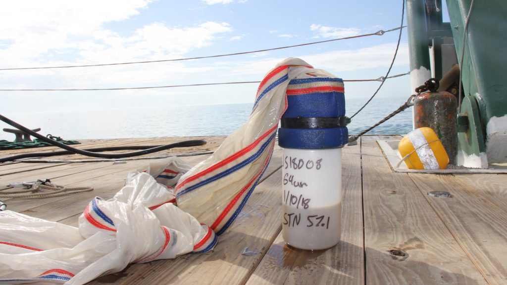
AOML scientists recently returned from the first cruise of 2018. As part of the South Florida Project, regional surveys over the southwest Florida shelf and the Florida Keys reef tract are routinely performed aboard the R/V F.G. Walton Smith on a bimonthly basis, to keep a watchful eye over sensitive marine habitats found in the region. Sampling methodologies include discrete sampling and flow through measurements of water quality and chemistry, and biological oceanographic parameters.
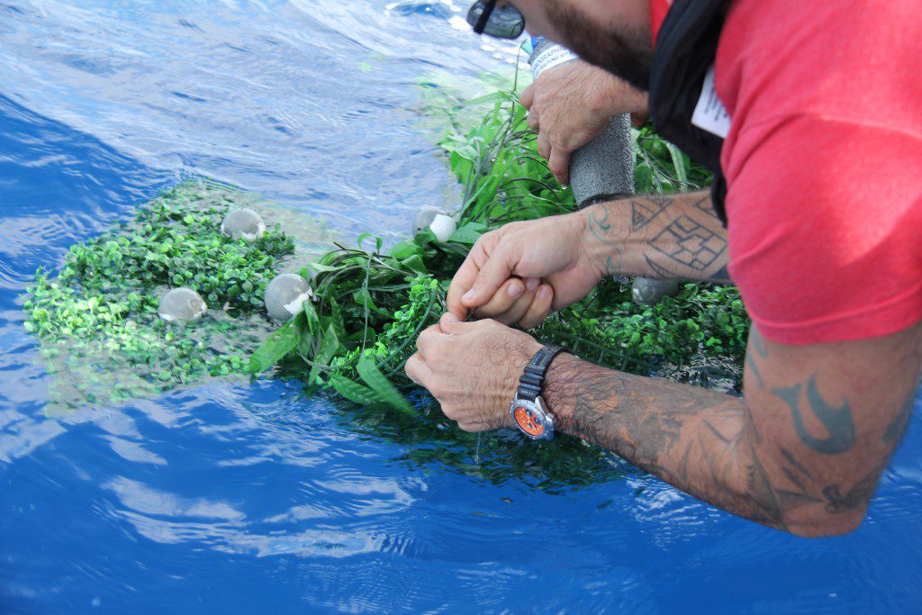
Researchers at AOML, NESDIS CoastWatch, and the University of Miami are currently exploring how the distribution of marine debris is affected by both ocean currents and wind. During a recent experiment, scientists deployed several prototype drifters in the Florida Current off the coast of Miami to simulate commonly found debris of varying weights and shapes. These drifters carry GPS transmitters that provide their location four times per day.
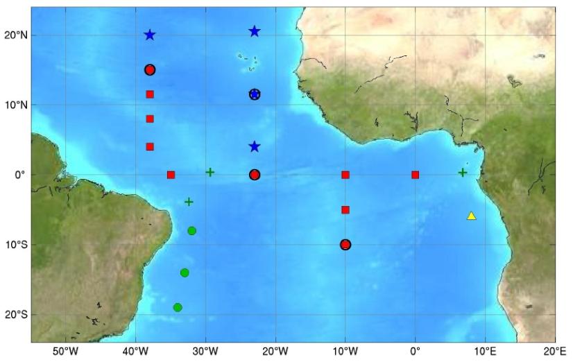
Researchers at NOAA AOML have released a new tropical Atlantic data set that includes several enhancements to improve data accuracy and data collection in the tropical Atlantic. The new data set is called enhanced PIRATA, or ePIRATA, and provides continuous records of upper-ocean temperature, salinity, and currents, together with meteorological data such as winds, humidity, and solar radiation. ePIRATA should prove valuable in better analyzing ocean and atmospheric processes in the tropical Atlantic.
PIRATA, the Prediction and Research Moored Array in the Tropical Atlantic, is a multinational observation network, established to improve knowledge and understanding of ocean-atmosphere variability in the tropical Atlantic. It is a joint project of Brazil, France and the United States of America, motivated by fundamental scientific issues and by societal needs for improved prediction of climate variability and its impact on the countries surrounding the tropical Atlantic basin. PIRATA provides measurements at 18 locations throughout the tropical Atlantic
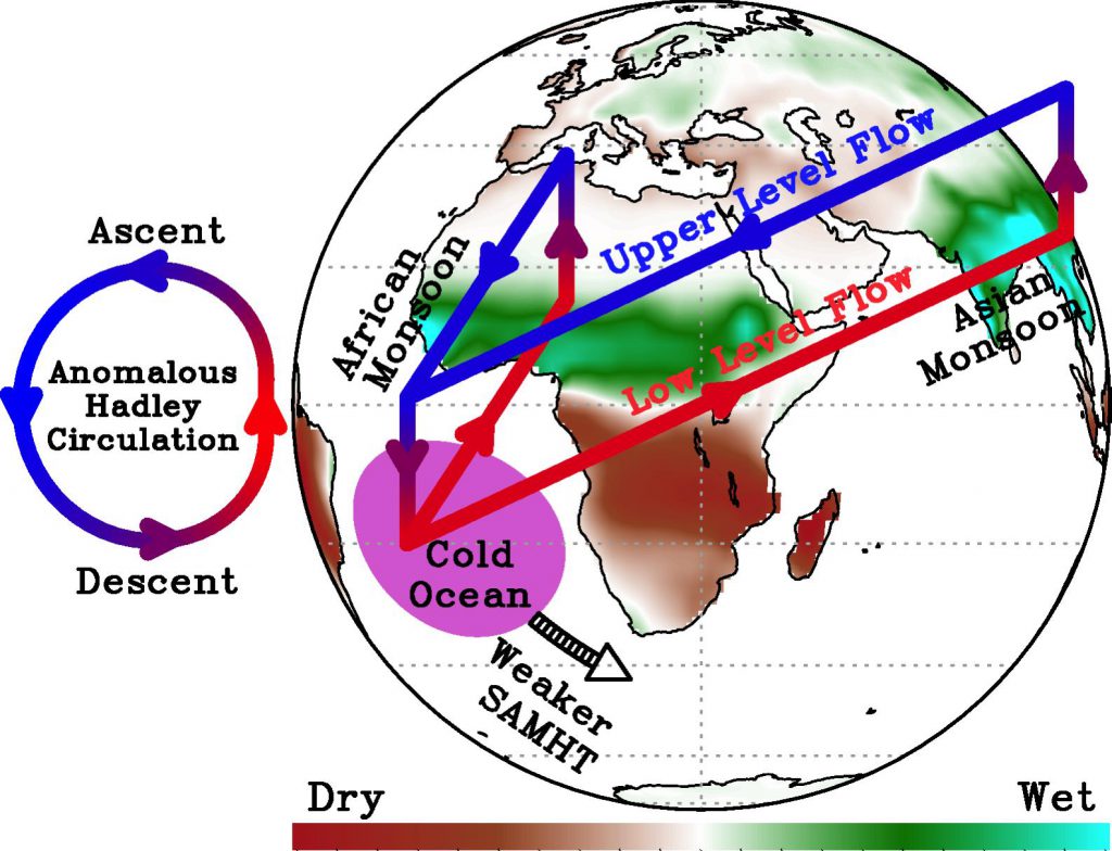
There have been many efforts to understand the role of the Atlantic Meridional Overturning Circulation (AMOC) as a potential predictor of decadal climate variability, motivated partly by its inherent relationship with North Atlantic sea surface temperature. In contrast, there is currently limited knowledge about the underlying mechanisms that govern the South Atlantic Meridional Overturning Circulation (SAMOC) variability and how it might feedback into climate, partly due to the small number of direct observations in this ocean basin.

Recent studies have suggested the possibility of the southern origin of the Atlantic MHT anomalies. These studies have used General Circulation Models (GCMs) to demonstrate covariability between the South Atlantic MOC (SAMOC) and the Southern Hemisphere westerlies at interannual to longer time scales. However, it has been pointed out that the sensitivity of the SAMOC to the changes in the Southern Hemisphere westerlies depends critically on the representation of mesoscale eddies in those models.
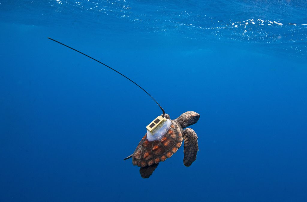
The behavior and movement of sea turtles during their first few years at sea, known as the ‘lost years’, remains largely a mystery. Researchers from NOAA-AOML, NOAA Fisheries, University of Central Florida, and Projecto TAMAR recently collaborated on a study to explore the mechanisms of dispersal in Brazilian loggerhead turtles, to fill in some of these important early life history gaps. A previous study conducted in the Gulf of America debunked the historic belief that young sea turtles rely solely on riding currents as a passive mechanism of dispersal. This latest study uncovers new drivers behind the travels of young sea turtles, suggesting there may be more of an ecological implication behind their behavior than previously realized.
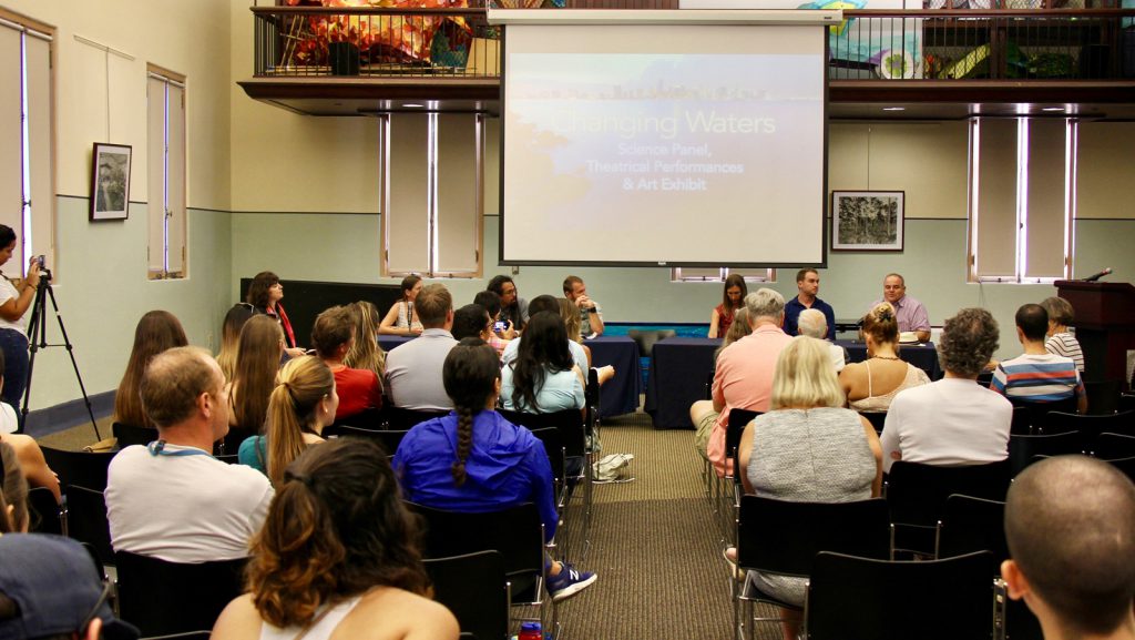
This past Saturday, December 2nd, the FIU School of Environment, Arts and Society and FIU Sea Level Solutions Center hosted their “Changing Waters” event: an innovative science-art event focused on the issue of sea level rise. The event featured a science panel with experts from a variety of disciplines in addition to musical and theatrical performances inspired by the global rise of sea levels and the search for solutions. AOML researcher and oceanographer Chris Kelble sat on the panel, sharing his unique knowledge of water quality in Biscayne Bay and the impact of sea level rise in South Florida’s coastal communities.
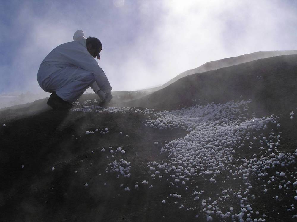
In an effort to better understand our microbiomes, scientists from NOAA’s Atlantic Oceanographic and Meteorological Laboratory (AOML) took part in a massive global research collaboration known as the Earth Microbiome Project (EMP), which recently released the first reference database, or atlas, of microbes covering the planet. This guide, released online in Nature today, will allow scientists to collaborate on studies and catalogue microbial diversity at an unprecedented scale.
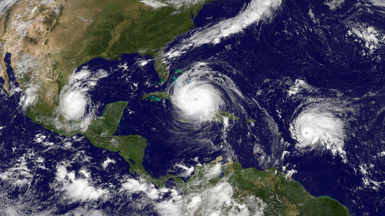
Over the past 20 years, improvements in hurricane computer modeling, observational instrumentation, and forecaster training have greatly increased forecast accuracy. The many complex interactions that occur within the atmosphere remain to be fully understood, especially at the small scales associated with tropical cyclones. However, these milestones mark critical advances in numerical weather prediction that are paving the way to the next generation of NOAA models. While hurricanes cannot be controlled, vulnerability to these complex storms can be reduced through preparedness. Early warning and improved accuracy of forecasts can help save lives and reduce property damages caused by hurricanes.

In a new study published in Environmental Health Perspectives, a team of scientists including researchers from NOAA’s Atlantic Oceanographic and Meteorological Laboratory (AOML) explore the future risk of waterborne disease in a warming climate. Recently, the European Center for Disease Prevention and Control (ECDC) developed an interactive online tool that can be used to monitor coastal marine areas with environmental conditions favorable to Vibrio growth, aquatic bacteria that can cause human illness. The Vibrio Map Viewer is a real-time global model that uses daily updated remote sensing data to determine marine areas vulnerable to higher levels of Vibrio.
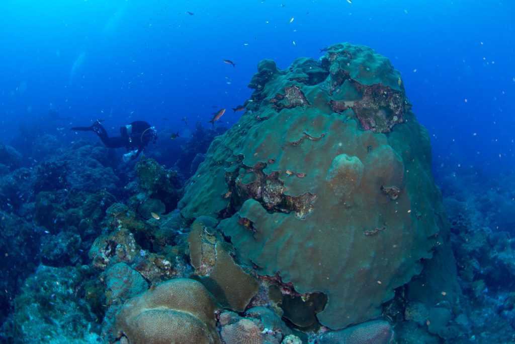
Coral scientists at NOAA’s Atlantic Oceanic and Meteorological Laboratory (AOML) are in the process of analyzing data that may shed light on the sub-lethal effects of sedimentation stress in coral larvae. Scientists recently conducted a series of lab experiments aimed at assessing the effects of Port of Miami dredge sediments on the larval performance of the Caribbean threatened coral Orbicella faveolata (also known as the mountainous star coral). Preliminary analysis suggests significant effects of sedimentation on both the survival and settlement of coral larvae.

AOML is currently in the midst of a multi-year effort called the Intensity Forecasting Experiment (IFEX). IFEX aims to improve the understanding and prediction of intensity change by collecting observations from all stages of a tropical cyclone life cycle—genesis to decay—to enhance current observational models. By building on years of observational expertise and cutting-edge approaches to data integration and model development, hurricane scientists at AOML lead advancements in observations and modeling that have improved intensity forecasts by 20% in recent years.
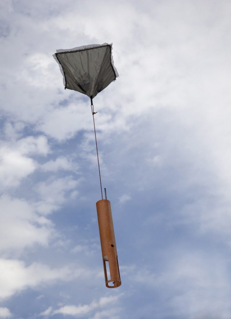
Observations of the atmosphere are critical to every aspect of weather forecasting. While there are several new and improved tools used to enhance storm forecasts, weather balloons prevail as one of the longest running and most dependable tools deployed by meteorologists. Released twice a day, every day of the year in the U.S. – sometimes more frequently during extreme weather events – weather balloons, also known as radiosondes, provide detailed and reliable data that ultimately help predict the path of storms.
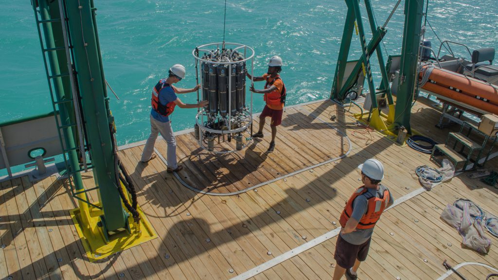
Throughout the month of October, AOML scientists were hard at work surveying south Florida’s coastal waters. The research team focused on monitoring water quality, seagrass beds, and juvenile sport fish populations throughout Florida Bay, Biscayne Bay, Florida Keys and the southwest Florida shelf. These surveys assessed ocean temperatures, salinity, nutrients, environmental DNA and primary productivity to better understand how south Florida’s coastal ecosystems were impacted by the passage of Hurricane Irma.
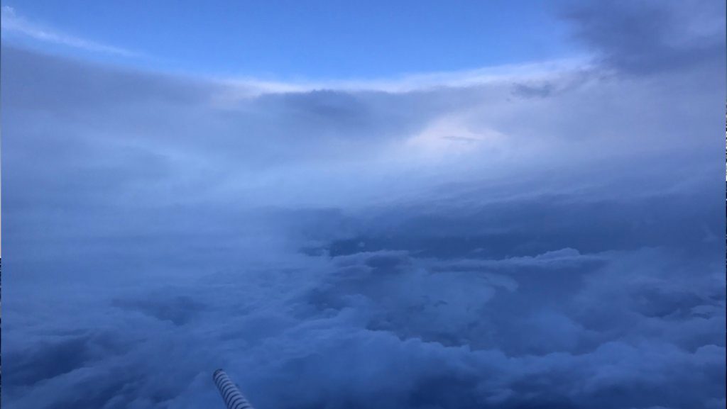
The 2017 hurricane season has already fulfilled forecaster predictions of a busy year. Hurricane Harvey rapidly strengthened to a Category 4 hurricane before making landfall in Texas, late on August 25th.
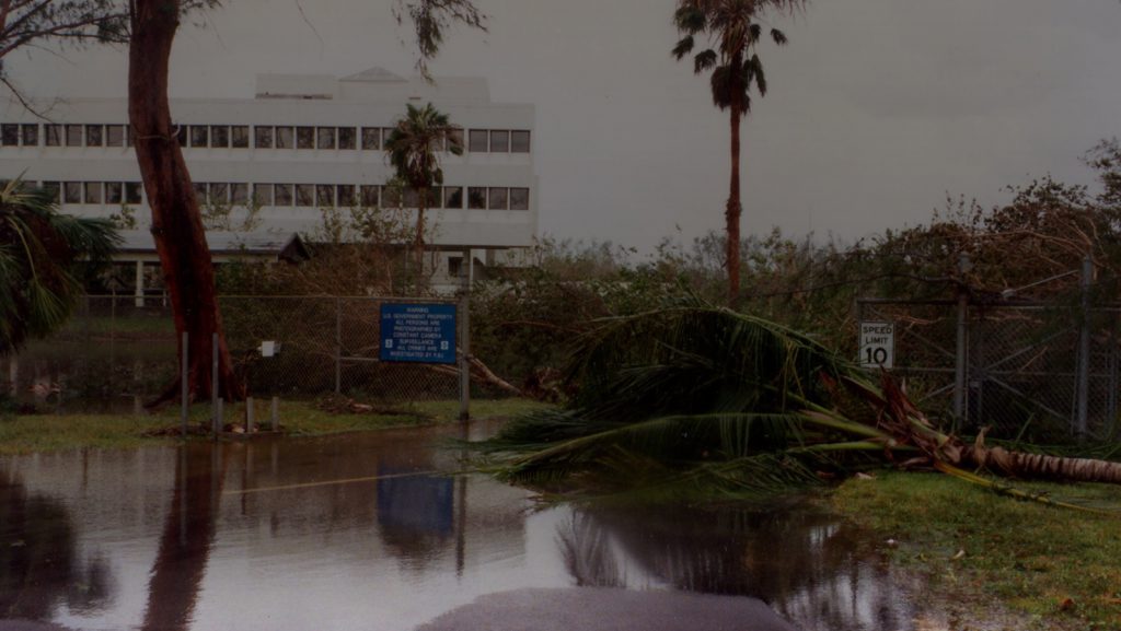
Hurricane Andrew made landfall in Homestead, Florida, on August 24, 1992, with sustained wind speeds maxing out at 165 mph. This year marks the 25th anniversary of the storm, still one of the most catastrophic and costliest hurricanes in US History.
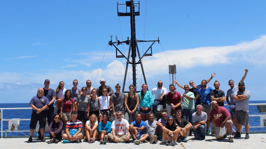
AOML scientists have returned from the third Gulf of America Ecosystems and Carbon Cycle cruise (GOMECC-3), which took place to perform a large-scale survey of ocean acidification trends and dynamics in the Gulf of America aboard NOAA ship Ronald H. Brown from July 18 through August 21, 2017.
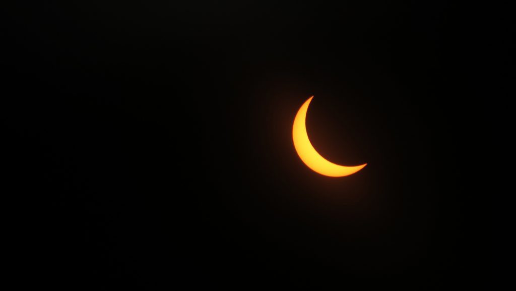
On August 21st, 2017, the entire nation celebrated a unique celestial event: the first total solar eclipse to cross the contiguous United States in 99 years.
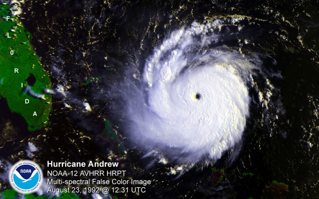
Hurricane Andrew made landfall around 5 am in Homestead, Florida, on August 24, 1992, with sustained wind speeds maxing out at 165 mph. This year marks the 25th anniversary of the storm, still one of the most catastrophic hurricanes in US History. Andrew developed into a Category-5 hurricane in no more than 36 hours, roaring across south Florida and decimating the urban landscape in its wake. Not only did the storm reconfigure much of south Florida, causing an estimated $26.5 billion in direct damages in 1992, but it also led to a reconfiguration of the tools now used to study, forecast, prepare for, and respond to hurricanes. Many AOML staff members who lived in south Florida when the storm struck remain at the laboratory today, inspired by Hurricane Andrew to enhance the science behind forecasts and mitigate future damages from tropical cyclones.
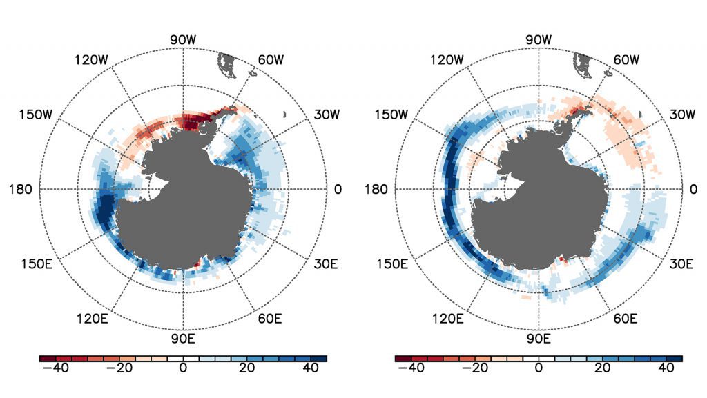
“Much of the work on the cause of Antarctic sea ice over recent decades has focused on atmospheric drivers but this paper focuses on the ocean’s role. The authors analyse the trend of Antarctic sea ice over the past 35 years on the basis of satellite data and model simulations forced with atmospheric reanalysis products. Their findings suggest that ocean processes play a crucial role in determining the seasonality of sea ice trends. They also reveal that the sea-ice response is regional.”
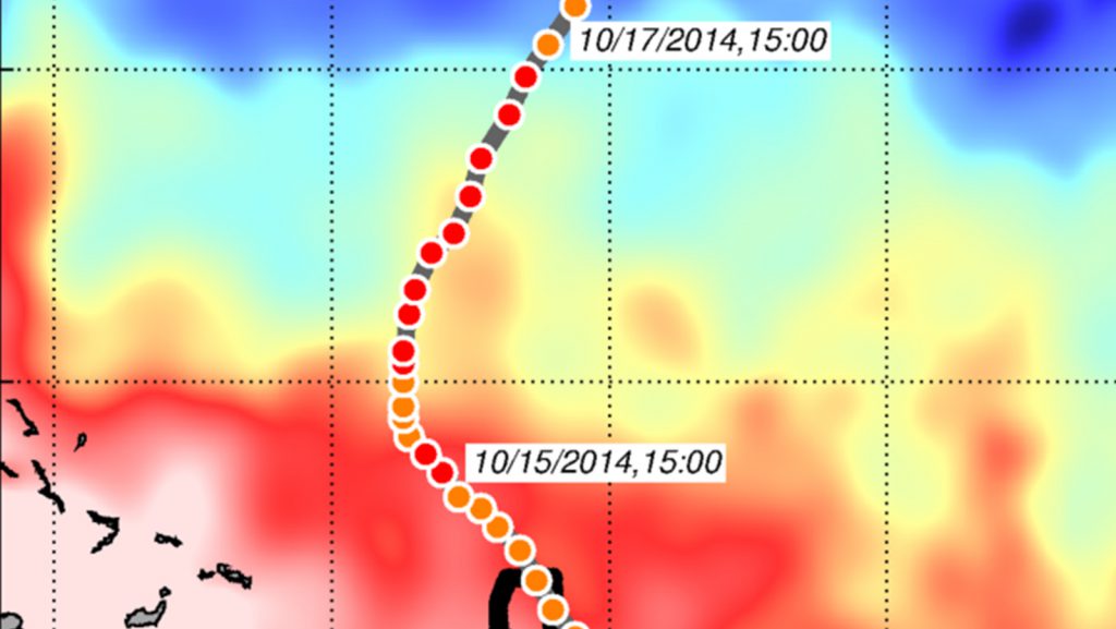
In a recent study published in Weather and Forecasting,* AOML researchers and their colleagues used NOAA’s HWRFHYCOM operational hurricane forecast model to quantify the impact of assimilating underwater glider data and other ocean observations into the intensity forecasts of Hurricane Gonzalo (2014). Gonzalo formed in the tropical North Atlantic east of the Lesser Antilles on October […]
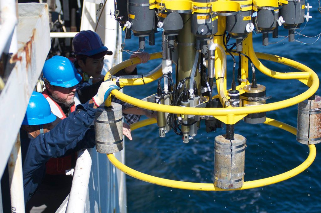
On July 18, NOAA AOML and partner scientists will depart on the Gulf of America Ecosystems and Carbon Cycle (GOMECC-3) research cruise in support of NOAA’s Ocean Acidification Monitoring Program. This isn’t the first time researchers will head to sea in this region. Previous cruises have taken place along the east and Gulf of America (GOM) coasts of the US in both 2007 and 2012. Together, these cruises provide coastal ocean measurements of unprecedented quality that are used both to improve our understanding of where ocean acidification (OA) is happening and how ocean chemistry patterns are changing over time. This will be the most comprehensive OA cruise to date in this region, set to include sampling in the international waters of Mexico for the first time. Ocean acidification is a global issue with global impacts, and international collaboration like this is vital to understanding and adapting to our changing oceans.
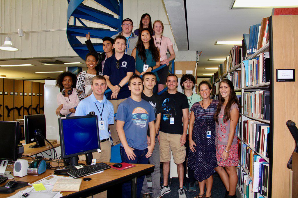
Each year, NOAA AOML welcomes a group of talented students from across the country to join our team by way of summer internships. Seventeen highly motivated students have traveled to our laboratory in Miami to work alongside leading oceanic and atmospheric research scientists. NOAA internships, scholarships, and fellowships provide students with an unparalleled opportunity to develop and fine tune their research and field skills, giving them a glimpse of what it takes to establish a professional career in a federal research laboratory. Each student works side by side with a AOML mentor, who help to advise the students along their chosen scientific career paths and various research projects. Here at AOML, these career opportunities include jobs in physical oceanography, ocean chemistry and ecosystems, hurricane research, engineering, computer science and communications.
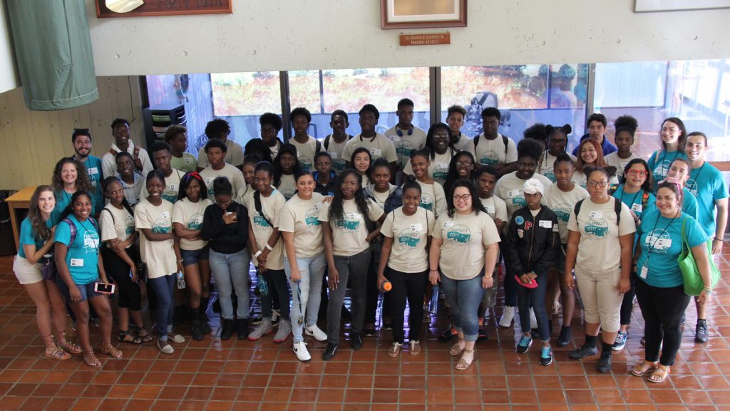
This June, AOML hosted students from the Frost Science Upward Bound Math and Science program. This program provides high school students with access to mentors and technology, interaction with scientists, as well the IMPACT (Integrated Marine Program and College Training) Summer Program, in which they delve specifically into marine science.
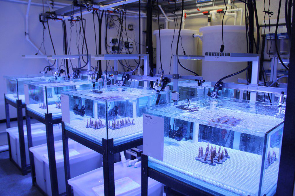
Coral researchers at AOML unveiled a new state of the art experimental laboratory this spring at the University of Miami’s Rosenstiel campus. The new “Experimental Reef Laboratory” will allow NOAA scientists and colleagues to study the molecular mechanisms of coral resiliency. Modeling studies indicate that thermal stress and ocean acidification will worsen in the coming decades. Scientists designed the Experimental Reef Laboratory to study the combined effect of these two threats, and determine if some corals are able to persist in a changing environment.
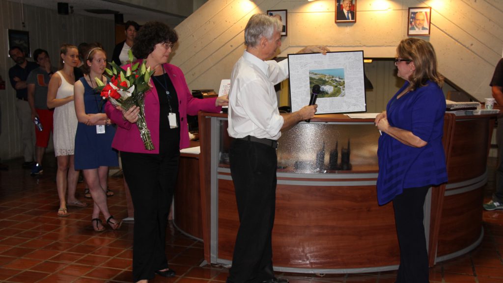
AOML employees commemorated Gladys Medina’s retirement after 45 years of federal service as executive assistant to the AOML director.

Congratulations to AOML’s research oceanographer Sang-Ki Lee for winning the scientific category at the 52nd Annual Federal Employee of the Year Award Program on May 12th.
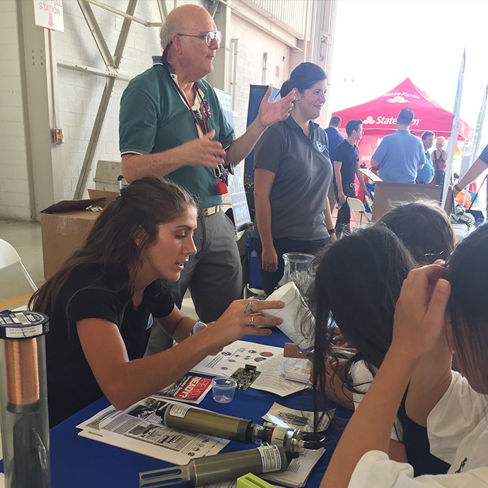
On May 12th, 2017, AOML oceanographic and meteorological scientists participated in the final leg of NOAA’s Hurricane Awareness Tour in Miami at the Opa-Locka Executive Airport.
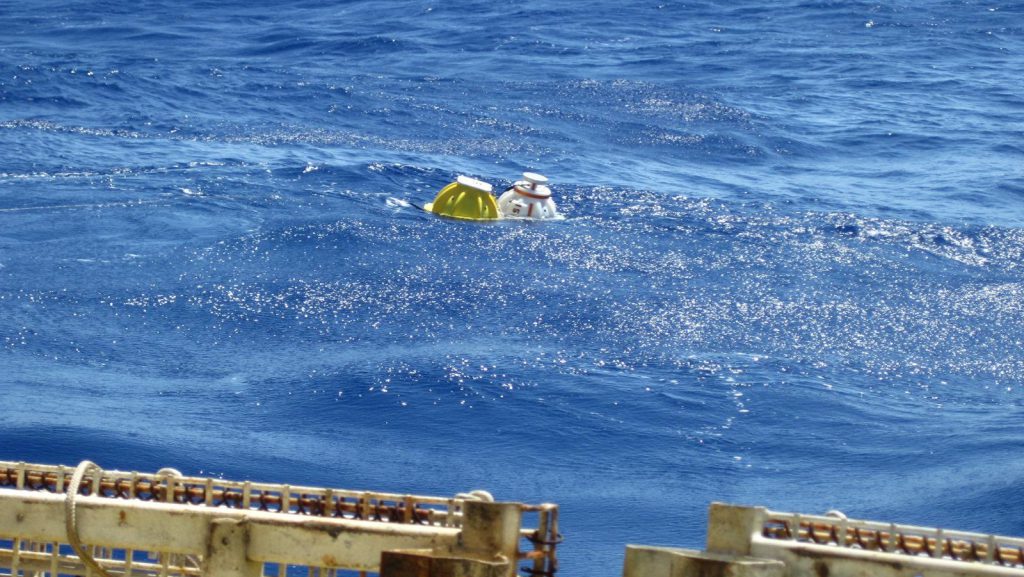
AOML scientists and colleagues from the University of Miami took part in a 17-day research cruise aboard R/V Endeavor in support of the NOAA-funded Western Boundary Time Series project.
Scientists found that microbes and their genetic material from land-based sources of pollution could be found in reef water and in tissues of corals. This could affect the genomics of the native microbial communities found in coral reefs, which can impact how corals thrive and survive. These new insights highlight an additional potential threat to corals from land-based sources of pollution in southeast Florida, where corals are already under existential threat from warming oceans and resulting coral bleaching, disease and mortality.
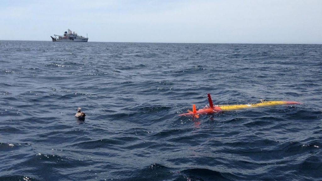
The California Cooperative Oceanic Fisheries Investigations (CalCOFI) cruise sampling was completed on April 21st aboard NOAA Ship Bell M. Shimada.
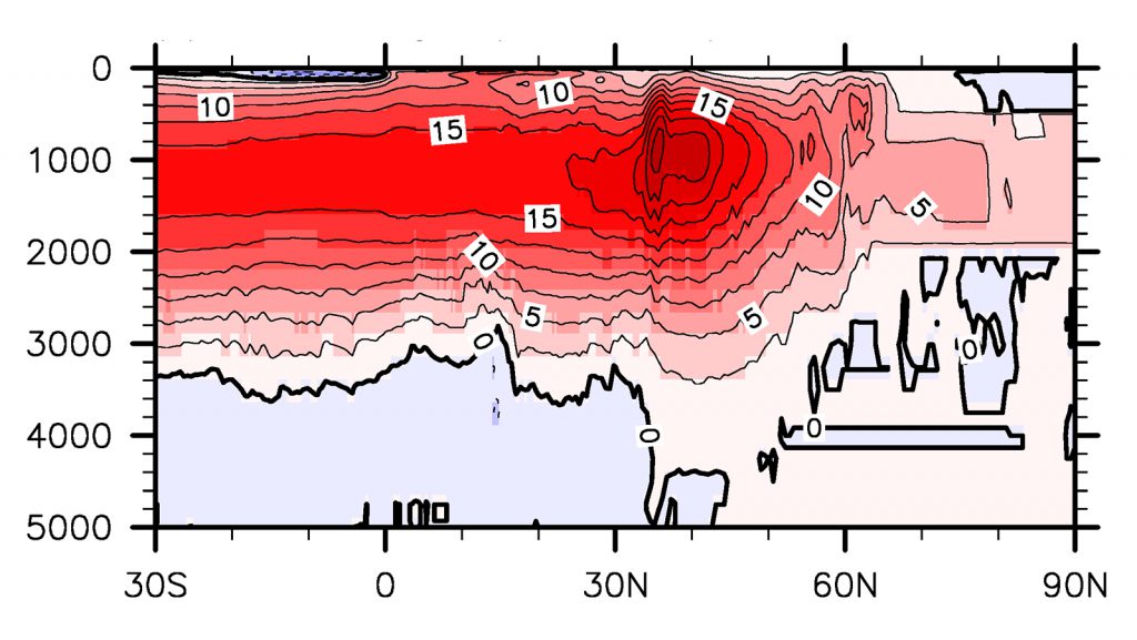
The Atlantic Meridional Overturning Circulation (AMOC) transports the upper warm water northward and the deep cold water southward in the Atlantic, and is a key component of the global energy balance. In many of the climate models that participate the Coupled Model Inter-comparison Project Phase 5 (CMIP5), the amplitudes of the AMOC agree very well with or are even larger than the observed value of about 18 Sv at 26.5N; but they still show cold upper ocean temperature biases in the North Atlantic.
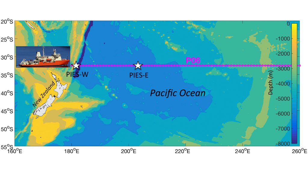
One of the most challenging questions in global climate change studies today is how quickly, or if, heat that accumulates within the Earth system penetrates into the deep ocean. Scientists with the University of Miami (UM), AOML, and NASA’s Jet Propulsion Laboratory (JPL) recently tackled this question by using a combination of present-day satellite and in situ observing systems to study the distribution of heat in the oceans.
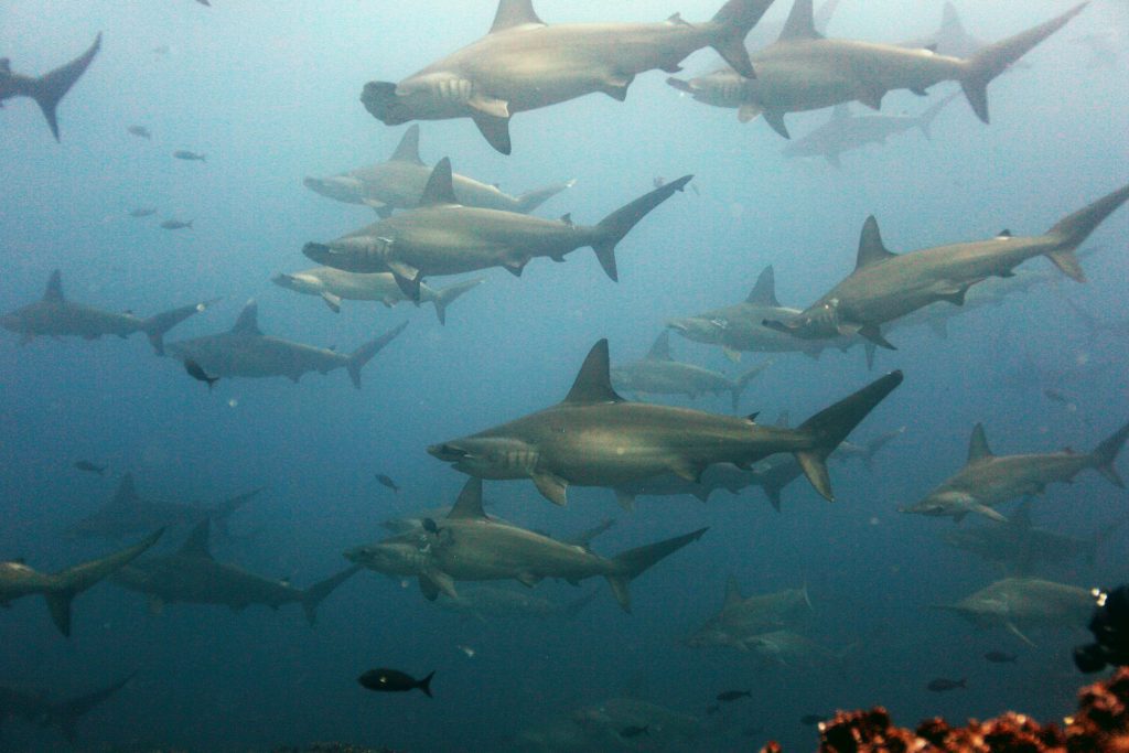
Coral scientists recently traveled to the Galapagos Islands to document coral reef health following the 2016-17 El Niño Southern Oscillation event (ENSO), which bathed the region in abnormally warm waters. Historically, these events have triggered coral bleaching and large-scale mortality, as seen in response to ENSO events of 1982-83 and 1997-98. Interestingly, these same reefs exhibited minimal bleaching in response to this most recent event. Scientists are determining whether this response is due to differing levels of heat stress, or an increased tolerance to warm water in the remnant coral communities.
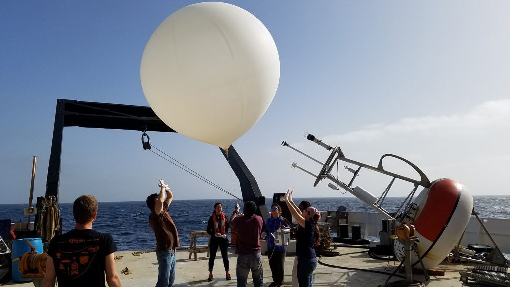
NOAA AOML scientists participated in the 2017 annual PIRATA Northeasten Extension (PNE) and Saharan Dust AERosols and Ocean Science Expeditions (AEROSE) cruise aboard the NOAA Ship Ronald H. Brown from February 19 to March 25.
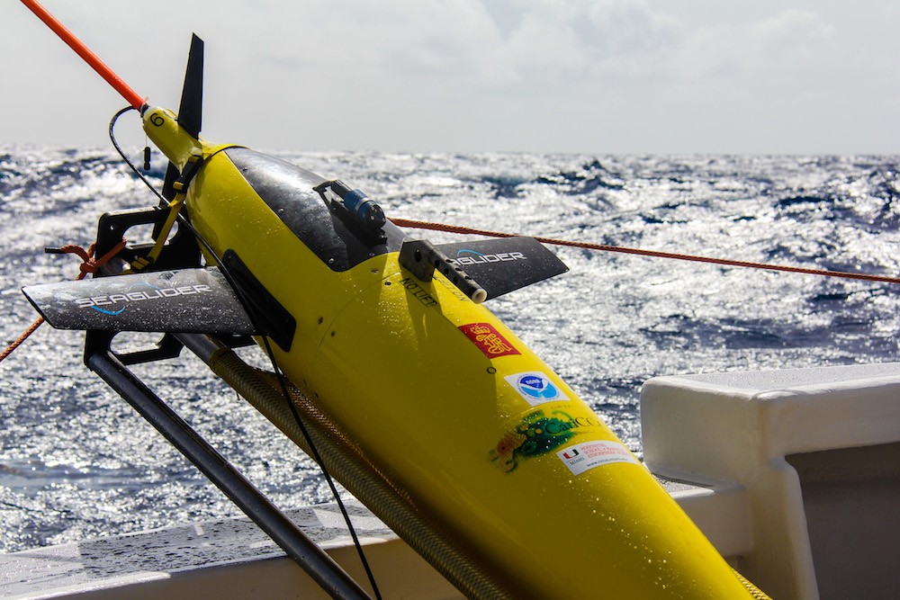
Throughout the Atlantic hurricane season, this autonomous underwater vehicle dives to depths up to 1,000 meters and travels thousands of kilometers across the Caribbean Sea.
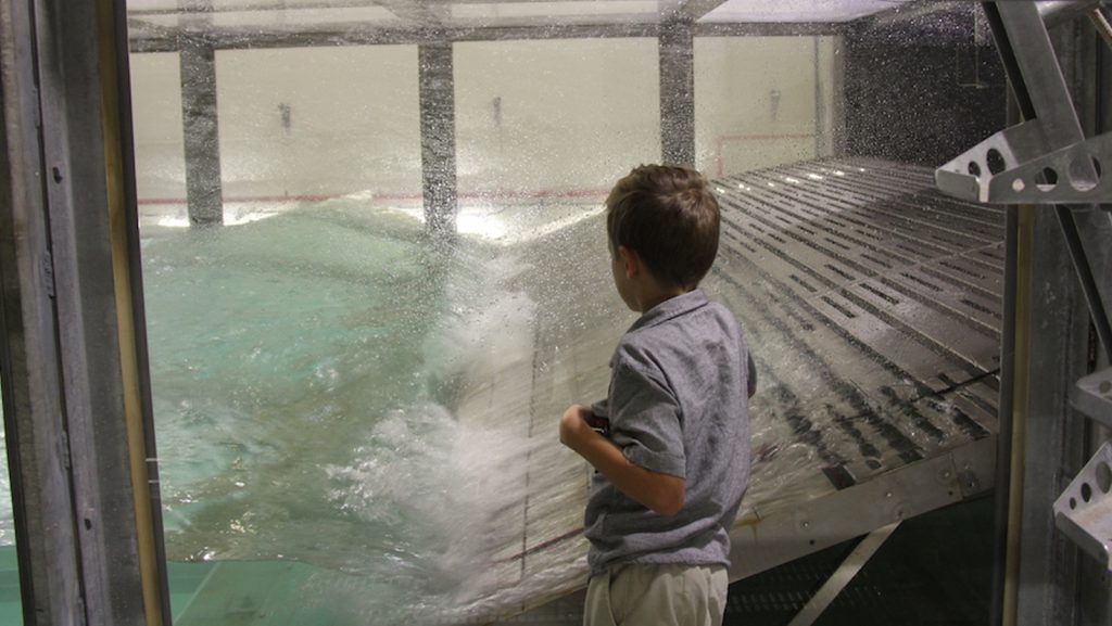
NOAA’s Atlantic Oceanographic and Meteorological Laboratory hosted take your child to work day at the lab.
Glider SG609 is one of four gliders that are part of the Hurricane Field Program at NOAA’s Atlantic Oceanographic and Meteorological Laboratory. AOML launched its glider project in 2014 with the goal of enhancing the understanding of air-sea interaction processes during tropical cyclones. Scientists and technicians from AOML and the University of Puerto Rico at Mayagues run the deployments and recoveries out of Isla Magueyes Marine Laboratories in Puerto Rico, which neighbors the colorful coastal island community of La Paguera.
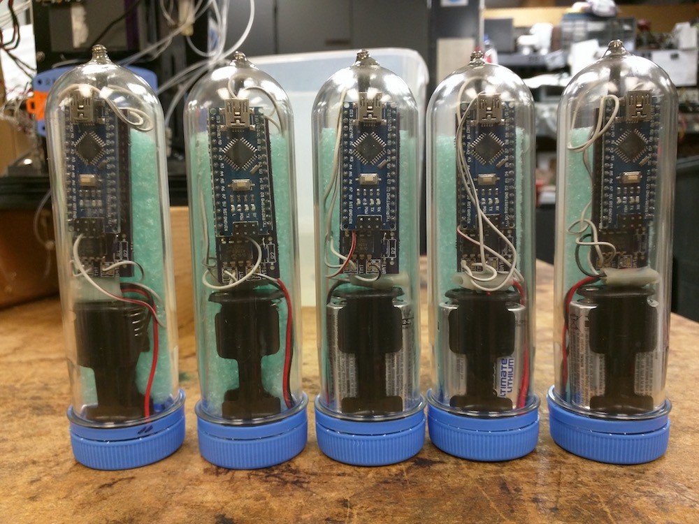
Warm ocean water can be a killer for coral reefs, and AOML recently developed a new inexpensive sensor to drastically improve our ability to measure and monitor changing temperatures on reefs at an unprecedented scale. The low cost sea temperature sensor, known as InSituSea, costs roughly $10 in parts to produce while providing high accuracy (0.05-0.1 C) in measurement. With a production cost that is 10% of an off-the-shelf temperature sensor, colleagues have expressed strong interest in deploying the InSituSea sea temperature sensor at coral reefs around the world.
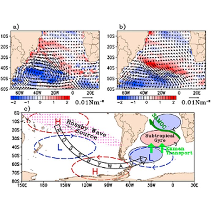
This study explores potential factors that may influence decadal variability of the South Atlantic meridional overturning circulation (SAMOC) by using observational data as well as surface-forced ocean model runs and a fully coupled climate model run.
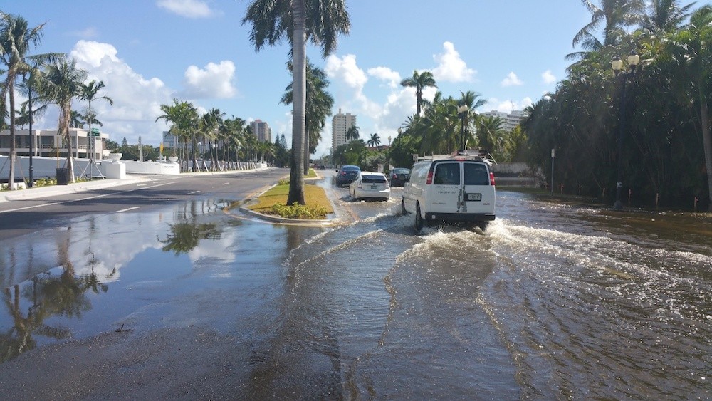
Tidal flooding from events such as the so-called “King Tides” and “Super Tides” are flooding urban coastal communities with increasing frequency as sea levels rise. These tidal flood waters can acquire a wide range of contaminants and toxins as a result of soaking in the built environment of urbanized coastlines. A multi- institutional, interdisciplinary research team, including scientists from AOML, is examining the types of contamination picked up from the urbanized coastal landscape and transported into coastal waters through tidal flooding.
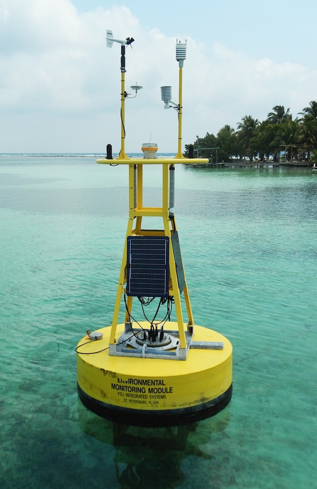
Coral Health and Monitoring Program (CHAMP) researchers at AOML have worked cooperatively with the Caribbean Community Climate Change Centre (CCCCC), headquartered in Belize, over the past several years to install Coral Reef Early Warning System (CREWS) stations at key coral reef sites in countries throughout the Caribbean. CREWS stations monitor an array of atmospheric and oceanographic parameters to assess the health and integrity of coral reefs. The stations are part of the CCCCC’s efforts to strengthen the Caribbean region’s ability to respond to climate variability, extreme weather conditions, pollution, and habitat change.
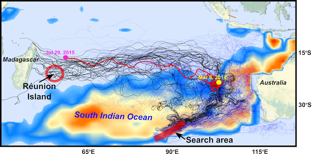
In a paper published in the Journal of Operational Oceanography, a team of scientists with the Physical Oceanography Division at AOML, the University of Santiago de Compostela in Spain, the University of Miami, the University of Hawaii, and the Commonwealth Scientific and Industrial Research Organisation (CSIRO) of Australia analyzed possible pathways to link the location of the found debris in the southwestern Indian Ocean with potential crash sites, probably in the eastern Indian Ocean.
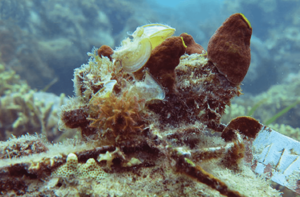
The study, published in the Proceedings of the Royal Society B, measured changes in the reef framework in several naturally high-carbon dioxide settings near Papua New Guinea. For the first time, scientists found increased activity of worms and other organisms that bore into the reef structure, resulting in a net loss of the framework that is the foundation of coral reef ecosystems.
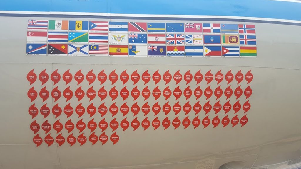
NOAA’s Hurricane Hunters fly into hurricanes to help study important features and improve forecasts. The photos below highlight two different flights, on October 5 & 6, 2016, that were taken from flights into Hurricane Matthew as it moved through the Atlantic and up the East Coast of the United States. Hurricane Matthew eventually moved off the East Coast and would dissipate out in the Atlantic Ocean.
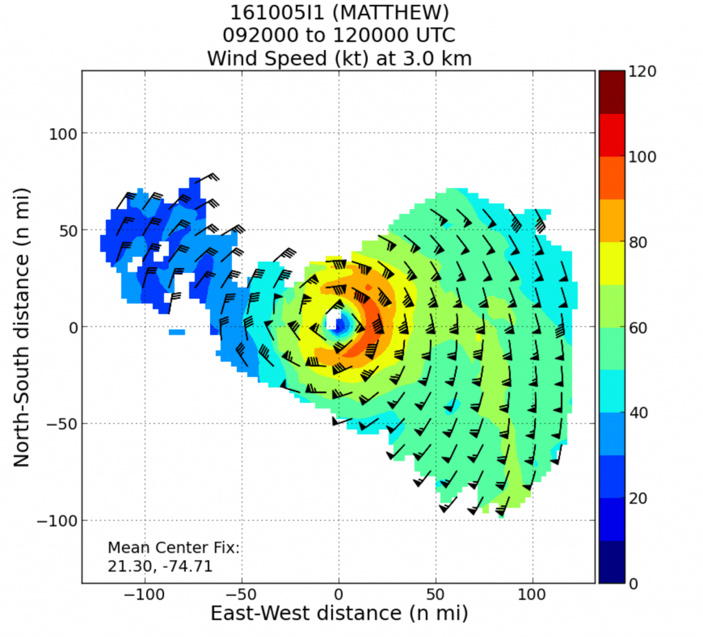
NOAA’s hurricane hunter aircraft carry a unique radar that measures wind in hurricanes where there is rain. Located in the tail of the aircraft and known as the Tail Doppler Radar, this instrument produces images that can provide detailed pictures scientists use to study storm structure and changes. Scientists can also piece together wind speed information gathered over the course of a flight to paint a complete picture of the wind speed in the regions of the storm where the aircraft flies.
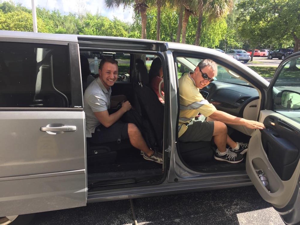
There aren’t many people who can say they have flown directly into a hurricane, but on October 5, 2016, I had a very unique opportunity to fly into Hurricane Matthew with NOAA’s Hurricane Hunters. Matthew was quickly moving across the Atlantic Ocean, and each new forecast moved it closer to the East Coast of Florida. With the high potential for hurricane watches and warnings, NOAA started preparations for routine flight operations.

With hurricane season in full swing, NOAA will host a Reddit Ask Me Anything (AMA) about the Science of Hurricane Hunting to Improve Forecasts on September 22, 2016 at 1:00 p.m. Hurricane scientist Frank Marks, Sc.D., Director of the Hurricane Research Division at AOML, and P-3 hurricane hunter pilot Commander Justin Kibbey of the NOAA Corps will answer questions. The first half of hurricane season has produced a significant number of storms in the Atlantic and Gulf of America. This AMA is a great opportunity to answer questions about how and why we study these storms.
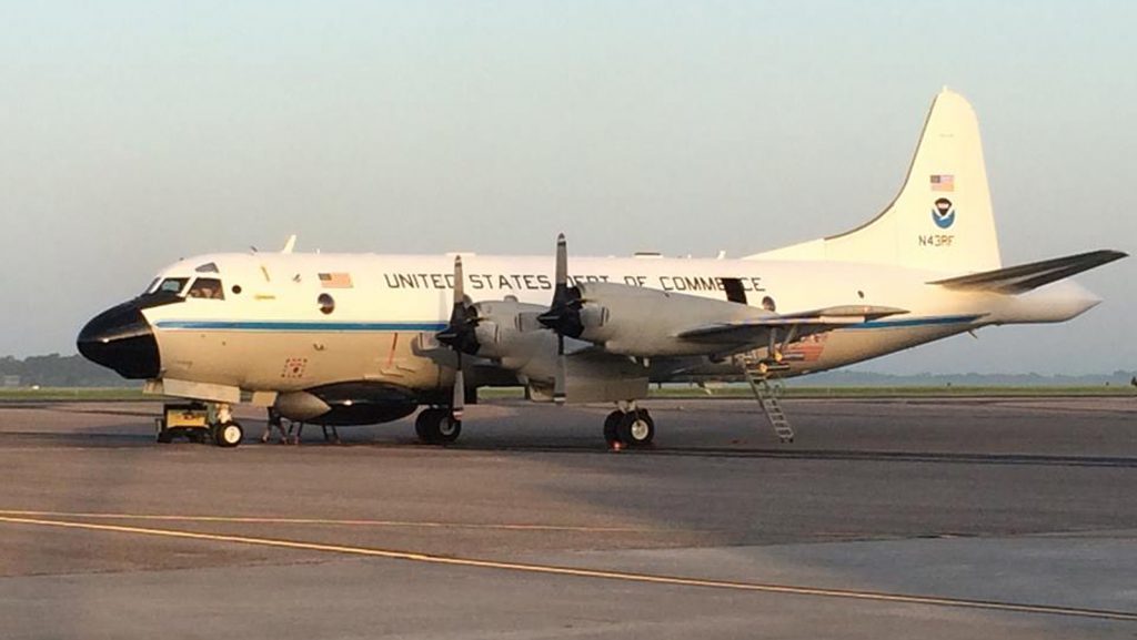
NOAA AOML will play host to a Reddit Ask Me Anything (AMA) on September 22, 2016 from 1:00-3:00pm EST. Frank Marks, Sc.D., Director of the Hurricane Research Division at AOML, and P-3 hurricane hunter pilot Commander Justin Kibbey of the NOAA Corps will answer questions.

NOAA’s Hurricane Hunters regularly fly into developing systems that may threaten landfall or to study important features to improve forecasts.
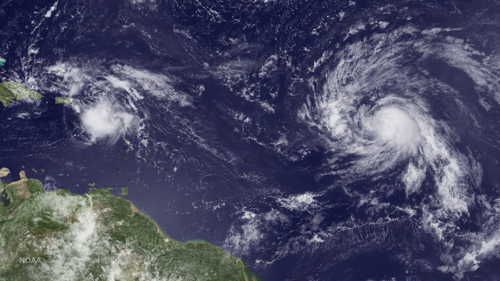
NOAA Hurricane Hunters are flying back-to-back missions to study the newly developed Tropical Storm Hermine in the Gulf of America, capturing its evolution from a cluster of thunderstorms into a tropical storm. Getting data during such transitions can help improve hurricane models which currently don’t predict transitions well. Our understanding of the physical processes of early storm development remains limited, largely because there are few observations.
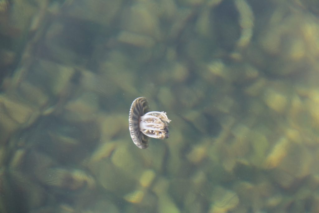
Photo Essay Adjacent to Everglades National Park, Florida Bay encompasses the shallow waters, mangrove islands, and grassy banks between mainland Florida and the Keys; an area about 1,000 square miles in size. With an average depth of only 3 feet, the bay is home to a number of marine populations as well as a […]
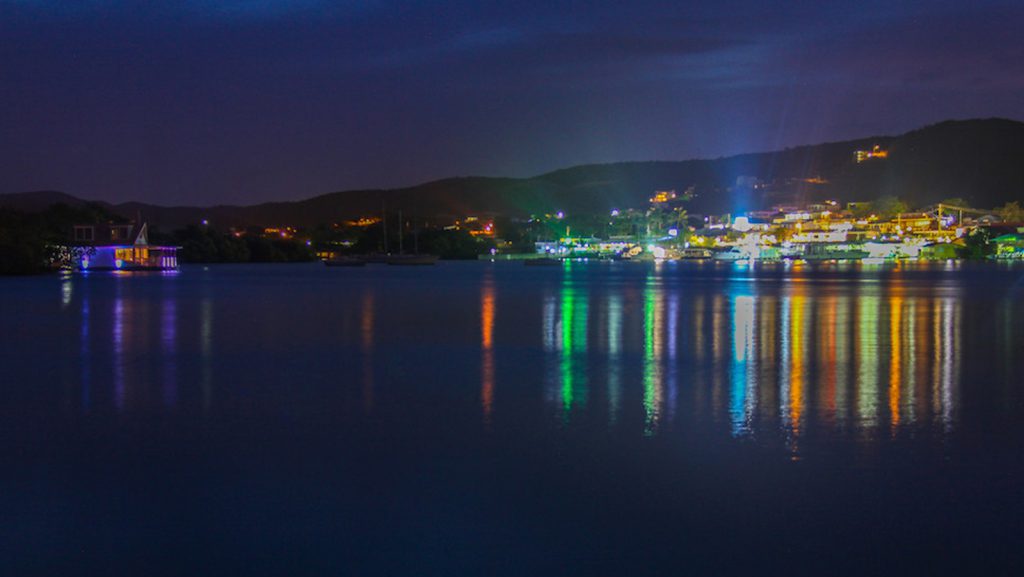
On Thursday July 21st, PHOD began its fifth underwater glider mission in the Caribbean Sea. Two underwater gliders, SG609 and SG630, were successfully deployed off of Puerto Rico. The deployment was carried out by AOML researchers on board the R/V La Sultana with the help of personnel from the University of Puerto Rico Mayaguez (UPRM). The refurbished gliders have sensors that measure temperature, salinity, oxygen, Chlorophyll-a, and turbidity. This deployment is the beginning of the 2016 Atlantic Hurricane Season deployment, with two more gliders scheduled for deployment in the tropical North Atlantic in August.
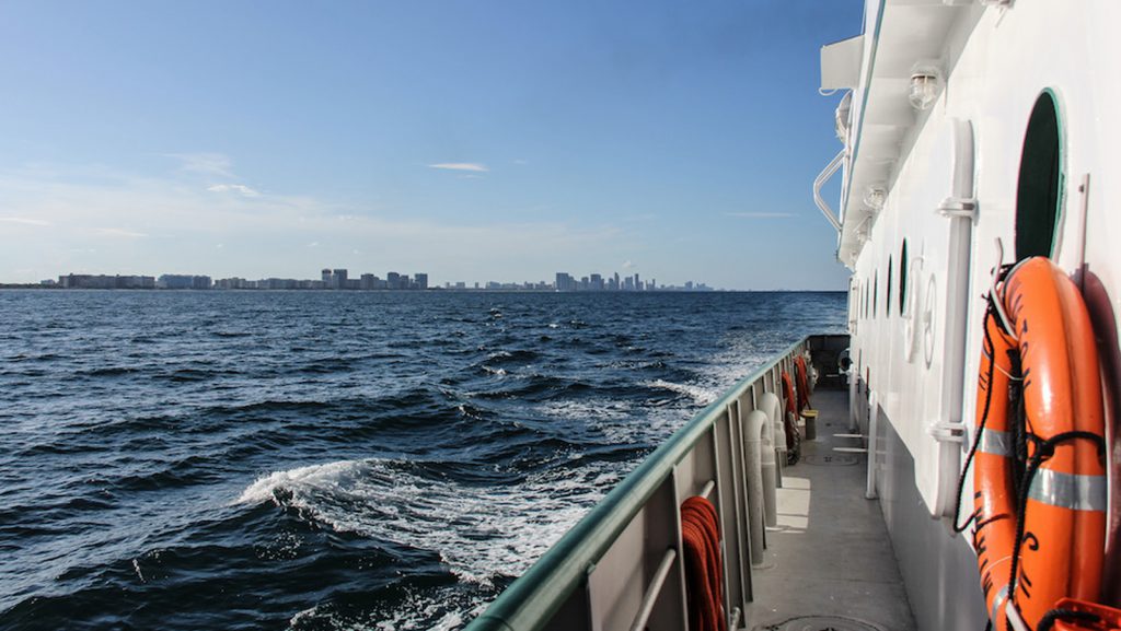
From July 13th to 14th, AOML researchers conducted a hydrographic survey along 27N in the Florida Straits as part of the Western Boundary Time Series project aboard the R/V F.G. Walton Smith. The cruise conducts surveys to quantify Florida Current volume transport and water mass changes.
The 2016 Atlantic Oceanographic and Meteorological Laboratories’ (AOML) cadre of summer interns inspired us with a very promising group of motivated individuals. Fourteen students came from all over the country to complete a wide array of projects in different thematic areas of AOML’s workforce; Physical Oceanography, Ocean Chemistry and Ecosystems, Hurricane Research, Engineering, and Communications.AOML is home to some of the nation’s leading scientists, and internships offer a great opportunity for students to learn alongside these experts and develop skills that they will take with them in the future. The summer internships also expose students to careers at a federal research laboratory. NOAA offices are located all across the country, so students who enjoy their summer internship can consider NOAA or other federal science agencies for future employment when they enter the workforce.
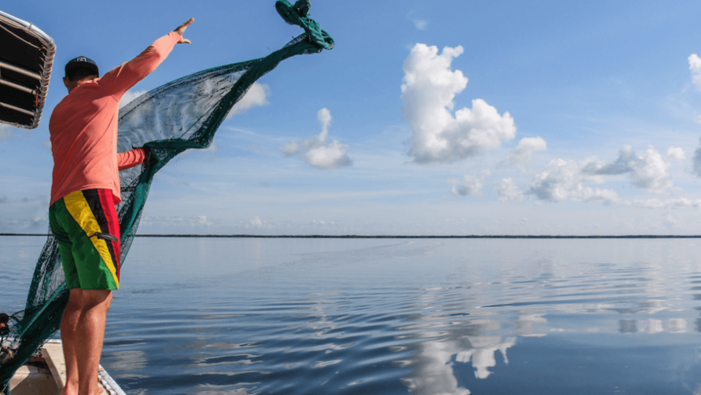
With an average depth of only 3 feet, the Florida Bay is home to a number of marine populations, as well as a vital nursery ground for commercial and recreational reef fish species. The Florida Bay also plays host to a group of NOAA researchers who are investigating how habitat changes in Florida Bay are impacting juvenile sportfish populations, with a focus on the spotted seatrout.
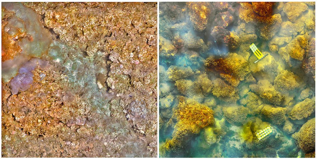
The new research published online August 10 in Nature Climate Change provides a stark look into the future of ocean acidification – the absorption by the global oceans of increasing amounts of human-caused carbon dioxide emissions. Scientists predict that elevated carbon dioxide absorbed by the global oceans will drive similar ecosystem shifts, making it difficult for coral to build skeletons and easier for other plants and animals to erode them.
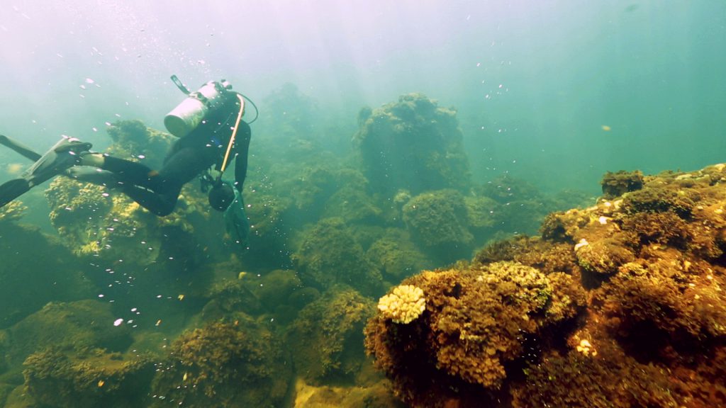
Corals live and thrive by maintaining a careful balance between their growth rate and the rate of erosion. Scientists already know the projected increases in carbon dioxide in our global oceans, known as ocean acidification, will slow the rate at which corals build the hard calcium carbonate skeletons that are the foundation of their habitat. A new study published online today in PLOS ONE demonstrates that in naturally highly acidified waters, these coral skeletons will also face increased erosion from microscopic organisms, called bioerosion. The result is accelerated breakdown and loss of reef structures, and potentially the loss of essential habitat.
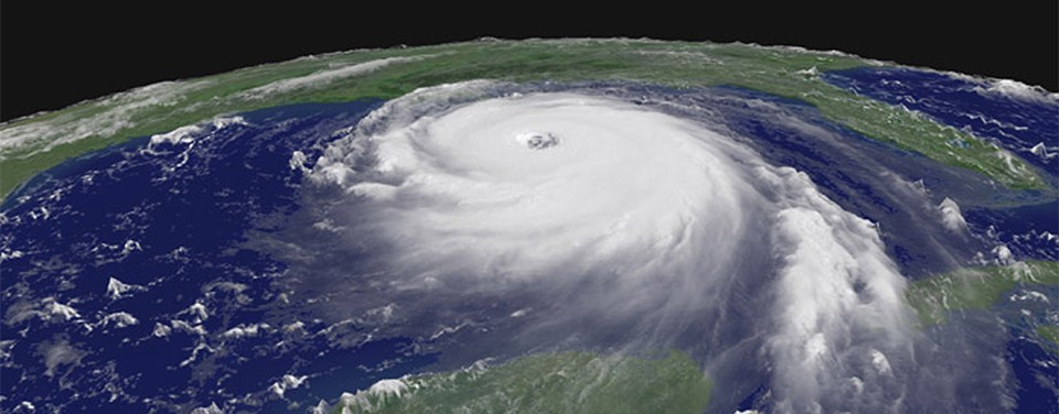
Scientists at NOAA’s Atlantic Oceanographic and Meteorological Laboratory (AOML) are at the vanguard of hurricane research. Each hurricane season we fly into storms, pore over observations and models, and consider new technological developments to enhance NOAA’s observing capacity and improve track and intensity forecasts. The 2016 hurricane season will provide an opportunity for our scientists to test some of the most advanced and innovative technologies and refined forecasting tools to help better predict a storm’s future activity.
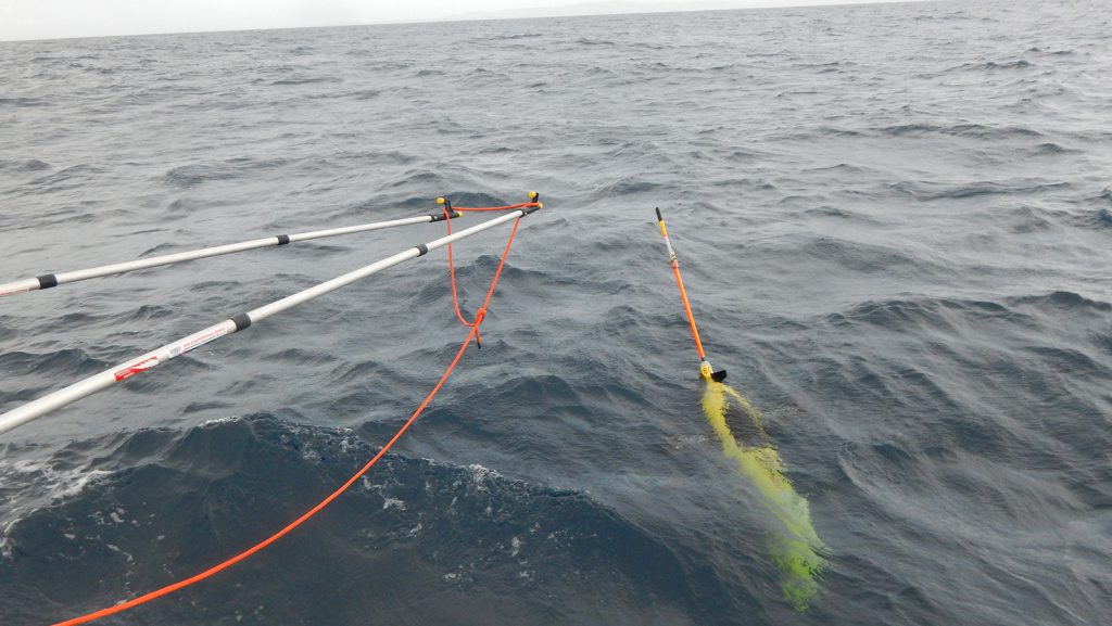
On Thursday June 2nd, PHOD concluded its fourth underwater glider mission in the Caribbean Sea. Along with their partners at the University of Puerto Rico at Mayaguez, the glider was recovered from the R/V La Sultana.
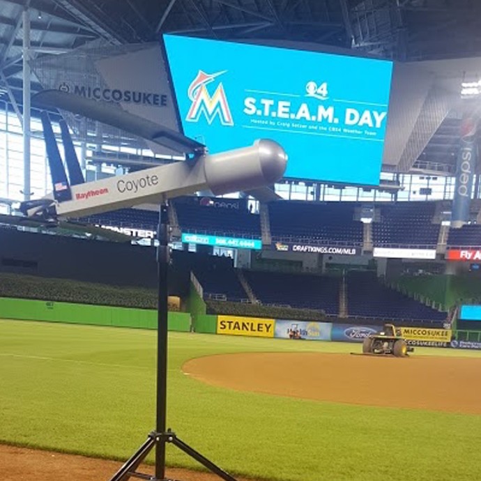
On Tuesday, May 24th, AOML Associate Director and hurricane hunter pilot LCDR Justin Kibbey and AOML Communications staff participated in the S.T.E.A.M. (Science, Technology, Engineering, Arts, Mathematics) Day event at Marlins Park, hosted by local news station CBS4.
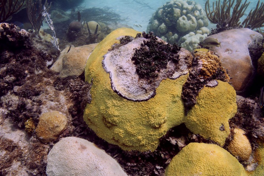
On May 13th, the White House Office of Science and Technology Policy introduced the National Microbiome Initiative, an effort to support multi-agency research to help sample and better understand communities of microorganisms that are critical to both human health and the world’s ecosystems. As the nation’s premier ocean science agency, NOAA is leading interdisciplinary research to improve observation and assessment of marine microbiomes. To support this national initiative, NOAA’s Atlantic Oceanographic and Meteorological Laboratory (AOML) received nearly $2 million in funding this year to conduct a number of projects that integrate genetic sampling techniques and technologies to help advance the understanding of the ocean’s microbiomes.
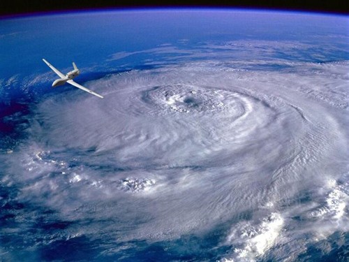
As a hurricane approaches landfall, citizens are hoping that they are adequately prepared for the potential damage from strong winds and rising oceans. NOAA’s job is to forecast the storm location and strength, or intensity, to help communities make the best informed decisions. For many scientists, predicting intensity is a challenge at the forefront of hurricane research, and in recent years advancements in observations and modeling have improved NOAA’s forecasts of intensity by 20%. We are now at the point where scientists can observe and predict with very fine detail what is happening in the inner core of the storm.

A new study published in the journal Nature Microbiology highlights how emerging, devastating outbreaks of Vibrio infection in Latin America might be linked to El Niño, a climate pattern that periodically causes surface temperatures to warm throughout the equatorial Pacific Ocean. A researcher with the University of Miami’s Cooperative Institute of Marine & Atmospheric Studies at NOAA’s Atlantic Oceanographic & Meteorological Lab was part of an international research team that used microbiological, genomic, and bioinformatic tools to demonstrate how El Niño provides a mechanism for the transport of disease from Asia into the Americas.
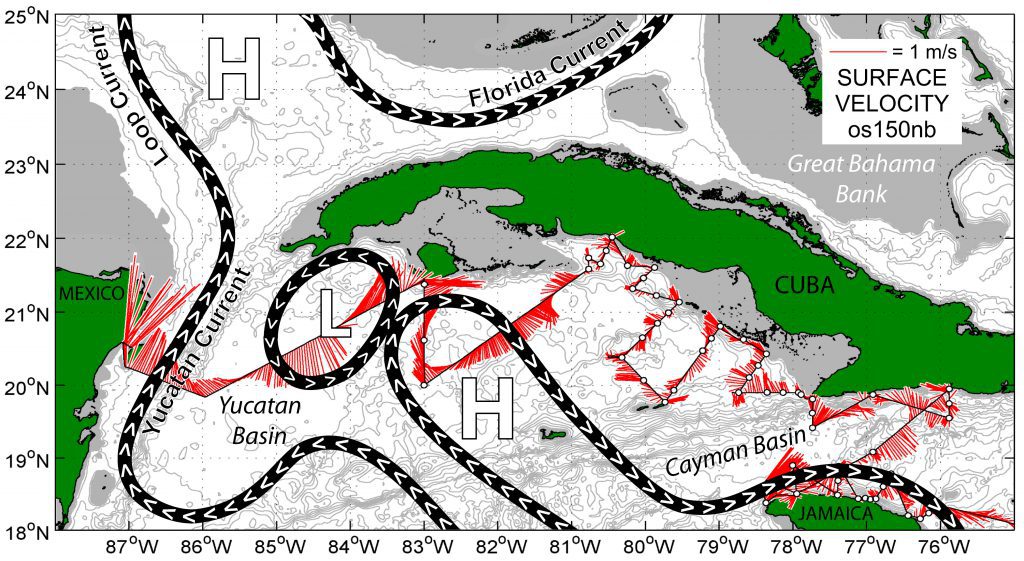
A team of NOAA oceanographers sets sail from Miami aboard the NOAA Ship Nancy Foster on May 7th to investigate ocean currents and fish larvae distribution in the southern Gulf of America and western Caribbean. The joint cruise between NOAA’s Atlantic Oceanographic and Meteorological Laboratory (AOML) and Southeast Fisheries Science Center (SEFSC) is a new chapter in a long-term effort that pools cross-line office resources to better understand the early life history and larval recruitment pathways of important fisheries in the region, including the ecologically important and commercially valuable Atlantic bluefin tuna.
Tornadoes are one of nature’s most destructive forces. Recent violent and widespread tornado outbreaks in the United States, such as occurred in the spring of 2011, have caused significant loss of life and property. Currently, our capacity to predict tornadoes and other severe weather risks does not extend beyond seven days. Extending severe weather outlooks beyond seven days will assist emergency managers, businesses, and the public prepare the resources needed to prevent economic losses and protect communities. So how can scientists better predict when and where tornadoes are likely to strike, before the tornado season begins?
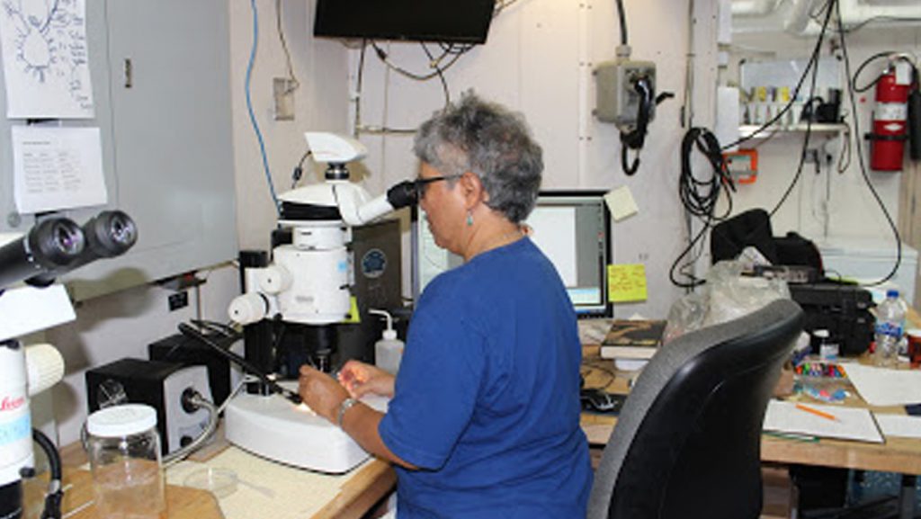
Photos from the scientists and data from the NOAA Nancy Foster Cruise that sailed off in May. The Nancy Foster sailed out on a research survey to search for bluefin tuna larvae among other fishy creatures
In a recent paper published in the Journal of Climate, scientists with NOAA and the University of Miami have identified how variability in ocean circulation in the South Atlantic Ocean may influence global rainfall and climate patterns. The study by researchers at NOAA’s Atlantic Oceanographic and Meteorological Laboratory (AOML) and the Cooperative Institute for Marine and Atmospheric Studies (CIMAS) suggests that the South Atlantic is a potential predictor of global rainfall variability with a lead-time of approximately 20 years. This link between the South Atlantic Ocean and weather and climate could provide significant long-term insight for water management on a global scale.
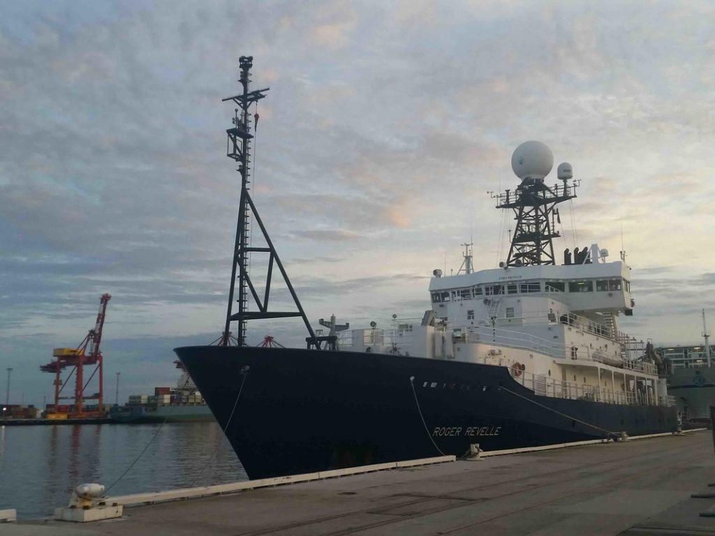
During the months of March and April, AOML joined an international team of oceanographers to actively sample the Indian Ocean in support of the Global Ocean Ship-Based Hydrographic Investigation Program (GO-SHIP), an initiative to measure and investigate the ocean basins from coast to coast and from top to bottom. Aboard the R/V Roger Revelle, the team transected the Indian Ocean from the Antarctic northward into the Bay of Bengal, collecting seawater samples at 113 stations as part of a multi-decadal effort to measure various ocean properties, including temperature, salinity, nutrients, carbon and other gases.
Photos from the March- April 2016 GO-SHIP cruise transecting the Indian Ocean.
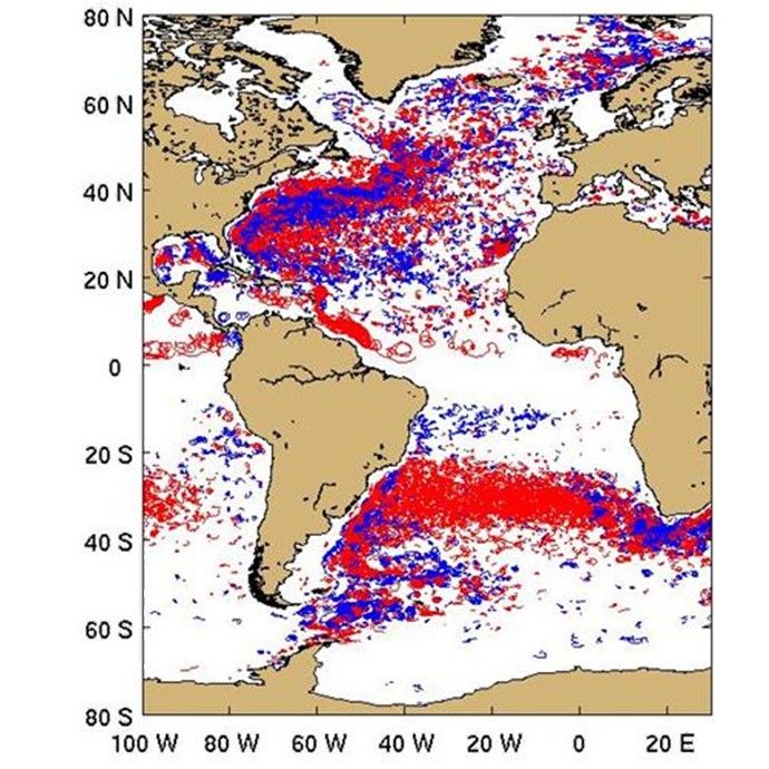
In a recent study by Lumpkin (2016) looping trajectories of surface drifting buoys were extracted from the global drifter dataset and analyzed in order to examine the distribution of submesoscale to mesoscale vortices. Over 15,000 looping trajectory segments were identified worldwide.
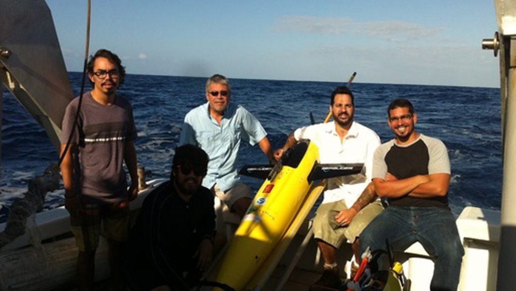
The fourth underwater glider mission began in March with the deployment of two refurbished gliders in the Caribbean Sea off Puerto Rico. The deployment was carried out by AOML researchers on board the R/V La Sultana with the help of personnel from the University of Puerto Rico Mayaguez (UPRM).
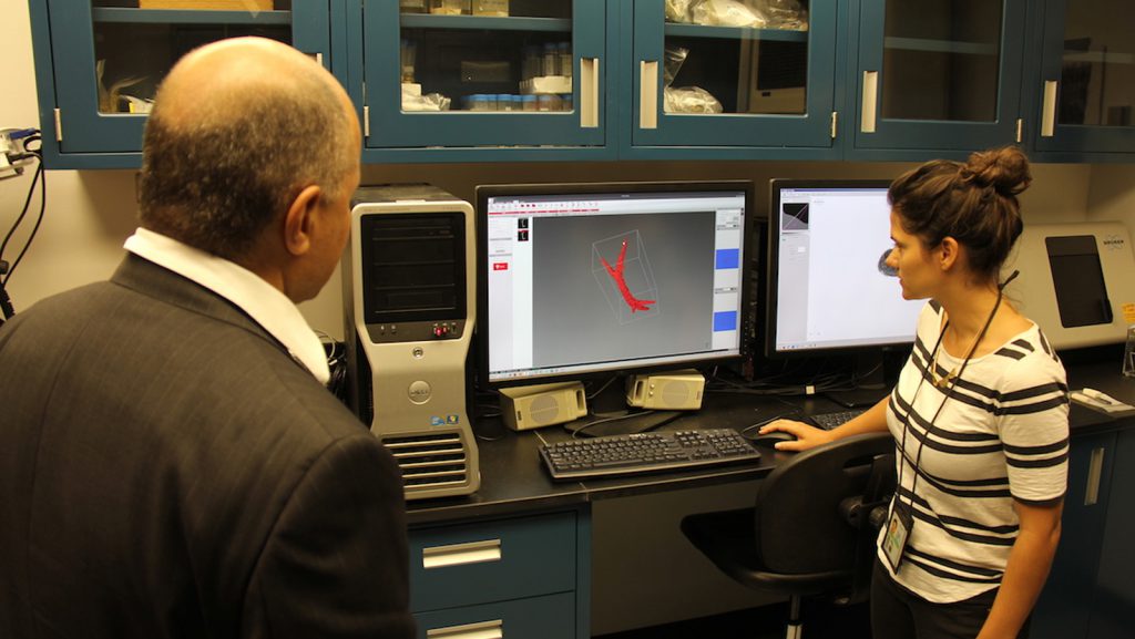
VADM Brown took a tour of AOML and the Southeast Fisheries Science Center on March 15th to learn about current research and addressed staff during a town hall session.

When Barack Obama becomes the first president to visit Cuba since Calvin Coolidge, his visit will highlight not only a new course in international relations, but showcase on-going scientific opportunities with the country only 90 miles off the Florida coast.
Scientists and engineers from NOAA have successfully designed, built, and tested a new antenna system that dramatically increases data transmission reliability while drastically reducing operating costs. The new Iridium-based transmission system, developed by NOAA’s Atlantic Oceanographic & Meteorological Laboratory (AOML) & the Cooperative Institute for Marine & Atmospheric Studies (CIMAS), has no restrictions on data format or size, allowing data from various ocean and land-based observation platforms to be transmitted more securely and at a fraction of the cost of the older Inmarsat-C platform.
On Friday, March 4th, AOML hosted 35 students from Miami’s Booker T. Washington High School for the Obama Administration’s My Brother’s Keeper National Labs Week. This national event is designed to introduce students from communities that are not well represented in STEM (Science, Technology, Engineering, Mathematics) careers to federal employees and lab facilities in the hopes of inspiring interest in these fields.

From March 1st through March 3rd, AOML coral scientists traveled to reefs in the Upper and Lower Florida Keys to swap out instruments being used for an ongoing coral bleaching study. Both pH and light loggers were collected and deployed at inshore and offshore study sites.
AOML hurricane researcher Jason Dunion participated in NOAA’s El Niño Rapid Response Field Campaign, a comprehensive land, sea, and air sampling effort in the tropical Pacific, to study the current El Niño and improve weather forecasts thousands of miles away.
A recent paper published in the Journal of Climate led by PHOD researchers Hosmay Lopez, Shenfu Dong, Sang-Ki Lee, and Gustavo Goni provides a physical mechanism on how low frequency variability of the South Atlantic Meridional Heat Transport (SAMHT) associated with the Atlantic Meridional Overturning Circulation ( AMOC) may influence decadal variability of atmospheric circulation and monsoons. This is the first attempt to link the South Atlantic Overturning Circulation variability to weather and climate.
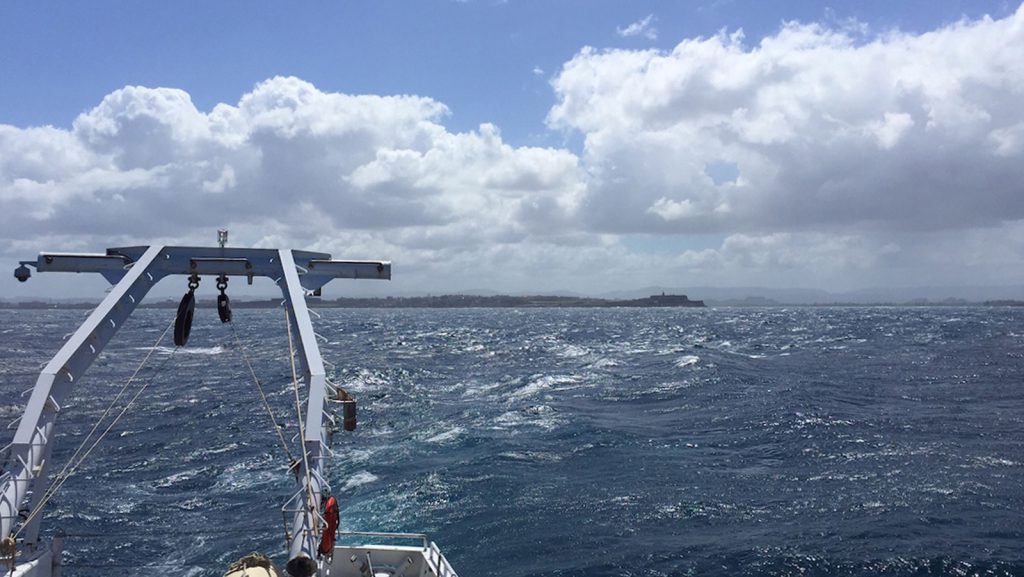
AOML researchers completed a Western Boundary Times Series cruise in February aboard the UNOLS Ship R/V Endeavor. The AOML team was supported by additional crew from the University of Puerto Rico.
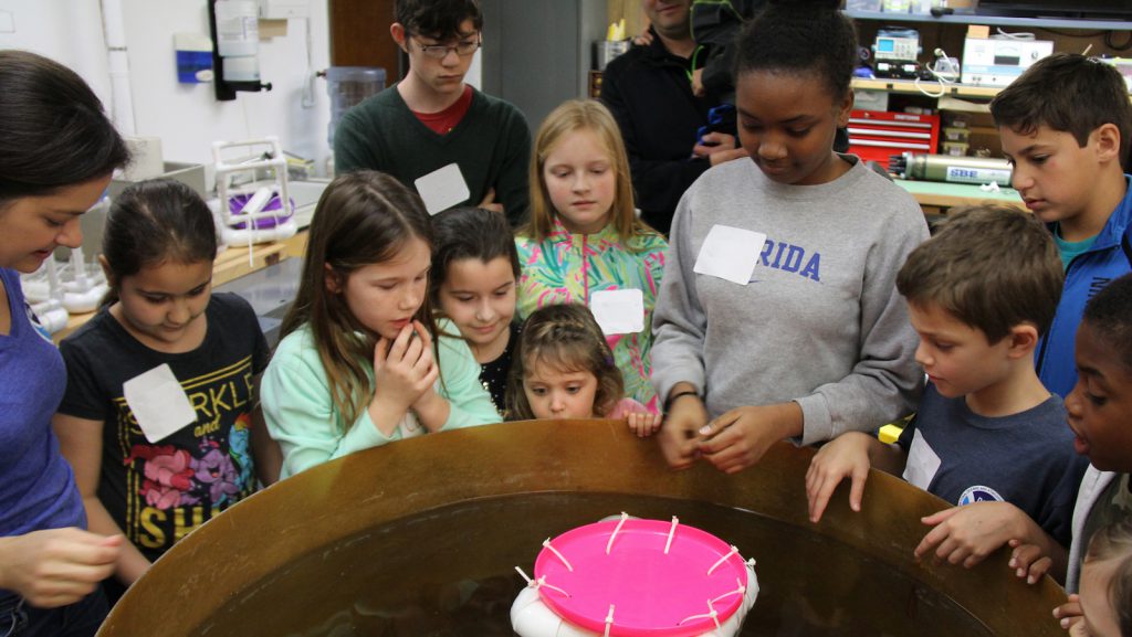
On February 5, 2016, AOML was a proud participant in the annual ‘Take Your Child to Work Day’ tradition. This year’s theme focused on the global ocean observing system, a network of ocean buoys and drifters to which AOML contributes to, that collects vital data on the world’s oceans.
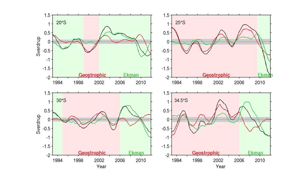
The Meridional Overturning Circulation (MOC) plays a critical role in global and regional heat and freshwater budgets. Recent studies have suggested the possibility of a southern origin of the anomalous MOC and meridional heat transport (MHT) in the Atlantic, through changes in the transport of warm/salty waters from the Indian Ocean into the South Atlantic basin. This possibility clearly manifests the importance of understanding the South Atlantic MOC (SAMOC). Observations in the South Atlantic have been historically sparse both in space and time compared to the North Atlantic. To enhance our understanding of the MOC and MHT variability in the South Atlantic, a new methodology is recently published to estimate the MOC/MHT by combining sea surface height measurements from satellite altimetry and in situ measurements (Dong et al., 2015).
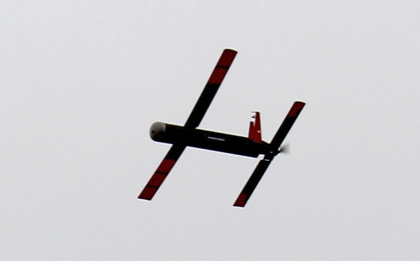
A team from NOAA and Raytheon successfully demonstrated recent advancements of the Coyote Unmanned Aircraft System (UAS) while completing a mid-flight launch from the NOAA P-3 Hurricane Hunter aircraft on January 7th. The successful flight verified new technology designed to improve Coyote’s ability to collect vital weather data to improve hurricane forecasts.
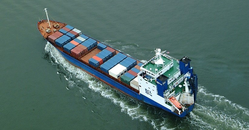
Researchers with the Global Carbon Budget released their annual update for the global carbon budget in December 2015, revealing carbon dioxide (CO2) emissions from fossil fuels increased slightly in 2014 (+0.6%), but are projected to decline slightly (by est. -0.6%) in 2015. The global oceans serve as a natural buffer, offsetting increased emissions by absorbing an estimated 27% of human-produced CO2 from the atmosphere in 2014. Data collected, in part, from long-term surface ocean CO2 monitoring efforts, funded by NOAA’s Climate Program Office and the Ocean Acidification Program, indicate that the oceans removed about 10.7 billion tons of CO2 from the atmosphere in 2015.

On November 16th-18th, AOML physical oceanographers partnered with the University of Puerto Rico to successfully recover two underwater gliders from the Caribbean Sea aboard the M/V La Sultana of the University of Puerto Rico Mayaguez. Over the course of the summer, the gliders successfully transected a region in the eastern Caribbean providing approximately 3000 profile observations of temperature, salinity, oxygen, and surface as well as depth-average current velocities.
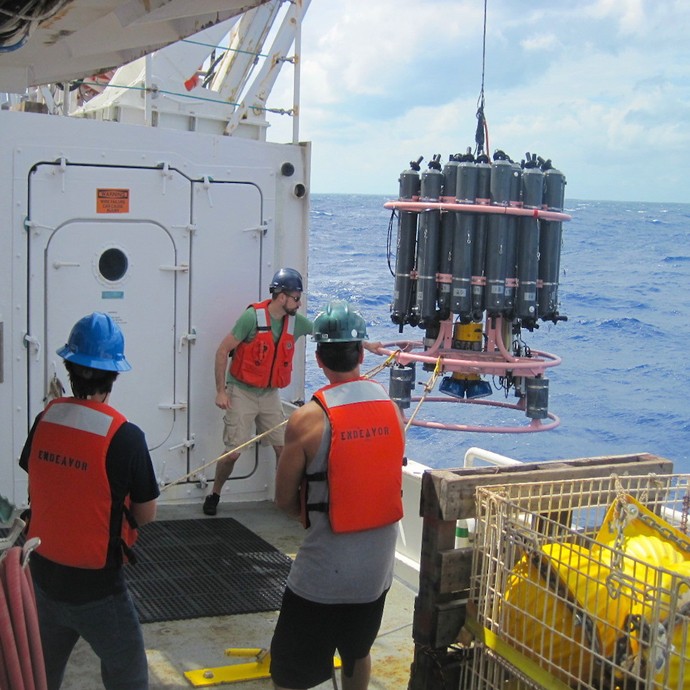
AOML oceanographers are participating in a joint research cruise to study the Meridional Overturning Circulation onboard the R/V Endeavor during October 3-20. The team will sail from Fort Lauderdale, FL to collect roughly 55 full-depth conductivity-temperature-depth (CTD) profiles in the Florida Current and the Deep Western Boundary Current east of the Bahamas. The scientists will also work with their partners from the University of Miami to recover, redeploy, and maintain three tall moorings and nine smaller moored instruments during this cruise in support of the NOAA Western Boundary Time Series project and its partner National Science Foundation project.
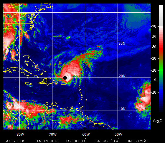
Hurricanes are known to drive the cooling of surface waters as they travel over the ocean, leaving a cooling swath where they pass. The sea surface cooling is mostly caused by mixing forced by the strong winds of the hurricane, which occurs as the mixture of warm surface waters with colder waters that can be as deep as 100 m below the surface.
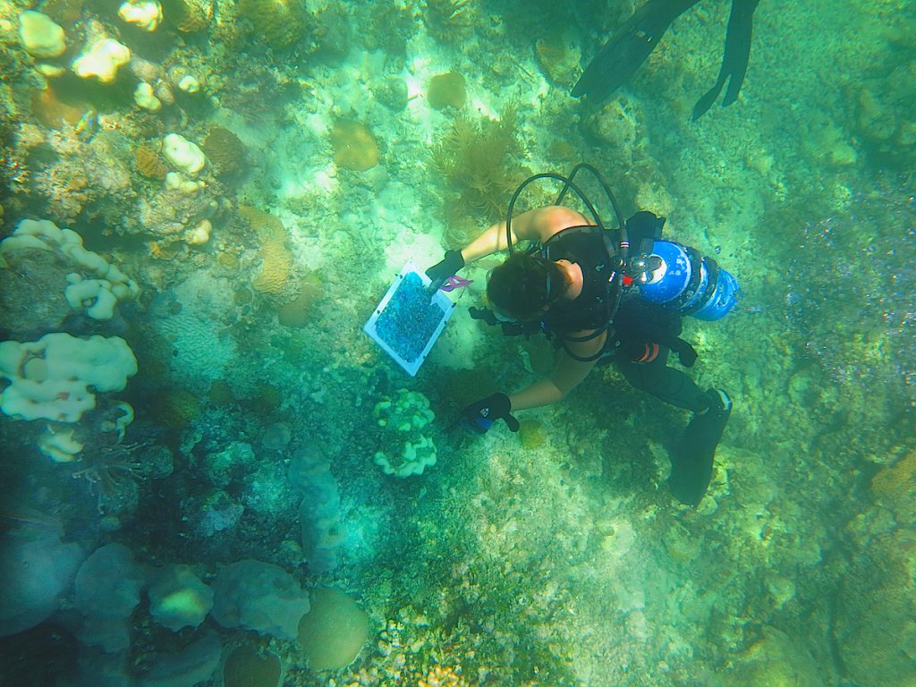
AOML coral researchers conducted a number of reef monitoring activities during the month of October at Cheeca Rocks off of Islamorada, Florida. Among the activities was the installation of new sensors to measure pH and photosynthetic light levels at the on-site MapCO2 buoy. The team also conducted benthic surveys and deployed a pH sensor at an inshore patch reef where they are conducting an experiment to examine the impacts of bleaching across Florida Keys reefs. They were also joined by a colleague from the University of Miami who conducted photo mosaic surveys of the reefs. A photo mosaic is a tool used by researchers to map reefscapes and involves the stitching together of hundreds of photos taken simultaneously across the reef to form one giant image. Photo mosaics provide coral researchers with an important tool to more accurately document community-wide changes in reef health.
On October 15, 2015, the scientists, technicians, and engineers involved in the AOML Western Boundary Time Series (WBTS) project marked a milestone with the completion of the 100th successful dropsonde cruise in the Florida Current since the project’s inception in 2000.
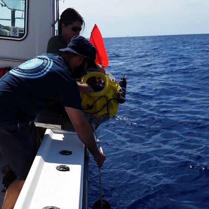
In October, AOML scientists, technicians and engineers involved in the Western Boundary Time Series (WBTS) project completed the 100th successful dropsonde cruise in the Florida Current since the project’s inception in 2000. The dropsonde cruises measure volume transport in the Florida Current using an out-of-service telephone cable between Florida and Grand Bahama Island.
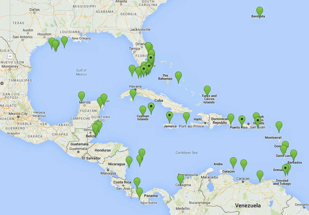
AOML’s Coral Health and Monitoring Program (CHAMP) rolled out a new data source in October as part of its online data query tool. Optimally Interpolated Sea Surface Temperatures, or OISSTs, are data from microwave satellite observation platforms, products that are sourced from Remote Sensing Systems. Whereas other sea surface temperature sources might be missing data due to orbital gaps or non-ideal environmental conditions such as cloud cover or rainfall, the OISST platform corrects for these errors to provide a complete, daily sea surface temperature map that can benefit coral health and monitoring efforts worldwide.
NOAA selected AOML oceanographer Dr. Rik Wanninkhof in October 2015 to become a Senior Technical Scientist, the highest attainable level for federal research scientists within NOAA. Rik is an internationally recognized authority on air-sea gas transfer with close to 25 years of experience studying the effects of atmospheric carbon dioxide on the ocean. Senior Technical Scientist positions are held by individuals who achieve national and/or international distinction in their field through their high-level research.
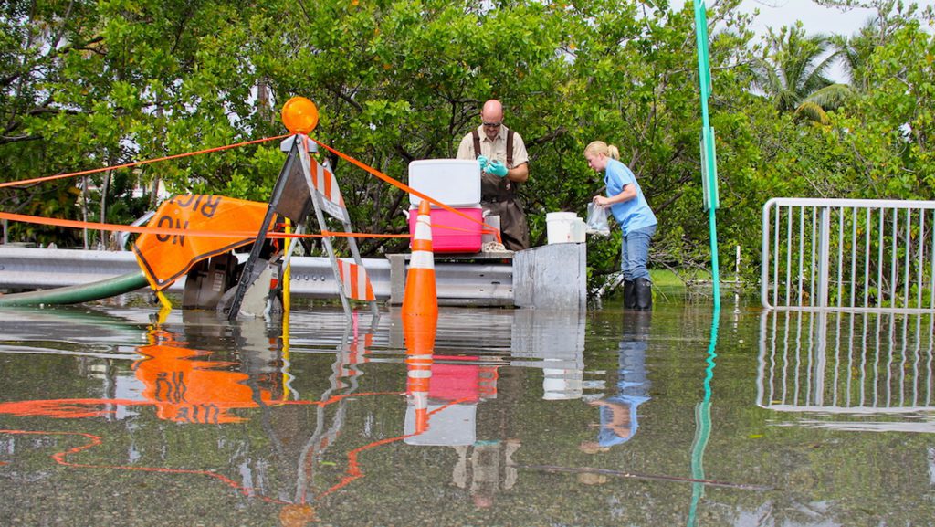
On September 29th, researchers from AOML’s Environmental Microbiology Lab along with scientists from Florida International University’s Southeast Environmental Research Center collected water samples along Miami Beach during a king tide event, the highest astronomical tide of the year. Sample sites were located adjacent to pumps installed by the City of Miami Beach to actively pump super-tidal floodwaters out of the streets and back into Biscayne Bay. AOML’s team continuously monitored and collected water samples over a 5-hour period at locations in Maurice Gibb Memorial Park, along 14th Street, and at 27th Street and Indian Creek Drive. During sampling, physical water properties such as temperature, salinity, pH, turbidity, and dissolved oxygen content were also measured.
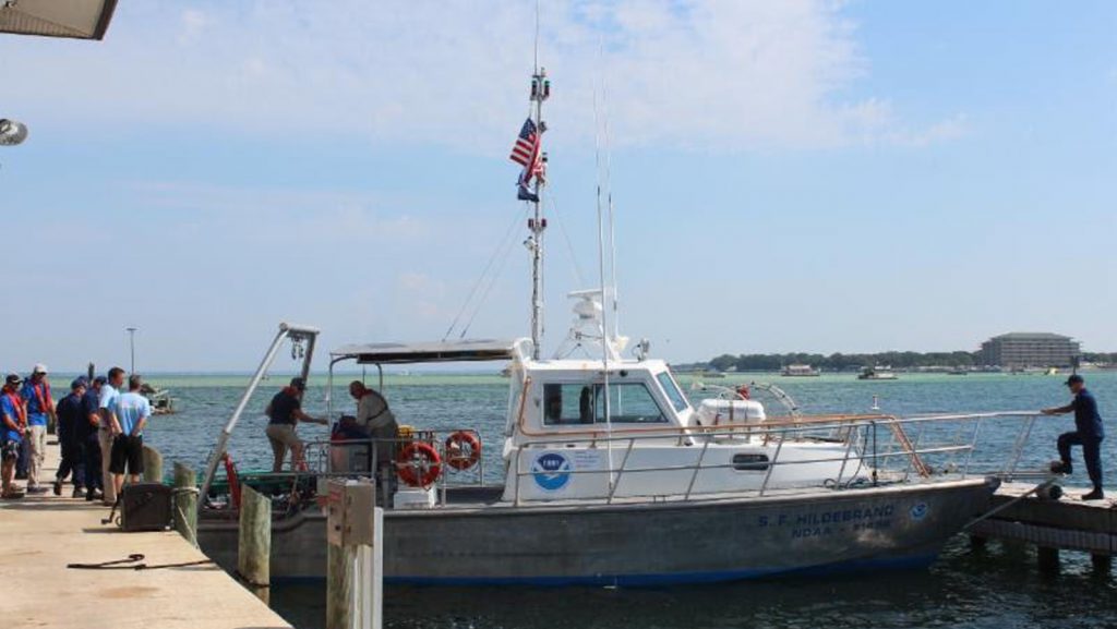
A team of NOAA scientists from the Southeast Fisheries Science Center (SEFSC) and AOML conducted a survey aboard the NOAA research vessel Hildebrand to capture, tag and release leatherback sea turtles in the Gulf of America. The survey, which took place off the coast of the Florida Panhandle, was the first directed research on leatherbacks in Gulf waters. The team of scientists sought to obtain accurate information on these endangered animals in order to answer questions relating to habitat use, migrations, and distribution within the Gulf region. After locating a turtle with help from spotters in NOAA aircraft, each turtle was secured with a net and brought to the vessel to be measured and equipped with a satellite tag, which will collect data on dive patterns and water temperatures in addition to long-term movement. The team successfully tagged a total of six turtles during the survey. The team also assisted in the scheduled release of a female leatherback that had stranded earlier in September off of Fort Walton Beach, FL. The turtle, which had been rehabilitated at the local Gulfarium Marine Adventure Park, was brought aboard the R/V Hildebrand in Destin, FL and successfully released 20 miles offshore.
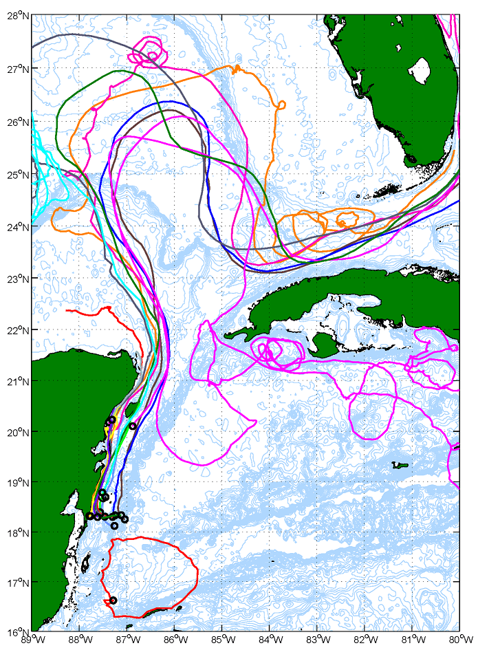
The results of two oceanographic cruises conducted in the Mexican and Belizean shelf waters over the Mesoamerican Barrier Reef during 2006 and 2007 show that the circulation can be divided into two distinct regimes: a northern region dominated by the strong, northward-flowing Yucatan Current, and a southern region with weaker southward coastal currents and the presence of the Honduras Gyre.
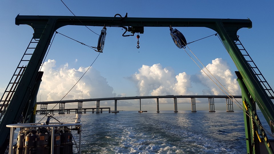
AOML scientists aboard the R/V F.G. Walton Smith conducted the bimonthly water quality research cruise in support of the South Florida Project during the week of September 21st. The AOML South Florida Project (SFP), and its associated field operations, have enabled scientists and resource managers to keep a watchful eye on the sensitive marine habitats found in the region and have served as a sentinel during periods when the ecosystem has been subjected to extreme events such as hurricanes, harmful algal blooms (HAB), and more recently, potential oil spill contaminants. Additionally, the AOML SFP has produced a comprehensive, long-term baseline regarding regional circulation, salinity, water quality, and biology for the ecosystem.
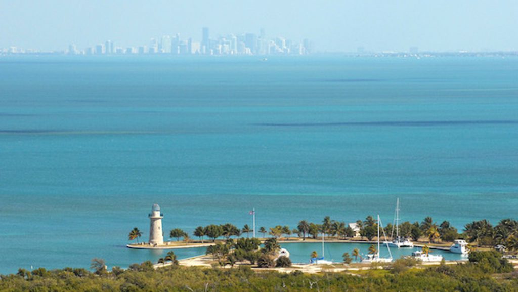
AOML’s ecosystem assessment and modeling group is collaborating with the protected species and biodiversity lab at NOAA’s SEFSC to begin a water quality monitoring survey of South Florida’s Biscayne Bay watershed. Biscayne Bay is a designated Habitat Focus Area under NOAA’s Habitat Blueprint, a program which offers opportunities for NOAA to partner with organizations to address coastal and marine habitat loss and degradation issues. Scientists will collect continuous temperature, salinity, turbidity, dissolved organic matter, and fluorescence measurements, as well as discrete samples for Chlorophyll a, nutrients, and phytoplankton. The surveys will occur quarterly and will examine the sources of potential contaminants from canals and waterways, and the subsequent effects these contaminants will have on the Bay.
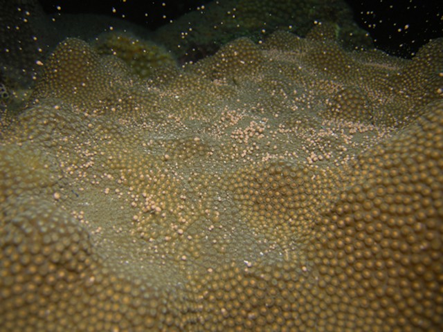
AOML coral scientists participated in a NOAA National Marine Fisheries Service-led project to document coral spawning in the Florida Keys National Marine Sanctuary during August & September 2015. The project aims to measure spawning success for two imperiled Caribbean species, elkhorn coral (Acropora palmata) and mountainous star coral (Orbicella faveolata) in the Florida Keys. The team collected gametes from both species to be used in experiments that aim to improve the understanding of factors that may enhance the likelihood of coral larvae to survive and settle on the ocean floor. Experiments will also assess impacts of current and future global environmental changes, such as ocean acidification, on these vulnerable early life stages of corals. Click on the image below to view a video of a spawning mountainous star colony.
Photo and Video credit: NOAA
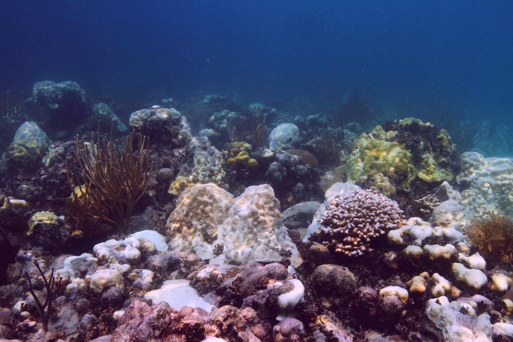
For the third time in recorded history, a massive coral bleaching event is unfolding throughout the world’s oceans, stretching from the Indian Ocean to the Caribbean. Above average sea surface temperatures exacerbated by a strong El Niño could result in the planet losing up to 4,500 square miles of coral this year alone, according to NOAA. The global event is predicted to continue to impact reefs into the spring of 2016.
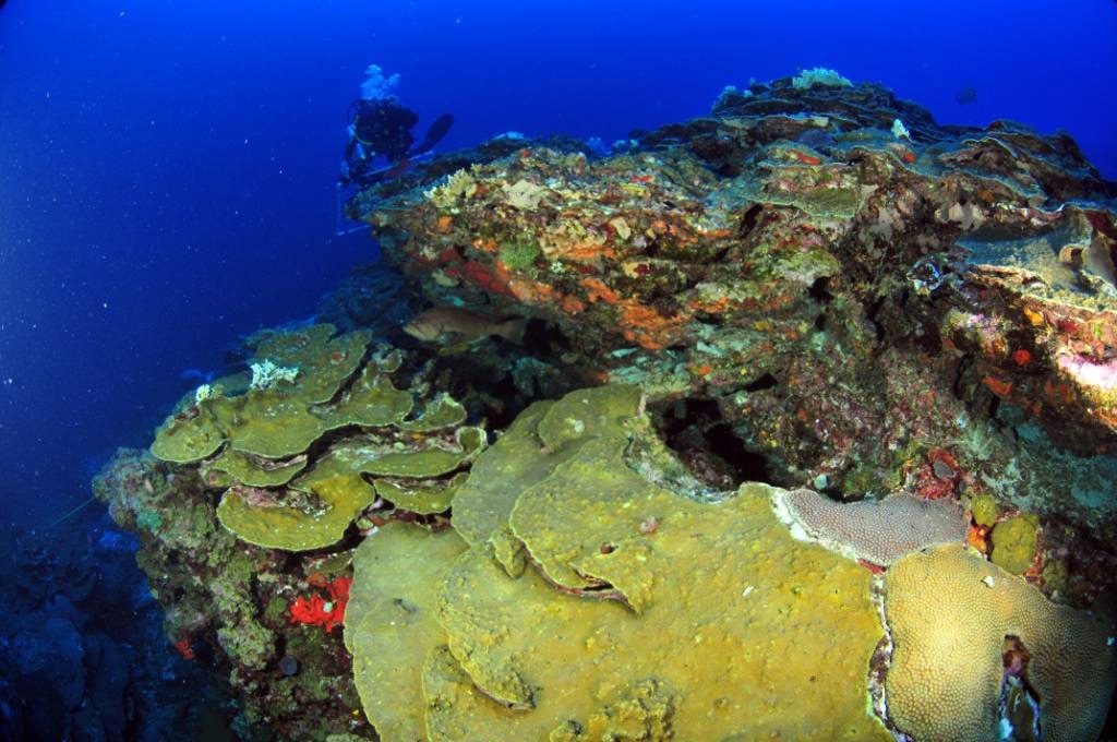
Members of AOML’s Acidification, Climate, and Coral Reef Ecosystems Team (ACCRETE) recently traveled to two remote reef locations to expand the National Coral Reef Monitoring Program’s (NCRMP) network of sentinel climate and ocean acidification monitoring sites. The newly established sites, located in the Flower Garden Banks and the Dry Tortugas, will provide researchers with additional data and insights into the ocean’s changing chemistry and the progression of ocean acidification, as well as the ecological impacts of these variables across the Caribbean basin and the Gulf of America.
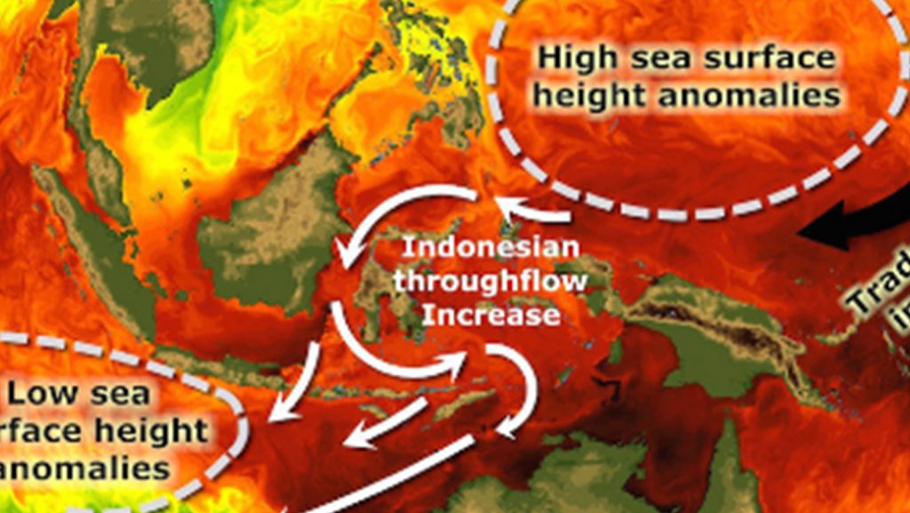
The earth is warming, but atmospheric and oceanic temperatures that rose steadily over the last half century have leveled off and slowed this past decade, causing the appearance of an imbalance in the Earth’s heat budget. Scientists looking to the deep ocean for where the additional heat energy might be stored recently traced a pathway that leads to the Indian Ocean.
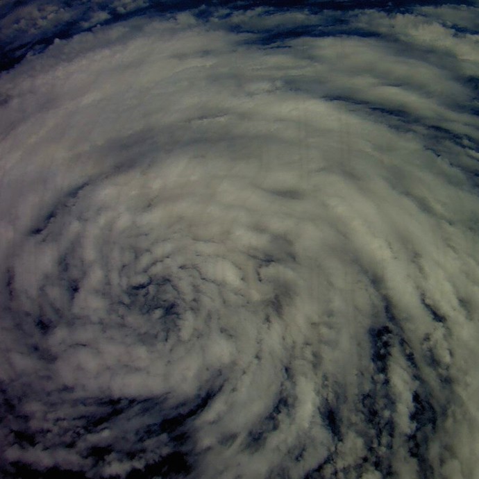
On September 5th, NASA’s Global Hawk took off from Wallops Island, Virginia to fly a 24 hour mission over Tropical Storm Fred. The Global Hawk launched dropsondes to measure the wind structure of the storm and gathered other meteorological data such as temperature and moisture with instruments on board. The Global Hawk is part of NOAA’s Sensing Hazards with Operational Unmanned Technology (SHOUT) field campaign.
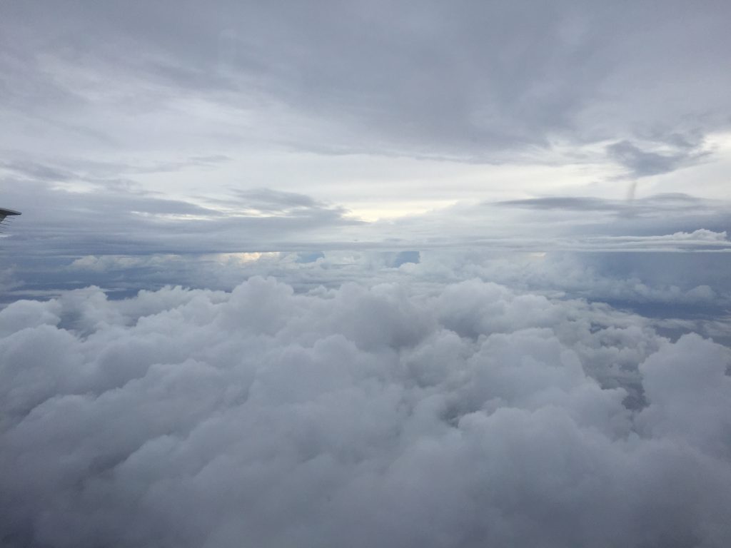
AOML is partnering with Woods Hole Oceanographic Institution in their effort to deploy eight more Air-Launched Autonomous Micro Observer (ALAMO) floats in the path of Tropical Storm Erika. ALAMO profiling floats will be air-deployed through a chute in the belly of a US Air Force C-130 airplane. ALAMOs are a smaller Argo-style floats that will make 11 profile per day of the upper ocean down to 300m. They communicate via satellite and AOML will receive and conduct data processing to upload ocean temperature data onto the Global Telecommunication System so that it can be incorporated into ocean models. The ALAMO floats are manufactured by MRV Systems.
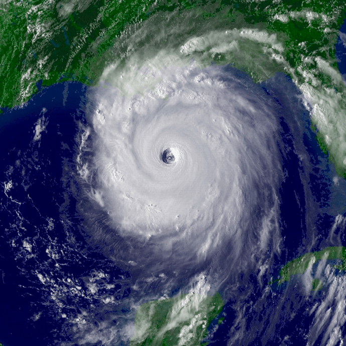
Early on the morning of August 29th, 2005, Hurricane Katrina made landfall on the Louisiana delta region and the Mississippi coast. The storm surge brought enormous damage to the Gulf Coast and, when the levees around New Orleans failed, a great number of fatalities. Coming amidst the very busy 2005 hurricane season, Katrina brought death and destruction not seen in a U.S. land-falling hurricane in decades.
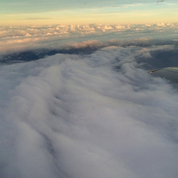
Photos taken from NOAA’s P-3 aircraft during Hurricane Hunter flights conducted on Saturday, August 22nd and Sunday, August 23rd inside Hurricane Danny. Peaking at Category 3 strength on Friday, August 21, Danny had maximum sustained winds of 115 mph as it churned in the Atlantic. Danny then weakened to a tropical depression due to interaction with high levels of wind shear and a mass of dry air in the Caribbean as it moved across the Lesser Antilles. The Hurricane Hunter missions profiled Danny’s wind structure with Tail Doppler Radar, conducted various projects in support of the Hurricane Research Division’s 2015 Field Program, and surveyed the ocean ahead of the storm in order to improve forecasts.
Scientists from NOAA and the Cooperative Institute for Marine and Atmospheric Studies at the University of Miami have documented a dramatic shift from vibrant coral communities to carpets of algae in remote Pacific Ocean waters where an undersea volcano spews carbon dioxide.

With the 2015 Atlantic hurricane season underway, researchers are pointing to the strong presence of El Niño as the major driver suppressing the development of tropical cyclones in the Atlantic basin. But what specific conditions are associated with El Niño that lead to a less than ideal environment for tropical cyclone development? Through research and observation, hurricane researchers know strong environmental wind shear is a major factor affecting potential hurricane development and growth. This hurricane season, AOML researchers are delving further into the relationship between wind shear and tropical cyclones.
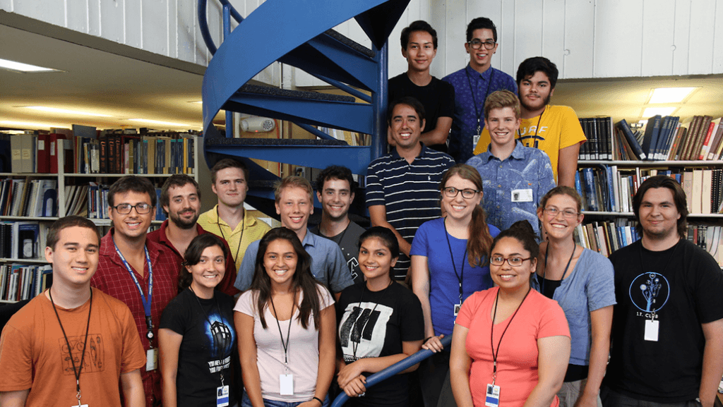
AOML welcomes 22 young men and women, including new and returning high school, undergraduate, and graduate students, who are completing internships at the lab this summer. Over the course of their six to ten week internships, students will work with mentors in the fields of Ocean Chemistry & Ecosystems, Physical Oceanography, and Hurricane Research, as […]
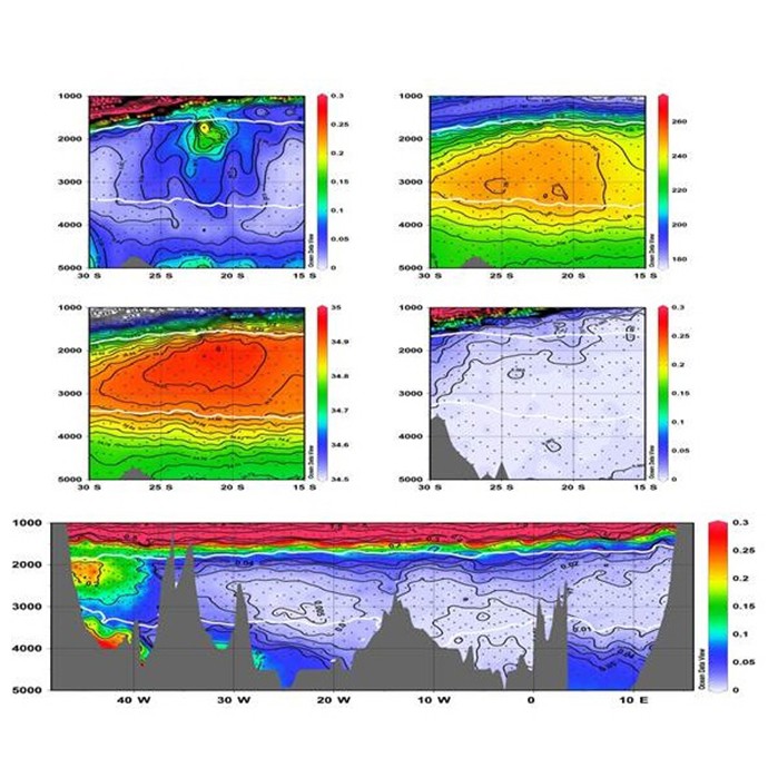
The pathways of recently ventilated North Atlantic Deep Water (NADW) are part of the lower limb of the Atlantic Meridional Overturning Circulation (AMOC). In the South Atlantic these pathways have been the subject of discussion for years, mostly due to the lack of observations. Knowledge of the pathways of the AMOC in the South Atlantic is a first order prerequisite for understanding the fluxes of climatically important properties.
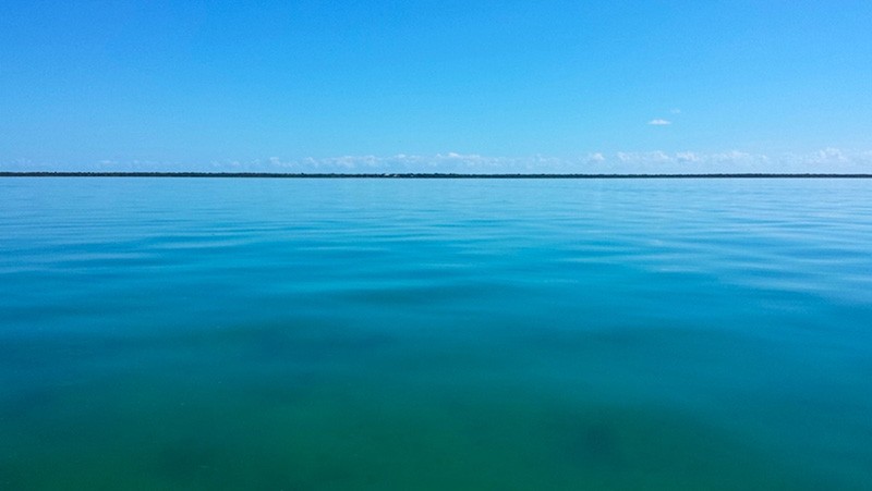
A team of scientists from NOAA’s AOML and Southeast Fisheries Science Center have conducted a series of surveys in Florida Bay this year as part of an ongoing project to investigate how juvenile sport fish in the bay respond to changes in water quality and habitat resulting from Everglades restoration. During the survey, scientists collected water quality and seagrass measurements and conducted otter trawls to sample the juvenile sport fish populations.
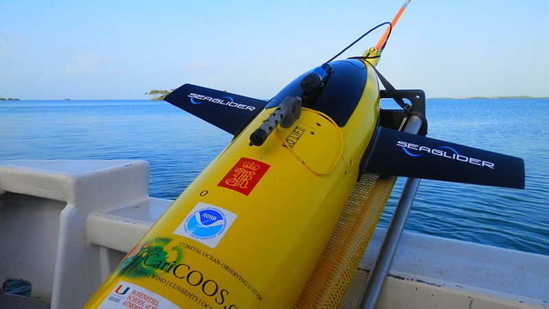
On July 14th, 2015, AOML physical oceanographers deployed one of two sea gliders in the Caribbean from the University of Puerto Rico’s R/V La Sultana. The third deployment will continue the project’s mission to gather important data in the Caribbean and Tropical North Atlantic Ocean to help with hurricane intensity forecasting and provide valuable information about the role the ocean plays in tropical cyclone development. What’s new for this mission? For the first time, the gliders will collect ocean current velocity profiles in addition to the real-time temperature, salinity, and oxygen data. AOML scientists also equipped the glider with an improved battery which will allow the glider to record more profile measurements. The second of the two gliders will be deployed in the Tropical North Atlantic in the upcoming weeks.
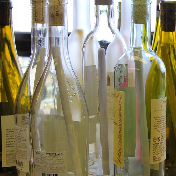
AOML physical oceanographers and interns conducted a hydrographic survey along the 27th north parallel in the Florida Straits aboard the R/V F.G. Walton Smith on July 14-15 as a component of the Western Boundary Time Series project. These 2-day cruises are designed to calibrate daily estimates and quantify Florida Current volume transport and water mass changes.
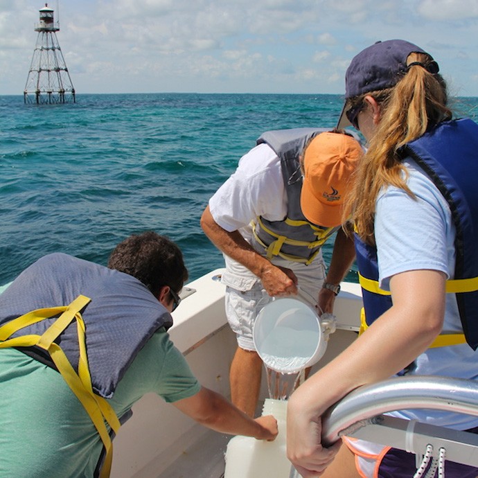
Photos of AOML microbiologists, interns and citizen scientists collecting samples on Ocean Sampling Day at sites in the Florida Keys, Miami, and La Jolla.
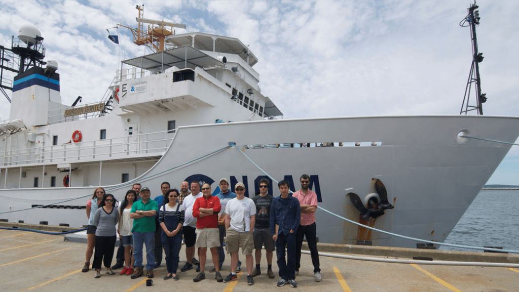
A team of researchers, including scientists from AOML and the University of Miami, set sail June 19th on a research cruise aboard the NOAA ship Gordon Gunter to provide increased understanding of ocean acidification and its drivers along the U.S. East coast. The cruise, which is part of a larger effort supported by NOAA’s Ocean Acidification Program, investigated near-shore and deep waters, and provided researchers with more detailed information about changing ocean chemistry in different environments.
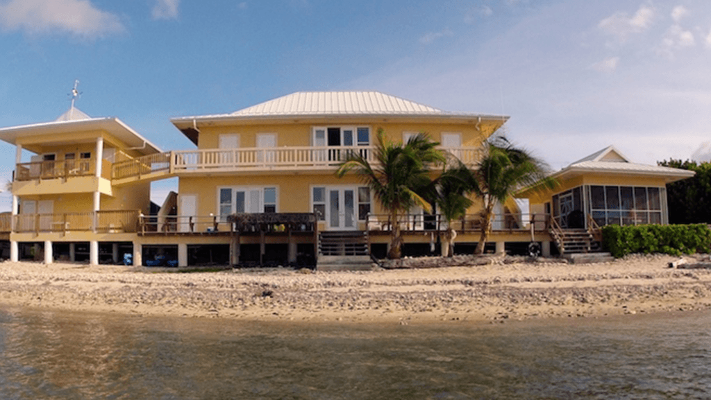
This summer, AOML will be diving into a new outreach initiative with the Central Caribbean Marine Institute, a coral reef research organization based in the Cayman Islands. From June through August, NOAA oceanographers from AOML will give a series of talks on various oceanographic topics to the institute’s staff and students participating in the National Science Foundation’s (NSF) Research Experiences for Undergraduates program at the institute’s Little Cayman Research Centre (LCRC).
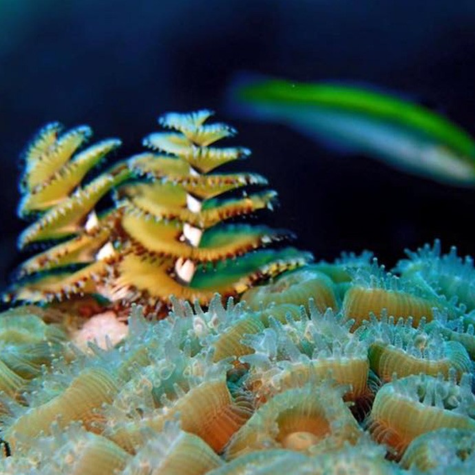
AOML successfully established the final of three sentinel climate and ocean acidification monitoring sites at the Flower Garden Banks National Marine Sanctuary in the Gulf of America this month. Below are a few photos taken by AOML researchers of the biodiversity found on the reefs at the Flower Garden Banks. Photo credit: Lauren Valentino, NOAA
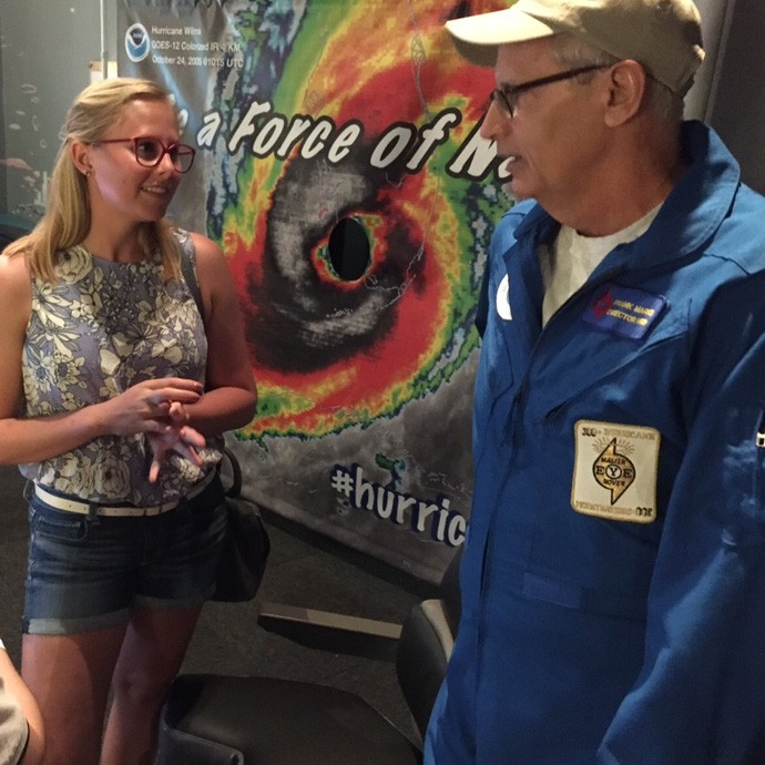
On Saturday, May 30th, personnel from AOML’s Hurricane Research Division along with Outreach & Communications staff participated in the Patricia and Philip Frost Museum of Science’s annual “Feel the Force” event. The one-day outreach event drew over 1000 people who learned about preparing their homes and families to deal with disasters, especially hurricanes. HRD scientists staffed the permanent museum exhibit dedicated to explaining how scientists fly into storms to gather scientific data. In addition to speaking to people about the experience of flying into tropical cyclones, they also took the opportunity to explain the latest innovations in technology being tested this season and how their work will benefit hurricane intensity forecasts. HRD scientists also granted media interviews throughout the day and led a team of children in the Museum’s “Wild and Crazy Weather Challenge”.
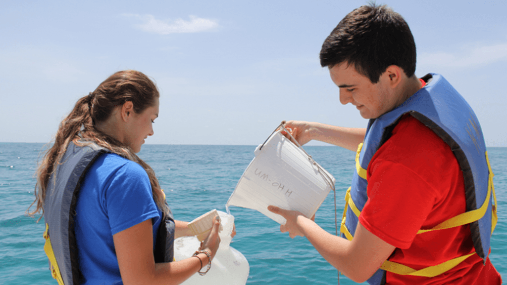
Researchers with AOML’s Environmental Microbiology Lab joined a global effort to sample the smallest members of the ocean ecosystem on June 21 during International Ocean Sampling Day. Organized and led by the European Union’s MicroB3 organization and the Ocean Sampling Day Consortium, Ocean Sampling Day (OSD) is a simultaneous sampling campaign of the world’s oceans and coastal waters. These cumulative samples, related in time, space and environmental parameters, contribute to determine a baseline of global marine biodiversity and functions on the molecular level.
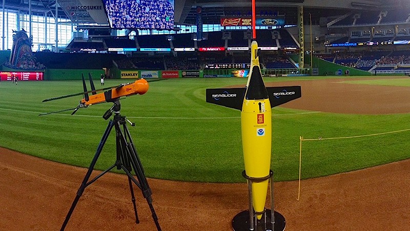
On Thursday, May 21st, AOML hurricane researcher Dr. Eric Uhlhorn participated in the 10th annual Weather Day event at Marlins Park, hosted by local news station CBS4. Thousands of elementary and middle school students from across Miami-Dade, Broward and Palm Beach counties were on hand as part of the fun-filled, science-focused educational field trip at the ballpark. The pre-game program was designed to teach students the basic concepts of weather and climate and how these topics relate to living in South Florida. Dr. Uhlhorn discussed the unmanned technology that NOAA uses to conduct research on hurricanes, including ocean gliders and the Coyote unmanned aircraft system.
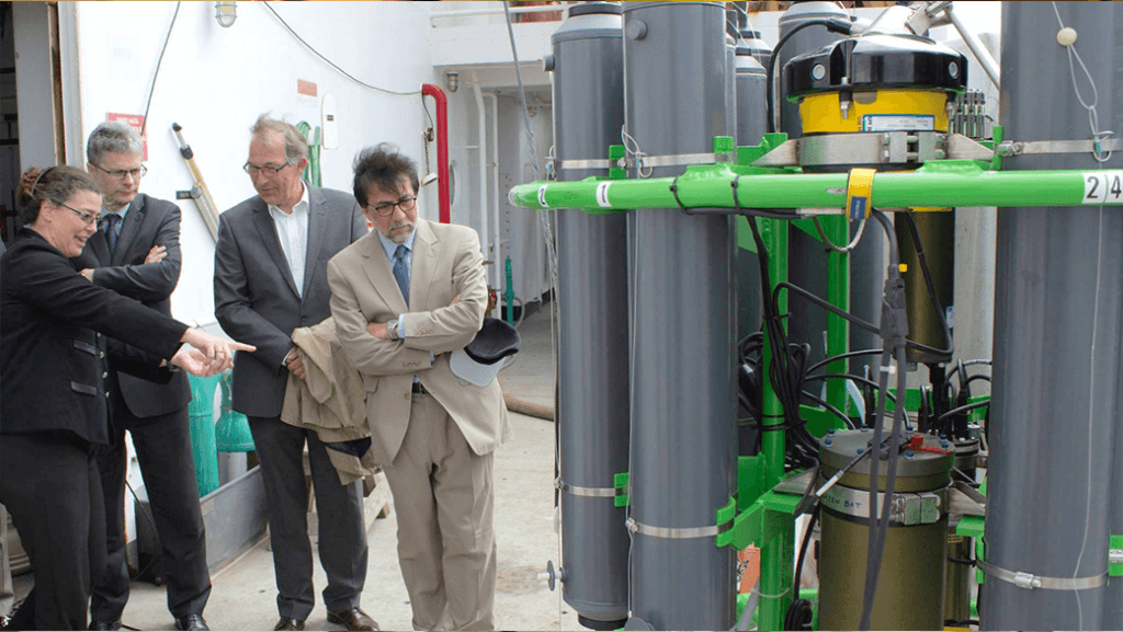
AOML is pleased to announce Dr. Molly Baringer as AOML’s next deputy director. Molly officially began her new position on May 18 after serving in an acting capacity since October, 2014. Molly is a veteran sea-going oceanographer and has led numerous research projects during her 21-year tenure at AOML. Her research portfolio is strongly rooted […]
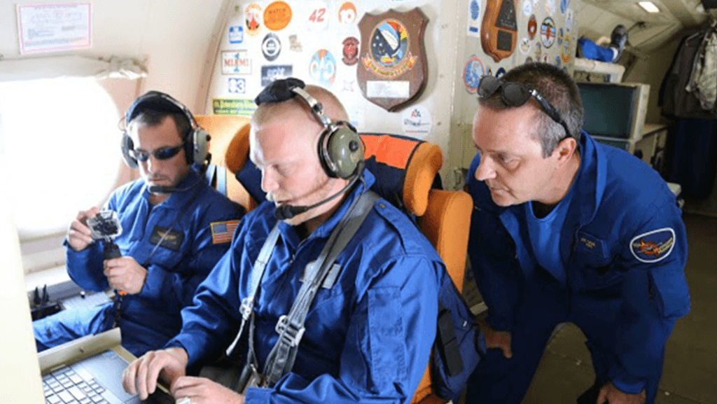
This hurricane season, NOAA’s Office of Oceanic and Atmospheric Research will work with NOAA’s National Weather Service to upgrade weather forecast models and conduct research with unmanned air and water craft to improve forecasts of hurricane track and intensity.A highlight this season is the upgrade of the operational Hurricane Weather Research and Forecast system (HWRF), an advanced hurricane prediction model. This year’s version now has increased the resolution from 3 to 2 kilometers, and will use tail Doppler radar data collected from the NOAA P-3 and G-IV hurricane hunter aircraft to improve the storm representation within the model.
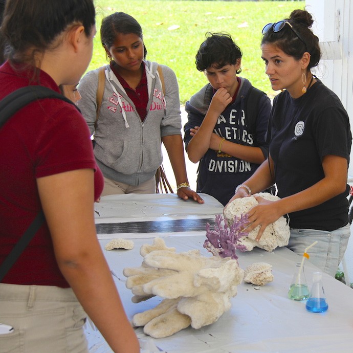
NOAA’s Atlantic Oceanographic and Meteorological Laboratory (AOML) and the National Marine Fisheries Service/Southeast Fisheries Science Center (SEFSC) partnered with the University of Miami Rosenstiel School for Marine and Atmospheric Science to host an open house May 14th-16th. The three day event brought over 1300 people to Virginia Key to learn about a variety of scientific topics including hurricane research, climate science, oceanography, local fisheries, coral communities, and endangered species. NOAA and UM scientists were on-hand to describe their research projects and answer questions and visitors got to participate in a number of hands-on demonstrations at AOML, SEFSC, the University of Miami, and the Maritime and Science Technology (MAST) Academy Land SHARC and Weather on Wheels mobile outreach programs.
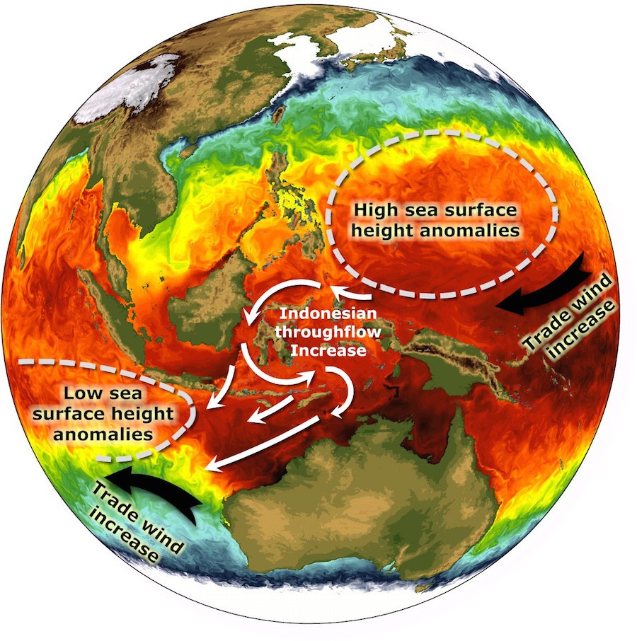
The earth is warming, but temperatures in the atmosphere and at the sea surface that steadily rose in the last half-century have leveled off and slowed in the past decade, causing the appearance of an imbalance in Earth’s heat budget. Scientists are looking into the deep ocean to determine where this additional heat energy could be stored, and recently traced a pathway that leads to the Indian Ocean.
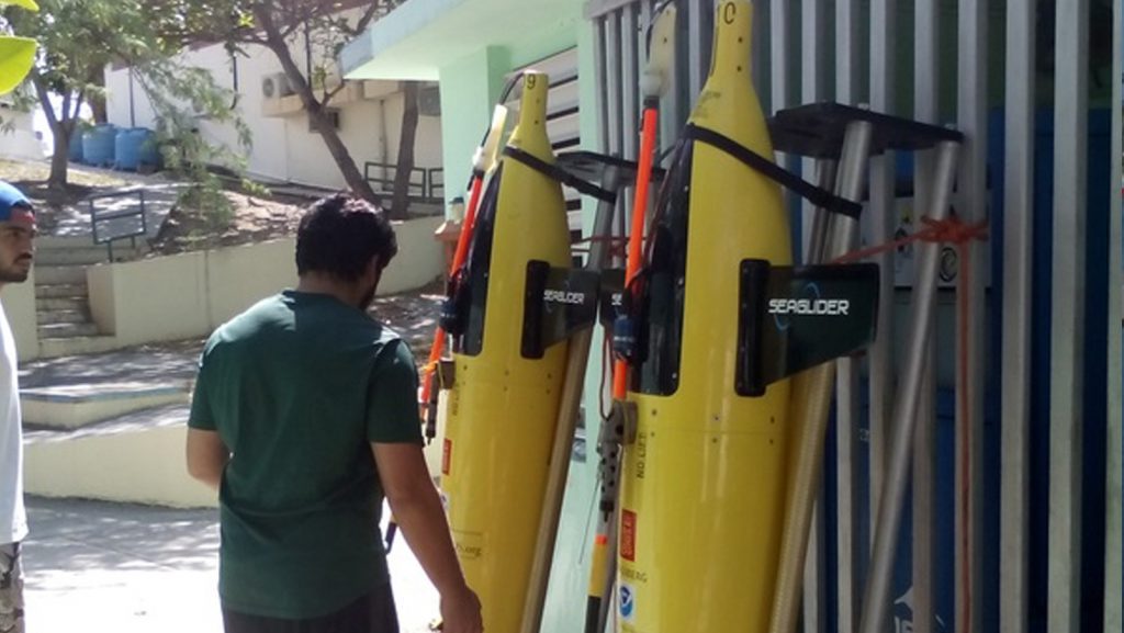
On April 27th, AOML physical oceanographers partnered with the University of Puerto Rico to successfully recover two underwater gliders from the Caribbean Sea aboard the R/V La Sultana of the University of Puerto Rico Mayaguez. The gliders successfully transected a region in the eastern Caribbean providing approximately 3000 profile observations of temperature, salinity, oxygen, and surface as well as depth-average current velocities.
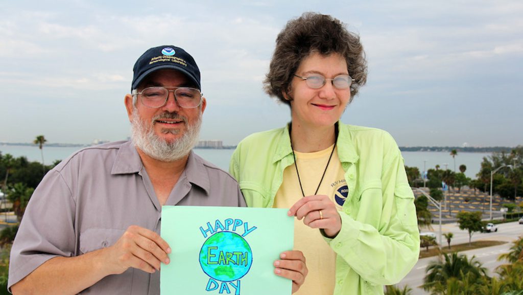
Photos of AOML personnel celebrating Earth Day 2015 on land and at sea!
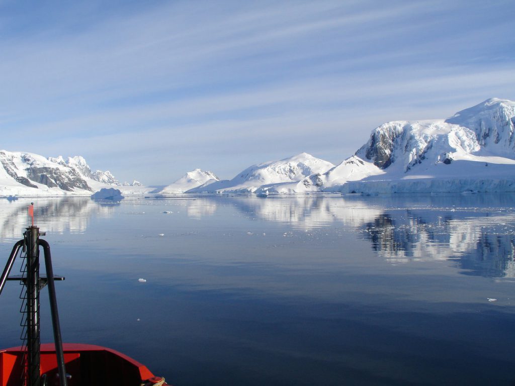
A research vessel ploughs through the waves, braving the strong westerly winds of the Roaring Forties in the Southern Ocean in order to measure levels of dissolved carbon dioxide in the surface of the ocean. (Nicolas Metzl, LOCEAN/IPSL Laboratory).
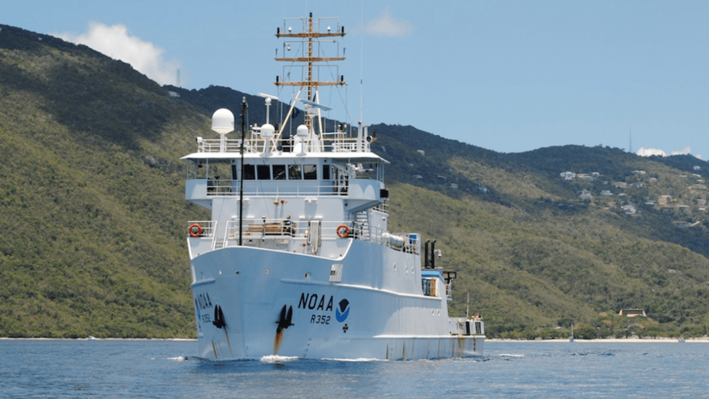
AOML is partnering with NOAA’s Southeast Fisheries Science Center (SEFSC) to conduct an interdisciplinary research cruise aboard the NOAA Ship Nancy Foster from April 11, 2015 through June 3, 2015. The cruise will begin in the U.S. Virgin Islands and extend westward across the northern Caribbean conducting various biological and physical oceanographic surveys.
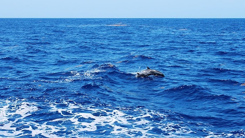
AOML partnered with NOAA’s Southeast Fisheries Science Center (SEFSC) to conduct an interdisciplinary research cruise aboard the NOAA Ship Nancy Foster from April 11, 2015 through June 3, 2015. The cruise began in the U.S. Virgin Islands and extended westward across the northern Caribbean to Mexico. Researchers from various institutions conducted a myriad of biological and physical oceanographic surveys during the three month cruise.
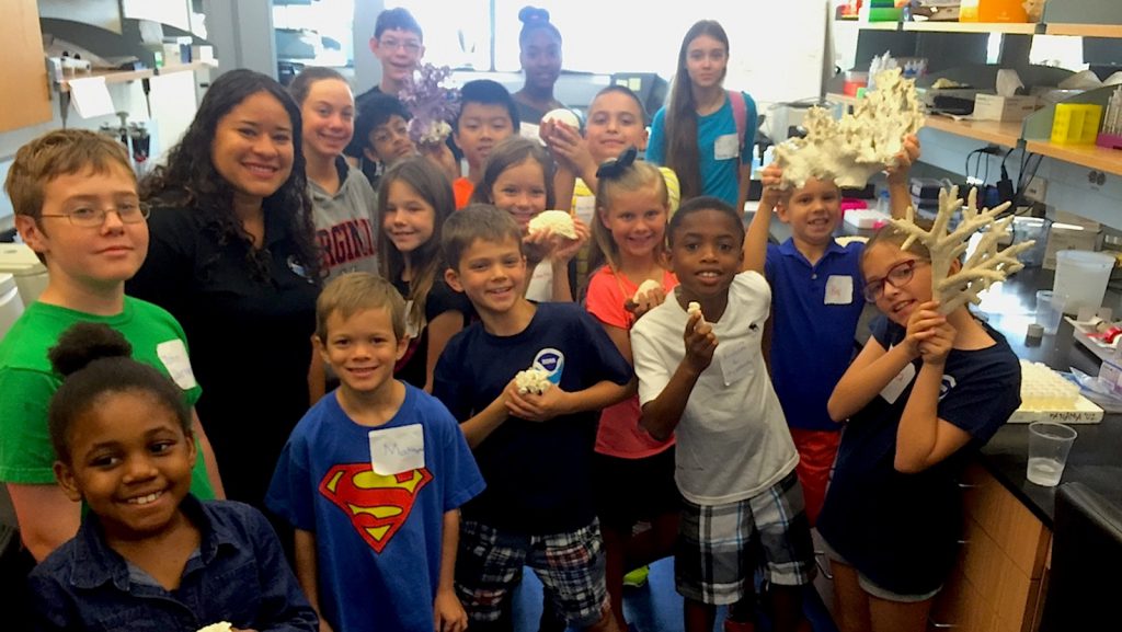
On April 10, 2015, AOML personnel participated in the annual ‘Take Your Child to Work Day’ tradition. Parents and students shared a day full of science which included a tour of the UM Rosenstiel School’s new Marine Technology & Life Sciences Seawater Complex. At the MTLSSC, participants observed the SUSTAIN wave tank in action, interacted with the resident aplysia, and toured a coral nursery. Thanks to all the AOML staff and young scientists who joined us this year!
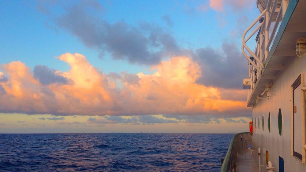
AOML physical oceanographers conducted a hydrographic survey along the 27th north parallel in the Florida Straits aboard the R/V F.G. Walton Smith on April 9-10, 2015. The cruise was conducted as part of the ongoing Western Boundary Time Series project, which is designed to quantify Florida Current volume transport and water mass changes. Scientists measured full water column values of salinity, temperature, and oxygen using CTD equipment. This survey and others help to calibrate daily estimates of the Florida Current volume transport.
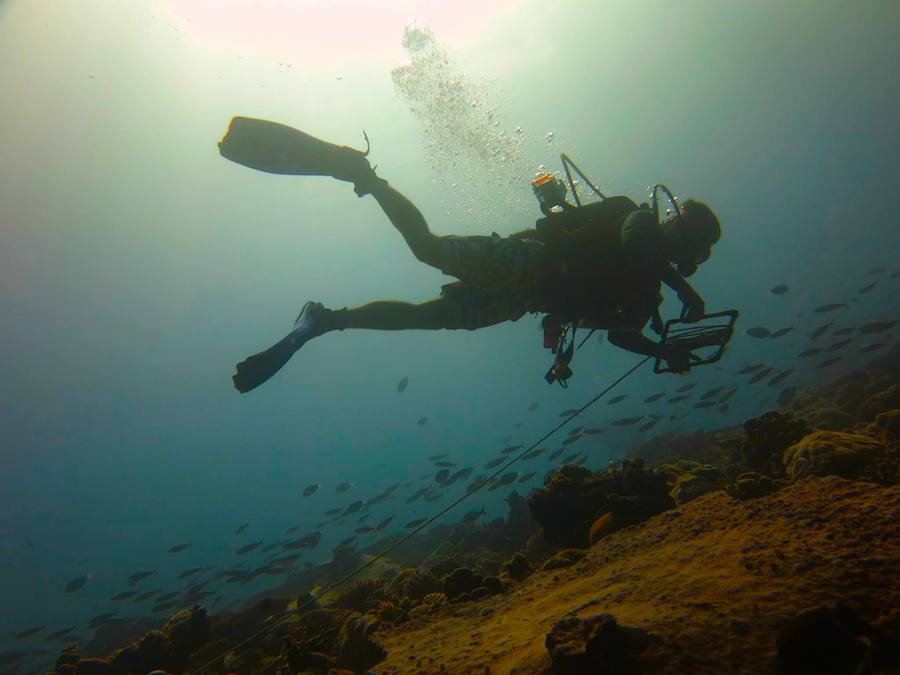
During the months of March & April, AOML researchers participated in the Khaled bin Sultan Living Oceans Foundation’s Global Reef Expedition cruise which took place in the waters of the British Indian Ocean Territory. Some of the areas explored included the Maldives and the Chagos archipelago, home to the world’s largest Marine Protected Area. Aboard the R/V Golden Shadow and working under the theme “Science Without Borders,” the Global Reef Expedition team researches remote coral reef locations around the globe documenting their health to better understand which factors are crucial to reef resilience. AOML has participated in 12 Global Reef Expedition cruises since June 2012.
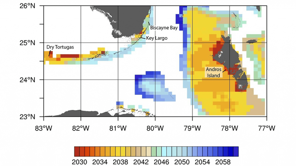
In a new study published April 1 in Global Change Biology, NOAA oceanographers and colleagues have developed a new method to produce high-resolution projections of the range and onset of severe annual coral bleaching for reefs in the Gulf of America and Caribbean
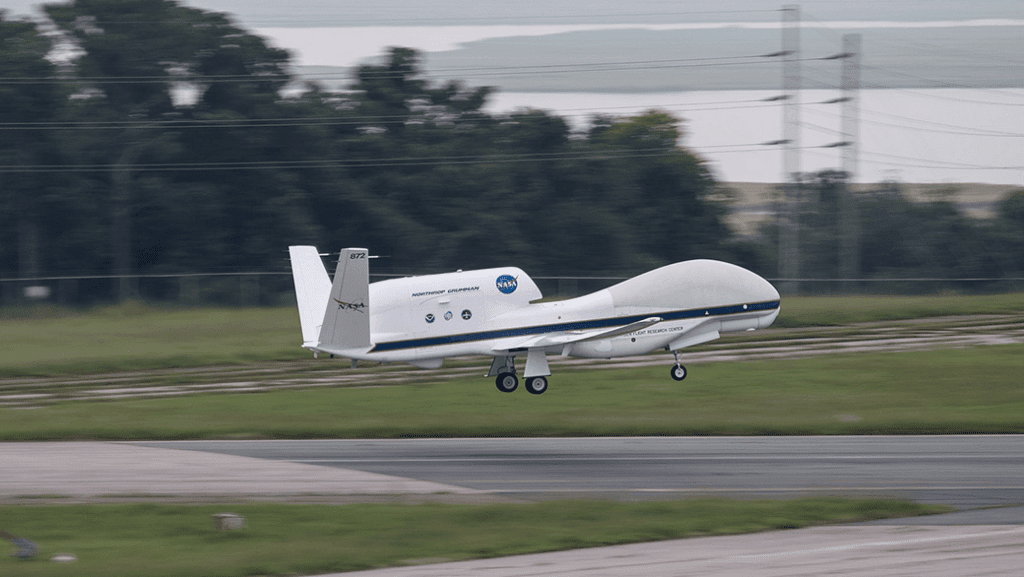
AOML’s hurricane researchers conducted a number of field activities in August that provided data and critical insights into two Atlantic tropical cyclones, Danny and Erika. The two storms enabled researchers to test new instruments in support of the 2015 Hurricane Field Program and conduct research that will benefit future forecasts. Among the highlights were more than 15 successful manned and unmanned aircraft missions into Danny and Erika to collect and provide real-time data to the National Hurricane Center (NHC), as well as evaluate forecast models.
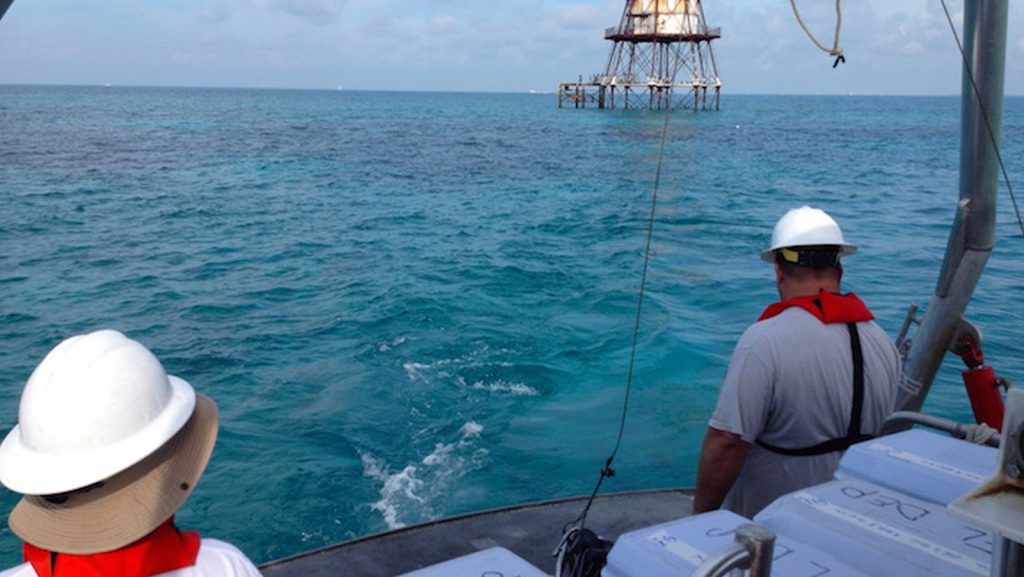
AOML scientists conducted a Numeric Nutrient Criteria Study cruise Wednesday and Thursday, March 18-19th in Biscayne Bay off of Broward and Miami-Dade Counties aboard the NOAA R/V Hildebrand. The study provides concurrent water column and coral reef status data for four coral assemblies off of Miami-Dade and Broward County. These results will be employed by the Florida Department of Environmental Protection to determine numeric nutrient criteria for the coastal waters of Southeast Florida.
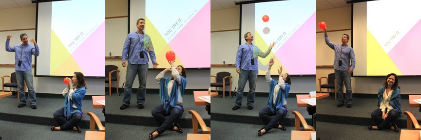
Jana Goldman, a science communicator and plain language trainer, traveled to Miami on Wednesday, March 11, 2015 to engage AOML employees in a workshop on how to communicate science effectively to non-science audiences. While participating in the science communications exercises, AOML staff learned a myriad of successful plain language techniques as well as effective methods to develop clear scientific messages.
Women’s History Month is celebrated annually in March and pays tribute to the generations of women whose contributions made a historical impact on society. It is also a month to honor women who are currently working hard to make positive innovations and impressions on the world.
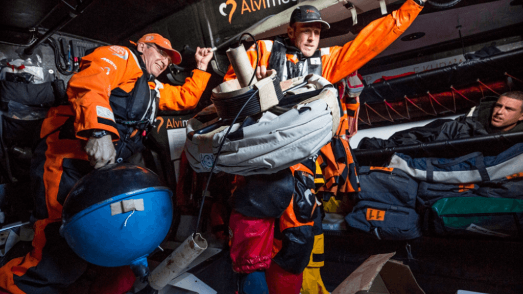
If you’ve ever sailed aboard a ship in the coastal ocean, or checked a weather report before going to the beach, then you are one of many millions of people who benefit from ocean observations. NOAA collects ocean observations and weather data to provide mariners with accurate forecasts of seas, as well as coastal forecasts and even regional climate predictions. It takes a lot of effort to maintain observations in all of the ocean basins to support these forecasts, and NOAA certainly can’t do it alone. Partnerships are essential to maintaining a network of free-floating buoys, known as drifters, and NOAA’s latest partner is not your typical research or ocean transportation vessel: the six sailboats and crew currently racing around the world in the Volvo Ocean Race.
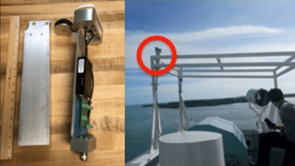
Scientists and engineers from NOAA have successfully designed, built, and tested a new antenna system that dramatically increases data transmission reliability while drastically reducing operating costs. The new Iridium-based transmission system, developed by NOAA’s Atlantic Oceanographic & Meteorological Laboratory (AOML) & the Cooperative Institute for Marine & Atmospheric Studies (CIMAS), has no restrictions on data format or size, allowing data from various ocean and land-based observation platforms to be transmitted more reliably and at a fraction of the cost of the older Inmarsat-C platform. Since completion, the Iridium system has been adopted on a number of Expendable Bathythermographs (XBTs) observation transects and have been simultaneously tested and implemented in other AOML observing systems.
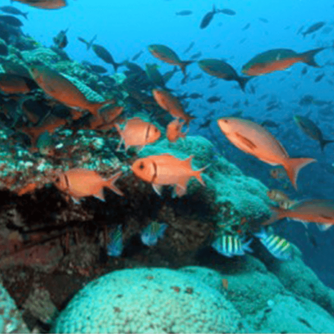
Scientists in the Gulf of America now have a better understanding of how naturally-occurring climate cycles–as well as human activities–can trigger widespread ecosystem changes that ripple through the Gulf food web and the communities dependent on it, thanks to a new study published Saturday in the journal Global Change Biology.
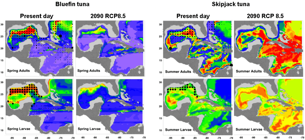
A collaboration paper between SEFSC and AOML/PhOD scientists Potential impact of climate change on the intra-Americas sea: Part 2. Implications for Atlantic bluefin tuna and skipjack was selected as a NOAA research highlight.
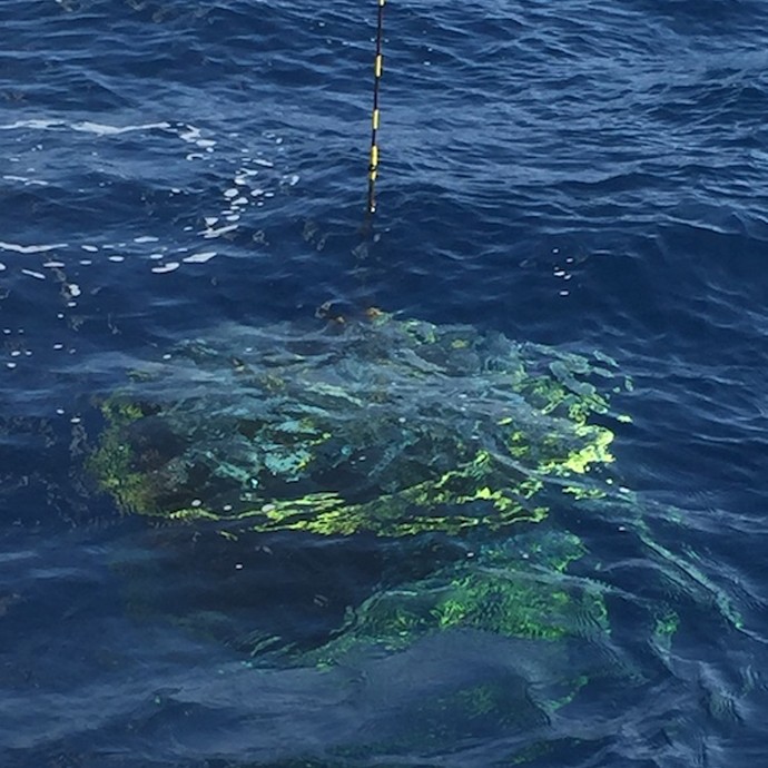
AOML physical oceanographers Molly Baringer, Ulises Rivero, Pedro Pena, Andrew Stefanick, Grant Rawson, Jay Hooper and Francis Bringas conducted a Western Boundary Times Series cruise aboard the UNOLS R/V Endeavor on February 15, 2015. Molly Baringer, AOML Deputy Director, served as chief scientist and was supported by additional crew from the University of Puerto Rico. Scientists measured full water column values of salinity, temperature, and oxygen. Scientists also telemetered data from a series of moorings along the 26th north parallel for a joint NOAA and National Science Foundation program designed to monitor the Atlantic meridional overturning circulation current. Francis Bringas also conducted a fall rate experiment that consisted of deploying 200 XBTs from different launch heights.
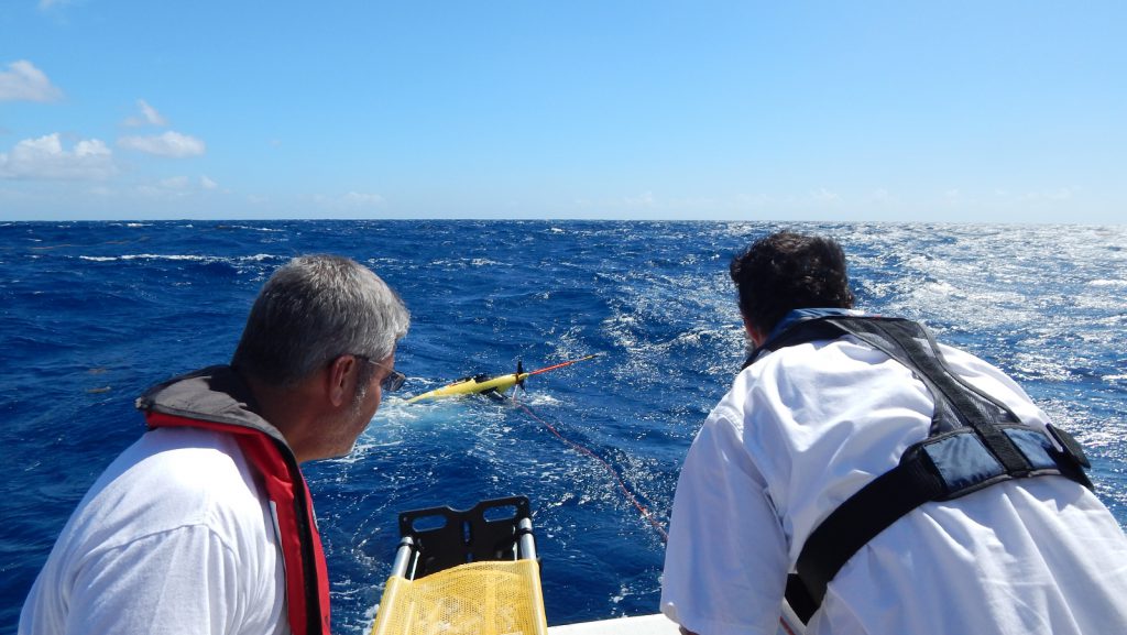
On February 6, 2015, AOML physical oceanographers deployed two underwater sea gliders from the University of Puerto Rico’s R/V La Sultana in hopes of improving prediction of hurricane intensity. This is the second deployment trial after two gliders had a successful first mission at sea from July-November 2014. The main goal of this project is to deploy a pilot network of underwater gliders in the Caribbean Sea and Tropical North Atlantic Ocean to help with hurricane intensity forecasting and provide valuable information about the role the ocean plays in tropical cyclone development.
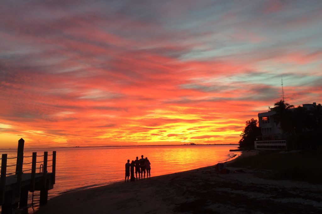
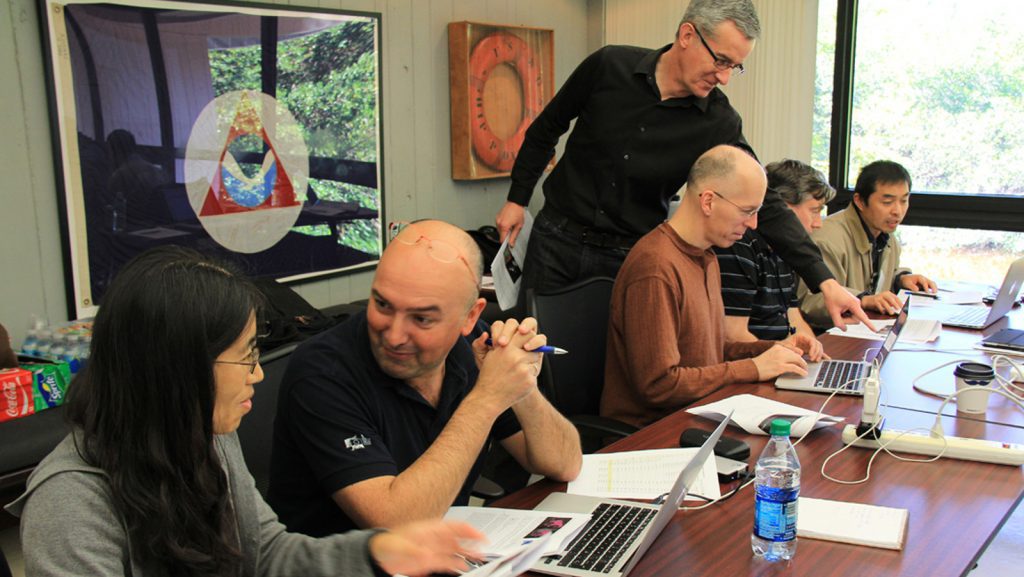
Scientists from University of Wisconsin-Madison Space Science and Engineering Center (SSEC) and the Cooperative Institute for Meteorological Satellite Studies visited AOML to provide training on how to use direct broadcast polar-orbiting satellite data for the enhancement of environmental forecasting and decision making. The course focused on the use of data from the new AOML antenna, including SuomiNPP and Aqua/Terra instrument observations and products.
AOML is proud to announce the selection of Dr. James “Jim” Hendee as the director of its Ocean Chemistry and Ecosystems Division. Internationally recognized for his expertise in coral observing systems and data management, Jim’s almost 25-year tenure with AOML began in 1990 as a data manager for several ocean chemistry programs. Jim is well known for his ability to leverage resources to innovatively develop and inspire productive research teams. Jim steps into the role of director after serving in an acting capacity since June 2013.
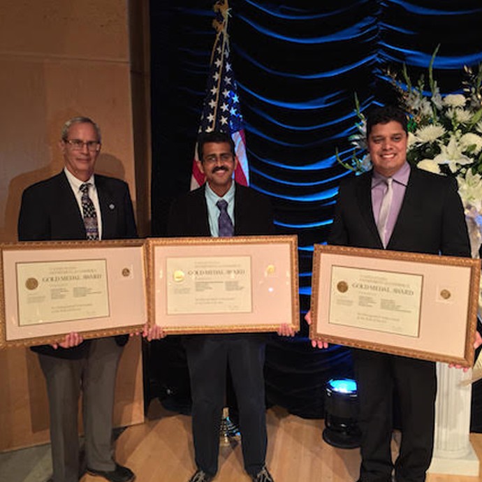
Congratulations to the Hurricane Research Division and the Hurricane Weather Research & Forecast System modeling team for receiving DOC Gold Medal and aiding in the advancement of hurricane intensity prediction.

Dr. Robert Atlas was a guest at the swearing-in ceremony for U.S. Representatives Wasserman Schultz, Frederica Wilson, and Lois Frankel at the Fort Lauderdale Federal Courthouse on January 23, 2015. Pictured at left (L to R) are Congresswoman Lois Frankel, Judge Beth Bloom Congresswoman Wasserman Schultz, Dr. Fred Lippman, and Congresswoman Wilson. Pictured at right are Dr. Robert Atlas and Congresswoman Debbie Wasserman Schultz.
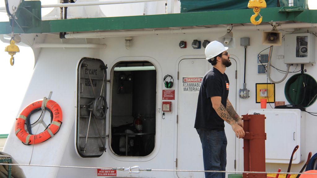
PhOD personnel Ryan Smith, Grant Rawson, and Jay Hooper conducted a hydrographic survey along 27N in the Florida Straits aboard the R/V F.G. Walton Smith on January 12-13, 2015. The cruise was part of the Western Boundary Time Series project, which is designed to quantify Florida Current volume transport and water mass changes. This survey and others help to calibrate daily estimates of the Florida Current volume transport derived from a submarine telephone cable deployed across the Straits. Divers also exchanged a project pressure gauge on the west side of the 27N section.
A study of Galápagos’ coral reefs provides evidence that reefs exposed to lower pH and higher nutrient levels may be the most affected and least resilient to changes in climate and ocean chemistry.
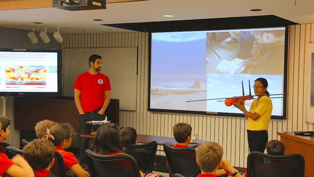
NOAA’s Atlantic Oceanographic and Meteorological Laboratory (AOML) and the National Marine Fisheries Service/Southeast Fisheries Science Center (SEFSC) partnered with the University of Miami Rosenstiel School for Marine and Atmospheric Science and the Maritime and Science Technology (MAST) Academy to host an open house May 14th-16th.

Shannon Jones, Austin Flinn, and Chloe Fleming celebrated their graduation from the University of Miami’s Rosenstiel School of Marine and Atmospheric Science. All three worked with NOAA in south Florida as part of their graduate research. Austin Flinn also received funding for his degree from NOAA’s Environmental Partnership Program (EPP). Congratulations to all graduates!
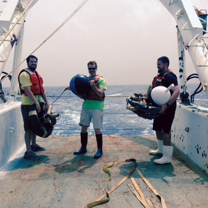
On December 28, 2014 scientists with the PIRATA Northeast Extension cruise deployed drifters, collected CTD casts and deployed/recovered moorings. Aboard the UNOLS R/V Endeavor, the PNE project is a joint AOML and PMEL effort to expand the PIRATA array of tropical Atlantic ATLAS moorings into the northern and northeastern sectors of the Tropical Atlantic Ocean.
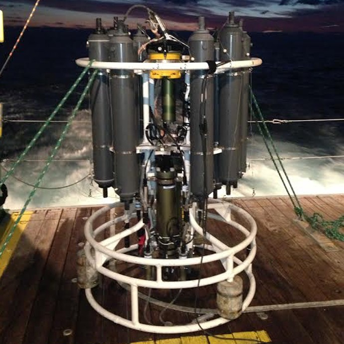
Ryan Smith, Robert Roddy, and Jay Hooper conducted a hydrographic survey along 27N in the Florida Straits aboard the R/V F.G. Walton Smith December 11-12, 2014. The cruise was performed as part of the Western Boundary Time Series project, which conducts regular surveys such as this to quantify Florida Current volume transport and water mass changes in the Straits of Florida. This survey and others also help to calibrate daily estimates of the Florida Current volume transport derived from a submarine telephone cable deployed across the Straits.
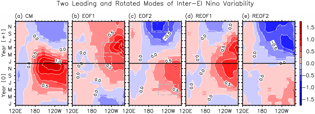
From its onset to the decay, El Niño-Southern Oscillation (ENSO) plays an important role in forcing climate variability around the globe. A new study led by Sang-Ki Lee, a PhOD/CIMAS scientist, provides an efficient approach to explore the differences in the evolution of space-time patterns of sea surface temperature observed during El Niño events
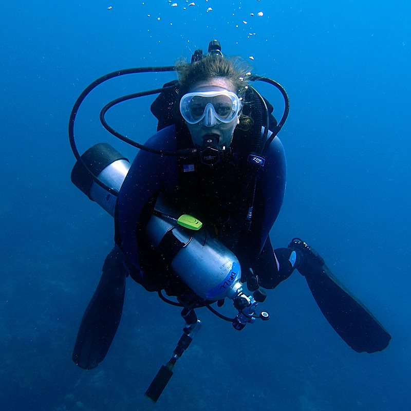
AOML coral scientists Renee Carlton participated in the Living Oceans Foundation Global Reef Expedition to the Solomon Islands from October 27, 2014 through November 25, 2014. Carlton collected seawater carbon dioxide data and coral cores for calcification analysis as part of the ongoing collaboration between the Living Oceans Foundation and AOML to obtain baseline ocean acidification-related data from remote coral reef locations across the Pacific Ocean.
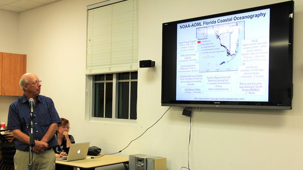
On November 12, 2014, Dr. Thomas Carsey presented results from investigations his team has conducted in the waters off of Miami-Dade, Broward and Palm Beach Counties for the Key Biscayne’s Citizen Science Project.
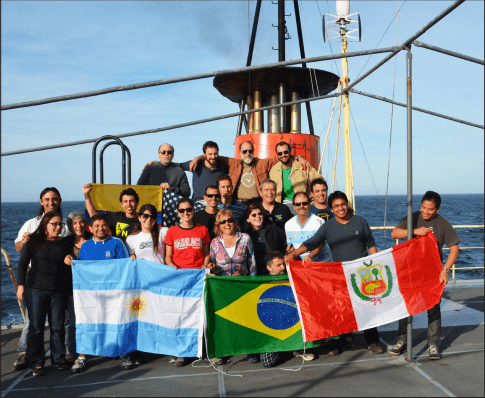
If you want to understand Earth’s climate and how it changes from year-to-year and decade-to-decade, look to the oceans, and follow the heat. The major driver in the redistribution of heat around the globe in the ocean-climate system is Meridional Overturning Circulation, or MOC. The MOC is a vertical circulation pattern that exchanges surface and deep waters via poleward movement of surface waters. As an example, the well known Gulf Stream on the eastern seaboard of North America carries warm water northward to the Greenland and Norwegian Seas, where it cools and sinks.
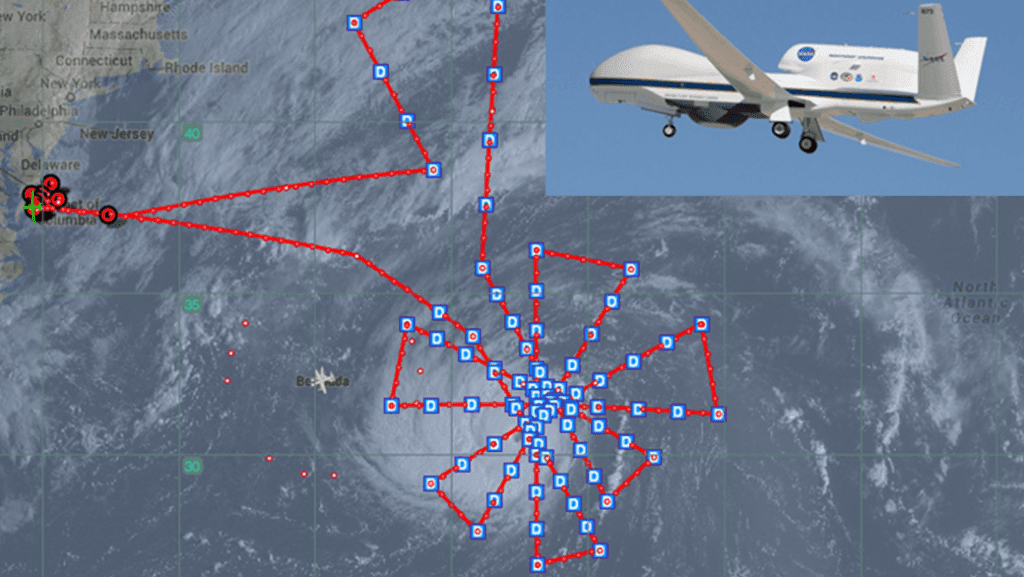
The Atlantic hurricane season will officially end November 30, and will be remembered as a relatively quiet season as was predicted. Still, the season afforded NOAA scientists with opportunities to produce new forecast products, showcase successful modeling advancements, and conduct research to benefit future forecasts.
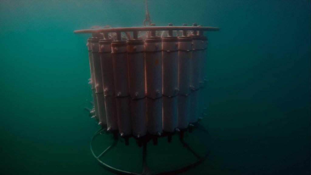
NOAA’s Atlantic Oceanographic and Meteorological Laboratory is teaming up with NOAA’s Office of Ocean Exploration and Research, National Marine Fisheries Service, and Integrated Ocean Observing System, as well as the J.C. Venter Institute and the Scripps Institution of Oceanography to enhance ecosystem observation programs by integrating genome-enabled techniques and technologies (i.e., ‘omics) into the California Cooperative Oceanic Fisheries Investigations (CalCOFI). CalCOFI is a multi-partner, long-term ecosystem and fisheries study off the coast of California. The first quarterly CalCOFI expedition that included ‘omics recently completed at the end of November.
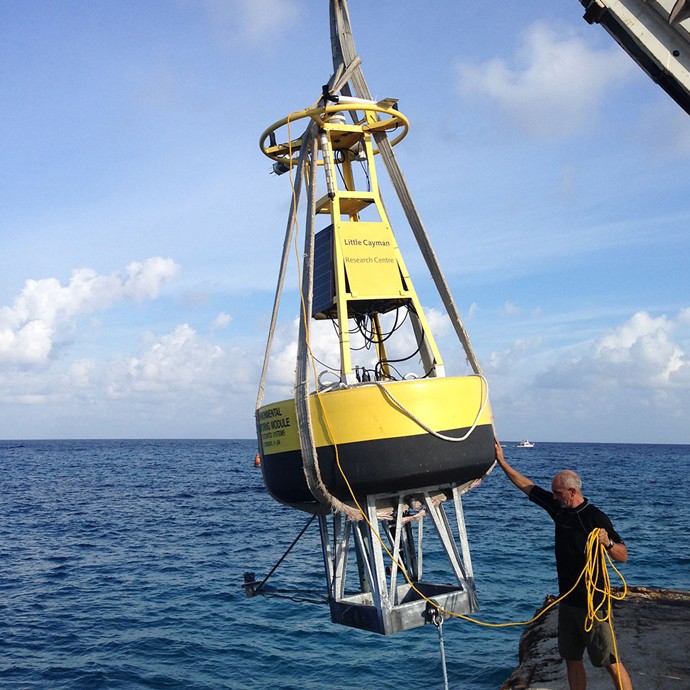
During the month of October, the Central Caribbean Marine Institute (CCMI) finished redeploying their buoy, which is part of the Coral Reef Early Warning System (CREWS). The buoy was first deployed in October 2013 and needs to be returned to land each year for cleaning, repainting and instrumentation swap. The buoy was towed from its deployment site on October 14th and returned to position on October 29th. AOML’s Mike Jankulak worked remotely with CCMI personnel to update the buoy’s programming and develop procedures for instrument configuration. As of October 31st all data feeds from the buoy to AOML and NDBC has fully resumed.
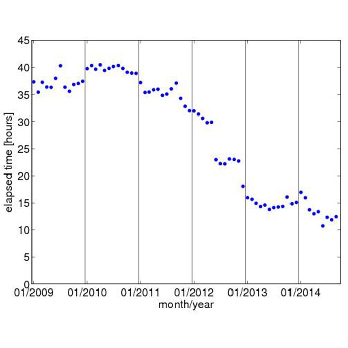
The US Argo Data Assembly Center at PhOD used the transition to the NETCDF profile format version 3.0 to consolidate three processes into one process. This major development had multiple benefits. The primary benefit is that during the development stage the rapid changes in the float technology, for example the addition of sensors, were taken into account to increase the adaptability of the software to future changes of floats as well as the NETCDF profile format. Prior to this development, three programs required adaptation when float types with a new combination of sensors was deployed.
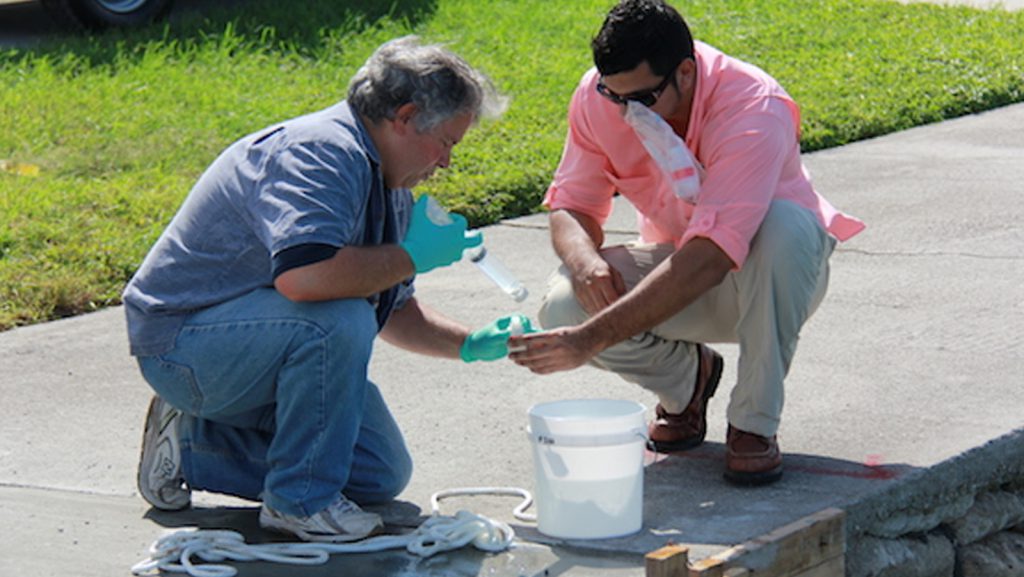
On October 9th, researchers from AOML’s Environmental Microbiology Lab monitored and collected water samples in Maurice Gibb Memorial Park during the King Tide, the highest astronomical tide of the year.
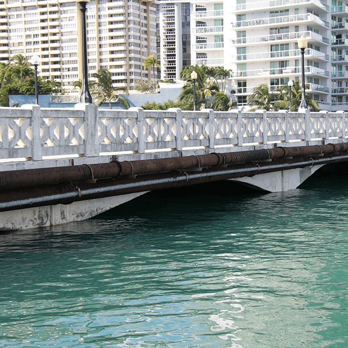
The colloquial term ‘king tides’, referring to the highest astronomical tides of the year, is now part of most Miami Beach residents and city managers’ vocabulary. Exacerbated by rising seas, these seasonal tides can add up to 12 inches of water to the average high tide, threatening the urbanized landscape of Miami Beach. During these events, AOML’s Microbiology Team is on the scene to investigate these tidal waters as they rise and recede. The microbiologists are part of a research consortium for sea level rise and climate change, led by Florida International University’s Southeast Environmental Research Center. The research effort focuses on collecting samples and monitoring water quality at locations along the Biscayne Bay watershed where the City of Miami Beach has installed pumps to actively push these super-tidal floodwaters back into the bay.
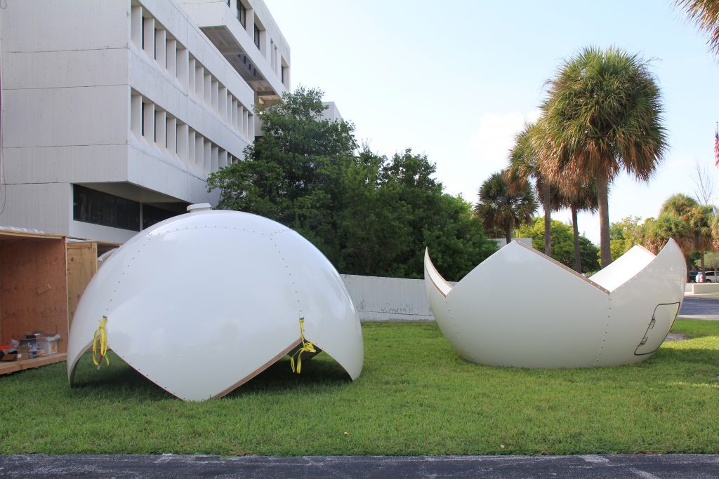
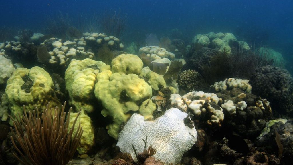
Images of corals taken on September 17, 2014, at Cheeca Rocks, which is in the Florida Keys off of Islamorada.
Photos taken from a NOAA P-3 aircraft during a Hurricane Hunter flight inside Hurricane Edouard. NOAA successfully deployed a Coyote Unmanned Aircraft System (UAS) directly into a hurricane from a NOAA P-3 Hurricane Hunter for the first time. During flights conducted September 15-17, 2014 out of Bermuda, scientists aboard the P-3 aircraft received meteorological data from the Coyote UAS in both the eye and surrounding eyewall of Hurricane Edouard.
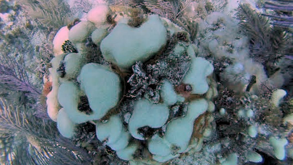
Images of corals taken from Horseshoe Reef and Little Grecian Rocks, in the vicinity of Key Largo, Florida.
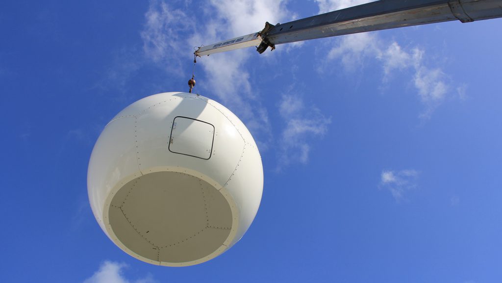
On Tuesday, September 16, 2014, a new X/L-band satellite receiving system was installed on the roof of AOML, augmenting the existing L-band antenna. This new system will expand AOML capabilities to receive telemetry and create products from the next generation of NOAA’s polar-orbiting environmental satellites, including Suomi NPP and the Joint Polar Satellite System (JPSS) constellation. Infrared and microwave sounder data from the system will be delivered to NOAA NCEP for assimilation in NWP models.
Scientists at NOAA’s Atlantic Oceanographic and Meteorological Laboratory are at the forefront of hurricane research to improve track and intensity forecasts. Every hurricane season they fly into storms, pour over observations and models, and consider new technological developments for how to enhance NOAA’s observing capabilities. The 2014 hurricane season will provide an opportunity to test some of the most advanced and innovative technologies, including unmanned hurricane hunter aircraft and sea gliders, which will help scientists better observe and, eventually, better predict a storm’s future activity.
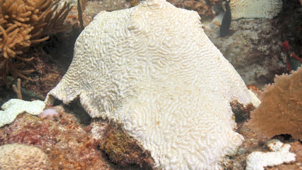
2014 was a relatively warm summer in South Florida, and local divers noticed the effects of this sustained weather pattern. Below the ocean surface, corals were bleaching. In the month of August, the Coral Bleaching Early Warning Network, jointly supported by Mote Marine Lab and NOAA’s Florida Keys National Marine Sanctuary, received 34 reports describing paling or partial bleaching and an additional 19 reports indicating significant bleaching. Scientists continue to monitor the impact of this severe bleaching event to determine the extent of coral mortality.
NOAA hurricane hunters are prepared to enter a new chapter in the use of unmanned aircraft systems: deploying an unmanned aircraft from an airplane inside a hurricane. Starting on September 14, 2014, NOAA’s hurricane hunting manned aircraft fleet will fly into position to observe any developing tropical systems in the Atlantic using this new tool. The Coyote unmanned aircraft will be the first unmanned aircraft deployed directly inside a hurricane from NOAA hurricane hunter aircraft. The goal of the Coyote is to collect temperature, pressure and wind observations below 3,000 feet, where manned aircraft can not fly safely.
NOAA successfully deployed unmanned aircraft from a NOAA P-3 Hurricane Hunter directly into a hurricane for the first time. NOAA deployed four Coyote Unmanned Aircraft Systems (UAS) in Hurricane Edouard during flights conducted September 15-17, 2014 out of Bermuda. Scientists on board the P-3 aircraft received meteorological data from the Coyote UAS in both the eye and surrounding eyewall of Hurricane Edouard.
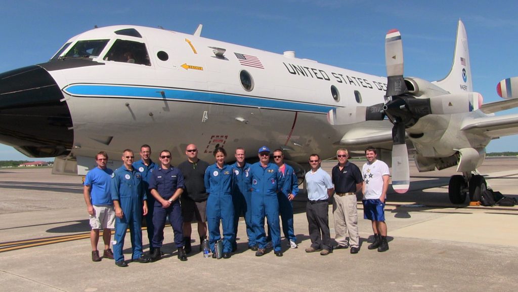
AOML, NOAA’s Aircraft Operations Center, and partners from Sensitel completed a successful calibration flight of the Coyote unmanned aircraft system (UAS) on September 3, 2014.
MAST Academy interns Arturo Toro, Michelle Mestres, and Ryan Winslow from MAST Academy set up the experiment to illustrate some of the effects of changing salinity on density and the buoyancy of objects. (credit: NOAA/AOML) Three summer interns collaborated with AOML’s Physical Oceanography Division to develop a hands-on outreach demonstration experiment that will be a useful tool […]
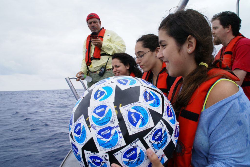
Drifting buoys are a primary tool used by the oceanographic community to measure ocean surface circulation at unprecedented resolution. A drifter is composed of a surface float, which includes a transmitter to relay data via satellite, and a thermometer that reads temperature a few centimeters below the air-sea interface. The surface float is tethered to a holey sock drogue (a.k.a. “sea anchor”), centered at 15 m depth. The drifter follows the ocean surface current flow integrated over the drogue depth.
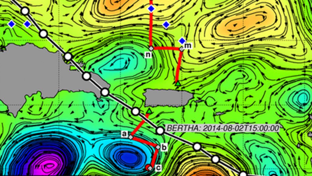
In a joint effort between AOML, NDBC, the University of Miami, and the University of Puerto Rico Mayaguez, AOML deployed two underwater gliders off Puerto Rico, one in the Caribbean Sea and another one in the Atlantic Ocean, in mid-July.
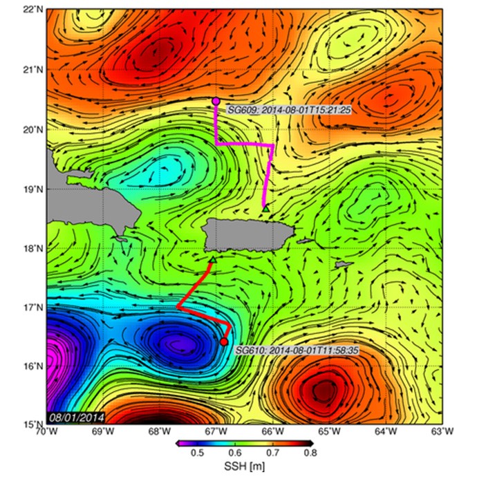
Underwater glider SG610, deployed on July 14, is located in the Caribbean Sea. This glider navigated in a SW, then in a SE, and now in a SW direction since it was deployed. The temperature and salinity profile observations indicate that on July 25 this glider started sampling waters of a cyclonic eddy that is now centered at approximately 16.5°N, 67.5°W, and has a radius of ~0.75deg as derived from satellite altimetry observations. These profile observations show a decrease in the salinity maximum, and a shallowing of the depth of this maximum salinity and of the depth of the 26°C isotherm.
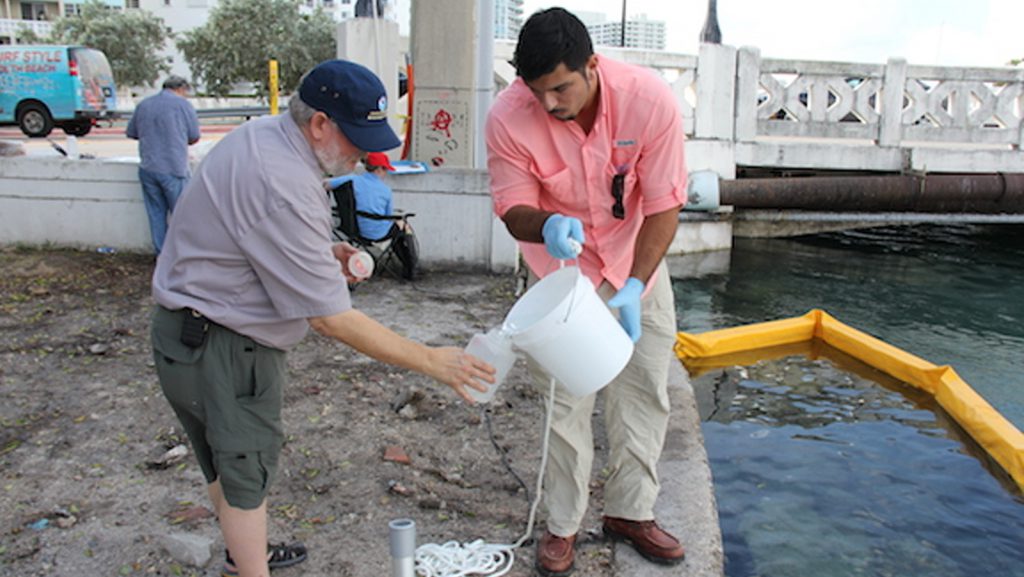
On October 9th, researchers from AOML’s Environmental Microbiology Lab monitored and collected water samples in Maurice Gibb Memorial Park during the King Tide, the highest astronomical tide of the year.
NOAA’s Vice Admiral Devany, Dr. Richard Spinrad, and Craig McLean, Deputy Assistant Administrator for Programs and Administration joined AOML and SEFSC to learn about current research and happenings in South Florida.
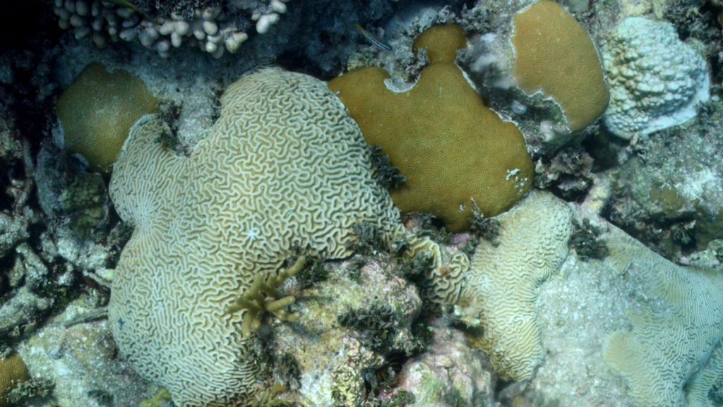
Images of bleached corals off of Key Biscayne, Florida and in Biscayne National Park.
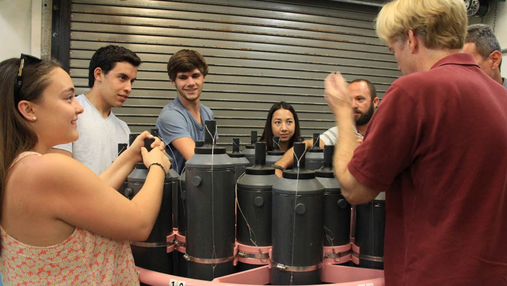
Undergraduate students from the University of Miami started off the fall semester with a tour of AOML’s ocean observing platforms and the engineering group that makes it all happen.
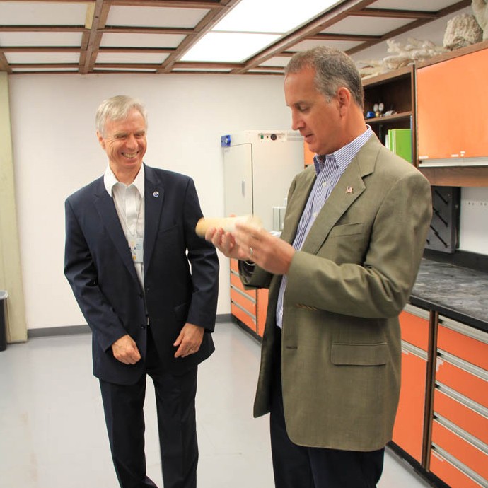
The Congressman representing Florida’s 25th district took a tour of AOML to learn about current research supporting south Florida and the Nation.
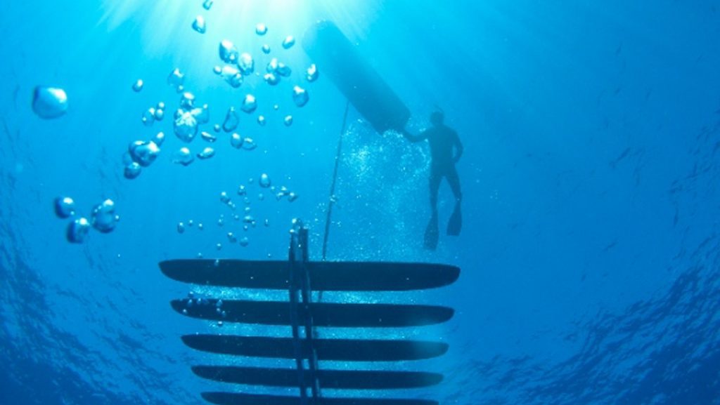
AOML joined Mississippi State University to deploy three wave gliders in the Gulf of America to observe hurricanes and underlying oceans.
AOML employees commemorated Dr. Robert Atlas’ nine years (and counting) as the AOML director!
Photos from two recent cruises to the Pacific Island of Maug to study the effect of ocean acidification on coral ecosystems.
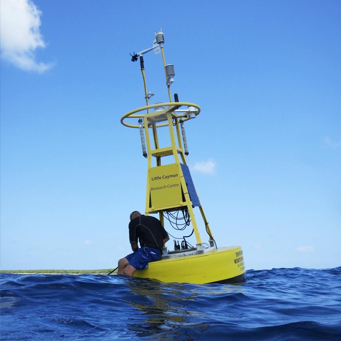
Photos from Little Cayman CREWS Station deployed by NOAA AOML.
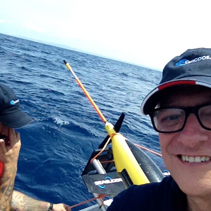
Photos from Caribbean deployment sites by NOAA AOML. Photo credit: NOAA
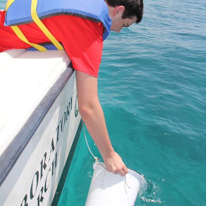
Photos of AOML researchers and interns at Ocean Sampling Day sites in Ft. Lauderdale, the Florida Keys, and La Jolla, California
Scientists at NOAA’s Atlantic Oceanographic and Meteorological Laboratory are in the Caribbean to launch two underwater gliders from a vessel off Puerto Rico to collect temperature and other weather data to improve hurricane forecasting.One of the gliders will collect observations in the Caribbean Sea, and another in the North Atlantic Ocean. They are positioned to operate over the next six months (June-November) collecting data in areas where hurricanes are common and areas where there is a lack of environmental data.
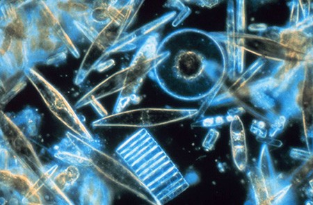
NOAA’s Atlantic Oceanographic and Meteorological Laboratory (AOML) participated in Ocean Sampling Day on June 21, the first global simultaneous sampling for microbes in ocean, coastal and Great Lakes waters. Over time, sampling will support international and NOAA missions to provide a snapshot of the diversity of microbes, their functions, and their potential economic benefits. Among other economic applications, microbes have been used for novel medicines, as biofuels, and to consume spilled oil. Organized and led by the European Union’s MicroB3 organization, NOAA coordinated twelve sampling sites for Ocean Sampling Day 2014 within U.S. coastal waters.
The Marine and Estuarine Goal Setting for South Florida (MARES) project, led by NOAA’s Cooperative Institute for Marine and Atmospheric Studies at the University of Miami, continues to increase awareness of and appreciation for the value of coastal marine ecosystems, and their impacts upon human society. From 2009 through 2013, NOAA’s National Centers for Coastal Ocean Science funded MARES with the goal of creating a consensus-based process for managing South Florida’s coastal marine environments. MARES is unique in that it was among the first major efforts to include human benefits in a systematic framework to enable integrated ecosystem based management. The MARES approach embodies NOAA’s effort to serve as the Nation’s environmental intelligence agency by providing actionable information from science-based models to support environmentally-sensitive decisions made every day by individuals, communities, and governments.
Maug is a unique natural laboratory that allows us to study how ocean acidification affects coral reef ecosystems. We know of no other area like this in U.S. waters. Increasing carbon dioxide in seawater is a global issue because it makes it harder for animals like corals to build skeletons.
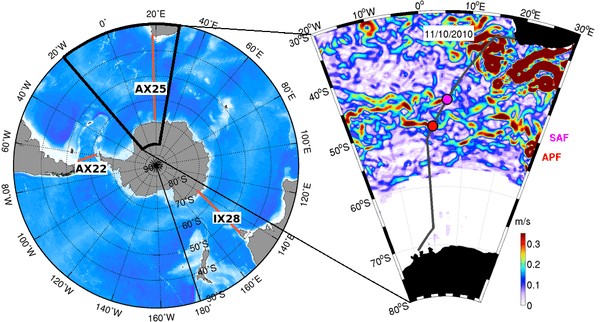
Researchers from PhOD and from the University of Cape Town used temperature data from the AX25 repeat XBT transect (from South Africa to Antarctica) in combination with other hydrographic and satellite observations to report a mechanism by which local winds alter the structure of the Antarctic Circumpolar Current flow south of Africa.
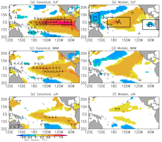
Results from research performed by Dillon Amaya, an undergraduate Hollings Scholar from Texas A&M University, were published recently in Journal of Geophysical Research. Dillon’s work was carried out in the Physical Oceanography Division of AOML during the summer of 2013 and focused on understanding the impacts of different types of El Niño events (“canonical” and “Modoki”) on sea surface temperatures in the tropical Atlantic. The main result from the research is that Modoki El Niño;s fail to produce significant warming in the tropical North Atlantic, in contrast to the well known warming following canonical events.
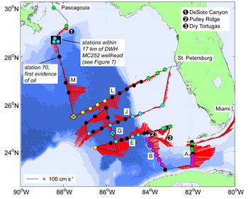
Results from collaborative research conducted by AOML and NOAA’s Southeast Fisheries Science Center (SEFSC) in response to the 2010 Deepwater Horizon oil spill, were recently published in Continental Shelf Research (December, 2013). PhOD oceanographers R. Smith, E. Johns, G. Goni, J. Trinanes, and R. Lumpkin, in collaboration with other researchers at AOML (M. Wood, C. Kelble, and S. Cummings) and SEFSC (J. Lamkin and S. Privoznik) report on the surface and subsurface connectivity across the eastern Gulf of America (GOM) during July 2010.
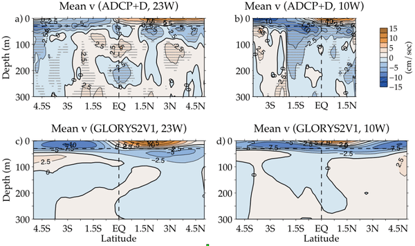
In an article recently published in Climate Dynamics (Perez et al., 2013) , scientists in PhOD (R. Perez, R. Lumpkin, C. Schmid) described for the first time the mean vertical and cross-equatorial structure of the upper-ocean meridional currents in the Atlantic cold tongue region, using in situ observations including drifters, Argo, shipboard/lowered ADCP, and moored ADCP. This study involves collaborations with scientists from the University of Miami, Scripps Institution of Oceanography, and several international institutions and makes use of data from several major tropical Atlantic field programs including NOAA’s PIRATA Northeast Extension.
The AOML technology test of a system to autonomously retrieve data from subsurface moored instruments has had a major success. The Adaptable Bottom Instrument Information Shuttle System (ABIISS) is in the midst of its first 4000+ meter test, and on November 6th, 2015 the first data pod surfaced and successfully transmitted its daily data record from the ocean bottom pressure-equipped inverted echo […]
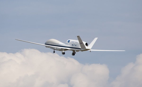
The 2013 Atlantic hurricane season, which officially ended on November 30th, will be noted in the record books as having been a relatively quiet year with the fewest hurricanes since 1982. In fact, it will be ranked as the sixth least-active Atlantic hurricane season since 1950. Despite this, the 2013 season was quite an active […]
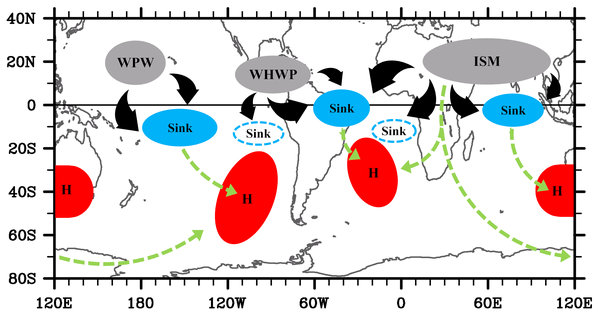
In a recent article accepted for publication in the Journal of Climate, scientists in PhOD, S.-K. Lee (CIMAS) and C. Wang collaborated with R. Mechoso and D. Neelin, both at UCLA, to explore why the southern subtropical anticyclones are notably stronger in the austral winter than in summer, which is in contrast with the Northern Hemisphere (NH) in which subtropical anticyclones are more intense in summer according to the monsoon heating paradigm. They performed model experiments to show that during the boreal summer enhanced tropical convection activity in the NH plays important roles in strengthening the southern subtropical anticyclones.
While tropical cyclones can dramatically impact coral reefs, a recent study reveals their passage also exacerbates ocean acidification, rendering reef structures even more vulnerable to damage. Calcifying marine organisms such as corals that thrive in alkaline-rich waters are increasingly imperiled as seawater becomes more acidic due to the ocean’s uptake of carbon dioxide. The detrimental effects upon these organisms have been documented, but less is known about how reefs might react to ocean acidification when coupled with an additional stress factor such as a tropical cyclone.
NOAA hurricane scientists are expanding their observations this summer, working with NASA’s Hurricane and Severe Storm Sentinel (HS3) mission and its innovative Global Hawk unmanned aerial vehicles to push the boundaries of hurricane operations. NASA looked to NOAA’s hurricane experts to augment its HS3 science team, supporting their five-year mission to investigate the processes that underlie hurricane formation and intensity change in the Atlantic Ocean basin.
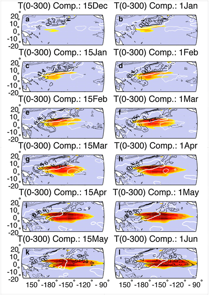
In a recent study by scientists at Boston University, PHOD, and NCAR, a new mechanism was uncovered for initiating ENSO events wherein SLP-generated North Pacific trade winds induce subsurface heat content changes that serve as precursors to El Ninos. This trade-wind charging mechanism of the equatorial Pacific is fundamentally different from any previously diagnosed, and studies examining the surface and subsurface ocean dynamics associated with this mechanism are underway.
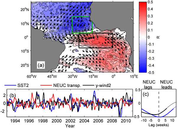
Scientists at PHOD developed a synthetic method, which combines high-density expendable bathythermograph (XBT) temperature data along the AX08 XBT transect (which runs between Cape Town and NYC) with altimetric sea level anomalies, to estimate the variability of the off-equatorial currents, such as the North Equatorial Countercurrent and the North Equatorial Undercurrent, on seasonal to interannual timescales. Understanding how the ocean dynamics is liked to anomalies of temperature and wind-stress in the tropical Atlantic is critical to understand the climate and weather variability in the adjacent continental areas.
In its 2013 Atlantic hurricane season outlook issued today, NOAA’s Climate Prediction Center is forecasting an active or extremely active season this year.For the six-month hurricane season, which begins June 1, NOAA’s Atlantic Hurricane Season Outlook says there is a 70 percent likelihood of 13 to 20 named storms (winds of 39 mph or higher), of which 7 to 11 could become hurricanes (winds of 74 mph or higher), including 3 to 6 major hurricanes (Category 3, 4 or 5; winds of 111 mph or higher).
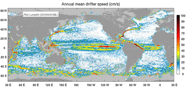
Using over 30 years of observations from drogued, satellite-tracked surface drifting buoys, Lumpkin and Johnson (2013) developed a methodology to map seasonally-varying surface currents at 1/2 degree resolution. Results from this study can be used to better understand how the ocean transports properties like heat, salt, and passive tracers, and serves as a reference to study changes in ocean currents over time. One key result from this study is the global distribution of mean, seasonal and eddy kinetic energy, which totals 4.6x10¹⁷J in the upper 30 m of the ocean and reveals the presence of three large eddy “deserts”, one in the Atlantic Ocean and the other two in the Pacific.
AOML partnered with NOAA’s Southeast Fisheries Science Center (SEFSC) to host an open house for local students and the public on May 24th and 25th. The two-day event drew 425 students and 275 members of the public for a total of 700 visitors. Staff from Representative Ileana Ros-Lehtinen’s office (FL-27) and Senator Marco Rubio’s (FL) office also participated in the very successful event.
Using over 30 years of observations from satellite-tracked surface drifting buoys, NOAA oceanographers derived a global climatology of seasonally-varying ocean surface currents at one-half degree resolution. This data set can be used to better understand how the ocean transports properties like heat, salt, and passive tracers, and as a reference to study changes in ocean […]
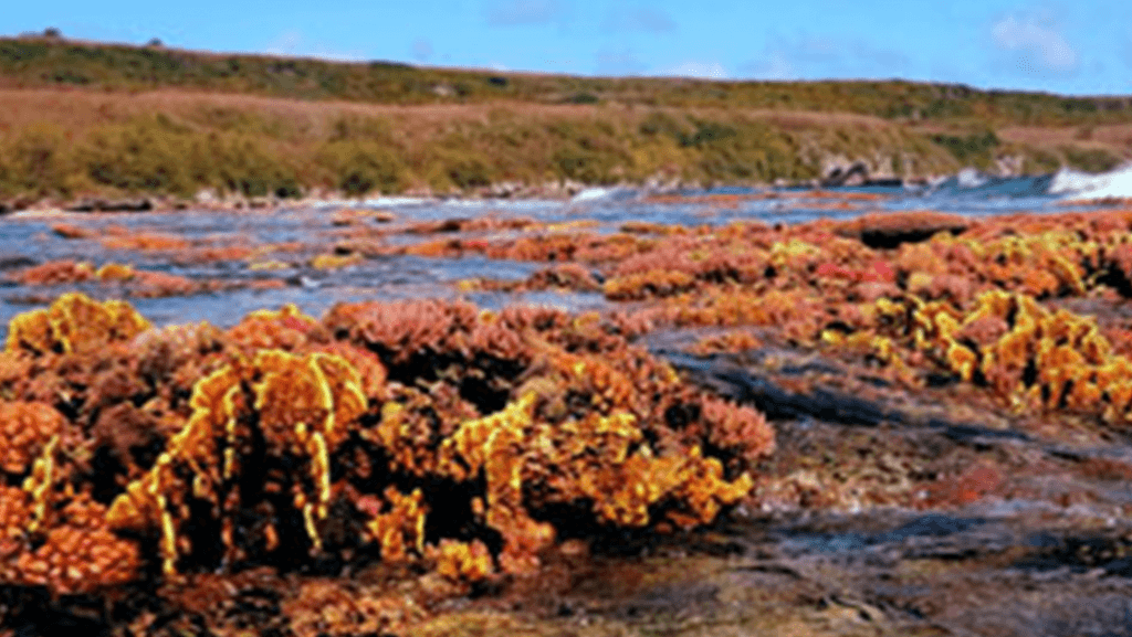
NOAA oceanographers traveled to Saipan this spring to refurbish the Coral Reef Early Warning System (CREWS) station in Lao Lao Bay and conduct site surveys for the potential location of a moored autonomous pCO2 (MApCO2) buoy. Staff from the Pacific Islands Ocean Observing System (PacIOOS) program in Honolulu joined them during the site visit hosted by the Division of Environmental Quality (DEQ) of the Commonwealth of the Northern Mariana Islands (CNMI).
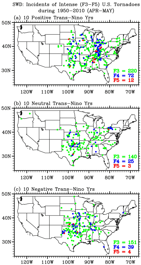
The record-breaking U.S. tornado outbreaks in the spring of 2011 prompt the need to identify long-term climate signals that could potentially provide seasonal predictability for U.S. tornado outbreaks. A new research led by scientists in the Physical Oceanography Division of NOAA-AOML used both observations and model experiments to show that a positive phase Trans-Niño may be one such climate signal.
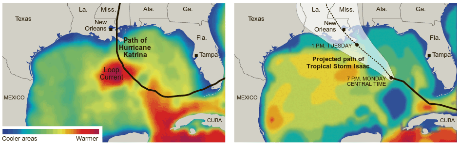
A news article that appeared on August 27 shows the ocean conditions in the Gulf of America during hurricanes Katrina (August 2005) and Isaac (August 2012). The ocean conditions are depicted by the upper ocean heat content derived from satellite altimetry using a methodology developed at NOAA/AOML. The upper ocean heat content had larger values during Katrina mainly due to an anticyclonic warm ring and an extended Loop Current. These conditions, not found during the passage of Hurricane Isaac, partly contributed to the intensification of Katrina.
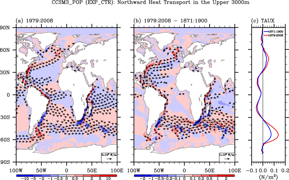
A new study led by researchers from University of Miami, NOAA-AOML, IFM-GEOMAR, and NCAR explores why the Atlantic Ocean has warmed substantially more than any other ocean basin since the 1950s. The research article published in the Geophysical Research letters evidences that the observed large warming of the Atlantic Ocean since the 1950s is largely induced by an increase in the inter-ocean heat transport from the Indian Ocean via the Agulhas leakage. The study points to an important role played by the Atlantic meridional overturning circulation (AMOC) in the South Atlantic in enhancing the secular warming of the Atlantic Ocean.
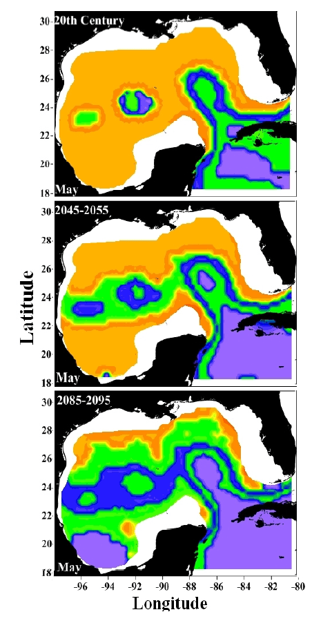
A joint workshop hosted by NOAA and the National Aeronautics and Space Administration (NASA) for bluefin tuna research was held at the University of Miami on December 6-7th. Researchers with AOML’s Physical Oceanography Division (PhOD) presented the results of their collaborative efforts with NOAA’s Southeast Fisheries Science Center (SEFSC), which have focused on the link between the ocean and stock assessment species of relevant commercial importance.

