
AOML hurricane scientists supporting NOAA reconnaissance into Hurricane Laura recognized the onset of rapid intensification when thunderstorms, often referred to as convection, began working its way around the entirety of the storm center.
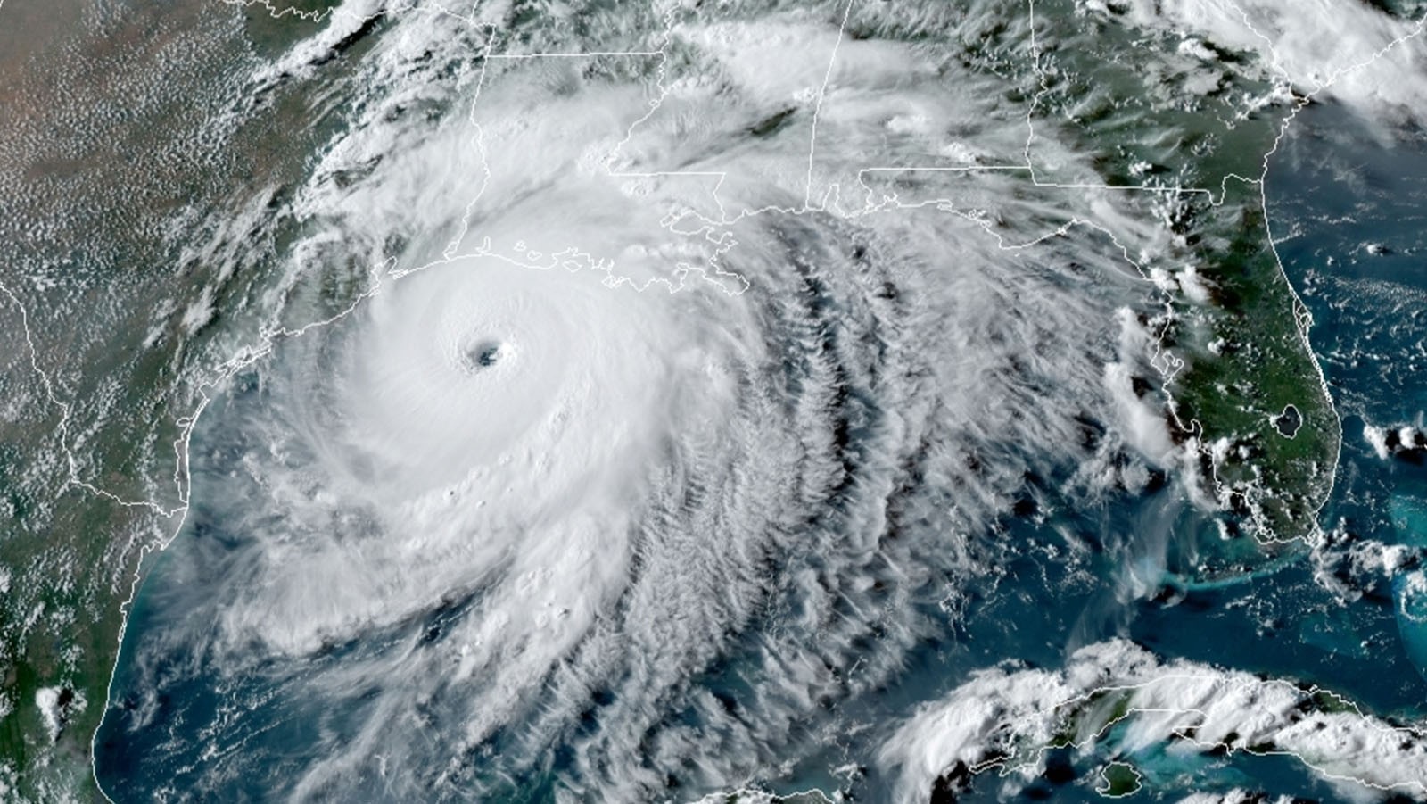
Now Laura is a major Category 4 hurricane. The National Hurricane Center (NHC) and Environmental Modeling Center (EMC) tasked NOAA’s P-3 Hurricane Hunters for a final flight into Laura’s center. This flight took off from Lakeland, FL at 5PM EDT on August 26.
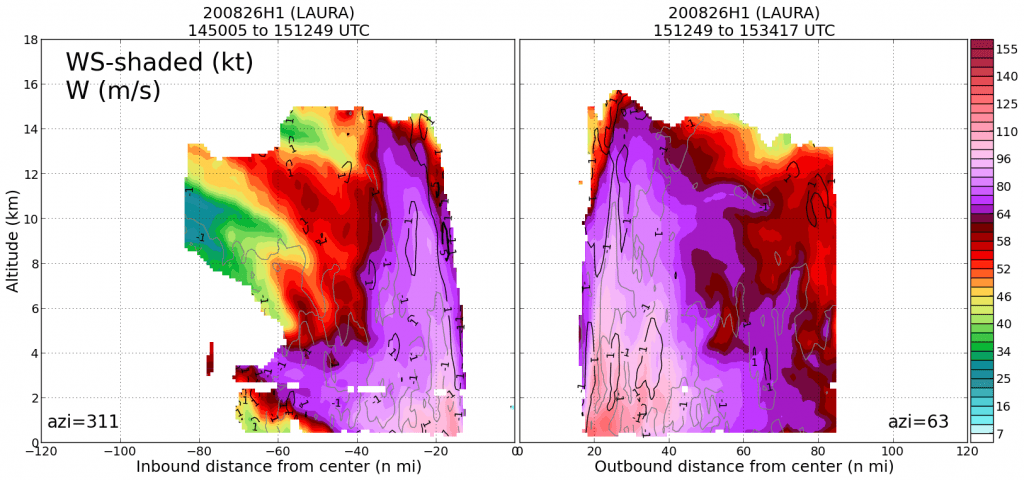
The mission has multiple goals: to collect information about the peak winds and minimum central pressure, send measurements for numerical weather model initialization, and collect observations to complement data from research crews staged on the ground in Louisiana.
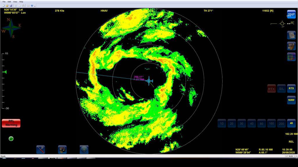
Hurricane scientists and forecasters observed the complex configuration of precipitation that is theorized to precede rapid intensification. Tail Doppler Radar analyses showed strong winds racing towards Hurricane Laura’s center, allowing the system to enhance strengthening of its circulation.
Hurricane Laura remains a major hurricane over extremely warm ocean waters and a favorable atmospheric environment. Of the many hazards Laura brings at landfall, NHC describes the storm surge as “unsurvivable.”
For the latest information about tropical cyclones and other weather systems, visit the NOAA National Weather Service National Hurricane Center.
For information on numerical prediction of tropical cyclones, visit the NOAA National Centers for Environmental Prediction Environmental Modeling Center.