
NOAA and Saildrone are collecting scientific data from inside Hurricane Sam
Originally posted on NOAA.Gov September 30th, 2021
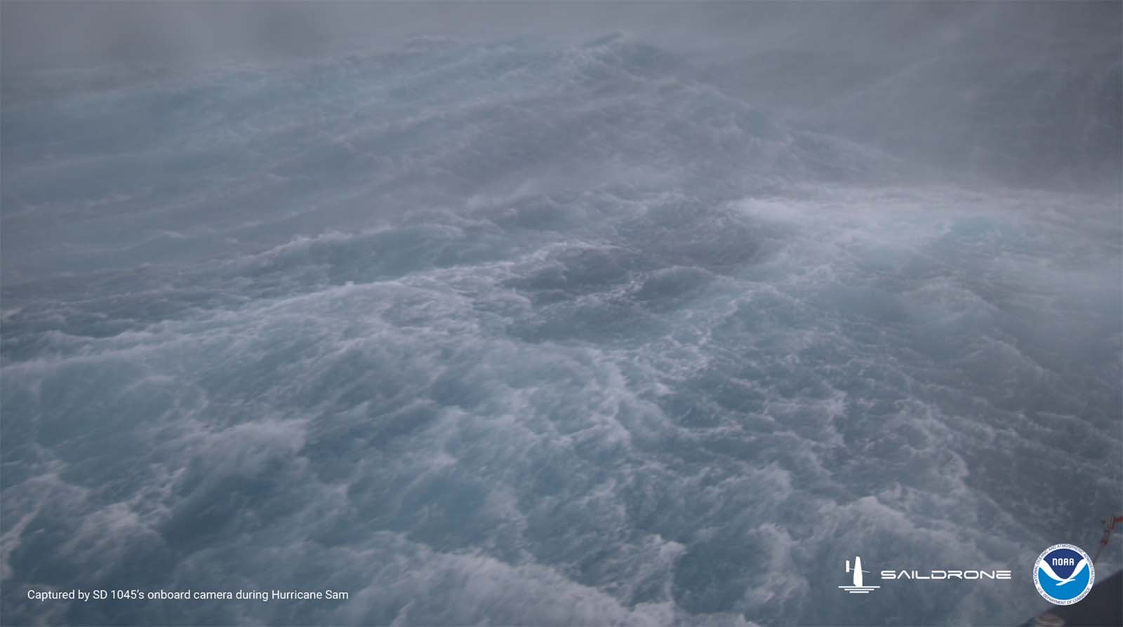
Saildrone Inc. and the NOAA have released the first video footage gathered by an uncrewed surface vehicle (USV) from inside a major hurricane barreling across the Atlantic Ocean.
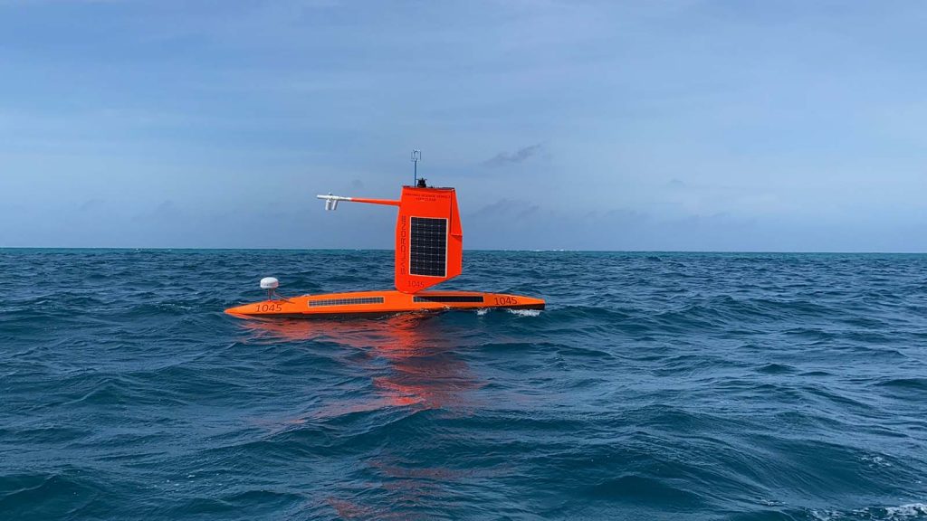
The Saildrone Explorer SD 1045 was directed into the midst of Hurricane Sam, a category 4 hurricane, which is currently on a path that fortunately will miss the U.S. east coast. SD1045 is battling 50 foot waves and winds of over 120 mph to collect critical scientific data and, in the process, is giving us a completely new view of one of earth’s most destructive forces.
Equipped with a specially designed “hurricane wing,” enabling it to operate in extreme wind conditions, SD 1045 is braving Hurricane Sam in the open ocean, collecting real-time observations for numerical hurricane prediction models, which are expected to yield new insights into how large and destructive tropical cyclones grow and intensify.
SD 1045 is one of a fleet of five ‘hurricane’ Saildrones that have been operating in the Atlantic Ocean during hurricane season, gathering data around the clock to help understand the physical processes of hurricanes. This knowledge is critical to improving storm forecasting and is expected to reduce loss of human life by allowing better preparedness in coastal communities.
“Saildrone is going where no research vessel has ever ventured, sailing right into the eye of the hurricane, gathering data that will transform our understanding of these powerful storms,” said Richard Jenkins, Saildrone founder and CEO. “After conquering the Arctic and Southern Ocean, hurricanes were the last frontier for Saildrone survivability. We are proud to have engineered a vehicle capable of operating in the most extreme weather conditions on earth.”
The Saildrones provide data directly to NOAA’s Pacific Marine Environmental Laboratory and Atlantic Oceanographic and Meteorological Laboratory, Saildrone’s partners in this mission.
“Using data collected by saildrones, we expect to improve forecast models that predict rapid intensification of hurricanes,” said Greg Foltz, a NOAA scientist. “Rapid intensification, when hurricane winds strengthen in a matter of hours, is a serious threat to coastal communities. New data from saildrones and other uncrewed systems that NOAA is using will help us better predict the forces that drive hurricanes and be able to warn communities earlier.”
Media contact: Monica Allen, NOAA Communications, monica.allen@noaa.gov, 202-379-6693