
Scientists at NOAA’s Atlantic Oceanographic and Meteorological Laboratory (AOML) found that Atlantic Niño, the Atlantic counterpart of the Pacific El Niño, increases the formation of tropical cyclones off the coast of West Africa, also known as Cape (Cabo) Verde hurricanes. The study published in Nature Communications is the first to investigate the links between Atlantic Niño/Niña and seasonal Atlantic tropical cyclone activity and the associated physical mechanisms.
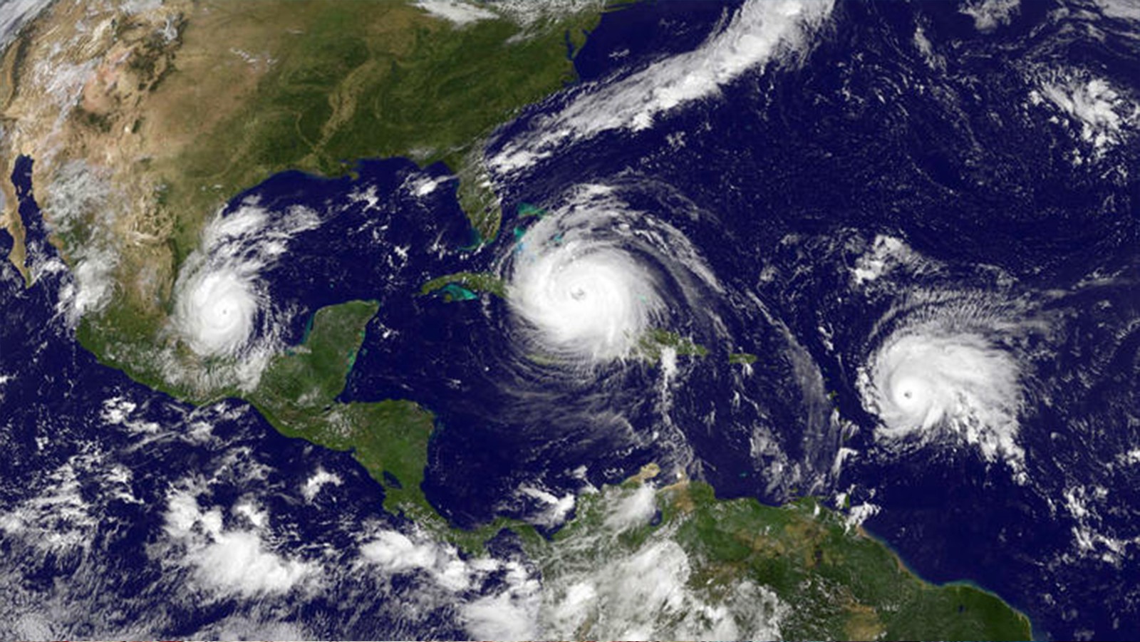
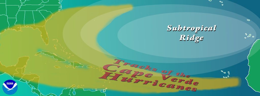
Cape (Cabo) Verde hurricanes are Atlantic basin tropical cyclones that develop into tropical storms fairly close (<600 miles or so) to the Cape Verde Islands and then become hurricanes before reaching the Caribbean. The Cape Verde region produces some of the Atlantic’s longest lasting, most intense and destructive hurricanes due to having plenty of warm open ocean over which to develop before encountering land or other factors prompting weakening. Tropical cyclones that develop here make up more than half of the named tropical systems that annually form and account for more than 80-85% of all major hurricanes (Category-3 and above) that strike the United States and Caribbean islands.
Atlantic hurricane activity is known to be largely regulated by El Niño – Southern Oscillation, a periodic fluctuation (every 2–7 years) in sea surface temperature and air pressure across the equatorial Pacific Ocean, and the Atlantic Meridional Mode, the dominant pattern of coupled ocean-atmosphere variability in the tropical Atlantic. However, these climate patterns develop predominantly in the Northern Hemisphere’s winter or spring and are weaker during the Atlantic hurricane season (June-November).
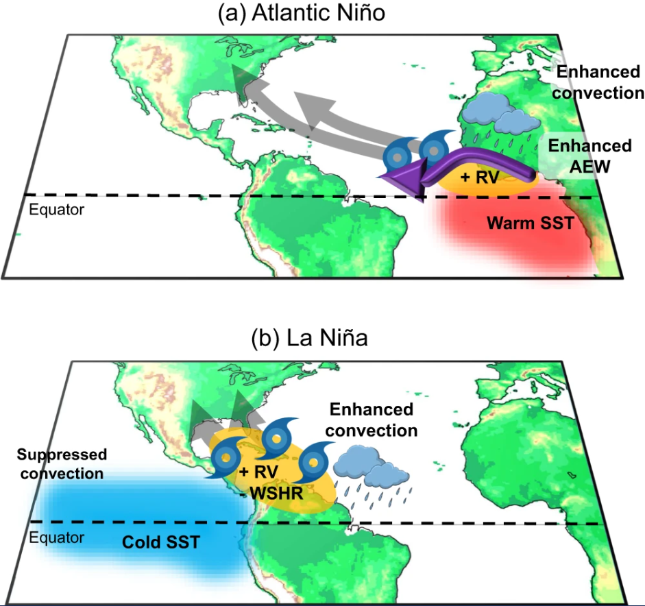
The leading pattern of sea surface temperature variability in the tropical Atlantic during the Atlantic hurricane season is Atlantic Niño/Niña, a periodic fluctuation of sea surface temperature in the equatorial Atlantic, similar to El Niño/La Niña in the Pacific. However, the linkage between Atlantic Niño/Niña and Atlantic hurricane activity had not been previously examined.
In this study, scientists use observations and reanalysis data to show that Atlantic Niño strengthens the rainband over the tropical Atlantic which enhances African easterly wave activity and low-level cyclonic vorticity (rotation) across the deep tropical eastern North Atlantic. African easterly waves are fluctuating winds in the lower atmosphere that originate and travel westward from West Africa. These winds are seen from April until November and are responsible for about 85% of intense hurricanes and about 60% of smaller storms. Such conditions increase the likelihood of tropical cyclones developing near the Cape Verde islands, elevating the risk of major hurricanes impacting the Caribbean islands and the U.S.
Seasonal outlooks for Atlantic tropical cyclone activity are issued by the National Oceanic and Atmospheric Administration (NOAA) and other agencies to provide the public with a guide to the expected overall activity during the upcoming hurricane season. These outlooks are largely based on foundational relationships between observed oceanic and atmospheric states, particularly those involving the previously mentioned El Niño – Southern Oscillation and Atlantic Meridional Mode, and tropical cyclone activity. This study shows that Atlantic Niño/Niña is potentially an additional predictor of seasonal Atlantic hurricane activity that can be used to improve seasonal Atlantic hurricane outlooks, especially when other predictors are in near-normal conditions, as happened during the 1992, 2003, and 2008 hurricane seasons.
Kim et al. (2023) is the result of a collaboration between physical oceanographers, climate scientists, and hurricane scientists at the Cooperative Institute of Marine and Atmospheric Science (CIMAS), NOAA’s Climate Prediction Center, the Northern Gulf Institute (NGI), and AOML.
This study highlights that Atlantic Niño/Niña, which has received little attention until now, is relevant for NOAA’s research, and needs to be explored further in the future.
Reference:
Kim, D., Lee, SK., Lopez, H. Foltz, GR., Wen, C., West, R. & Dunion, J. (2023). Increase in Cape Verde hurricanes during Atlantic Niño. Nature Communications 14, 3704. https://doi.org/10.1038/s41467-023-39467-5