
The Global Drifter Program at AOML has a new ERDDAP, or Environmental Research Division Data Access Program, server that is now publicly available and hosts both hourly and 6-hour quality-controlled interpolated drifter datasets. This new scientific data server uses free and open-source software created by the Environmental Research Division of NOAA’s Southwest Fisheries Science Center.
For a step by step guide of how to use the new ERDDAP server, please view the video below.
ERDDAP provides a simple, consistent way to download drifter data in common file formats, resulting in easier access to data for the scientific community. It is currently used by approximately 100 organizations in more than 17 countries, and NOAA’s Data Access Procedural Directive recommends ERDDAP as a data server for groups within NOAA.
The staff of the Global Drifter Program is excited to enhance its users’ experience through the ERDDAP server. Distributing publicly-available data through ERDDAP provides many advantages, including compliance with NOAA’s Findable, Accessible, Interoperable, and Reusable (FAIR) standards, the flexibility of offering numerous output file formats, and the minimal need to reformat data on the user’s end. ERDDAP provides an additional benefit for data analysts, web application developers, and numerical modelers interested in retrieving drifter data through computer programs, rather than the ERDDAP webpage interface.
Specifically, the RESTful API (representational state transfer application programming interface) feature of ERDDAP, which provides an interface for two computer systems to securely exchange information over the internet, allows users to access drifter data through coding languages such as Matlab, R, Python, Javascript, HTML, Fortran, and Bash. As a result, the ERDDAP server helps increase drifter data accessibility and data sharing for weather model improvements, the validation of satellite temperature measurements, hurricane intensity forecasts, and scientific research.
Notably, the hourly drifter dataset now includes diurnal and non-diurnal sea surface temperature estimates, in addition to drifter positions and velocities. Users can quickly retrieve these datasets in their desired file format, as well as filter their query by constraining drifter variables such as time, location, drifter identification number, and/or World Meteorological Organization number.
Additionally, simplifying the data output format and providing an option for plotting drifter trajectories further supports the Global Drifter Program’s involvement in NOAA’s Adopt A Drifter and Teacher at Sea programs. These educational programs enable K–12 students to use drifter data to learn about ocean climate science.
Finally, the Global Drifter Program’s database spans 40+ years, covers all ocean basins, and includes contributions from more than 25 countries. The ERDDAP product provides users with access to metadata that recognizes the considerable impacts of the Global Drifter Program’s global partners and the immense efforts from agencies worldwide to sustain the global coverage of drifting buoys.
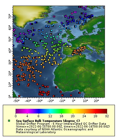
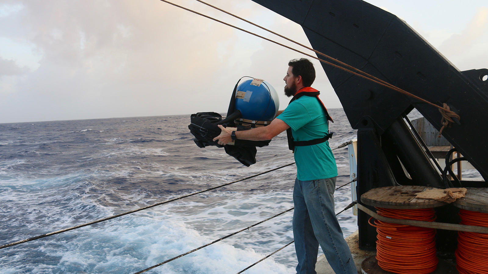
Example of a drifter data plot that shows sea surface bulk temperature (°C) in the Atlantic basin. Drifting buoys float on the ocean surface and are carried by near-surface ocean currents. They measure sea surface temperature, mixed layer currents, wind, and atmospheric pressure. The data are transmitted in real-time to the Global Telecommunications System for use in research studies and weather and climate forecasts.
The ERDDAP server was developed and implemented by Samantha Ouertani and Shaun Dolk of AOML’s Global Drifter Program and Jay Harris, an IT Specialist with AOML’s Physical Oceanography Division. Significant assistance was also provided by Kevin O’Brien of the Cooperative Institute for Climate, Ocean, and Ecosystem Studies at NOAA’s Pacific Marine Environmental Laboratory in Seattle, Washington. The project was jointly funded by NOAA’s Global Ocean Monitoring and Observing Program and AOML.