
This summer marks AOML’s tenth consecutive year of gathering underwater glider observations during the Atlantic hurricane season. The project began in 2014 with two gliders deployed off Puerto Rico to study the ocean’s role in tropical cyclone development and intensification. Since then, glider observations have become an integral part of the data gathered annually to improve tropical cyclone forecasts, as well as better understand how the ocean and atmosphere interact during the passage of tropical cyclones.
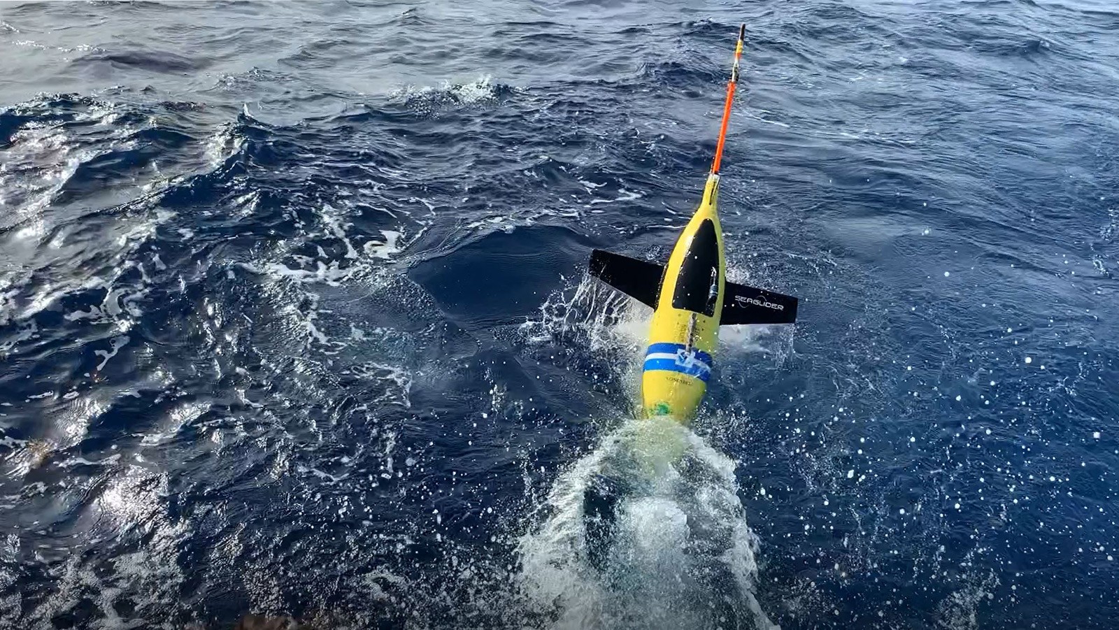
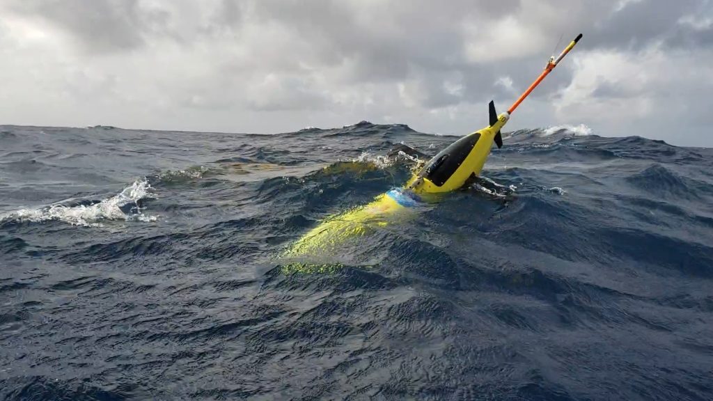
Gliders are autonomous, remotely piloted observing platforms. They monitor the thermal structure of the upper ocean along pre-programmed tracks in the Caribbean Sea and tropical North Atlantic, regions where tropical cyclones typically pass. Advancing at speeds of up to 1.2 miles per hour, i.e., 1 knot, gliders dive to depths of 900 meters several times a day to measure temperature, salinity, and dissolved oxygen. Upon returning to the surface, their data are transmitted to AOML for quality control and then added to tropical cyclone forecast models.
To date, AOML has conducted 61 glider missions, of which 12 were in partnership with the US Navy. These missions have spent more than 4,900 combined days at sea; traveled more than 68,000 kilometers, approximately one and a half times the distance around the Earth; obtained more than 72,000 profiles of temperature, salinity, and dissolved oxygen; and surveyed ocean conditions under 21 tropical cyclones.
“Over the past ten years we have implemented a fleet of gliders with our US and international partners that continuously provides an enormous amount of data in regions otherwise not properly observed. These data are used for research to improve our understanding of how water mass properties and ocean dynamics contribute to hurricane intensity changes.”
Gustavo Goni, PhD, a science lead for the glider project
During the 2023 Atlantic hurricane season, AOML will work with numerous partners to implement and maintain a robust network of underwater gliders. One glider will operate east of the Bahamas; another will peruse the Caribbean Sea south of the Dominican Republic; four will monitor the waters off Puerto Rico, one to the north and three to the south; and one will observe the Gulf of America. AOML will additionally lead and/or participate in operations for three US Navy gliders off Puerto Rico and contribute to a mission led by staff from the Caribbean Coastal Ocean Observing System.
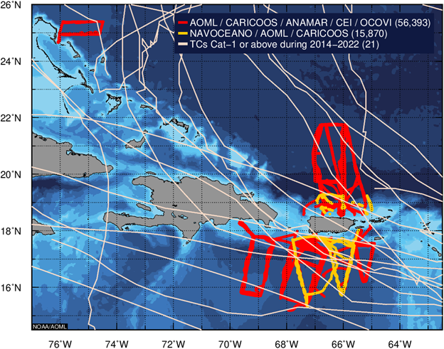
These gliders will be deployed in collaboration with the US Integrated Ocean Observing System (IOOS), Dominican Republic Maritime Authority, the Cape Eleuthera Institute, Naval Oceanographic Office, Gulf of America Coastal Ocean Observing System, NOAA’s National Data Buoy Center, the University of Southern Mississippi, and NOAA’s Environmental Modeling Center.
Research derived from data collected by AOML gliders has advanced the understanding of the ocean’s role in tropical cyclone intensity changes, leading to improved forecasts. Additionally, AOML scientists have participated in the publication of 18 peer-reviewed journal articles based on glider data.
The most relevant research results include studies of how areas of low salinity water of riverine origin, e.g., the Mississippi, Orinoco, and Amazon rivers, contribute to the intensification of tropical cyclones. Other studies have assessed the impact of glider observations in reducing intensity errors in NOAA’s experimental and operational forecast models and the impact of integrating glider observations with data from other observing platforms.
More recently, AOML scientists have gathered collocated, simultaneous observations using gliders and saildrone uncrewed surface vehicles to improve estimates of heat fluxes between the ocean and atmosphere during tropical cyclone events. This summer the gliders will also collect collocated observations with NOAA drifting buoys in the Gulf of America and Caribbean Sea.
AOML gliders are an integral component of NOAA’s 2023 Hurricane Field Program. They are also part of the new NOAA-funded Coordinated Hurricane Atmosphere-Ocean Sampling, or CHAOS, field experiment. Glider operations at AOML are funded by US Congress appropriation funds, NOAA, and IOOS.
Visit the Hurricane Gliders webpage for more information about AOML’s current hurricane glider missions and operations. Visit the NOAA CoastWatch and AOML Ocean Observations Viewer to view the near-real time location of AOML’s gliders, other ocean-observing instruments, and satellite products throughout the 2023 Atlantic hurricane season.