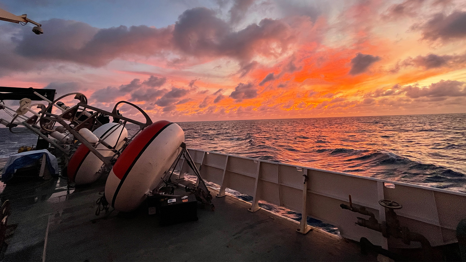

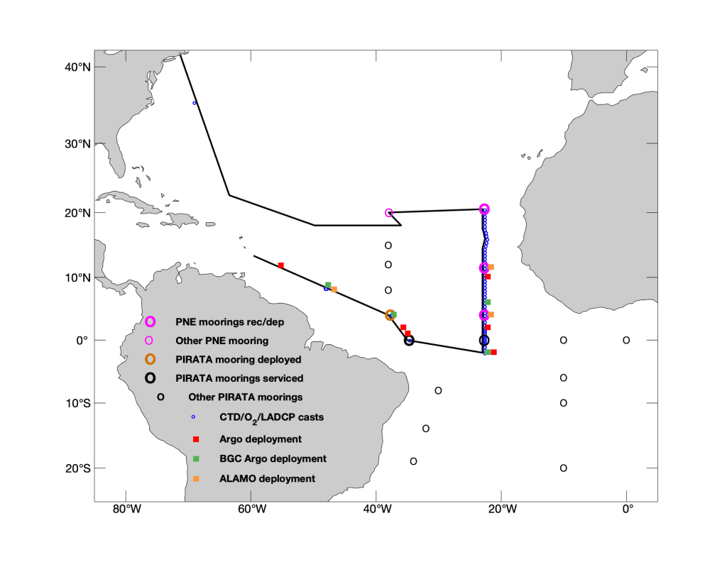
Researchers with NOAA’s Atlantic Oceanographic and Meteorological Laboratory (AOML), NOAA’s Pacific Marine Environmental Laboratory (PMEL), NOAA’s National Environmental Satellite, Data and Information Service, and partners set sail from Bridgetown, Barbados aboard NOAA Ship Ronald H. Brown on November 1st, 2022. Over the next 40 days, the crew and scientists recovered and redeployed key moorings in the Prediction and Research Moored Array in the Tropical Atlantic (PIRATA), deployed an additional mooring, and serviced two equatorial PIRATA buoys in support of the PIRATA Northeast Extension project and broader PIRATA objectives. They also conducted a number of research projects on the ocean and atmosphere that advance our understanding of carbon absorption in the ocean and atmospheric pollution.
PIRATA is a nearly 30 year old collaborative effort between Brazil, France, and the United States to study and improve the predictability of ocean-atmosphere interactions in the tropical Atlantic Ocean. Air-sea interactions in this region have a strong impact on weather and climate variability in surrounding countries and can be a determining factor for the prediction of extreme weather and ocean changes. Teamwork between the international partners is key to maintaining a healthy PIRATA array. The moorings in the western Atlantic basin are typically serviced during Brazilian cruises, those in the southeast Atlantic are maintained by France, while the U.S. is responsible for the moorings in the northeast tropical Atlantic. Due to the pandemic, some of the moorings in the array were unable to be serviced in a timely manner and were at risk of going adrift which would lead to the loss of all data they had collected. To prevent this from happening, researchers from the three countries are now visiting and servicing any mooring that is on the track of their science cruises, regardless of which country the mooring is assigned to.
“Throughout its history, PIRATA has benefited greatly from close partnerships between France, Brazil, and the U.S. This was especially true during the COVID pandemic, which limited the availability of ship time for mooring servicing cruises,” said Greg Foltz, AOML lead principal investigator for the PIRATA Northeast Extension cruise from November to December 2022. “Several moorings stopped transmitting data completely after being in the water for more than two years. Now 17 of the 18 PIRATA moorings are transmitting data and have been serviced in the past year, thanks to the dedication and coordination between all three countries.”
PIRATA Northeast Extension is a joint project between AOML and PMEL that expanded the array of moored buoys into the northern and northeastern sectors of the tropical Atlantic Ocean. The extension of the array is crucial because Atlantic hurricanes frequently form in this region. The buoys provide critical information on the Atlantic climate system that is used globally for ocean and weather prediction. The project is funded by NOAA’s Global Ocean Monitoring and Observation program, with personnel support from AOML and PMEL.
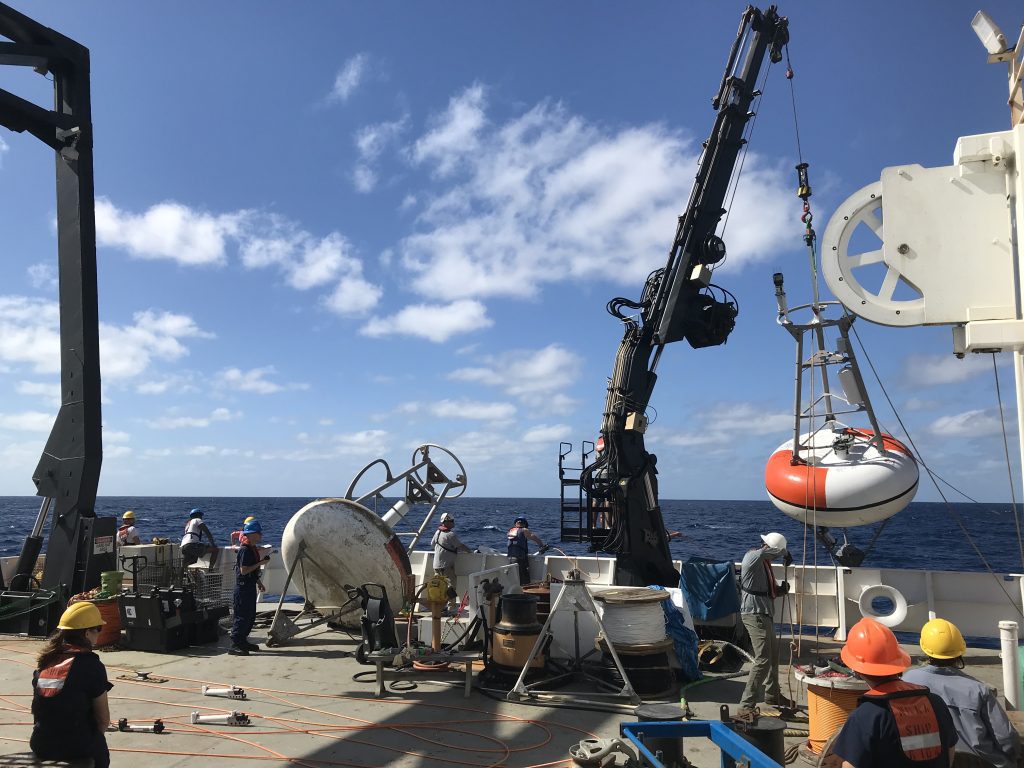
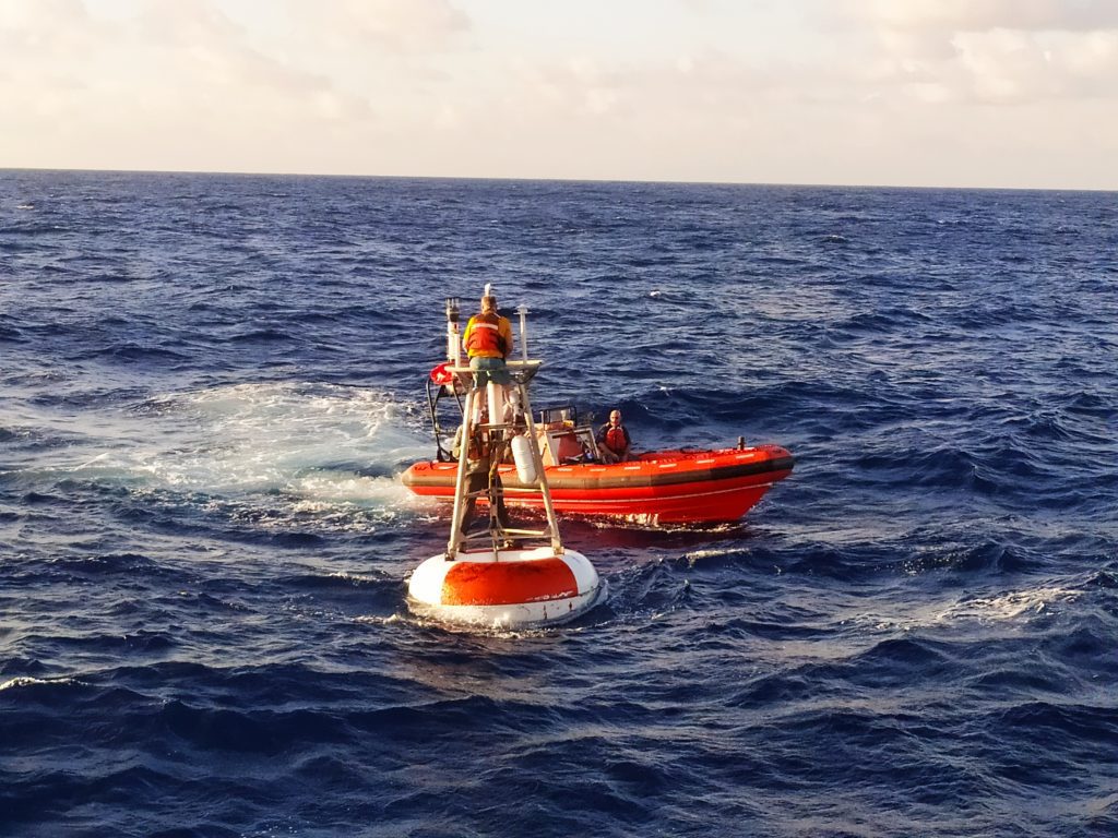
PIRATA buoys measure subsurface ocean temperature, salinity, velocity, and sea surface variables like wind direction and speed, air temperature, humidity, solar radiation, and rainfall. During the cruise, three of the four PIRATA Northeast Extension buoys were recovered and redeployed, a new mooring was deployed at a Brazilian PIRATA site because the previous buoy had become unmoored and was adrift, and sensors were replaced on one Brazilian and one French mooring.
While on the way to the fourth PIRATA Northeast Extension buoy, the ship received a distress call alerting the crew of a sailboat needing help in the area. NOAA Ship Ronald H.Brown detoured from its cruise track to provide assistance to the passengers on the boat. Three sailors were rescued and brought safely aboard the Brown, where they stayed for two weeks until they were brought to shore in Newport, Rhode Island at the end of the cruise.
During the cruise, scientists also performed 56 profiles of ocean temperature, salinity, and depth using the Conductivity, Temperature, Depth (CTD) sensor, which collects data from the ocean’s surface to about a mile depth. CTD devices give scientists a detailed look into the properties of the water column by detecting how the salinity and temperature of the water changes relative to depth. These measurements support oceanographic, meteorological, and environmental research. Scientists and crew also deployed 13 surface Argo profiling floats at various locations along the cruise track. The Argo profiling floats were strategically deployed in areas where there are gaps in information about the global ocean.
In addition to fostering international collaboration, the PIRATA Northeast Extension cruise supported several research projects. Researchers from the Fearless Fund and Woods Hole Oceanographic Institution conducted Sargassum sampling experiments and measured ocean nutrients. The experiments by Fearless Fund examine how the growth of Sargassum, a type of seaweed, can help remove carbon dioxide from the ocean. Woods Hole scientists are studying the environmental conditions that affect Sargassum growth, its species diversity, and how its spatial distribution and abundance change from month to month and year to year. When Sargassum was spotted at sea, a physical sample was obtained, a CTD cast was conducted near the Sargassum, and surface water samples were collected for nutrient analysis. This is the third year Sargassum sampling was done aboard the PNE cruise.
Additionally, researchers aboard the cruise from Arizona State University, the University of Maryland Baltimore County, and NOAA’s National Environmental Satellite, Data and Information Service Center for Satellite Applications and Research(NESDIS/STAR) collected aerosol measurements and performed radiosonde/ozonesonde launches in support of the Aerosols and Oceanographic Science Expeditions (AEROSE) project. The project’s goal is to gain an understanding of the weather and climate impacts of long-range transport of mineral dust and smoke aerosols over the tropical Atlantic. Red tides, increasing rates of asthma, and precipitation variability in the eastern Atlantic and Caribbean have all been linked to increases in the quantity of dust and aersols transported across the Atlantic.
The PIRATA Northeast Extension cruise typically occurs annually and serves as a place for academic and international collaboration to advance the understanding of the ocean and to work towards improved prediction of weather and climate variability.
AOML’s cruise participants were Greg Foltz (chief scientist), Diego Ugaz (NOAA’s Cooperative Institute for Marine and Atmospheric Studies (CIMAS)), Philip Tuchen (National Research Council), Aurpita Saha (CIMAS), and Lev Looney (University of Miami). NOAA partners included: the University of Miami, Woods Hole Oceanographic Institution, the Fearless Fund, Arizona State University, and the University of Maryland Baltimore County.