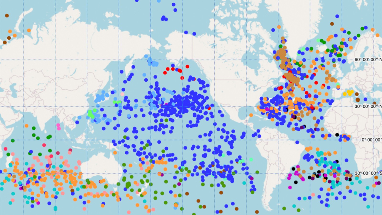

The Global Drifter Program’s Drifter Data Assembly Center (DAC) at AOML has launched a new interactive map of the global drifter array. This new tool features the ability to zoom and scroll, hover the cursor over drifters to get their identification numbers, and click to see data and metadata including deployment information, manufacturer, and drifter type in an ID card that can be viewed as a high-resolution image with an additional click.
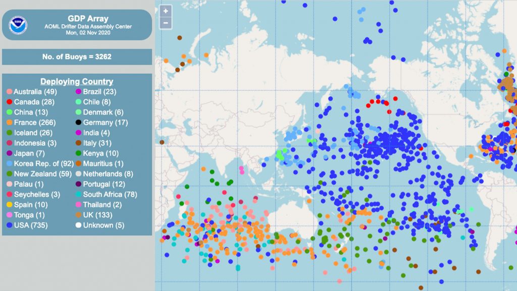
“This new tool will provide value for different types of users. A user can find out who is deploying drifters and where they are, while someone else can use the tool to visualize drifter data, evaluate their quality, and see if the drifter has lost its drogue” said Rick Lumpkin, co-principal investigator of the Global Drifter Program.
The Global Drifter Program is a part of the Global Ocean Observing System and a scientific project of the Data Buoy Cooperation Panel.
Drifters are deployed in the global ocean to measure sea surface temperature and ocean currents, but most are also equipped to measure other variables. As the drifter moves around, guided by currents, measurements of atmospheric pressure, winds, wave spectra, and salinity can also be taken. These data are collected by sensors in the drifter and transmitted to overhead satellites. Tracking the location of drifters over time allows scientists to build a profile of ocean currents.
“In the past, when we would get asked for information regarding a specific drifter, we would generate this type of ID card on the fly. Now this is automatically done for every drifter in the global array, giving the user immediate access to the information they are looking for either by searching an ID number or by finding it themselves on the map,” said Lumpkin.
This product reflects work by the entire Data Assembly Center team, especially its newest members Bertrand Dano (ID cards created from several data and metadata bases) and Caridad Gonzalez (JavaScript programming of map functionality), and was coordinated by Shaun Dolk.