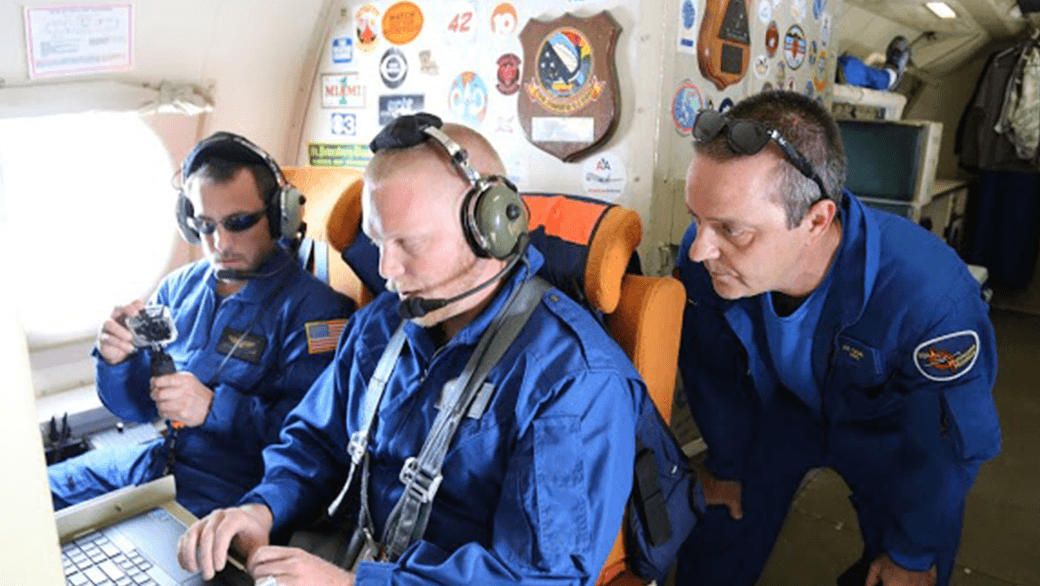

This hurricane season, NOAA’s Office of Oceanic and Atmospheric Research will work with NOAA’s National Weather Service to upgrade weather forecast models and conduct research with unmanned air and water craft to improve forecasts of hurricane track and intensity.
A highlight this season is the upgrade of the operational Hurricane Weather Research and Forecast system (HWRF), an advanced hurricane prediction model. This year’s version now has increased the resolution from 3 to 2 kilometers, and will use tail Doppler radar data collected from the NOAA P-3 and G-IV hurricane hunter aircraft to improve the storm representation within the model.
With each upgrade to a higher resolution the model helps improve predictions of hurricane intensity because we’re able to more closely model features such as clouds that can significantly affect storm intensity,” said Frank Marks, Sc.D., director of NOAA’s Hurricane Research Division. “Our goal is to give communities the forecasts they need to be ready, responsive and resilient to severe weather.
Not only does the operational HWRF have better resolution but NOAA is also running HWRF globally in support of the Joint Typhoon Warning Center, the center responsible for issuing tropical cyclone warnings for the U.S. Department of Defense for the North West Pacific Ocean, South Pacific Ocean and Indian Ocean. There is also a new data assimilation system that takes advantage of the HWRF ensemble to do inner core assimilation of the aircraft data.
NOAA’s Hurricane Research Division and Unmanned Aircraft Program will be working with NOAA’s Environmental Monitoring Center to transition the G-IV Tail Doppler Radar and NOAA dropsonde data collected by the NASA Global Hawk into operational use. We will be demonstrating the potential of the NASA Global Hawk unmanned aircraft, the smaller unmanned aircraft called Coyote, ocean gliders, and Doppler wind Lidar as new observing technologies that could be used to improve forecasts of intensity and track.
NOAA is also adding a Doppler wind Lidar on the P-3 aircraft which is used to collect, process and transmit atmospheric data from within a hurricane. The Lidar will complement the P-3 tail Doppler radar, allowing NOAA to sample the winds inside the hurricane, even within the eye of the storm, which may be driving rapid changes in hurricane intensity.
Building upon earlier collaborative research with NASA, NOAA will direct 10 flights of the Global Hawk in late August through early September to gather data on hurricanes to improve forecasts of intensity and track. The Global Hawk will carry instruments to measure temperature, moisture, wind speed and direction to profile hurricanes from 60,000 feet down to the surface of the ocean. The new mission for the Global Hawk is called Sensing Hazards with Operational Unmanned Technology and was funded in part by the Disaster Relief Appropriations Act of 2013.

Flying the Global Hawk with weather observing sensors above a storm is like putting the storm under a microscope. We can gather high resolution data to see more clearly inside the storm and better capture changes in wind speed and intensity,” said Robbie Hood, director of NOAA’s Unmanned Aircraft System Program. “We are also testing how unmanned aircraft can be a reliable observation tool to augment weather observations from satellites, and in the event of an unplanned gap in satellite coverage, to provide severe weather forecast information.
Not only can the Global Hawk fly at altitudes nearly twice as high as manned aircraft, but it can also fly for 24 hours, much longer than manned aircraft, allowing it to gather data on the evolution of a hurricane over a whole day. Data collected will be used by the National Weather Service operational hurricane forecast system (HWRF) and will be evaluated to determine how they improve forecast guidance on hurricane intensity and track.
NOAA successfully deployed an unmanned aircraft, the Coyote, from a hurricane hunter into the eye of Hurricane Edouard last season, and will expand the use of this small unmanned aircraft this hurricane season. Planned flights timed to hurricanes will measure the regions of strongest winds at low altitudes in hurricanes and send that data in real-time to forecasters at NOAA’s National Hurricane Center.
")
Northern Gulf Institute scientists working with NOAA’s National Weather Service Lower Mississippi River Forecast Center will fly a small unmanned aircraft to study the Pearl River, looking at water levels, vegetation and impacts from storms. The research by the NOAA cooperative institute at Mississippi State University will be used to improve flooding forecasts and damage assessments after flooding in areas that are difficult to reach by manned aircraft, but often severely affected by hurricanes.
NOAA is also planning to deploy two underwater gliders north and south of Puerto Rico to collect data in the upper ocean before, during, and after a storm passes. These measurements will provide a better understanding of the ocean response to a hurricane’s passage, which in turn improves ocean models used in hurricane forecasts.
We must continue to push the boundaries of science to increase lead times for severe tropical storms, floods and other severe weather,” said Marks. “This season’s research is designed to find earlier clues to when a storm rapidly intensifies in order to help build a more weather ready nation.
Originally Published by Shannon Jones, AOML