
A complex suite of variables impact hurricane development, track, and intensity. As such, hurricane researchers must have a complex suite of tools to enhance forecasts. This year, NOAA brings exciting new observing, modeling, forecasting, and communication tools to the table to enhance its hurricane warning capabilities and aid public readiness.
Hurricane researchers at AOML will use a number of these tools and aircraft-related instruments during the 2017 Hurricane Field Program to measure changes in air and sea surface temperature, moisture, winds, and pressure, all with the goal of improving the accuracy of forecasting severe storms.
AOML is currently in the midst of a multi-year effort called the Intensity Forecasting Experiment (IFEX). IFEX aims to improve the understanding and prediction of intensity change by collecting observations from all stages of a tropical cyclone life cycle—genesis to decay—to enhance current observational models. By building on years of observational expertise and cutting-edge approaches to data integration and model development, hurricane scientists at AOML lead advancements in observations and modeling that have improved intensity forecasts by 20% in recent years.
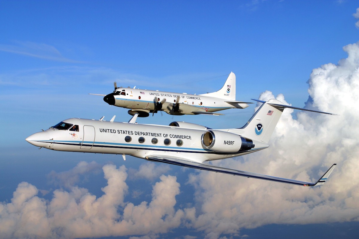
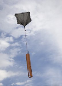
In partnership with NOAA’s Aircraft Operations Center, AOML’s hurricane researchers gather data from aboard Hurricane Hunter aircraft—two P3s that fly directly into storms and a G-IV jet that flies at higher altitudes above and around the periphery of storms. These aircraft routinely pepper tropical systems with dropsondes to gather vertical profiles from within the eyewall and the surrounding environment. Shirley Murillo, the new HRD deputy director, considers dropsondes one of the biggest advances HRD has made in terms of forecasting storm intensification, as they provide vital information about the damaging winds embedded within tropical cyclones.
In addition to dropsonde data, researchers continue to test a Doppler Wind Lidar instrument aboard the P3s, which provides vertical profiles of the winds above and below the aircraft using a laser. “The benefit of Lidar is that it gathers data in areas of the atmosphere where tail Doppler radar cannot measure. It is more useful in areas that are cloud free, have little cloud cover, or no precipitation,” said Murillo. She explained that the tail Doppler radar and Doppler Wind Lidar instruments together provide more complete, three-dimensional depictions of the winds inside tropical systems, and their profiles have shown excellent agreement with dropsonde data this season.
NOAA also uses unmanned aircraft to collect observational data. The Coyote observes the lowest parts of the hurricane environment, the critical boundary layer where the atmosphere meets the sea, providing an opportunity for more complete data collection at lower altitudes within the storm. The Global Hawk flies above tropical systems, providing measurements from heights of 60,000 feet to the ocean surface. The global hawk is also equipped with GPS drop sondes, and can fly longer and further than conventional aircraft.
The sophisticated camera on NOAA’s new GOES-16 satellite will provide hurricane forecasters with higher resolution images. The satellite is also equipped with a lightning mapper, which will allow forecasters to observe lightning strikes that build within tropical cyclones. Recent studies have shown that an increase in lightning activity can or may indicate that a storm is strengthening. “It is one of many factors that can indicate rapid intensification,” said Murillo.
Finally, an experimental visualization tool called the Coastal Resilience Mapping Port has been introduced to enhance public engagement. This online, interactive tool helps users view areas that are vulnerable to future flood risks from sea level rise and storm surge. Another visualization tool enables the public to see when damaging winds are forecast to impact their region.
Predicting the rapid intensification of a tropical cyclone remains one of NOAA’s top forecasting priorities. Murillo explained “there are many different factors in predicting the track and intensity of a storm. Not only must we make observations at the environmental scale, but we also must observe what is happening inside the storm, and how the environment behaves with it.” By incorporating data from an assortment of instruments into hurricane forecast models, AOML can evaluate how such observations can best improve predictions of hurricane track and intensity change.
Originally Published September 2017 by Sierra Sarkis