

NOAA reconnaissance continues into Tropical Storm Isaias today after their most recent P-3 Hurricane Hunter aircraft returns home from its 7-hour mission tasked by the Environmental Modeling Center (EMC), which took off Saturday, August 1 at 4:30 AM EDT.
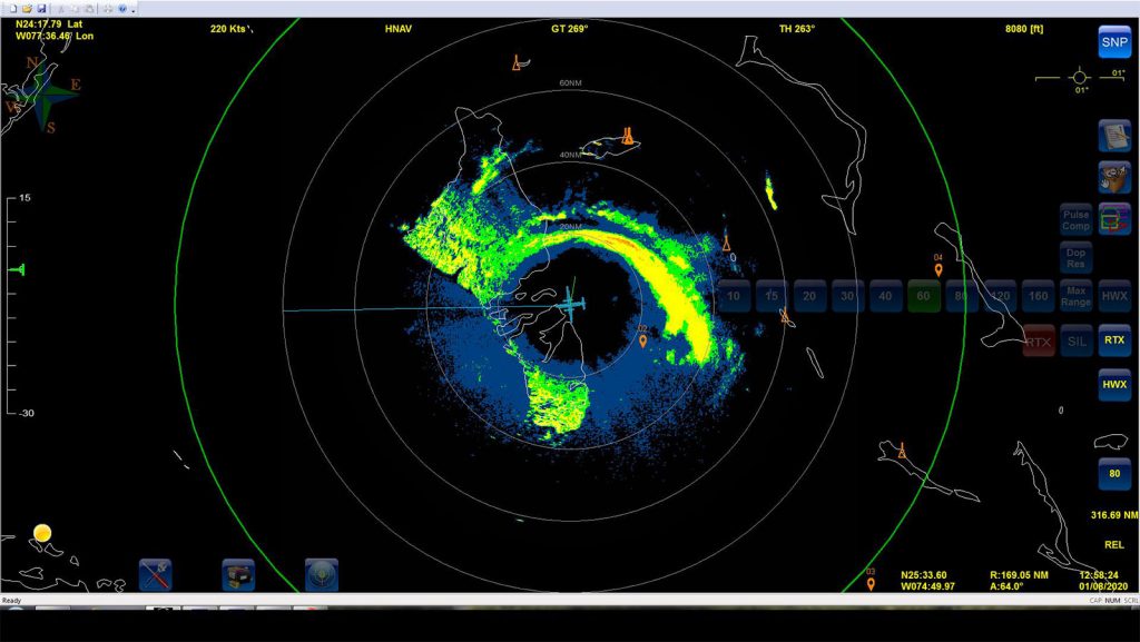
Tropical Storm Isaias’ convection illustrates the storm’s battle with vertical wind shear and dry air apparent via radar and satellite imagery today. The National Hurricane Center (NHC) expects this meteorological configuration to persist over the next day as the storm tracks to the northwest through the Bahamas before recurving toward the north. Isaias will track over the warm Gulf Stream waters as it turns to the north, which NHC predicts will allow for brief re-intensification.
The combined information from onboard tail-Doppler radar, dropsonde, SFMR, and flight level sensors suggests that mid-level vertical wind shear has forced Isaias’ vortex to tilt with height, limiting potential intensification of the hurricane and exposing its core to dry air in the west and south quadrants of the cyclone.
NOAA reconnaissance data have been ingested into operational weather models since missions began on July 31. NOAA’s P-3 took off at 5:00 PM for its second mission of the day, and subsequent missions are planned through the weekend to monitor the evolution of Isaias.
For the latest information about tropical cyclones and other weather systems, visit the NOAA National Weather Service National Hurricane Center.
For information on numerical prediction of tropical cyclones, visit the NOAA National Centers for Environmental Prediction Environmental Modeling Center.