
NOAA’s groundbreaking Argo Program was highlighted in a recent publication in Frontiers in Marine Science. The Argo program began in 1998 when a team of international scientists, known as the “Argo Science Team,” proposed the idea for a global array of autonomous floats to obtain temperature and salinity measurements of the upper 2,000 meters of the global ocean. The array of floats, called Argo, would go on to be endorsed as a pilot program of the Global Ocean Observing System and be used to fill in the large data gaps in ocean observations.
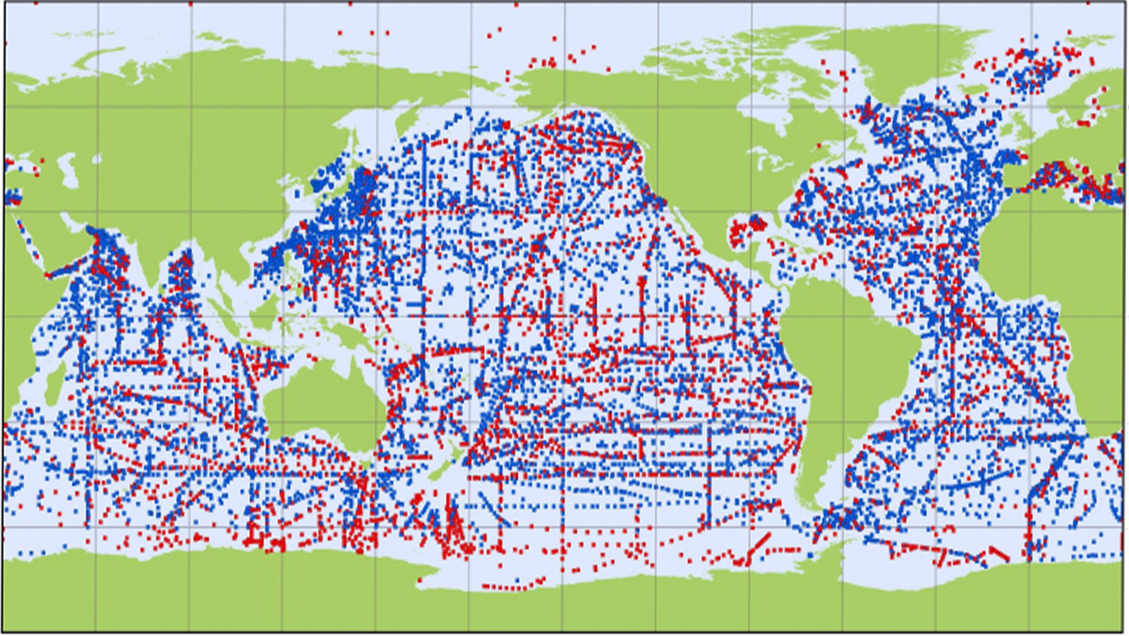
The Argo Program has collected, processed, and distributed over two million vertical profiles of temperature and salinity from the upper ocean in the past two decades. The initial goal of the program called for the deployment of 3,000 profiling floats in a 3◦ x 3◦ array in the open ocean between 60◦N and 60◦S (Argo Science Team, 1998). These floats would be deployed separately by participating countries, but the data would be shared internationally.
NOAA/AOML serves as the US Argo Data Acquisition Center (DAC) for the program. The role of the DAC is to collect and quality control all of the Argo data collected by US scientific and governmental institutions before it is transmitted to the two international data acquisition and distribution centers, who distribute Argo data to the world. The data from Argo floats are freely available in real-time and are widely used in ocean and atmospheric models.
The name Argo was chosen because of the program’s partnership with the Jason earth observing satellites that measure the shape of the ocean surface. In Greek mythology, Jason sailed on his ship the Argo. In oceanography, Jason and Argo together would provide regular global sea surface height and subsurface temperature and salinity measurements.
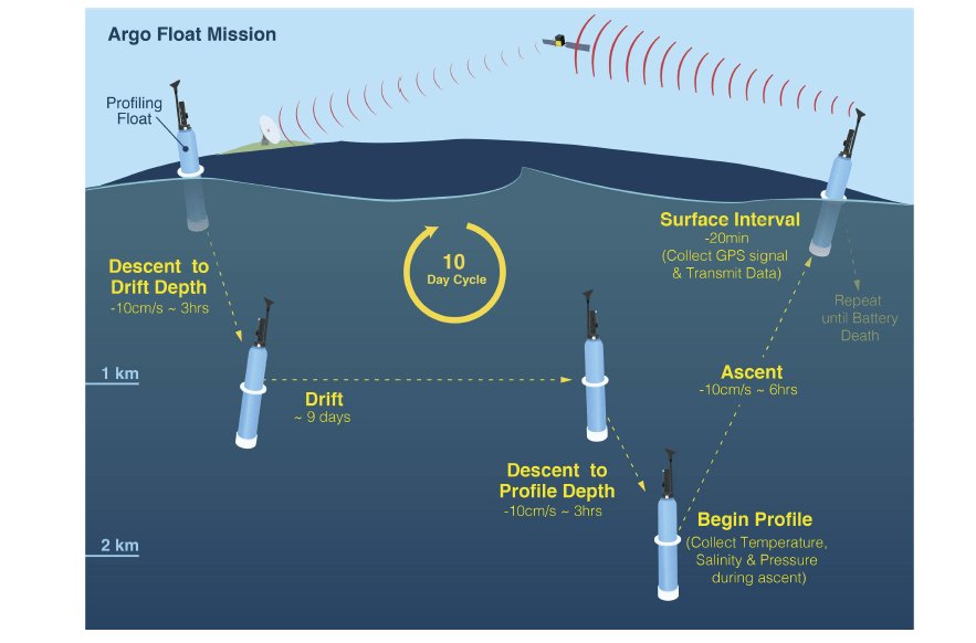
The standard Argo mission is known as “park-and-profile” and is shown below in figure 1. To begin, the float descends to a target depth of 1,000m to “park” and drift with the ocean currents. Every 10 days the float descends to 2,000m and then collects a vertical profile of temperature and salinity during ascent to the surface. When a float surfaces, the data are transmitted and the float’s position is determined either by Système Argos or by GPS. The float then returns to the target park pressure and the cycle is repeated. Deployments of Argo floats began in 1999, and the 3,000-float goal was reached in November 2007.
Today, Argo is an international collaborative project, involving 34 countries, that has deployed more than 15,000 floats. After two decades Argo has surpassed its original goals and continues to look for ways to improve and expand its coverage. Argo’s nearly global coverage is crucial for the detection of climate change signals, estimation of the ocean’s heat content, and for observation of the intensification of the global hydrological cycle.
Looking forward, advances in machine learning algorithms have the potential to provide an important resource to the Argo community by helping to meet the challenge of maintaining the quality of data from more floats and diversified missions as the program continues to expand.
In October 2019, NOAA Research’s Global Ocean Monitoring and Observing Program awarded $3 million in funding for projects that will expand the ability of the global Argo Program to measure ocean chemistry.
AOML contributing authors:
Molly Baringer and Claudia Schmid
References:
Argo Science Team (1998). On the design and implementation of argo-a global array of profiling floats. International CLIVAR Project Office.