The 2013 Atlantic hurricane season, which officially ended on November 30th, will be noted in the record books as having been a relatively quiet year with the fewest hurricanes since 1982. In fact, it will be ranked as the sixth least-active Atlantic hurricane season since 1950.
Despite this, the 2013 season was quite an active year for scientists with AOML’s Hurricane Research Division (HRD). Flying aboard NOAA’s hurricane hunter aircraft, they conducted missions into Tropical Storms Gabrielle and Karen, as well as Hurricane Ingrid, to gather data for research and assimilation into numerical models.
These data were collected as part of HRD’s annual Hurricane Field Program, a large component of which is the Intensity Forecasting Experiment (IFEX). A goal of IFEX is to better understand the physical processes and other factors that enable tropical cyclones to change intensity, as well as improve tropical cyclone intensity forecasts.
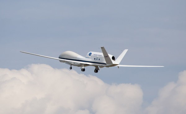
As part of their efforts to gather data for research, HRD scientists released 136 airborne expendable bathythermographs and 367 dropwindsondes from NOAA’s P3 and Gulfstream-IV (GIV) aircraft. These instruments enabled them to obtain information about important features in the atmosphere and ocean. The G-IV jet gathered data during nine flights and the two P3 aircraft conducted 17 missions, for a total of 150 flight hours spent sampling these three tropical systems. Many of the flights were coordinated with NASA’s Hurricane Severe Storm Sentinel missions, which featured two high-altitude, unmanned, Global Hawk aircraft.
One of the highlights of the season was that, for the first time, the P3’s tail Doppler radar data were transmitted directly to NOAA Central Operations and successfully assimilated into the operational HWRF model. This was a significant accomplishment for NOAA that enabled the P3’s Doppler radar data to be included in the latest high-resolution models as part of the effort to continually improve intensity and track forecasts. The tail Doppler radar data provided vital information about the direction and strength of the winds found in Gabrielle, Ingrid, and Karen.
On the modeling and data assimilation fronts, a new basin-wide version of the Hurricane Weather and Research Forecast (HWRF) model developed at HRD was run in real-time during the season, allowing for multiple storms to be forecast concurrently for the first time. Additionally, HRD provided near-real-time runs of a research version of HWRF initialized with the Hurricane Ensemble Data Assimilation System (HEDAS), a testbed for improving the assimilation of data into the operational HWRF model.
For the first time, high-resolution cloud-motion vectors, as well as other satellite retrievals, were ingested with HEDAS. The model forecasts showed that the assimilation of these data with a sophisticated data assimilation system could provide better forecasts of track and intensity than the current operational system. HRD’s HWind group successfully made 33 surface-wind analyses for six storms that formed in the Atlantic basin this year.
HRD scientists are thankful for the successes and major milestones achieved during the 2013 Atlantic season, all without having a single hurricane make landfall in the U.S. and with only minimal loss of life and property to the public due to tropical systems.
