
One of the most challenging questions in global climate change studies today is how quickly, or if, heat that accumulates within the Earth system penetrates into the deep ocean. Scientists with the University of Miami (UM), AOML, and NASA’s Jet Propulsion Laboratory (JPL) recently tackled this question by using a combination of present-day satellite and in situ observing systems to study the distribution of heat in the oceans.
Their findings, published in the journal Geophysical Research Letters,* show that the subtropical South Pacific Ocean is one of the key regions where a long-term accumulation of heat at depth may be occurring. To better understand the rates and mechanisms involved in this deep heating, a group of scientists Denis Volkov (UM/AOML), Felix Landerer (JPL), and Gustavo Goni, Sang-Ki Lee, and Christopher Meinen (AOML) have begun a new project to monitor and analyze the horizontal and vertical redistribution of heat in the western subtropical South Pacific Ocean. Funding for the project is provided by NASA’s Ocean Surface Topography Science Team and AOML. Because this new research addresses one of NOAA’s key goals to understand and predict changes in climate, weather, oceans, and coasts AOML is providing the funding for much of the moored instrumentation that will be deployed as part of the new study. Specifically, AOML will supply two Pressure-equipped Inverted Echo Sounder (PIES) instruments.
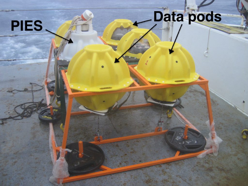
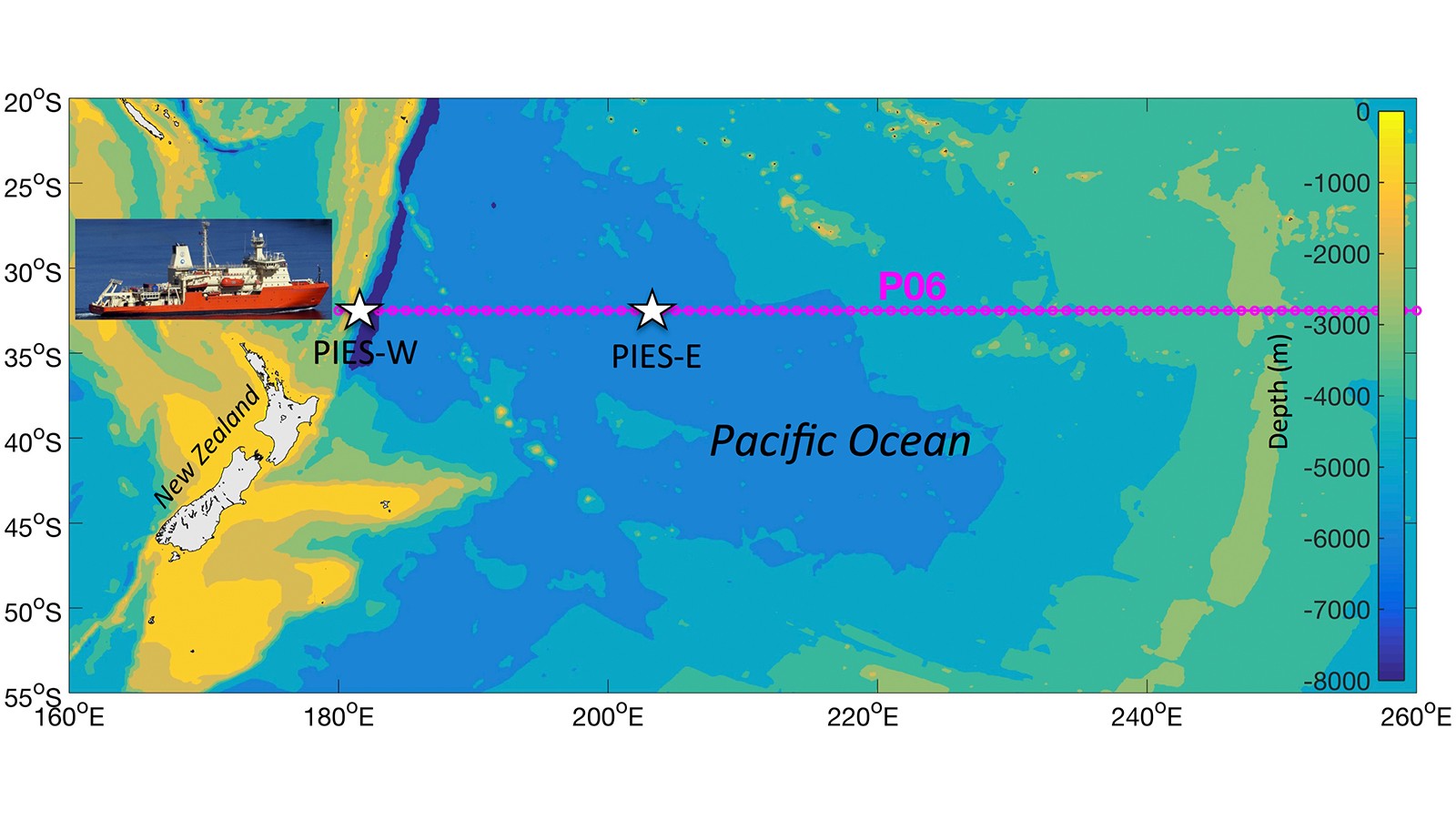
These instruments will be deployed during the first leg of the upcoming GO-SHIP/ CLIVAR P06 cruise aboard the R/V Nathaniel B. Palmer sailing from Sydney, Australia to Papeete, Tahiti in July 2017 (see cruise track and proposed deployment sites for the PIES instruments in the image above right). PIES is an ocean bottom moored instrument that measures: (i) the time for a sound pulse to travel round-trip from the ocean bottom to the ocean surface and back; and (ii) the pressure variations at the bottom of the sea. The travel time measurements from each PIES can be calibrated into full-depth profiles of temperature, salinity, and specific volume anomaly when combined with hydrographic information from the region. These profiles and bottom pressure measurements will provide the needed data to monitor the evolution of the full-depth heat content and changes in the meridional (north-south) flows in the southwest subtropical Pacific Ocean. Another exciting aspect of this deployment is that both PIES moorings will be equipped with AOML’s Adaptable Bottom Instrument Information Shuttle System or ABIISS. This expendable data pod technology system has been under development at AOML for the past several years, and its deployment represents the first deep ocean field application as an integral part of a science project.
ABIISS provides a cost-effective method for collecting observations from ocean bottom moored instruments. It uses autonomous expendable data pods that record data from the primary moored instrument. At user pre-programmed intervals, the data pods self-release and rise to the ocean surface, transmitting their stored data to land via the Iridium satellite network. Being an expendable system, it requires no need for recovery or the use of ship time to retrieve observations, important advantages when conducting research in a remote and rarely visited region like the southwest Pacific Ocean.
Scientists and engineers at AOML have already successfully tested the ABIISS technology with instruments moored at both 750 and 4600 meter depths. However, the new study in the southwest Pacific Ocean is ABIISS’ first science-driven deployment and will demonstrate some of the exciting possibilities of this new AOML-designed technology. By combining advanced, up-to-date satellite and in situ observing systems, including the PIES instruments and state-of-the-art ocean models, this project is expected to identify the dynamic processes that have led to the observed accumulation of heat in the subtropical South Pacific and other regions. The deployment of PIES instruments will also enable researchers to monitor the evolution of heat content in the study region as a response to the 2015-2016 El Niño event. These tasks have special significance, as they will generate insights to help predict the fate of the accumulated heat and provide guidance for potential future changes on time scales from years to decades.
____________
*Volkov, D.L., S.-K. Lee, F.W. Landerer, and R. Lumpkin, 2017: Decade-long deep-oceanwarmingdetectedinthesubtropical SouthPacific. Geophysical Research Letters, 44(2):927-936 (doi:10.1002/2016GL071661).