
Researchers from the Physical Oceanography Division of AOML conduct regular hydrographic surveys to monitor the western boundary current system in the subtropical North Atlantic Ocean. These cruises are a part of the laboratory’s long-running Western Boundary Time Series (WBTS) project and are designed to monitor both the Florida Current, east of Florida in the Florida Straits, and the North Atlantic Deep Western Boundary Current east of the Bahamas in the North Atlantic Ocean. These western boundary currents are important parts of the Atlantic Meridional Overturning Circulation (AMOC).
The AMOC is the Atlantic Ocean component of the Global Meridional Overturning Circulation. The circulation is driven by regional differences in heat and salt, as well as ocean mixing and wind forcing at and near the ocean surface. It redistributes heat and salt, as well as carbon and nutrient concentrations, with important impacts on many global scale climate phenomena such as sea level changes, extreme weather, and precipitation patterns.
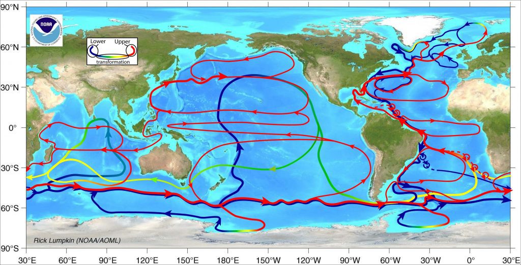
Image Credit: NOAA/AOML
The WBTS project plays a critical role in long term monitoring of the circulation and variability of the AMOC which helps scientists to detect how it is changing over time. Recognizing new changes, above the natural variability in the system, is an important factor in understanding the impacts of climate change on our oceans.
The WBTS project is part of an international collaboration which partners include AOML’s WBTS, which is funded by NOAA’s Global Ocean Monitoring and Observing (GOMO) Program, the University of Miami’s Rosenstiel School of Marine and Atmospheric Science (UM/RSMAS) Meridional Overturning Circulation and Heat-flux Array (MOCHA) Program (funded via the National Science Foundation, NSF), and the UK National Oceanography Centre’s Rapid Climate Change (RAPID) Program.
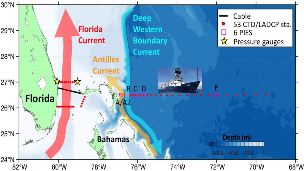
As its name implies, WBTS focuses on the “western boundary” of the transatlantic section. The project conducts regular bimonthly surveys of the Florida Current, a component of the Gulf Stream system (a strong western boundary current in the North Atlantic). WBTS also works with its MOCHA partners at UM/RSMAS in operating surveys east of Abaco Island in the Bahamas along 26.5°N out to 69.5°W approximately every nine months. AOML and UM/RSMAS alternate running these cruises.
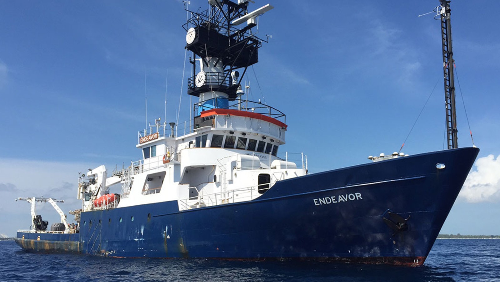
In February and March, AOML and UM/RSMAS scientists, engineers, and technicians participated in one of the project’s collaborative surveys aboard the R/V Endeavor in the Florida Straits, Bahamas, and North Atlantic Ocean. The 18-day hydrographic research cruise provided direct measurements of the Florida Current, Northwest Providence Channel in the Bahamas, and the 26.5°N section. The latter, which extends east of Abaco Island into the North Atlantic Subtropical Gyre, is designed to capture the water mass properties and flow characteristics of the smaller, near-surface Antilles Current, the Deep Western Boundary Current and the gyre interior (Figure 2).
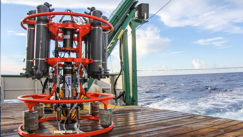
At 49 locations during the survey, AOML and UM/RSMAS researchers lowered an instrument package known as a CTD (which stands for Conductivity, Temperature, Depth) from the sea surface to just above the sea floor using a large oceanographic winch fixed to the research vessel. Configured with multiple sensors, the CTD provides the team with full water column profiles of temperature, salinity, and dissolved oxygen, with the ability to capture seawater samples at up to 24 locations between the surface and the bottom via attached Niskin bottles. Data collected by the CTD are viewable by scientists in real time during the CTD cast, as they are sent up the winch cable to a display in the ship’s computer room.
Additionally, the WBTS CTD package is configured with two Lowered Acoustic Doppler Current Profilers (LADCP) that use acoustic pulses to measure water velocity. LADCP measurements provide a surface to bottom profile of ocean current velocity. These data can help provide researchers a snapshot of how water masses in the ocean are moving, transporting heat, salt and other water properties.
Project time series moorings were also serviced along the 26.5°N section during this cruise. Project deepwater moorings provide scientists with continuous measurements of ocean conditions. However, these moored instruments must be recovered and replaced so that data may be recovered from them. Once an old mooring is recovered, a new one, with fresh batteries, is deployed in its place to continue the time series record. On the February-March cruise, 4 UM/RSMAS current meter moorings and 6 AOML pressure gauge moorings were recovered and replaced.
In addition to the larger shipboard surveys conducted every nine months, the WBTS research team leads 2-day cruises in the Florida Straits aboard the R/V F.G. Walton Smith approximately six times a year. These surveys focus on the 27°N section between West Palm Beach, Florida and the Bahamas (Figure 2). Two such cruises were conducted in April and May. These cruises help to quantify Florida Current volume transport and water mass changes. The data collected also help to improve estimates of daily current transport derived from a submarine telephone cable spanning the section.