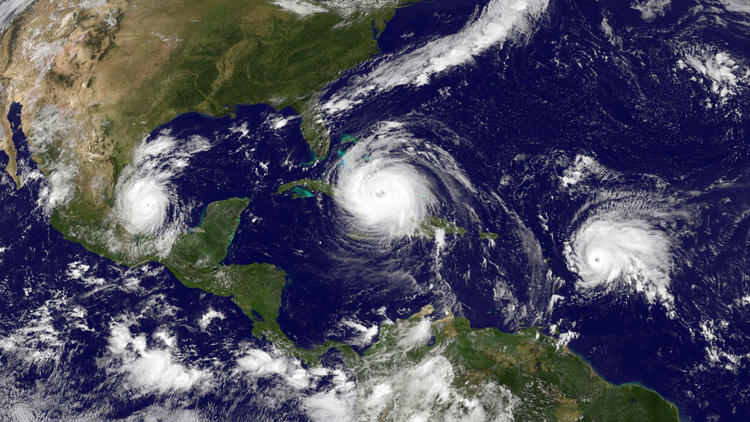

The National Oceanic and Atmospheric Administration (NOAA) uses several advanced numerical weather prediction models to generate forecasts of tropical cyclone track and intensity. These tropical cyclone models have tremendous variations in grid structure, representation of physics, and how data is assimilated, all of which have important implications for forecast accuracy. NOAA’s operational Hurricane Weather Research and Forecasting (HWRF) model, jointly developed by our scientists at AOML and scientists with NOAA’s National Centers for Environmental Prediction, proved to be the most accurate operational NOAA hurricane forecasting model for intensity during the 2017 Atlantic season.
HWRF is a coupled ocean-atmosphere model, which makes use of a wide variety of observations from satellites, data buoys, and hurricane hunter aircraft. This season, increased vertical resolution and timely data collected by NOAA’s P3 and Gulfstream-IV Hurricane Hunter aircraft resulted in more accurate track and intensity forecasts for Hurricanes Harvey, Irma, and Maria. Furthermore, recent experiments have shown that NOAA’s Hurricane Hunter aircraft reconnaissance data helped improve intensity skill by at least 10%.

Additionally, during this year’s hurricane season, an experimental and more advanced version of HWRF, called the basin-scale HWRF, or HWRF-B, was run in parallel with the HWRF model for the entire 2017 hurricane season. Developed at AOML and supported by NOAA’s Hurricane Forecast Improvement Program, HWRF‑B demonstrated up to a 10% improvement in the track forecasts of Harvey and Irma, both high-impact landfalling tropical cyclones, over the current operational HWRF model.
This experimental system also accurately captured the rapid intensification of Harvey over several cycles in advance of landfall in Texas and provided guidance on tropical cyclone genesis forecasts that helped pinpoint tropical systems to be sampled by NOAA’s Hurricane Field Program. For the first time, tail Doppler radar wind data from NOAA’s P3 and Gulfstream-IV Hurricane Hunter aircraft were assimilated in real-time into HWRF-B.

Over the past 20 years, improvements in hurricane computer modeling, observational instrumentation, and forecaster training have greatly increased forecast accuracy. The many complex interactions that occur within the atmosphere remain to be fully understood, especially at the small scales associated with tropical cyclones. However, these milestones mark critical advances in numerical weather prediction that are paving the way to the next generation of NOAA models. While hurricanes cannot be controlled, vulnerability to these complex storms can be reduced through preparedness. Early warning and improved accuracy of forecasts can help save lives and reduce property damages caused by hurricanes.
Originally Published November 2017 by Sierra Sarkis