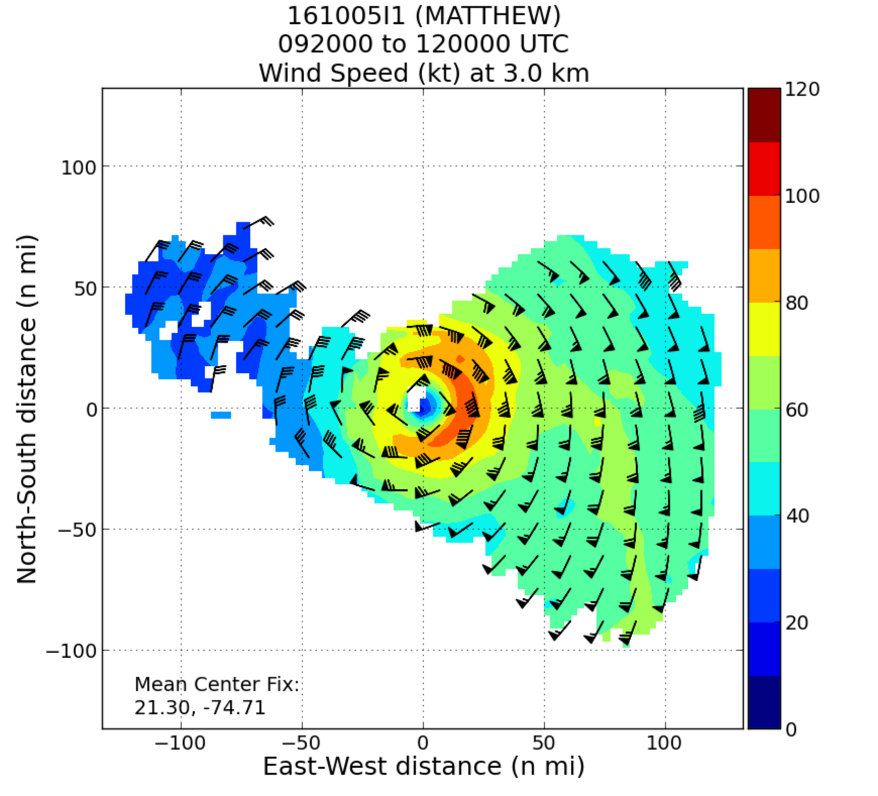


NOAA’s hurricane hunter aircraft carry a unique radar that measures wind in hurricanes where there is rain. Located in the tail of the aircraft and known as the Tail Doppler Radar, this instrument produces images that can provide detailed pictures scientists use to study storm structure and changes. Scientists can also piece together wind speed information gathered over the course of a flight to paint a complete picture of the wind speed in the regions of the storm where the aircraft flies.
These colorful images can be used to identify where in the storm the strongest winds can be found, as well as the direction of the wind. The colorful background image correlates to the wind speed measured in knots (kt). Meteorologists use knots as a common measurement of wind speed. To convert knots to miles per hour, simply add 15% (like figuring a tip at a restaurant). Bright red orange represents an average wind speed of 100 kts, which is about 115 mph.
The wind barbs convey both the wind speed and the wind direction. If you consider the full barb to be an arrow, with the triangular flags and lines representing the feathers at the base of the arrow, the wind is flowing in the direction the arrow is pointing. Each flag represents 50 knots. Each full barb is 10 knots. Each half barb is 5 knots. (See image at right: credit: UCAR)
The images created represent the wind speed and direction measured from the Tail Doppler Radar along the flight track through a storm. As the aircraft pass back and forth through the eye from different approaches, they can eventually paint a picture of the winds over the course of a flight. The winds are estimated for two altitudes, flight level (typically 8,000 feet) and about 1,600 ft. These radar images can help identify where the strongest winds are in a storm, and how far they extend from the storm’s center, information that is helpful when forecasting the impacts of the typically weaker winds at the surface.