

NOAA hurricane scientists are expanding their observations this summer, working with NASA’s Hurricane and Severe Storm Sentinel (HS3) mission and its innovative Global Hawk unmanned aerial vehicles to push the boundaries of hurricane operations. NASA looked to NOAA’s hurricane experts to augment its HS3 science team, supporting their five-year mission to investigate the processes that underlie hurricane formation and intensity change in the Atlantic Ocean basin.
The Hurricane Research Division at AOML has a long history of using NOAA’s P-3 Orions and the G-IV jet hurricane hunter aircraft to observe the inner core and environment of these storms, studying the dynamics of structure and intensity change. The P-3’s often fly right through the eye of hurricanes to collect observations, where small parachuted instruments called dropsondes are deployed to collect temperature and pressure data and measure wind-speed. AOML pioneered the use of these instruments in hurricanes and are world experts in the requisite data processing and real-time transfer of data to operational modeling centers and NOAA’s National Hurricane Center.
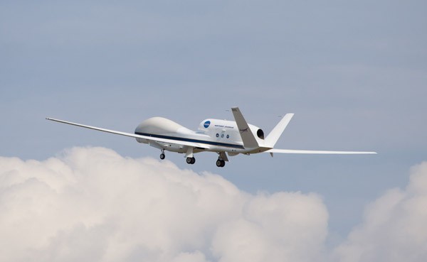
NASA worked with NOAA’s Earth System Research Laboratory and its engineering partners at the National Center for Atmospheric Research to re-design and implement as autonomous dropsonde system for the Global Hawks platform. Hurricane researchers at AOML process data obtained from the dropsonde system and with 26 hours of flight time per mission that can mean up to 89 drops per flight.
Each HS3 flight averages three times the length of a traditional hurricane hunter flight, allowing the aircraft to fly further and much higher than the flight path of the NOAA P-3’s. This expanded flight track allows the Global Hawks to directly sample regions of the Atlantic typically only observed via satellites. One type of large-scale feature that is of particular interest is Saharan dust storms.
These dust storms bring a massive layer of very dry air out over the Atlantic Ocean, known as the Saharan Air Layer, or SAL. Scientists believe that this injection of extremely dry air into the birthplace of Atlantic hurricanes inhibits storm development. A SAL has been present in the eastern Atlantic since July and continues to interact with nascent tropical waves rolling off of Africa.
This summer NOAA and NASA scientists will coordinate Global Hawk flights along with NOAA’s hurricane hunter aircraft to observe the convection that drives intensification within the core of hurricanes, as well as the broader environment that may influence track as well as intensity.