
AOML’s Coral Health and Monitoring Program (CHAMP) rolled out a new data source in October as part of its online data query tool. Optimally Interpolated Sea Surface Temperatures, or OISSTs, are data from microwave satellite observation platforms, products that are sourced from Remote Sensing Systems. Whereas other sea surface temperature sources might be missing data due to orbital gaps or non-ideal environmental conditions such as cloud cover or rainfall, the OISST platform corrects for these errors to provide a complete, daily sea surface temperature map that can benefit coral health and monitoring efforts worldwide.
The new data source is loaded from OISST files dating back to January 1, 1998 through the present day. These Remote Sensing data are distinct from longer-term climate data records in that they represent “foundation sea temperature” estimates. These estimates use a one-dimensional model to calculate daytime warming for each region, represented by a pixel in the global dataset, based on local conditions of wind and light penetration. In well-sampled regions this may not impact the final product, but the data sources used in most analyses have large regions where few satellite retrievals exist each month due to persistent cloud cover, making the daytime satellite retrievals of the OISST extremely valuable.
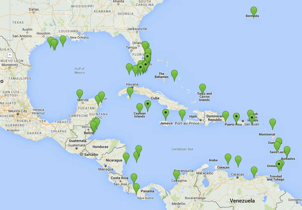
Prior to the integration of the OISST data, the CHAMP Portal included 54 sites, 14 of which reported data from on-site instrumentation and the rest of which were termed “virtual stations.” Virtual stations are locations of interest throughout the world’s coral habitats for which remotely-sensed data products are available. Often, these locations are selected to be virtual forerunners of on-site observation platforms to be deployed at a later date. Integration of the Remote Sensing Systems’ OISSTs has enabled AOML to add an additional 92 virtual stations for a current total of 146 sites, nearly tripling the amount of coverage across the world’s coral habitats.
NOAA oceanographers recently added two new sites to its collection of virtual stations in Cuban waters. The two new stations are located at sites near Cuban coral reefs, known to be some of the most pristine in the region. The virtual station at Banco de San Antonio is in a commercially important fisheries region and serves as a sister sanctuary to NOAA’s Flower Garden Banks National Marine Sanctuary in the Gulf of America. The other virtual station is located in Cabo San Antonio, part of the Guanahacabibes National Park, a sister sanctuary to NOAA’s Florida Keys National Marine Sanctuary. By monitoring conditions at these comparable sister sanctuary sites, NOAA oceanographers will be able to evaluate ecosystem function and changes occurring across the Straits of Florida.

Originally Published by Edward Pritchard, 2015