
The 2021 hurricane season is off to a busy start with five named storms having already formed in the Atlantic Ocean. Recently, Tropical Storm Claudette travelled directly over three ocean observation platforms, providing key ocean data for the initialization of the ocean component for hurricane forecast models.
Research performed by scientists at AOML, the Cooperative Institute for Marine and Atmospheric Studies (CIMAS), and partners in the Integrated Ocean Observing System (IOOS) and universities show that the ocean plays an important role in determining the intensity of hurricanes provided the appropriate atmospheric conditions are also present. In support of enhanced ocean monitoring geared towards improving hurricane forecasts, AOML, together with other NOAA Labs, the US Navy, academic institutions, and private industry, will be deploying multiple ocean-observing platforms this hurricane season that provide satellite-transmitted data to forecasters in real-time. Understanding the ocean’s role in hurricanes is crucial for improving forecast models and providing more advanced, targeted warnings to coastal communities in harm’s way.
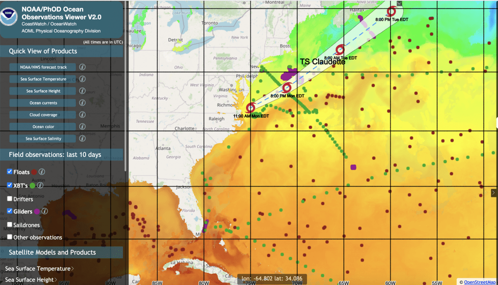
In June 2021, Tropical Storm Claudette travelled over areas in the Atlantic Ocean off the northeast US coast being surveyed by three ocean observation platforms conducting profile observations: gliders, Argo floats, and eXpendable BathyThermographs (XBTs) (shown in figure 1 below). All three datasets were assimilated into the Real-Time Ocean Forecast System (RTOFS) at NOAA’s Environmental Modeling Center for ocean and hurricane forecasts.
XBT observations were carried out by cargo ships that travelled in the region a few days ahead of the passage of the tropical storm and provided observations of temperature in the upper hundred meters across and along the Gulf Stream and over shelf waters. Gliders provided continuing temperature-salinity profile observations at one location to the left of the storm, and Argo floats provided information on the background temperature-salinity field.
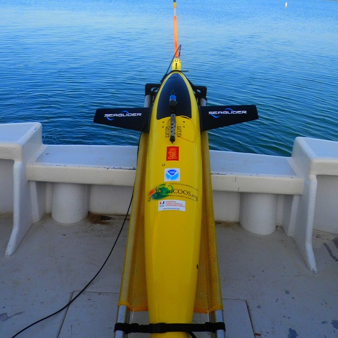
Gliders are autonomous platforms that profile the temperature and salinity of the water column from the ocean’s surface to half a mile below and then transmit their data to shore in real or near-real time. The glider observations under Claudette corresponded to a Woods Hole Oceanographic Institution glider.
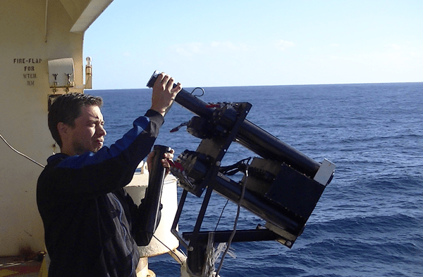
Additionally, Argo and XBT observations were collected under the forecasted track of Tropical Storm Claudette. Argo floats measure temperature and salinity in the upper 2000 meters of the ocean by descending for 10 days and then ascending to transmit the data via satellite. These observations allow for continuous monitoring of the state of the ocean for climate and to possibly monitor ocean conditions for extreme weather events, studies, and forecasts. EXpendable BathyThermoGraphs (XBTs) are temperature probes that provide observations to estimate the heat contained in the upper ocean and surface currents, which drive sea surface temperatures. These probes are deployed several times per year along many established transects throughout all ocean basins from a network of research vessels and volunteer ships from the Ship of Opportunity Program. The XBT deployments crossing the Gulf Stream under Tropical Storm Claudette were performed by the Oleander (URI, WHOI, Bios, SUNY, AOML), and by the Okeanos Explorer (AOML probes).
AOML’s Physical Oceanography division recently started a new partnership within the Ship of Opportunity Program in June 2021 to begin conducting measurements of temperature profiles using XBTs along the continental shelf between the northeast US and Florida, and across and along the Gulf Stream. The ships and crew currently contributing to this effort are the Hapag Lloyd vessels Chicago Express and Bremen Express, Maersk Vilnius and Maersk Visby, and the Oleander.
Data from these three observing platforms are continuously transmitted in real-time into the Global Telecommunication System (GTS) and provide temperature and salinity profile observations in regions that are known to contribute to hurricane intensity changes. These observations are routinely assimilated into NOAA operational ocean models and are expected to help better characterize the upper ocean thermal structure in the ocean by providing continuous profile observations in areas that would be otherwise undersampled.
Using multiple observation platforms that provide targeted and sustained ocean observations to collect ocean data allows for the most accurate representation of the ocean for hurricane forecast models. Argo floats provide a broad picture of the ocean, while gliders and XBTs provide a more fine horizontal resolution of the water column, which are key to correctly represent horizontal gradients in the ocean. Although Tropical Storm Claudette weakened, heading northeast over the ocean, these observing platforms showed how different components of the observing system are currently providing key upper ocean profile data to correctly represent the ocean during extreme weather events.