
Major Hurricane Teddy Missions Provide Unique Dataset for Hurricane Scientists at AOML
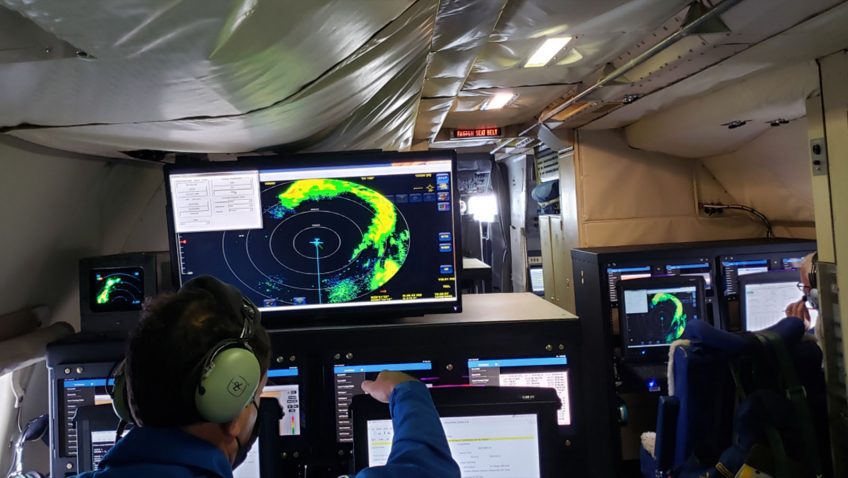
NOAA’s Hurricane Hunters continue reconnaissance for Major Hurricane Teddy, conducting numerous science experiments developed by AOML and its collaborators.
NOAA’s Hurricane Hunters continue reconnaissance for Major Hurricane Teddy, conducting numerous science experiments developed by AOML and its collaborators.
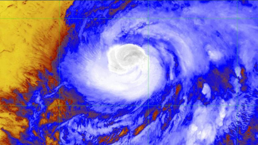

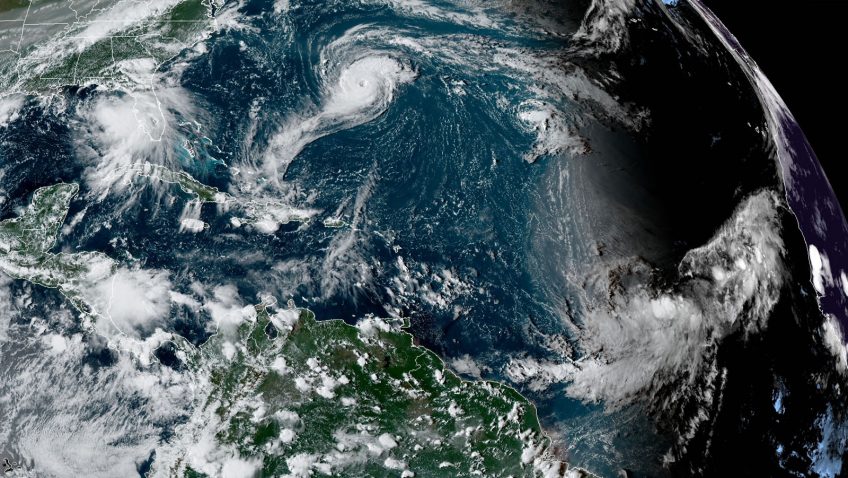
AOML’s Hurricane Research Division tasked all three NOAA Hurricane Hunter aircraft to perform science operations into Hurricane Teddy, now a category-3 tropical cyclone and still intensifying in the mid-Atlantic.
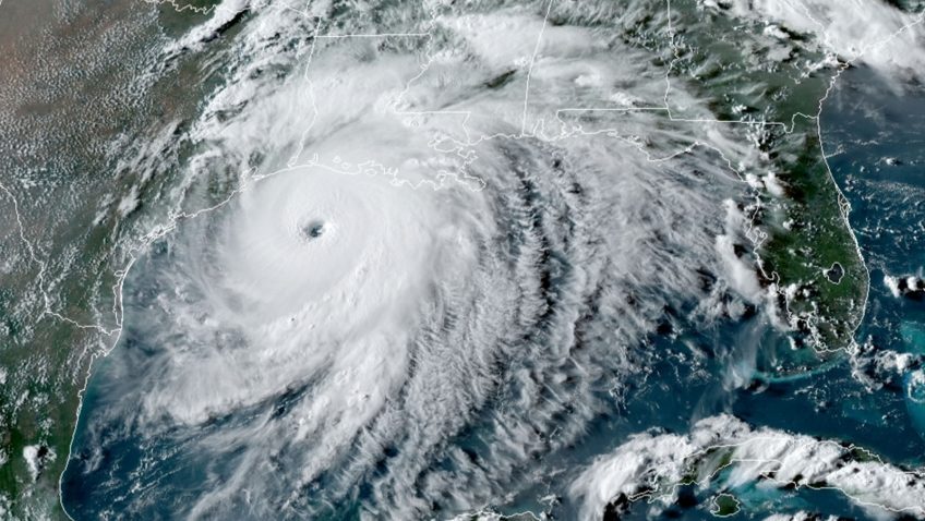
NOAA’s P-3 aircraft wraps up its sequence of missions into Hurricane Sally prior to the system’s eventual landfall along the central Gulf Coast. Tasked by the National Hurricane Center (NHC), its final flight took off on September 15 at 9:30 EDT from Lakeland, FL.

NOAA’s G-IV and two P-3 Hurricane Hunter aircraft took off from Lakeland, FL at 10:30 AM, 1:30 PM and 4:30 PM EDT on September 14th to investigate Hurricane Sally’s circulation. AOML scientists providing onboard and remote support for these missions ensure that Tail Doppler Radar, dropsonde, and Stepped Frequency Microwave Radiometer (SFMR) measurements allow for adequate coverage of the storm environment.

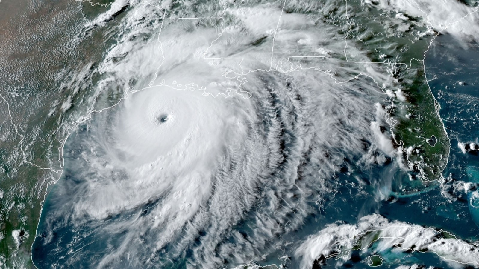
A very active peak in this year’s Atlantic hurricane season has prompted NOAA’s National Hurricane Center (NHC), Environmental Modeling Center (EMC), and AOML’s Hurricane Research Division to task their G-IV and both P-3 aircraft to investigate multiple storms in the Gulf of America and mid-Atlantic.

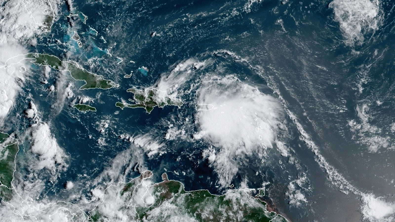
NOAA’s P-3 Hurricane Hunter aircraft completed a flight into Tropical Storm Nana in the Caribbean on the morning of September 2. AOML scientists onboard the aircraft, and from the ground, quality controlled and sent dropsonde and radar data to the Environmental Modeling Center (EMC) and National Hurricane Center (NHC) in real time.

AOML hurricane scientists coordinated with ground crews stationed in the path of Laura’s trajectory to obtain valuable measurements that captured the structural evolution of major Hurricane Laura upon landfall, while successfully completing all operational mission objectives.
AOML hurricane scientists supporting NOAA reconnaissance into Hurricane Laura recognized the onset of rapid intensification when thunderstorms, often referred to as convection, began working its way around the entirety of the storm center.

The National Hurricane Center (NHC) upgraded Tropical Depression 13 to Tropical Storm Laura after yesterday morning’s reconnaissance mission confirmed gale-force surface winds within Laura’s vortex. AOML scientists provided remote support for onboard Tail Doppler Radar and dropsonde data processing and continue to do so for upcoming missions into the system.

With peak Atlantic hurricane season fast approaching, AOML scientists begin supporting NOAA Hurricane Hunter missions into Tropical Storm Laura. The National Hurricane Center (NHC) and Environmental Modeling Center (EMC) have tasked NOAA’s two P-3 aircraft to investigate the atmospheric conditions associated with the tropical storm.

