Tag: Gus Alaka

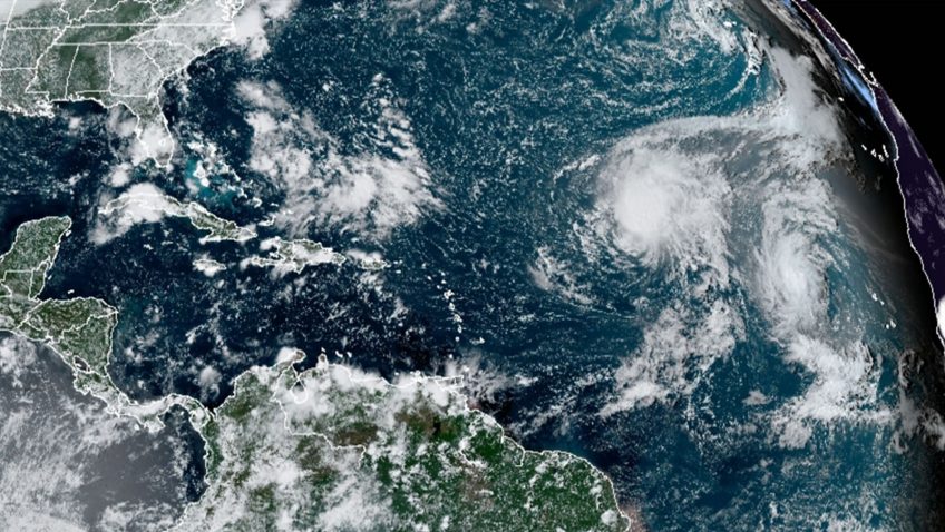
Hurricane Model that Follows Multiple Storms Improves Intensity Forecasts

Warning the public of the damaging winds in tropical cyclones is critical for safeguarding communities in harm’s way. A new study by hurricane scientists at AOML is the first to quantify the value added to tropical cyclone intensity forecasts by storm-­following nests. The research, published in the Bulletin of the American Meteorological Society, demonstrates that storm-­following nests applied to multiple hurricanes in the same forecast cycle can improve intensity predictions by as much as 30%.

Read Full Article

A New Study Connects Greater Amounts of Cloud Ice in Tropical Cyclones to Intensification

A new study published in Geophysical Research Letters looks at the relationship between how fast a tropical cyclone intensifies and the amount of ice in the clouds that make up the storm. Hurricane scientists found that tropical cyclones with greater amounts of cloud ice are likely to intensify faster than those with less cloud ice.

Read Full Article

NOAA Hurricane Model Performance is Evaluated for the First Time in Predicting Rainfall from 2017 Hurricane Harvey

A recent study published in the journal Atmosphere evaluated for the first time, how well NOAA’s regional hurricane model was able to forecast the location and amount of devastating rainfall in 2017’s Hurricane Harvey. The Hurricane Weather Research and Forecasting (HWRF) model predicted the realistic total rainfall and the location of the maximum rainfall of Hurricane Harvey, which were the most devastating impacts of the storm’s landfall in coastal Texas.

Read Full Article

Braving the Eye of the Storm

The most dangerous part of the hurricane is the eyewall close to the ocean. It’s where the storm draws energy from heat in the water, which influences how strong – and how quickly – the storm will develop. It’s also where the strongest winds lurk.Direct and continuous observations of the lower eye-wall would help forecasters understand critical information about the storm’s development. NOAA P-3 “Hurricane Hunters” routinely fly through hurricane eyewalls to gather storm data, but avoid flying close to the ocean because conditions are too hazardous.

Read Full Article

Hurricane Researchers “Feel The Force” at the Frost Museum of Science

On Saturday, May 30th, personnel from AOML’s Hurricane Research Division along with Outreach & Communications staff participated in the Patricia and Philip Frost Museum of Science’s annual “Feel the Force” event. The one-day outreach event drew over 1000 people who learned about preparing their homes and families to deal with disasters, especially hurricanes. HRD scientists staffed the permanent museum exhibit dedicated to explaining how scientists fly into storms to gather scientific data. In addition to speaking to people about the experience of flying into tropical cyclones, they also took the opportunity to explain the latest innovations in technology being tested this season and how their work will benefit hurricane intensity forecasts. HRD scientists also granted media interviews throughout the day and led a team of children in the Museum’s “Wild and Crazy Weather Challenge”.

Read Full Article