Tag: Grant Rawson

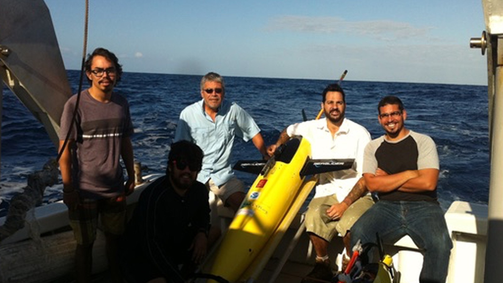
AOML Tests New Hurricane Ocean Profilers for Deployment in 2021 Hurricane Season

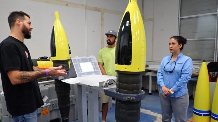
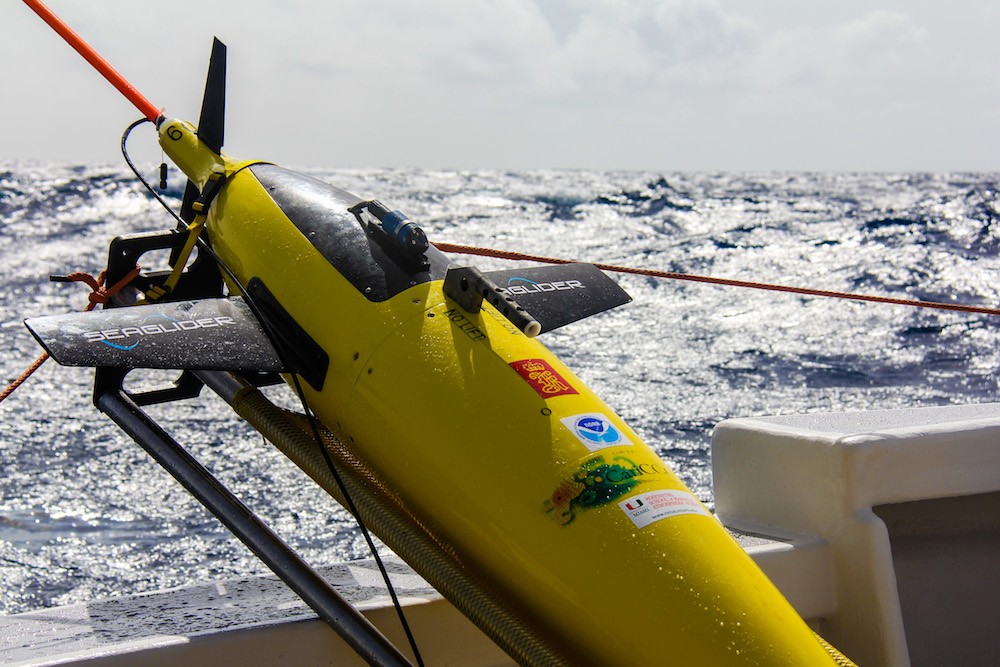
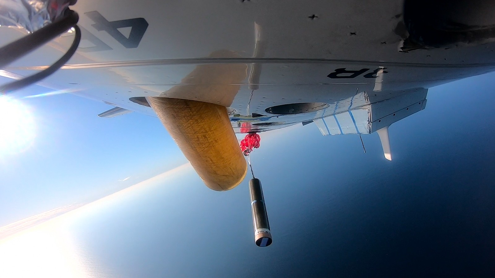
In January 2021, AOML in partnership with NOAA’s Aircraft Operations Center (AOC) completed the air launch testing of the Air-Launched Autonomous Micro-Observer (ALAMO) profiling float. This testing cleared the ALAMO floats for flight and deployed from the NOAA P3 Hurricane Hunter aircraft during their hurricane reconnaissance missions. The data collected and transmitted by the ALAMO floats will be used to understand the ocean’s interaction with tropical cyclones and improve coupled hurricane forecasting models.

Read Full Article

Scientists at AOML Awarded Ocean Observing Team Award for Western Boundary Time Series Project

NOAA’s Western Boundary Time Series (WBTS) project, alongside partner projects RAPID and MOCHA, have been awarded the inaugural “Ocean Observing Team Award” by The Oceanography Society (TOS). This award recognizes innovation and excellence in sustained ocean observing for scientific and practical applications. The WBTS/RAPID/MOCHA team is recognized for significantly improving our understanding of Atlantic circulation through the breakthrough design of a basin-wide observing system using endpoint measurements to measure the variability of the overturning circulation across wide areas of the ocean. This design provided continuous, cost-effective measurements that led to a transformation in ocean observing and advances in scientific knowledge.

Read Full Article

Hurricane Gliders Return Home from 2020 Season

NOAA’s hurricane gliders are returning home after a successful journey during the 2020 hurricane season. These gliders were deployed off the coasts of Puerto Rico, Dominican Republic, the U.S. Virgin Islands, the Gulf of Mexico, and the eastern U.S. to collect data for scientists to use to improve the accuracy of hurricane forecast models.

Read Full Article

NOAA Conducts Interdisciplinary Research Cruise in the Caribbean Aboard the Nancy Foster

AOML partnered with NOAA’s Southeast Fisheries Science Center (SEFSC) to conduct an interdisciplinary research cruise aboard the NOAA Ship Nancy Foster from April 11, 2015 through June 3, 2015. The cruise began in the U.S. Virgin Islands and extended westward across the northern Caribbean to Mexico. Researchers from various institutions conducted a myriad of biological and physical oceanographic surveys during the three month cruise.

Read Full Article

February 2015 Western Boundary Time Series Cruise

AOML physical oceanographers Molly Baringer, Ulises Rivero, Pedro Pena, Andrew Stefanick, Grant Rawson, Jay Hooper and Francis Bringas conducted a Western Boundary Times Series cruise aboard the UNOLS R/V Endeavor on February 15, 2015. Molly Baringer, AOML Deputy Director, served as chief scientist and was supported by additional crew from the University of Puerto Rico. Scientists measured full water column values of salinity, temperature, and oxygen. Scientists also telemetered data from a series of moorings along the 26th north parallel for a joint NOAA and National Science Foundation program designed to monitor the Atlantic meridional overturning circulation current. Francis Bringas also conducted a fall rate experiment that consisted of deploying 200 XBTs from different launch heights.

Read Full Article

Underwater Gliders Second Deployment

On February 6, 2015, AOML physical oceanographers deployed two underwater sea gliders from the University of Puerto Rico’s R/V La Sultana in hopes of improving prediction of hurricane intensity. This is the second deployment trial after two gliders had a successful first mission at sea from July-November 2014. The main goal of this project is to deploy a pilot network of underwater gliders in the Caribbean Sea and Tropical North Atlantic Ocean to help with hurricane intensity forecasting and provide valuable information about the role the ocean plays in tropical cyclone development.

Read Full Article

Hydrographic Survey Conducted in the Florida Straits

PhOD personnel Ryan Smith, Grant Rawson, and Jay Hooper conducted a hydrographic survey along 27N in the Florida Straits aboard the R/V F.G. Walton Smith on January 12-13, 2015. The cruise was part of the Western Boundary Time Series project, which is designed to quantify Florida Current volume transport and water mass changes. This survey and others help to calibrate daily estimates of the Florida Current volume transport derived from a submarine telephone cable deployed across the Straits. Divers also exchanged a project pressure gauge on the west side of the 27N section.

Read Full Article