NOAA Nancy Foster Research Cruise
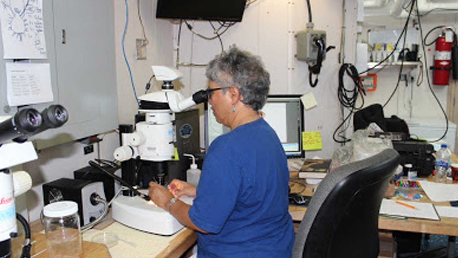
Photos from the scientists and data from the NOAA Nancy Foster Cruise that sailed off in May. The Nancy Foster sailed out on a research survey to search for bluefin tuna larvae among other fishy creatures
Photos from the scientists and data from the NOAA Nancy Foster Cruise that sailed off in May. The Nancy Foster sailed out on a research survey to search for bluefin tuna larvae among other fishy creatures
In a recent paper published in the Journal of Climate, scientists with NOAA and the University of Miami have identified how variability in ocean circulation in the South Atlantic Ocean may influence global rainfall and climate patterns. The study by researchers at NOAA’s Atlantic Oceanographic and Meteorological Laboratory (AOML) and the Cooperative Institute for Marine and Atmospheric Studies (CIMAS) suggests that the South Atlantic is a potential predictor of global rainfall variability with a lead-time of approximately 20 years. This link between the South Atlantic Ocean and weather and climate could provide significant long-term insight for water management on a global scale.
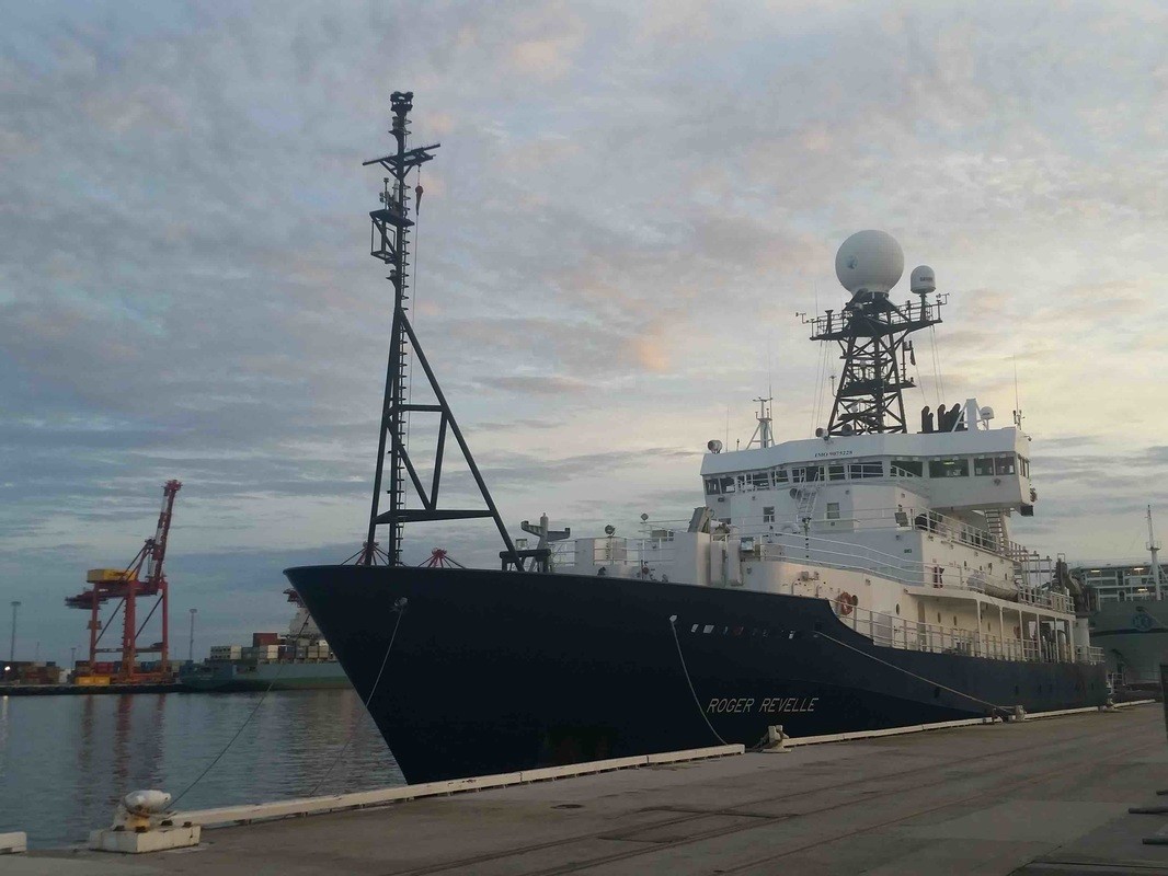
During the months of March and April, AOML joined an international team of oceanographers to actively sample the Indian Ocean in support of the Global Ocean Ship-Based Hydrographic Investigation Program (GO-SHIP), an initiative to measure and investigate the ocean basins from coast to coast and from top to bottom. Aboard the R/V Roger Revelle, the team transected the Indian Ocean from the Antarctic northward into the Bay of Bengal, collecting seawater samples at 113 stations as part of a multi-decadal effort to measure various ocean properties, including temperature, salinity, nutrients, carbon and other gases.
Photos from the March- April 2016 GO-SHIP cruise transecting the Indian Ocean.
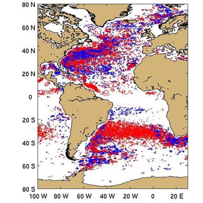
In a recent study by Lumpkin (2016) looping trajectories of surface drifting buoys were extracted from the global drifter dataset and analyzed in order to examine the distribution of submesoscale to mesoscale vortices. Over 15,000 looping trajectory segments were identified worldwide.
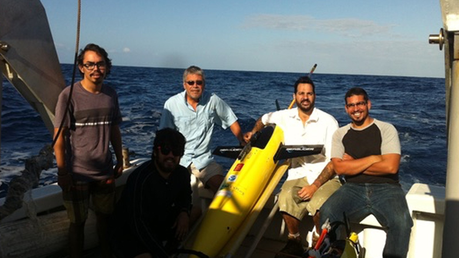
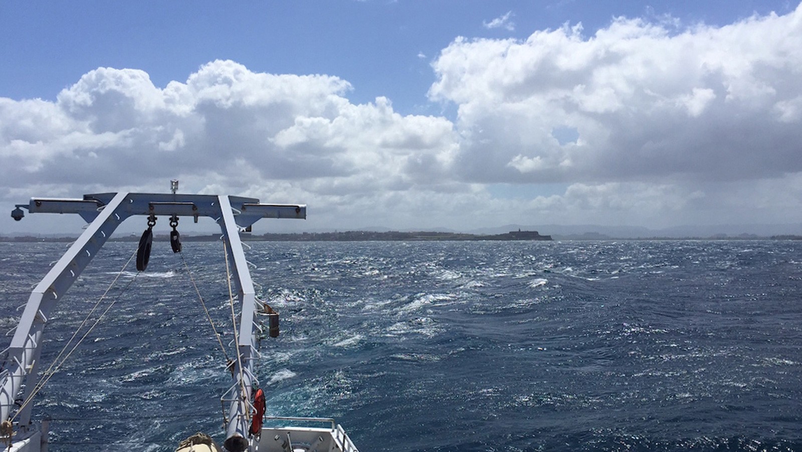
The fourth underwater glider mission began in March with the deployment of two refurbished gliders in the Caribbean Sea off Puerto Rico. The deployment was carried out by AOML researchers on board the R/V La Sultana with the help of personnel from the University of Puerto Rico Mayaguez (UPRM).

Scientists and engineers from NOAA have successfully designed, built, and tested a new antenna system that dramatically increases data transmission reliability while drastically reducing operating costs. The new Iridium-based transmission system, developed by NOAA’s Atlantic Oceanographic & Meteorological Laboratory (AOML) & the Cooperative Institute for Marine & Atmospheric Studies (CIMAS), has no restrictions on data format or size, allowing data from various ocean and land-based observation platforms to be transmitted more securely and at a fraction of the cost of the older Inmarsat-C platform.
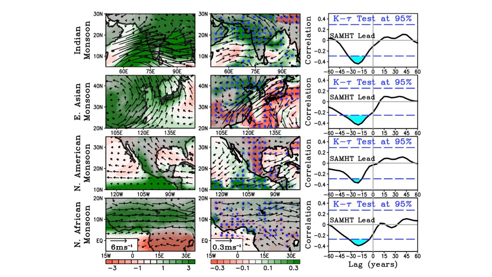
A recent paper published in the Journal of Climate led by PHOD researchers Hosmay Lopez, Shenfu Dong, Sang-Ki Lee, and Gustavo Goni provides a physical mechanism on how low frequency variability of the South Atlantic Meridional Heat Transport (SAMHT) associated with the Atlantic Meridional Overturning Circulation ( AMOC) may influence decadal variability of atmospheric circulation and monsoons. This is the first attempt to link the South Atlantic Overturning Circulation variability to weather and climate.
AOML researchers completed a Western Boundary Times Series cruise in February aboard the UNOLS Ship R/V Endeavor. The AOML team was supported by additional crew from the University of Puerto Rico.

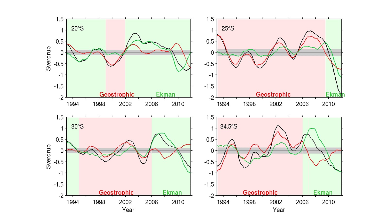
The Meridional Overturning Circulation (MOC) plays a critical role in global and regional heat and freshwater budgets. Recent studies have suggested the possibility of a southern origin of the anomalous MOC and meridional heat transport (MHT) in the Atlantic, through changes in the transport of warm/salty waters from the Indian Ocean into the South Atlantic basin. This possibility clearly manifests the importance of understanding the South Atlantic MOC (SAMOC). Observations in the South Atlantic have been historically sparse both in space and time compared to the North Atlantic. To enhance our understanding of the MOC and MHT variability in the South Atlantic, a new methodology is recently published to estimate the MOC/MHT by combining sea surface height measurements from satellite altimetry and in situ measurements (Dong et al., 2015).

