Category: Physical Oceanography

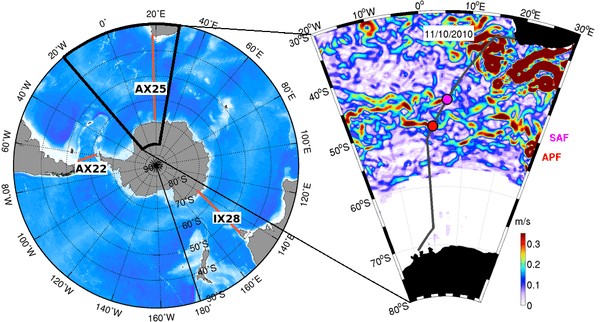
Meridional Overturning Circulation: Following the Heat

If you want to understand Earth’s climate and how it changes from year-to-year and decade-to-decade, look to the oceans, and follow the heat. The major driver in the redistribution of heat around the globe in the ocean-climate system is Meridional Overturning Circulation, or MOC. The MOC is a vertical circulation pattern that exchanges surface and deep waters via poleward movement of surface waters. As an example, the well known Gulf Stream on the eastern seaboard of North America carries warm water northward to the Greenland and Norwegian Seas, where it cools and sinks.

Read Full Article

The US Argo Data Assembly Center improves the real-time processing system and adds new float types

The US Argo Data Assembly Center at PhOD used the transition to the NETCDF profile format version 3.0 to consolidate three processes into one process. This major development had multiple benefits. The primary benefit is that during the development stage the rapid changes in the float technology, for example the addition of sensors, were taken into account to increase the adaptability of the software to future changes of floats as well as the NETCDF profile format. Prior to this development, three programs required adaptation when float types with a new combination of sensors was deployed.

Read Full Article

Hurricane Scientists Bring a New Wave of Technology to Improve Forecasts

Scientists at NOAA’s Atlantic Oceanographic and Meteorological Laboratory are at the forefront of hurricane research to improve track and intensity forecasts. Every hurricane season they fly into storms, pour over observations and models, and consider new technological developments for how to enhance NOAA’s observing capabilities. The 2014 hurricane season will provide an opportunity to test some of the most advanced and innovative technologies, including unmanned hurricane hunter aircraft and sea gliders, which will help scientists better observe and, eventually, better predict a storm’s future activity.

Read Full Article

NOAA’s Array of Drifting Ocean Buoys

Drifting buoys are a primary tool used by the oceanographic community to measure ocean surface circulation at unprecedented resolution. A drifter is composed of a surface float, which includes a transmitter to relay data via satellite, and a thermometer that reads temperature a few centimeters below the air-sea interface. The surface float is tethered to a holey sock drogue (a.k.a. “sea anchor”), centered at 15 m depth. The drifter follows the ocean surface current flow integrated over the drogue depth.

Read Full Article

Upcoming Observations with Underwater Gliders

Underwater glider SG610, deployed on July 14, is located in the Caribbean Sea. This glider navigated in a SW, then in a SE, and now in a SW direction since it was deployed. The temperature and salinity profile observations indicate that on July 25 this glider started sampling waters of a cyclonic eddy that is now centered at approximately 16.5°N, 67.5°W, and has a radius of ~0.75deg as derived from satellite altimetry observations. These profile observations show a decrease in the salinity maximum, and a shallowing of the depth of this maximum salinity and of the depth of the 26°C isotherm.

Read Full Article

Gliders Patrol Ocean Waters with a Goal of Improved Prediction of Hurricane Intensity

Scientists at NOAA’s Atlantic Oceanographic and Meteorological Laboratory are in the Caribbean to launch two underwater gliders from a vessel off Puerto Rico to collect temperature and other weather data to improve hurricane forecasting.One of the gliders will collect observations in the Caribbean Sea, and another in the North Atlantic Ocean. They are positioned to operate over the next six months (June-November) collecting data in areas where hurricanes are common and areas where there is a lack of environmental data.

Read Full Article

Wind forced variability of the Antarctic Circumpolar Current south of Africa between 1993 and 2010

Researchers from PhOD and from the University of Cape Town used temperature data from the AX25 repeat XBT transect (from South Africa to Antarctica) in combination with other hydrographic and satellite observations to report a mechanism by which local winds alter the structure of the Antarctic Circumpolar Current flow south of Africa.

Read Full Article