Category: Hurricane Research

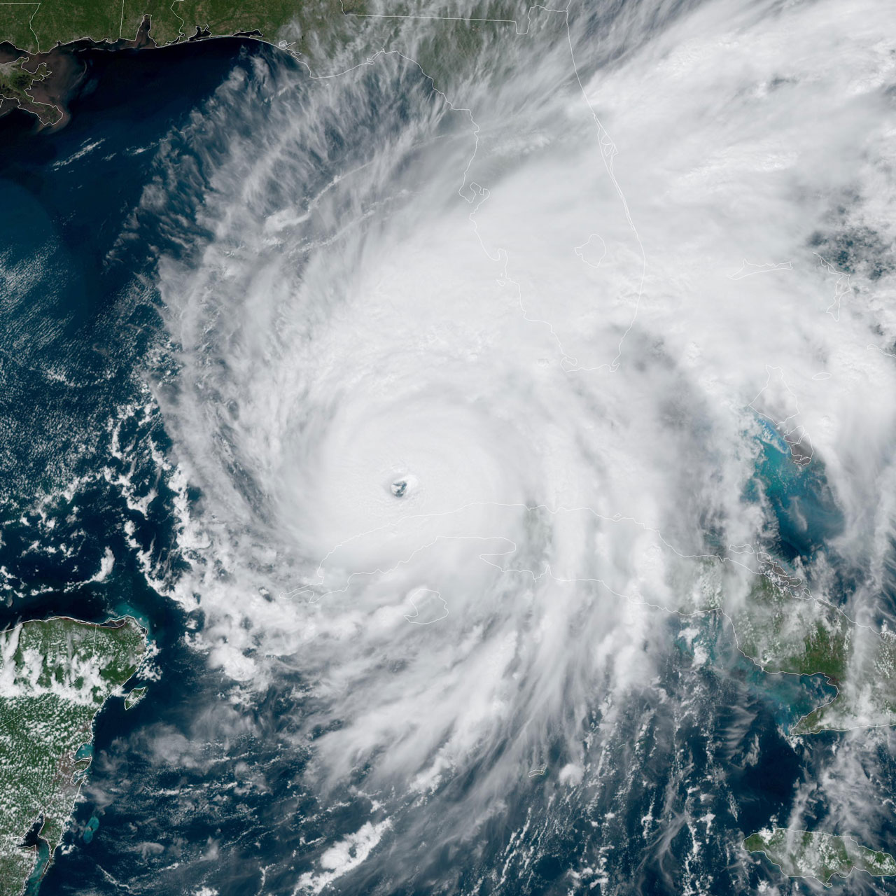
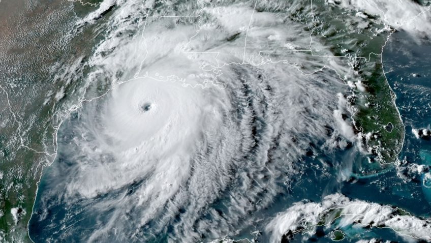
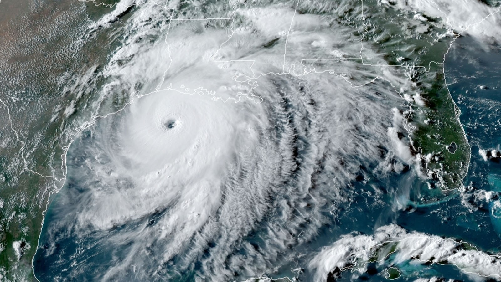
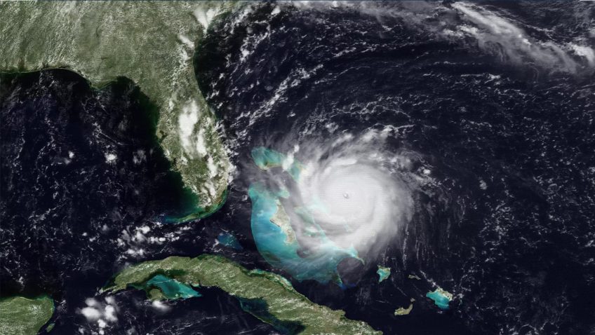
Wrapping up the 2022 Atlantic Hurricane Season

November 30th marked the official end to the 2022 Atlantic hurricane season. Scientists and forecasters from across NOAA worked tirelessly throughout the season to conduct critical tropical cyclone research. This year, NOAA’s Atlantic Oceanographic and Meteorological Laboratory (AOML) coordinated the longest series of missions into a single tropical system, arranged multiple observing assets for simultaneous data collection, deployed new sUAS technology, and included a novel “moving nest” to our next-generation hurricane model.

Read Full Article

How do weak, misaligned tropical cyclones evolve towards alignment? A multi-case study using the Hurricane Analysis and Forecast System

The ability to predict whether and when a tropical cyclone will become vertically aligned is critical for intensity change forecasts, as storms can intensify quickly after achieving an aligned structure. A recent study from researchers at NOAA’s Atlantic Oceanographic and Meteorological Laboratory and the University of Miami’s Cooperative Institute for Marine and Atmospheric Studies shows how weak, disorganized tropical cyclones containing different center locations with height, called misalignment, can develop a vertically aligned structure. This study works to improve forecasts of when this alignment might occur by identifying key times of the day and other tropical cyclone characteristics when alignment is likely.

Read Full Article

Investigating vertical wind shear influences on tropical cyclone intensity change

Scientists at NOAA’s Atlantic Oceanographic & Meteorological Laboratory (AOML) and the University of Miami’s Cooperative Institute of Marine & Atmospheric Studies (CIMAS) examine the challenges of accurately predicting when a tropical cyclone will begin a quick and sudden increase in intensity (called rapid intensification or RI) in a new study published in Monthly Weather Review.

Read Full Article

First Cabo Verde Missions Explore Earliest Roots of Atlantic Hurricanes

Scientists at AOML deployed to the Cabo Verde islands in August to explore how tropical waves that move off the coast of West African develop into tropical storms and hurricanes. These first-ever missions thousands of miles across the Atlantic mark the farthest distance traveled by NOAA’s Hurricane Hunters to help forecast models better predict the future track and intensity of developing storms.

Read Full Article

Thirty years of progress in hurricane forecasting since Hurricane Andrew

Hurricane Andrew made landfall on August 24, 1992, near Homestead, Florida, becoming one of the most catastrophic hurricanes in U.S. history. It had an extremely low central pressure of 922 millibars and maximum sustained wind speeds estimated at 165 miles per hour. The storm rapidly intensified less than 36 hours before landfall, leaving most residents less than a day to secure their homes and heed evacuation orders.

Read Full Article

NOAA and Saildrone Launch Seven Hurricane-Tracking Surface Drones

In partnership with NOAA, Saildrone Inc. is deploying seven ocean drones to collect data from hurricanes during the 2022 hurricane season with the goal of improving hurricane forecasting. For the first year, two saildrones will track hurricanes in the Gulf of Mexico.

Read Full Article