Ships of Opportunity (SOOP)
<!–
Quantifying Sea-Air CO2 Fluxes on Seasonal and Regional Timescales
–>
SCROLL TO LEARN MORE
What We Do
The AOML-led Ships of Opportunity – Carbon Dioxide (SOOP-CO2) consortium has collected ocean carbon data from automated instruments on ships since 2005 and is funded by NOAA’s Ocean Observation and Monitoring Division of the Climate Program Office. The SOOP-CO2 program has greatly enhanced the quantity and quality of surface carbon dioxide measurements worldwide and provides fundamental data for the Global Carbon Budget and for numerous studies that use global climate models for satellite and sensor validations.
Click the icons to explore:
Who We Are
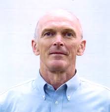
| Rik Wanninkhof, Ph.D.
Senior Technical Scientist
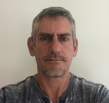
| Denis Pierrot, Ph.D.
Oceanographer
Our Research
Ships of Opportunity (SOOP-CO2) is the largest collector of global carbon dioxide measurements from surface seawater. The data from our group is provided to NOAA’s National Centers for Environmental Information for incorporation in the global dataset. Furthermore, we provide our data to the Surface Ocean Carbon Atlas (www.socat.info), a group endorsed by the International Carbon Coordination project (www.ioccp.org), and work with this effort to provide expert input on instrumentation and data acquisition. We have also helped to design and develop a state-of-the art automated surface water CO2 instrument produced by General Oceanics, Inc. which is used worldwide.
The global ocean takes up approximately one quarter of the anthropogenic CO2 released each year but the patterns of uptake and release of CO2 by the ocean vary in time and space. To quantify the fluxes on seasonal and regional scales, NOAA operates the largest automated measurement campaign of surface water CO2 from ships of opportunity in the world (SOOP-CO2). The objectives of this sustained effort are:
- Produce CO2 data at sufficient accuracy to constrain sea-air CO2 fluxes to 0.2 Pg C yr-1.
- Facilitate capacity building through instrumentation and data reduction guidance to attain a global network of SOOP-CO2.
- Create CO2 flux maps and related data products.
Underway Ships of Opportunity Cruise Data – pCO2
The Ship of Opportunity Program mission is to provide a global platform to deploy and operate oceanographic instrumentation from research vessels and cargo ships. Four NOAA investigators and three academic principal investigators have outfitted fifteen research and commercial vessels with automated carbon dioxide analyzers as well as thermosalinographs (TSGs) to measure the temperature, salinity and partial pressure of CO2 (pCO2) in surface water and air in order to determine the carbon exchange between the ocean and atmosphere. About 550,000 new observations were collected in this fiscal year.

Ongoing Collections by Ship
Completed Collection by Ship:
Atlantis A22 2012
Baldrige 1991-1996
Barcelona Express 2010-2013
Cape Hatteras 2006
Celtic Explorer MAP 2006
Explorer of the Seas 2002-2015
F.G.Walton Smith 2005
Knorr 1996-1997, 2008
Las Cuevas 2009-2012
Melville P6 2010
Polar Star 2001-2002
Revelle I8S 2007
Revelle I9N 2007
Revelle I6S 2008
Revelle 2016
Reykjafoss 2013
Skogafoss (V2EF3) 2014-2016
Skogafoss (V2XM) 2003-2007
Xuelong 2007-2008
National Geographic Islander II Underway Data and Research (Galapagos)
This web site provides access to the fugacity of CO2 (fCO2) data collected on this ship. Note, fCO2 is the partial pressure pCO2 corrected for non-ideality of the CO2 gas; they are numerically similar (fCO2 ≃ 0.995 pCO2).
The processed data are organized by year and by cruise. For each cruise, the color coded fCO2 values are plotted along the ship’s cruise track on a chart. Next to each chart are links to the comma-delimited data file and the associated Readme file.
About the National Geographic Islander II
The National Geographic Islander II is one of the latest additions to the Lindblad Expeditions fleet of 17 ships. It is a 48-passenger ship which sails in the Galapagos year-round. The vessel features an impressive observation deck and a high-tech science hub, thus bringing the passengers a unique experience where they get to see science being done in real-time in addition to observing the environment.
(Click the image to swipe)
In August of 2023, in collaboration with Dr. Nicolas Cassar of Duke University, our group installed one of our autonomous instruments on this vessel to measure CO2 in the surface water. An air line was also installed to measure the overlaying atmosphere above it. In addition, the system incorporates an Aaderaa Optode which measures dissolved oxygen. The region is extremely biologically active and we expect our data to reflect that. With additional carbonate parameters measurements, it will also give us an indication of the vulnerability of the region to ocean acidification.
Ship of Opportunity Program Reports
Partners
Funding Sources and Partners

