
NOAA’s G-IV and two P-3 Hurricane Hunter aircraft took off from Lakeland, FL at 10:30 AM, 1:30 PM and 4:30 PM EDT on September 14th to investigate Hurricane Sally’s circulation.
Tasked by the Environmental Modeling Center (EMC), NOAA’s P-3 aircraft each performed 4 passes through the system’s center, characterizing all quadrants of Sally’s current atmospheric conditions from an altitude of 10,000 feet.
AOML’s Hurricane Research Division tasked NOAA’s G-IV aircraft to survey Sally’s interaction with the environment in which the system is embedded. NOAA’s G-IV will conduct two concentric circumnavigations at 45,000 feet around the southern periphery of the storm.
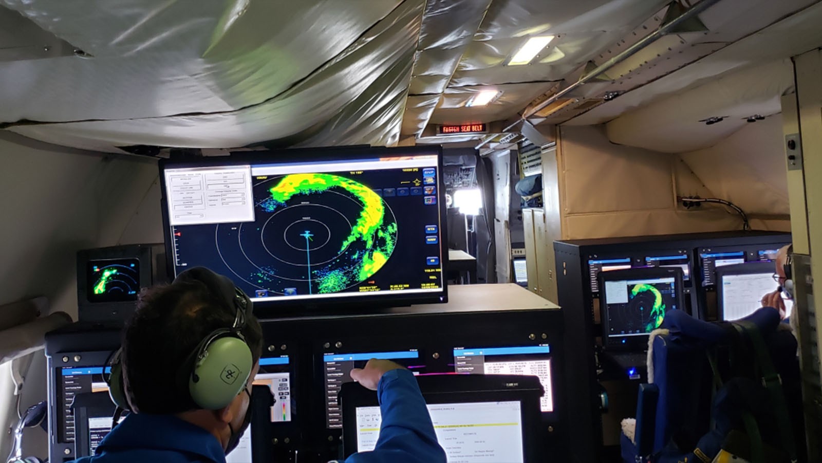
AOML scientists providing onboard and remote support for these missions ensure that Tail Doppler Radar, dropsonde, and Stepped Frequency Microwave Radiometer (SFMR) measurements allow for adequate coverage of the storm environment. These data are quality controlled and ingested into operational weather models to improve performance and reduce uncertainty in Sally’s forecast.
High-altitude G-IV dropsonde measurements, in coordination with onboard P-3 sensors, Tail Doppler Radar, SFMR, and inner-core dropsonde data, allow hurricane scientists to address science objectives that identify processes important for intensification when a tropical cyclone experiences moderate vertical wind shear. Vertical wind shear can inhibit the ability for a tropical cyclone to intensify.
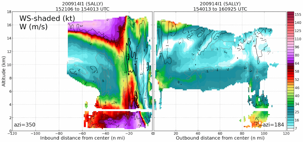
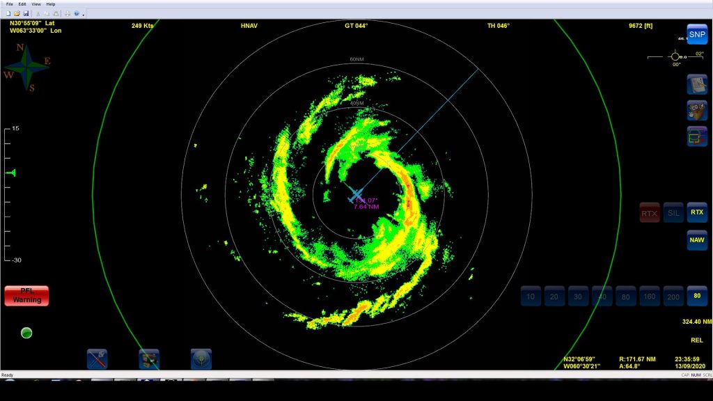
Tail Doppler Radar analyses indicate that Sally’s circulation appears tilted with height, which is supported by the asymmetric representation of its associated precipitation. Overnight, NOAA’s Hurricane Hunter operations captured the effects of vertical wind shear on Sally’s vortex prior to its strengthening in the Gulf of America.
Reconnaissance into Hurricane Sally provided the opportunity to conduct instrument validation tasks while accomplishing EMC directives. Wave and wind observations from onboard SFMR and Wide Swath Radar Altimeter (WSRA) will be compared to coincident dropsondes and available ocean buoy and profiler data (Argo) to determine and improve their accuracy.
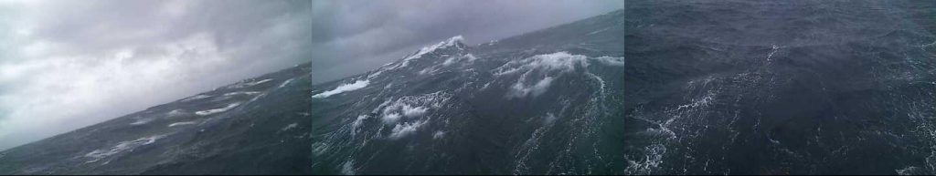
Ground-based Lead Project Scientist, Heather Holbach, PhD, emphasized that surface wave height measurements from the WSRA indicated wave heights upwards of 18 feet on the north side of the hurricane.
“The system continues to become better organized, but there are still some indications that easterly wind shear was impacting the hurricane,” Holbach said.
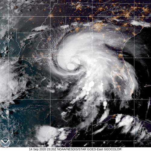
Despite considerable wind shear, Hurricane Sally has rapidly intensified likely due to warm ocean waters and an otherwise favorable environment. The National Hurricane Center (NHC) issued hurricane warnings extending from Louisiana to the Florida panhandle and predicts that the slow moving system will produce hazardous conditions across the Southeast regardless of the exact landfall location.
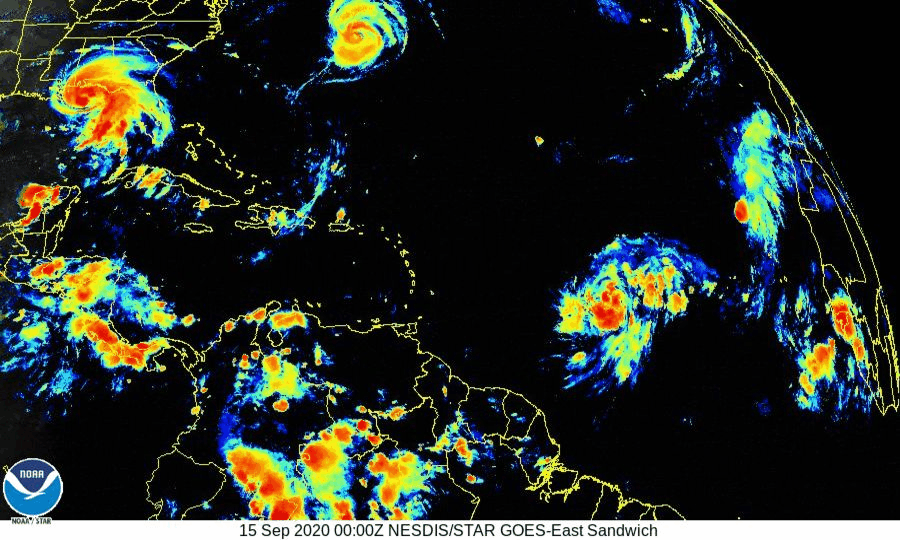
Five tropical cyclones currently exist in the Atlantic basin, tying the record for the number of tropical cyclones at one time. Hurricane experts have coordinated their assets to investigate the environment of multiple storms in addition to Hurricane Sally, an immediate threat to the United States.
NOAA’s Hurricane Hunters investigated Hurricane Paulette for an NHC-tasked mission, collecting measurements that allowed hurricane experts to determine the circulation’s position and intensity. Bermuda took a direct hit from the system, which made landfall as a category 2 hurricane. Hurricane Paulette is expected to strengthen to major hurricane intensity before dissipating over cooler Atlantic waters.
The two P-3 aircraft will continue missions into Sally out of Lakeland, FL, while the G-IV heads to St. Croix for science missions into Tropical Storm Teddy.
For the latest information about tropical cyclones and other weather systems, visit the NOAA National Weather Service National Hurricane Center.
For information on numerical prediction of tropical cyclones, visit the NOAA National Centers for Environmental Prediction Environmental Modeling Center.