The Ocean & Extreme Weather Events
Innovating Research to Improve Extreme Weather Forecasts
SCROLL TO LEARN MORE
Who We Are
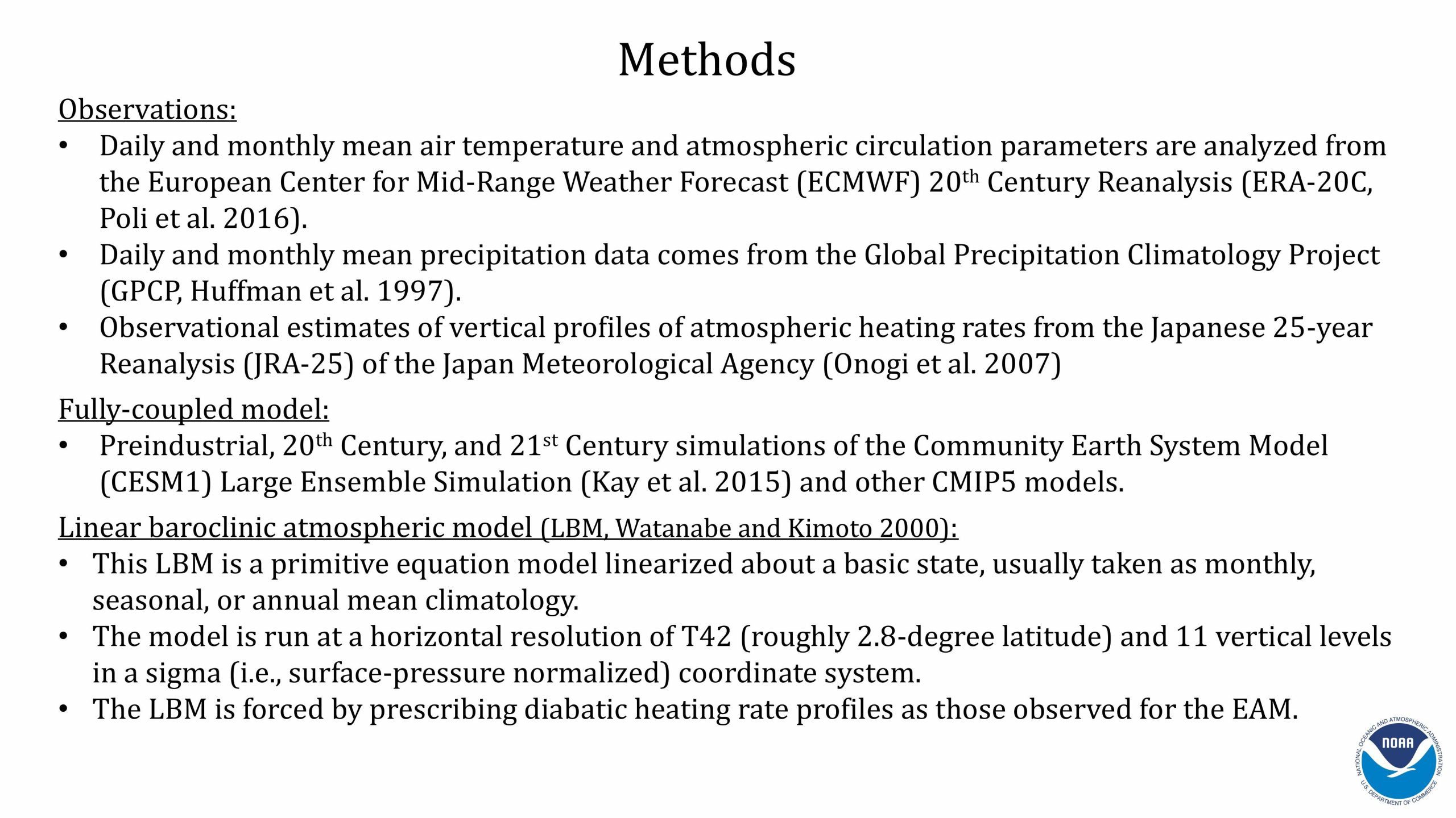
Scientists at AOML are working to extend forecasts for extreme weather events such as heat waves, tornadoes, and hurricanes by improving predictions on the subseasonal (2 weeks to 3 months) to seasonal (3 months to 2 years) timescale. We accomplish this by using a combination of ocean and atmospheric observations and model simulations. Improved forecasts serve to provide emergency managers, government officials, businesses, and the public with better advanced warning to minimize catastrophic loss of life and damage to critical infrastructure. This effort is crucial for informing public health security and impact mitigation strategies.
Our Objective
To advance our understanding of the physical links between ocean variability and extreme weather events at the subseasonal to centennial timescale.
AOML has formed collaborative partnerships with the Climate Prediction Center (NOAA/CPC), the Geophysical Fluid Dynamics Laboratory (NOAA/GFDL), the Physical Science Laboratory (NOAA/PSL), the National Severe Storms Laboratory (NOAA/NSSL), the Storm Prediction Center (SPC), and the Environmental Modeling Center (EMC). Our goal is to advance the understanding of severe weather events affecting the US by improving and extending predictions to better serve our country. We would like to acknowledge our collaborators at these offices for their work: Arun Kumar (CPC); Andrew Wittenberg (GFDL); Mike Alexander (PSL); and Avichal Mehra (EMC). We would also like to acknowledge our international partner Sang-Wook Yeh with Hanyang University in South Korea.
Read More News
Ocean Observations are Critical to Improve Extreme Weather Forecasts
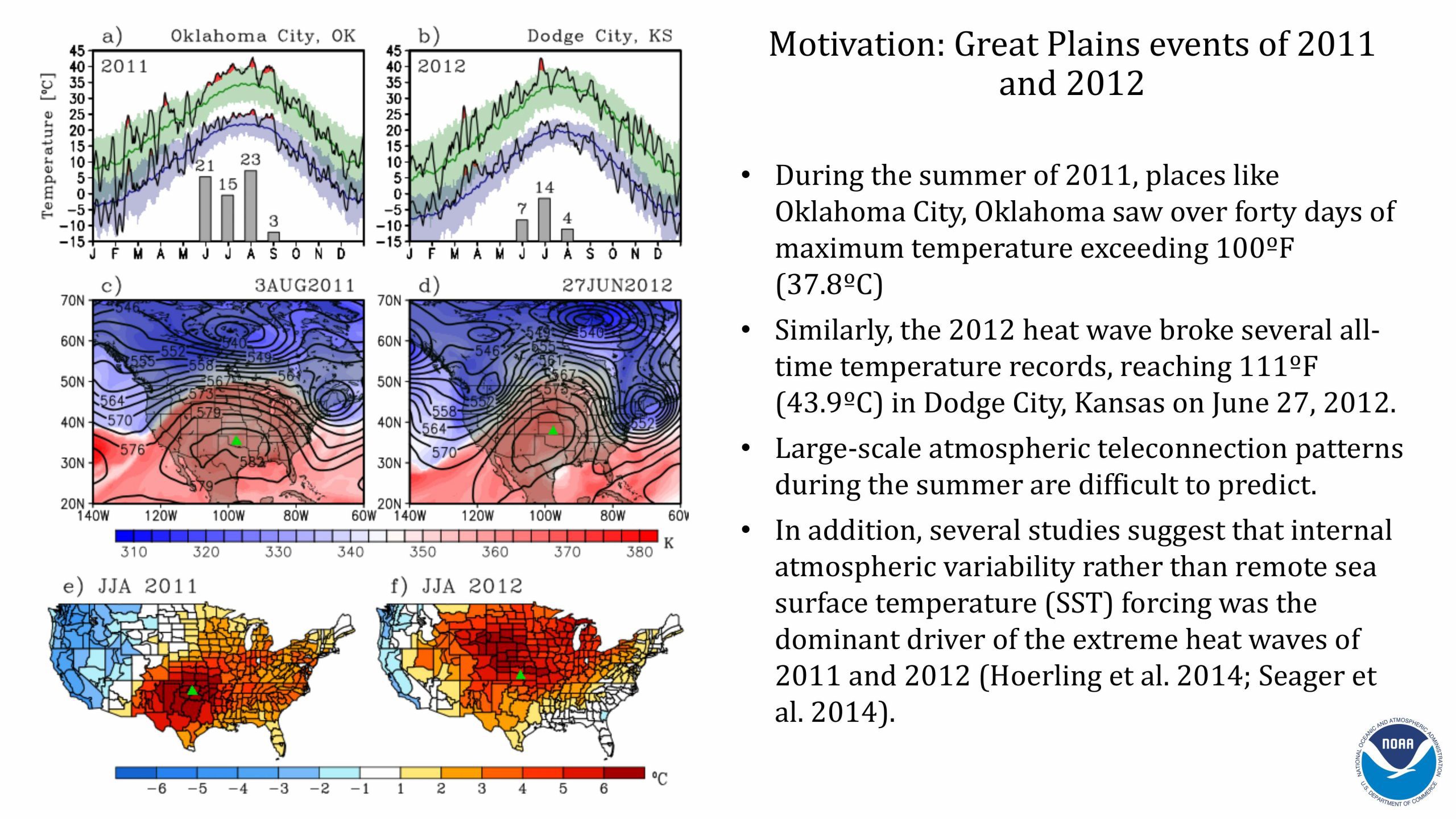
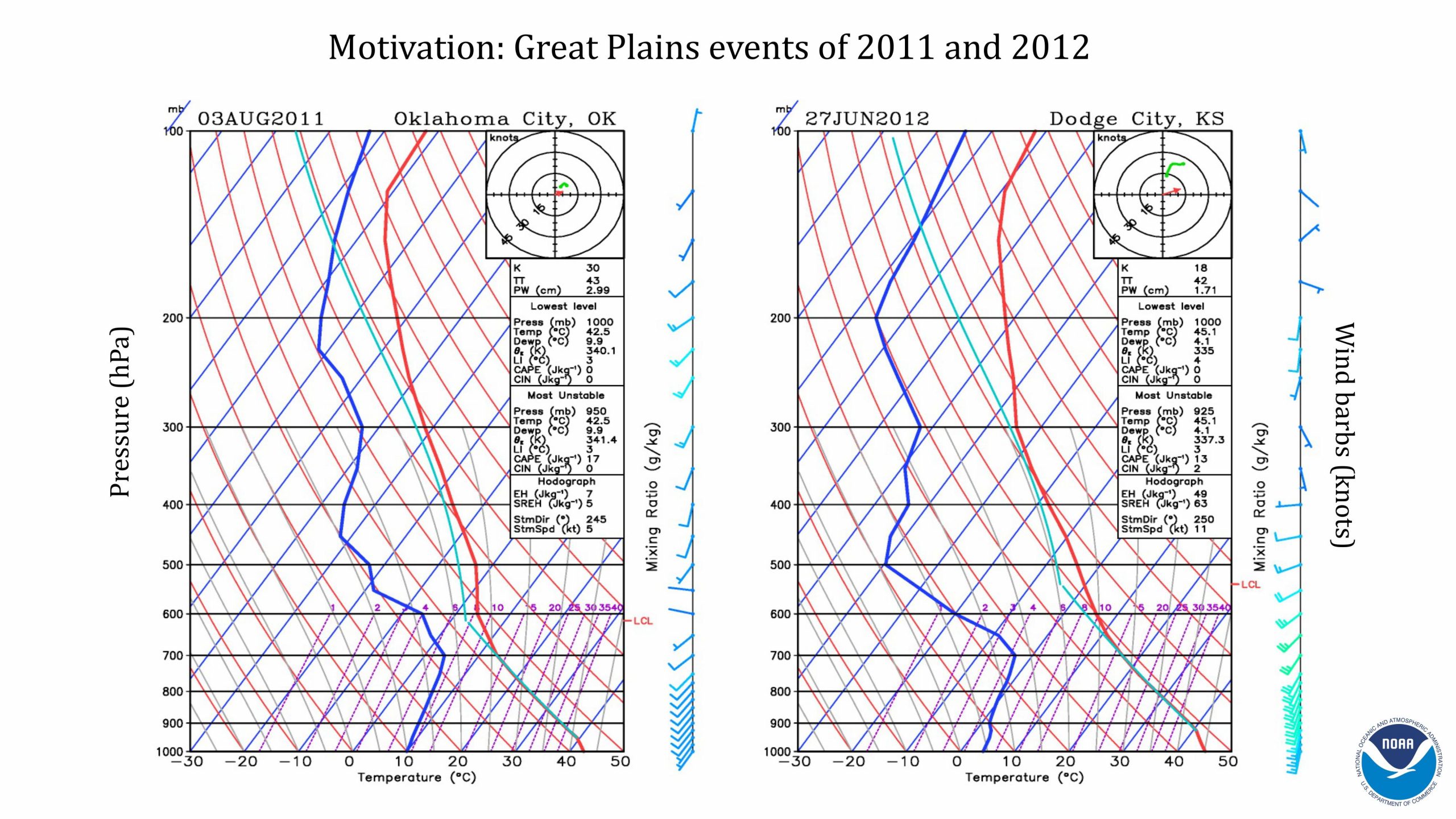
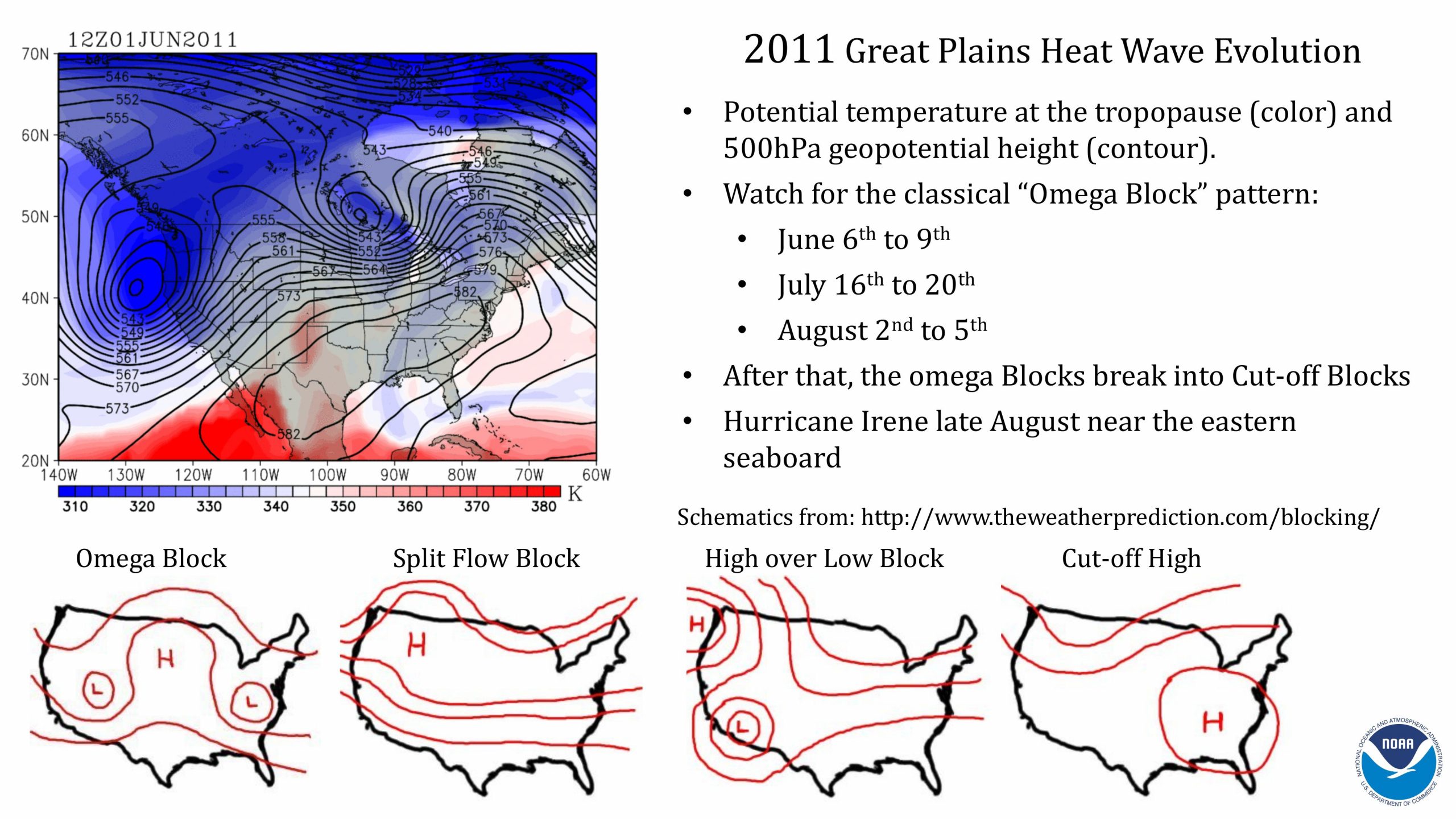
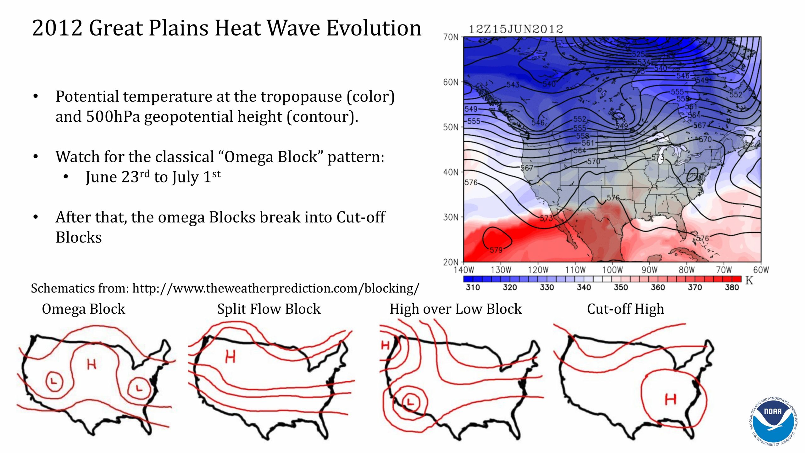
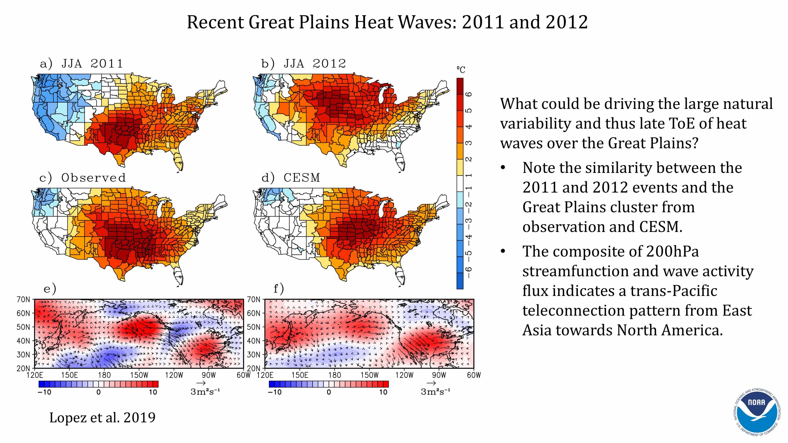
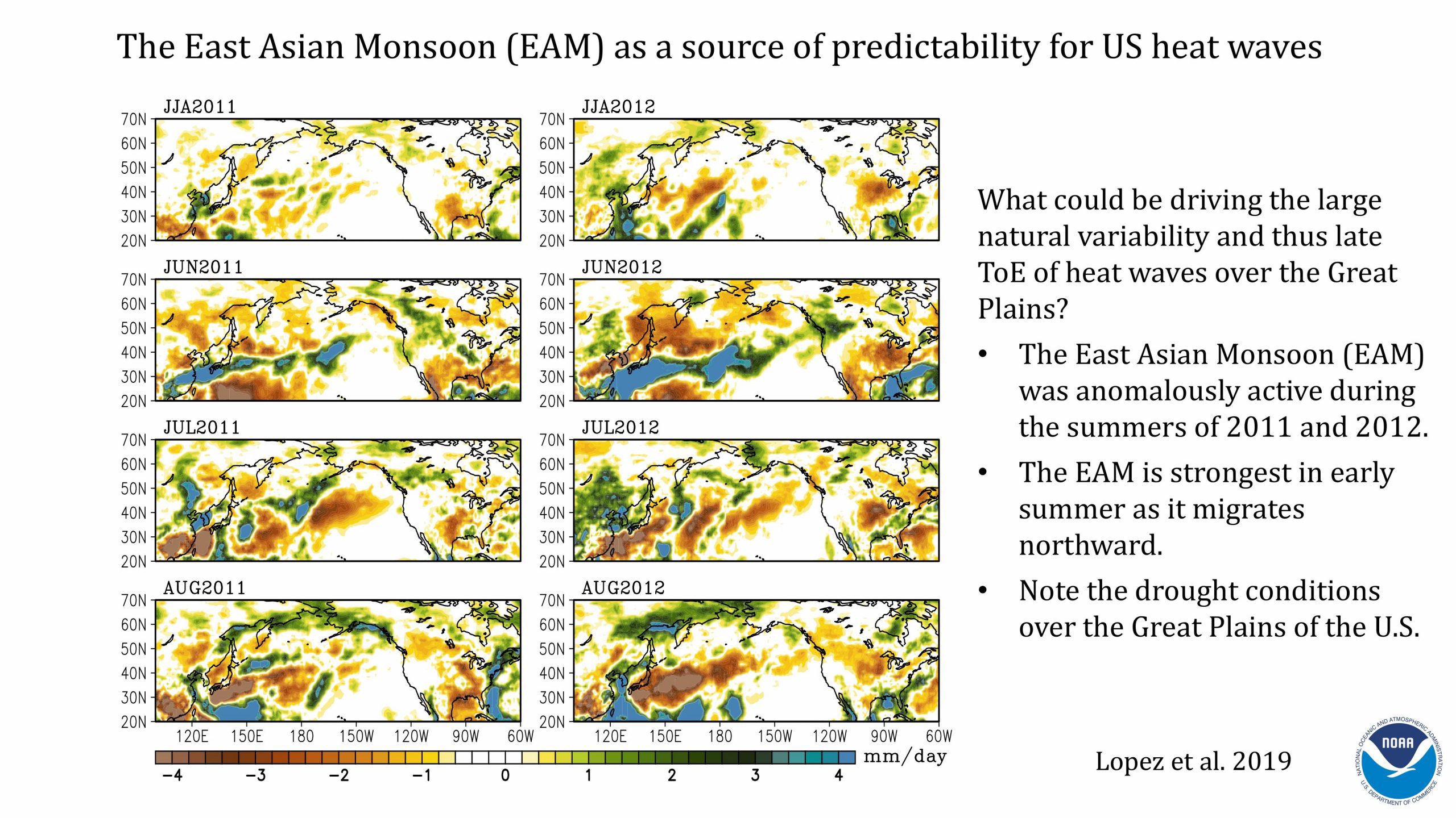
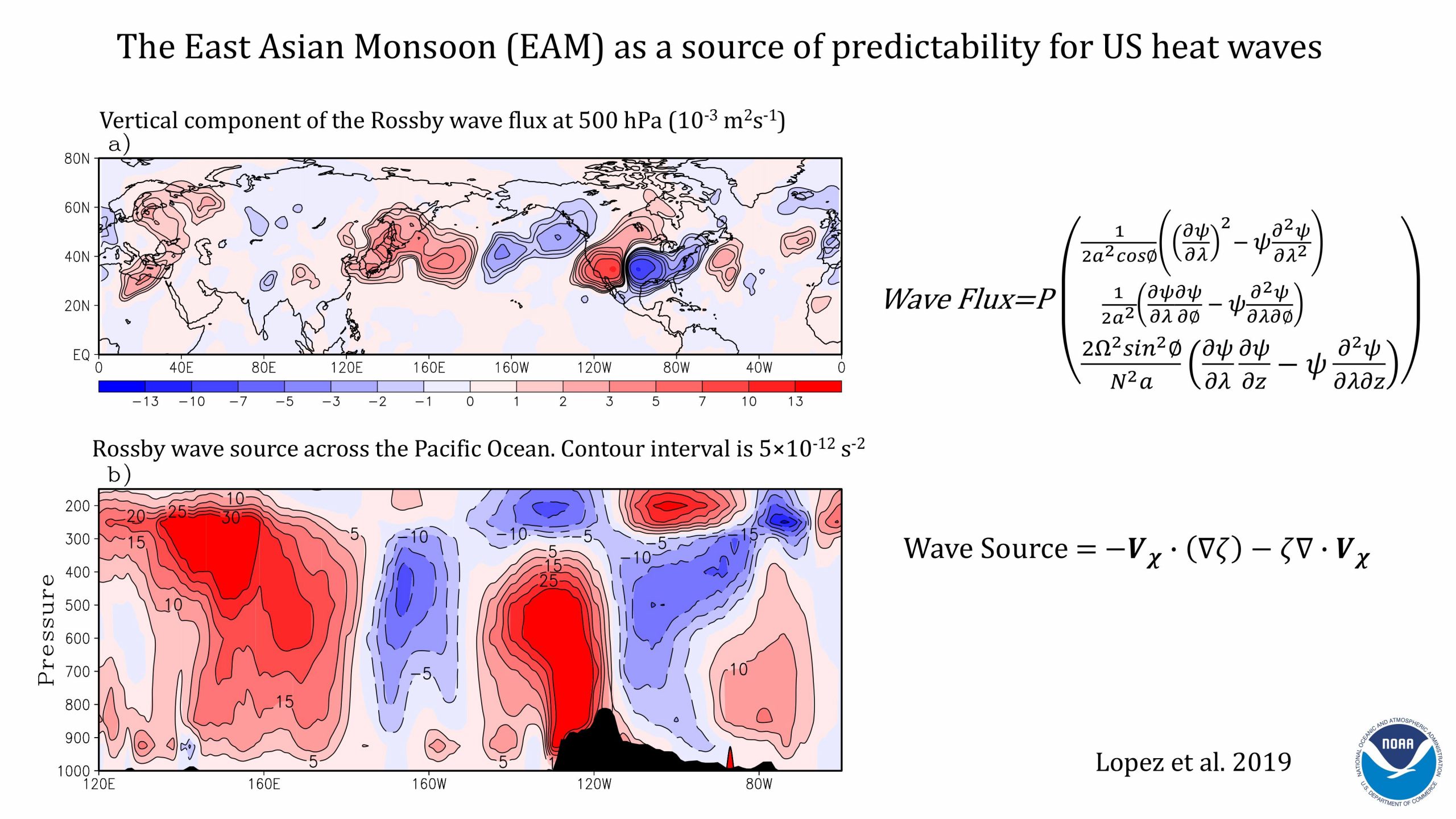
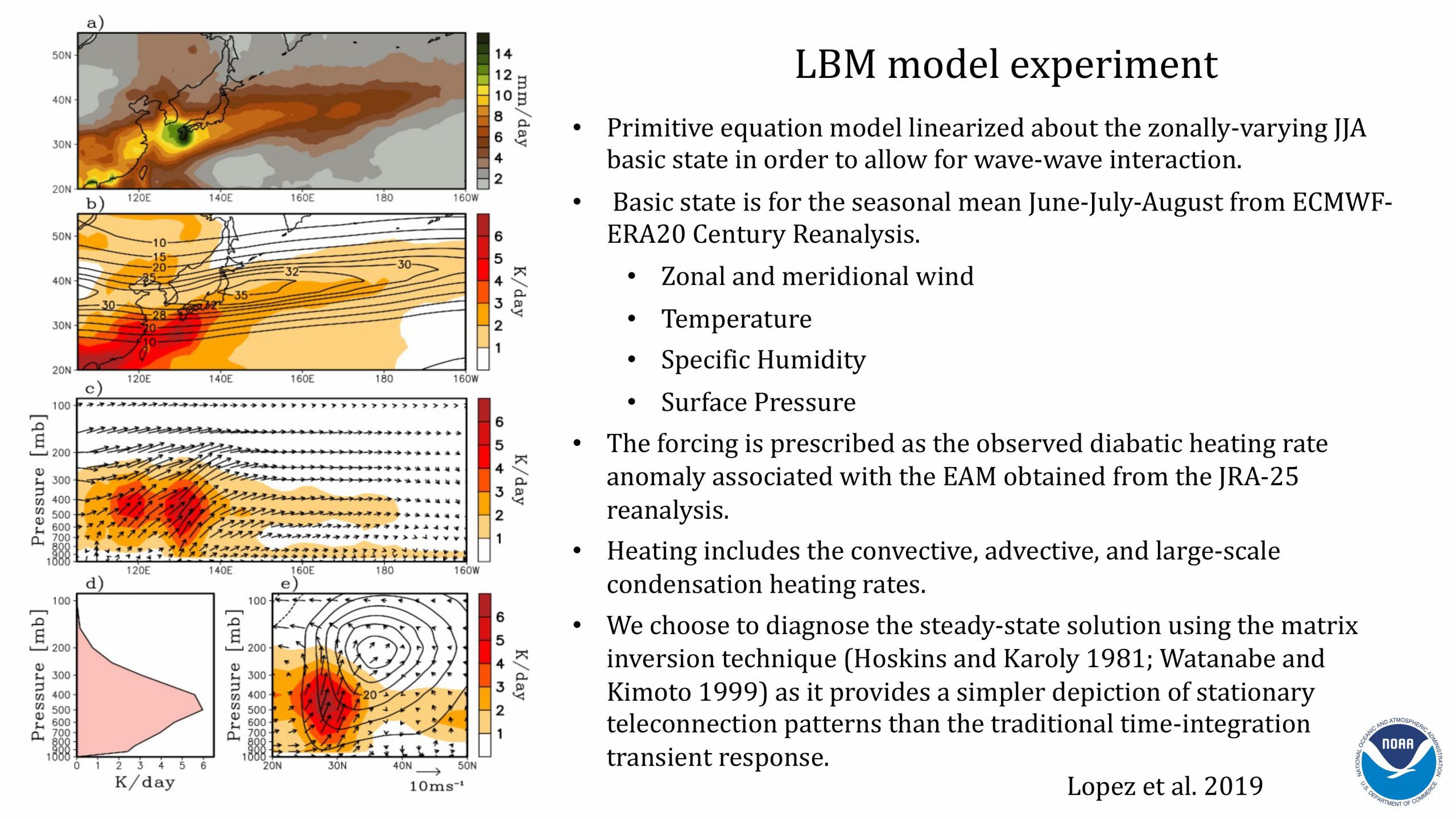
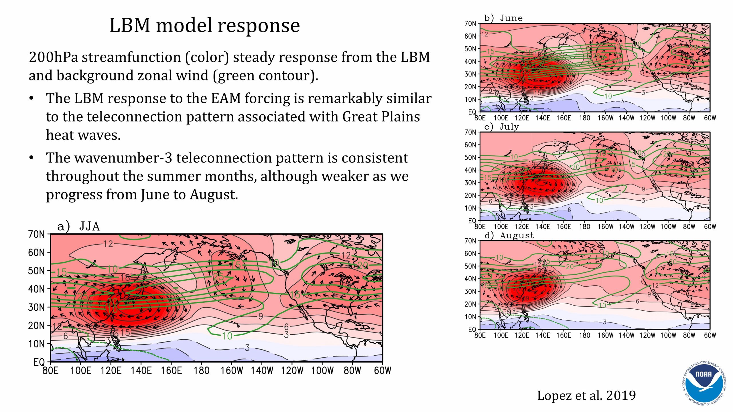
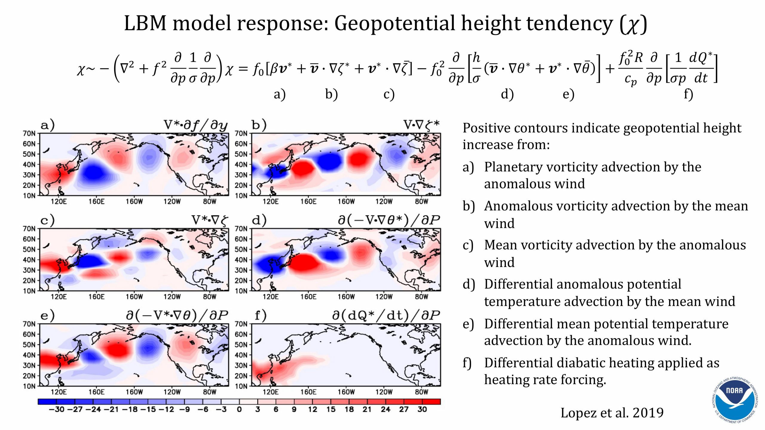
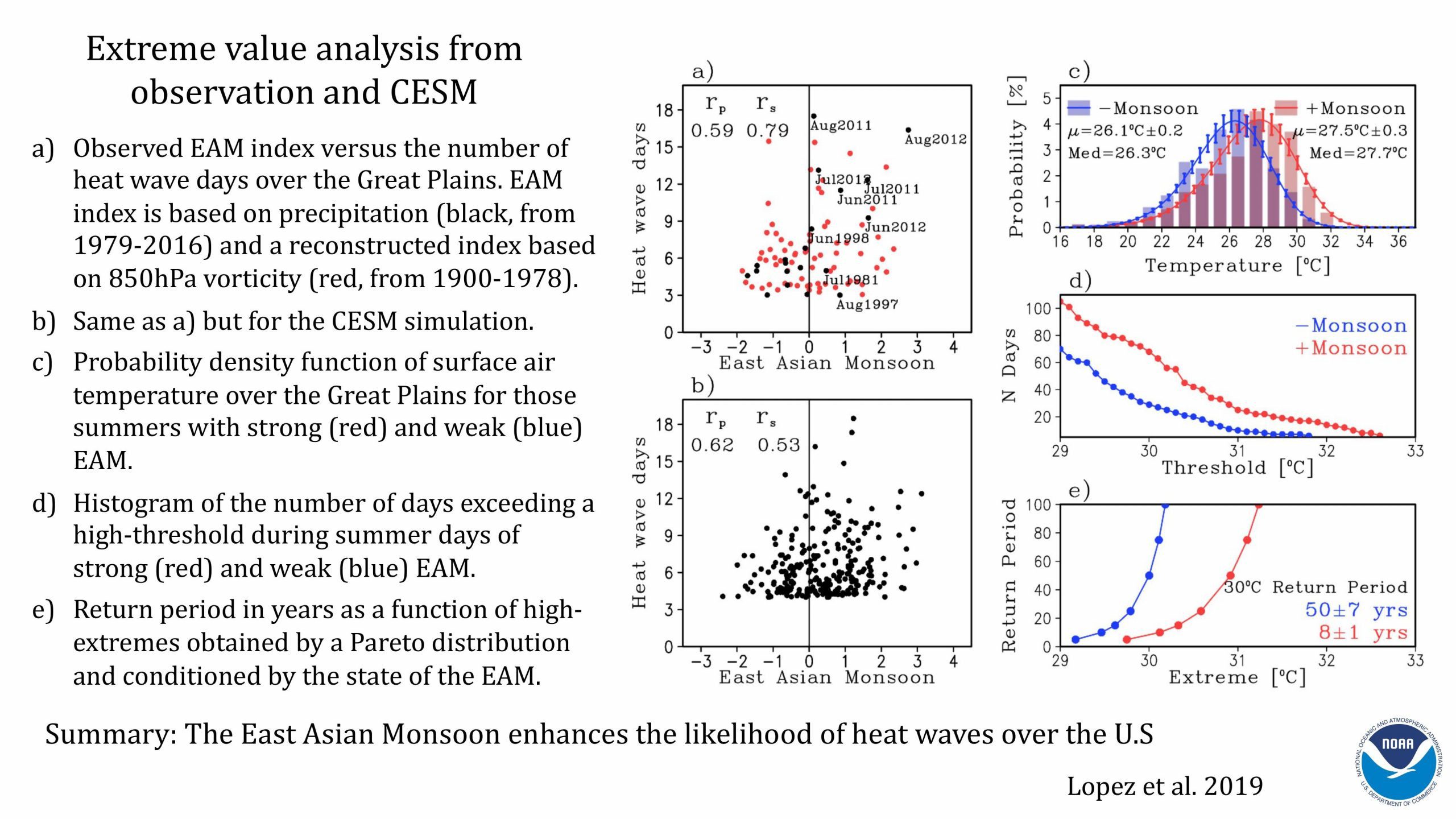
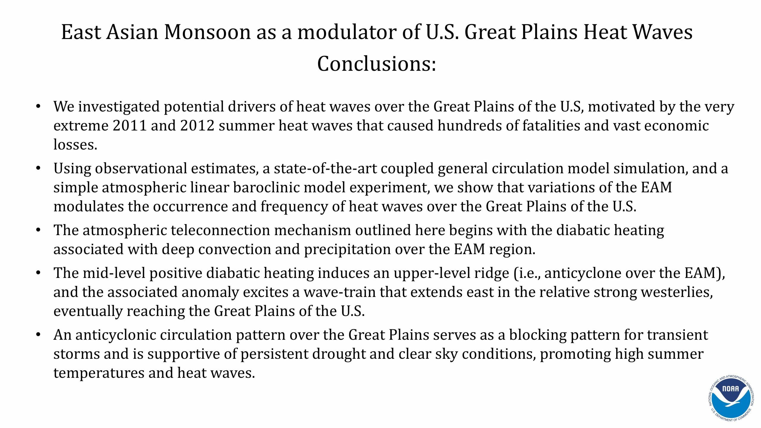
AOML scientists have also found that a series of record-breaking heat wave events over the Great Plains during the summers of 2011 and 2012, which resulted in 361 fatalities, were linked to an unusual convective heat release from the East Asian Monsoon and the associated atmospheric wave trains along the Pacific jet stream. This, in turn, promoted an anticyclonic circulation pattern over the Great Plains supporting persistent drought, clear sky conditions, high temperatures and heat waves.
The Ocean and Extreme Weather
The link between the ocean and extreme weather events is complex and needs to be better understood to improve and extend forecasts for such events. Heat wave occurrence in the US has been found to be linked to the Atlantic meridional overturning circulation and variations in the global monsoon on the subseasonal to multidecadal timescales.
Our scientists have also found that subseasonal variations of tornado activity are closely related to northeastern Pacific convection associated with the Madden-Julian Oscillation (MJO). Supported by a newly funded NOAA project, Subseasonal to Seasonal Severe Weather Prediction, the AOML science team and colleagues at other NOAA Research labs are currently exploring ways to apply this mechanism to develop a subseasonal US tornado outlook.
Extreme Weather Events
Extreme Rainfall
Our scientists are conducting research using observational datasets and numerical modeling with the goal of improving rainfall forecasts for the US. Understanding the physical mechanisms controlling summer rainfall over the US is of great importance because precipitation influences variations in extreme weather events, including drought, flooding, and heat waves.
Tornadoes
Scientists at AOML are developing a seasonal forecast model for tornado activity for the contiguous US with the goal to improve prediction and risk assessment. During the course of this work, they identified certain ocean conditions which may lead to a skillful prediction of severe US tornado outbreaks 1-3 months in advance.
Hurricanes
Our scientists are actively working to improve intensity forecasts of tropical cyclones by employing novel observational platforms (e.g., gliders, airborne drifters, and floats) and modeling techniques (e.g., Observing System Experiments). These platforms and techniques enable them to assess the impact of existing and new observing systems for improving the ocean analyses used to initialize coupled tropical cyclone forecast models.
Supporting the needs of NOAA and Line Offices.
The Weather Act.
The Weather Act was signed into law in April 2017, with goals to improve NOAA’s weather research through investments in observational, computing, and modeling capabilities, to support improvement in weather forecasting and prediction of high impact weather events, and expand commercial opportunities for the provision of weather data.
Our research advances the prediction of high impact weather events by improving severe weather forecasts beyond the 7-10 day timescale to subseasonal and seasonal timescales.
Learn more about the Weather Act at NOAA’s Weather Program Office.
Heat Waves
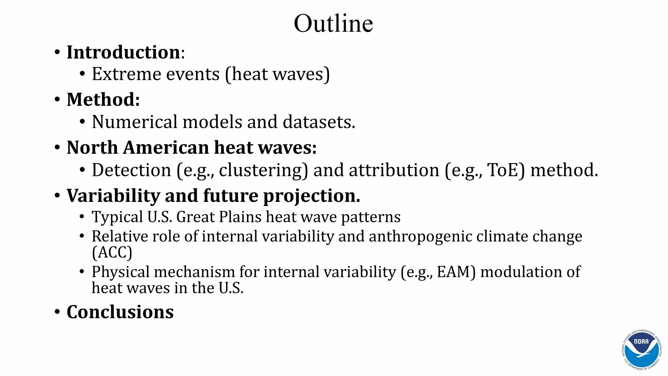
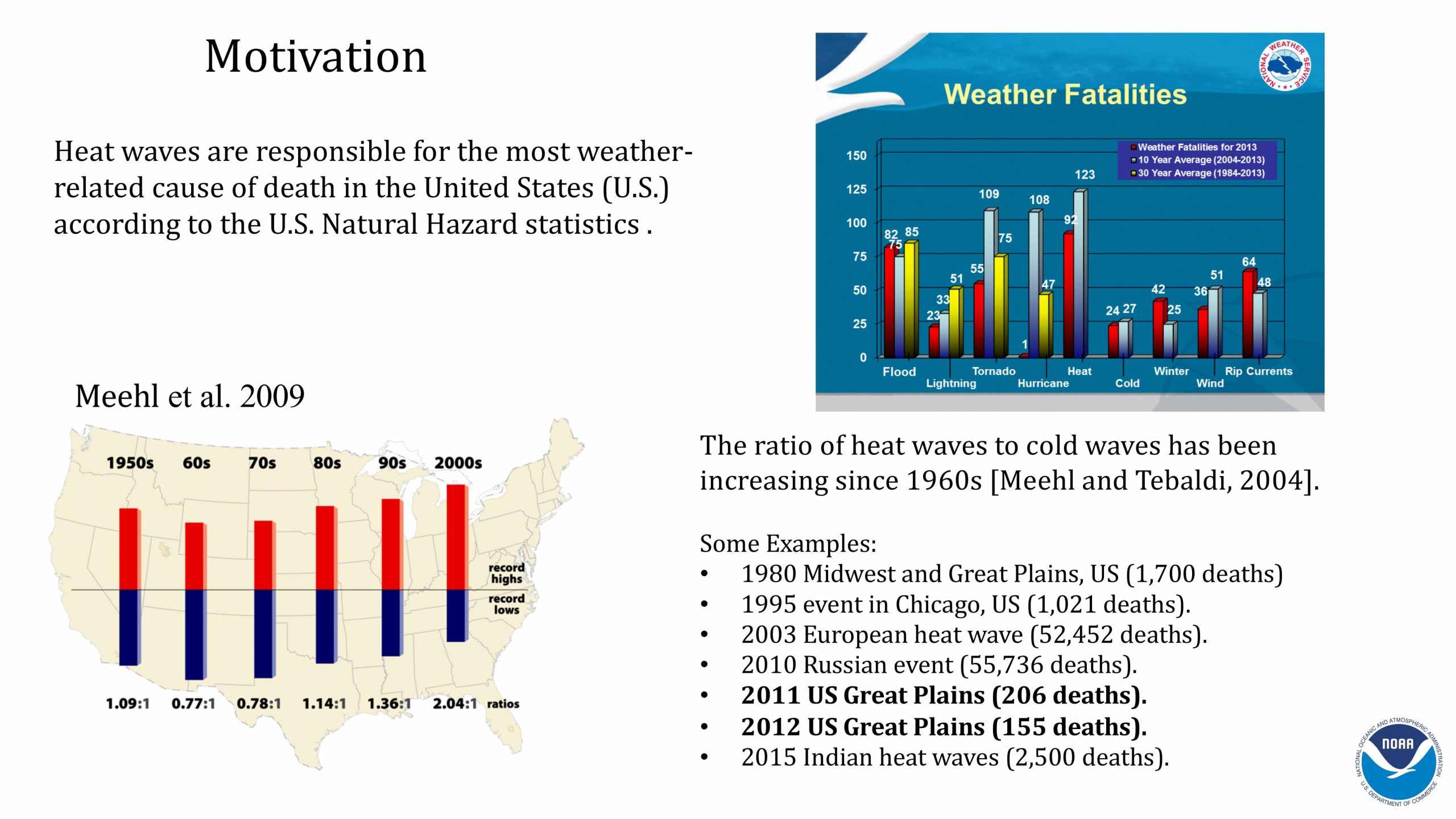
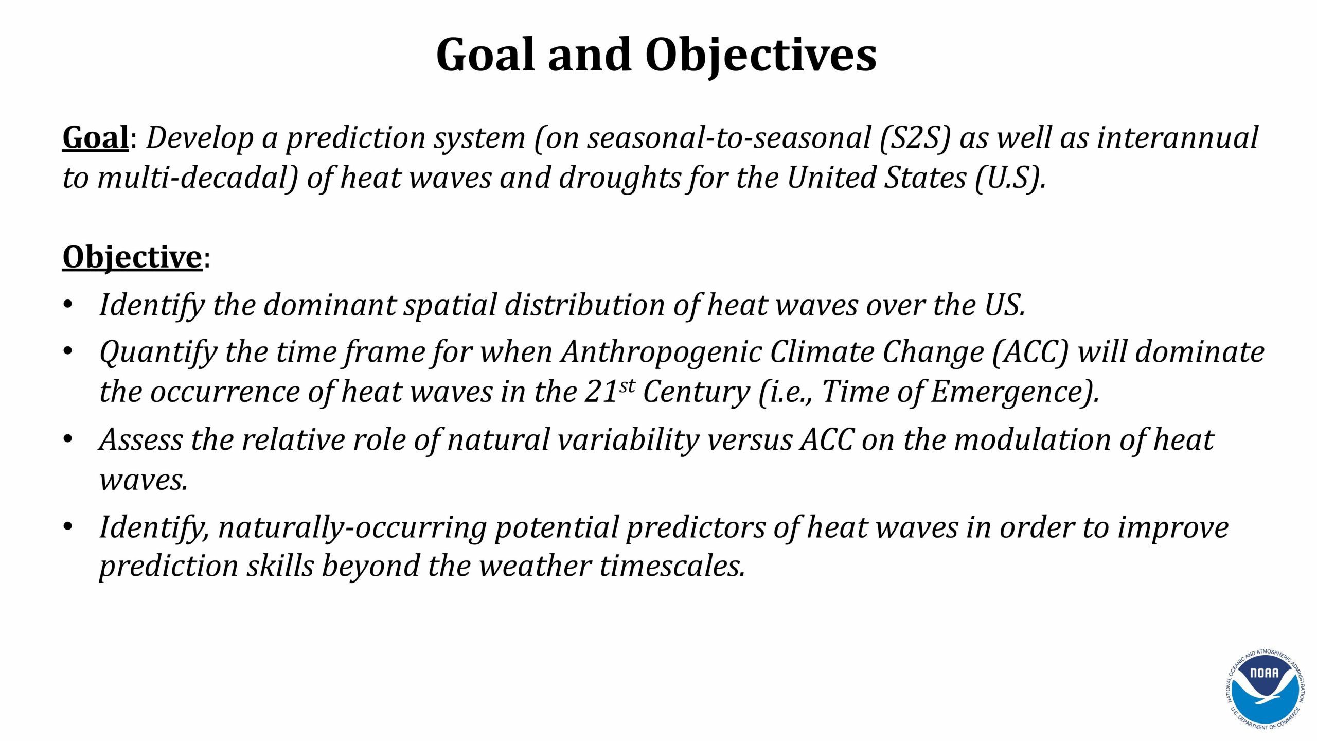
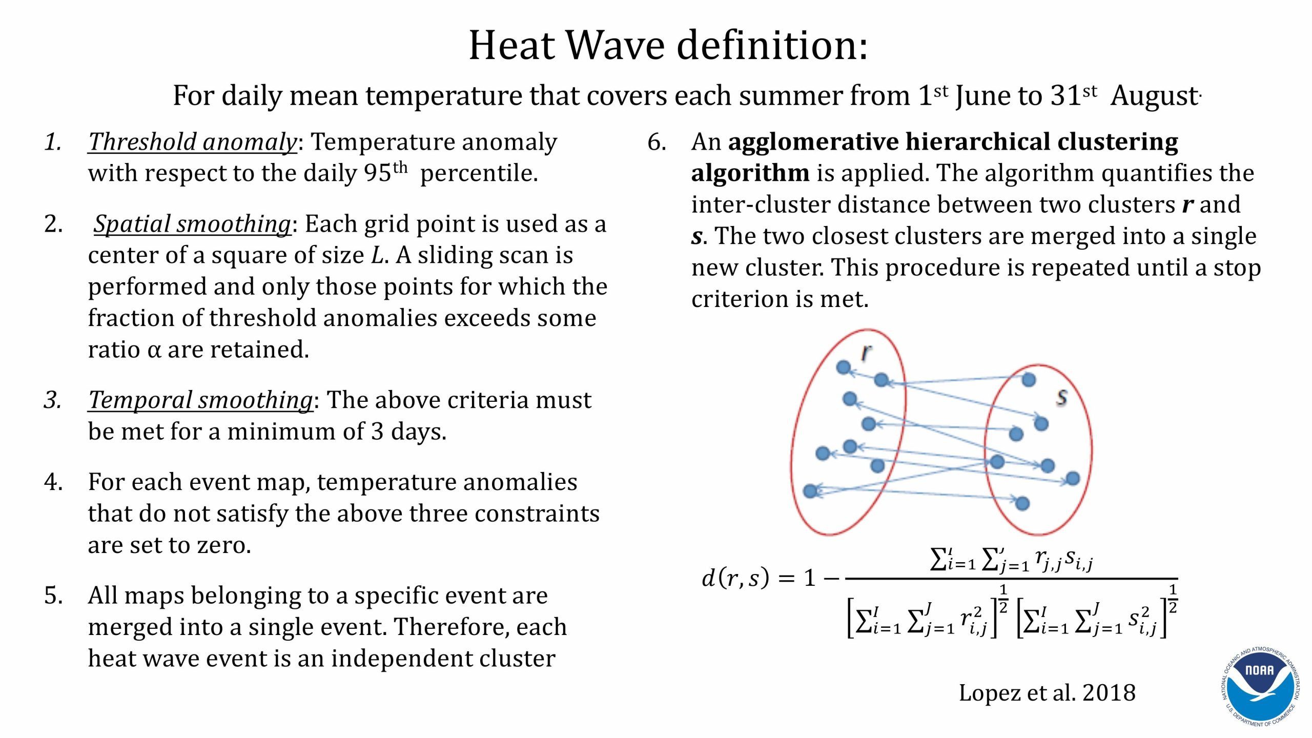
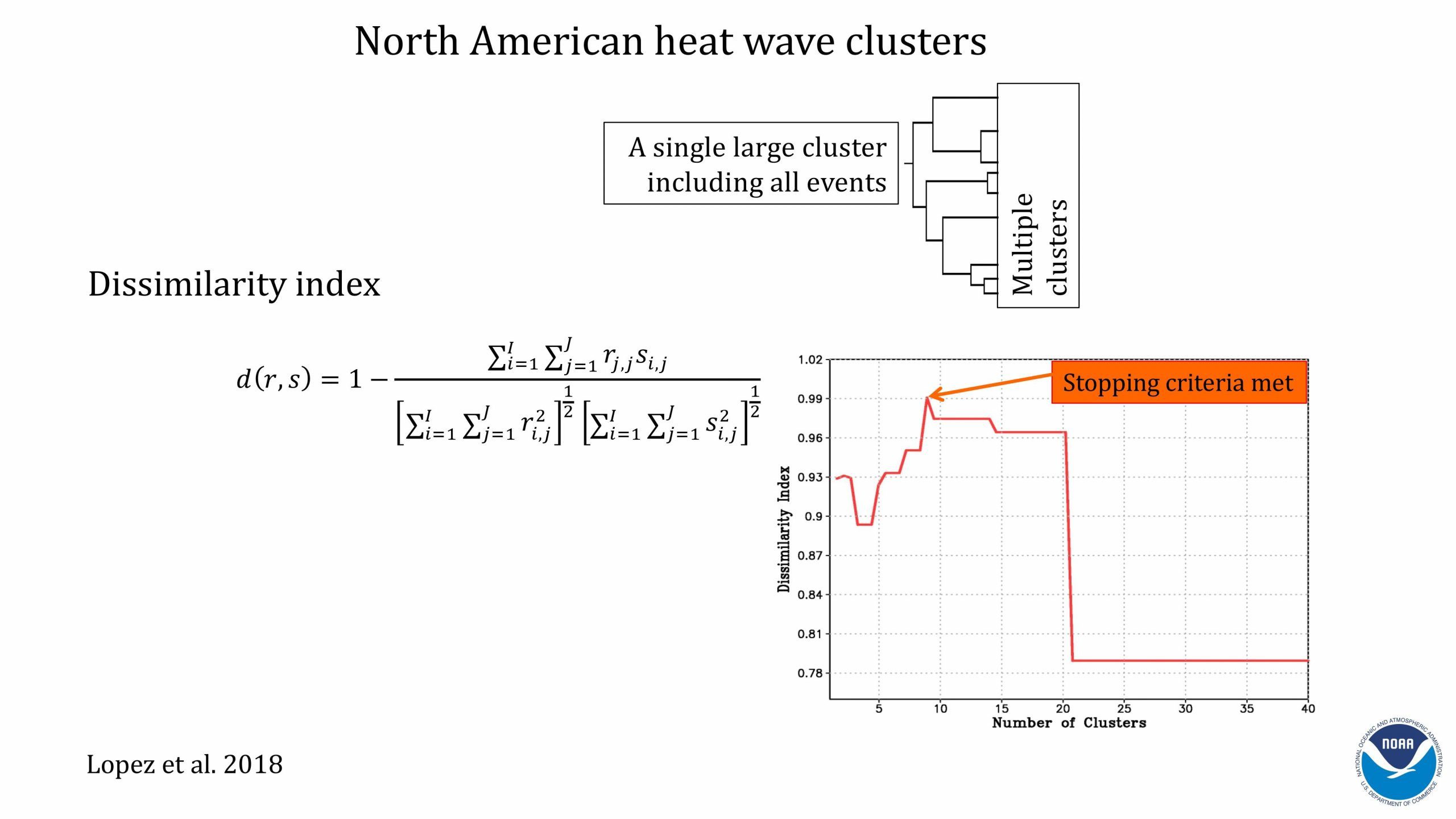
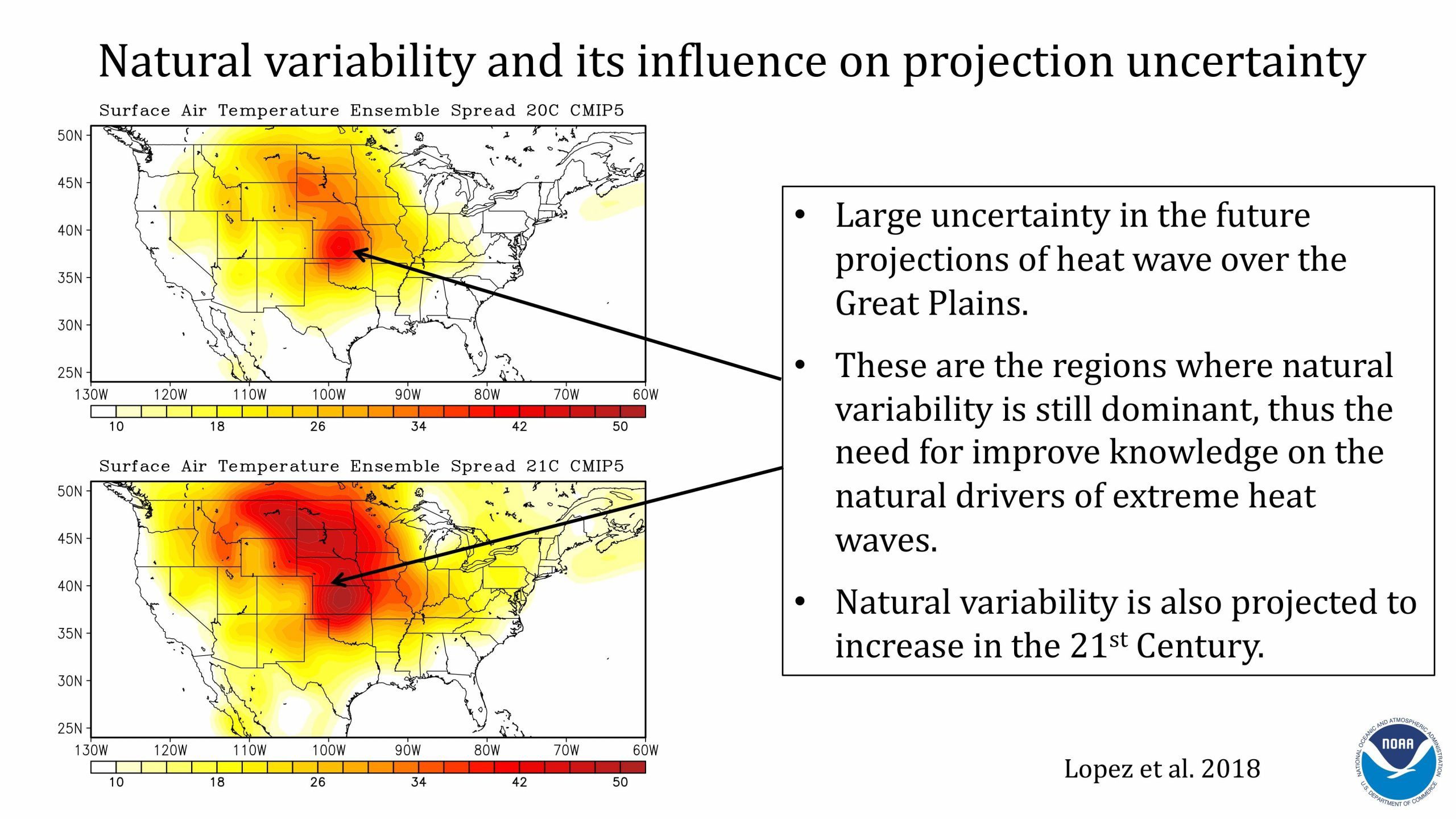
Heat waves are the leading weather-related cause of death in the US. These events are unusual and largely unpredictable beyond the 7-10 day timescale, indicating the need to identify the physical processes that modulate heat waves and, consequently, lead to improved prediction. Scientists at AOML are working to understand the driving forces behind heat wave occurrence, which is crucial for informing public health security and extreme heat mitigation strategies, and for developing effective heat wave forecasts to better prepare vulnerable communities. Click through the slides below to learn more about how the East Asian Monsoon is a modulator for heat waves across the US Great Plains.
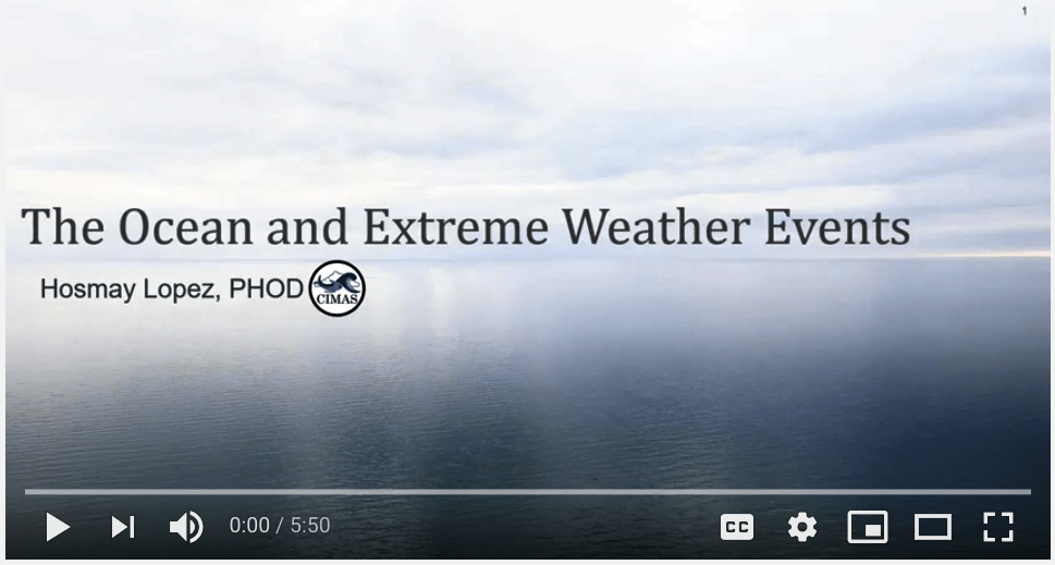
View the full presentation on youtube.


Heat Waves and Climate Change
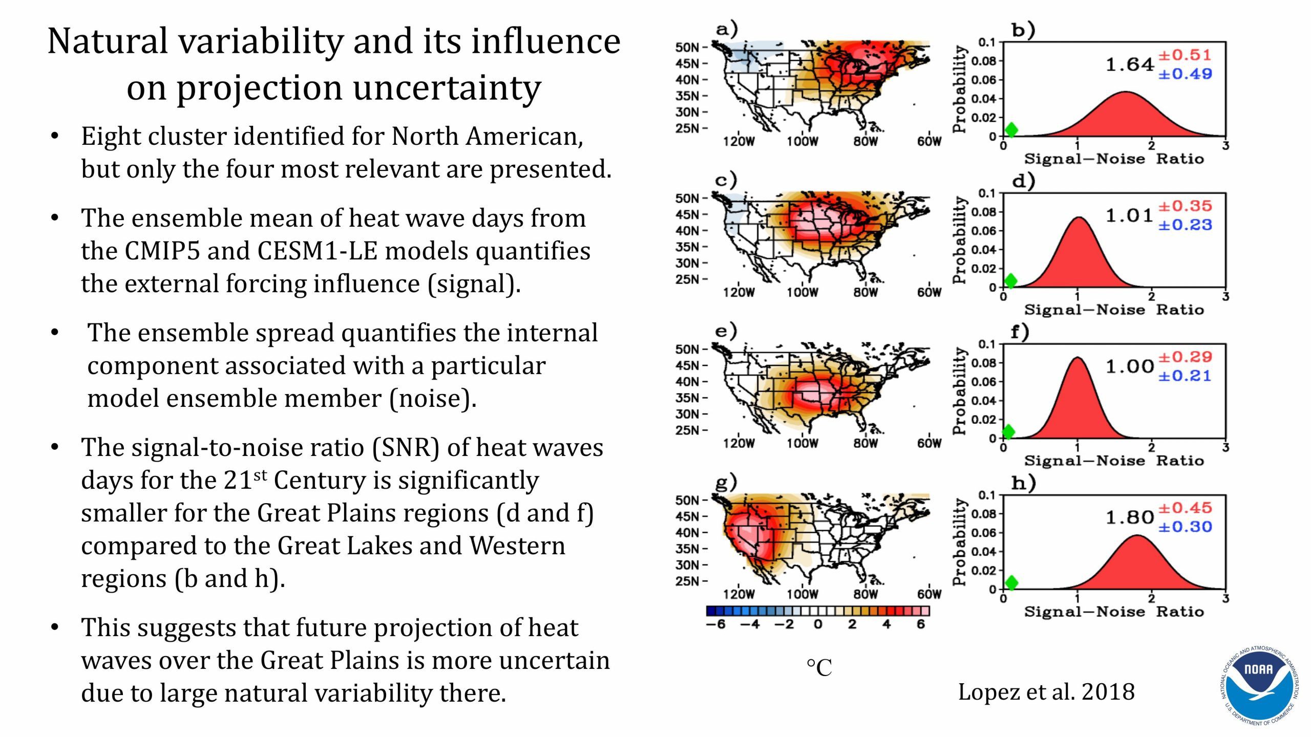
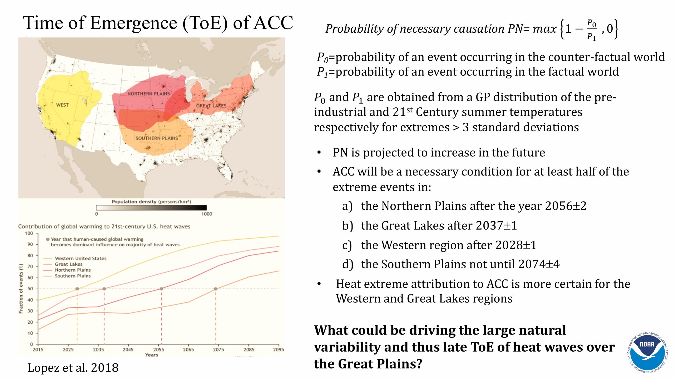
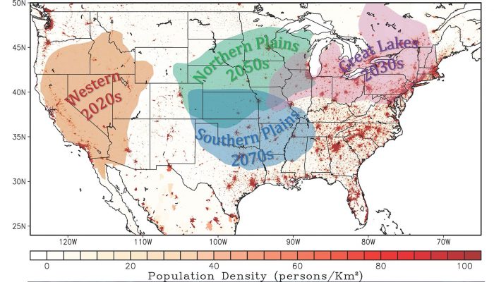
An analysis of heat wave patterns appearing in Nature Climate Change focuses on four regions of the United States where human-caused climate change will ultimately overtake natural variability as the main driver of heat waves. Climate change will drive more frequent and extreme summer heat waves in the western United States by the late 2020s, the Great Lakes region by the mid 2030s, and in the northern and southern Plains by the 2050s and 2070s, respectively. With growing populations in these regions, this study provides important information that can help inform adaptation and mitigation strategies to protect human health.
Find out more on our blog.
Tornadoes
The Madden-Julian Oscillation
During the spring months of March, April, and May, the central US east of the Rocky Mountains is most prone to severe thunderstorms that often spawn series of violent tornadoes, causing casualties and property losses.
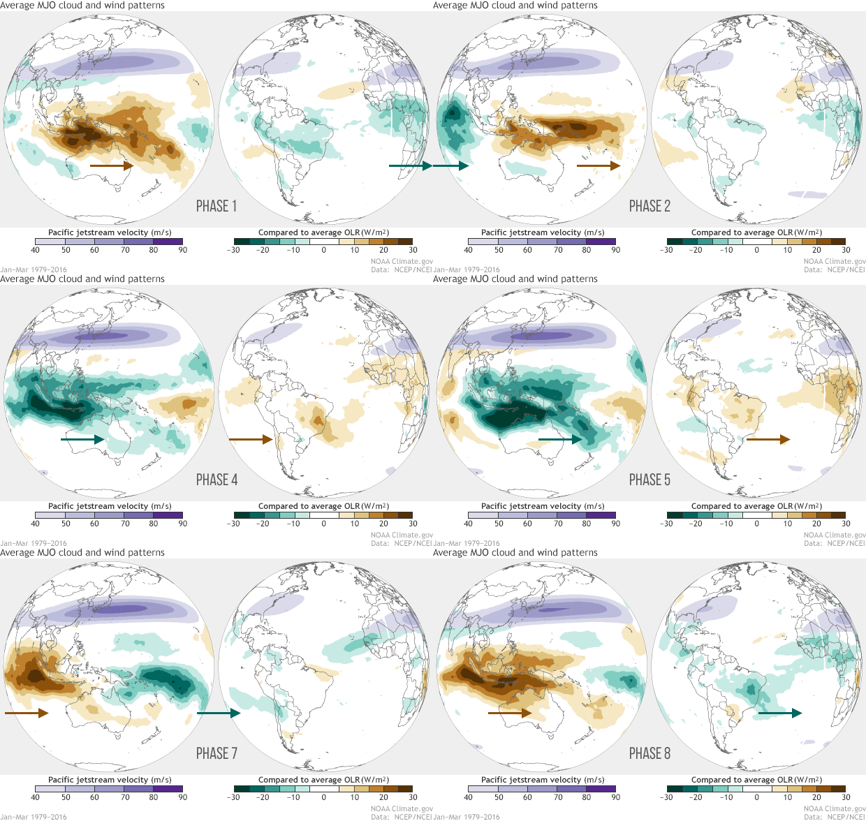
The Madden-Julian Oscillation is a patch of tropical thunderstorms that forms across the Indian Ocean. These storms move slowly eastward across the Pacific Ocean over a period of 30 to 90 days. Several studies have found a correlation between US tornado activity and how the Madden-Julian Oscillation passes across certain longitude bands in the tropical Pacific.
Read our news story to find out more.
El Niño-Southern Oscillation and Sea Surface Temperature in the North Atlantic
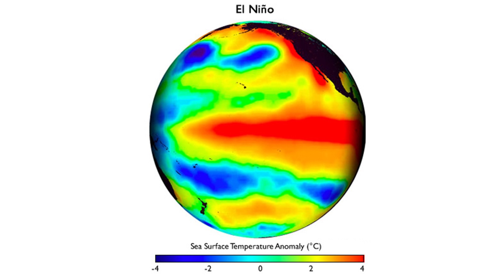
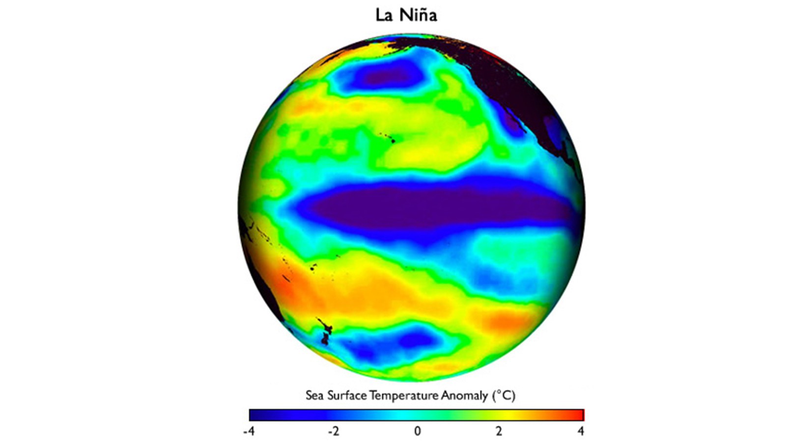
The temperature variations associated with El Niño and La Niña have far reaching impacts on global weather, including the likelihood of tornado outbreaks in the US.
Our scientists investigated the probability patterns of US regional tornado outbreaks during 1950–2014. They found that the four dominant springtime El Niño-Southern Oscillation (ENSO) phases (persistent versus early-terminating El Niño and resurgent versus transitioning La Niña) and the North Atlantic sea surface temperature tripole variability were linked to distinct and significant US regional patterns of outbreak probability.
Watch this video to learn more.
Extreme Rainfall and Droughts
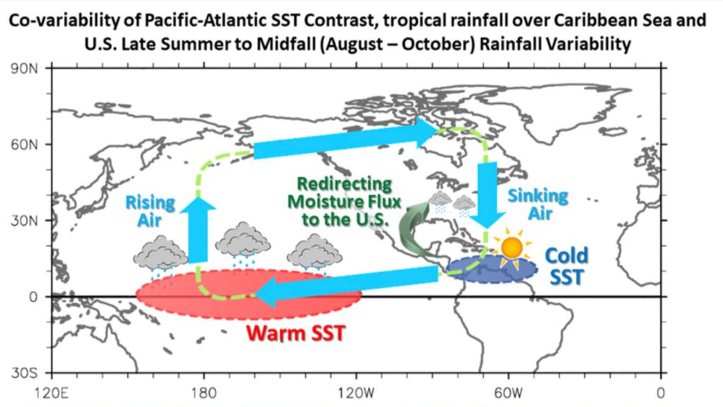
Understanding the physical mechanisms that control late summer to early fall (August to October) rainfall over the US is of great importance. Precipitation influences the variation of extreme weather events, including drought, flooding, and heat waves, and also has direct economic impacts on factors such as crop yield.
There is currently little knowledge about the physical factors controlling US rainfall in the late summer to early fall thus limiting our ability to forewarn extreme rainfall events beyond a few days. Motivated by such problems, scientists at AOML are using observational datasets and numerical modeling experiments to improve rainfall forecasts for the US.
Their research has found that the contrast in surface temperatures between the tropical Pacific and Atlantic oceans in the late summer to early fall is one of the main drivers for modulating US precipitation over the southern US region and Great Plains on various timescales (subseasonal to multidecadal). AOML scientists have also found that the decadal southeast U.S. drought is influenced by nonlinear inter-ocean interactions between the Pacific and Atlantic Oceans.
Hurricanes
The global ocean drives our weather and climate systems. Scientists at AOML use different observing technologies and instruments to measure and observe the global oceans. Research conducted at AOML using data and numerical models that assimilate ocean observations has shown that ocean observations are key to improving the representation of the upper ocean’s conditions within coupled hurricane-ocean models used in the forecasts. The assimilation of ocean observations contributes to improved ocean representation in the models and, consequently, to improved hurricane forecasts.
Satellite altimetry allows ocean features to be easily identified, Argo floats allow for correcting model temperature and salinity large scale biases, and glider data provide continuous temperature and salinity profiles in areas of intense mesoscale activity. Additionally, drifters are deployed ahead of some Atlantic hurricanes to measure pressure, wind, and temperature as the storm passes above. These ocean observations and data are used to improve hurricane intensity forecasts, and are a way of determining if forecast models are accurately representing the interaction between the atmosphere and the ocean.
Partners
Sharing Resources Delivers Results.
Expanding Reach Through Partnerships.
Since 2016, AOML’s seasonal hybrid forecast model has been used as one of the forecast tools for Climate Prediction Center (CPC)’s experimental severe weather outlook.
In collaboration with forecasters and scientists from Climate Prediction Center (CPC), Storm Prediction Center (SPC), National Severe Storm Laboratory (NSSL) and universities, AOML scientists are responsible for preparing and finalizing the annual severe weather outlook report.


