Paper on the eyewall replacement cycles in Hurricane Bonnie during a period of high wind shear published in Monthly Weather Review
You can read the paper at https://journals.ametsoc.org/doi/10.1175/MWR-D-18-0030.1.
You can read the paper at https://journals.ametsoc.org/doi/10.1175/MWR-D-18-0030.1.

On September 21, 1938, a hurricane moving at over 50 mph struck Long Island and raced over New England, bringing a storm surge and heavy rainfall. It would be remembered for generations as the “Long Island Express”. The storm originated from a disturbance detected off Africa on Sept. 9th. It was tracked via ship reports […]

Thursday, September 20, 2018 NOAA49: The NOAA G-IV will be flying a joint research mission for AOML/HRD and NOAA/NESDIS (National Environmental Satellite, Data, and Information Service) objectives to validate atmospheric moisture and temperature profiles in the NOAA Unique Combined Atmospheric Processing System (NUCAPS) satellite product. Of particular interest is assessing the ability of NUCAPS to represent […]

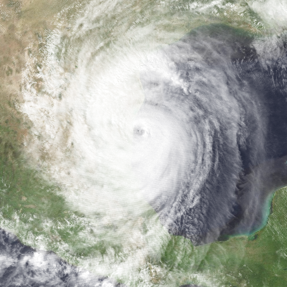
On September 16, 1988, Hurricane Gilbert made landfall at the Mexican city of La Pesca,Tamaulipas, with winds of 125 mph (200 km/hr). It had already brought destruction upon the Yucatan peninsula and the Caribbean islands. Along the way it set a new low-pressure record that would stand for 17 years. Gilbert was a classic Cape […]

On September 16, 1928, the deadliest hurricane in Florida’s history struck West Palm Beach. As it moved inland it drove the waters of Lake Okeechobee against the mud levees on its shores. When the levees failed, a surge inundated the communities of Okeechobee City, South Bay and Belle Glade, causing thousands of deaths. The storm […]
Friday, September 14, 2018 NOAA42: The P-3 will fly additional NHC tasked reconnaissance missions into Isaac. The P-3 departed Lakeland, FL at 9:30 AM EDT this morning for their mission into Tropical Depression Isaac, and will recover in St. Croix. An additional reconnaissance mission into Isaac is scheduled for takeoff from St. Croix at 11:30 PM EDT […]