Tag: global drifters

The Global Drifter Program Launches a New Interactive Map Tool

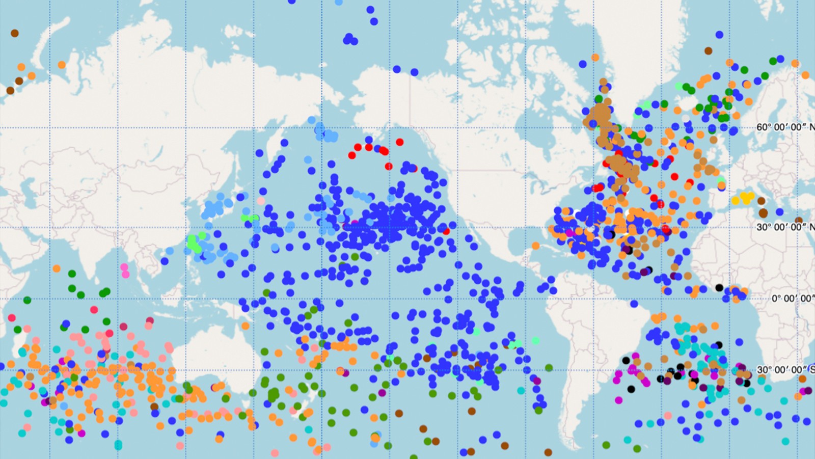
The Global Drifter Program’s (GDP) Drifter Data Assembly Center (DAC) at AOML has launched a new interactive map of the global drifter array. This new tool features the ability to zoom and scroll, hover the cursor over drifters to get their identification numbers, and click to see data and metadata including deployment information, manufacturer, and drifter type in an ID card that can be viewed as a high-resolution image with an additional click.

Read Full Article

AOML Supports the Deployment of Drifting Buoys Ahead of Tropical Storm Isaias

AOML scientists partnered with the U.S. Air Force 53rd Reconnaissance Squadron “Hurricane Hunters” to deploy eight drifting buoys in advance of Tropical Storm Isaias on August 3, 2020 off the Carolina coast, in collaboration with the National Weather Service (NWS), National Hurricane Center (NHC), and Scripps Institution of Oceanography.

Read Full Article

NOAA’s Global Drifter Program Partners with the National Data Buoy Center to Support US Navy-funded Spotter Drifter Deployments

NOAA’s Global Ocean Monitoring and Observation Division and Global Drifter Program recently extended a helping hand to support deployment of commercial Spotter drifters, supported by the U.S. Navy’s Office of Naval Research. These specialized drifters are designed to measure waves, in addition to winds and sea surface temperature, providing valuable data to scientists to be used in hurricane forecast models.

Read Full Article

Out at Sea With Our Heads in the Clouds

AOML is deploying drifting buoys as part of a large multinational project that aims to improve our current understanding of the complicated interactions between the air and sea which create shallow convective clouds.  NOAA scientists are interested in studying shallow cloud and air-sea interactions because of their influence on global conditions from temperature and precipitation to more extreme weather events.

Read Full Article

NOAA’s Global Drifter Program: Ocean Dynamics Data Improves Forecasting and Coastal Safety

NOAA’s Global Drifter Program is a globally collaborative research project that provides near real-time marine data for the world. It allows us to record data for weather forecasts, track decadal patterns, and pinpoint inter-annual climate variations like El Nino Southern Oscillation. Global drifters provide observational verification for weather models, calibrate satellite observations, and collect and transfer new data about the ocean temperature, currents and barometric pressure.

Read Full Article

Crash Site of Malaysian Airlines Flight MH370 Likely Falls Within Official Search Area

In a paper published in the Journal of Operational Oceanography, a team of scientists with the Physical Oceanography Division at AOML, the University of Santiago de Compostela in Spain, the University of Miami, the University of Hawaii, and the Commonwealth Scientific and Industrial Research Organisation (CSIRO) of Australia analyzed possible pathways to link the location of the found debris in the southwestern Indian Ocean with potential crash sites, probably in the eastern Indian Ocean.

Read Full Article

Drifter Program Catches a Lift to the Southern Ocean with the Volvo Ocean Race

If you’ve ever sailed aboard a ship in the coastal ocean, or checked a weather report before going to the beach, then you are one of many millions of people who benefit from ocean observations. NOAA collects ocean observations and weather data to provide mariners with accurate forecasts of seas, as well as coastal forecasts and even regional climate predictions. It takes a lot of effort to maintain observations in all of the ocean basins to support these forecasts, and NOAA certainly can’t do it alone. Partnerships are essential to maintaining a network of free-floating buoys, known as drifters, and NOAA’s latest partner is not your typical research or ocean transportation vessel: the six sailboats and crew currently racing around the world in the Volvo Ocean Race.

Read Full Article

NOAA’s Array of Drifting Ocean Buoys

Drifting buoys are a primary tool used by the oceanographic community to measure ocean surface circulation at unprecedented resolution. A drifter is composed of a surface float, which includes a transmitter to relay data via satellite, and a thermometer that reads temperature a few centimeters below the air-sea interface. The surface float is tethered to a holey sock drogue (a.k.a. “sea anchor”), centered at 15 m depth. The drifter follows the ocean surface current flow integrated over the drogue depth.

Read Full Article