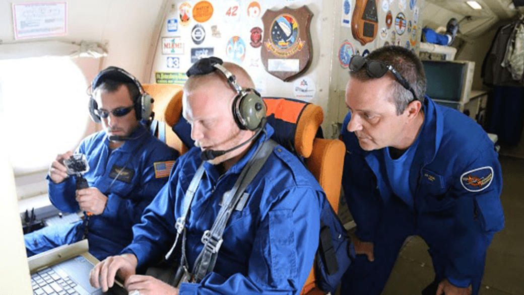
Category: Hurricane Research

Hurricane Danny

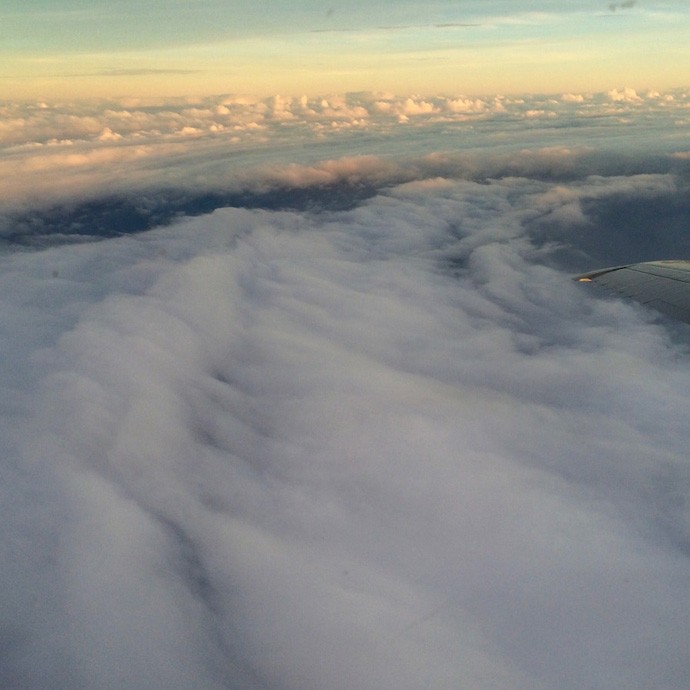
Photos taken from NOAA’s P-3 aircraft during Hurricane Hunter flights conducted on Saturday, August 22nd and Sunday, August 23rd inside Hurricane Danny. Peaking at Category 3 strength on Friday, August 21, Danny had maximum sustained winds of 115 mph as it churned in the Atlantic. Danny then weakened to a tropical depression due to interaction with high levels of wind shear and a mass of dry air in the Caribbean as it moved across the Lesser Antilles. The Hurricane Hunter missions profiled Danny’s wind structure with Tail Doppler Radar, conducted various projects in support of the Hurricane Research Division’s 2015 Field Program, and surveyed the ocean ahead of the storm in order to improve forecasts.

Read Full Article

Behind the 2015 Atlantic Hurricane Season: Wind Shear & Tropical Cyclones

With the 2015 Atlantic hurricane season underway, researchers are pointing to the strong presence of El Niño as the major driver suppressing the development of tropical cyclones in the Atlantic basin. But what specific conditions are associated with El Niño that lead to a less than ideal environment for tropical cyclone development? Through research and observation, hurricane researchers know strong environmental wind shear is a major factor affecting potential hurricane development and growth. This hurricane season, AOML researchers are delving further into the relationship between wind shear and tropical cyclones.

Read Full Article

NOAA Researchers Will Use 2015 Season to Improve Hurricane Track and Intensity Forecasts

This hurricane season, NOAA’s Office of Oceanic and Atmospheric Research will work with NOAA’s National Weather Service to upgrade weather forecast models and conduct research with unmanned air and water craft to improve forecasts of hurricane track and intensity.A highlight this season is the upgrade of the operational Hurricane Weather Research and Forecast system (HWRF), an advanced hurricane prediction model. This year’s version now has increased the resolution from 3 to 2 kilometers, and will use tail Doppler radar data collected from the NOAA P-3 and G-IV hurricane hunter aircraft to improve the storm representation within the model.

Read Full Article

Hurricane Danny & Tropical Storm Erika Provide Wealth of Research Opportunities for the 2015 Hurricane Field Program

AOML’s hurricane researchers conducted a number of field activities in August that provided data and critical insights into two Atlantic tropical cyclones, Danny and Erika. The two storms enabled researchers to test new instruments in support of the 2015 Hurricane Field Program and conduct research that will benefit future forecasts. Among the highlights were more than 15 successful manned and unmanned aircraft missions into Danny and Erika to collect and provide real-time data to the National Hurricane Center (NHC), as well as evaluate forecast models.

Read Full Article

Research Reveals New Theory on Hurricane Formation and Intensification

Download PaperThe Relative Roles of the Ocean and Atmosphere as Revealed by Buoy Air–Sea Observations in Hurricanes How do hurricanes form, survive, and intensify? Hurricane scientists have long believed upper ocean temperatures are the key factor. AOML’s Dr. Joe Cione reveals a new theory, after observing 62 Atlantic hurricanes of a span of 32 years, [...]
Read Full Article

Atlantic Hurricane Season Remains Quiet As Predicted

The Atlantic hurricane season will officially end November 30, and will be remembered as a relatively quiet season as was predicted. Still, the season afforded NOAA scientists with opportunities to produce new forecast products, showcase successful modeling advancements, and conduct research to benefit future forecasts.

Read Full Article

Hurricane Edouard

Photos taken from a NOAA P-3 aircraft during a Hurricane Hunter flight inside Hurricane Edouard. NOAA successfully deployed a Coyote Unmanned Aircraft System (UAS) directly into a hurricane from a NOAA P-3 Hurricane Hunter for the first time. During flights conducted September 15-17, 2014 out of Bermuda, scientists aboard the P-3 aircraft received meteorological data from the Coyote UAS in both the eye and surrounding eyewall of Hurricane Edouard.

Read Full Article

Hurricane Scientists Bring a New Wave of Technology to Improve Forecasts

Scientists at NOAA’s Atlantic Oceanographic and Meteorological Laboratory are at the forefront of hurricane research to improve track and intensity forecasts. Every hurricane season they fly into storms, pour over observations and models, and consider new technological developments for how to enhance NOAA’s observing capabilities. The 2014 hurricane season will provide an opportunity to test some of the most advanced and innovative technologies, including unmanned hurricane hunter aircraft and sea gliders, which will help scientists better observe and, eventually, better predict a storm’s future activity.

Read Full Article

All Systems Are Go for NOAA to Release an Unmanned Aircraft Within a Hurricane

NOAA hurricane hunters are prepared to enter a new chapter in the use of unmanned aircraft systems: deploying an unmanned aircraft from an airplane inside a hurricane. Starting on September 14, 2014, NOAA’s hurricane hunting manned aircraft fleet will fly into position to observe any developing tropical systems in the Atlantic using this new tool. The Coyote unmanned aircraft will be the first unmanned aircraft deployed directly inside a hurricane from NOAA hurricane hunter aircraft. The goal of the Coyote is to collect temperature, pressure and wind observations below 3,000 feet, where manned aircraft can not fly safely.

Read Full Article