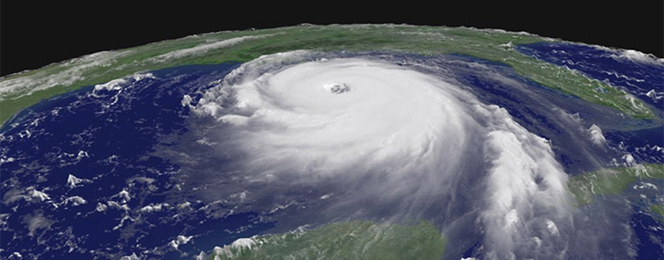

Scientists at NOAA’s Atlantic Oceanographic and Meteorological Laboratory (AOML) are at the vanguard of hurricane research. Each hurricane season we fly into storms, pore over observations and models, and consider new technological developments to enhance NOAA’s observing capacity and improve track and intensity forecasts. The 2016 hurricane season will provide an opportunity for our scientists to test some of the most advanced and innovative technologies and refined forecasting tools to help better predict a storm’s future activity.
Upgraded unmanned technologies for hurricane observations are expected to contribute significantly to NOAA’s study of intensity change in 2016. These unmanned systems include watercraft that patrol the ocean beneath a storm, small aerial systems that can propel deep into the eyewall and within a few hundred feet of the ocean’s surface, as well as larger aircraft that can jet high into the stratosphere to scan above and around a storm. Their instruments provide a broader, more comprehensive look at a storm’s inner workings, allowing scientists to better understand how hurricanes intensify and providing more accurate predictions of their path.
Traversing the waters of the Caribbean Sea and the tropical North Atlantic, NOAA’s underwater gliders are enhancing our knowledge of the role the ocean plays in the intensification of tropical cyclones. The gliders are durable, battery-powered autonomous vehicles operated remotely by scientists from AOML and the Caribbean Coastal Ocean Observing System (CariCOOS). Each glider collects thousands of ocean temperature and salinity profile observations to help improve hurricane intensity forecasts. Four gliders set for deployment in June and July will continuously survey the waters down to 1000 meters deep, even under hurricane force winds, to analyze the impact the upper ocean has on hurricane intensification and vice versa. NOAA scientists are assessing the impact of this ocean data to improve forecasts within the HYbrid Coordinate Ocean Model-Hurricane Weather Research and Forecasting Model (HYCOM-HWRF), currently being run in test mode.

In addition to data collected below the surface, another unmanned platform will provide coverage of the storm at the interface of the atmosphere and ocean, which is vital to understanding and predicting a storm’s strength. The Coyote, a small aircraft launched from NOAA’s P-3 aircraft, will collect data in this poorly-sampled region where manned aircraft cannot fly. Recent upgrades to the platform allow the Coyote to fly up to 50 miles from the P-3 aircraft, all while measuring the strongest winds and collecting critical, continuous observations at altitudes in the lower part of a storm. The Coyote will also have the ability to transmit real-time data collected from its instrument package to operators aboard the P-3, as well as at NOAA’s National Hurricane Center (NHC), where personnel monitor storms and develop forecasts. Data from the Coyote flights will provide NHC with an additional source of real-time measurements to be incorporated into the development of storm forecasts. Researchers will fly up to eight Coyotes this season, targeting mature storms (Category 1 or higher) in the Atlantic and East Pacific.

High above the storm at 60,000 feet, NOAA will once again fly targeted 24-hour missions of the NASA Global Hawk, an observing tool that has the endurance of a satellite but provides finer resolution data and the precision of an aircraft. The Global Hawk is part of NOAA’s Sensing Hazards with Operational Unmanned Technology (SHOUT) project that seeks to improve hurricane track and intensity forecasts by using data collected from above the storm down to the ocean’s surface. Results from recent hurricane modeling experiments suggest that by combining data from the Global Hawk with coverage from satellites, researchers can achieve full coverage of a storm, leading to significantly improved track forecasts. Global Hawk flights in 2016 will seek to complement satellite coverage to further test the impact of their combined data on forecast improvement.
Hurricane researchers also collect data from instruments aboard hurricane hunter aircraft, which fly multiple missions through a storm to help forecasters and scientists gather both operational and research data. NOAA will be using a Doppler Wind Lidar, mounted on the side of the P-3 aircraft, to improve storm representation within the Hurricane Weather Research and Forecasting system (HWRF), an advanced hurricane prediction model. Whereas Doppler radar provide three-dimensional wind estimates only where there is precipitation, Doppler Wind Lidar can provide wind estimates wherever there are fine drops of liquid, called aerosols, and broken cloudiness. The Doppler Wind Lidar will be used to sample the winds inside the hurricane that may be driving intensity changes. Coupled with the tail Doppler radar, these two instruments will provide a three-dimensional picture of the hurricane wind structure.

Incorporating data from these multiple platforms into dynamical models is vital for accurately forecasting a hurricane’s track and intensity. The rapid intensification of a tropical cyclone, or a period in which maximum sustained winds increase quickly in a short interval of time, is one of the most difficult factors to assess when forecasting a storm’s intensity and, as such, is one of NOAA’s top forecasting priorities. This season NOAA will implement an improved Rapid Intensification Index, a tool used by forecasters to predict rapid increases in maximum sustained winds of at least 30 knots in a 24-hr period. Recent improvements, led by AOML, extend the forecast period from 24 hours out to 48 hours, providing forecasters with additional lead-time to develop the most accurate estimates of a storm’s current intensity.
This season researchers and forecasters will be working with a recently upgraded version of the operational HWRF, the model that produced the best intensity forecast guidance in 2015 for the North Atlantic Basin. This year’s version will feature an expanded area of high resolution in the region immediately surrounding a hurricane. Based on limited observations from NOAA’s hurricane hunter aircraft, the model will also include improved representation of the lower 2 miles of the hurricane. These model enhancements advance our ability to predict small scale features that impact intensity change, providing forecasters with the information they need to inform communities and build a more weather-ready nation.
Originally Published by Edward Pritchard & Nicholas Komisarjevsky, 2016