
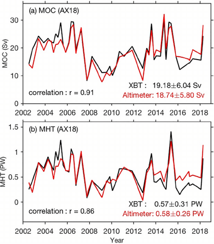
In a recently published study, scientists at AOML present 28-year long (1993-2020) estimates of the Atlantic Meridional Overturning Circulation (AMOC) volume and heat transports at multiple latitudes by merging in-situ oceanographic and satellite observations. By combining ocean observations with satellite data, they were able to estimate the AMOC volume and heat transports in near real time. These data can be used to validate ocean models, to detect climate variability, and to investigate their impact on extreme weather events.
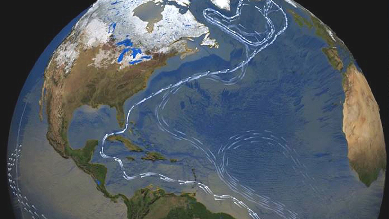
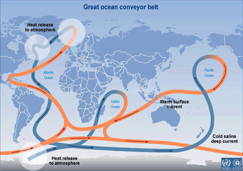
The Atlantic meridional overturning circulation (AMOC) is an oceanic conveyor belt that transports large amounts of heat northward throughout the Atlantic Ocean. The heat transported by the AMOC, usually referred to as Meridional Heat Transport (MHT), has impacts on climate and sea level. It also impacts regional and global extreme weather, such as hurricanes and heat waves. The AMOC plays a central role in sequestering carbon from the atmosphere into the deep ocean, which can have long-term implications for how the ocean regulates climate. Quantifying how the AMOC changes over time and understanding the underlying dynamics are crucial to advance our knowledge of the weather and climate systems and how they may change in the future.
Achieving a complete understanding of the variability of the AMOC system may require a sustained observational network that spans the entire Atlantic basin. Currently, in situ measurements specifically geared towards monitoring the AMOC are only available at a few latitudes over relatively short time periods, so they are not long enough to fully understand the AMOC’s variability and its underlying mechanisms. Further, some of the in situ measurements are often not optimal to derive more complex quantities such as the meridional transport of heat and freshwater.
In this study, scientists at AOML derived a 28-year long (1993-2020) observational estimate of the AMOC and MHT at multiple latitudes in the Atlantic Ocean by using an approach that merges in situ oceanographic and satellite observations to derive monthly synthetic temperature and salinity (T/S) profiles along sections in both the North and South Atlantic Ocean.
Most of the in-situ oceanographic observations used in this work came from eXpendable BathyThermograph (XBT) probes deployed through AOML’s XBT Network, as well as Argo floats and Conductivity Temperature Depth (CTD) observations. These observations, historically sparse, can be extended back to 1993 by combining them with satellite observations of sea surface height and sea surface temperature.
“Synthesis of observations from different platforms is key to address scientific and societal needs,” said Shenfu Dong, AOML scientist and lead author of the study.
The derived monthly T/S profiles were used to determine the density changes in the ocean, which, combined with wind observations, allowed scientists to obtain the strength of the AMOC and MHT in the ocean. The estimates indicate that the dominant mechanism causing changes in the strength of the AMOC varies from year-to-year between wind forcing and internal ocean dynamics. For example, wind forcing drove the North Atlantic heat transport in 2008-2013, while the 1993-2004 and 2014-2020 events were dominated by density field changes.
Results from this study allow scientists to detect the periods of increased / decreased heat transport that are related to changes in extreme precipitation in regional and remote regions. For example, a recent AOML study (Lopez et al, 2016) has shown that variations of the MHT in the South Atlantic can modulate the strength of global monsoons related rainfall with 15–20 years of lead time.
This study demonstrates the importance of integrating observations from different observing platforms to extract information not readily available from a single observing component. The multi-latitude estimates can be used to investigate the connectivity of the MOC and MHT across the Atlantic Ocean, and to improve our understanding of the driving mechanism and impacts of the MOC variability.
This research supports the AtlantOS program’s vision to implement an All-Atlantic Ocean Observing System that benefits all of us living, working and relying on the ocean.
Reference: Dong, S., Goni, G., Domingues, R., Bringas, F., Goes, M., Christophersen, J., & Baringer, M. Synergy of in‐situ and satellite ocean observations in determining meridional heat transport in the Atlantic Ocean. Journal of Geophysical Research: Oceans, e2020JC017073. (https://doi.org/10.1029/2020JC017073)