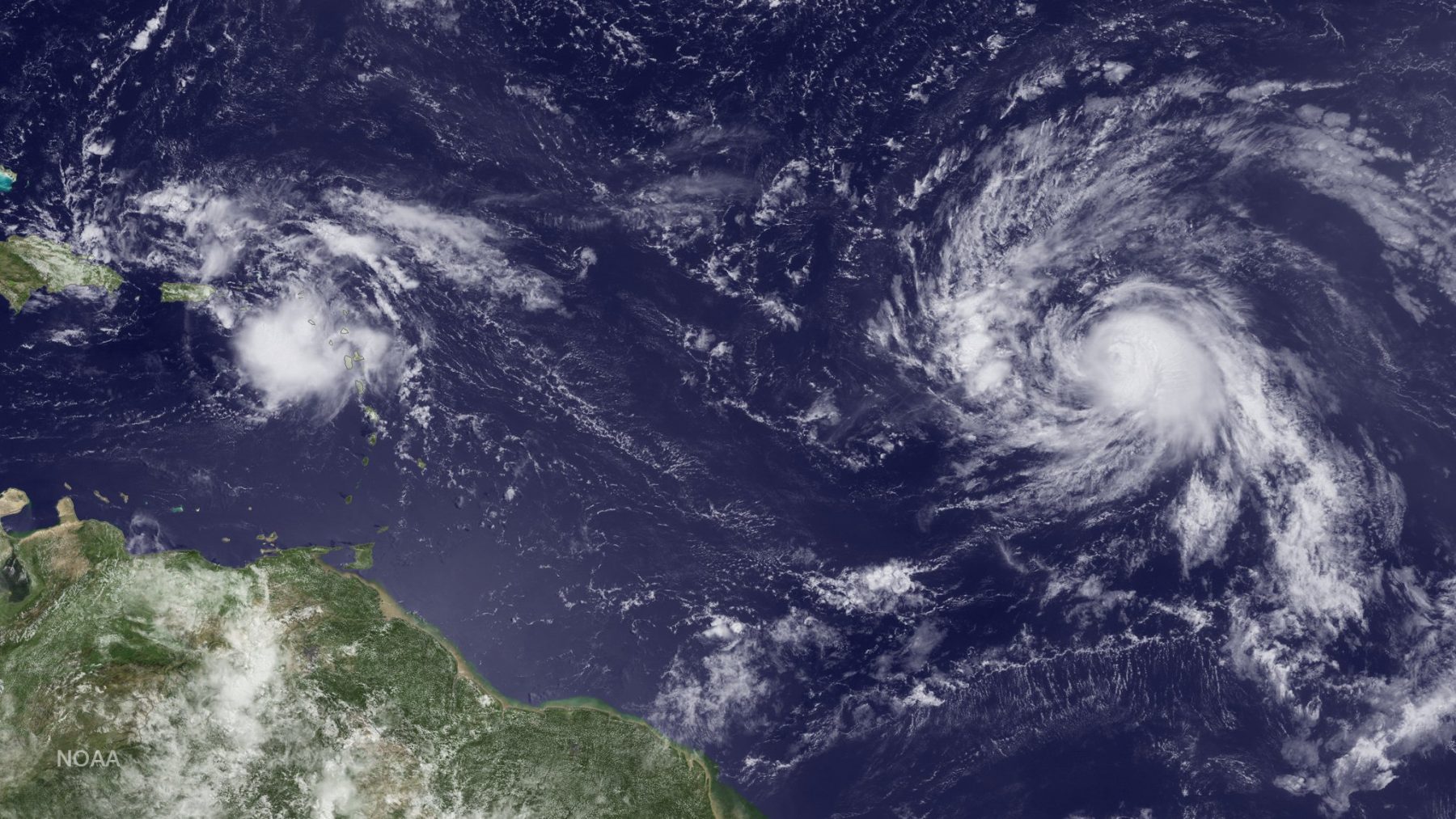

NOAA Hurricane Hunters are flying back-to-back missions to study the newly developed Tropical Storm Hermine in the Gulf of America, capturing its evolution from a cluster of thunderstorms into a tropical storm. Getting data during such transitions can help improve hurricane models which currently don’t predict transitions well. Our understanding of the physical processes of early storm development remains limited, largely because there are few observations.
“Several of the hurricane models have been predicting this particular system would develop into a tropical storm or hurricane for over a week,” said Robert Rogers, hurricane researcher at NOAA’s Atlantic Oceanographic and Meteorological Laboratory. “We’d like to understand why it did not intensify days earlier as predicted with a goal of improving the models’ ability to better predict these weak systems.”
A key aspect of NOAA’s hurricane field program is the collection of observations during all portions of a hurricane lifecycle, particularly on the early lifecycle stages. Observations during a storm’s genesis is one approach NOAA is taking to improve the understanding and forecasting of storm development. As hurricane researchers better understand genesis, they work closely with modelers to improve NOAA’s ability to forecast this aspect of storm development. NOAA scientists recently developed a new model to predict tropical genesis in the North Atlantic Ocean, the Tropical Cyclone GenesisIndex, which provides forecasters with an objective tool for forecasting hurricane formation in the two-day and five-day time frames. Based on early model predictions, NOAA researchers have been flying into and studying Tropical Storm Hermine since it was an area of investigation, called 99L, and transitioned to tropical depression (TD9), and now a tropical storm.
For 2016, researchers decided to execute a multi-plane experiment to target disturbances that forecasters believe have a chance to become a tropical cyclone. This experiment calls for the NOAA P-3 hurricane hunter to sample the system using Doppler radar, GPS dropwindsondes and flight-level instruments to create a full picture of the kinematic and thermodynamic structure of the potentially developing system.

When possible, the P-3 will fly coordinated missions with NOAA’s Sensing Hazards with Operational Unmanned Technology (SHOUT) Global Hawk unmanned aircraft to increase sampling of the system’s surrounding environment. With missions lasting 24 hours, the Global Hawk system flies at 60,000 ft and is equipped with a dropwindsonde system capable of deploying up to 88 of these mini weather stations per mission. The high flying aircraft also uses the NASA Jet Propulsion Laboratory High Altitude Monolothic Microwave Integrated Circuit Sounding Radiometer for measuring temperature and moisture below the cloud canopy, and the High altitude Wind and Rain Airborne Profiler for observing wind at the ocean surface and in the atmosphere below the plane. The data gathered from both the Global Hawk and P3 will help researchers gain a better understanding of both the inner-core and environmental processes that are important to hurricane intensity change.

For the latest on storm development please visit www.hurricanes.gov.
Read more about NOAA’s hurricane field program here.
For the latest on hurricane research flights, follow @HRD_AOML_NOAA