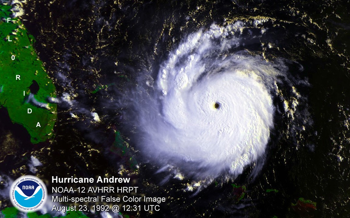
Storymap: Gliding Through the Blue Frontier

Glider SG609 is one of four gliders that are part of the Hurricane Field Program at NOAA’s Atlantic Oceanographic and Meteorological Laboratory. AOML launched its glider project in 2014 with the goal of enhancing the understanding of air-sea interaction processes during tropical cyclones. Scientists and technicians from AOML and the University of Puerto Rico at Mayagues run the deployments and recoveries out of Isla Magueyes Marine Laboratories in Puerto Rico, which neighbors the colorful coastal island community of La Paguera.

Read Full Article

Novel, Inexpensive Temperature Sensor Unlocks Coral Monitoring Challenge

Warm ocean water can be a killer for coral reefs, and AOML recently developed a new inexpensive sensor to drastically improve our ability to measure and monitor changing temperatures on reefs at an unprecedented scale.  The low cost sea temperature sensor, known as InSituSea, costs roughly $10 in parts to produce while providing high accuracy (0.05-0.1 C) in measurement. With a production cost that is 10% of an off-the-shelf temperature sensor, colleagues have expressed strong interest in deploying the InSituSea sea temperature sensor at coral reefs around the world.  

Read Full Article

Study Focuses on Contaminants Lurking in Urban Tidal Flooding

Tidal flooding from events such as the so-called “King Tides” and “Super Tides” are flooding urban coastal communities with increasing frequency as sea levels rise. These tidal flood waters can acquire a wide range of contaminants and toxins as a result of soaking in the built environment of urbanized coastlines. A multi- institutional, interdisciplinary research team, including scientists from AOML, is examining the types of contamination picked up from the urbanized coastal landscape and transported into coastal waters through tidal flooding.

Read Full Article

CHAMP Researchers at AOML to Install New Coral Monitoring Stations in the Caribbean

Coral Health and Monitoring Program (CHAMP) researchers at AOML have worked cooperatively with the Caribbean Community Climate Change Centre (CCCCC), headquartered in Belize, over the past several years to install Coral Reef Early Warning System (CREWS) stations at key coral reef sites in countries throughout the Caribbean. CREWS stations monitor an array of atmospheric and oceanographic parameters to assess the health and integrity of coral reefs. The stations are part of the CCCCC’s efforts to strengthen the Caribbean region’s ability to respond to climate variability, extreme weather conditions, pollution, and habitat change.

Read Full Article

Crash Site of Malaysian Airlines Flight MH370 Likely Falls Within Official Search Area

In a paper published in the Journal of Operational Oceanography, a team of scientists with the Physical Oceanography Division at AOML, the University of Santiago de Compostela in Spain, the University of Miami, the University of Hawaii, and the Commonwealth Scientific and Industrial Research Organisation (CSIRO) of Australia analyzed possible pathways to link the location of the found debris in the southwestern Indian Ocean with potential crash sites, probably in the eastern Indian Ocean.

Read Full Article

Study shows ocean acidification is two-front assault on coral reefs

The study, published in the Proceedings of the Royal Society B, measured changes in the reef framework in several naturally high-carbon dioxide settings near Papua New Guinea. For the first time, scientists found increased activity of worms and other organisms that bore into the reef structure, resulting in a net loss of the framework that is the foundation of coral reef ecosystems.

Read Full Article

NOAA Hurricane Hunters Fly into Hurricane Matthew

NOAA’s Hurricane Hunters fly into hurricanes to help study important features and improve forecasts. The photos below highlight two different flights, on October 5 & 6, 2016, that were taken from flights into Hurricane Matthew as it moved through the Atlantic and up the East Coast of the United States. Hurricane Matthew eventually moved off the East Coast and would dissipate out in the Atlantic Ocean. 

Read Full Article

NOAA Hurricane Hunter Radar Paints Picture of Hurricane Winds

NOAA’s hurricane hunter aircraft carry a unique radar that measures wind in hurricanes where there is rain. Located in the tail of the aircraft and known as the Tail Doppler Radar, this instrument produces images that can provide detailed pictures scientists use to study storm structure and changes. Scientists can also piece together wind speed information gathered over the course of a flight to paint a complete picture of the wind speed in the regions of the storm where the aircraft flies.

Read Full Article