Major Hurricane Teddy Missions Provide Unique Dataset for Hurricane Scientists at AOML
NOAA’s Hurricane Hunters continue reconnaissance for Major Hurricane Teddy, conducting numerous science experiments developed by AOML and its collaborators.

NOAA’s Hurricane Hunters continue reconnaissance for Major Hurricane Teddy, conducting numerous science experiments developed by AOML and its collaborators.


A new study published in Remote Sensing uses radar data from NOAA’s P-3 Hurricane Hunter aircraft to determine the characteristics a satellite would need to measure the surface wind in a tropical cyclone between areas of heavy rainfall. This study finds that satellites with higher resolution can measure larger regions of heavy rainfall.
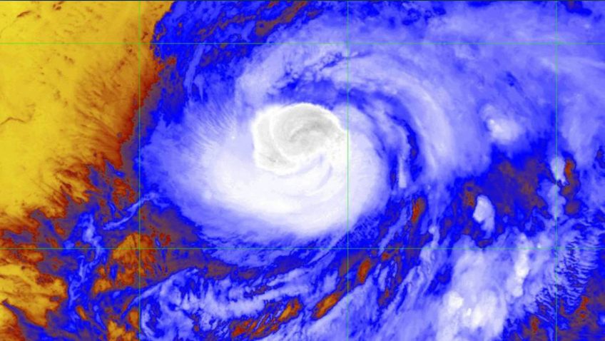

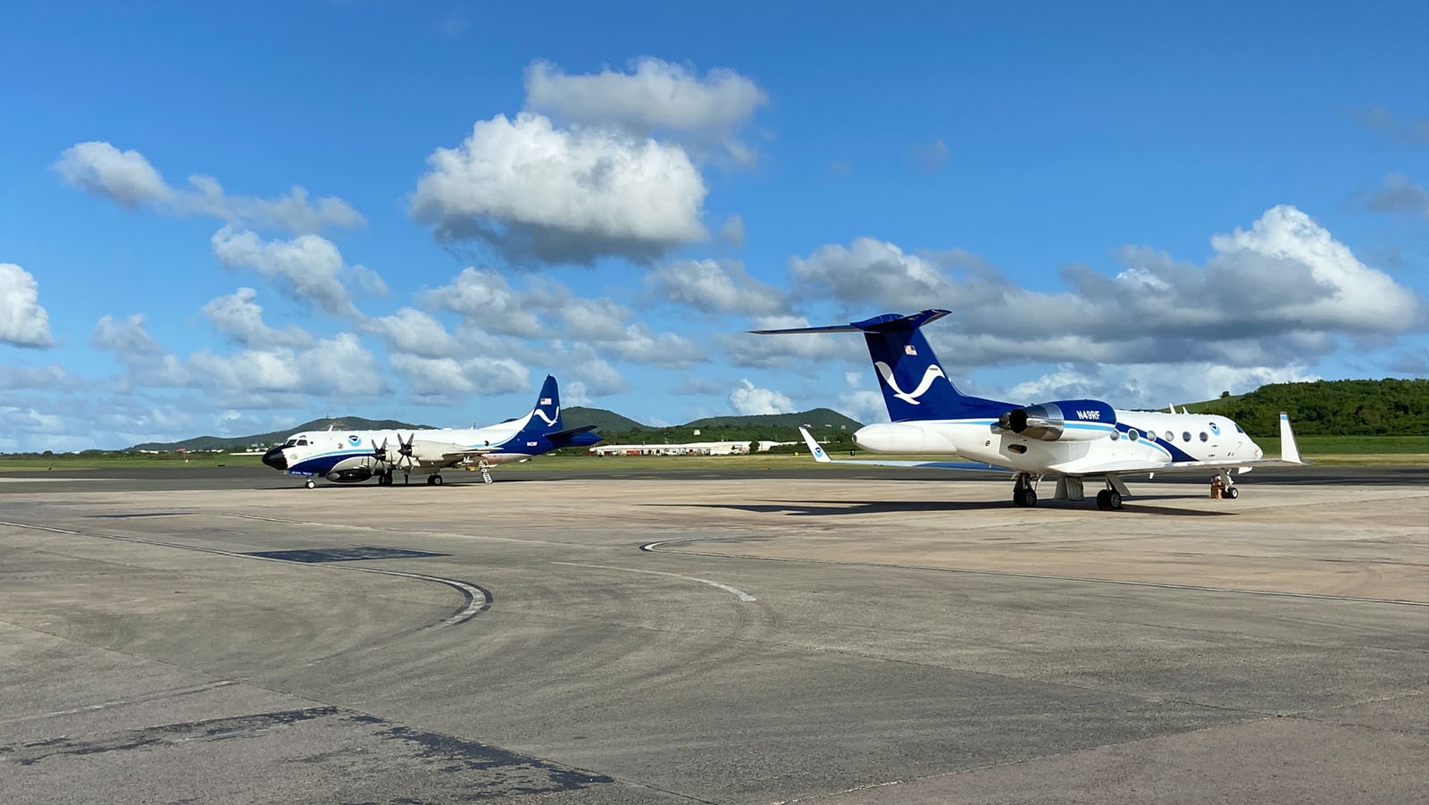
AOML’s Hurricane Research Division tasked all three NOAA Hurricane Hunter aircraft to perform science operations into Hurricane Teddy, now a category-3 tropical cyclone and still intensifying in the mid-Atlantic.


NOAA’s P-3 aircraft wraps up its sequence of missions into Hurricane Sally prior to the system’s eventual landfall along the central Gulf Coast. Tasked by the National Hurricane Center (NHC), its final flight took off on September 15 at 9:30 EDT from Lakeland, FL.
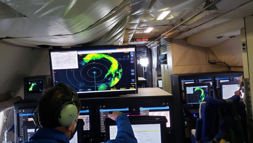

NOAA’s G-IV and two P-3 Hurricane Hunter aircraft took off from Lakeland, FL at 10:30 AM, 1:30 PM and 4:30 PM EDT on September 14th to investigate Hurricane Sally’s circulation. AOML scientists providing onboard and remote support for these missions ensure that Tail Doppler Radar, dropsonde, and Stepped Frequency Microwave Radiometer (SFMR) measurements allow for adequate coverage of the storm environment.

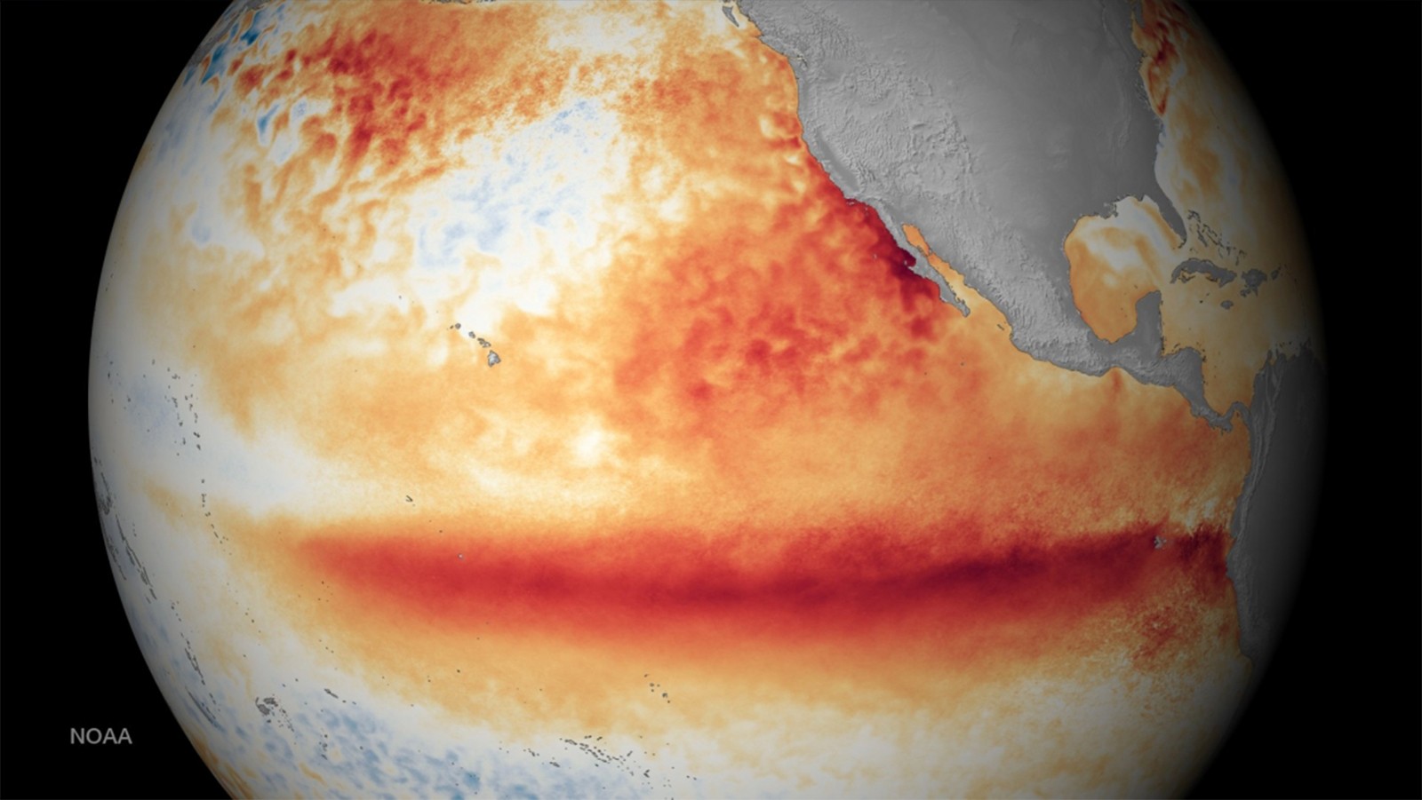
In a new article published in the Journal of Climate, scientists at AOML and the Cooperative Institute for Marine and Atmospheric Science, with collaborators at Boston University, Texas A&M, and North Carolina State University, document the role of ocean dynamics in linking Pacific atmospheric variability to El Niño-Southern Oscillation (ENSO) event generation. The results of the study could be used as a potential predictor of ENSO events up to a year in advance.
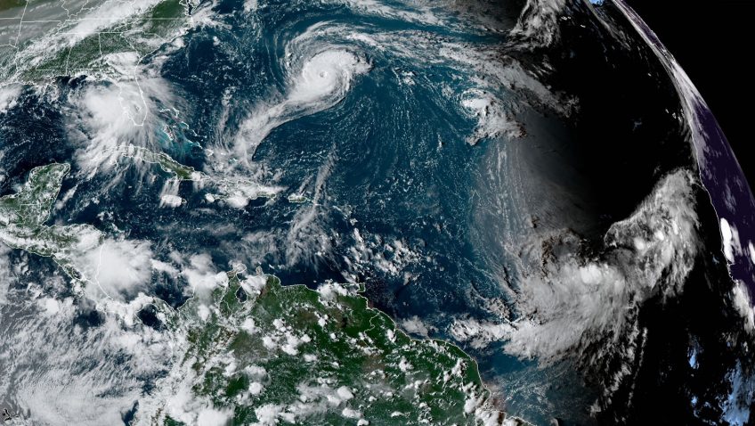

A very active peak in this year’s Atlantic hurricane season has prompted NOAA’s National Hurricane Center (NHC), Environmental Modeling Center (EMC), and AOML’s Hurricane Research Division to task their G-IV and both P-3 aircraft to investigate multiple storms in the Gulf of America and mid-Atlantic.

A new paper appearing in the International Journal of Environmental Research and Public Health examines how the presence of children’s open wounds and abrasions during play at the beach may put them at greater risk of skin infections from marine bacteria and other pathogens they encounter. The study finds that children with existing or newly-acquired wounds while at the beach are more susceptible to infection.


NOAA’s P-3 Hurricane Hunter aircraft completed a flight into Tropical Storm Nana in the Caribbean on the morning of September 2. AOML scientists onboard the aircraft, and from the ground, quality controlled and sent dropsonde and radar data to the Environmental Modeling Center (EMC) and National Hurricane Center (NHC) in real time.

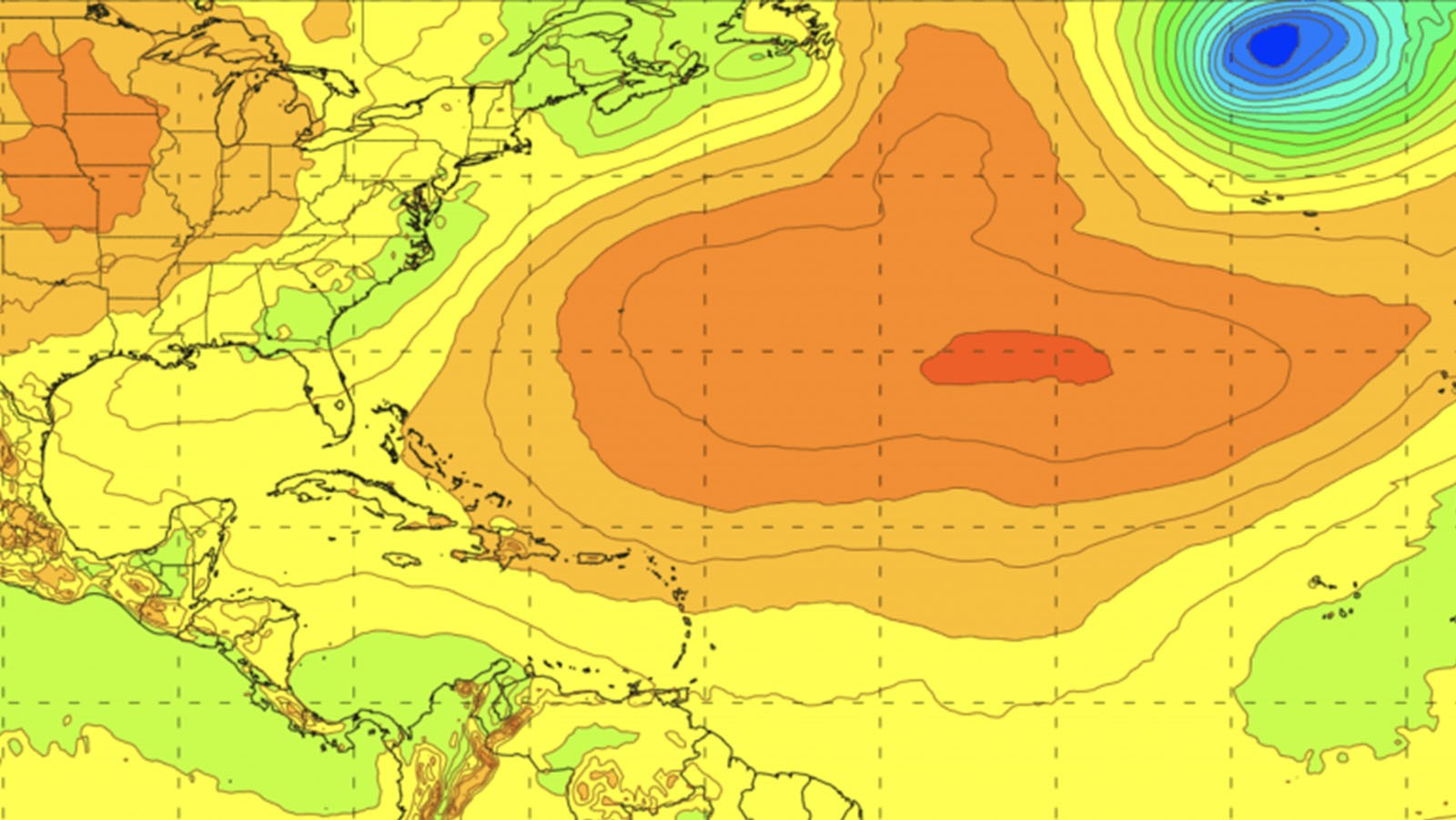
A recent paper published in Atmosphere introduces a new update to the Basin-Scale Hurricane Weather Research and Forecasting (HWRF-B) model, which pairs an atmospheric model with an ocean model via new coupling technology to forecast several tropical cyclones simultaneously. This model, shown to improve forecast skill, was developed at AOML in collaboration with NOAA’s Environmental Modeling Center and the Developmental Testbed Center.