Hurricane Gliders
Improving Hurricane Forecasts With Upper Ocean Observations
JUMP TO DATA DEPLOYMENT MAP
OR SCROLL TO LEARN MORE
The genesis, path, and intensity of Atlantic Ocean hurricanes are linked to atmospheric and ocean conditions. During the last 20 years, the improvements of hurricane intensity forecasts, and in particular of rapid intensification, have lagged behind those of hurricane track forecasts.
In general, when the appropriate atmospheric conditions (e.g. low wind shear or change of wind velocity with height) are present, hurricanes have the potential to intensify when a ocean conditions are optimal to provide heat energy.
Studies have shown that hurricane models that incorporate ocean temperature and salinity data from the upper hundred meters of the ocean have more accurate intensity forecasts.
For example, ocean features with high heat content and/or low salinity values may create conditions that are appropriate for hurricane intensification. The correct representation of these ocean features is key to improving hurricane intensification guidance. Our team of scientists, engineers, pilots and data specialists make this research possible.


| Christopher Garcia
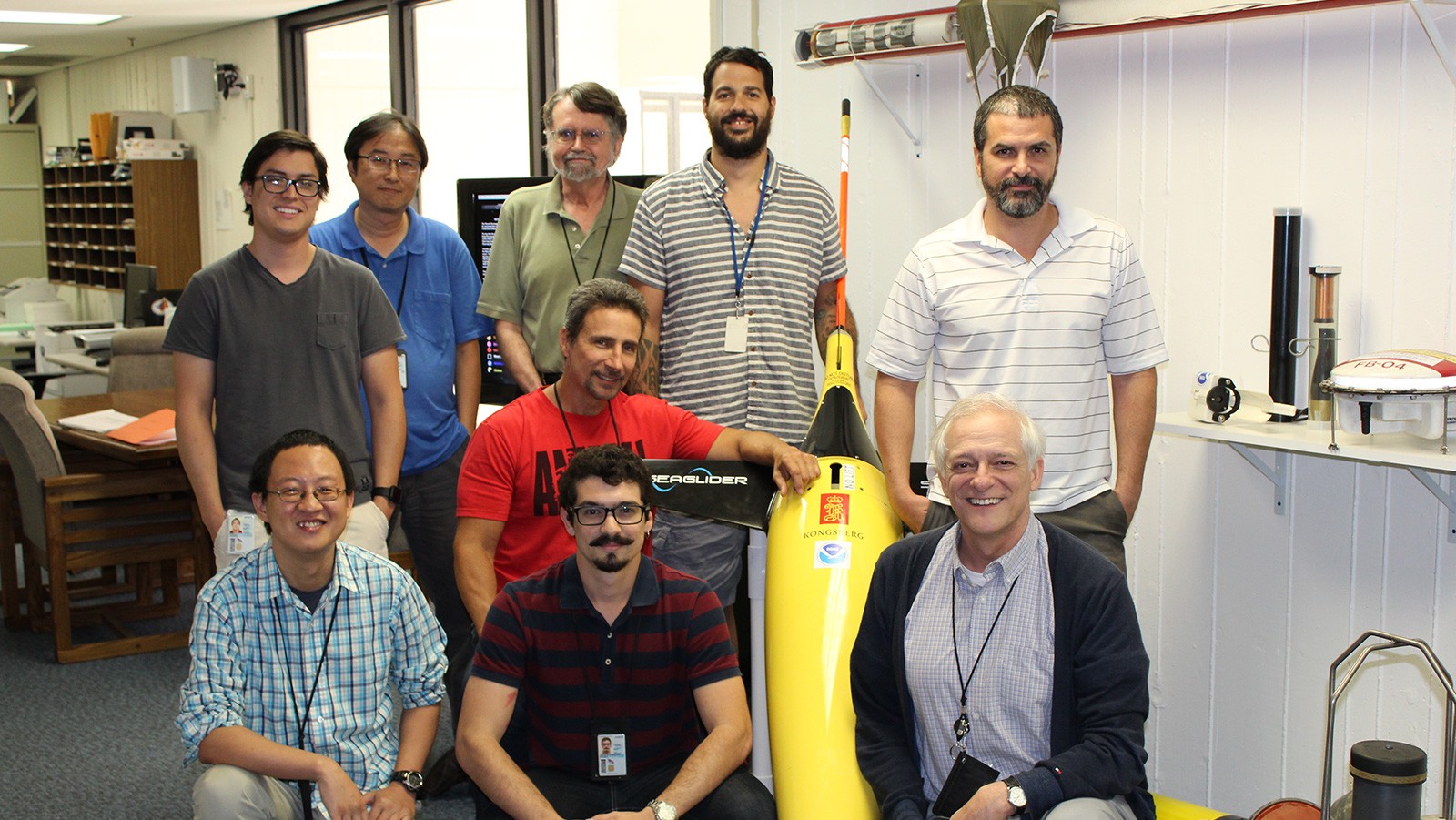
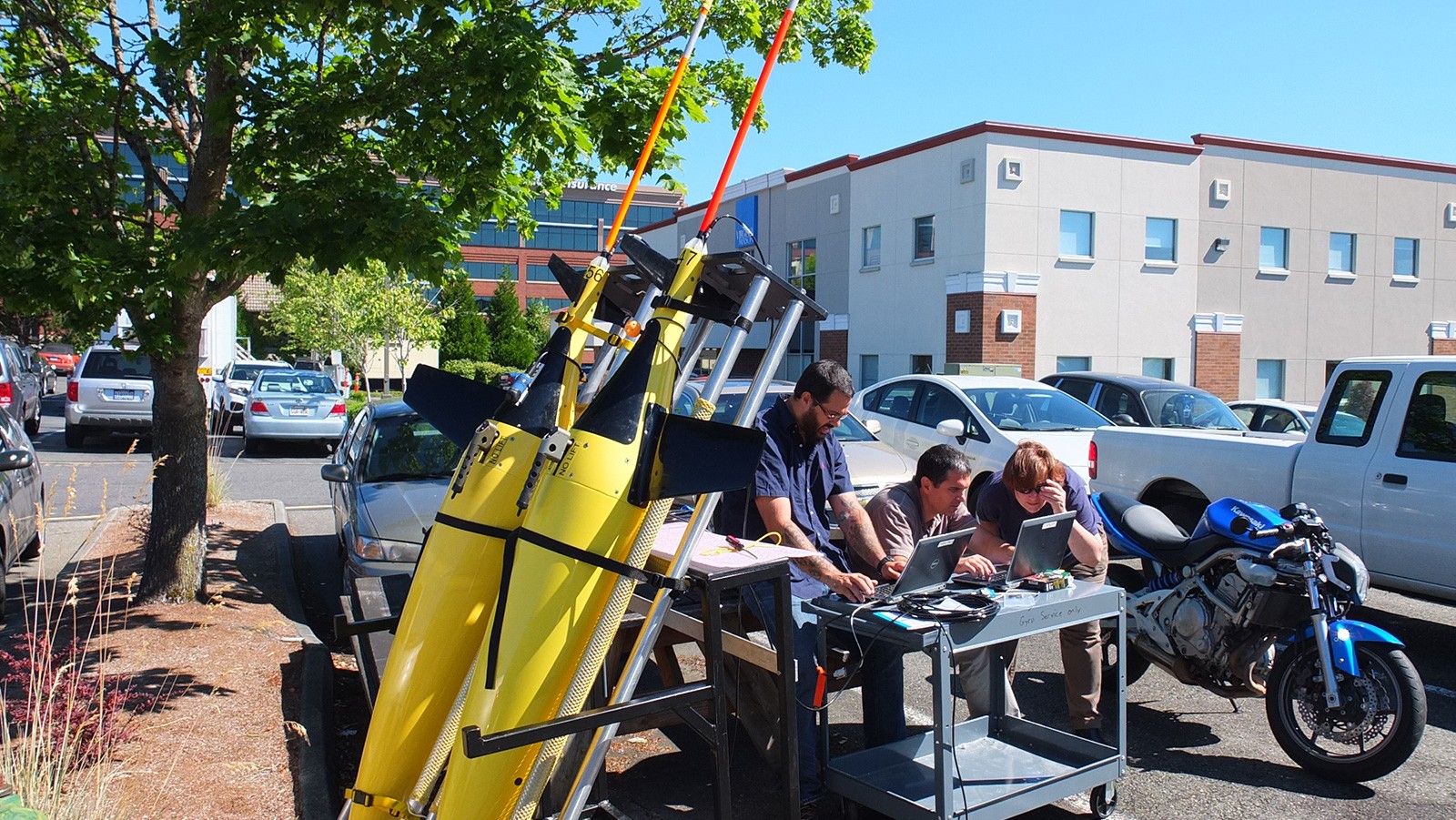
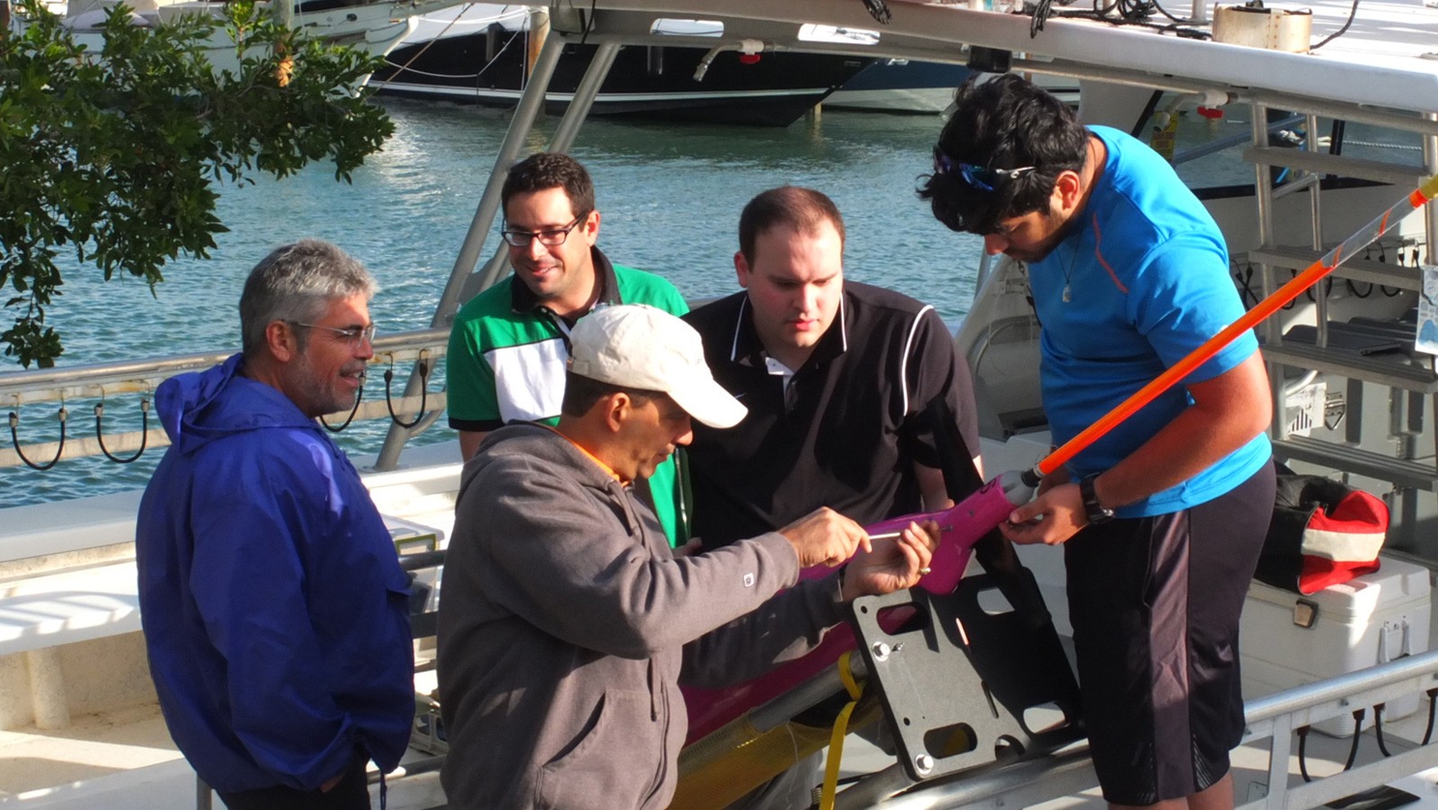
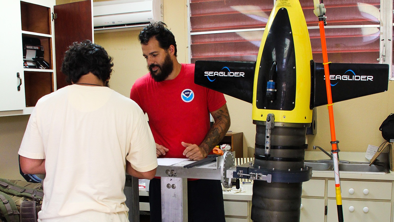
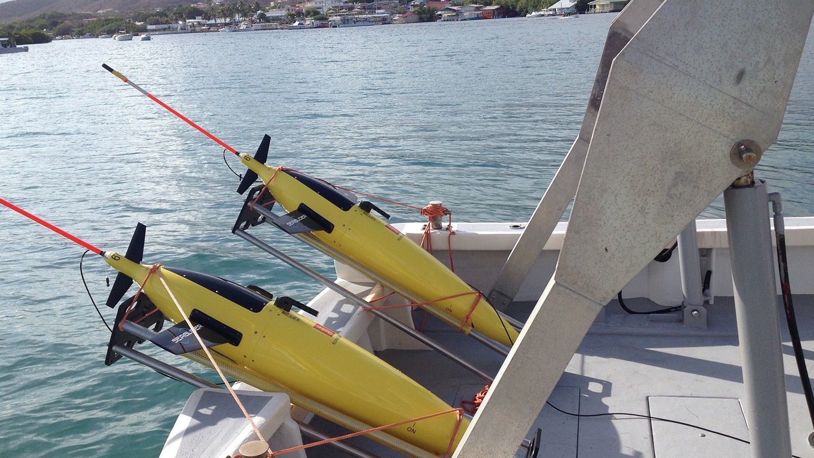
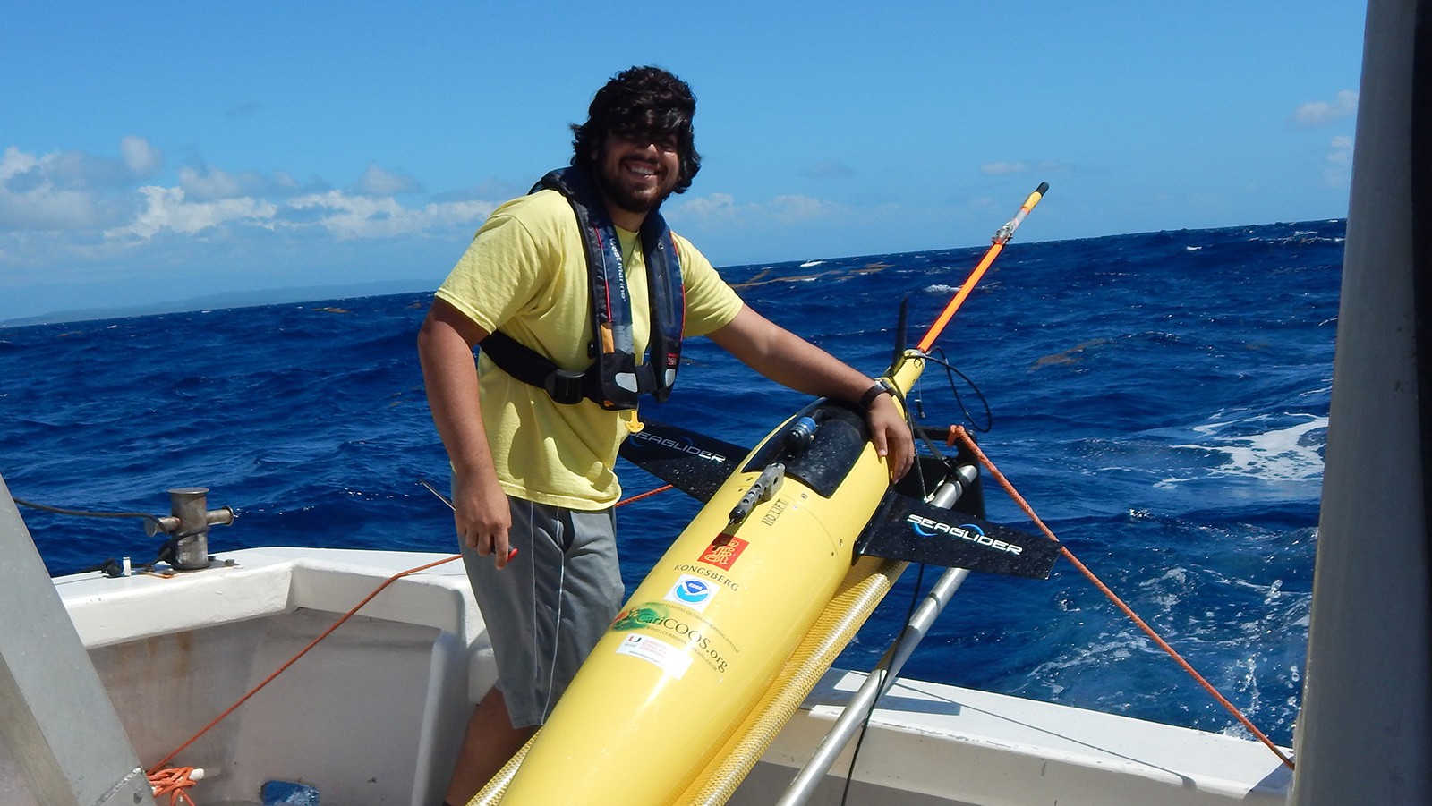
Hardware, Field Work, and Piloting


Top News
Ocean Month: Identifying the ocean’s role in fueling hurricanes
June 3, 2025
Join us as we celebrate and learn about our world ocean throughout National Ocean Month. June 1st not only marks the start of National Ocean Month, it also is the first day of hurricane season. To kick off this year’s Ocean Month, we are looking at the major role the ocean plays in the formation […]


Read More News
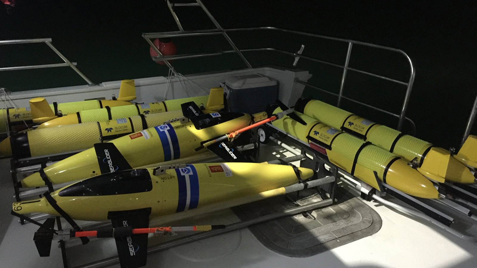
2025 AOML Hurricane Gliders in the Atlantic Ocean
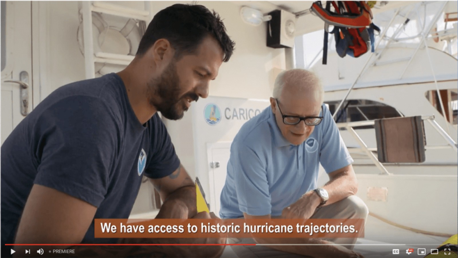
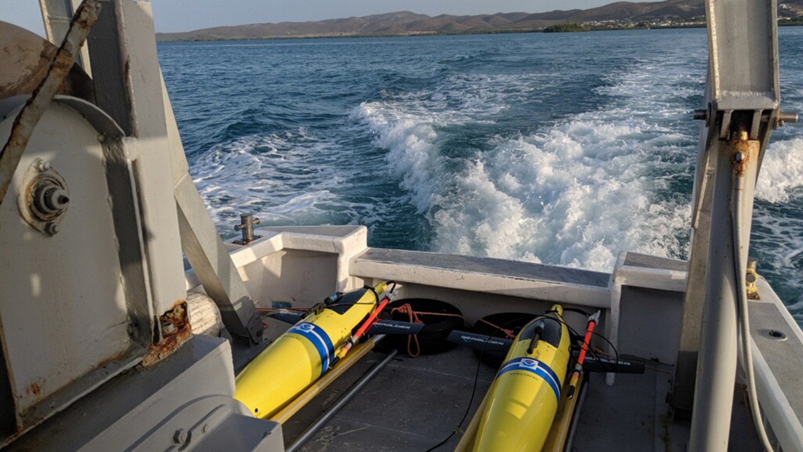
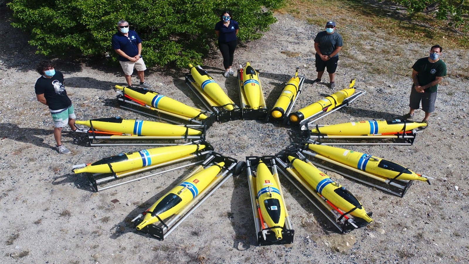
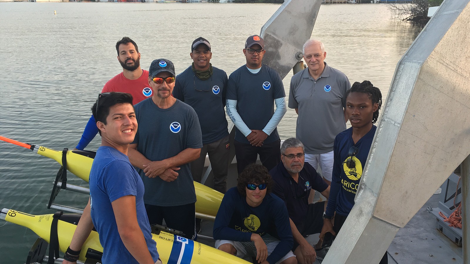
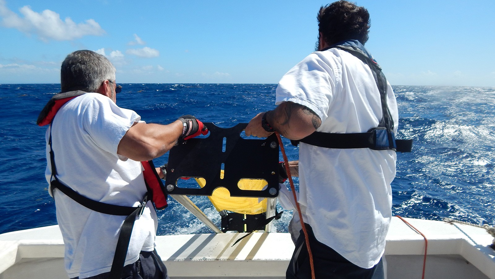
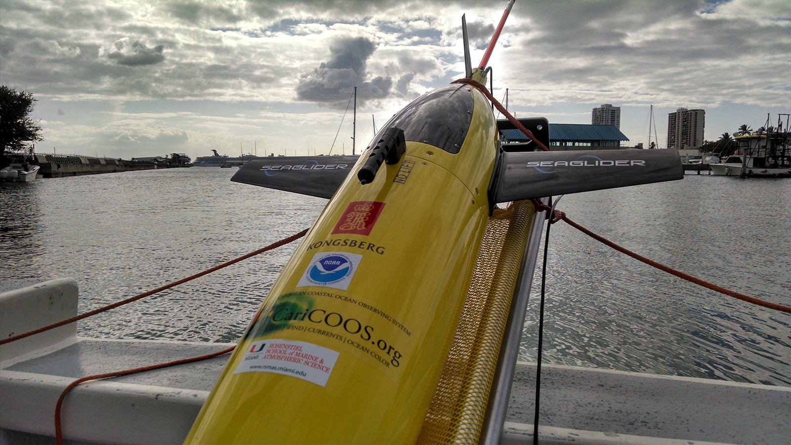
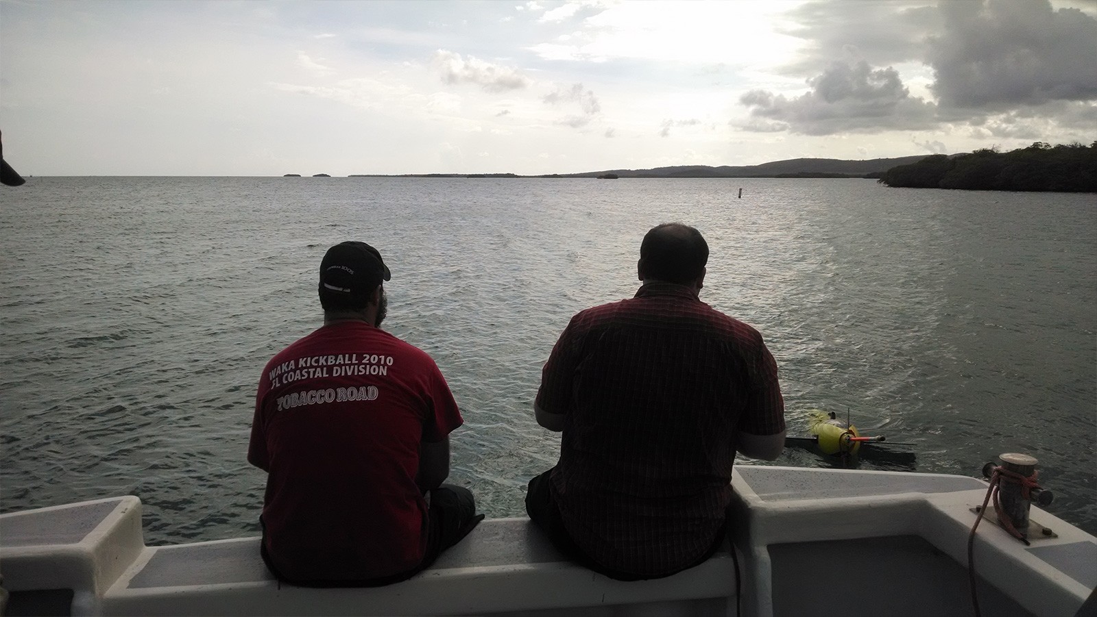
During the 2025 hurricane season, AOML participated in the operations of 4 glider missions in the Caribbean Sea, Tropical Atlantic and Gulf of America.
The preparations, deployments, piloting, and recovering operations were done with the following AOML partners: IOOS (Integrated Ocean Observing System) Regional Association (CARICOOS), the University of Puerto Rico Mayaguez, the Cooperative Institute for Marine and Atmospheric Studies (CIMAS) of the University of Miami, ANAMAR (Maritime Authority in the Dominican Republic), and Cape Eleuthera Institute in the Bahamas.
Background
How do ocean observations improve hurricane forecasts?
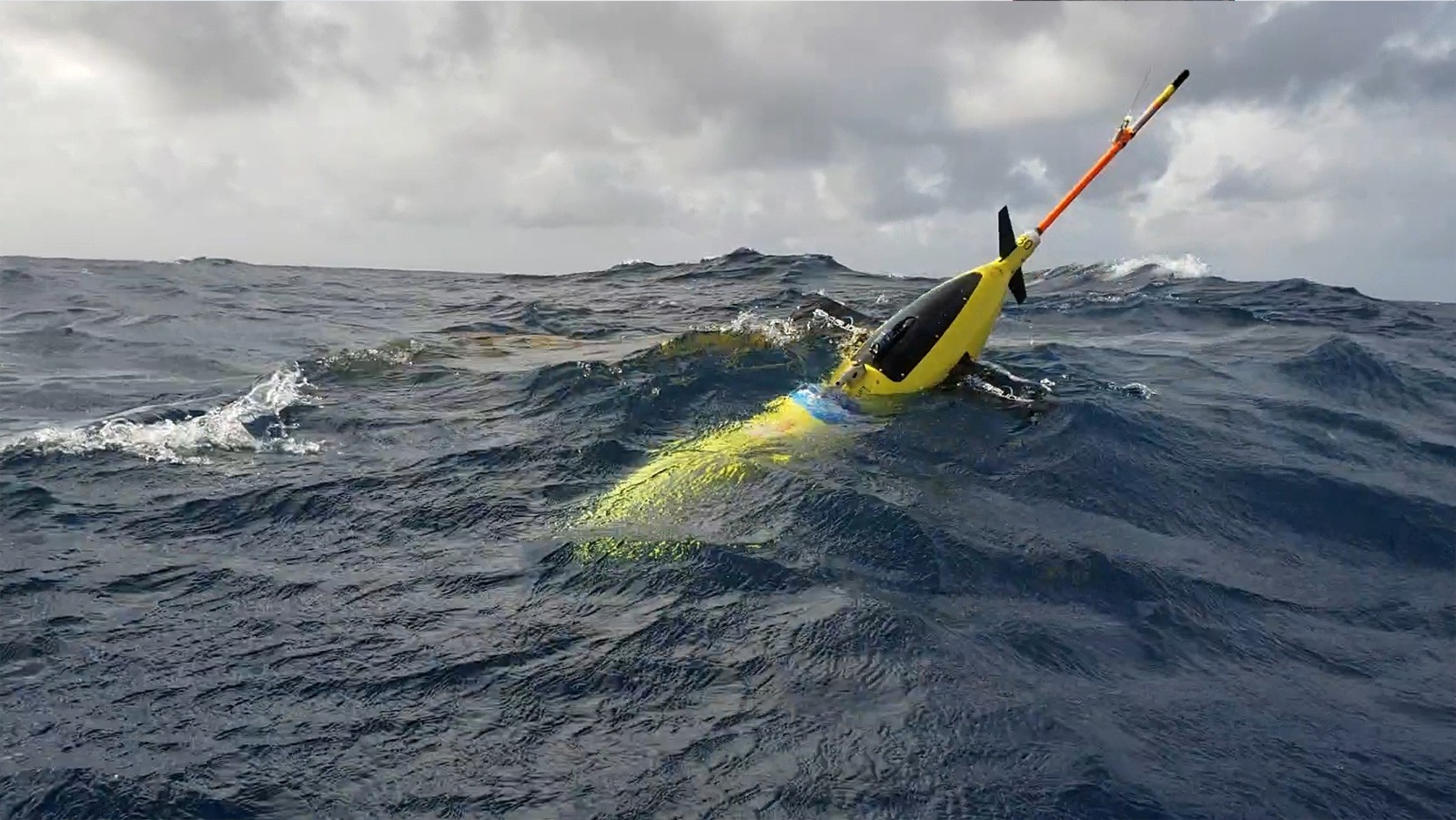
Sampling the ocean below a hurricane helps improve hurricane intensity forecasts.
Improvements in hurricane intensity forecasts for the Atlantic have lagged in comparison to hurricane track forecasts. Rapid hurricane intensification is often observed when tropical cyclones move over warm ocean features, given appropriate atmospheric conditions. AOML plays a key role in collecting and maintaining sustained ocean observations that monitor the thermal structure of these warm ocean features using drifters, Argo floats, XBTs, moorings, etc. Since 2014, sustained and targeted ocean observations have been gathered in support of hurricane intensity forecasts using underwater gliders.
What is the hurricane glider project?
NOAA/AOML leads a multi-institutional effort that brings together the research and operational components within NOAA and the university community to implement and carry out sustained and targeted ocean observations from underwater gliders in the Caribbean Sea and tropical North Atlantic Ocean in support of hurricane studies and forecasts.
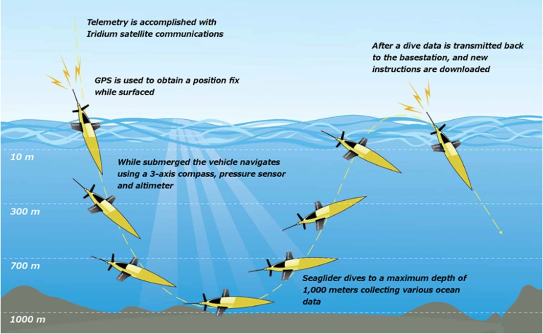
How do underwater gliders work?
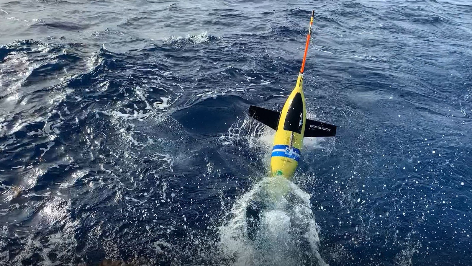
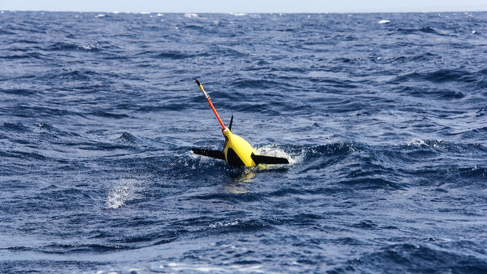
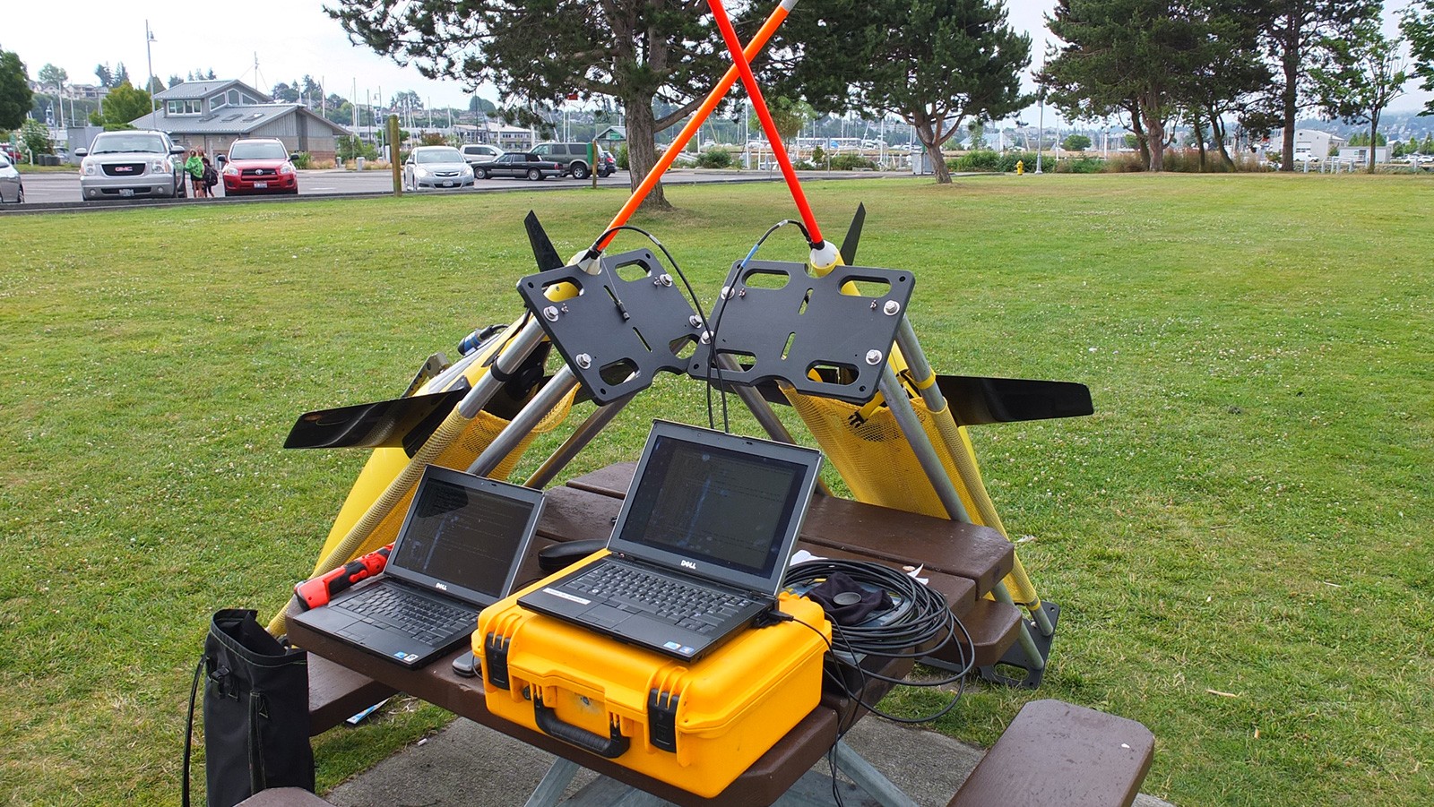
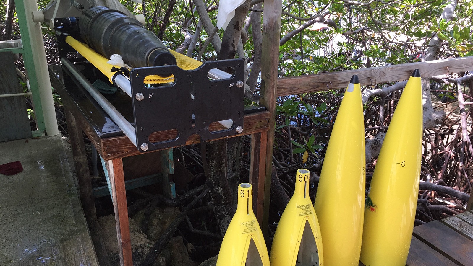
An underwater glider is an autonomous underwater vehicle (AUV) that uses small changes in buoyancy together with wings to propel itself by converting vertical motion into horizontal motion. Thanks to a very small consumption of energy, underwater gliders have longer ranges when compared to other AUVs, with a capacity to measure several ocean parameters during a period of weeks or months along thousands of kilometers. Gliders use different sensors to measure ocean temperature and salinity profiles. Depending on the instruments installed in the device, they can also measure ocean currents, chlorophyll fluorescence, optical backscatter, and bottom depth among other parameters. Gliders are commanded remotely via satellite and data transmissions are performed in real-time. Click next to see an illustration.
What type of information is collected by the gliders and where does it go?
Underwater gliders provide information about the properties of the seawater. All underwater gliders have the capability of measuring temperature, salinity, and pressure. Additional sensors may also be included, such as chlorophyll fluorometers, oxygen sensors, and ocean current profilers.
AOML Underwater gliders currently have sensors to monitor the following parameters:
- Temperature
- Salinity
- Dissolved Oxygen
- Chlorophyll Concentration
- CDOM – Chromophoric Dissolved Organic Matter
Transmission & data delivery
After each dive, the vehicle surfaces to transmit the data collected and receive commands via satellite telemetry. Data is obtained in near real time at the laboratory. Jump to the Our Data section for Glider Data.
How is AOML using glider missions to improve forecasts?
The benefits of hurricane gliders are two-fold. First, the gliders that are deployed in a given season will send back observations which are used to better represent the ocean conditions in NOAA’s operational hurricane models. This ocean data can help improve the National Hurricane Center’s forecasts for current storms.
Secondly, the data collected from the gliders is used by our oceanographers and model experts to help validate how the ocean data improved the forecast guidance, and if changes to the model code or how data is assimilated is needed. We use our understanding of the ocean to help improve how the ocean is represented in operational models, with a goal that future model versions will more accurately forecast ocean conditions and help drive improvements to intensity forecasts.
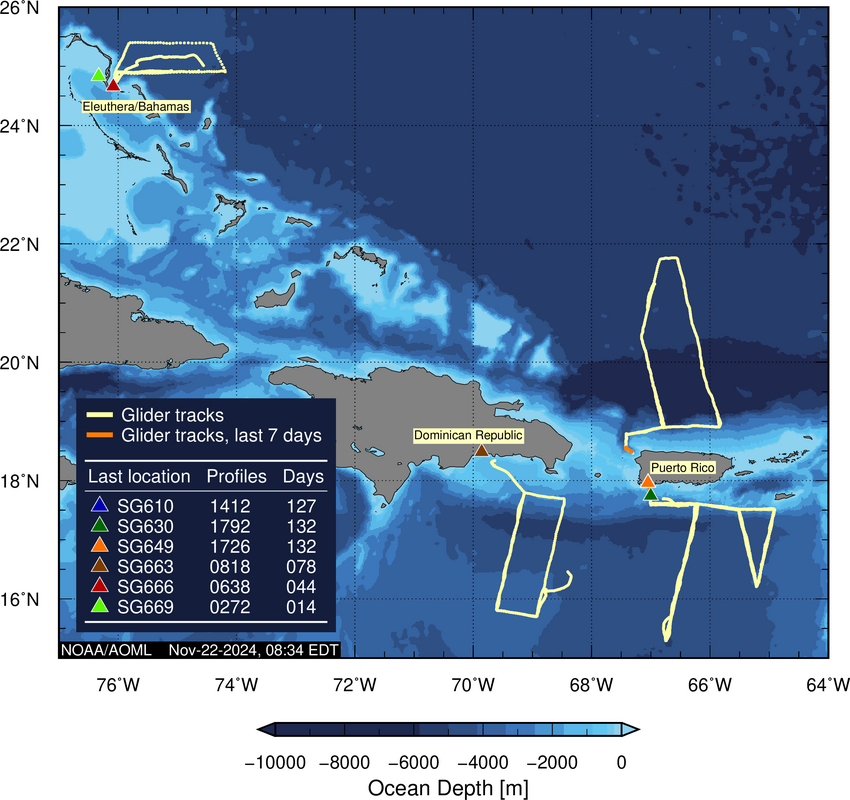
2024 glider tracks
2025 Observational Plan
")
Vehicle Deployment Status (2024)
| Glider ID | Status | Region | Deployment | # of profiles | # of days | Last Comm. (UTC) |
|---|---|---|---|---|---|---|
| SG610 | Recovered | Caribbean Sea | 2024-07-11 |  |
 |
 |
| SG630 | Recovered | Caribbean Sea | 2024-07-13 |  |
 |
 |
| SG649 | Recovered | North Atlantic | 2024-07-12 |  |
 |
 |
| SG663 | Recovered | Caribbean Sea | 2024-07-10 |  |
 |
 |
| SG666 | Recovered | North Atlantic | 2024-07-25 |  |
 |
 |
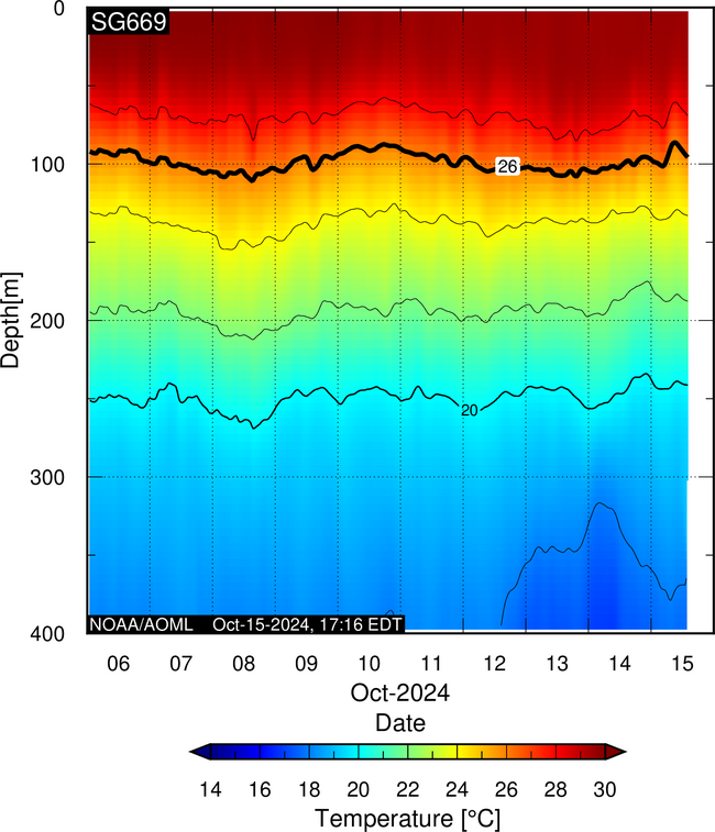
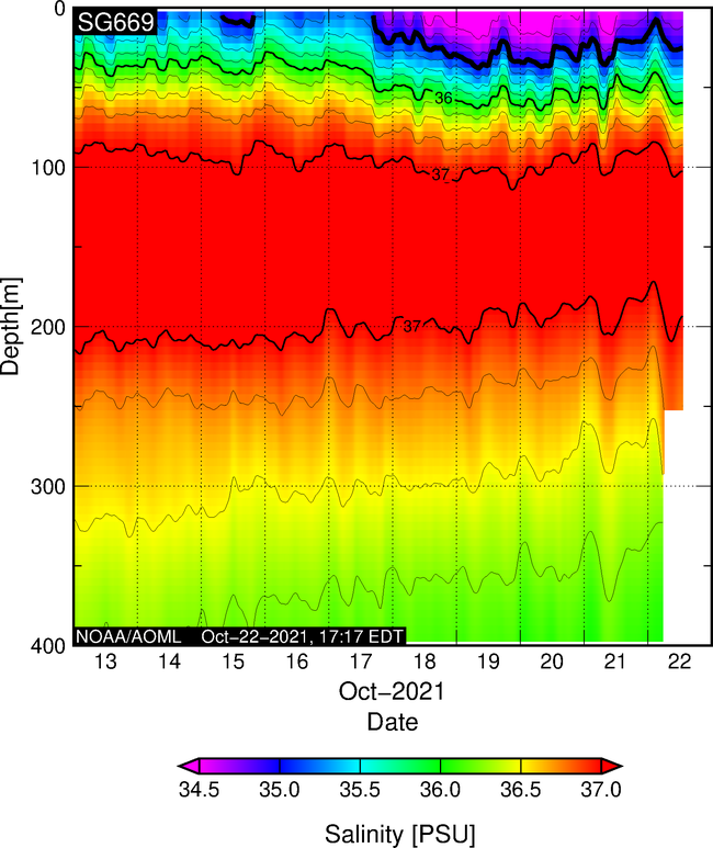
| SG669 | Recovered | North Atlantic | 2024-10-01 |  |
 |
 |
Research to Improve Hurricane Intensity Forecasts
The goal of this work is to enhance our understanding of air-sea interaction processes during hurricane force wind events. In order to accomplish this goal, a pilot network of hurricane underwater gliders is implemented to assess the impact of hurricane force winds on upper ocean density structure, and assess the impact of ocean profile data from underwater gliders in operational hurricane intensity forecasts
Dive into more technical information and data in the Glider Data Pages.
Temperature, Salinity, Dissolved Oxygen, Chlorophyll Concentration and Chromophoric Dissolved Organic Matter
Data collected by this project is transmitted in real-time into the Global Telecommunications Systems (GTS), and distributed through this webpage, and through NOAA Integrated Ocean Observing System Data Assembly Center (IOOS-DAC).
This webpage provides access to real-time underwater glider data* collected by this project. Data for each dive by each underwater gliders is in NetCDF format and updated every 6 hours in the FTP link below.
Additionally, data for each dive by each underwater gliders is in NetCDF format and updated every 6 hours in the FTP link below.
*Please acknowledge as follows: Underwater glider data provided by NOAA/AOML as part of the NOAA funded “Sustained and Targeted Ocean Observations for Improving Tropical Cyclone Intensity and Hurricane Seasonal Forecasts” Project
Glider Profiles & Observations (2024)
Real-Time Observations
10-day data. The black line on the temperature and salinity sections shows the 26°C isotherm and the 35 isohaline, respectively.
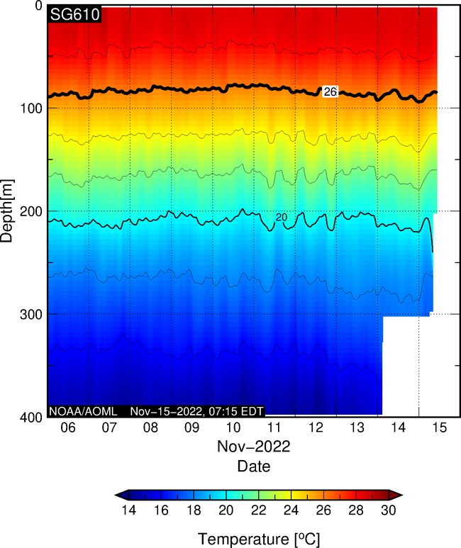
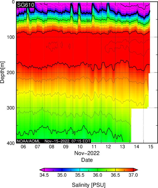
More Data from Glider SG610
Real-Time Observations
10-day data. The black line on the temperature and salinity sections shows the 26°C isotherm and the 35 isohaline, respectively.
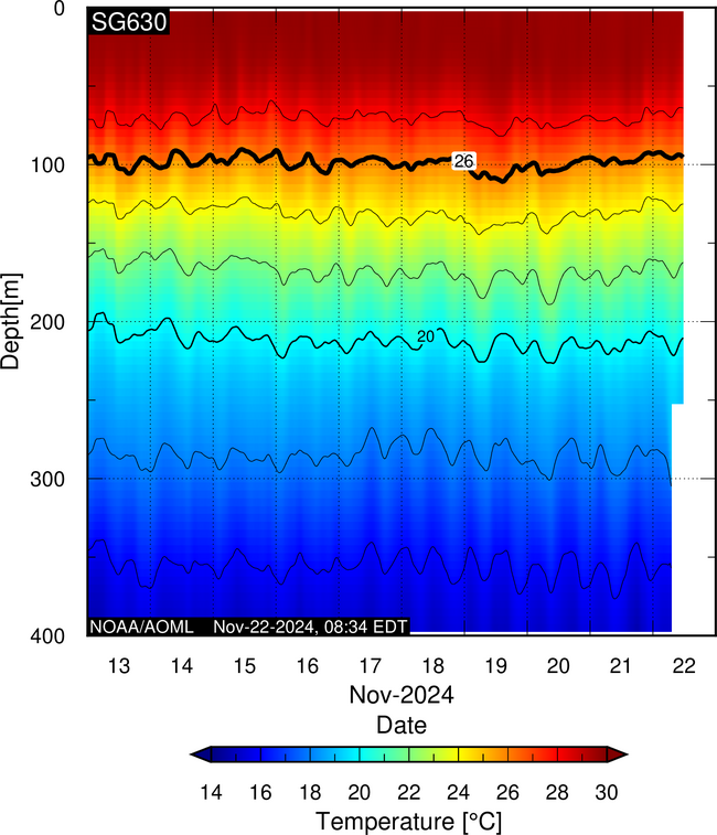
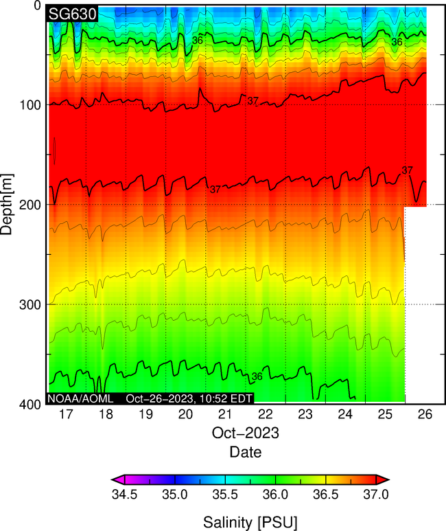
More Data from Glider SG630
Real-Time Observations
10-day data. The black line on the temperature and salinity sections shows the 26°C isotherm and the 35 isohaline, respectively.
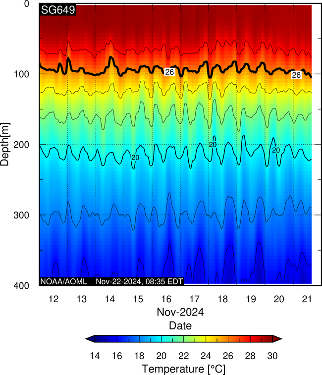
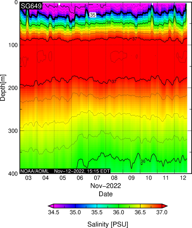
More Data from Glider SG649
Real-Time Observations
10-day data. The black line on the temperature and salinity sections shows the 26°C isotherm and the 35 isohaline, respectively.

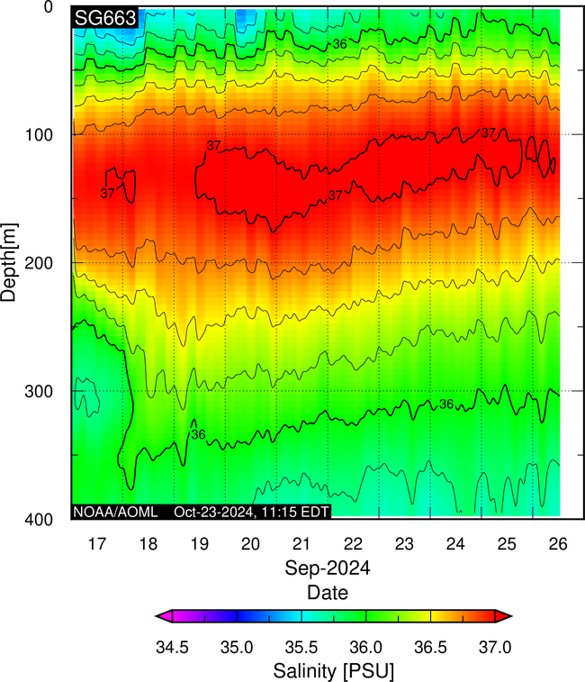
More Data from Glider SG663
Real-Time Observations
10-day data. The black line on the temperature and salinity sections shows the 26°C isotherm and the 35 isohaline, respectively.
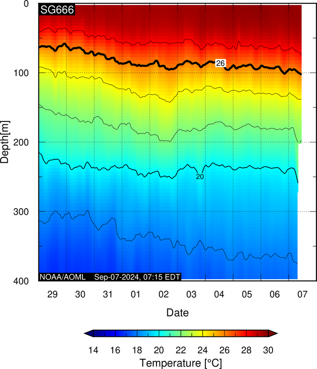
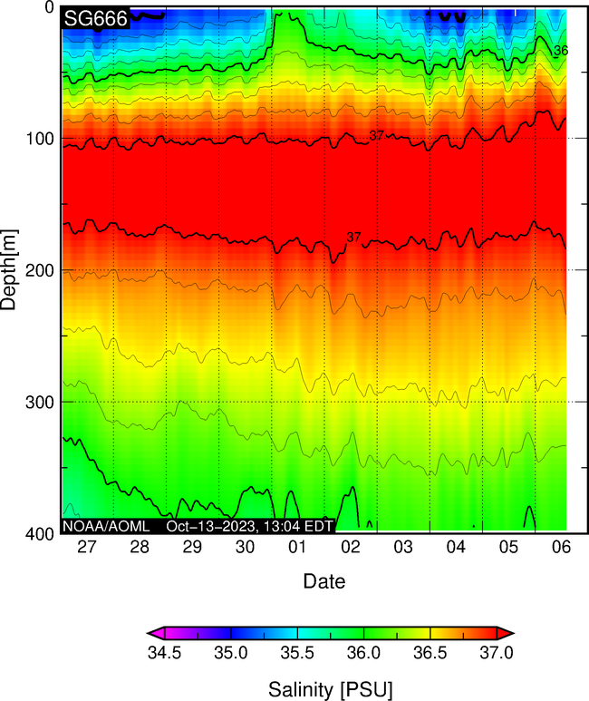
More Data from Glider SG666
Real-Time Observations
10-day data. The black line on the temperature and salinity sections shows the 26°C isotherm and the 35 isohaline, respectively.
More Data from Glider SG669
Sampling Methods
The Underwater Glider Project
Learn about the details about NOAA’s underwater glider project. See how sampling occurs and how this valuable data is used to help better predict when and where hurricanes will make landfall.
Photos from the Field

Publications & References
Click to Expand List
Miles, T.N., D. Zhang, G.R. Foltz, J.A. Zhang, C. Meinig, F. Bringas, J. Trinanes, M. Le Hénaff, M.F. Aristizabal Vargas, S. Coakley, C.R. Edwards, D. Gong, R.E. Todd, M.J. Oliver, W.D. Wilson, K. Whilden, B. Kirkpatrick, P. Chardon-Maldonado, J.M. Morell, D. Hernandez, G. Kuska, C.D. Stienbarger, K. Bailey, C. Zhang, S.M. Glenn, and G.J. Goni. Uncrewed ocean gliders and saildrones support hurricane forecasting and research. Oceanography 34(4):78-81 (https://doi.org/10.5670/oceanog.2021.supplement.02-28) (2021). Read Paper.Le Hénaff, M., Domingues, R., Halliwell, G., Zhang, J. A., Kim, H. S., Aristizabal, M., … & Goni, G. The role of the Gulf of America ocean conditions in the intensification of Hurricane Michael (2018). Journal of Geophysical Research: Oceans, e2020JC016969 (https://doi.org/10.1029/2020JC016969). (2021). Read Paper.
Domingues, R., M. Le Hénaff, G. Halliwell, J.A. Zhang, F. Bringas, P. Chardon, H.-S. Kim, J. Morell, and G. Goni. Ocean conditions and the intensification of three major Atlantic hurricanes of 2017. Monthly Weather Review, 149(5):1265-1286 (https://doi.org/10.1175/MWR-D-20-0100.1) (2021). Read Paper.
Halliwell, G.R., G.J. Goni, M.F Mehari, V.H. Kourafalou, M. BAringer, and R. Atlas. OSSE assessment of underwater glider arrays to improve ocean model initialization for tropical cyclone prediction. Journal of Atmospheric and Oceanic Technology, 37(3):467-487 (https://doi.org/10.1175/JTECH-D-18-0195.1) (2020). Read Paper.
Domingues, R., Kuwano-Yoshida, A., Chardon-Maldonado, P., Todd, R. E., Halliwell, G., Kim, H. S., … & Goni, G. (2019). Ocean observations in support of studies and forecasts of tropical and extratropical cyclones. Frontiers in Marine Science, 6, 446. Read Paper.
Domingues, R., Goni, G.J., Knaff, J.A., Lin, I.-I., and Bringas, F. (2019), The tropics- Tropical cyclone heat potential. In State of the Climate in 2018, J. Blunden, D.S. Arndt, and G. Hartfield (eds.). Bulletin of the American Meteorological Society. Read Report.
Goni, G.J., Knaff, J.A., Lin, I.-I., and Domingues, R., 2018: The tropics-Tropical cyclone heat potential. In State of the Climate in 2017, J. Blunden, D.S. Arndt, and G. Hartfield (eds.). Bulletin of the American Meteorological Society, 99(8):S129-S132 (doi:10.1175/2018BAMSStateoftheClimate.1). Read Report.
Dong, J.,R. Domingues, G. Goni, G. Halliwell, H.-S. Kim, S.-K. Lee, M. Mehari, F. Bringas, J. Morell, and L. Pomales, 2017: Impact of assimilating underwater glider data on Hurricane Gonzalo (2014) forecast. Weather and Forecasting, 32(3):1143-1159, (doi:10.1175/WAF-D-16-0182.1). Read Paper.
Goni, G. J., R. E. Todd, S. R. Jayne, G. Halliwell, S. Glenn, J. Dong, R. Curry, R. Domingues, F. Bringas, L. Centurioni, S. F. DiMarco, T. Miles, J. Morell, L. Pomales, H.-S. Kim, P. E. Robbins, G. G. Gawarkiewicz, J. Wilkin, J. Heiderich, B. Baltes, J. J. Cione, G. Seroka, K. Knee, and E. R. Sanabia, 2017: Autonomous and Lagrangian Ocean Observations for Atlantic Tropical Cyclone Studies and Forecasts. Journal of the Oceanography Society, 30(2):85-95, (doi:10.5670/oceanog.2017.227). Read Article.
Domingues, R ., G. Goni, F. Bringas, S.-K. Lee, H-S Kim, G. Halliwell, J. Dong, J. Morell, and L. Pomales, 2015: Upper ocean response to Hurricane Gonzalo (2014): Salinity effects revealed by sustained and targeted observations from underwater gliders. Geophys. Res. Lett., 42(17):7131-7138, (doi:10.1002/2015GL065378). Read Paper.
Goni, G. J., J. A. Knaff, and I-I Lin, 2015: [Global Oceans] Tropical cyclone heat potential [in “State of the Climate in 2014”]. Bull. Amer. Meteor. Soc., 96, (7), S121-S122,. Read Report.
Looking for Literature? Search our Publication Database.
Glider Team Internal Access
Click on the buttons below to access the internal site
Sharing Resources Delivers Results.
Expanding Reach Through Partnerships.
40+
Missions
Glider missions have been conducted by AOML and partner organizations since the start of the project in 2014.
10+
Partners
Partners have used the glider data for hurricane research.

