Tornadoes are among the deadliest and costliest natural disasters in the United States and are one of the hardest to predict. In December 2021, the most destructive winter tornado outbreak, known as the Quad-State Tornado Outbreak, caused 89 fatalities, 672 injuries, and at least $3.9 billion in property damages. Scientists at the University of Miami’s Cooperative Institute of Marine and Atmospheric Studies (CIMAS) and NOAA’s Atlantic Oceanographic and Meteorological Laboratory (AOML) investigated this outbreak and found that it occurred under an exceptionally strong and prolonged negative Pacific-North American (PNA) pattern, which created favorable conditions for tornado outbreaks.

Key atmospheric ingredients that lead to tornado formation include atmospheric instability, i.e., warm moist air near the ground with cooler dry air aloft, and wind shear, a change in wind speed and/or wind direction with height. These conditions most commonly occur during April, May, and June in the United States east of the Rockies. However, winter tornado outbreaks still occasionally occur, sometimes sneaking up on residents in lowlands and plains and causing large socioeconomic impacts.
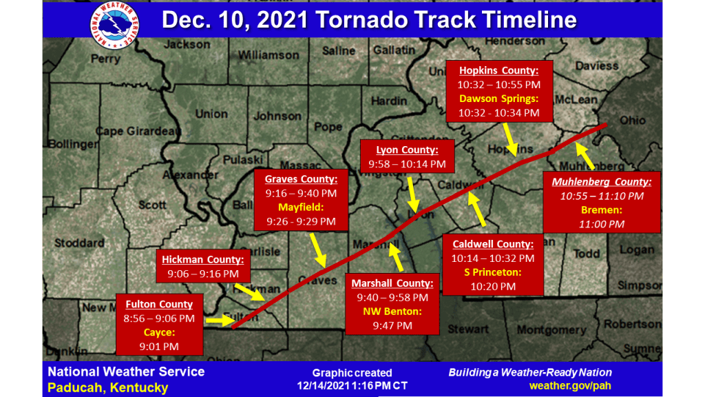
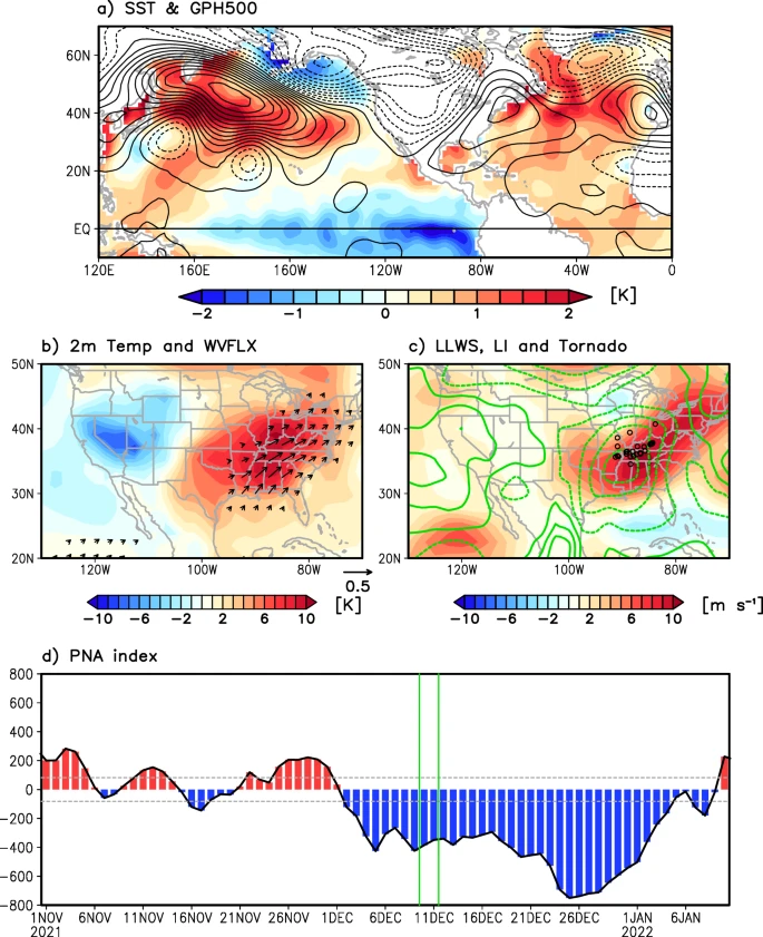
On December 10, 2021, the Quad-State Tornado Outbreak developed in northeastern Arkansas and struck portions of the Ohio Valley over two days, including Missouri, Illinois, Tennessee, and Kentucky. In this study, researchers show that the outbreak occurred under a multi-year La Niña, warm Gulf of America sea surface temperatures, and unusually strong and persistent negative PNA pattern characterized by abnormally high and low atmospheric pressure over the North Pacific Ocean and North America, respectively (Figure). This prolonged negative PNA developed around December 1 and persisted for a month. The study shows that the large-scale atmospheric and oceanic conditions associated with the prolonged negative PNA promoted the environmental conditions that led to Quad-State Tornado Outbreak.

More specifically, the study shows that a prolonged (>6 days) negative PNA produces an atmospheric ridge, an area of high atmospheric pressure, along the southern and eastern US seaboard, which helps warm the Gulf of America. Warm Gulf of America sea surface temperatures and the atmospheric ridge produce favorable atmospheric conditions for US tornado outbreaks over a broad region of the central and eastern US where the Quad-State Tornado Outbreak predominantly occurred. Conversely, a short period (<6 days) of negative PNA does not warm the Gulf of America significantly, thus its impact is limited. The study also suggests that La Niña may have promoted the prolonged negative PNA during the Quad-State Tornado Outbreak. Scientists believe the duration of the PNA may be a potential predictor for US tornado forecasts on the subseasonal (2 weeks to 3 months) timescale.
“An important question scientists want to answer is if the frequency of long-lived negative PNA will change in the future. Addressing this question could potentially help achieve a useful forecast capability for future winter US tornado outbreaks beyond the weather time scale,” said Dongmin Kim, CIMAS scientist and lead author of the study.
