The Saharan Air Layer
Studying Impacts of Transatlantic Saharan Dust Storms on Atlantic Oceanic and Atmospheric Phenomenon
SCROLL TO LEARN MORE
Who We Are
What We Do
Our main goal is to study all aspects of the Saharan Air Layer, including its thermodynamic and kinematic structure, vertical extent, mineral dust impacts, and affect on the climatology of the North Atlantic atmosphere. This allows us to integrate new Saharan Air Layer observations collected from aircraft-deployed GPS dropsondes into models in order to improve forecasts and advance our knowledge of the Saharan Air Layer’s impact on extreme weather and climate in the Atlantic Basin. A special thank you to our external partners, Chris Velden (UW-CIMSS), Jeff Hawkins (NRL-Monterey, retired), and Joseph Prospero (University of Miami/CIMAS, retired).
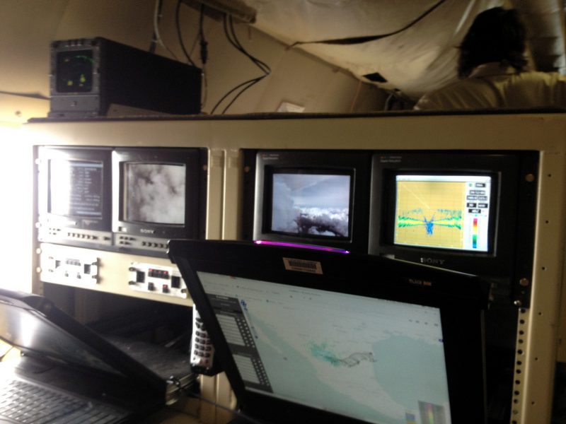
The team members working on the Saharan Air Layer project conduct experiments using NOAA’s two P-3 Orions aircraft and G-IV high altitude jet as described in HRD’s Hurricane Field Program. Our Saharan Air Layer monitoring is conducted using a combination of NOAA’s Geostationary Operational Environmental Satellites (GOES), the Meteosat Second Generation (MSG) satellites, as well as the NOAA-20, Suomi-NPSS, Special Sensor Microwave Imager/Sounder (SSMIS), Global Change Observation Mission (GCOM), Global Precipitation Measurement (GPM), and Coriolis polar orbiting satellites. Read more about our current operations on the Hurricane Research Division’s Blog.


Top News
The Saharan Air Layer: What is it? Why does NOAA track it?
June 24, 2020
Originally Published Wednesday, June 24, 2020 at NOAA NESDIS
As we move through the 2020 Atlantic Hurricane Season, you will no doubt hear a lot about the Saharan Air Layer—a mass of very dry, dusty air that forms over the Sahara Desert during the late spring, summer and early fall. This layer can travel and impact locations thousands of miles away from its African origins, which is one reason why NOAA uses the lofty perspective of its satellites to track it.


Read More News
The Saharan Air Layer and Extreme Weather
The Saharan Air Layer Affects our Weather and Climate
The Saharan Air Layer has unique properties of warmth, dry air, and strong winds that can have significant moderating impacts on tropical cyclone formation and intensification. There are three characteristics of these Saharan dust outbreaks that can affect tropical cyclones, tropical disturbances, and the general climatology of the Atlantic tropical atmosphere:
- Extremely Dry Air
- African Easterly Jet
- Warm Temperatures
Extremely Dry Air
First, The Saharan Air Layer’s dry, dusty air has about 50% less moisture than the typical tropical atmosphere. This extremely dry air can weaken a tropical cyclone or tropical disturbance by promoting downdrafts around the storm.
African Easterly Jet
Second, Strong winds in the Saharan Air Layer (25-55 mph or 10-25 meters per second) can substantially increase the vertical wind shear in and around the storm environment. This “mid-level jet” of enhanced winds, typically found at a height of 6,500-14,500 feet (2000-4500 meters), can cause tilting of the tropical cyclone vortex with height and can disrupt the storm’s internal heat engine.
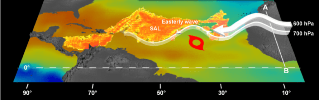
Warm Temperatures
Third, The Saharan Air Layer’s warmth acts to stabilize the atmosphere, which can suppress the formation of clouds. This stabilizing effect is produced when the Saharan Air Layer’s warm, buoyant air rides above relatively cooler, denser air. The Saharan Air Layer’s suspended mineral dust also absorbs sunlight, which helps maintain its warmth as it crosses the Atlantic Ocean.
Read more about the project in the selections below or click next to start over.
What is the Saharan Air Layer?
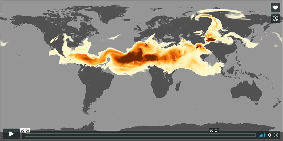
The Saharan Air Layer is a mass of very dry, dusty air that forms over the Sahara Desert during the late spring, summer, and early fall, and moves over the tropical North Atlantic Ocean every three to five days. Saharan Air Layer outbreaks usually occupy a 2 to 2.5-mile-thick layer of the atmosphere with the base starting about 1 mile above the surface.
Saharan Air Layer activity usually ramps up in mid-June, peaks from late June to mid-August, and begins to rapidly subside after mid-August. During the peak period, individual Saharan Air Layer outbreaks emerge from the coast of Africa every 3-5 days, reach farther to the west (as far west as Florida, Central America and even Texas), and cover vast areas of the Atlantic (sometimes as large as the lower 48 United States).
How does the Saharan Air Layer influence hurricane development?
The warmth, dryness, and strong winds associated with the Saharan Air Layer have been shown to suppress tropical cyclone (hurricane) formation and intensification.
How does the Saharan Air Layer influence weather and climate?
The Saharan Air Layer has unique properties of warmth, dry air, and strong winds that can have significant moderating impacts on tropical cyclone formation and intensification. There are three characteristics of these Saharan dust outbreaks that can affect tropical cyclones, tropical disturbances, and the general climatology of the Atlantic tropical atmosphere:
Extremely Dry Air: First, the Saharan Air Layer’s dry, dusty air has about 50% less moisture than the typical tropical atmosphere. This extremely dry air can weaken a tropical cyclone or tropical disturbance by promoting downdrafts around the storm.
African Easterly Jet: Second, strong winds in the Saharan Air Layer (25-55 mph or 10-25 meters per second) can substantially increase the vertical wind shear in and around the storm environment. This “mid-level jet” of enhanced winds, typically found at a height of 6,500-14,500 feet (2000-4500 meters), can cause tilting of the tropical cyclone vortex with height and can weaken the storm’s internal heat engine.
Warm Temperatures: Third, the Saharan Air Layer’s warmth acts to stabilize the atmosphere, which can suppress the formation of clouds. This stabilizing effect is produced when the Saharan Air Layer’s warm, buoyant air rides above relatively cooler, denser air. The Saharan Air Layer’s suspended mineral dust also absorbs sunlight, which helps maintain its warmth as it crosses the Atlantic Ocean.
How does the Saharan Air Layer affect the weather and skies when it reaches the U.S.?
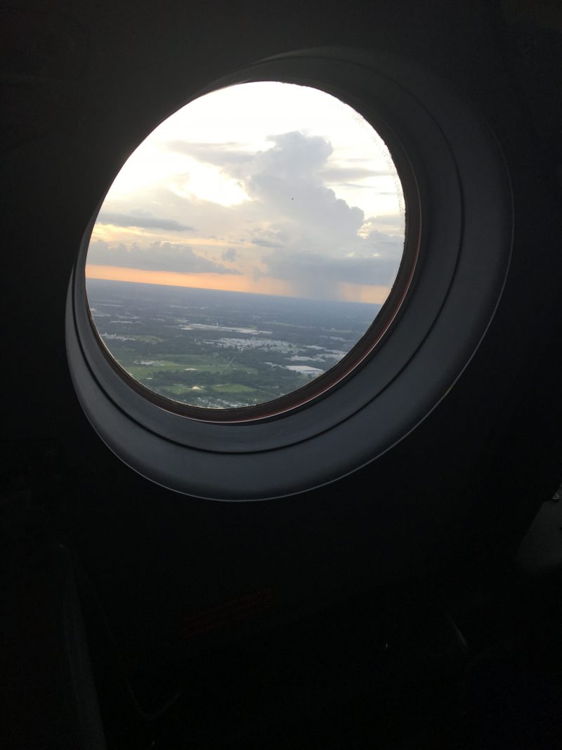
The Saharan Air Layer can suppress clouds and thunderstorms when it reaches the U.S. coastline. Some areas will experience their hottest days of the summer when the SAL’s dry, dusty air is overhead and afternoon thunderstorms are being stifled. Because of the special way Saharan dust scatters sunlight, the best times of day to spot it are usually a few hours after sunrise and in the late afternoon. During the day, the sky will have a hazy white look and sunsets will take on an orange glow.
How/why does the Saharan Air Layer cause pretty sunsets?
The sun’s white light is composed of all the colors of the rainbow. Our skies are normally blue because the gases that make up the atmosphere naturally scatter blue hues (shorter wavelengths) as opposed to the yellow-orange-red hues (longer wavelengths). Sunsets and sunrises take on more yellow and reddish hues because the low-angle sunlight passes through more of the atmosphere before it reaches your eyes. A heavy load of dust in the atmosphere can enhance this effect, leading to longer-lasting, duskier colors that cause vivid sunsets and sunrises.
What are the health impacts of the Saharan Air Layer dust traveling over parts of the US?
For more on the potential health impacts, we refer you to your state agency that tracks air quality or to the CDC at CDC.gov. In general, it is important that people with asthma and other chronic lung diseases take precautions to maintain control of their underlying conditions and reduce exposure to dust by limiting time outdoors during dust storms.
Is it common for dust from the Sahara to cross the Atlantic on a regular basis? How far west can it go into the U.S.?
Saharan Air Layer activity typically ramps up in mid-June and peaks from late June to mid-August, with new outbreaks occurring every three to five days. During this peak period, it is common for individual SAL outbreaks to reach farther to the west (as far west as Florida, Central America and even Texas) and cover extensive areas of the Atlantic (sometimes as large as the lower 48 United States).
How do forecasters and scientists monitor and study the Saharan Air Layer?
The Saharan Air Layer has unique properties of warmth, dry air, and strong winds that can act to suppress hurricane formation and intensification. Thanks to recent advancements in satellite technology, we can better monitor and understand the Saharan Air Layer, from its formation over Africa, to its interactions with tropical cyclones, to its impacts on weather along the U.S. Gulf coast and Florida. Forecasters and researchers at NOAA routinely use satellite data to detect these aspects of the Saharan Air Layer and some of this information is ingested into models to improve forecasts. Ground-based sensors are also positioned across the North Atlantic that continuously monitor SAL events. A multi-agency scientific collaboration called the AErosol RObotic NETwork (AERONET) is used to monitor the Saharan Air Layer’s dust and dry air as it passes overhead. The University of Miami has a science station located in Barbados that has been collecting Saharan dust particles in filters for detailed analysis since the mid-1960s. NOAA also conducts Saharan Air Layer research using its Hurricane Hunter aircraft to study the Saharan Air Layer and better understand how it can suppress the formation and intensification of tropical cyclones.
Read the Science Q&A at NESDIS for more.
Science on a Sphere
Data Visualization for the Saharan Air Layer. Get the Science on a Sphere App for more.
Project Goals
Key Accomplishments
Developed New Satellite Products For SAL Monitoring With NOAA’s Next Generation Satellites
Developed several new satellite products to track the SAL continuously using NOAA’s next generation GOES-16 satellite. These products include split window infrared (IR), mid-level water vapor, and multi-spectral pseudo natural color satellite imagery and are available in real-time on the UW-CIMSS tropical cyclone website:
http://tropic.ssec.wisc.edu/real-time/sal/
GOES-R Proving Ground
2018Conducted SALEX missions during the 2006 Atlantic hurricane season that used the NOAA P-3 Orions and G-IV high altitude jet to investigate interactions between the SAL and Tropical Storm Debby and Hurricane Helene. These NOAA missions were coordinated with the NASA African Monsoon Multidisciplinary Analyses (NAMMA) field campaign based in the Cape Verde Islands. P-3 and G-IV SALEX missions were also conducted in 2015 to investigate interactions between the SAL and Tropical Storm Erika.
25 Aug 2006 (G-IV jet): TS Debby
26 Aug 2006 (G-IV jet): TS Debby
15 Sep 2006 (G-IV jet): TS Helene
16 Sep 2006 (G-IV jet): Hurricane Helene
18 Sep 2006 (P-3 Orion & G-IV jet): Hurricane Helene
20 Sep 2006 (P-3 Orion & G-IV jet): Hurricane Helene
25 Aug 2015 (P-3 Orion & G-IV jet): TS Erika
26 Aug 2015 (P-3 Orion): TS ErikaSALEX Aircraft Missions
2006, 2015Developed a 1995-2002 database of GOES satellite imagery, aerosol analyses, and Caribbean rawinsonde observations to create a revised set of atmospheric soundings for the tropical North Atlantic. These new soundings, partly based on knowledge of the SAL, represent a new benchmark for describing the climatological state of the tropical atmosphere during the hurricane season:
https://journals.ametsoc.org/doi/10.1175/2010JCLI3496.1
A Revision of the Climatology of the Tropical Atlantic Atmosphere
2011Conducted first-ever SALEX aircraft missions during the 2005 Atlantic hurricane season that used the NOAA G-IV high altitude jet to investigate interactions between the SAL and Tropical Storm Irene (07-08 Aug) and an African easterly Wave (27-28 Sep):
Aug. 07, 2005 (G-IV jet)
Aug. 08, 2005 (G-IV jet)
Sept. 27, 2005 (G-IV jet)
Sept. 28, 2005 (G-IV jet)Pioneered the Saharan Air Layer Experiment (SALEX)
2005Successfully submitted a proposal to the NOAA Joint Hurricane Testbed (JHT) program to examine the impacts of assimilating moisture information from GPS dropsondes launched from the NOAA G-IV jet in operational parallel runs of the NOAA Global Forecast System (GFS) model and assess the impact of of this data on GFS initial/forecast humidity fields and its forecasts of TC track and intensity. Results from this 2005-2007 JHT project led to a decision by the NOAA National Centers for Environmental Prediction (NCEP) to begin routinely assimilating humidity data from GPS dropsondes into the operational version of the GFS model beginning on 22 Aug 2006.
Dropsonde Assimilation
2005Developed automated geostationary satellite imagery (GOES-EAST and Meteosat) to track the SAL continuously. This product used split window infrared (IR) imagery and was first made available in real-time on the UW-CIMSS tropical cyclone website in 2001:
http://tropic.ssec.wisc.edu/real-time/sal/
Developed Satellite Imagery for Monitoring the SAL
2001
Featured Publication

Esmaili, R., Barnet, C., Dunion, J., Folmer, M., & Zawislak, J. (2022). Evaluating Satellite Sounders for Monitoring the Tropical Cyclone Environment in Operational Forecasting. Remote Sensing, 14(13), 3189.
Abstract: Tropical cyclones can form over open ocean where in situ observations are limited, so forecasters rely on satellite observations to monitor their development and track. We explore the utility of an operational satellite sounding product for tropical forecasting by characterizing the products retrieval skill during research flights. Scientists from both the NOAA-Unique Combined Atmospheric Processing System (NUCAPS) research team and tropical cyclone communities collaborated to target relevant tropical cyclones during the campaign. This effort produced 130 dropsondes that are welltimed with satellite sounder overpasses over three different tropical cyclones and one Saharan Air Layer outbreak…
Evaluating Satellite Sounders for Monitoring the Tropical Cyclone Environment in Operational Forecasting
Esmaili, R., Barnet, C., Dunion, J., Folmer, M., & Zawislak, J. (2022). Evaluating Satellite Sounders for Monitoring the Tropical Cyclone Environment in Operational Forecasting. Remote Sensing, 14(13), 3189.
Abstract: Tropical cyclones can form over open ocean where in situ observations are limited, so forecasters rely on satellite observations to monitor their development and track. We explore the utility of an operational satellite sounding product for tropical forecasting by characterizing the products retrieval skill during research flights. Scientists from both the NOAA-Unique Combined Atmospheric Processing System (NUCAPS) research team and tropical cyclone communities collaborated to target relevant tropical cyclones during the campaign. This effort produced 130 dropsondes that are welltimed with satellite sounder overpasses over three different tropical cyclones and one Saharan Air Layer outbreak…

Publications & References
Dunion, J.P., 2011: Re-Writing the Climatology of the Tropical North Atlantic and Caribbean Sea Atmosphere. J. Climate. 24, 893-908.Dunion, J.P., and C.S. Marron, 2008: A Reexamination of the Jordan mean tropical sounding based on awareness of the Saharan Air Layer: Results from 2002. J. Climate. 21, 5242-5253.
Dunion, J.P., and S.D. Aberson, 2007: Assimilating moisture information from Global Positioning System (GPS) dropwindsondes into the NOAA Global Forecast System, 61st Annual Interdepartmental Hurricane Conference, New Orleans, LA, Office of Fed. Coord. For Meteor. Services and Supporting Research, NOAA.
Dunion, J.P., J.D. Hawkins, and C.S. Velden, 2006: Hunting for Saharan Air with the NOAA G-IV Jet. AMS 27th Conference on Hurricanes and Tropical Meteorology, Monterey, CA, American Meteorological Society.
Dunion, J.P., and S.D. Aberson, 2006: Assimilating moisture information from Global Positioning System (GPS) dropwindsondes into the NOAA Global Forecast System, 60th Annual Interdepartmental Hurricane Conference, Mobile, AL, Office of Fed. Coord. For Meteor. Services and Supporting Research, NOAA.
Dunion, J.P., and C.S. Velden, 2004: The impact of the Saharan Air Layer on Atlantic tropical cyclone activity. Bull. Amer. Meteor. Soc., 85 no. 3, 353-365.
Ismail, S., R.A. Ferrare, E.V. Browell, S.A. Kooi, J.P. Dunion, G. Heymsfield, A. Notari, C.F. Butler, S. Burton, M. Fenn, T.N. Krishnamurti, M. Biswas, G. Chen, and B. Anderson, 2010: LASE measurements of water vapor, aerosol, and cloud distributions in Saharan Air Layers and tropical disturbances. J. Atmos. Sci, 67 no. 4, 1026-1047.
Jones, T., D. Cecil, and J.P. Dunion, 2007: The environmental and inner core conditions governing the intensity of Hurricane Erin (2001). Wea. Forecast. 22, 708-725.
Evan, A.T., J.P. Dunion, J.A. Foley, A.K. Heidinger, and C.S. Velden, 2006: New evidence for a relationship between Atlantic tropical cyclone activity and African dust outbreaks. Geophys. Res. Lett., L19813, doi:10.1029/2006GL026408.
Zipser, E.J., C.H. Twohy, S. Tsay, K. L. Thornhill, S. Tanelli, R. Ross, T.N. Krishnamurti, Q. Ji, G. Jenkins, S. Ismail, N. C. Hsu, R. Hood, G. M. Heymsfield, A. Heymsfield, J. Halverson, H. M. Goodman, R. Ferrare, J. P. Dunion, M. Douglas, R. Cifelli 1, G. Chen, E. V. Browell, and B. Anderson, 2009: The Saharan Air Layer and the fate of African easterly waves-NASA’s AMMA 2006 field study of tropical cyclogenesis. Bull. Amer. Meteor. Soc., 90, 1137-1156.
Looking for Literature? Search our Publication Database.