
PIRATA Northeast Extension
Tropical Atlantic Observations for Weather & Climate
JUMP TO DATA
OR SCROLL TO LEARN MORE
Who We Are
PIRATA, the Prediction and Research Moored Array in the Tropical Atlantic, is a multinational observation network, established to improve our knowledge and understanding of ocean-atmosphere variability in the tropical Atlantic. It is a joint project between Brazil, France, and the United States of America. PIRATA is motivated by fundamental scientific issues and by societal needs for improved prediction of weather and climate variability, and their impacts on the countries surrounding the tropical Atlantic basin. The overarching goals of the project are below.
Our Objectives
1. Improve the description of sub-seasonal to interannual variability in the atmospheric and oceanic boundary layers of the tropical Atlantic Ocean.
2. Improve our understanding of the relative contributions of air-sea fluxes and ocean dynamics to variability in sea surface temperature, salinity, and sub-surface heat content.
3. Provide a set of data useful for developing and improving predictive models of the coupled ocean-atmosphere system and validate satellite data.
4. Document interactions between tropical Atlantic climate and variability outside the region, such as El Niño and the North Atlantic Oscillation.
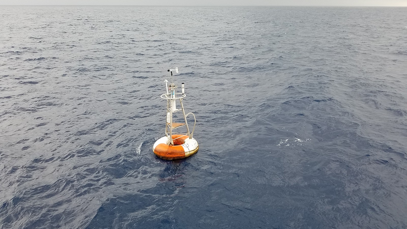
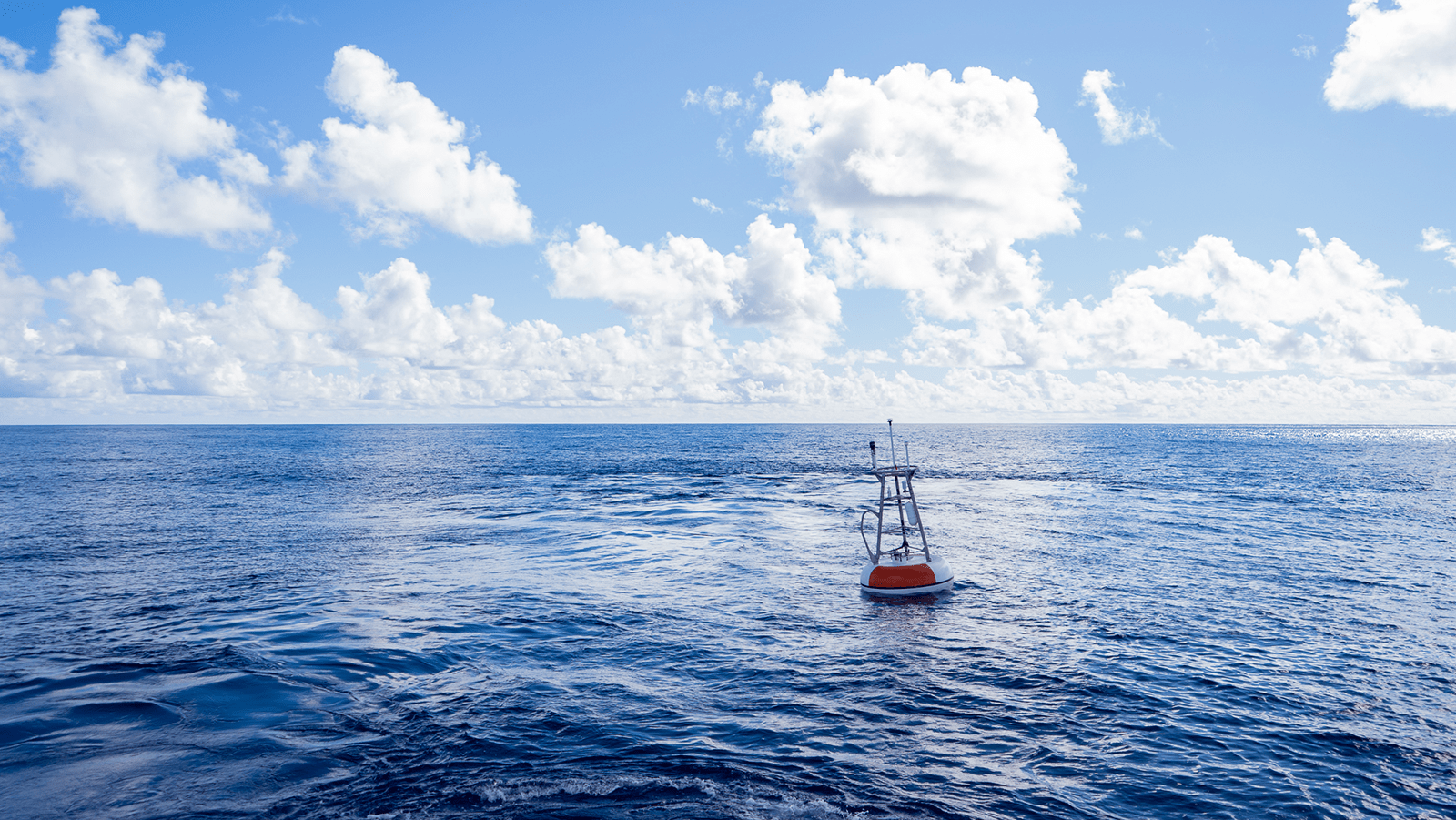
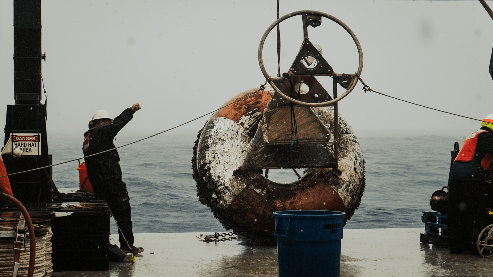
5. Design, deploy, and maintain an array of moored oceanic buoys and collect and transmit a set of oceanic and atmospheric data, via satellite in near-real time, to monitor and study the upper ocean and atmosphere of the tropical Atlantic Ocean.

| Gregory Foltz, Ph.D.
AOML Lead Principal Investigator
| Renellys Perez, Ph.D.
Co-Principal Investigator
Top News
Ocean Month: Exploring and understanding our ocean through research cruises
June 25, 2025
Research cruises are essential for scientists to collect data, deploy instrumentation, and maintain ocean observing systems. NOAA regularly conducts research at sea to study the ocean and atmosphere, advancing our understanding of the ocean, monitoring ocean conditions, and ensuring sustainable fisheries and healthy marine habitats. These expeditions provide essential data for weather prediction, ocean acidification […]


Read More News
Research Impacts & Key Findings
AOML has led 16 PIRATA Northeast Extension cruises from 2006 to 2022, with 713 hydrographic casts, 1369 XBTs deployed, 191 drifters, and 125 Argo floats deployed.
Over 404 peer-reviewed publications have used PIRATA mooring and cruise data.
PIRATA has collected over 26 years of data in the tropical Atlantic, and PIRATA Northeast Extension has collected over 17 years of data.
Background
Introduction
Air-sea interactions have a large impact on weather and climate variability and can be a determining factor in the prediction of extreme weather and ocean changes. In the tropical Atlantic, these interactions influence development of droughts, floods, marine heat waves, severe tropical storms and hurricanes, and fisheries landings, with direct impacts in the Americas and Africa.
About PIRATA
The Prediction and Research Moored Array in the Tropical Atlantic (PIRATA) is an multinational network of ocean buoys that serves as the backbone of the integrated tropical Atlantic observing system. PIRATA allows for the collection of scientific data to improve our knowledge and understanding of ocean-atmosphere variability in the tropical Atlantic, validate satellite observations, and provide data for weather and ocean models. PIRATA is a joint project between Brazil, France, and the United States of America.
From Pilot to Prediction
PIRATA was first established in the mid-1990s and has undergone expansions and enhancements since 2005 to improve its utility for ocean and climate research and forecasting. To reflect these improvements in design, the original PIRATA acronym was changed in 2008 from “Pilot Research Moored Array in the Tropical Atlantic” to “Prediction and Research Moored Array in the Tropical Atlantic.” PIRATA is supported by France (IRD, Meteo-France, CNRS and IFREMER), Brazil (INPE and DHN), and the USA (NOAA). AOML contributes to the PIRATA program by leading cruises and collecting shipboard measurements which are used by our sister lab, the Pacific Marine Environmental Laboratory (PMEL) in Seattle, to calibrate the mooring data. PMEL is responsible for servicing, maintaining, and deploying the moorings and making the mooring data available in near-real-time.
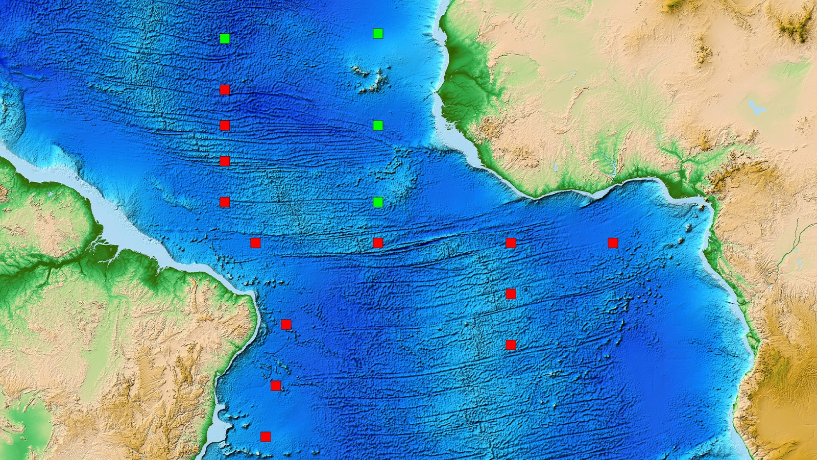
Northeast Extension & The Tropical North Atlantic
AOML’s field work contribution to the PIRATA program is focused on the PIRATA Northeast Extension (PNE). PNE is a joint project between AOML and PMEL to expand the set of tropical moored buoys into the northern and northeastern sectors of the Tropical Atlantic Ocean. The tropical North Atlantic is a region of strong climate variations from intraseasonal to decadal scales, with impacts on rainfall rates and storm strikes in the surrounding regions of Africa and the Americas. Important processes in this region include formation of Cape-Verde type Atlantic hurricanes, of which Irma and Florence are recent examples, seasonal migration of the Intertropical Convergence Zone (ITCZ) and the Guinea Dome, interannual variations of the ITCZ migration associated with rainfall anomalies in Africa and the Americas, off-equatorial eddy heat advection and turbulent cooling by tropical instability waves, and overturning-related ventilation of the oxygen minimum zone. Due to the significance of these processes, the northeast extension was added to the existing array in 2006.
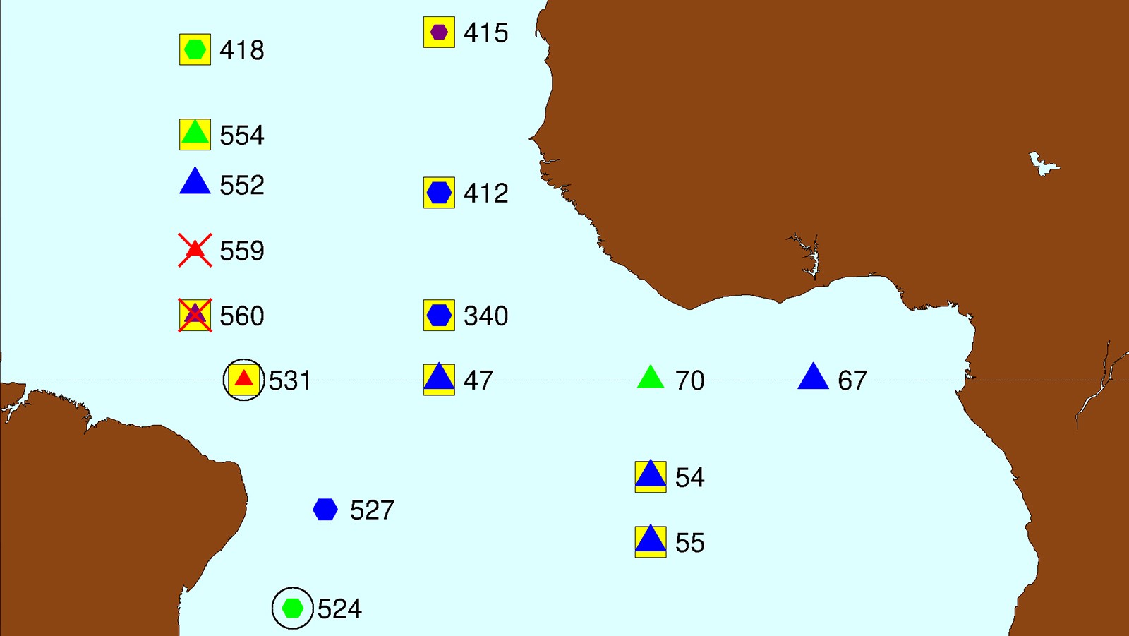
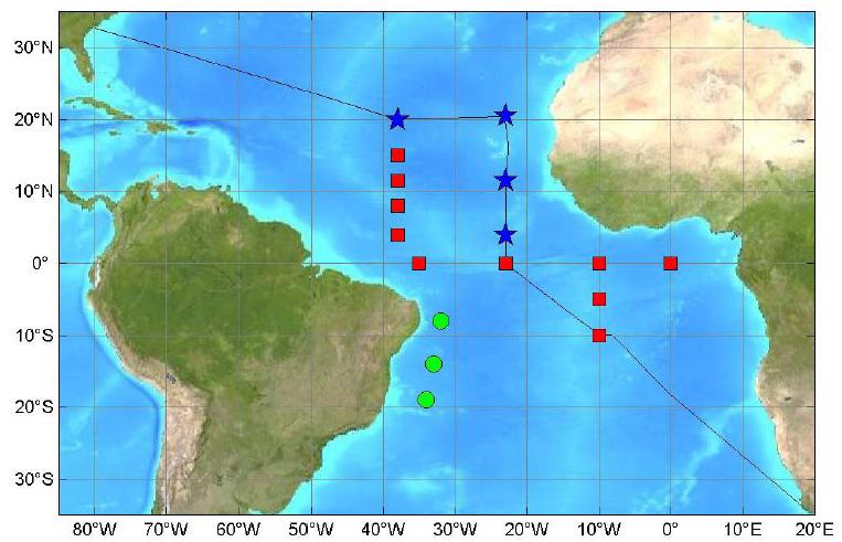
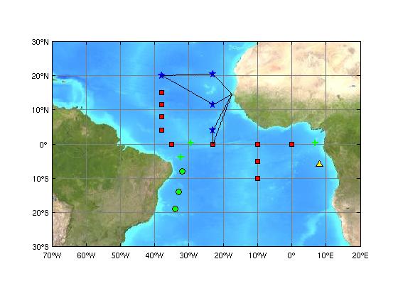
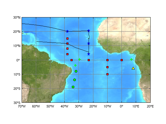
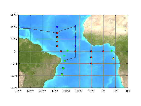
Mooring Array
Implementation of PIRATA started in 1997 with an array of backbone moored buoys in the Atlantic (Servain et al., 1998), similar to the Tropical Atmosphere-Ocean (TAO) array used to study ENSO variability in the equatorial Pacific (McPhaden et al., 1998).
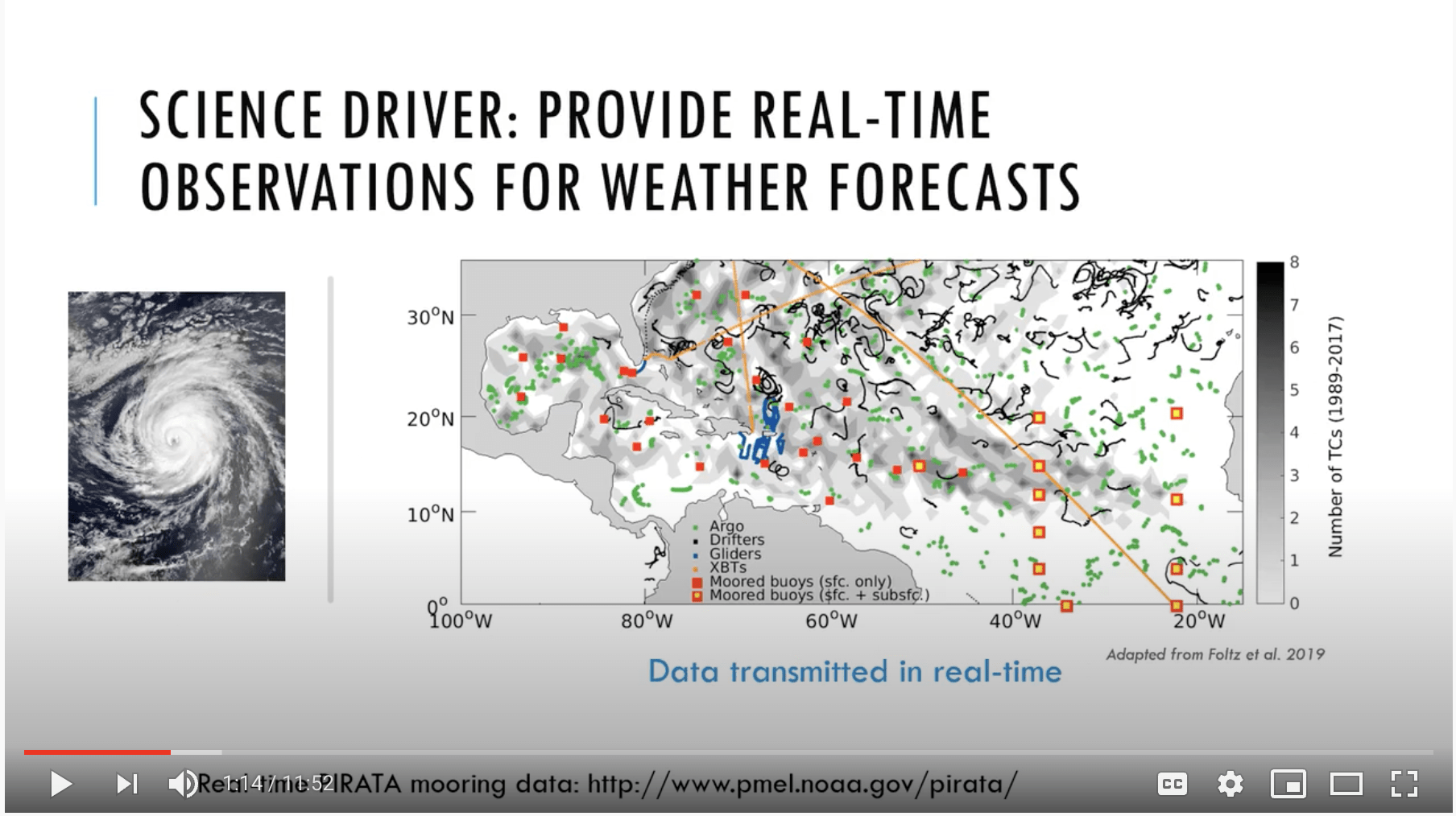
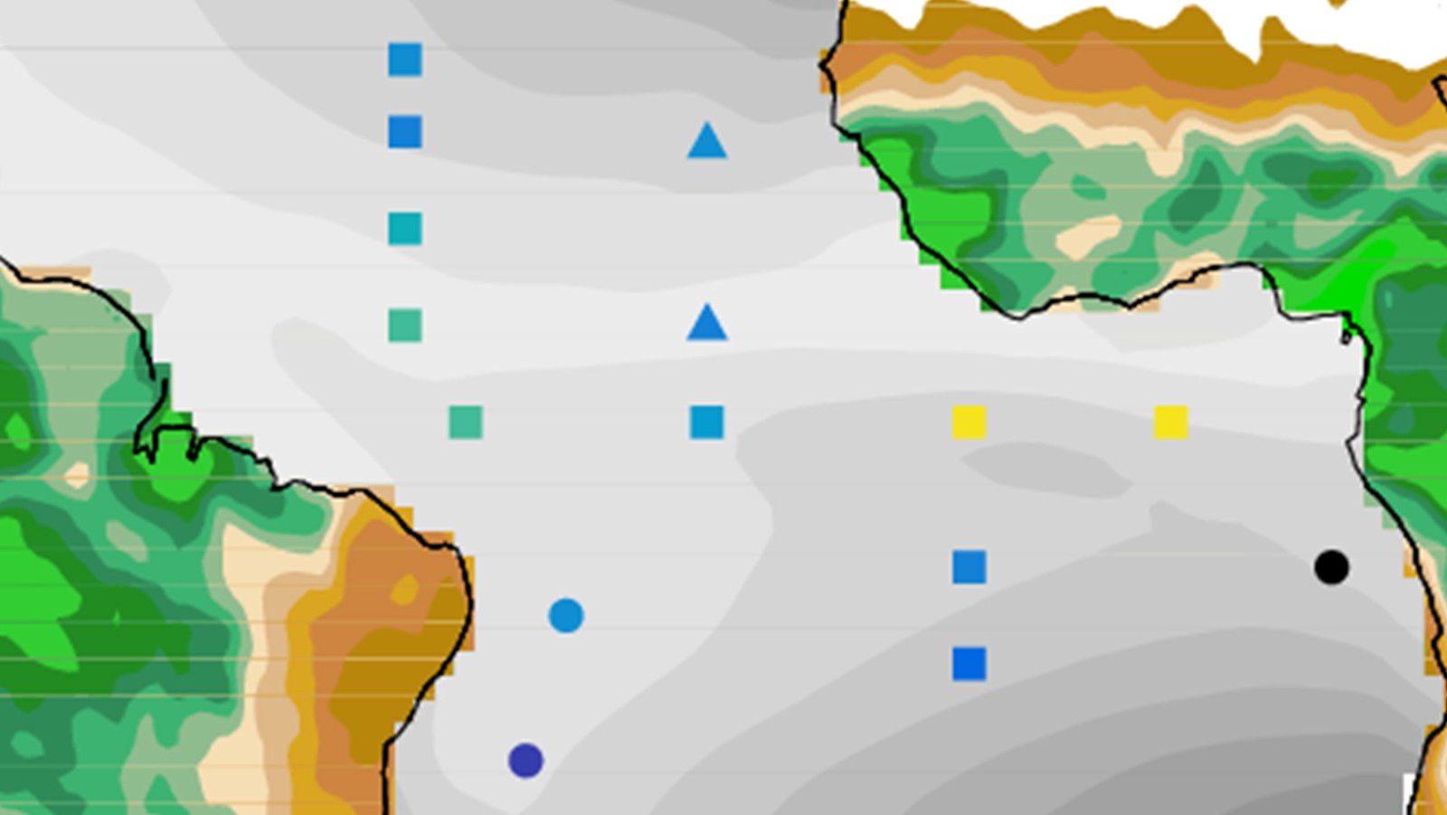
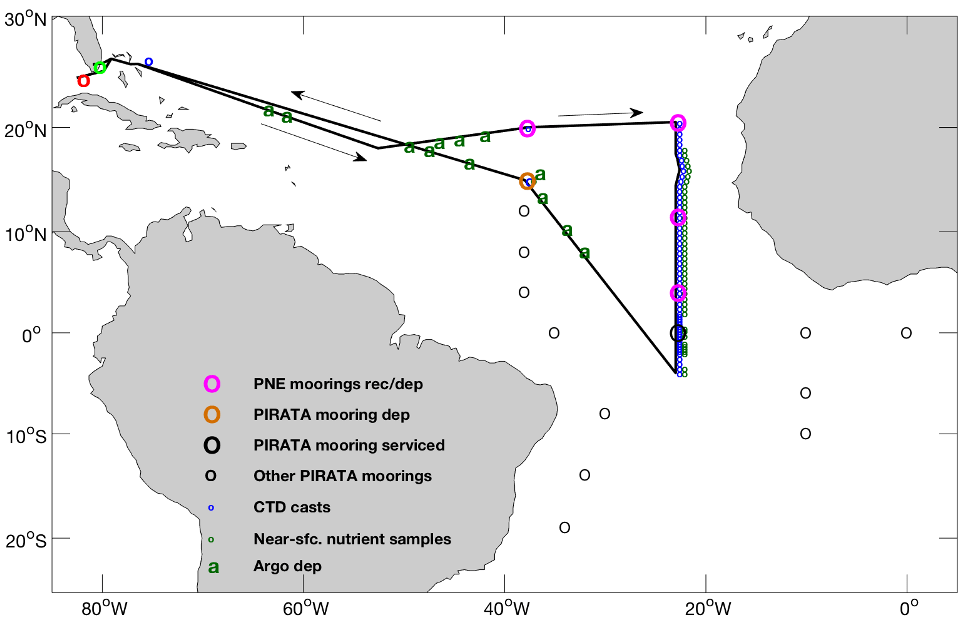
Starting in late 2005, extensions were added to the backbone array in key regions, including the US-led PIRATA Northeast Extension (PNE) in the climate-critical tropical North Atlantic (Bourles et al., 2008; Bourles et al. 2019; Foltz et al. 2019). The current configuration of the PIRATA array is shown below. The orange symbols represent the PNE moorings.
Complimentary Projects
Featured Project.
Tropical Atlantic Current Observations Study (TACOS)
TACOS is a pilot study focused on advancing understanding of ocean circulation and mixing and its impact on sea surface temperatures and the atmosphere. Using acoustic current meters augmented to the existing NOAA PIRATA Northeast Extension 4°N 23°W mooring, TACOS provides a novel time series of a horizontal velocity and its vertical shear in regions with strong ocean-atmosphere coupling on weather and climate timescales.
By establishing a long-term time series of current observations at 4°N 23°W, we can better understand how ocean currents, vertical shear, advection, and mixing can modify SSTs and overlying atmospheric processes. Additionally, TACOS observations can be used to validate tropical weather models and forecasts, which presently rely on lower resolution ocean measurements.
To learn more about the TACOS project at AOML, visit its project page.
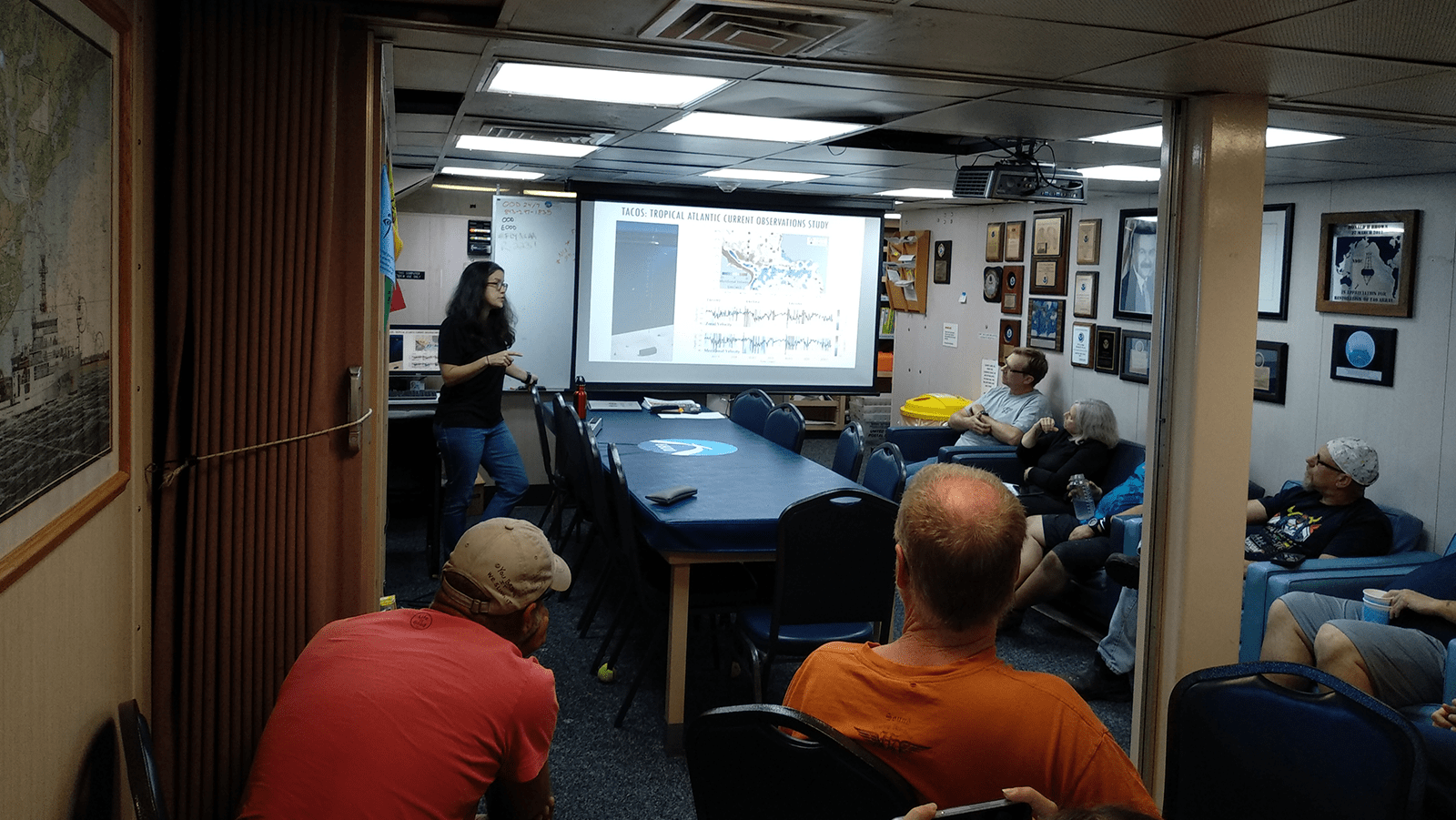
Science Seminar
The Tropical Atlantic Observing System
Project Highlight
PIRATA Field Journal: Come Sail Away
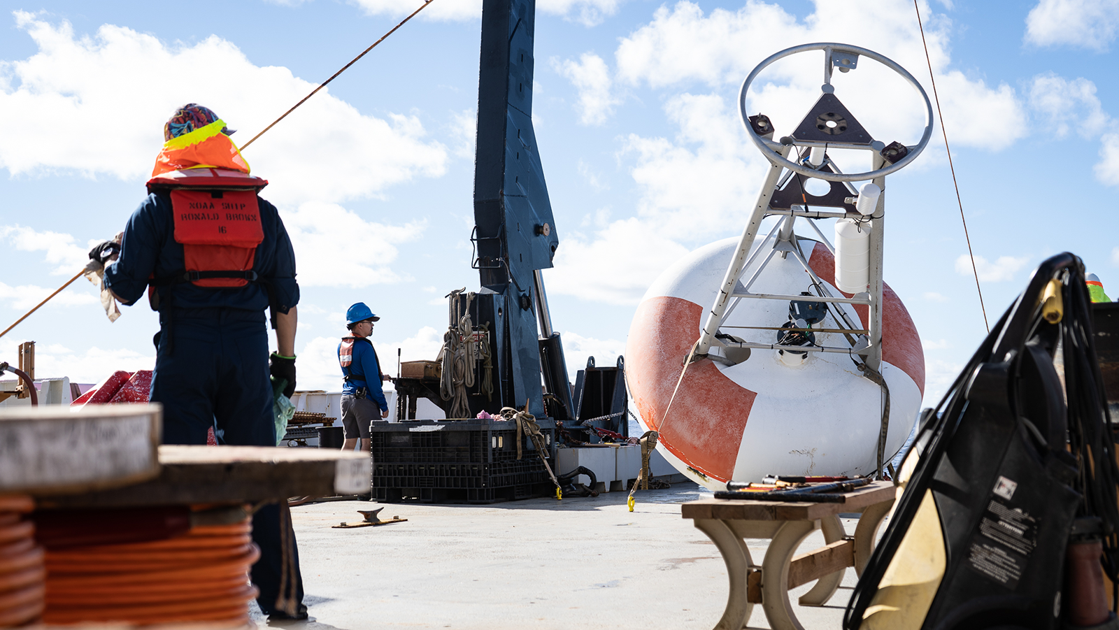
On February 24, 2021 researchers with AOML returned to land, docking in Key West after nearly six weeks aboard the NOAA ship Ronald H. Brown. The scientists were at sea for the PIRATA Northeast Extension (PNE) 2021 cruise. Diego Ugaz, an University of Miami Cooperative Institute technician, served as the Night Watch Leader for this cruise. Diego recorded his time aboard the ship and provided a look into his daily life at sea. This successful mission will ensure that the PNE buoys continue to effectively and accurately collect data to better understand ocean-atmosphere variability in the tropical Atlantic region.
Featured StoryMap
NOAA-led Cruise Expands Sensors for Climate Prediction
Follow along with scientists at AOML as they travel from St. Petersburg, FL to Praia, Cape Verde to service and collect data from ocean buoys in support of the PIRATA Northeast Extension project. PIRATA buoys provide critical data that are used to develop and improve predictive models of the Atlantic climate system, as well as used for ocean and weather prediction.
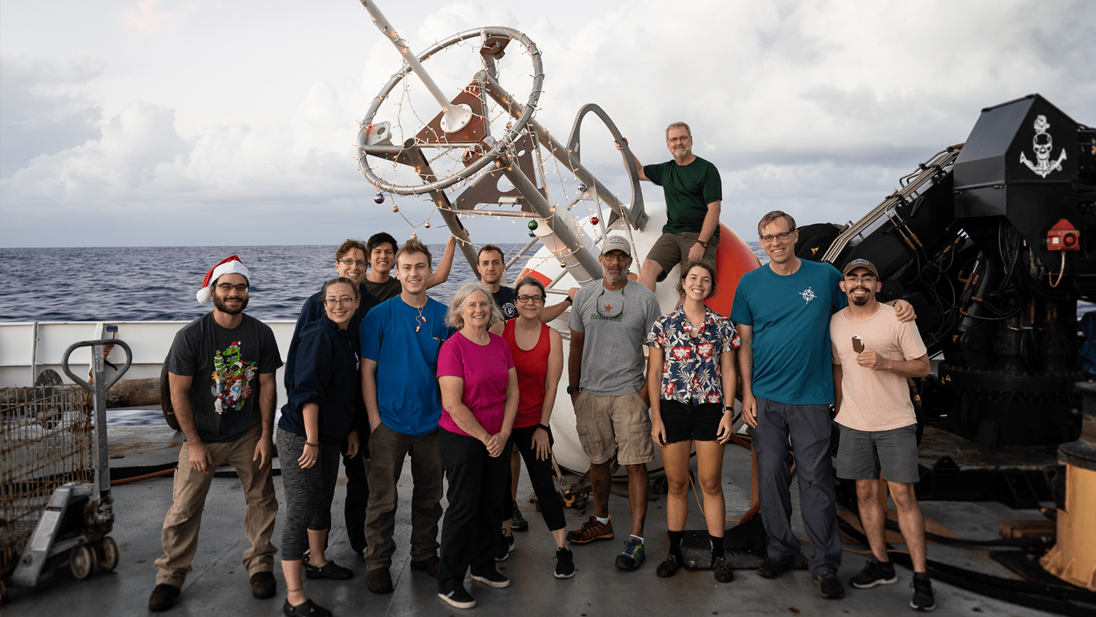
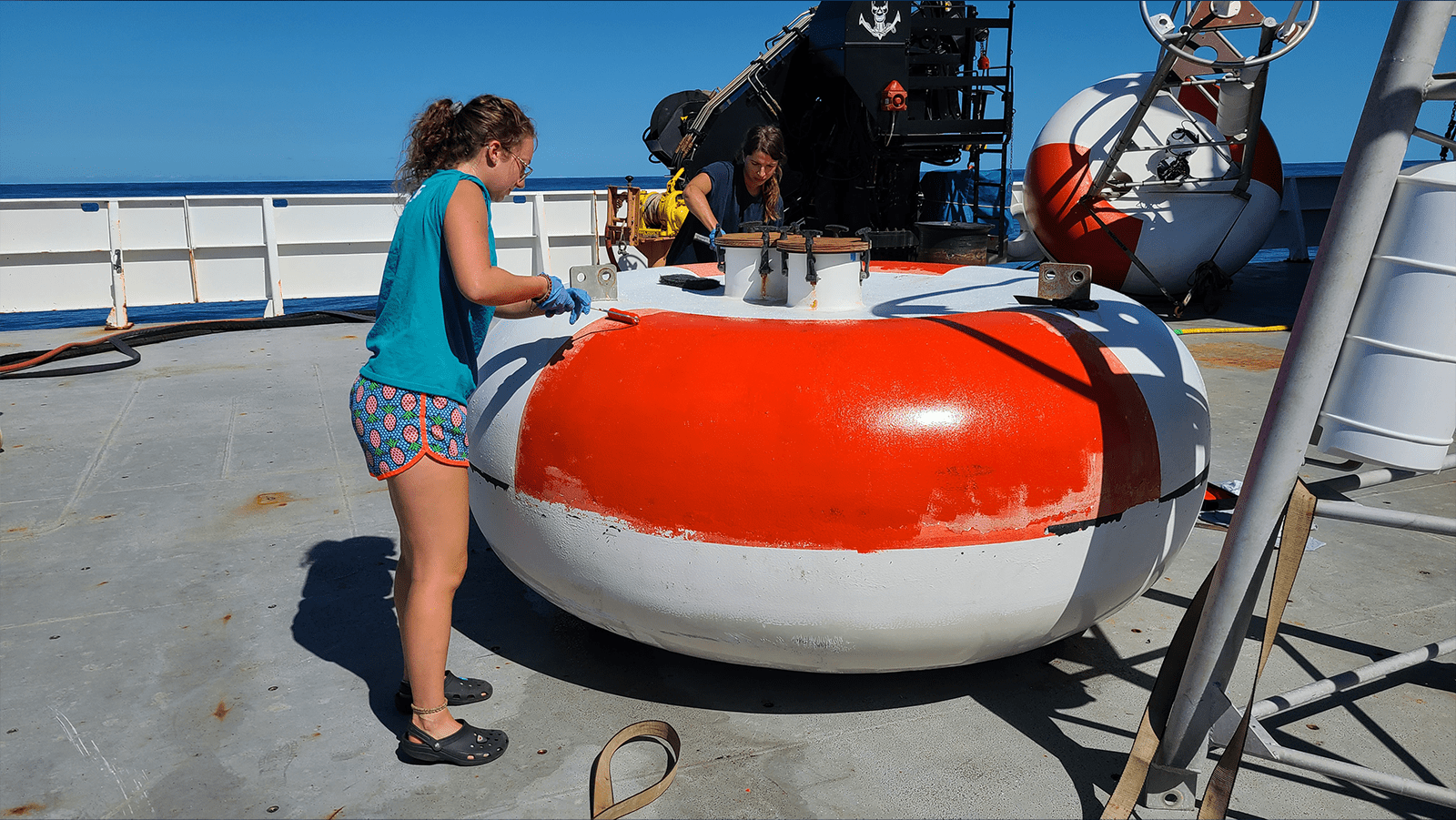
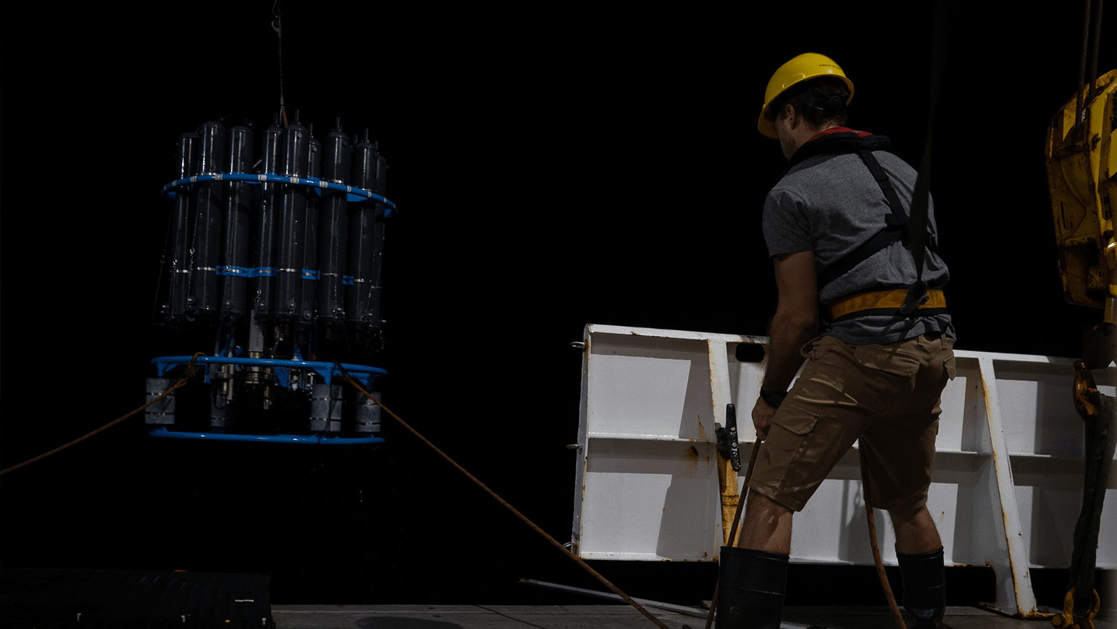
Photos from the Field
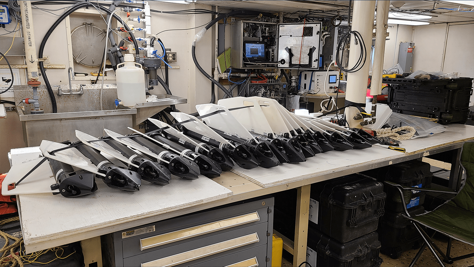
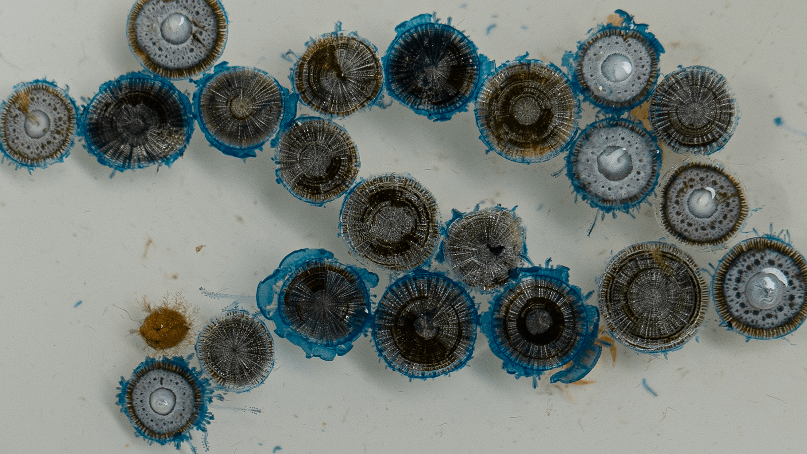
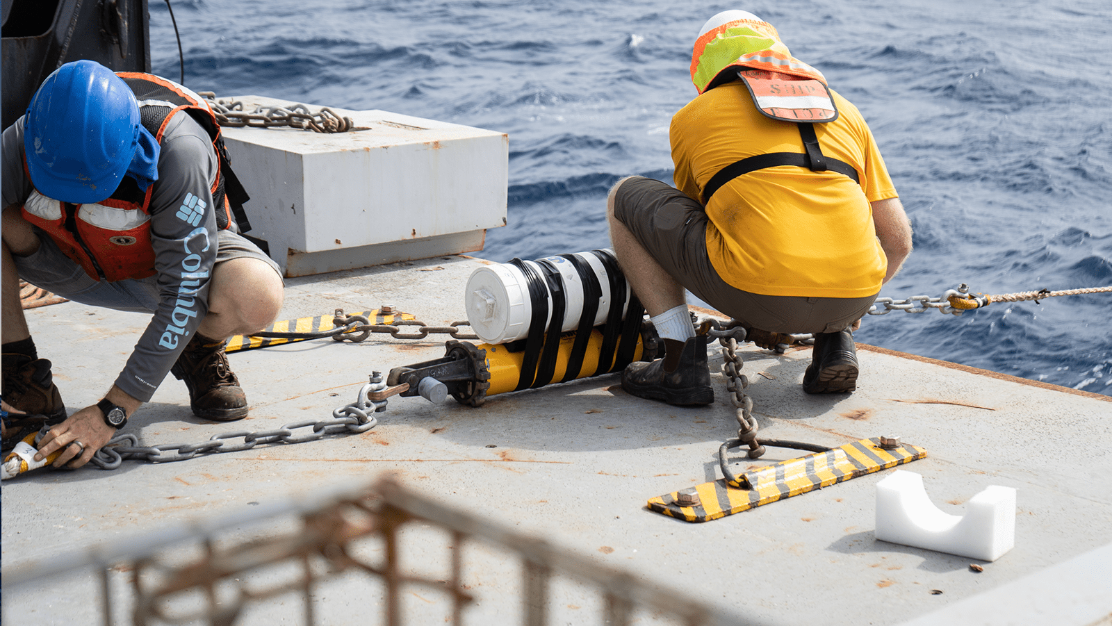
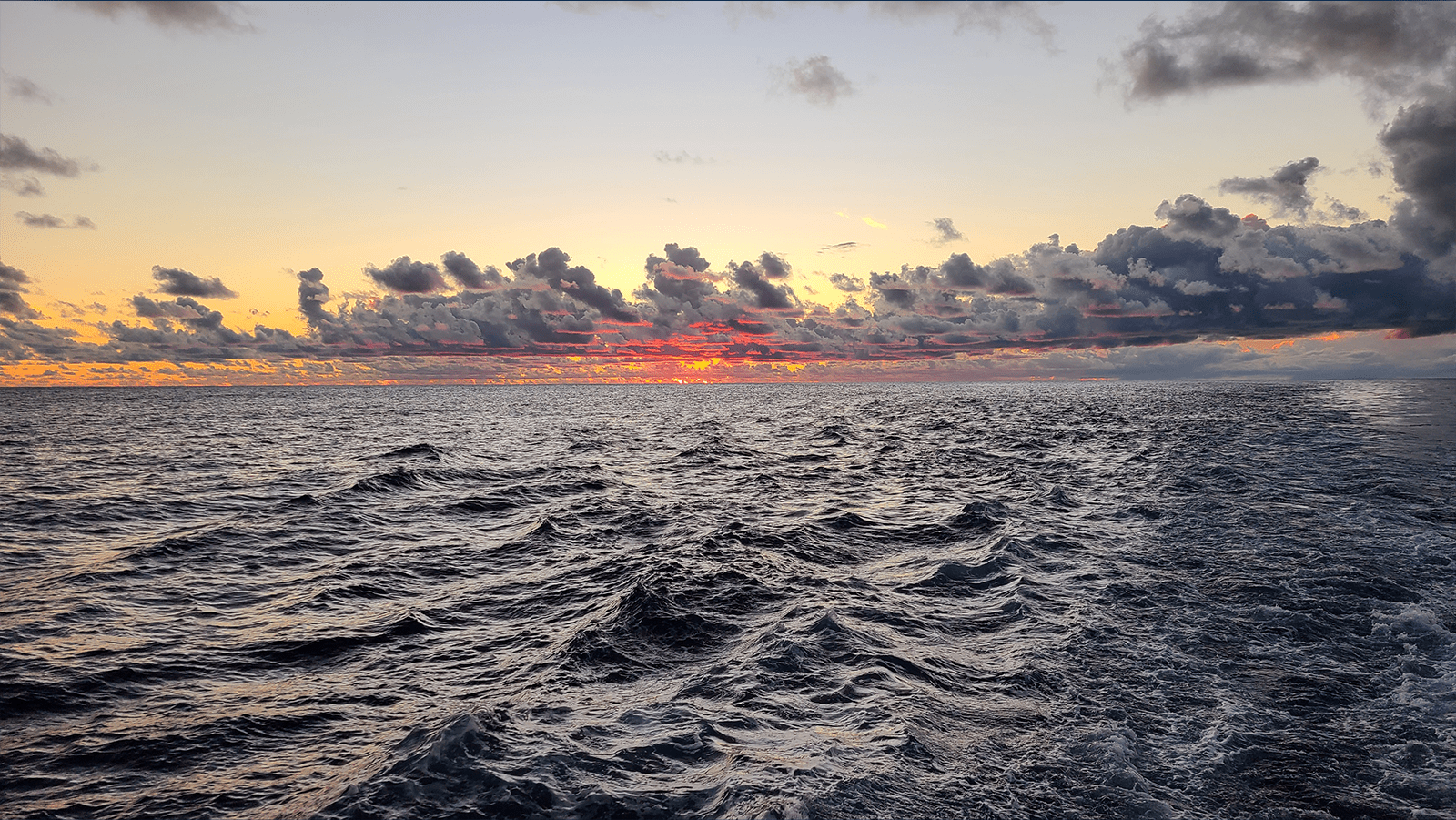


pnedata anchor
Data
Past Cruise Data
Click on each date below to see its corresponding data and report.
November 1 - December 9, 2022
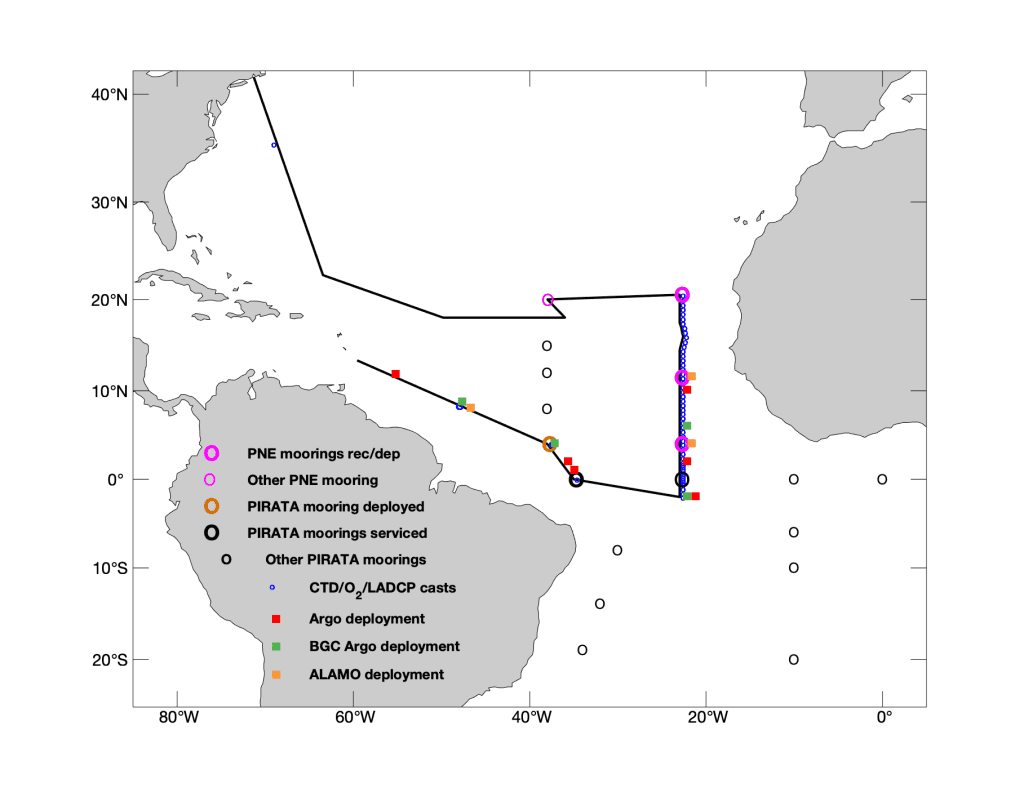
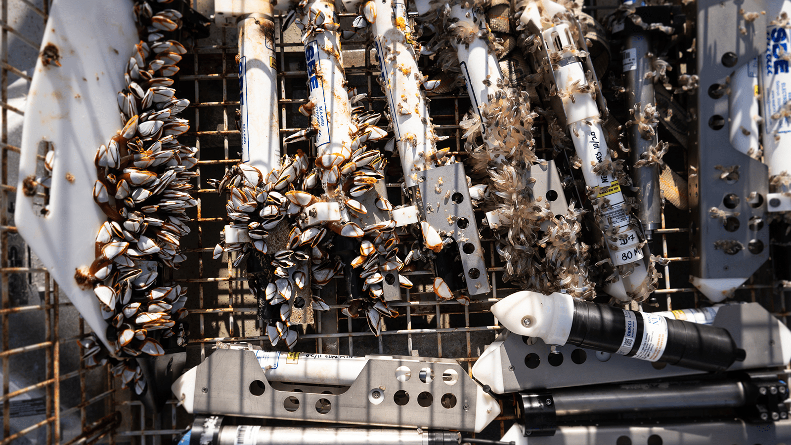
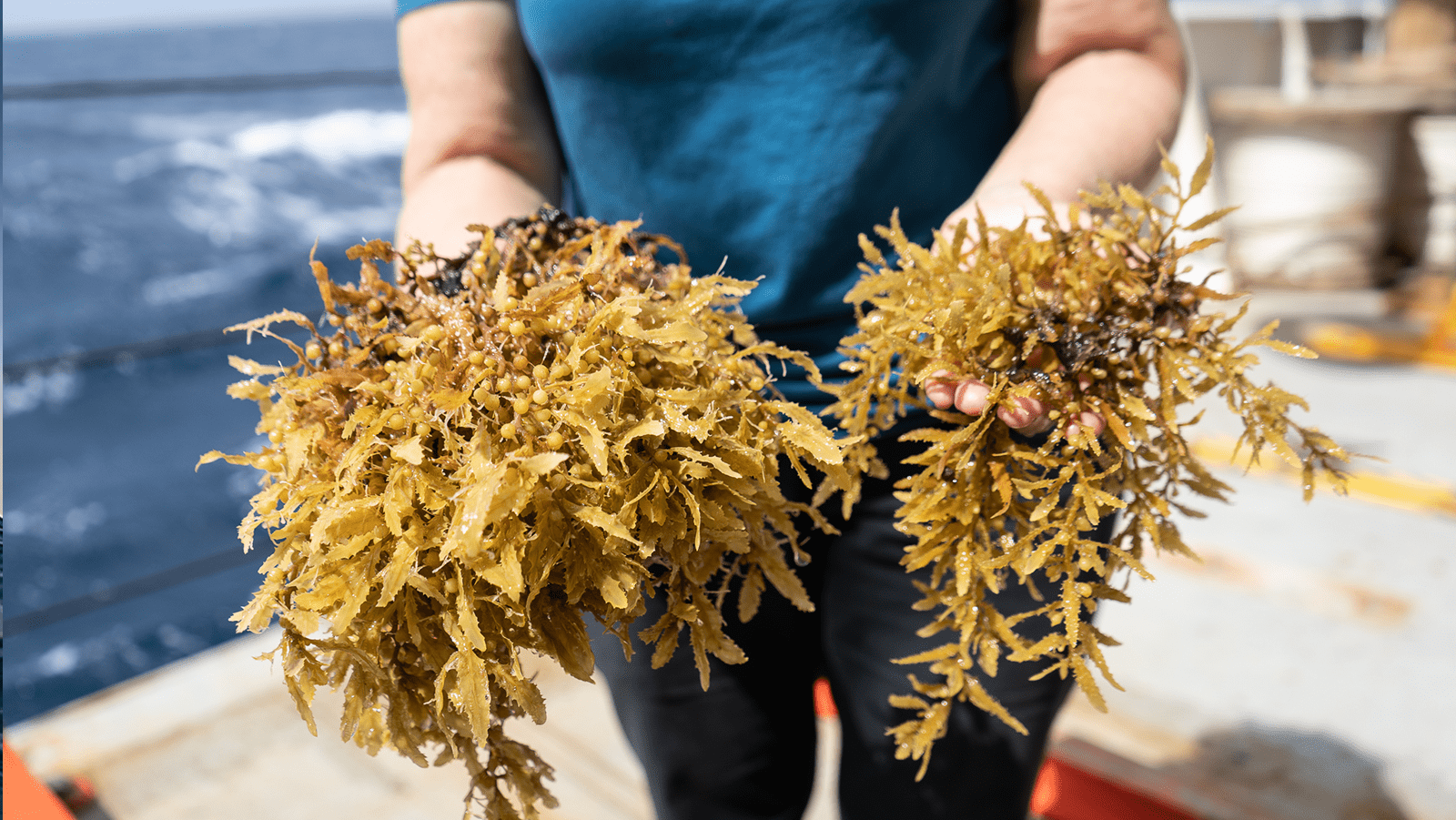
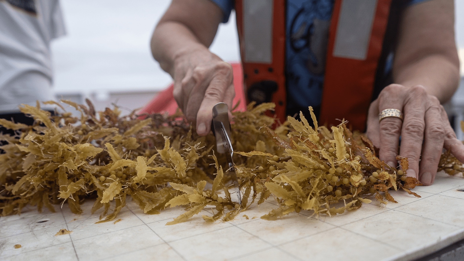
The 2022 PNE cruise took place from November 1 to December 9 on the R/V Ronald H. Brown, beginning in Bridgetown, Barbados and ending in Newport, RI. The chief scientist of PNE 2022 was Greg Foltz (NOAA/AOML). During the cruise, three of the four PIRATA Northeast Extension buoys were recovered and redeployed, a new mooring was deployed at the 4N, 38W Brazilian PIRATA site (the previous buoy had become unmoored and was adrift), the electronics tube on the 0, 35W Brazilian PIRATA buoy was replaced, and the rain gauge was replaced on the French PIRATA mooring at 0, 23W. 57 CTD casts were conducted, most along 23W. 6 Argo, 4 BGC Argo, and 3 ALAMO (small Argo) floats were deployed. AEROSE measured aerosol optical depth, launched 75 radiosondes, and collected dust samples from PIRATA moorings. Groups from Woods Hole and Fearless Fund collected samples of Sargassum for post-cruise analysis.
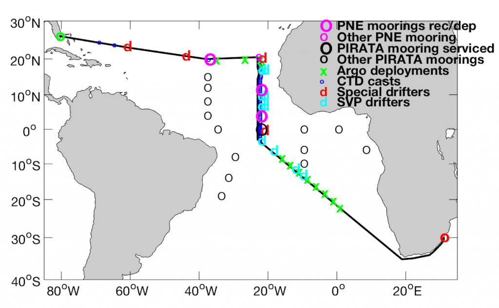
November 12 - December 19, 2021
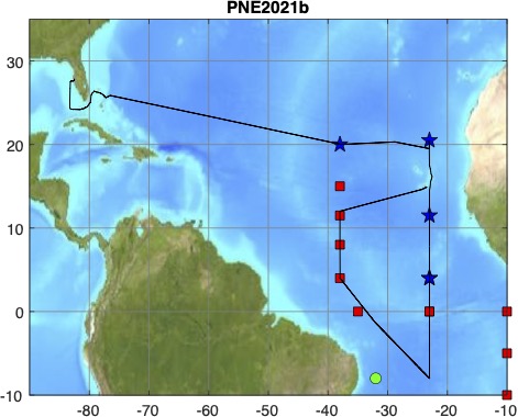
The FY2022 Prediction and Research Moored Array in the Tropical Atlantic (PIRATA) Northeast Extension (PNE) cruise began on November 12, 2021 in St. Petersburg, FL and ended on December 19, 2021 in Praia, Cape Verde. The chief scientist of PNE 2021b was Renellys Perez (NOAA/AOML). During the cruise, the NOAA/PMEL mooring team recovered and redeployed 4 PNE TFlex moorings, repaired a French PIRATA mooring at 0N, 23W, and recovered a Brazilian PIRATA mooring at 12N, 38W. The NOAA/AOML team conducted 70 hydrographic casts, deployed 15 surface drifting buoys, and deployed 11 Argo floats. For the first time, Tropical Atlantic Current Observations Study (TACOS current meters were deployed at the 20N, 38W PNE mooring. The Fearless Fund group collected samples of Sargassum for post-cruise analysis.
January 15 - February 24 , 2021
 The 2021 PNE cruise took place from January 15 to February 24 on the R/V Ronald H. Brown, beginning in Miami Beach, Florida and ending in Key West, Florida. The chief scientist of PNE 2021 was Greg Foltz (NOAA/AOML). During the cruise, all four PIRATA Northeast Extension buoys were recovered and redeployed, a new mooring was deployed at the 15N, 38W Brazilian PIRATA site (the previous buoy had become unmoored and was adrift), and the air temperature and relative humidity sensors were replaced on the French PIRATA mooring at 0, 23W. 61 CTD casts were conducted, most along 23W. 12 Argo floats were deployed. AEROSE measured aerosol optical depth and atmospheric carbon monoxide, ozone, and sulfur dioxide throughout the cruise. A group from Fearless Fund (Dept. of Energy/NOAA-funded project) collected samples of Sargassum and obtained more than 300 water samples from the CTD bottles for post-cruise nutrient analysis.
March 1 - March 29, 2019
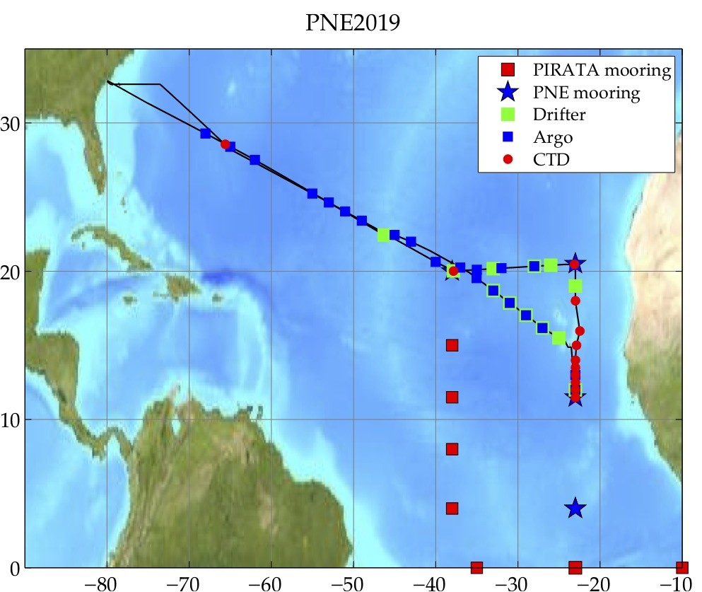
PNE2019 began on March 1, 2019 in Charleston, South Carolina on the NOAA R/V Ronald H. Brown, and ended early on March 29, 2019 in Charleston, South Carolina. Renellys Perez (NOAA/AOML) was the chief scientist. Science conducted during PNE2019 was greatly curtailed due to a reduction of almost two weeks at sea due to a series of delays/issues. Three moorings were serviced (20N, 38W; 20.5N, 23W; and 11.5N, 23W). The final mooring (4N, 23W) was serviced in May 2019 aboard the UNOLS R/V Thomas G. Thompson. Only 12 CTD casts were conducted due to limited time, and 14 surface drifters for NOAA’s Global Drifter program and 22 profiling floats for the Argo program were also deployed in areas with limited data coverage. AEROSE deployed 101 radiosondes and 8 ozonesondes during the cruise. Sargassum sightings were recorded by student volunteers.
March 7 - April 14, 2018
 The 2018 PNE cruise was conducted from March 7 to April 14 on the R/V Ronald H. Brown, beginning in Fort Lauderdale, Florida and ending in Durban, South Africa. The chief scientist of PNE 2018 was Greg Foltz (NOAA/AOML). During this cruise, three of the four PIRATA Northeast Extension buoys were serviced (the mooring at 20.5N, 23W was not replaced due to high winds and rough seas), and the rain and radiation sensors were replaced on the French PIRATA mooring at 0, 23W. 50 CTD casts were conducted, most of them along 23W. 12 Argo floats and 10 surface drifters were deployed. 55 experimental surface drifters were deployed as part of an experiment to study the pathways of Sargassum in the tropical North Atlantic.
February 19 - March 25, 2017
February 19 – March 25
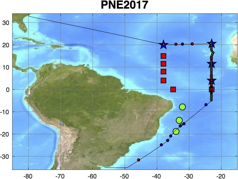 The 2017 PIRATA Northeast Extension (PNE) cruise was conducted from February 19 to March 25, 2017, from Montevideo, Uruguay to Charleston, S.C., aboard the NOAA R/V Ronald H. Brown. The chief scientist of PNE2017 was Renellys C. Perez (NOAA/AOML). During the 35-day cruise from Montevideo, Uruguay to Charleston, S.C., 61 CTD/O2/LADCP casts were conducted and four PNE moorings were successfully recovered and redeployed. The PNE team also deployed 16 drifters, 8 Argo floats, and 70+ XBTs. The TFLEX mooring at 4N, 23W was augmented with an additional 10 acoustic current meters to study upper ocean velocity and shear (lead PI Renellys Perez). The AEROSE team collected a wide variety of atmospheric observations during the “leg 1” transit from Punta Arenas, Chile to Montevideo, Uruguay (Chief Scientist: Vernon Morris). They also collected atmospheric observations during the “leg 2” PNE cruise from Montevideo to Charleston, S.C.
November 15 - December 14, 2015
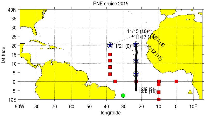 The 2015 PNE cruise was conducted from November 15 to December 14, 2015 aboard the NATO R/V Alliance. The port of call was Las Palmas de Gran Canaria. The chief scientist was Claudia Schmid (NOAA/AOML). During this cruise, the four PIRATA Northeast Extension buoys were serviced and a mooring that was part of the T-FLEX validation was recovered near the PNE mooring site at 4N, 23W with 10 point acoustic current meters to study upper ocean shear (lead PI Renellys Perez). Dust was sampled from the shortwave radiometers at locations prone to dust accumulation, including at the 11.5N, 23W site which had a second shortwave radiometer with a washing system. 41 CTD/O2/LADCP stations were conducted, most of them along 23W. Two experiments targeted at improving the quality of XBT data were done: (1) 48 enhanced Deep Blue XBTs were deployed as part of a joint project with Sippican; (2) 60 pairs of XBTs were dropped simultaneously from different heights as part of the fall height experiment. The AEROSE team collected a wide variety of atmospheric observations.
December 28 - February 12, 2014
 The 2014 PNE cruise was conducted from 28 December 2014 to 12 February 2015, Bridgetown, Barbados to San Juan, Puerto Rico, aboard the UNOLS R/V Endeavor. The chief scientist of PNE 2014 was Rick Lumpkin (NOAA/AOML). During this cruise, the four PIRATA Northeast Extension buoys were serviced and a T-FLEX mooring was deployed within five miles of the PNE mooring at 4N-23W with 10 point acoustic current meters to study upper ocean shear (lead PI Renellys Perez). An experimental washer system was installed at the 11.5N-23W site to clean dust off a second shortwave radiometer. 51 CTD stations were conducted, most of them along 23W. Five subsurface hydrophone moorings deployed in an NSF-funded project were also recovered. Due to ship space constraints, the AEROSE team was not able to participate in this cruise.
November 11 - December 8, 2013
 The (late) 2013 PNE cruise was the second conducted in the year 2013 due to the delay of the 2012 cruise (see below), and is thus “PNE2013b”. This cruise was conducted on November 11 to December 8, from Bridgetown, Barbados to Recife, Brazil, on the R/V Ronald H. Brown. The chief scientist of PNE 2013b was Greg Foltz (NOAA/AOML). During this cruise, the four PIRATA Northeast Extension buoys were serviced and a T-FLEX mooring was deployed within five miles of the PNE mooring at 20N-38W. 69 CTD stations were conducted, most of them along 23W. 96 XBTs were dropped, some as part of an XBT comparison experiment. The AEROSE team collected a wide variety of atmospheric observations.
January 8 - February 13, 2013
 The 2012 PNE cruise was initially canceled due to mechanical failures of the R/V Ronald H. Brown, and subsequently scheduled for early 2013. It was conducted on January 8 to February 13, from Charleston, SC to San Juan, Puerto Rico. Because the next PIRATA Northeast Extension cruise is scheduled for late 2013, this cruise is “PNE 2013a” while the late 2013 cruise is “PNE 2013b”. The chief scientist of PNE 2013a was Claudia Schmid (NOAA/AOML). During this cruise, the four PIRATA Northeast Extension buoys were serviced, a T-FLEX mooring was deployed within five miles of the PNE mooring at 20N-38W, and the backbone mooring at Eq-23W was repaired. 50 CTD stations were conducted, most of them along 23W and at the PIRATA mooring sites. 120 Underway CTD casts were performed to test the system and collect data along 23W and during the transit to Puerto Rico. Along the same sections, 265 XBTs were dropped. In addition, 6 XBT comparison tests were done with up to 10 pairs of XBTs at each location close to a CTD cast. The AEROSE team collected a wide variety of atmospheric observations. In addition, two hydrophone moorings were recovered and redeployed, and one hydrophone mooring was deployed.
July 21 - August 21, 2011
 The 2011 PNE cruise was conducted aboard the R/V Ronald H. Brown on July 21 to August 21, from Charleston, SC, USA to Cape Town, South Africa. The chief scientist was Rick Lumpkin (NOAA/AOML). During this cruise, the four PIRATA Northeast Extension buoys were serviced, a T-FLEX mooring was deployed within five miles of the PNE mooring at 20N-38W, and the backbone moorings at Eq-23W and 10S-10W were repaired. Six hydrographic casts were conducted, one at each of the PIRATA mooring sites visited during the cruise.
April 26 - May 22, 2010
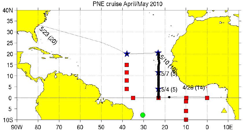 The 2010 PNE cruise was conducted aboard the R/V Ronald H. Brown on April 26 to May 22, from Takoradi, Ghana to Charleston, SC, USA. The chief scientist was Claudia Schmid (NOAA/AOML). During this cruise, the four PIRATA Northeast Extension buoys were serviced, the backbone mooring at Eq-23W was repaired via tube swap, and the backbone mooring at 0N0E (which had gone adrift) was recovered. A hydrographic line along 23W was occupied from the Equator to 20.5N.
July 11- August 11, 2009
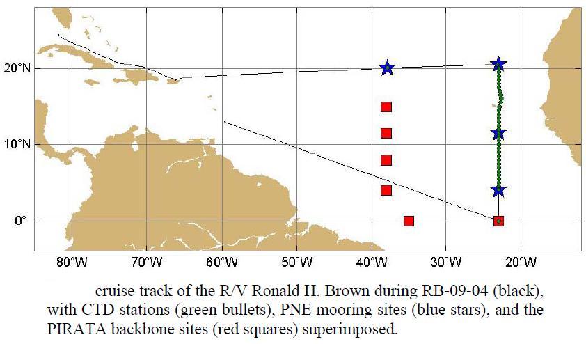 The 2009 PNE cruise was conducted aboard the R/V Ronald H. Brown on July 11 to August 11, from Bridgetown, Barbados to Key West, FL USA. The chief scientist was Rick Lumpkin (NOAA/AOML). During this cruise, the four PIRATA Northeast Extension buoys were serviced, and the backbone mooring at Eq-23W was repaired. A hydrographic line along 23W was occupied from 4N to 20.5N.
July 11- August 11, 2009
The 2009 PNE cruise was conducted aboard the R/V Ronald H. Brown on July 11 to August 11, from Bridgetown, Barbados to Key West, FL USA. The chief scientist was Rick Lumpkin (NOAA/AOML). During this cruise, the four PIRATA Northeast Extension buoys were serviced, and the backbone mooring at Eq-23W was repaired. A hydrographic line along 23W was occupied from 4N to 20.5N.
October 5 - October 18 & October 22 - November 5, 2008
 The 2008 PNE cruise was conducted aboard the R/V Antea, a French vessel that was chartered by NOAA after the originally scheduled, April 2008 cruise on the R/V Ron Brown had been canceled due to mechanical issues. The Ron Brown cruise had been scheduled to include a repeat hydrographic section along 23W, but ship time costs prohibited this work from being done on the Antea. The replacement cruise was focused entirely on replacing the four PNE moorings and the backbone mooring at 0, 23W, with CTD sections at these five sites. The cruise was conducted in two legs to accommodate the limited endurance of the Antea. Leg 1 began on October 5th out of Dakar, Senegal and lasted 13 days, until the Antea’s return to Dakar on October 18. Leg 2 began on October 21 and ended on November 5, also in and out of Dakar, Senegal. The chief scientist was David Zimmerman (NOAA/PMEL).
May 2 - May 29, 2007
 The 2007 PNE cruise was conducted aboard the R/V Ronald H. Brown on May 2-29, from Bridgetown, Barbados to Ft. Lauderdale, FL USA. The chief scientist was Rick Lumpkin (NOAA/AOML). During this cruise, the moorings at 4N, 23W and 11.5N, 23W were serviced, and longwave and barometric pressure measurements were added to the 11.5N buoy. New buoys were deployed at 20.5N, 23W and at 20N, 38W, completing the originally envisioned PNE array. A hydrographic line along 23W was occupied from 4N to 20.5N.
May 27 - June 18 & June 22 - July 16, 2006
 The 2006 PNE cruise was the first cruise of this project. It was conducted aboard the R/V Ronald H. Brown in two legs. Leg one was May 27-June 18, from San Juan, Puerto Rico to Recife, Brazil, chief scientist Rick Lumpkin (NOAA/AOML). During this leg, the first two PNE moorings were deployed at 4N, 23W and 11.5N, 23W and the sites of future deployments were surveyed. The PIRATA backbone mooring on the equator, 23W was also serviced, and a hydrographic line was conducted from 20.5N to 5S, 23W. Leg two was June 22-July 16, from Recife, Brazil to Charleston, SC USA, chief scientists Claudia Schmid (NOAA/AOML) and Vernon Morris (Howard University). During this leg, the hydrographic line was repeated from 5S to the Cape Verde plateau.
In the Literature
Driving Innovative Science with Data.
Our Contribution to Global Ocean Observing.
A PIRATA science publication is any publication that specifically mentions using PIRATA data, either mooring or cruise-related, or relies on these data in a significant manner. A paper using reanalysis or assimilation output that incidentally includes PIRATA data is not considered to be a PIRATA publication.
A PIRATA recent related and best practices publication is any that makes recommendations about best practices for tropical Atlantic observing and cites PIRATA as an example (e.g., sampling practices, quality control, real-time data sharing, governance, international collaboration, etc.) or uses PIRATA metadata for science or operations.
Please complete the form below to suggest additions or revisions to the PIRATA bibliography.

- Bourles et al. 2019, “PIRATA: A sustained observing system for tropical Atlantic climate research and forecasting”: 101
- Bourles et al. 2008, “The PIRATA program: History, accomplishments, and future directions”: 406
- Servain et al. 1998, “A pilot research moored array in the tropical Atlantic (PIRATA)”: 319
Sharing Resources Delivers Results.
Expanding Reach Through Partnerships.
11
International universities and organizations have used PIRATA moorings and cruises to deploy scientific instruments and acquire measurements in the tropical Atlantic.
67%
Of our research, data sharing, and science is supported by Europe and South America.