
Hurricane scientists at NOAA’s Atlantic Oceanographic and Meteorological Laboratory have created a new, advanced moving nest model within the Unified Forecast System, the bedrock of NOAA’s weather prediction applications. AOML’s Hurricane Modeling and Prediction Team developed the high resolution moving nest model for the FV3 dynamical core, laying the foundation for next generation advancements in hurricane forecasting.
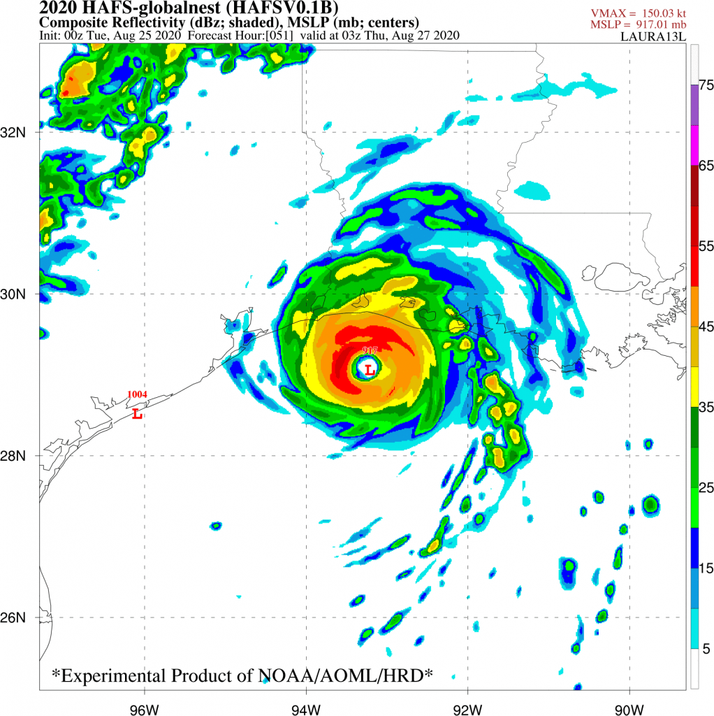
The Hurricane Analysis and Forecast System (HAFS) is NOAA’s next-generation numerical model and data assimilation system, which is being developed within the framework of the Unified Forecast System. Central to the improvement of HAFS has been the goal of adding an embedded moving nest to the FV3 dynamical core, enabling scientists to track the inner core region of tropical cyclones at 1-2 km resolution.
“The development of the moving nest capability is a key milestone to the development of the next generation Hurricane Analysis and Forecast System,” said Frank Marks, Director of hurricane research at AOML.
Researchers at AOML partnered with NOAA’s Environmental Modeling Center and NOAA’s Geophysical Fluid Dynamics Laboratory during the overactive 2020 Atlantic hurricane season to test and evaluate the HAFS in real-time. AOML scientists configured two models within the framework of the 2020 Hurricane Forecast Improvement Project for testing purposes. The first model was a version of HAFS with a high resolution static nest embedded within a global domain. However, the FV3 dynamical core with an embedded moving nest is key to improving hurricane structure and intensity predictions in the future.
The second model was a version of the Hurricane Weather Research and Forecasting (HWRF) system with multiple storm-following nests that allows hurricane researchers and forecasters to simultaneously track multiple tropical cyclones. The HWRF model has demonstrated remarkable improvement as a result of the Hurricane Forecast Improvement Project, which aims to reduce errors in hurricane track and intensity forecasts. Since its inception in 2009, the Hurricane Forecast Improvement Project has reduced track forecasting errors by about 30% and reduced intensity forecast errors by about 25%. The HWRF model has demonstrated a near 10% improvement in hurricane intensity forecast accuracy annually since 2011.
“We are now developing a system that will surpass the HWRF system,” said lead scientist for AOML’s Hurricane Modeling and Prediction Program and chief architect of the HWRF model, Sundararaman Gopalakrishnan. “We’re moving from one generation to the next.”
The advancements made in these models will improve hurricane forecasting skill by increasing the accuracy of extended forecasts and extent of evacuation areas, especially on 5-7-day timescales, well before tropical cyclones make landfall. This research transition will greatly benefit emergency managers in their decision-making process by information available for improving the quality of emergency planning information, reducing property damage, and saving lives.