Study on how different techniques to model the hurricane boundary layer can improve forecasts published in Atmosphere
In a new study published in Atmosphere, hurricane scientists looked at how turbulent mixing in the boundary layer affects the intensity and structure of hurricanes in NOAA’s Hurricane Weather Research and Forecasting (HWRF) model. They found that turbulent mixing affects where thunderstorms in hurricanes occur, and how fast air flows towards the center of a storm.
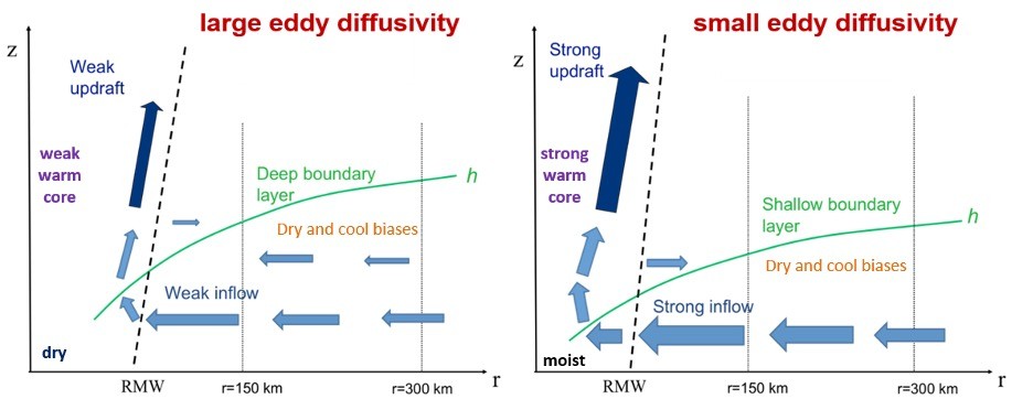
Image showing differences in the hurricane structure in the region closest to the storm center due to changes in the vertical eddy diffusivity. RMW represents the radius of maximum wind speed, or the eyewall. The light blue arrows show the radial flow. The dark blue arrows show the updrafts and convection. The region below the green line is the boundary layer. Dry and cool biases were identified based on model evaluation against observations. These biases need to be corrected in future model physics upgrades.
Read more about this study at https://go.usa.gov/x73rz. For more information, contact aoml.communications@noaa.gov.