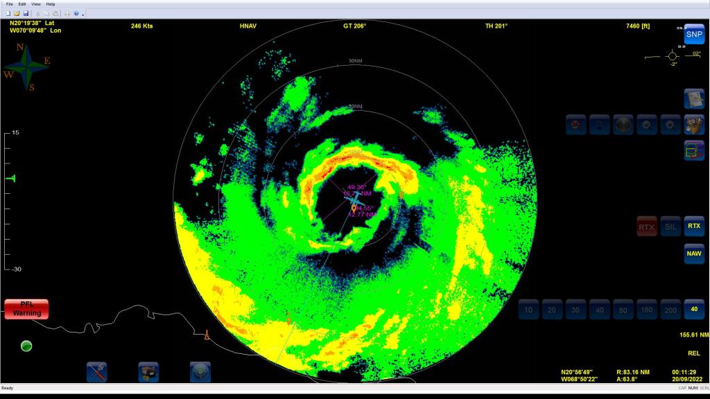
On the night of September 19th, 2022, NOAA Hurricane Hunter “Miss Piggy” penetrated the eyewall of Hurricane Fiona as it emerged from the northern coast of Hispañola. The researchers onboard captured data of an intensifying storm as it moved toward the Turks and Caicos Islands. During the course of the flight, instruments onboard measured a surface wind speed of 94 knots (48 m/s). Fiona was adjusting to the marine environment after leaving the island, and the shape of the eye fluctuated from oval to square.
Data from the flight, including from extra dropsondes, were transmitted in real-time to forecast centers to help improve forecasts as the hurricane moves northward.
For the latest information about tropical cyclones and other weather systems, please visit the NOAA/NWS/National Hurricane Center.
Media inquiries should be directed to AOML Communications (aoml.communications@noaa.gov), or Monica Allen (301-734-1123) or Monica.Allen@noaa.gov.
DISCLAIMER: The above discussion is intended to provide a brief summary of recent and future HRD Hurricane Field Program Operations. Any use of this material beyond its original intent is prohibited without permission of the HRD Director, Frank Marks (Frank.Marks@noaa.gov).


