It is Friday, Sept 8, 2017, and the NOAA hurricane hunters continue to fly and collect data. Every flight gives us up to date information on how powerful Hurricane Irma is. Today we have several flights scheduled. The G-IV jet and the P3 are already in flight gathering data. The jet took off at 1:30 AM (0530 UTC). Below is their planned flight track. The jet gathers data around Irma. The dots represent the dropwindsonde launch locations. These instruments measure pressure, temperature, relative humidity, wind speed and wind direction every 30 seconds as it descends down to the sea surface.

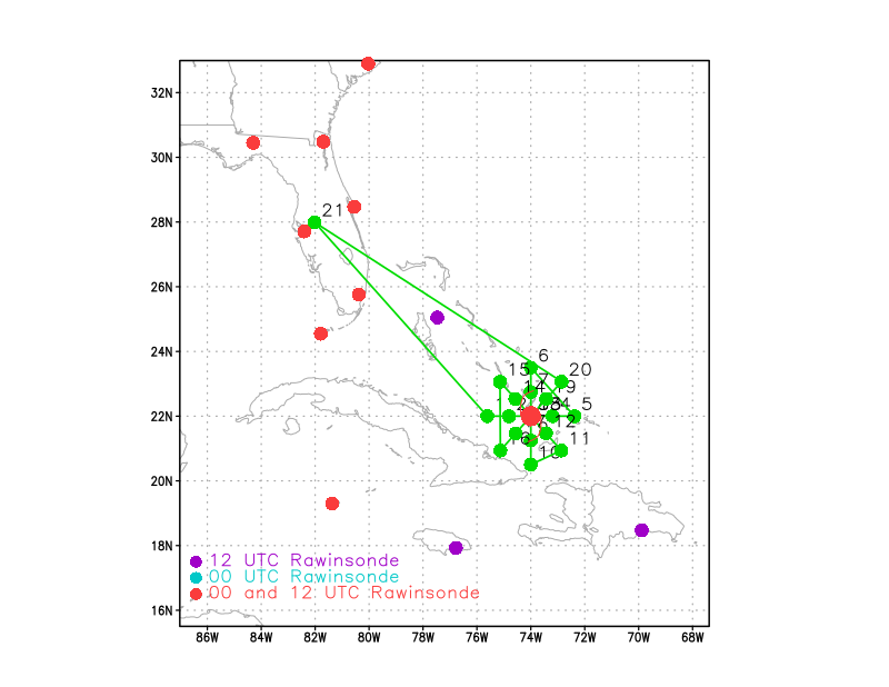
The NOAA42 P3 aircraft is also in the air and flying inside Irma. This flight took off at 3 AM ET (0700 UTC). Below is their proposed flight track. The dots on the flight track below (shown in green) represent the P3 aircraft turn points. The red dots in the figure show the locations that launch weather balloons twice a day while the purple dots are the locations that launch balloons once a day.