Discussion:
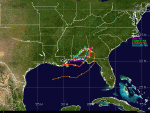
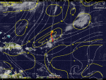
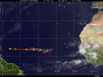
The tropical Atlantic is dominated by two features: a ridge confined to the eastern part of the basin and a stationary front and associated baroclinic low pressure in the western part of the basin extending across the mid-Atlantic states (Fig. 1). A series of tropical waves are apparent in the MDR and into the Caribbean, but only some of these waves are associated with pouches as identified by the PREDICT team. Showers and thunderstorms are associated with PGI29L, which is the remnants of TD#5, in the northern Gulf of America (Fig. 2). Showers are also associated with PGI25L northeast of the windward islands. Other showers are evident in the southwestern Caribbean, but they are not associated with any identified pouch. Finally, pouches PGI27L in the eastern Atlantic is devoid of convection and poses little chance for development, and PGI28L is over western Africa.
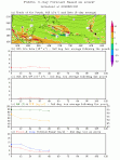
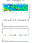
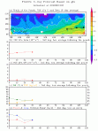
PGI29L is located over southern Louisiana, with scattered showers offshore and deep convection in the northern part of the circulation (Fig. 3). Pouch analysis of the model forecasts (Fig. 4) indicate that this system will likely make an anticyclonic loop, possibly emerging over the northern Gulf of America in 3-5 days’ time. Depending on the amount of time the system is over water, regeneration is possible.
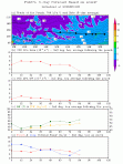
PGI25L, northeast of the Leeward islands, does have some scattered shower activity associated with it (Fig. 5). It is expected to move toward the north over the next 24-48 h. The shear is low at this time, but it is moving into a region of higher shear. Neither the GFS nor the ECMWF develop this system (Figs. 6,7).
PGI27L in the eastern Atlantic is devoid of any precipitation (Fig. 8), though the models forecast a generally westward track for the next 24-48 h. Both the GFS and ECMWF are able to track a pouch at 700 hPa (Fig. 9,10), but they both fail to intensify it after 36-72 h.
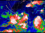
PGI28L over Africa shows very impressive, widespread deep convective and stratiform precipitation that also indicates a circulation at least in the midlevels (Fig. 11). However, all model guidance takes the system off toward the northwest, well east of any possible operations for any agency.
A well-defined squall line east of PGI28L is evident in the satellite imagery in Fig. 11. While not identified as a pouch yet, global model guidance suggests this may develop into a tropical cyclone in the eastern Atlantic in 6-7 days’ time (Fig. 12). This system will definitely bear watching in the coming days.
Mission synopsis:
No NOAA missions are planned in the next 48 h. Attention will be focused on the remnants of TD#5, in the event that it re-emerges over the northern Gulf of America. The aircraft for GRIP and PREDICT are either enroute or already in place in their respective bases of operation.
A test flight is planned for the Global Hawk on Tuesday, possibly flying to the Gulf and back to Dryden.
A test flight is also planned for the G-V on Sunday.
Robert Rogers
2010 IFEX Field Program Director


