
NOAA has so far completed five flights into and around Hurricane Ida as it crossed over the Cayman Islands and western Cuba toward its forecast landfall along the Louisiana coast. Two synoptic surveillance missions were conducted by the NOAA G-IV high-altitude aircraft to gather dropwindsonde and Doppler radar data around the hurricane to be ingested into the computer models that the National Hurricane Center uses to make their forecasts. These data over oceanic areas where other data are not available have been shown to make these forecasts better than they would be without them.

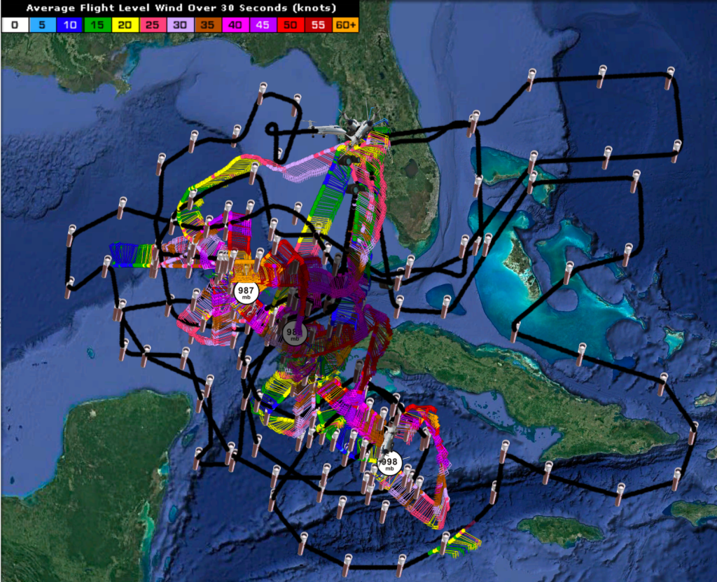
In addition, three flights with the two NOAA P-3 aircraft have been completed. The first, on the morning of 27 August, was tasked by NOAA’s Environmental Modeling Center (EMC) to gather dropwindsonde and Doppler radar data in the hurricane core to improve model forecasts. The second mission, 12 h later, was a research mission, but the data were also sent to the modeling centers for use in the models. This mission collected observations spanning Ida’s approach to the southern coast of Cuba all the way until it emerged off the northern coast of Cuba. The data showed the structure of the convection that drives the hurricane winds, especially on Ida’s east side, and newly formed convection on the north side after the center of Ida emerged into the Gulf of America. These data will be studied to learn how the convection allowed for Ida to develop an eye and begin intensifying. The image below, from the lower-fuselage radar aboard the P-3, shows the ring of convection surrounding the center of the hurricane.

The third P-3 mission, like the first one, was tasked by to gather dropwindsonde and Doppler radar data in the hurricane core to improve model forecasts. The mission gathered data during the crucial time when Ida was reorganizing after emerging off the coast of Cuba and developing an eye that was visible in satellite images by the end of the flight.

NOAA will continue flying missions in Ida up to landfall. For details about upcoming aircraft missions, please see NOAA’s official Plan of the Day.
For the latest information about tropical cyclones and other weather systems, please visit the NOAA/NWS/National Hurricane Center.
For information on numerical prediction of tropical cyclones, please visit NOAA/NCEP/Environmental Modeling Center.
To access updates on the Intensity Forecasting EXperiment (IFEX) and other activities via Facebook, Twitter, or RSS feed, check out the NOAA/AOML/HRD page.
To directly access updates on IFEX HFP Operations via our WordPress blog on the web, check the site: https://noaahrd.wordpress.com/category/ifex-hurricane-field-program/
DISCLAIMER: The above discussion is intended to provide a brief summary of recent and future HRD Hurricane Field Program Operations. Any use of this material beyond its original intent is prohibited without permission of the HRD Director, Frank Marks (Frank.Marks@noaa.gov). Media inquiries should be directed to AOML Communications (aoml.communications@noaa.gov), Monica Allen (301-734-1123) or Monica.Allen@noaa.gov.