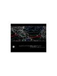
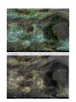
PGI17L was once associated with one of two tropical waves in the Caribbean, but has since separated from the westernmost wave. The westernmost wave is located near 74W from 19N to 8N. This wave used to contain PGI17L which was later named Invest AL97 by NHC. This wave is no longer producing much convective activity and except for a thin band of showers near Jamaica is located within a very dry sector of the north and central Caribbean. This can be seen in satellite imagery (B.) There are two upper-level low pressure systems of note in the Western Atlantic and Gulf of America. The first is located over the western Gulf near 95W/25N according to CIMSS satellite winds analysis (see D.). The second is located over 73W/25N near the Bahamas. This intense upper-level low is of particular interest to mission activities due to its interaction with AL97 and its associated upper level confluence (see D and F.), which has resulted in sinking motion over Cuba, the Bahamas and S. Florida (See GOES-E water vapor image). Also of note is a large high-pressure ridge over the north Atlantic which has weakened in intensity slightly from yesterday to a max surface pressure of 1028 hPa (see A.) but has extended further westward toward the US East Coast.
AL97 continues to be a monitored area for TC development by the NHC. The NHC downgraded the potential for TC development for the next 48 hours from 60% to 50% as of 1805 UTC. This system has undergone a transformation since yesterday. The tropical wave which spawned AL97 has since separated from the major convection, moving west while the fledgling system has remained near a surface trough, analyzed at 1200 UTC, running through eastern Hispaniola. Convective activity became less organized overnight, possibly due to the influence of the nearby upper level cold low. In addition, the vorticity analyses from CIMSS (see F.) show that vorticity maxima at various levels are now tilted with height towards the upper low to the northwest of AL97. This is in contrast to 24 hours ago, when vorticity at the mid and low levels was stacked vertically. AL97 is still very near a region of high deep-layer shear, (see D.) and while no closed surface circulation has been observed thus far, it is likely that AL97 is located in the region of high shear gradient near the southeastern tip of the Dominican Republic. The 1200 UTC sounding from the Dominican Republic shows the various directions of winds throughout the layers (see C.). The unfavorable upper level winds, the shear created by its proximity to the upper level low, the system’s interaction with the mountainous landmass of Hispaniola, and dry Saharan Air at mid levels to the West and North of the system are all limiting factors for the development potential of AL97 at this time.
Model track guidance for AL97 (See H.) has changed slightly over the last 24 hours, with most models trending toward a more southern track. Pouch tracking from the NRL group shows high deep shear, and a steady weakening of AL97s vorticity after 48 hours from both GFS and NOGAPS model forecasts (see I.). Model intensity forecasts have decreased significantly since yesterday as well. The bulk of the models have AL97 briefly gaining tropical storm status, before dissipating beyond 60 hours. Of note is the fact that there is disagreement between the dynamical models, which dissipate AL97 rather quickly, and the statistical and hybrid statistical-dynamical models. Some of the latter models persist AL97 as a tropical storm out to 120 hours. (See H.) The 1200 UTC GFS forecast suggests that the upper-level cold low which is limiting development of AL97 will remain strong and move west-northwestward over the next several days (see G.). If current track guidance for AL97 and the TUTT holds, shear over AL97 may weaken and become southeasterly, which should be more conducive to development. Flights are currently planned to AL97 by the NOAA P3 and GIV, as well as by the NASA DC-8. The system will be closely monitored, but is not expected to develop into a TC within the next 24 hours.


Mission plan
With the likelihood that this system will not develop imminently, or if it does that it will impact Florida within 48 h, it was decided to cancel the EMC-tasked P-3 missions. The system will continue to be monitored, however, in case it tracks through the Florida straits into the Gulf of America. In that case EMC tasking for TDR missions may follow.
Robert Rogers
HFP IFEX Field Program Director 2010