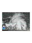
97L was upgraded by the NHC today to a high probability of formation during the next 48 hours. The third wave is along 86W in the Eastern Gulf/ Western Caribbean, and is the wave that was formerly discussed as PGI16L. While this still carries a circulation, the disorganization of the decreased convection and its impending movement over land make it so this wave warrants little further discussion. The fourth wave in the Western Gulf of America is near 93*W and lies within a region of deep moisture producing numerous showers and thunderstorms, and is located to the south of a persistent upper tropospheric cold low in the mid-Gulf. Further development of either of the last two waves is not expected.
The huge area of high pressure dominating much of the Atlantic basin has continued to increase in pressure over the last 24 hours, and now is analyzed as a 1030 hPa ridge extending from Spain to Florida in an elongated oval. The ridge’s structure and strength will be a big player in the determination of the track of 97L in the coming days, as well as the strength and movement of a TUTT (Tropical Upper Tropospheric Trough) located to the north of the system. The TUTT has been interacting with the developing Invest for a couple of days so far, aiding a region of high E-W shear that has inhibited the persistence of convection too far north of Puerto Rico. This morning there was a nice flare-up of convection in this region and was subject to this heavy shear (30-40kt), though convection to the south of Puerto Rico appears to be flaring again. Please see slide 2 and slide 5.
One thing that Invest 97L is lacking (and there has been some debate about where it might form in the next 48 hours) is a defined center of circulation at mid-low levels. It is not currently present in satellite imagery, nor is one present in the radar reflectivity out of Puerto Rico. (slide 3). ASCAT winds from an earlier pass do not indicate a circulation, only strong easterlies appear present at that time (slide 4), although now there is a much more southerly component to the precipitation seen in the radar reflectivity.
The vorticity associated with 97L is beginning to stack nicely at levels 850, 700, and 500 hPa compared to yesterday (slide 6). This shows increased organization of the system, even though there is not yet a coherent circulation. Additionally, water vapor imagery plus AMSU TPW (total precipitable water) imagery overlain with the rain from the system shows how the convection associated with 97L is being encouraged by the extremely moist environment (slide 7). Also of note, some of the convection associated with 97L has been particularly deep with IR imagery indicating cloud top temperatures as cold as -70*C, and they are being supported by good upper level divergence also evident in the CIMSS products (not shown).
Over the next several days, the global models and the regional models have converged on the solution of expected development of this system into a tropical cyclone. Bob Hart’s Phase space diagram, which utilizes the 06 UTC forecast by the HWRF model shows that it is expected to become a warm core cyclone in the next 60-72 hours (slide 8). This model is one of the most aggressive at developing the invest, and it even forecasts the system to cross Florida and reintensify in the Gulf of America before making a second landfall in the FL Peninsula. One thing that several models do not seem to yet agree on is the expected track forecast of the system (see slide 9 for the model forecasts of track and intensity). Perhaps this is due to the inability to locate a center point for vortex bogusing in the regional models, but the global models vary widely on taking the wave to the west on a more southerly route or a northerly track, and this depends on where the TUTT moves and its shear influence, as well as if the Subtropical high will experience any weakening near the East Coast of FL. The track and intensity spreads appear as seen in slide 10. Most models have guided the official forecast to show intensification to a Category 1 hurricane can be expected within 72+ hours. SHPS keeps the shear low in the forecast based on the GFS fields it is initialized from as it follows the official forecast track. This track takes the system into SE Florida in the vicinity of Miami in 84-96 hours as a 70 kt Cat 1 hurricane. Additionally, the Montgomery pouch tracking guidance based on the GFS and NOGAPS forecasts is divided, yet both intensify the system, at least in the short term, based on good values for the Okubo-Weiss parameter at 700 hPa and decreasing values of vertical shear associated with the pouch region of PGI17L (slides 10 and 11). This system will be closely monitored in the coming days by several aircraft missions by all of the three agencies. Please see the mission science report for more details on tri-agency flight expectations.


Mission plans:
With the expected development of this system into a tropical storm and possibly a hurricane, the G-IV aircraft has been tasked by NHC for synoptic surveillance missions beginning at 1730 UTC on 21 July, with a follow-on mission scheduled for the same time on 22 July. N42RF has also been tasked by EMC to begin TDR (Tail Doppler Radar) missions into the system, with a first take-off scheduled for 08 UTC 22 July and a follow-on mission at 20 UTC 22 July. Additional missions are possible and are currently anticipated, depending on the development of the system and proximity to the islands.
Robert Rogers
NOAA IFEX/HFP Field Program Director 2010