
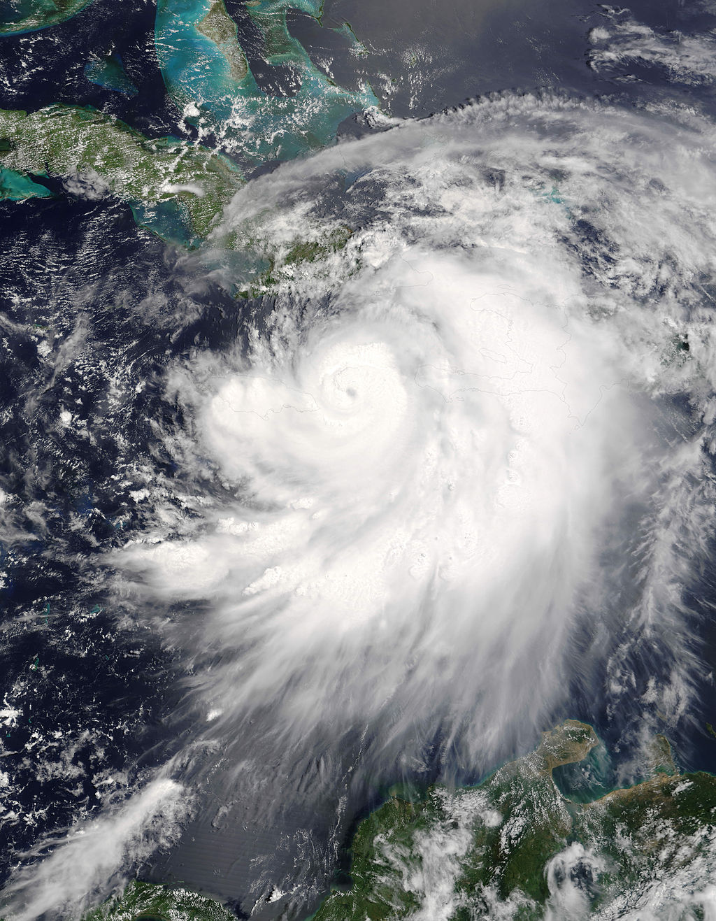
On July 8, 2005, Hurricane Dennis became one of the strongest Atlantic hurricanes ever recorded in July. It formed into a tropical depression on July 4th and struck the island of Grenada in the eastern Caribbean Sea. It moved quickly northwestward while it strengthened. It became a hurricane on July 6th while south of the island of Hispañola, then underwent rapid intensification. By the 7th it was a Category Four hurricane, the earliest in the hurricane season that a tropical cyclone has been recorded at that strength. Later that day, Dennis made landfall at Punta del Inglés, Cuba with sustained winds of 140 mph (220 km/hr). While its strength dipped as it was briefly over land, its wind grew to 150 mph (240 km/hr) once it moved back over the Sea. It then made a second landfall at Punta Mangles Altos, Cuba with as much force as it had struck Punta del Inglés. Crossing Cuba reduced Dennis to Category One status, but in again rebounded once over the warm Gulf Loop Current north of the island. As it tracked north-northwest toward the Florida/Alabama coast, its winds peaked at 145 mph (234 km/hr), but luckily diminished to 120 mph (195 km/hr) just prior to landfall. The remnants of Dennis persisted for another three days as it meandered over the Midwest and Canada, dumping heavy tropical rains along the way.

38 people lost their lives when Dennis had its impact on Cuba and Haiti, and another 15 in the United States. The storm caused an estimated US $4 billion in damages along its path. The name Dennis was retired from the Atlantic lists. Dennis was also a harbinger of the very busy 2005 hurricane season that would witness many new record-breaking storms. Indeed, Hurricane Emily would surpass Dennis’ early-season record only six days later.
HRD flew many missions into Hurricane Dennis, and six manuscripts on the data have been published:
Rogers, R., 2010: Convective-Scale Structure and Evolution during a High-Resolution Simulation of Tropical Cyclone Rapid Intensification. J. Atmos. Sci., 67, 44-70.
Halverson, J., M. Black, R. Rogers, S. Braun, G. Heymsfield, D. Cecil, M. Goodman, R. Hood, A. Heymsfield, T. Krishnamurti, G. McFarquhar, M. J. Mahoney, J. Molinari, J. Turk, C. Velden, D-L. Zhang, E. Zipser, R. Kakar, 2007: Nasa’s Tropical Cloud Systems and Processes Experiment. Bull. Amer. Met. Soc., 88, 867-882.
Rogers, R., S. Aberson, M. Black, P. Black, J. Cione, P. Dodge, J. Gamache, J. Kaplan, M. Powell, J. Dunion, E. Uhlhorn, N. Shay, N. Surgi, 2006: The Intensity Forecasting Experiment: A NOAA Multiyear Field Program for Improving Tropical Cyclone Intensity Forecasts. Bull. Amer. Met. Soc., 87, 1523-1537.
DeMaria, M., J. A. Knaff, J. Kaplan, 2006: On the Decay of Tropical Cyclone Winds Crossing Narrow Landmasses. J. Appl. Met. Clim., 45, 491-499.